15 INCREDIBLE Waterfalls In Alaska

Visiting the “last frontier,” the 49th state of the union, is an adventure. Alaska is untouched by man in ways that few places in the world are, so there’s no shortage of breathtaking landscapes, breathtaking glaciers, and an abundance of wildlife. And of course, that means that Alaska also has some of the most gorgeous waterfalls in the world!

The best part is that many Alaska waterfalls don’t require overnight journeys or extensive hikes. If you’re visiting Alaska, you definitely need to check out at least a fall falls.

Here are the 15 most incredible waterfalls in Alaska that should be on your bucket list.

15. Virgin Creek Falls

Closest Town: Girdwood | Height: 15 feet | Hike Time: 5 minutes

Incredible Virgin Creek Falls in Alaska: Cascading Beauty

Visit this gorgeous and active waterfall in the Girdwood region rain forest (on the same mountain as the Alyeska Ski Resort) if you’re in the mood for lush vegetation. You’ll experience “old growth:” Devil’s ferns, mossy logs, and towering spruces.

These Alaska waterfalls themselves are around 15 feet tall and quite noisy. The falls are encased in ice during the winter, making for a spectacular picture year-round. The trek up to the falls takes about five minutes trek, so it’s suitable for children of all ages. Plus, these falls are located super close to other attractions.

The Lower Virgin Creek Falls path is one of Girdwood’s most accessible treks. The round trip distance is roughly 1/2 mile, with an elevation gain of 180 feet. The track is well-marked and winds through an enchanting forest, but watch out for tree roots and the steep embankment along the river’s side.

To reach this stunning waterfall, take Timberline Drive (the first road after crossing Glacier Creek while going toward the resort) until it stops from the Alyeska Highway in Girdwood. The unmarked route to the falls follows the stream upward for approximately 150 yards.

At the end of Timberline Drive is a trailhead sign. There is no parking lot, so park in front of houses/on the street. Because it is a temperate rainforest, carry a light rain jacket.

Once you’ve arrived at the falls, follow the short route down to the pool and waterfalls. Expect to see other people in the neighborhood since this is a popular spot and is busy on weekends (sometimes you’ll even see a wedding).

14. South Fork Eagle River Falls

Closest Town: Anchorage | Height: 25 feet | Hike Distance: 1/2 mile

Beautiful South Fork Eagle River Falls in Alaska: Cascading Beauty
pinterest.com

South Fork Eagle River Falls is about a half-mile walk on ancient roads from the end of Ken Logan Circle in a subdivision off Hiland Road overlooking Eagle River Valley. A modest South Fork bridge is a few hundred yards upstream from the falls.

As it fills its narrow canyon with a roar that can be heard throughout the approach, this secluded, seldom visited waterfall seems enormous. The Alaskan waterfalls break into two channels as they tumble over a massive granite outcrop and are incredibly beautiful.

They are tucked within a canyon where the South Fork of Eagle River makes a 25-foot-plus plummet. The Eagle River Greenbelt system includes the surrounding access routes, although private land is nearby.

13. Thunderbird Falls

Closest Town: Anchorage | Height: 200 feet | Hike Time: 50 minutes

Incredible Thunderbird Falls in Alaska: Cascading Beauty
countryliving.com

Thunderbird Falls is one of Alaska’s most famous waterfalls, falling 200 feet down a gap in the Chugach State Park foothills. You can see the falls from a viewing platform, located up a short (and occasionally steep) one-mile hike through a beautiful birch woodland beside the Eklutna River.

You can approach the canyon bottom through an access route and make your way upstream to the base to feel the icy spray of Thunderbird Creek on your face. During the winter, the falls generally freeze and create ropey ice columns. After the temperature drops, make sure your shoes have ice grippers.

Parents should be cautious of the canyon lip in all seasons and keep youngsters far away. While this is one of the most impressive waterfalls in Alaska, it’s also one of the most dangerous!

To reach Thunderbird Falls, take the Glenn Highway north of Mirror Lake to the Thunderbird Falls exit around Mile 25, the first exit. Exit at Eklutna, head toward the mountains and travel south on the Old Glenn beyond the Eklutna Lake turnoff. On the Old Glenn Highway, the trailhead is located less than a mile north.

12. Pitchfork Falls

Closest Town: Skagway | Height: 2,100 feet | Hike Time: 10 minutes

Unforgettable Pitchfork Falls, Alaska: Hike Through Breathtaking Scenery
waterfallsnorthwest.com

Pitchfork Falls is a waterfall with a reputation that is definitely justified – this is one of the most impressive waterfalls in Alaska. The falls are located approximately 6 miles north of Skagway, on the other side of the valley from the Klondike Highway, on the unnamed discharge stream of Goat Lake.

It is one of the best-kept mysteries of the U-shaped A fjord valley. The route leading to these falls is extremely short, and even first-time visitors will have no trouble finding their way here.

Because it may be difficult to see the entire waterfall from the path or the gravel parking lot, you will need to walk to the middle or lower area of the fall.

According to several sources (though some measurements are imprecise because these falls are DIFFICULT to measure), these Alaskan waterfalls drop approximately 2,100 feet as the water flows down the slope, putting it on various World’s Tallest lists in the past.

11. Brooks Falls

Closest Town: King Salmon | Height: 88 feet | Hike Time: 1.25 hours

Stunning Brooks Falls in Alaska: Cascading Beauty

Brooks Falls is one of the more popular waterfalls in Alaska on the Brooks River.

Sockeye salmon migrate up the Brooks River to breed every summer. To get to their spawning site, they’ll have to swim upriver and overcome a few additional obstacles, making this a prime bear-sighting spot. And these bears come in droves – they’re hungry creatures!

Between 200,000 and 400,000 salmon migrate upriver each year, sot he bears aren’t the only ones that go salmon fishing in the Brooks River. This river is a well-known fly-fishing hotspot. Brooks Lodge was explicitly created to accommodate visitors on fly fishing expeditions.

Later, it was discovered that this is also a fantastic wildlife viewing location. Hundreds of tourists visit Katmai every day during the summer months to witness brown bears, thanks to the construction of viewing platforms.

10. Blackstone Falls

Closest Town: Whittier | Height: 500 feet | Hike Time: N/A (visit by boat)

Incredible Blackstone Falls, Alaska: Hike Through Breathtaking Scenery

For Blackstone Glacier in Prince William Sound, this 500-foot cascade cascades into a cove encircled by massive rocks along the northwest edge of the inner fiord.

The Alaskan waterfall is one of the most photographed areas, and it is readily seen on maritime cruises. It is just about a mile from the active face of the glacier and approximately a mile within the fiord.

Kayakers, both self-directed and guided, will enter the cove’s entrance to immerse themselves in the roar and spatter of falling water and feel the vastness of the landscape. It’s only one of the numerous Alaskan waterfalls at Blackstone Bay’s head.

You’ll need a boat to go around and fully experience these falls. Most visitors take a marine cruise from Whittier to Blackstone Bay or organize a guided or self-directed kayaking experience. Entering the cove and looking up at the cascade—with a sight of the Northland Glacier dangling from the rock face—can be an incredible peak moment. Seriously – this is Alaskan nature at its finest.

Do not approach the pouring water shower under any circumstances. Always maintain a distance of several hundred yards – this is another one of the more dangerous waterfalls in Alaska. Northland Glacier chunks have been reported to fall into the ocean unexpectedly, so most boats prefer to stay a good distance away. Several decades ago, a kayaker was killed while attempting to fill a water bottle at the foot of the falls; it really pays to be cautious. But don’t let that scare you: these Alaska waterfalls are incredible and are certainly not to be missed.

9. Russian River Falls

Closest Town: Cooper Landing | Hike Distance: 2 miles

Incredible Russian River Falls, Alaska: Hike Through Breathtaking Scenery
flickr.com

The Russian River is teeming with thousands of green-headed, red-bodied sockeye salmon between mid-June and late July. Hike out and see the giant runs rush upstream in the solid water for their native spawning places.

The Russian Lakes Trail starts at milepost 52 on the Sterling Highway, off the entrance road to the Russian River Campground at Cooper Landing. The route to the falls is two miles long and broad, with just minor elevation changes. It’s a short trek that seems more like a stroll, making it ideal for families and hikers of all abilities.

The trailhead starts with a woody entrance and ultimately leads to a clearing where the sun may shine through. Get off the usual road and stroll two miles to the falls, where you’ll be rewarded with stunning salmon views and the possibility of seeing bears.

Although the salmon flow is a natural spectacle near the falls, travelers should be aware of bear activity. Both black and brown bears dwell in this area, and they sometimes emerge on the river to scoop fish out of the water. There isn’t as much bear activity as some of the more popular waterfalls in Alaska but it’s definitely a possibility. There is an observation platform that offers a view of the falls but it’s sort of a hike-at-your-own risk situation.

This is definitely one of the more fun hikes where you can also check out waterfalls, plus there’s camping and fishing areas if you want to turn this waterfall visit into a full-on vacation. Since there isn’t much nearby, we recommend staying at these Alaskan waterfalls for a few days to get the full experience.

8. Horsetail Falls

Closest Town: Valdez | Height: 300 feet | Hike Time: 2 minutes

Unforgettable Horsetail Falls, Alaska: Hike Through Breathtaking Scenery

A few yards from a vast, paved pullout, the magnificent cascade plunges over a 300-foot rock within Keystone Canyon near Valdez. Horsetail is one of the numerous snow-fed cascades inside the three-mile-long canyon, just up the Richardson Highway from town, along with Bridal Veil Falls, which is just a few hundred yards away.

Horsetail Falls, which only flows throughout the winter and early spring, is fed by snow and ice melt and serves as the focal point for seeing multiple waterfalls.

The stunning waterfall cascades in two streams and sits immediately next to the road, making it the region’s most prominent feature.

Horsetail Falls, which sprawl out a little over the bedrock at more significant flows, is accessible on foot. These falls freeze into massive ropey curtains in the winter, attracting ice climbers from all over the globe. The trail leading to Horsetail is a treasure trove of incredible sights for intermediate and expert hikers. Despite the area’s steep slopes, beginners can give it a shot if they’re athletic (it isn’t too hard).

To reach Horsetail Falls, drive east from Valdez to the start of Keystone Canyon, which is around Mile 13 on the Richardson Highway. Drive 180 miles northeast of Anchorage on the Glenn Highway to Glennallen, then 100 miles south on the Richardson Highway to the canyon.

7. Nugget Falls

Closest Town: Juneau | Height: 377 feet | Hike Distance: 1 mile (with more advanced trails available)

Stunning Nugget Falls in Alaska: Cascading Beauty

This stunning waterfall plunges roughly 377 feet down the steep slope into Mendenhall Lake, about a three-quarter mile south of the active face of Mendenhall Glacier, and is one of the most remarkable natural phenomena around Juneau.

The cascade descends in two tiers (99 feet and 278 feet) before spilling into the frigid, turquoise sea, powered by meltwater flow from hanging Nugget Glacier. Before the glacier receded in recent decades, the falls splashed into the ice, though the picture is a bit different today.

The falls are only one feature of the Mendenhall leisure area, which include spectacular vistas of the receding Mendenhall Glacier and a lake where royal blue icebergs are visible. The visitor center has many museum-quality displays, and there are several hiking routes, including a mossy rainforest trek to the foot of Nugget Falls.

Spectacular vistas of the receding Mendenhall Glacier

Hike to a sand-and-gravel flat at the foot of the falls that stretches out along the shoreline and let the tremendous foamy awe and noise wash over you. A new, low-grade route runs about one mile from the visitor center to the falls, making it a reasonably pleasant stroll for families with children.

Before you witness the falls, you’ll hear them!

6. Liberty Falls

Closest Town: Anchorage | Height: 20 feet | Hike Time: Variable (a short walk is available)

Incredible Liberty Falls in Alaska: Cascading Beauty

With snow-capped mountain ranges and beautiful wildlife and flora, this gorgeous setting is a nature lover’s dream.

A rushing, white waterfall bursts from a crevice in the rocks and plunges about 20 feet into Liberty Creek. The relentless noise permeates the rural campsite. The falls are visible from the Edgerton Highway on the route to Wrangell-St. Elias National Park, which is a popular place for tourists to camp.

To access the modest recreation area and campground, use the gravel road that loops from two exits off the Edgerton Highway, about 24 miles east of the Richardson Highway.

Immediately downstream of the falls, the access road crosses the creek on a bridge. You may want to park at the bridge and stroll upstream to the foot of the falls to enjoy the mist and fresh air. You can spend the night at one of many campsites or tent platforms and fall asleep to the whoosh of the falls.

To get to these Alaskan waterfalls, from Anchorage, go 180 miles northeast on the Glenn Highway to Glennallen, then 32 miles south on the Richardson Highway to the Edgerton Highway intersection. (It’s about 82 miles north of Valdez.) Mile 23.5 is the location of Liberty Falls. The settlement of Chitina is seven miles away, and the Copper River bridge into Wrangell-St. Elias National Park is one mile farther.

5. Rudlestone Falls

Closest Town: Valdez | Height: 869 feet | Hike Time: 2 minutes

Incredible Rudlestone Falls in Alaska: Cascading Beauty

Travelers heading east in Alaska toward the vacation destination city of Valdez will enjoy seeing Rudleston Falls, a stunning but unexpectedly accessible Alaskan waterfall situated just off Richardson Highway.

These lovely falls, which are located across from a well-known Old Railway Tunnel, tumble slowly and generously over a rock face, surrounded by lush foliage and wildflowers in the summer. It’s a popular spot for people to snap photographs, whether for special events or fill up their Instagram grid! This is definitely one of the best Alaskan waterfalls for photos because it’s so easy to get to and is in just the perfect place to actually capture a human in front of the falls.

Valdez is an excellent spot to stay if you’re searching for a home base to explore Chugach National Forest and Wrangell-St. Elias National Park & Preserve, yet this is a genuinely wild area, so be prepared.

4. Serenity Falls

Closest Town: Eklutna | Height: 1,200 feet | Hike Distance: 13 miles

Unforgettable Serenity Falls, Alaska: Hike Through Breathtaking Scenery

In Chugach State Park, this typical mountain waterfall cascades down a massive wall in the valley beyond the head of Eklutna Lake. The free-fall drop is hundreds of feet—some say 700 feet—but the beautiful strand of whitewater cascades more than 1,200 feet from the alpine realm and makes for a spectacular shot across the valley.

In addition to being a popular ice climbing location in the winter, Serenity Falls is perhaps most stunning in the early summer when snowmelt increases the volume. The terrace of the Serenity Falls Hut, a multi-party public use hut administered by state parks, has excellent views.

Reaching the falls on a backcountry bike can be an all-day experience on relatively flat routes and jeep roads. An overnight stay at the Hut lets you take in the autumn scenery as the canyon dims in the twilight light. This is one of the best waterfalls in Alaska to visit if you plan to spend at least a few days in the area.

To get to the falls, leave the Glenn Highway at Eklutna (Mile 26.5) and drive ten miles to the state campground and day-use facilities at the end of the road.

The Eklutna Lakeside Trail requires 13 miles of biking, hiking, or vehicle transportation. Continue beyond the lake’s head at Mile 8 until you reach the Serenity Falls Hut turnoff at Mile 12. Continue another mile or two across the bridge until you see and hear the falls a few hundred feet into the woods.

3. Winner Creek Gorge

Closest Town: Anchorage | Height: 10 feet | Hike Distance: 3 miles

Unforgettable Winner Creek Gorge, Alaska: Hike Through Breathtaking Scenery
pinterest.com

In Girdwood Valley, a journey through a foggy rain forest of tall trees leads to a tiny wooden bridge that spans the spectacular canyon where Winner Creek roars over steep rock walls. This site is unusual and even otherworldly, offering a deep-woods, high-adventure vibe, and an almost fairy-like vibe.

Making your way down the stream on the west/north bank, you can sit on stones below the falls, next to the rolling water, for the best views. The adventure, however, isn’t over yet. Go another 0.2 miles to the hand tram and trolley across Glacier Creek for some seriously incredible views. You can either visit the viewpoint, return the same way you came, take the tram over the creek, or go to Crow Creek Mine. There’s clearly lots to do here!

The track, which is part of the famous Iditarod system and is managed by Chugach National Forest, is generally level and family-friendly, rare for an adventure in the deep outback. You and the whole family will love this place.

2. Bird Creek Falls

Closest Town: Anchorage | Height: 20 feet | Hike Distance: 1.2 miles

The best waterfalls in Alaska for your Alaska vacation

This vast, high-volume waterfall lurks in a difficult-to-find valley about 1.2 miles up Bird Creek from its mouth on Turnagain Arm.

The falls drop roughly 20 feet into a pool, with the whole volume of Bird Creek blasting through a rocky cleft barely a few yards wide. The falls freeze into a magnificent ice curtain in the winter (seeps on a nearby rock wall also create a fantastic ice mural.)

It’s not a tourist-friendly attraction: you’ll have to descend slick slopes and crawl through the bush to get your waterfall fix. If you’re ready for an adventure, hiking to these falls is a blast, and you can manage route finding and some steep trekking descents since there are a few various options for paths. You’ll feel like you’ve been through hell and back and finally discovered the prize.

Indeed, this Alaskan waterfall is a hidden treasure in Chugach State Park.

1. Reid Falls

Closest Town: Skagway | Height: 15 feet | Hike Distance: 5 miles roundtripThe best waterfalls in Alaska for your Alaska vacation

The spectacular Reid Falls, named after Frank Reid, who dedicated his life (and his family jewels) for the glory of Skagway, features two falls.

The first waterfall is around 100 feet up the mountain, whereas the second is roughly 800 feet up. Named after Frank, these two falls were known as Lower Reid Falls and Upper Reid Falls, respectively.

There is no way to trek to both waterfalls on the same path. It’s much too high. Before starting any trek, you should acquire a route map at the Visitor’s Center and read it.

Lower Reid Falls is reachable by almost anybody who is moderately athletic. The path is well marked – it would be difficult to get lost on this hide

Upper Reid Falls is more complicated. It would be best to trek up to Lower Dewey Lake and continue north until the trail’s end. The round trip distance is around 5 miles.

The Upper Reid Falls Trail does not go to Upper Reid Falls, making it one of its most misnamed hiking routes. The route ends at a lovely site along Reid Creek, where you’ll probably see other visitors stumbling about in hopeless attempts to find the waterfall.

Alaskan Waterfall Safety Tips

We always recommend caution around large waterfalls, but we can’t stress safety enough for some of these waterfalls in Alaska. Insane views = dangerous!

  • Wear sturdy hiking shoes or boots.
  • Always stick to well-maintained paths. Do not wander from viewing decks and platforms.
  • Don’t ignore a warning notice or regulation put near a waterfall.
  • Never climb on or near waterfalls.
  • Never leap from waterfalls or dive into plunge pools.
  • Supervise youngsters and pets carefully.
  • Never play in the stream or river above a waterfall, or try to shoot photographs at the top of a waterfall.

The natural beauty of Alaska waterfalls just can’t be overstated! If you haven’t explored these waterfalls yet, you should include them in your itinerary.
Next: The Top National Parks In Alaska To Visit

The Ultimate Havasu Falls Hiking Guide

Havasu Falls is a piece of paradise on Earth.  No amount of photographs can do it justice! Located at the bottom of the Grand Canyon in Arizona, it has breathtaking scenery and waterfalls.

For centuries, the Havasupai Tribe has protected the Grand Canyon’s natural beauty on their territory, making them the proud proprietors of these natural treasures.

If you’re hiking Havasu Falls, there’s a lot you need to know. Consider this post to be a one-stop-shop for all your Havasupai Falls hiking needs.

We’ll provide you with all the information you need to know about hiking Havasu Falls, from the falls and the various hikes to packing your gear.

Why Should You Hike Havasu Falls?

The ultimate guide to your Havasu Falls hike! If you're planning on hiking Havasu Falls in the Grand Canyon for your Arizona vacation, there are a few things you need to know.

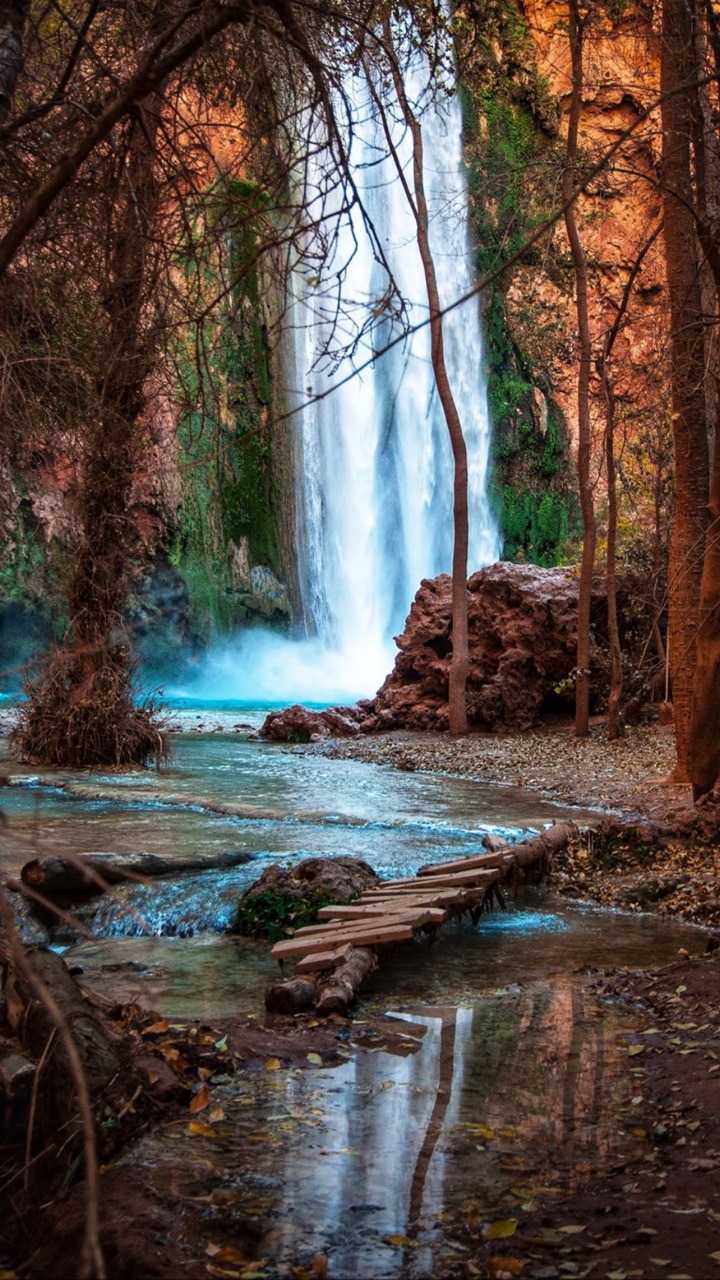
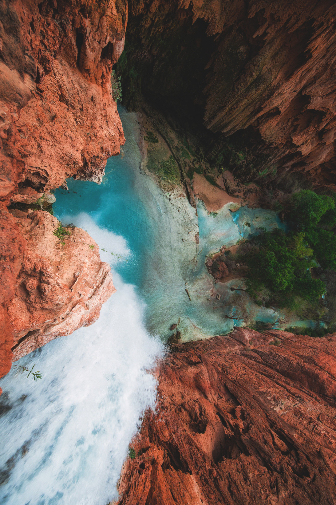
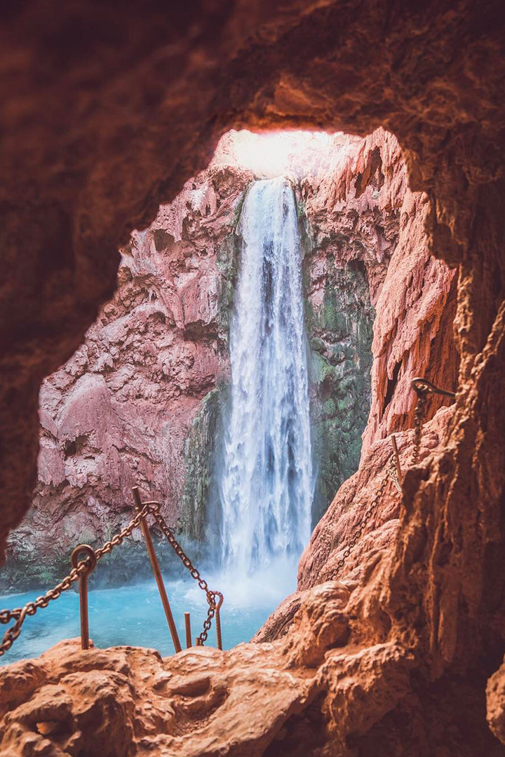
From a beautiful red rock, a stream of emerald-blue water flows. Light from the shifting sun illuminates the canyon in various shades and colors, from a dark amber-red to a vibrant blue. Intricate colors that seem to have been painted on a canvas are natural here – it’s insane.

If you haven’t hiked Havasu, you definitely should. It’s one of the most magnificent climbs in the world and is certainly one of the most beautiful waterfalls in Arizona. There aren’t enough words to describe how breathtaking this oasis is in the middle of the desert.

The “Havasu Falls Trail” is named after one of the area’s five significant waterfalls, “Havasu Falls.” The Havasupai Indian Reservation is home to this section of Havasu Falls.

Originally known as the Havasu Baaja, or “people of the blue-green lakes,” the Havasupai Tribe is a nomadic people that live in this part of northwestern Arizona. The Havasupai Indian Reservation’s Supai Community is now the most isolated village in the United States.

Havasu Falls is really paradise in nature. Not only are the spiritual vibes pretty intense, but the views alone are just incredible. It’s better than Disney World!

The Havasupai Waterfalls

Before we get into the actual Havasu Falls hike, I want to go over the 5 waterfalls you can see along the way.

The ultimate guide to your Havasu Falls hike! If you're planning on hiking Havasu Falls in the Grand Canyon for your Arizona vacation, there are a few things you need to know.

Havasupai is home to five of the world’s most impressive waterfalls. Most are commonly regarded as world-class in their splendor, like Havasu Falls and Mooney Falls. The term “Shangri-la of the Grand Canyon” is often used to refer to this location.

The following is the list of the Havasu waterfalls (in order) that you can view on the hike from Supai to the Colorado River.

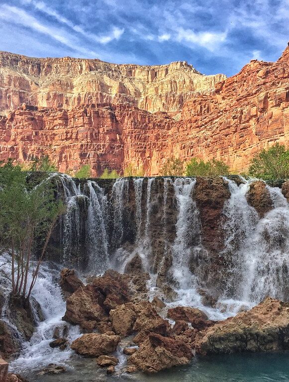
1. Fifty Foot Falls (New Navajo Falls)

The ultimate guide to your Havasu Falls hike! If you're planning on hiking Havasu Falls in the Grand Canyon for your Arizona vacation, there are a few things you need to know.

  • 50 feet in height
  • The result of the devastating 2008 floods and mudslides
  • Compared to the other swimming holes, it provides better swimming conditions and is less crowded
  • Situated around 0.8 miles upstream of Havasu Falls and about 1.0 miles below Supai Village
  • Surprisingly, this is the nearest significant waterfall to Supai

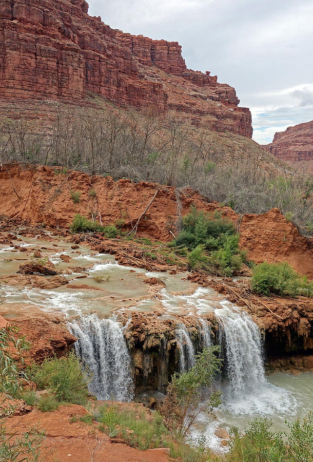
2. Lower Navajo Falls (Rock Falls)

The ultimate guide to your Havasu Falls hike! If you're planning on hiking Havasu Falls in the Grand Canyon for your Arizona vacation, there are a few things you need to know.

  • 30 feet in height
  • Created in part by the devastating floods and mudslides that struck the region in 2008
  • Excellent swimming chances even though many of the sites are shallow
  • About 0.15 miles of Upper Navajo Falls downstream

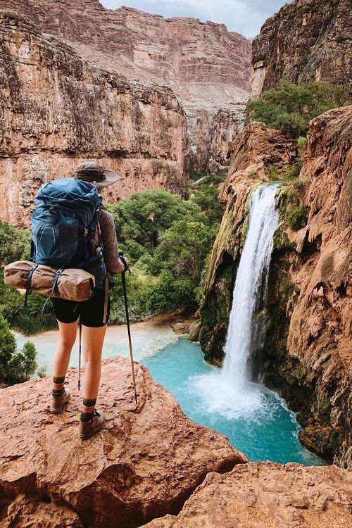
3. Havasu Falls

The ultimate guide to your Havasu Falls hike! If you're planning on hiking Havasu Falls in the Grand Canyon for your Arizona vacation, there are a few things you need to know.

  • 96 feet in height
  • This waterfall is among the most well-known in Havasupai
  • Provides a wide range of fantastic swimming options
  • Situated immediately before the campsite (about 1.8 miles downstream of the Supai Village)

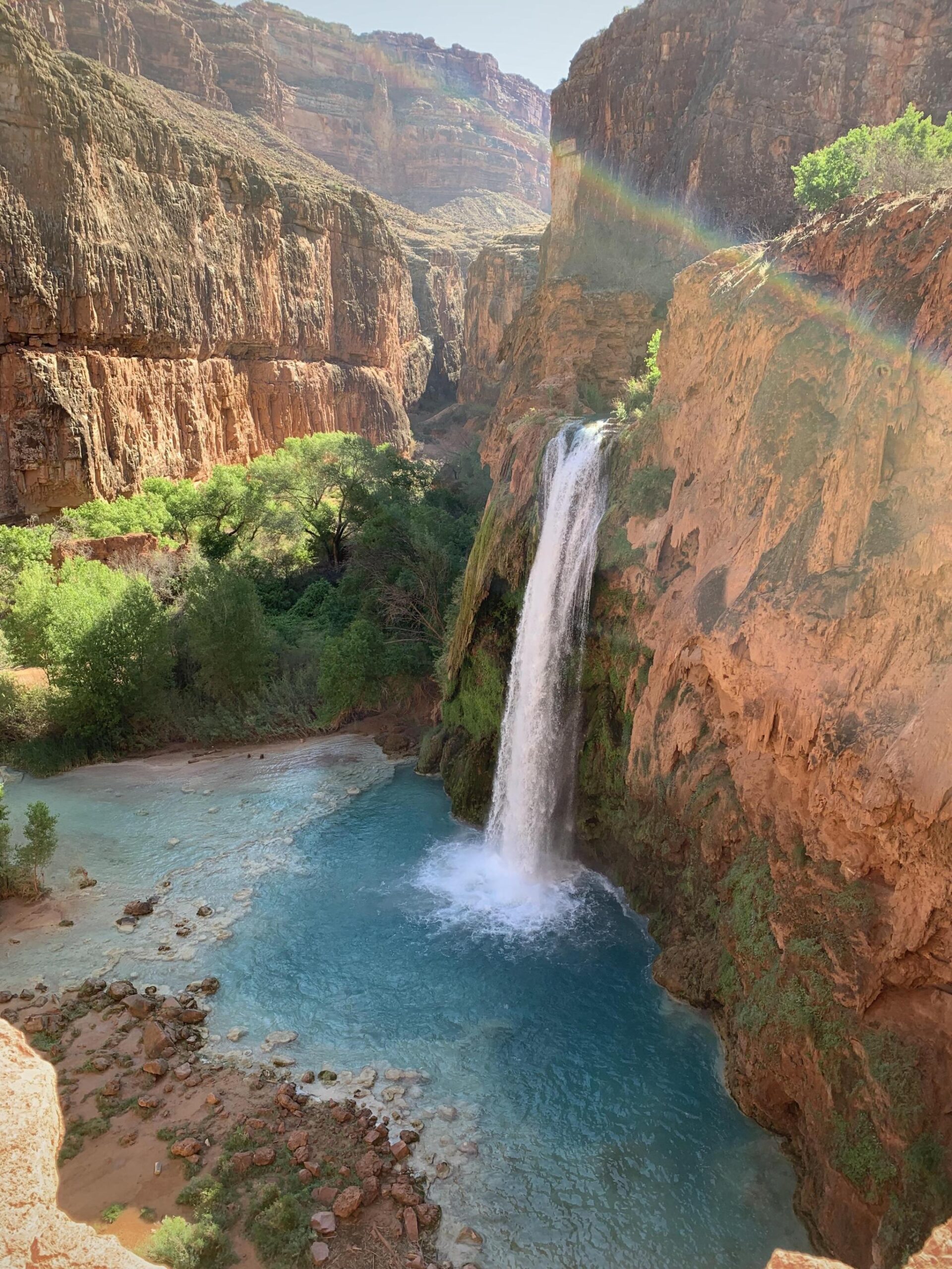
Don’t worry: Havasu Falls lives up to the photos in person. And unlike Mooney Falls, it’s pretty swimmable, making it a great place for families and adults. If you see nothing else on this trip you must see and hike Havasu Falls.  Plus, it’s a really short hike!

4. Mooney Falls

The ultimate guide to your Havasu Falls hike! If you're planning on hiking Havasu Falls in the Grand Canyon for your Arizona vacation, there are a few things you need to know.

  • 196 feet in height
  • Although the flowing currents can make it dangerous, it is a fantastic place to swim at certain times of the year (check the signage)
  • To get to the waterfall’s base, you’ll have to descend a sheer rock face (you’ll find shackles and ladders to help you along the way)
  • Near the bottom of Havasu Falls, about a half-mile downstream from the campsite

Most people don’t realize that Mooney Falls is actually way bigger than Havasu Falls. However, hiking Havasu Falls is a lot easier, so not as many people actually make it to Mooney Falls. The climb down is more than a little treacherous.

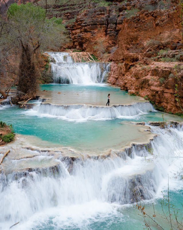
5. Beaver Falls

The ultimate guide to your Havasu Falls hike! If you're planning on hiking Havasu Falls in the Grand Canyon for your Arizona vacation, there are a few things you need to know.

  • 40 feet-high waterfalls that cascade over five levels
  • Provides a wide range of fantastic swimming options
  • Situated a distance of 3.0 miles from Mooney Falls
  • To get here, you’ll need to trek 6.0 miles round trip across challenging and rocky terrain and cross multiple streams
  • We don’t advise visiting Beaver Falls during the summer because of the excessive temperatures

At Havasupai, it’s challenging to select a favorite waterfall because they all have their own unique and beautiful traits. Beaver Falls would be our pick if we had to make a choice.  It’s just the best place for swimming and actually hanging out.

The 6.0-mile round-trip journey to Beaver Falls from the campsite is famous, although only about half of the tourists to the Havasupai Indian Reservation do it.

If you don’t want to swim, then just hike to Havasu Falls and back – you’ll get incredible views without a super long trip.

Hiking The Havasu Falls: What To Anticipate

The ultimate guide to your Havasu Falls hike! If you're planning on hiking Havasu Falls in the Grand Canyon for your Arizona vacation, there are a few things you need to know.

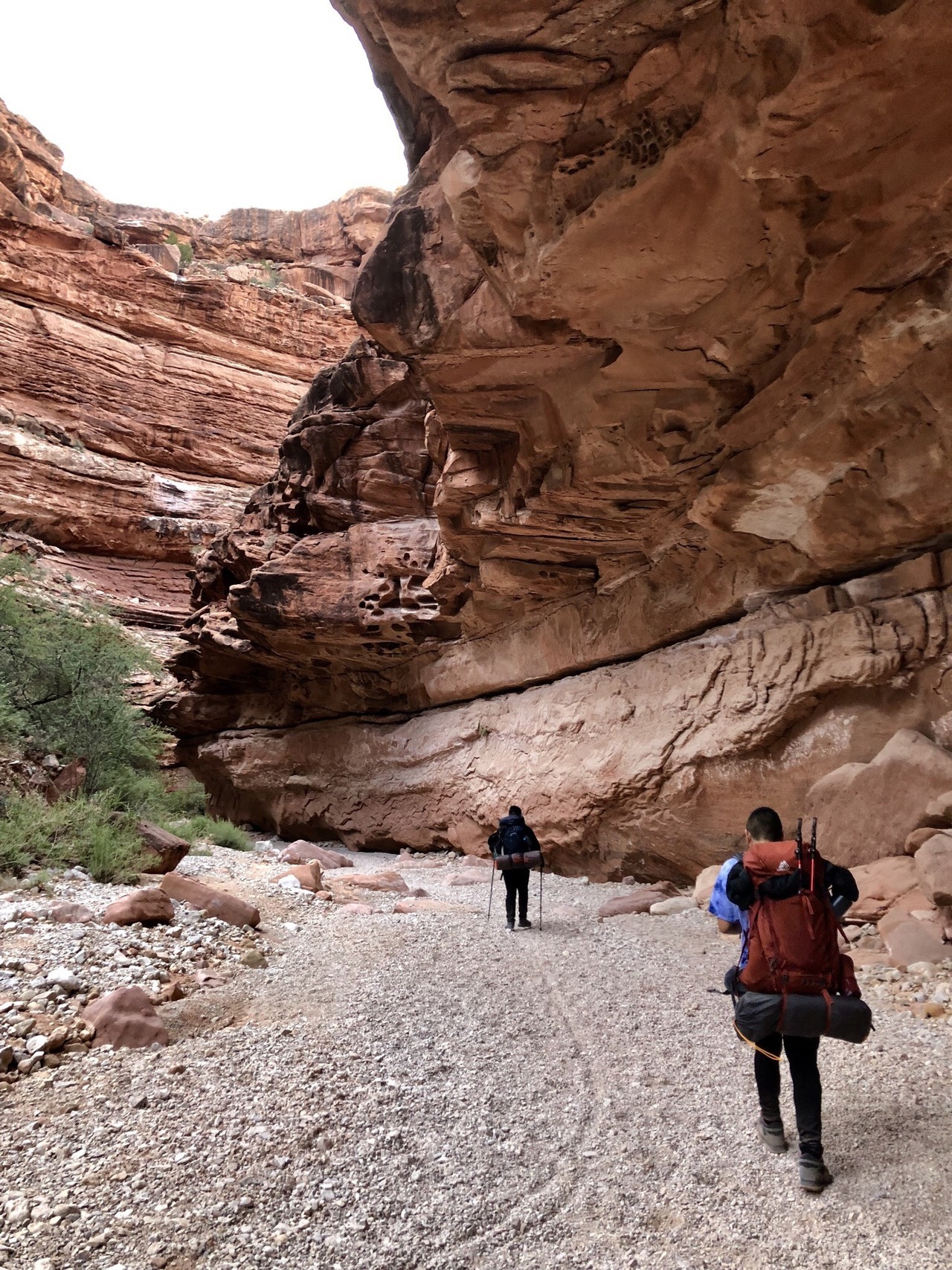
You can reach Havasupai and Havasu Falls by a 10.0-mile one-way climb that descends 2,400 feet in height, making it one of the more difficult hikes in Arizona. We can classify the trek to Havasu Falls as moderately challenging, yet it’s not difficult to follow at all because it’s well laid out. Inexperienced hikers can find things more complicated than they are.

Havasu Falls, the community, and the campsite are all accessible without much difficulty; however, the base of Mooney Falls requires a steep down-climb.

Most of the hike’s decrease in height happens within its first mile. A series of switchbacks eases hikers down a somewhat steep descent.

Between the trailhead and Supai (8.0 miles away), there are just a few places to rest under a tree. Thus, during the year’s hottest months, most hikers start early (between 3:00 and 6:00 am) to make the return journey as comfortable as possible.

After 7 miles of hiking downhill, there are no water sources to replenish one’s fluids. Bring at least 2 liters of water with you.

Most hikers need 5-6 hours to complete the 10.0-mile trail from trailhead to campsite. Quick hikers will take less time (4-5 hours), whereas slow hikers will take longer (6-7 hours). Most individuals spend 30-60 minutes longer on the trek back out than they did on the way in.

Hualapai Hilltop Trailhead to The Confluence

The ultimate guide to your Havasu Falls hike! If you're planning on hiking Havasu Falls in the Grand Canyon for your Arizona vacation, there are a few things you need to know.

The information below provides you with the distances and elevations covered by the Havasupai Trail and the numerous locations that it leads to. We include a complete list of all the points of interest from the Hualapai Hilltop trailhead to the Confluence of Havasu Creek and the Colorado River:

  • The trailhead at Hualapai Hilltop (5,200 feet in elevation) is the starting point for the hike.
  • Havasu Creek is 6.7 miles (3,240 feet in elevation) from the trailhead.
  • The Tourist Office / Village of Supai is at 8.0 miles (3,190 feet in elevation).
  • The Upper Navajo Falls is 9.0 miles (3,095 feet in elevation).
  • At an elevation of 3,018 feet, Lower Navajo Falls is about 9.15 miles.
  • It takes 9.8 miles to reach Havasu Falls, at 2,812 feet in elevation.
  • The campground’s starting point is 10.0 miles away, with an elevation of 2,741 feet.
  • It takes 10.3 miles at 2,708 feet elevation from the end of the campground.
  • You can reach Mooney Falls in 10.4 miles at 2,607 feet elevation.
  • Beaver Falls is a 13-mile hike up a mountain (2,246 feet in elevation).
  • The Confluence is a distance of 16.00 miles (elevation of 1,820 feet).

Things to Consider

It’s worth noting that most tourists only go to Havasu Falls or Mooney Falls. If forecasted high temperatures are approaching, there is no need to go farther than Havasu/Mooney Falls from June to September. In the colder months, seasoned hikers only should attempt extending their journey beyond Havasu and Mooney Falls. It is not part of the standard Havasupai experience to trek Beaver Falls or The Confluence.

Getting to the foot of Mooney Falls and continuing downstream requires an extremely steep descent down a precarious rock face. There are many chains and ladders that you can use to help you. Those afraid of heights can have a panic attack and have to get back down. It should be okay as long as you can help them overcome their modest fear of heights. To make the descent and ascent easier, some hikers pack gloves made of rubbery material.

Beaver Falls and The Confluence are optional excursions and should only be for experienced hikers during the colder months. Hiking over rocky and rugged terrain to reach these two unique places might be challenging at times. Many improvised bridges span Havasu Creek, and you’ll encounter a few tricky sections of scrambling. Hiking back from The Confluence is best done as soon as the sun comes up so that you have plenty of time to get there and back before the sunsets.

Always bring an updated Havasupai trail map, and find it on the official Havasupai Tribe website. The Havasu Falls hike tends to change (slightly) quite often from storms!

Havasu Falls Hiking Permits

The ultimate guide to your Havasu Falls hike! If you're planning on hiking Havasu Falls in the Grand Canyon for your Arizona vacation, there are a few things you need to know.

The Havasupai Tribe forbids day-through Havasu Falls hikes. To hike to Havasu Falls, you must purchase a 3-night/4-day camping permit instead of a 1-2 night ticket.

Do this via the Havasupai reserve system’s website when purchasing camping permits for your Havasu Falls hike. If you attend on certain days of the week, tickets might cost anything from $300 to $375 (weekends are more costly). The number of permits sold each day is limited to 300, and when they go on sale on February 1st each year, they sell out fast.

So OK: it’s kind of expensive, but it’s also never too crowded, which is the plus of purchasing tickets in advance.

It’s a good idea to have the following information on hand before attempting to make a reservation:

  • The name on the reservation. Reservations can only be confirmed if they are presented to Supai Village’s Tourist Check-in Office with a valid ID by the individual on the reservation;
  • Your preferred dates. Prepare a few selections before making your reservation. You may not secure your first, second, or third pick, so plan ahead of time;
  • A payment method. Reservations are non-refundable, non-transferable, and you can’t modify them once they are made;
  • You and your companions’ total number (you can’t change this later either)
  • Where you intend to rest your head at night (more on that shortly – there are a few different options)

The Havasupai Policies

These guidelines apply to visitors to Havasupai when hiking Havasu Falls:

  • Please refrain from photographing Havasupai’s citizens or community
  • Your permit does not enable you to remain longer than the allotted time
  • Please don’t bring more individuals than the number of persons permitted on your ticket
  • Practice the leave no trace (LNT) principles
  • Nudity is strictly prohibited
  • There will be no trekking at night, except for the hike in and out

Havasupai also forbids the following:

  • Alcohol (it will be confiscated if discovered)
  • Wood-burning fires (propane stoves, on the other hand, are acceptable)
  • Drones (it will be confiscated if found)
  • Major waterfall cliff-jumping
  • Rock-climbing
  • Off-trail hiking
  • Music played loudly
  • Littering (unfortunately, you’ll notice a lot of other people’s rubbish littering the place)

Havasupai and Havasu Falls are no longer open to day visitors. Before, it was possible to visit Havasupai on a 20+ mile day hike, but that option no longer exists today.

Havasupai tribal members can issue penalties and accompany day hikers off the reservation without their consent. So trust me: you don’t want to try and get around these rules. It’s definitely not worth it.

When Is the Best Time To Go to Havasu Falls?

The ultimate guide to your Havasu Falls hike! If you're planning on hiking Havasu Falls in the Grand Canyon for your Arizona vacation, there are a few things you need to know.

Havasu Falls permits are available from February to November, and the busiest months are May to September, with the monsoon months between July and August.

But that’s simplifying it since there are so many variables when hiking Havasu Falls. Here are more details about visiting each month.

February to April

During the colder months, the weather might be chilly, making it difficult to go for a swim. The Havasu Falls hike in (and back) will be considerably more pleasant in the colder months since the trail is mainly open to the sun. You’ll need to make sure that you have appropriate clothing and bedding since the nights can get cold.

May to June

It’s slightly warmer, but it might also be a little buggier. The average temperature in June is  96°F.

July to August

Havasupai receives the warmest temperatures during this period, with an average of 37℃/99°F. However, this is also the monsoon season and the busiest period for obtaining permits, even though the heat is extreme.

September to November

Temperatures can still be pretty warm in September but anticipate cooler temperatures in October and November and the chance that it could be freezing to swim depending on the year. Hiking Havasu Falls in the fall is definitely more of an adventure and less of a leisure vacation.

The ideal months to hike Havasu Falls are April, May, and October if you want the best of all worlds: mild temperatures that may yet urge you to take a dip in the water.

Remember that rain does not always imply the canyon is closed. Also, during the summer, when conditions are drier and the soil less able to absorb precipitation, flash floods are more likely to occur.

Getting to Havasupai

Getting to Havasupai isn’t always easy, but the reward is worth it! For Havasupai’s trailhead at Hualapai Hilltop, public transit is unavailable. To visit Havasupai, you’ll need to fly into one of these locations:

Major Airports

  • Las Vegas, Nevada (if you’re looking for a convenient airport, this is the best choice getting to Havasupai)
  • Phoenix, Arizona
  • Albuquerque, New Mexico

Minor Airports

  • Flagstaff, Arizona (even though this is the nearest airport, flying into it might be exorbitantly expensive)

To get to the Hualapai Hilltop trailhead at the end of Indian Road #18 in Arizona, you’ll need to hire a vehicle from one of these airports. From AZ 66 on the eastern edge of Peach Springs, go north on Indian Road #18 for approximately 60 miles (80 minutes).

Hualapai Hilltop trailhead is 170 miles from Flagstaff, Arizona, which takes around 3.0 to 3.5 hours to drive.

Las Vegas, Nevada to the Hualapai Hilltop trailhead is 221 miles, which takes around 4.0-5.0 hours to drive.

Phoenix, Arizona, to the Hualapai Hilltop trailhead is a 260-mile trip that takes between 4.5 to  5.5 hours of driving.

To get to the Hualapai Hilltop trailhead from Albuquerque, New Mexico, you’ll need to drive 490 miles for 7.5-8.5 hours.

Although the Havasupai Reservation is near Grand Canyon National Park, no highways lead there.

There are two primary routes to Havasupai from the Hualapai Hilltop trailhead:

  • 8-mile hike (one-way) to the Supai Village, followed by a 2-mile trek (one-way) to the campsite past Havasu Falls; and
  • A 15-minute helicopter flight to the Supai Village, followed by a 2-mile hike (one-way) past Havasu Falls to the campground.

The majority of visitors to Havasupai take the scenic route on foot. Helicopters are a possibility; however, there are several things to keep in mind:

  • No helicopter bookings are available, and flights are available on a “first-come, first-served” basis
  • Helicopter flights generally need a long wait time. Someone waited for seven hours, according to one report
  • Bring cash even though some people say credit cards are accepted if you’re taking a helicopter ride
  • For some reason, figuring out when the helicopter will take off is very hard since it doesn’t fly every day

Tips for Reaching the Trailhead

The ultimate guide to your Havasu Falls hike! If you're planning on hiking Havasu Falls in the Grand Canyon for your Arizona vacation, there are a few things you need to know.

It would be best to stop for gas before heading to the trailhead. That road is 60 miles long, and you’ll need another 60 miles to go back to the main road, so you’ll need at least 120 miles of gasoline in your tank. I can’t stress this enough when planning your Havasu Falls hike! It would suck to be stuck without gas.

Maintain vigilance. There are enormous animals on the route, like moose, cows, and deer, that can easily wreck your vehicle if you aren’t cautious while driving to the trailhead.

Keep an eye out for pebbles that can fall and damage vehicles if you park too close to the trailhead itself.

When you get to the village, you’ll need your license plate number, so snap a picture or write it down.

The trailhead does not have water, so bring your own.

Note that a mule ride to Havasupai is possible, but it’s pricey, and there are weight restrictions. If you want more information about a mule rental guide, you can go to the official website of Havasupai Tribe.

Lastly, neither powered nor mountain bikes are permitted in Havasupai.

Where To Sleep Before Havasupai?

The following hotels are the nearest to Hualapai Hilltop (the trailhead for the Havasupai hike):

Grand Canyon Caverns’ Inn

At the entryway to the Grand Canyon Caverns, situated in Peach Springs, Arizona, there is a 48-unit hotel room. It takes 66 miles and 80-90 minutes to travel from the trailhead. This is where we usually stay when hiking Havasu Falls (the night before).

Hualapai Lodge

It is also located in Peach Springs, where it offers 54 rooms in all. From the trailhead, it’s around 68 miles and takes about 80 to 90 minutes to travel.

There are several accommodation options in neighboring Kingman, Arizona (approximately 120 miles) and a couple in Seligman, Arizona (about 90 miles) in addition to the two hotels mentioned above.

There are also various campsites in Seligman and Kingman, including KOA Kampgrounds in both places.

Supai Village

The ultimate guide to your Havasu Falls hike! If you're planning on hiking Havasu Falls in the Grand Canyon for your Arizona vacation, there are a few things you need to know.
southwestexplorers.com

You’ll be at the Supai Village in no time at all. You can’t miss it since it’s located along the primary route in town and well-marked. It’s tiny, and you’ll see some residences, a small shop, a school, a restaurant, the lodge, and a few other structures. Check-in and obtain your wristband and tent tag at the tourist office.

Fill your water bottles at the water station near the office, which also serves as a pleasant rest stop before the last push to the campsite. Feel free to explore some, but keep in mind that this is their home, so be kind. You are not permitted to capture the region, particularly the individuals who reside there.

There are barely two miles remaining on the trek at this point. On your route, there are a few lesser waterfalls worth seeing that give you a taste of what’s to come. There are several unique rock formations worth studying in this region.

You’ll see the gorgeous Havasu Falls on your right as you enter the campsite, which is up a somewhat steep climb. Have a few moments to admire how beautiful it is and take some photos since this is an excellent viewing location.

Where To Camp?

The ultimate guide to your Havasu Falls hike! If you're planning on hiking Havasu Falls in the Grand Canyon for your Arizona vacation, there are a few things you need to know.

The Havasupai campground, located on the banks of Havasu Creek, is a lovely spot to spend the night. We definitely recommend camping when hiking Havasu Falls!

All of these amenities are available at the campsite.

  • Several campsites are level and well-shaded
  • There are a plethora of trees to hang a hammock
  • Toilets that use compost as waste
  • Picnic tables (not every site has this)
  • A Fern Spring on the western side of the canyon provides drinking and cooking water; watch for water coming out of a pipe
  • Havasu Falls, Mooney Falls, and a slew of minor falls and swimming areas are all within easy reach

A “distributed” kind of camping allows campers to set up camp in whatever location they like. Campsites are available on both banks of Havasu Creek. Some temporary wooden bridges will enable you to cross the stream safely.

Havasupai does not allow you to book a particular campground. First-come, first-served is the rule for all sites. Campsites with a picnic table are available at a limited number of spots, so groups will have to move throughout their stay to find a better location.

Havasu Falls campsite is around 0.2 miles downstream and stretches for 0.3 miles. At the very end of the grounds, you will locate Mooney Falls, a beautiful spot to explore. You can pitch a tent anywhere you choose between the camp and the last pit toilets above Mooney Falls. There are no camping options below Mooney Falls and upstream of Havasu Falls.

A lot of people come to the campsite. Any night of the week, up to 300 individuals can camp here. Due to a shortage of more private areas on popular evenings, other groups can choose to camp extremely near you.

You must be extra cautious with your food and equipment at the campsite. Critter bags, bear canisters, or sturdy plastic buckets (with full closures) are excellent choices. In particular, mice, raccoons, and squirrels can be ruthless in their pursuit of a free meal.

The creatures can or will eat your backpacks, tents, coolers, plastic water bottles, and other items. Please do not disregard this warning; folks lose meals and have their gear damaged every night because of these animals. Put a massive boulder on top of a sturdy plastic bucket if you’re using one.

While camping immediately by Havasu Creek might be nice, we don’t suggest it during the rainy season (July to early September). We recommend camping on higher ground at this period (if you can spot it; there are just a few upland campsites).

What To Bring – Packing List for Havasu Falls

Reduce the amount of stuff you bring with you. There are pack mules and helicopters that can bring your luggage down for a price, but we recommend you carry your luggage right to the campground!

If you can’t carry your gear down the falls (with obvious exclusions), you shouldn’t be hiking to the falls, or you should lighten your load.

Here are the essentials you need when you hike Havasu Falls:

Tent/Hammock: To conserve weight, we opted not to pack a tent but instead slept in our hammocks.

Cameras and Other Equipment: Take a picture of this breathtaking scene. In addition to a camera and lenses, we also carried a Go-Pro camera and a portrait lens for taking close-up images, and a wide-angle lens for capturing landscapes (NOTE: Drones are prohibited, but tripods are allowed).

Hiking Shoes: We recommend hiking boots with ankle supports.

Water Shoes: The canyon is rocky and slippery, and at the bottom of the rivers you’ll be going through, so we recommend bringing this stuff. Take a pair of Chaco or any other form of water shoe on your explorations. From the town of the tribe to the campground, the last 2 miles are all sand, and walking in hiking shoes through this terrain becomes quite tricky. Sandals will be a tremendous assistance, believe us.

Outfits: It’s okay to re-wear clothing while you’re down at the falls, but you’ll want a new pair for your two significant hiking days, especially socks.

Hat: It will be sunny, so wear a hat and sunscreen to be safe.

Food: Some meal options are available within the Grand Canyon, but they are inconsistent, and you do not want to travel to the Grand Canyon’s bottom without sustenance. It’s vital to pack electrolytes and dry fruit, but you should also bring your favorite snacks.

Water: A half-gallon water supply is sufficient for the first 10 miles, but you will need to replenish it when you get to the campground. We are advised to carry filters, but we didn’t use them and were okay.

First Aid Kit: Ensure you pack a lot of bandaids since it’s almost impossible to go this far without getting a single blister.

Bug Spray: We highly recommend that you use bug bands. It has a milder odor and is much easier to handle than traditional materials.

Blanket: Even while it did not seem like it would be so chilly, the wind chill and night with just an added effect to block the cold makes you want to snuggle up.

Charger/Battery: If you forget to put your phone into airplane mode when visiting the Grand Canyon and hiking Havasu Falls, it is still a good idea to pack a charger in case your phone runs out of power while you’re there.

Flashlight/Headlamp: A headlamp or flashlight can come in handy if you go out before sunrise when hiking Havasu Falls.

Quick-dry Towel: You need this to wipe out your sweat during your hike.

Toiletries: Avoid taking a bath in the water. Don’t contaminate their water by using your chemicals since the tribe performs an excellent job protecting the water.

Photography Tips:

The ultimate guide to your Havasu Falls hike! If you're planning on hiking Havasu Falls in the Grand Canyon for your Arizona vacation, there are a few things you need to know.

It is a photographer’s dream! The Havasu Falls Trail is a great place to take stunning photographs. For the most fantastic Havasu Falls photos, here are a few tips:

Learn Long-exposure Photography: Long exposure photographs offer the illusion of movement in the image, such as water flow, and enable night photography. Depending on your camera, you can access advanced capabilities like long-exposure photographs. Get to know your camera.

Get a Tripod: Bringing a tripod can assist keep your camera stable for long exposure photographs and keep it dry. We shot pictures in the water to properly frame the waterfalls.

Bring a Powerful Light if Shooting at Night: If you’re interested in hiking Havasu Falls, bring a stronger light than your headlamps, such as a bike light or an LED flashlight. These additional lights might assist expose a night photograph or highlighting a specific subject in the photo.

Pack a Wide-Angle Lens: On this trip hiking Havasu Falls, a wide-angle lens can help depict the size of several waterfalls.

Grab a Lightweight Camera Case: It’s a damp environment and a steep climb at points, so carry a hand-free camera bag.

Bring a Waterproof Camera Like a GoPro: A GoPro HERO4 Silver with water housing is a terrific alternative if you want to go more in the water with your camera.

For Pictures, Wear Bright Colors or Swimwear: The rocks of Havasu Falls are brilliant blue and red, so wear colors that contrast with them.

Wait for the Ideal Shot: The Havasu Falls trail is a popular hike, so expect to share the course with other hikers. Unless you are an expert at Photoshop, try waiting a few minutes or getting up early than others to photograph the falls alone.

Use Your Phone To Snap Photos: Nowadays, you can shoot excellent shots even with a phone. Many modern phones, like the iPhone, have lengthy exposure and water resistance. To be safe, we suggest packing a waterproof phone case.

The baby blue tint of the falls is stunning in any light, but we preferred it with a bit of cloud cover. If you go in March, much of the weather is like this. When the sun hit the falls, they were utterly bleached out to our camera but remained stunning to the naked eye.

The weather is unpredictable, so we avoid photographing the falls during noon. Photography is best done early in the morning or late in the day. It was approximately 4 pm when we arrived in Beaver Falls, ideal. If you don’t, you’ll end up with unsightly shadows.

If you travel to Beaver Falls in the afternoon, make sure you get back to camp before dark. Don’t forget about the spooky ladder at Mooney!

It’s a once-in-a-lifetime opportunity to backpack Havasu Falls. We hope this article has you in your preparations for your hike to Havasu Falls.

8 Breathtaking National Parks In Alaska To Visit

Alaska is home to the most magnificent national parks globally. And some of them are massive: if Alaska’s National Parks formed a state, it would be the 14th biggest state in the country, ahead of Utah.

Alaska’s national parks contain some of the most spectacular natural beauty featuring gigantic glaciers, jaw-dropping mountain ranges, vast herds of caribou, grizzly bears, bald eagles, wild salmon, etc.

There are 17 national parks in this Alaska and hundreds of smaller National Park Service locations, monuments, and state parks. With so much to select from, it’s easy to feel overwhelmed. Even for the most experienced explorer, finding out where to go, what to do, when to do it, and how might seem like a lot.

But don’t worry: we’ve provided you with a list of Alaska’s most beautiful national parks, with various activities to do in each one and all the information you’ll need. Some of these are the most popular while others are our favorites!

8. Kenai Fjords National Park

The best national parks in Alaska to visit during your Alaska vacation

Kenai Fjords National Park, outside of Seward, was established in 1980 to safeguard some of Alaska’s most magnificent and inaccessible nature.

Snow and ice dominate 60% of the park, with the huge 936-square-mile Harding Icefield bordering the park’s perimeter. Countless tidewater glaciers stream down from the enormous icefield, creating valleys that fill with saltwater to produce magnificent fjords. The water views are incredible!

The Exit Glacier, the Harding Icefield, and the shoreline are the three primary regions of Kenai Fjords National Park. The park’s most accessible portion is Exit Glacier, a half-mile-wide river of ice. The 700-square-mile Harding Icefield is one of the few remaining icefields in the United States, and it’s also the country’s largest.

You can find beautiful tidewater glaciers and abundant marine life throughout the park’s rocky coastline.

How To Get There

Seward is 130 miles south of Anchorage, and you can access it year-round through the Seward Highway or during the summer months by the Alaska Railroad.

From the Exit Glacier region in Seward, travelers can enter the park by tour boats, water taxis, air taxis, and foot. Seward is also a popular stop for cruise ships.

What To Do

The best national parks in Alaska to visit during your Alaska vacation

Take a Hike on the Harding Ice Fields Trail: In Kenai Fjords National Park, the Harding Ice Fields Trail is the most popular hiking route. Over 4000 feet of elevation rise makes this 8-mile round-trip climb a challenge.

Explore Exit Glacier: Alternatively, you can go up to exit Glacier, which is a straightforward climb but still provides stunning views of a natural glacier from the comfort of your camp.

Take a Ferry Ride: Take a day to see the park in the best manner possible: by ship! This is ideal for viewing the park since you cover a lot of land and get up close to some fantastic species and scenery.

Paddle a Kayak: Water taxis and guided tours from Seward are available for kayaking in Resurrection Bay.

The best national parks in Alaska to visit during your Alaska vacation

Wildlife Viewing: A varied range of flora and fauna call the craggy coastline and magnificent fjords home. Black and brown bears, mountain goats, lynx, porcupines, moose, wolverines, and marmots are among the land animals found in the region. Orcas, gray whales, humpback whales, minke whales, fin whales, Dall’s porpoises, sea otters, Steller sea lions, and harbor seals make their homes in the nutrient-rich glacial waters.

The best national parks in Alaska to visit during your Alaska vacation

The park also provides a haven for migratory and resident birds. Puffins, common murres,  cormorants, kittiwakes, pigeon guillemots, and eagles are among the over 190 species present in the region.

Where To Stay

Exit Glacier Campground:  Only one developed campsite is available near Exit Glacier in Kenai Fjords National Park. This campground offers 12 walk-in tent-only sites on a first-come, first-served basis.

Backcountry Camping: Most people who camp in the Kenai Fjords’ backcountry choose to kayak down the shore.

There are various backcountry choices to consider (even on the Harding icefield). Anyone traveling into the woods should be highly cautious of bears and consider hiring a guide.

Holgate Cabin and Ailiak Cabin are two public-use cottages in Kenai Fjords National Park that you can reserve during the summer and are only accessible by boat.

When the Exit Glacier road shuts for the winter, another cabin, the Willow Cabin, becomes accessible for public use.

The Kenai Fjords Glacier Lodge is the only lodge on the Kenai Fjords Coast. You can only access it by boat. Alternatively, you can find various lodges and hotels in the Seward.

When To Visit

Summer is the most incredible season to explore Kenai Fjords National Park since the days are longer. Temperatures in the summer vary from 40 to 70 degrees Fahrenheit.

Exit Glacier’s road typically opens in May and shuts when the first snow falls (around October). However, the park itself is open year round.

For the most excellent possibilities of clear days, we recommend July and August. There’s just so much to see at this Alaska national park in the summer!

7. Wrangell-St Elias National Park

The best national parks in Alaska to visit during your Alaska vacation

With its towering peaks and enormous glaciers, Wrangell-St Elias National Park is the most extensive and most magnificent unit of the United States National Park System. Wrangell-St. Elias spans from Mount St Elias (18,008 feet), one of North America’s highest peaks, to the Gulf of Alaska’s ocean.

The Chugach, Wrangell, and St. Elias Mountain Ranges meet in a region the size of six Yellowstone National Parks, earning it the nickname “the mountain kingdom of North America.”

The Copper Center Visitor Center, located near the hamlet of Copper Center at Mile 106 of the Richardson Highway, is the park’s primary visitor center. A theater, natural history displays, a bookshop, and a giant interactive map display are all available at the center.

The Ahtna Cultural Center, located next to the tourist center, has exhibits, a museum, and information on the Ahtna Athabascan people. A short nature walk outside the visitor center leads to stunning views of the Wrangell Mountains.

How To Get There

The Copper Center Visitor Center is 190 miles on the Glenn Highway from Anchorage, 250 miles from Fairbanks, and 110 miles on the Richardson Highway from Valdez.

This vast park is only accessible through two dirt roads. The 42-mile Nabesna Road connects to the park’s northernmost point, while the 60-mile McCarthy Road leads straight into the park’s core. Air taxis and flightseeing tours into the park are available from Glennallen, McCarthy, and Chitina airstrips.

What To Do

The best national parks in Alaska to visit during your Alaska vacation

Discover the Kennecott Mine: Wrangell St. Elias National Park is famous for its old Kennecott Mine, shown prominently in many of the park’s photographs.

Make Your Way Up the Root Glacier Trail: The Root Glacier can be found just beyond the Kennecott Mine. We highly recommend taking the picturesque route to and from the Glacier!

Drive the Nabesna Roador or McCarthy Road: We strongly suggest driving down one or both of the park’s roads if you have the appropriate (4WD) vehicle. There are few other people, so there is plenty of wildlife, camping, beauty, and hiking in private.

Embark on a Beautiful Flight: Flying above the park is ideal for experiencing its splendor and making the most of your stay there. Wrangell’s flightseeing is spectacular, though not super affordable.

Wildlife Viewing: Wrangell-St. Elias National Park is home to a diverse range of wildlife, including Dall sheep and mountain goats in the alpine, caribou in the Wrangell Mountains to the north, and moose in the bogs and brushy parts of the lowlands.

The park is also home to both brown and black bears. Bison herds were released in the Copper River Valley in 1950 and along the Chitina River in 1962, and remnants of both herds can still be seen today.

Where To Stay

McCarthy Road and Nabesna Road are two sites in Wrangell St. Elias that provide many camping opportunities. Along these routes are various roadside camping spots that offer picnic tables and pit or vault toilets.

Wrangell St. Elias National Park also offers a variety of backwood camping possibilities. Even wilderness lodges are available! Visit the park service’s backcountry website for more information about backcountry camping.

The picturesque Kennecott Glacier Lodge, situated inside the park overlooking the Root Glacier, is highly recommended. Ma Johnson’s Historic Hotel, Currant Ridge, Blackburn Cabins, and Kennecott River Lodge are a few more places to stay in and surrounding McCarthy.

When To Visit

The most fantastic time visiting Wrangell-St Elias National Park in Alaska is from June through August, when temperatures are pretty cold, but there is minimal rainfall. In Wrangell-St. Elias National Park’s highest average temperature is 13°C in July, and the lowest is -10°C in December.

If you want to visit in May/June, keep in mind the passes may still be snowy. By September, it’s normal to have freezing temperatures at night. I definitely suggest that you take advantage of the short summer window!

6. Gates of The Arctic National Park

The best national parks in Alaska to visit during your Alaska vacation

The Arctic Divide of the Brooks Range, America’s northernmost series of mountains, is crossed by the Gates of the Arctic National Park. It stretches from the Brooks Range’s southern foothills, past its craggy peaks, and onto the North Slope.

Gates of the Arctic National Park, which stretches 13,238 square miles and is north of the Arctic Circle, is only second in size to Wrangell-St. Elias National Park.

In its most basic form, the Gates of the Arctic is an immense wilderness the size of Switzerland with no National Park Service services, visitor centers, or campsites. The park is devoid of highways, except the Dalton Highway (renowned for its portrayal in Ice Road Truckers), and has just one hamlet, which is the Anaktuvuk Pass. Eight other Alaska Native settlements dot the outskirts, although each has less than 400 permanent people.

This is certainly one of the most rural national parks in Alaska!

How To Get There

Most travelers fly from Fairbanks to Anaktuvuk Pass, Bettles, or Coldfoot on a scheduled or charter flight. Bettles and Coldfoot provide bush charters into the park’s limits.

The Dalton Highway, which is accessible all year, is just 5 miles from the park, and some travelers choose to trek in from there, usually starting in Wiseman or Coldfoot.

What To Do

The best national parks in Alaska to visit during your Alaska vacation

Wilderness Adventure: The Gates of the Arctic is one of the world’s few actually wild regions. You can travel through broad valleys and gaunt mountains of austere beauty on an adventure, exploration, and solitude excursion and see intact ecosystems where people have lived with the land for thousands of years.

Explore the Brooks Range: The Brooks Range’s isolated location, harsh climate, and terrain require visitors to have the knowledge and abilities to be genuinely self-sufficient. Those who visit will discover several chances for leisure, natural calm, isolation, and wilderness pleasure, but make sure you know what you’re doing/what time of year to go.

Backcountry Camping: Backpackers have access to 8.4 million acres of magnificent wilderness where they may roam at their leisure. You can find camping areas around lakes and gravel bars surrounded by breathtaking natural beauty. There are many rivers to float, including six classified as Wild Rivers.

Flightseeing: You can have flightseeing tours, day outings, and overnight camp-outs in distant areas via local air taxis. Visitors can also take air taxis to the nearby Kobuk Valley National Park to explore the dunes or the Noatak Preserve. The Bettles Visitor Center at Gates of the Arctic National Park and Preserve and the Arctic Interagency Visitor Center in Coldfoot are where visitors may receive their National Park Service passport stamps for those places.

Wildlife Viewing: Grizzly bears, wolves, Dall sheep, moose, and wolverines can all be found in the park and preserve. The park’s sole paths are those created by the Western Arctic caribou herd, one of Alaska’s most prominent, with over 200,000 animals. Grayling and Arctic char fishing are excellent in the clear streams, while lake trout fishing is excellent in the more significant, deeper lakes.

Where To Stay

Gates of The Arctic National Park isn’t the place for you if you’re searching for a lodge or an established campsite. Campgrounds and hotels in Gates of the Arctic aren’t a thing; there are no pre-existing facilities.

The only option is to camp in the wilderness.

When To Visit

Summer is the best time of year to explore Lake Clark National Park. The months of July and August provide the highest chances of seeing clear skies. Regardless of the weather prediction, rain is almost sure to fall throughout your getaway.

5. Glacier Bay National Park

The best national parks in Alaska to visit during your Alaska vacation

Glacier Bay National Park is one of Alaska’s most magnificent locations with lofty mountain peaks, ice-sculpted fjords, various marine animals, and large tidewater glaciers. Every cruise ship passing through the Inside Passage must stop at the 3.3 million-acre park for a reason.

Glaciers still cover around a quarter of the park today. More than 50 glaciers have been named, with seven active tidewater glaciers that calve icebergs into the sea. The Fairweather Range, at 15,000 feet, encircles the park to the west, making it the world’s highest coastal mountain.

How To Get There

The best national parks in Alaska to visit during your Alaska vacation

Most Glacier Bay National Park and Preserve tourists come by cruise ship and do not disembark during their stay. By plane or passenger ferry, you can reach the adjacent town of Gustavus. Alaska Airlines flies from Seattle and Anchorage to Juneau daily, connecting to Gustavus via various carriers.

Several air taxi firms fly small planes to Gustavus all year from several locations in southeast Alaska. The park headquarters at Bartlett Cove is 10 miles from Gustavus airport. A passenger ferry connects Juneau to Gustavus/Bartlett Cove on a restricted timetable.

This is one of the more difficult national parks in Alaska to actually get to, but trust me: the views are worth it.

What To Do

The best national parks in Alaska to visit during your Alaska vacation

Boat Tour: Glacier Bay National Park in Alaska is best seen by boat. While the trip might be pricey, it’s well worth it if you have the funds.

Kayaking: You can find some of the best kayaking in the world at Glacier Bay, which is surrounded by gigantic glaciers and magnificent coastline scenery.

Hiking: Glacier Bay’s Bartlett Cove has multiple routes with boardwalks along the shore, making it the most popular place to trek in the region.

Wildlife Viewing: Glacier Bay is home to humpback whales, orcas, Stellar sea lions, harbor seals, sea otters, and porpoises, which make up almost one-fifth of the park’s marine waters. Glacier Bay is also home to a significant bear population, both brown and black, and the blue glacier bear, a unique color phase of the black bear. The park is also home to wolves, moose, mountain goats, Sitka blacktail deer, and bald eagles.

Where To Stay

Glacier Bay National Park has only one developed campground, Bartlett Cove. Visitors must get a free permit from the ranger station to camp in this area.

Glacier Bay is a popular destination for kayak-based backcountry camping. It’s one of the more rural national parks in Alaska.

Campers must first complete a park service-required backcountry camping orientation and permit application.

The Glacier Bay Lodge is an excellent choice for your accommodation. Glacier Bay Country Inn and Bear Track Inn are two more accommodation alternatives in Gustavus.

When To Visit

The best national parks in Alaska to visit during your Alaska vacation

Summer is the perfect time to explore Glacier Bay National Park. If you want the highest possibility of rain-free days, we recommend July and August as the ideal months, like most other Alaska national parks.

Regardless of the weather prediction, the rain will fall throughout your vacation, and there will be a lot of it, so bring your rain gear!

4. Katmai National Park

The best national parks in Alaska to visit during your Alaska vacation

Katmai National Park is a real wilderness destination located about 260 miles southwest of Anchorage. The park is home to over 2,200 brown bears, many of which cluster on the Brooks River to feast on summer salmon runs, making it one of Alaska’s most fabulous bear-watching places.

Some visitors come for the valley of 10,000 Smokes’ unearthly volcanic environment, but most come for the bears. This is one of the best national parks in Alaska to see wildlife up close and personal!

How to Get There

The park is accessible all year, although concessioner services are only available from June to mid-September at Brooks Camp, the park’s central entrance point.

Brooks Camp, 30 miles distant, is only accessible by tiny floatplane and can only be accessed by commercial airplane from Anchorage. From Kodiak, Homer, and Anchorage, bear-watching tour packages, including one-day trips, are available.

What To Do

The best national parks in Alaska to visit during your Alaska vacation

Bear Watching at Brooks Falls: Brooks Falls is home to the world-famous Katmai National Park bear cam. Once you arrive, you can enjoy the most extraordinary bear watching on the globe from a protected platform.

Fishing: Because the Brooks River is home to world-class fish, bears assemble in such large numbers near Brooks Falls. You will have a world-class fishing experience at this location alongside some furry friends.

Observe the Valley of 10,000 Smokes: Volcanic vistas of Katmai National Park include the Valley of 10,000 Smokes, possibly the most renowned and stunning. From Brooks Camp, you can take a bus excursion to this breathtaking valley. This is one of the coolest national parks in Alaska to see volcanos.

Flightseeing Katmai National Park:  The best way to appreciate Katmai National Park’s magnificent volcanic terrain is to fly above it. The trip has an hour of flying time to enjoy the superb view of the park.

Where To Stay

At Katmai National Park, Brooks Camp is the only established campsite. You’ll need to take a little aircraft ride to get to the campsite.

Instead of defined campsites, the campground has a 60-person capacity quickly booked through recreation.gov.

The Brooks Lodge, situated near Brooks Falls, a well-known spot for observing bears, comes highly recommended.

When To Visit

The most excellent time to see bears in Katmai National Park is from late June to September, and that’s why most people come. During this period, there are possibilities to see bears.

The salmon runs at Brooks Falls in late June, July, and September. However, like most Alaska national parks, you’ll be limited in September since the temperatures majorly drop.

3. Kobuk Valley National Park

The best national parks in Alaska to visit during your Alaska vacation

Kobuk Valley National Park is a 1.7 million-acre park in Arctic Alaska that encompasses a vast valley where the Baird and Waring Mountain ranges surround the middle segment of the Kobuk River. This semi-enclosed basin, 75 miles east of Kotzebue, preserves numerous unique geological features and lies on the Western Arctic caribou herd’s migratory path.

The Kobuk Valley is at the crossroads of the boreal forest and the treeless Arctic tundra that stretches westward to the Chukchi Sea. The boreal forest is open woodland with few trees in a layer of thick tundra at its northernmost point.

The Great Kobuk Sand Dunes, which comprise 25 square miles, the Little Kobuk Sand Dunes at Onion Portage, and the Hunt River Dunes occupy a large portion of the southern Kobuk Valley. These are the Arctic’s most fabulous active dunes. These wind-sculpted dunes reach up to 100 feet and are stabilized by the area’s flora. Despite 40 miles above the Arctic Circle, summer temperatures can reach 100 degrees. The dunes are accessible through a challenging hour-long climb down Kavet Creek from the Kobuk River.

How To Get There

The best national parks in Alaska to visit during your Alaska vacation

Kobuk Valley is not accessible by road. The majority of people fly in either Kotzebue or Bettles to get to the park. Regular flight service is provided throughout the summer from Anchorage to Kotzebue and Fairbanks to Bettles.

The park is only accessible by aircraft, snowmobile, or dogsled in the winter. While it’s one of the tougher national parks in Alaska to access, the views and activities are incredible.

What To Do

The best national parks in Alaska to visit during your Alaska vacation

Kobuk River: The Kobuk River is a slow-moving river that provides incredible wilderness float trips through magnificent boreal woods surrounding animals. Boaters can reach the Salmon River’s headwaters by loading their boats from high mountain airstrips.

Wilderness Adventure: The finest wilderness trekking is done in the mountains, where there are more wide vistas and firmer footing than on the mushy lowland tundra. The Onion Portage and the Great Kobuk Sand Dunes, where the Western Arctic caribou herd crosses the Kobuk River twice a year, are popular camping and hiking destinations.

Flightseeing: Another excellent method to experience the park’s distinctive sights and fauna is flying above it. Flightseeing trips over the park are available from Kotzebue and Bettles, with the possibility to land in the area for up-close exploration.

Wildlife Viewing: The Western Arctic caribou herd, one of Alaska’s largest with roughly 200,000 animals, travels through the park from calving grounds north of the Brooks Range to winter grounds south of the range.

This 600-mile trek is one of the world’s last extensive animal migrations. Thousands of migrating birds, including arctic terns, swans, cranes, geese, and ducks, spend the summer months in the park. Moose, grizzly bears, wolves, wolverines, foxes, and porcupines are among the park’s other land wildlife.

Where To Stay

Within Kobuk Valley, there are no roads, campsites, or maintained trails. However, you can do backcountry camping here. The Onion Portage and the Great Kobuk Sand Dunes are popular backpacking destinations. The park’s information is available through the Northwest Arctic Heritage Center, Kotzebue.

While we personally think this is one of the best national parks in Alaska, don’t plan a trip lightly: you ned to know what you’re doing to survive.

When To Visit

The ideal time to visit Kobuk Valley National Park is during the summer. The days are long (the sun doesn’t set from roughly June 3 to July 9), and temperatures in many regions may reach the 80s or higher. The best time to see wildflowers is from mid-June until late July. The Kobuk River ice breaks up in May and starts to rebuild by mid-October.

2. Lake Clark National Park

The best national parks in Alaska to visit during your Alaska vacation
Instagram.com/jakeelko/

This park is an undiscovered gem, with gorgeous scenery, near access to Anchorage and Homer, and less than 20,000 people visiting each year.

Lake Clark National Park is about 100 miles southwest of Anchorage and has some of Alaska’s most beautiful scenery, including mountains, glaciers, granite spires, thunderous waterfalls, wave-washed beaches, and the state’s biggest lake.

The 5,625-square-mile park runs from the Cook Inlet coastlines to the tundra-covered highlands of Southwest Alaska, passing via the Chigmit Mountains. Lake Clark, a 42-mile-long turquoise body of water surrounded by mountains, is the park’s showpiece. Mount Iliamna, at 10,016 feet, and Mount Redoubt, at 10,197 feet, are active volcanoes that erupted in 1990, throwing ash to Anchorage, in the Chigmit Mountain, where the Alaska Range meets the Aleutian Range.

The valleys, lakes, and foothills on both sides of the Alps indicate glacially changed topography. The lowest areas of the park’s southwest region are covered with boreal forest, with white and black spruce accounting for the majority of the coniferous trees. Tundra dominates the farther north and west areas.

How To Get There

The only approach to get to Lake Clark is via a small charter plane from Anchorage, Kenai, or Homer, which takes about an hour. Small aircraft that fly guests into the park for day excursions land on lakes, gravel bars, or beaches where they can spend the day fishing or observing bears.

You can only reach the majority of isolated lodges by air taxi from Port Alsworth, located on Lake Clark’s south side.

What To Do

The best national parks in Alaska to visit during your Alaska vacation

Bear Watching: Brown bears congregate along the shore, lakes, and streams to eat salmon and clams, making bear watching a highlight of Lake Clark National Park. Visitors can fly into the park on guided day trips from Anchorage, Kenai, and Homer to spend time seeing these beautiful creatures.

Canoeing and Kayaking: You will find some of the world’s most breathtaking water sports in Lake Clark National Park. Experience it firsthand by paddling a canoe or kayak on Lake Clark.

Wildlife Viewing: You can find a diverse range of subarctic fauna in Lake Clark. Some land animals include brown and black bears, moose, the more than 100,000-strong Mulchatna caribou herd, Dall sheep, and wolves. Also, you can witness harbor seals, beluga whales, Steller sea lions, and sea otters along the coastline.

Day Hikes:  From Port Alsworth, you may take a leisurely walk through some of the most magnificent landscapes in Alaska.

Fishing: This world-class fishing destination is known for its abundant wild salmon and beautiful trout.

Where To Stay

For those searching for a pleasant multi-day vacation into the wilderness, Lake Clark boasts numerous isolated lodges accessible from Port Alsworth. There is one primary camping area and two public-use cabins on Lake Clark.

Priest Rock Public Use Cabin and Joe Thompson Public Use Cabin are the two public-use cabins that you can reserve.

The Farm Lodge, Chulitna Lodge, Redoubt Lodge, and the Silver Salmon Creek Lodge are just a few Lake Clark hotels and lodges.

When To Visit

Early summer is the perfect time to visit Lake Clark National Park to enjoy the sun and beautiful weather. However, many people claim that the park is gorgeous in August, with many visitors flocking to the park to take in its natural beauty.

Obviously, this is one of the most rural national parks in Alaska, so you should only visit if you’re ok with roughing it.

1. Denali National Park

The best national parks in Alaska to visit during your Alaska vacation

This world-famous national park is known for its pristine landscapes, spectacular wildlife, and the towering Denali.

Denali National Park encompasses 160 miles of the Alaska Range, featuring granite spires and snowy peaks occasionally buried in clouds. North America’s tallest mountain dominates the skyline.

Denali rises magnificently to 20,310 feet, making it one of Alaska’s most awe-inspiring spectacles. Around 400,000 adventurous visitors visit Denali National Park every year, mostly between late May and early September.

The Eielson Visitor Center is Denali National Park’s newest and most spectacular interpretive center. The 7,400-square-foot structure has natural history exhibits, a giant Denali model, and panoramic views of North America’s highest mountain.

How To Get There

The best national parks in Alaska to visit during your Alaska vacation

The Parks Highway provides easy access to the park’s entrance (120 miles south of Fairbanks; 235 from Anchorage). It’s one of the easier national parks in Alaska to access, which is one of the reasons it’s so popular. There are many ways to get to Denali!

What To Do

The best national parks in Alaska to visit during your Alaska vacation

Bus Tour: Ride the bus deep into the park to look at America’s last frontier.

Bike Tour: Rent a bike and pedal it beyond where the private automobiles can go witnessing all of the park’s amazing beauties in the open air.

Hike the Savage Alpine Trail: To test your mettle, we suggest a hike up the Savage Alpine Trail, which is 8 kilometers round trip and gains 1500 feet in altitude. This trek is often cited as one of the park’s best and is accessible through the Savage River area.

Wildlife: In addition to the beautiful golden eagle, the park is home to 37 other animal species, including lynx and marmots. On the other hand, most tourists are interested in seeing Alaska’s “Big Five” animals: moose, caribou, wolf, Dall sheep, and brown, or grizzly, bear. Grizzlies are the most common bears observed by park visitors along Park Road. Black bears live in Denali’s forested areas, whereas grizzly bears prefer the tundra’s open expanses.

You don’t need to be a traveler to witness this wildlife—people who never sleep in a tent have a fantastic opportunity to get a close look at these beautiful species grazing free in their native environment, unlike most wild places in the nation.

Camping: Take the bus to a tent and spend the night in Alaska’s premier national park on a bucket list trip.

Where To Stay

The best national parks in Alaska to visit during your Alaska vacation

Denali National Park has six constructed campsites accessible from the park’s main road.

Denali campsites do not need reservations in advance. However, reservations are recommended since space may be limited. Denali is definitely one of Alaska’s most popular national parks.

The campgrounds accessible to tourists are Riley Creek, Savage River, Sanctuary River, Teklanika River, Igloo Creek, and Lake Campground.

Except for Riley Creek, all campsites are only available during the summer. Those who dare can camp for free in the winter.

While Denali National Park lacks official park lodges, there are plenty of fantastic lodging options, most of which are expensive.

Most visitors choose to remain outside the park; however, there are four choices on privately owned property inside the park’s limits. You’ll find skyline Lodge, Kantishna Roadhouse, Camp Denali, and Denali Backcountry Lodge at the end of the park’s main road. We recommend reserving your accommodations as early as possible since they tend to sell out well in advance.

When To Visit

The best national parks in Alaska to visit during your Alaska vacation

Summer is the greatest time to visit Denali National Park because of the longer days and milder temperatures. The longer, brighter summer days are perfect for those who want to glimpse the big mountain’s summit. As a result, the weather prevents most tourists to this Alaskan national park from seeing Denali’s pinnacle.

August is the best month to visit Denali since it has fewer insects and nicer weather than July. In Denali National Park, the month of August has the best sunshine.

Things To Know Before Visiting an Alaska National Park

Have Bear Spray: Grizzly bear encounters in Alaska National Parks are significantly more likely than in parks in the lower 48 states, so bring bear spray. Even if you don’t need bear spray 99 percent of the time, it’s better to be safe than sorry.

Bring Insect Repellent: Alaska is notorious for its craziness when it comes to mosquitoes. Insect repellent is a must-have for everyone visiting coastal parks, regardless of the season or time of year. Mosquito net hats, trousers, and top covers are more options.

Verify If You Can Bring Your Dog: Dogs aren’t permitted on the trails in many national parks because their presence might harm the natural environment. Before bringing your pup to the park, double-check to see whether they’re allowed where automobiles are.

Protect Living Trees and Plants: Instead of securing your tarp to a tree, use tent stakes to hold it to the ground.

Keep Your Distance From Wildlife: Keep a safe distance from animals and allow them the right of way. Camping near denning sites, food caches, and alder or birch thickets is not recommended.

Leave Natural and Cultural Items Where You Find Them: All of Alaska’s parks and preserves have a rich human history, and evidence of these civilizations can be discovered all around the state. Read the rules for locating natural and cultural things in each park before going.

11 Dazzling Hot Springs In Utah To Visit: Complete Guide

Utah is home to many natural wonders, ranging from towering sandstone cliffs to massive rock formations with unusual shapes. You may not realize that Utah is also home to some of the best hot springs in the world, many of which are just as beautiful as the megaliths.

On-site extras like waterslides, yoga on a paddleboard, and camping transform a day trip into a fun-filled weekend of several activities. These hot springs in Utah have a lot to offer!

On your epic Utah vacation, don’t miss out on these 11 blissful hot springs, which range from the mineral-rich waters of Red Hill to the cascading waters of Mystic.

11. Mystic Hot Springs

The best hot springs in Utah on your Utah vacation | Utah hot springs and Utah activities
instagram.com/jonandhon

Mystic Hot Springs is located near Monroe and boasts the “edge of the wilderness.” Mainly because you’re literally in the wild while you soak in these infamous Utah hot springs.

The hot spring’s minerals accumulated through time, and the rock structure that beautifies the cascading flow of water is fantastic. The lovely hot springs have a temperature range of 99 to 110 ℉.

There are two vast pools on site. The first pool’s vibe is more relaxed; it’s also deeper than the second one, with water up to your shoulders. Meanwhile, the second pool is a bit more “fun” and family-friendly since it’s more shallow.

Artificial structures also shelter five separate baths in structures that look like bathtubs. One person can fit in the tubs scattered across the property. Two baths are positioned on a hill facing the mountains and the fish ponds down – those views are incredible.

Mystic Hot Springs is home to six enormous fish ponds with a diversified ecosystem. At 4 p.m., you can feed the fish, so we recommend staying a bit on the late side. This is one of our favorite activities at this Utah hot spring!

The best hot springs in Utah on your Utah vacation | Utah hot springs and Utah activities

The 175-acre resort boasts a range of housing options, so this is one of the best hot springs in Utah to visit for a prolonged bacation. You can find the right area according to your tastes and budget, from antique cabins for hire that date back to the 1800s to rooms, buses, and campsites.

Stay at the Grow Cabin, a traditional pioneer-type log cabin. Only one cottage can be considered “contemporary” in Mystic Hot Springs. Pets are not permitted in this unit, which sleeps up to four people.

They include eight distinct, colorfully renovated antique school buses. Each comes with electricity and furniture. One of them is the “Gypsy Wagon,” which comes in various sizes, and is our favorite!

Both tent campsites and RVs are available. The latter can handle up to 40-footers, with power, water, and sewer connections from April to October.

If you’re never seen any of the hot springs in Utah, we recommend starting here. This is one of the most popular hot springs for a reason!

10. Meadow Hot Springs

The best hot springs in Utah on your Utah vacation | Utah hot springs and Utah activities

These clear and deep hot springs with geothermal water will keep you warm even on the coldest days.

Meadow Hot Springs is a private property situated just south of Fillmore with three bathing spots. The springs are accessible through a half-mile stroll. With temperatures hovering over 100 degrees Fahrenheit, it is open all year and is dog-friendly.

It is about 2.5-3 hours from Salt Lake City and is located just south of Fillmore in the community of Meadow. Meadow Hot Springs is one of Utah’s most famous hot springs, so it’s easy to get to, but expect that it may be a bit crowded during the weekends.

Although Meadow Hot Springs is on privately owned land, visitors and campers are welcome as long as they clean up after and leave no trace. The owner supplies garbage cans and a tip jar, which he utilizes to keep the site clean for guests’ enjoyment.

The property has three pools with varying temperatures, but the nearest pool to the road is the hottest and deepest, measuring roughly 102°F and 27 feet deep. At best, the other two pools are lukewarm.

Meadow Hot Springs’ deepest pool is a fantastic freediving destination, unlike other hot springs in Utah. Locals have even attached a rope from the top to the bottom of the pit to aid divers’ navigation. If you plan to do the same, it goes without saying, but be cautious and know your limits.

9. Gandy Warm Springs

The best hot springs in Utah on your Utah vacation | Utah hot springs and Utah activities

Gandy Warm Springs is a desert oasis in western Utah. Its crystal clear waters provide an excellent way to warm yourself on a chilly day. You can explore a tranquil underwater tunnel that makes you feel more like you’re in a tropical paradise than in the desert.

Nearby attractions include Great Basin National Park, Devils Gate Slot Canyon, and Crystal Ball Cave, all within a few minutes’ drive. In the summer, the water is refreshingly chilly, but in the winter, it is toasty, so this is one of the best year-round hot springs in Utah to visit. According to the Utah Geological Survey, the water here can get as hot as 81°F.

Gandy Warm Springs has three natural pool spots to explore: the lower, middle, and upper pools.

The middle pool has a little waterfall and a small tunnel, making it the most popular. It is a unique pool with a waterfall and a cave at the end. Make sure to carry a headlamp so you can see into the cave – claustrophobic people should avoid the cave.

From the middle pool, you must walk to the upper pool. The upper pool is shallow and designed for lounging rather than swimming, so it’s a great spot for adults who want more of a lazy day. It’s situated on the ledges above the middle pool.

The Lower Pool is approximately 1/2 mile east of the Middle Pool and Cave. The lower pool area is more of a place in the river than an actual pool. It has more of a stream in spots and is deeper than the other two pools.

There are restrooms at the Bates Family Ranch, which is less than 10 minutes from the Warm Springs if you go on a tour of the Crystal Ball Cave.

About 10 minutes from Warm Springs, Bates Family Ranch provides cabins and camping.

8. Saratoga Hot Springs

The best hot springs in Utah on your Utah vacation | Utah hot springs and Utah activities

Saratoga Hot Spring is a beautiful natural bathing spring found in Utah Lake’s northwest edge marshes. It is also referred to as Inlet Hot Spring.

To get to the spring, park in Inlet Park and walk south on the cement walkway. After 150 yards, you’ll come to a grove of trees, and the soaking pool will be on your left, surrounded by reeds, mud, and spectacular views of the Wasatch Mountains.

The water is at a pleasant temperature, hovering about 100°F. The city has supplied a seat and towel rack, which are beneficial since the pool’s area is nearly always muddy. Even though there is plenty of space, weekends might be packed – this is one of the more popular Utah hot springs.

When you’re done bathing, follow the short walk out to the shore of Utah Lake, where you can go bird watching and take panoramic shots of the mountains. From this vantage point, the sunset is breathtaking. But keep track of the return route since it might be difficult to find amid the reeds, particularly after dark.

Filled with mineral elements that offer therapeutic advantages for your skin and assist in relaxing your muscles, these Utah hot springs provide the ideal location to sit back, unwind, and take in the immensity of the blue sky above you.

7. Red Hill Hot Springs

The best hot springs in Utah on your Utah vacation | Utah hot springs and Utah activities

Surrounded by the beautiful red granite of southern Utah, Red Hill Hot Springs is a well-known spot for travelers. This Utah hot spring, which sits on a hill above Monroe, is popular with visitors because of its convenient location and sense of seclusion.

Even though the property is privately held, the owners have given it to the public for usage. Red Hill Hot Springs is sometimes overlooked in favor of the more touristic Mystic Hot Springs, which is just four miles away and attracts more significant numbers each year. On the other hand, the Springs provide a once-in-a-lifetime chance to soak in mineral water while surrounded by gorgeous red rock and away from the crowd.

Anyone is welcome to visit these non-commercialized pools at any time of year. This stunning location is just a short drive away if you’re ever in southern Utah. We think these are some of the best Utah hot springs because they offer the beautiful look/scenery without the crowds.

The temperatures in each of the four pools are different. The pool nearest to the source is the hottest, with a high temperature that makes swimming difficult (it’s that hot), followed by three other pools that gradually become colder. As the water runs down the hill to each pool, it loses heat as it gets farther away from the spring’s source.

Each pool is tiny, with just a few individuals able to use it. You and your mates will become quick friends! With roughly 3 feet of water, the pool nearest to the spring is the deepest. Depending on when you arrive, the other three pools contain between 1 and 2 feet of water.

Murky mineral water combines with the red granite in the pools. None of the pools are fortified with barriers to keep the all-natural appearance. Guests can either enter the waters or relax on the red sand or rocks around the edge.

This is definitely one of the more natural hot springs in Utah but is so beautiful and has tons of beneficial minerals! I can’t recommend it enough.

6. Ogden Hot Springs

The best hot springs in Utah on your Utah vacation | Utah hot springs and Utah activities

You can find this spring just off of Ogden Canyon Road. These artificial pools are supplied with water by a hose from a concrete collecting system, since the springs are just across the river. The water temperature in these Utah hot springs is roughly 100°F.

Ogden Hot Springs is known for its riverfront position. It consists of two enormous ponds cut into the rock, located close to the beautiful Ogden River. You must cross the river to get to the hot spring, so be sure you have the necessary supplies. The most fantastic time to visit these Utah hot springs is in the middle to late summer, when the river is at its lowest. When the river is high, fording it might be risky.

Because the springs are popular with families and children, skinny dippers should be cautious. Expect a crowd throughout the spring and summer months. Parking is provided just off the canyon road, although it’s limited and only holds a few vehicles.

If you’re planning a trip to the springs during the winter, proceed with care. Some experienced a solid ice route, with a 15-foot plunge to the river below in several spots.

5. Horseshoe Springs

The best hot springs in Utah on your Utah vacation | Utah hot springs and Utah activities

Found in an oasis-like setting, Horseshoe Springs is located in western Utah’s Skull Valley, once known as Spring Valley.

Horseshoe Springs got its name from the “horseshoe shape” formed by two natural springs merging and running north into the Great Salt Lake. While visiting the springs, it is difficult to see the “U” form; nevertheless, the “U” is visible from any height.

Horseshoe Springs is a warm spring, with an average year-round temperature of 70 ℉. Winter is certainly not the ideal time to soak, but a dip in 70-degree water would be a terrific way to chill down in the summer.

In addition, the water in the springs is crystal transparent, allowing visitors to observe the fish swimming in the depths.

This is definitely a nature lover’s haven. ATV routes, hiking, and exploring the abandoned village of Iosepa are among the numerous additional activities accessible in the region.

Take a few minutes to stop at Horseshoe Springs the next time you drive along I-80. Go for a walk down the boardwalk, relax in the hot tub, try your hand at fishing, or read the instructive plaques about the area’s history.

4. Baker Hot Springs

The best hot springs in Utah on your Utah vacation | Utah hot springs and Utah activities

Three soaking baths are available at Baker Hot Springs. Each of the three tubs is big enough to hold a large group. The tubs are filled from two different sources: the hot water is carried in one ditch, while the cold water is taken in the other.

Baker is well-known in the surrounding town of Delta, Utah; therefore, skinny dipping is not recommended. But it’s great if you want the exact right water temperature since the temperature is entirely within your control.

There is a vast parking space at the spring that can accommodate numerous vehicles. A gravel trail leads to the springs’ source, north of the parking lot. If you visit this location, keep an eye on your children since there are various hot pools where they might easily get lost.

When visiting Baker Springs, use care. The hot water supply is incredibly hot, and you must chill it before soaking.

3. Crystal Hot Springs

The best hot springs in Utah on your Utah vacation | Utah hot springs and Utah activities

Crystal Hot Springs is in Honeyville, Utah, 12 miles north of Brigham City. It is unique in that there are both hot and cold springs. The hot spring temperature varies between 120 and 134℉, and it has the greatest mineral concentration in the United States, making it one of the best hot springs in Utah for therapeutic purposes.

More than 8,000 gallons of hot water reach the surface every five minutes, carrying roughly 900,000 pounds of mineral throughout 24 hours. The source of the cold spring is barely fifty feet away from the hot spring. The spring discharges approximately 9,000 gallons every five minutes, or 2.6 million gallons per day, with temperatures ranging from 65 to 75°F.

Three jetted hot tubs, a soaker pool, a lap pool, an Olympic-sized pool, and two 360-foot water slides make up Crystal Hot Springs’ pool area. Except for the slide pool, all pools are filled with a mixture of water from the two springs.

This Utah campsite has fire rings, drinking water, flush toilets, showers, and laundry facilities. Changing rooms and meeting areas are located in a big stone lodge at the entryway. There is a sand volleyball court at the far end. A gorgeous grass-covered and tree-lined campsite surrounds the pools and offers complete RV hookups and camping for tents. There are more than a hundred sites to pick from here.

There’s also a wonderful carp pond on the campground’s west side that’s a lot of fun to fish. Try chumming the water with breadcrumbs, then baiting your line with bread and tossing it into the mix. It is unlike any other fish bite you’ve ever experienced.

This is definitely one of the best hot springs in Utah if you want a full-on vacation and lots of attractions!

2. Homestead Crater

The best hot springs in Utah on your Utah vacation | Utah hot springs and Utah activities

One of Utah’s best-kept secrets is hidden in Heber Valley. The Homestead Crater in Midway is a geothermal hot spring formed about 10,000 years ago when melting snow plunged deep into the soil and was heated by the earth’s core. Warm water surged to the surface, picking up minerals and forming the Homestead Crater, a beehive-shaped limestone deposit.

Tourists from all over the world visit the Crater to see this natural phenomenon; it’s a once-in-a-lifetime event. The mineral-rich water is kept at a constant temperature of 90-96 °F all year and you can rest in it while enjoying the fresh mountain air and sunshine through the aperture at the top of the dome.

But don’t worry; you won’t have to launch 55 feet from the dome’s aperture. For easier access, take the tunnel through the slope of the Crater.

You don’t need to be a scuba diving expert to explore the Homestead Crater since all skill levels are welcome. But the Homestead is the greatest destination for scuba divers and diving enthusiasts worldwide, with a depth of 65 feet and a 400-foot-wide base.

If scuba diving isn’t on your list of activities, you can swim, soak, snorkel, or visit the hot spring. Homestead Resort provides life jackets and snorkels so that the whole family can enjoy the warm mineral water.

Also, the Homestead Crater offers paddleboard yoga courses for a more vigorous yet calming experience. The Crater, dubbed the oldest yoga studio globally, is a sought-after yoga venue.

They offer yoga classes every day of the week, including Restorative Paddleboard Yoga and sunrise/sunset hikes/snowshoes followed by paddleboard yoga. No prior yoga experience is required, and if you fall off your paddleboard, the warm geothermal water will catch you.

This is definitely one of the best Utah hot springs to visit in you want some insane views and deep, warm water.

1. Fifth Water Hot Springs

The best hot springs in Utah on your Utah vacation | Utah hot springs and Utah activities

Fifth Water Hot Springs is a popular hiking destination little over an hour’s drive from Salt Lake City, partially because of its beauty and accessibility. The hot springs are pretty famous, attracting large numbers of people on weekends throughout the summer.

There are many soaking pools to choose from. The water is transparent, and you can adjust the temperature by situating yourself in the pools and changing the water flow into the pools.

Warning: some people like to swim naked in the pools. Although it is against the law, it is usual to see individuals in their underwear here.

The best hot springs in Utah on your Utah vacation | Utah hot springs and Utah activities

The primary soaking pool is located close to the lower waterfall. The second waterfall is a photogenic multi-tiered cascade worth seeking out (counting up from the bottom). You will find a third waterfall farther up the stream.

The water becomes bluer as you come closer to Fifth Water Hot Springs. It will be such a distinct hue of blue that you have never seen before, making this one of the best hot springs in Utah for photos.

The snow usually is nicely compacted in the winter, and you can easily hike to the hot springs without snowshoes. You’ll need a four-wheel-drive car to get to the trailhead, though.

There’s no lack of places to stay in Salt Lake City. Some of the excellent hotels here are SLC Hostel, Little America Hotel, and Grand America Hotel. We definitely recommend spending a few days here for the full effect!

Things To Know Before Bathing in Hot Spring

Soaking in one of Utah’s hot springs is a highly calming and pleasurable experience. Seriously: these Utah hot springs are therapeutic in more ways than one! The mineral water provides several health advantages.

However, some people with pre-existing health conditions must take care to enjoy risk-free thermal bathing. Here are a few reminders when you plan to bathe in a hot spring:

  • Pregnant women should avoid using hot springs without first consulting a doctor.
  • Before soaking in hot water, those with circulatory system difficulties, cardiovascular problems, low or high blood pressure, and diabetes should consult a doctor.
  • Maintain a safe distance from the water’s edge.
  • Overheating should be avoided at all costs – take breaks if needed.
  • Stay hydrated by drinking lots of water.
  • Avoid alcoholic and caffeinated drinks as much as possible before swimming.

These are Utah’s best bubbling and steaming springs! If you’ve ever visited one of these tranquil havens, let us know about your experience.

If you’re heading on a road trip, check out our post all about the top hot springs in Nevada.

16+ Most Incredible Mountains In The United States To Check Out

Hikers and climbers from all over the world go to the mountains of the United States because they provide a diverse landscape and a LOT of challenges. We’ve got it all here!

The United States is home to many dramatic mountain ranges and quaint mountain villages. Some mountain towns provide adrenaline-pumping activities, while others are ideal for unwinding after a long day of fun and adventure. Some individuals go all out on ice cliffs in preparation for more challenging slopes, while others prefer to take in the scenery from their base camps.

We’ve compiled a list of the most incredible mountain ranges in the United States for you to have excellent hiking experiences and stunning vistas. Regardless of your skill level, grab your hiking boots and a water bottle, and get ready to see these 16 magnificent mountains in the US.

16. Denali (Alaska)

Mountains in the United States, mountains in the US

Since Denali was first ascended in 1913, the tallest peak in North America, once known as Mount McKinley, has been the objective of ambitious high altitude climbers. Its status as a highly sought-after peak stems from its proximity to the Arctic Circle and the Pacific Ocean (Gulf of Alaska), which provides some of the world’s most violent weather.

Due to Denali’s infamous weather and accessibility, some climbers utilize it as a training ground for the Himalayas‘ 8,000-meter peaks and lengthy journeys to the Arctic or Antarctic. Denali is the highest mountain in the Denali Borough, the state of Alaska, the United States, the Alaska Range, and North America.

Denali is one of the world’s most challenging expedition destinations. While peaks in South America and Asia surpass its elevation, its considerable height above the Alaskan plain makes it a demanding test of individual strength, teamwork, and logistics. Also, Read- ( Midas Manifestation Review  )

No other summit offers such relief as Denali. Denali is 17,000 feet above sea level, Kilimanjaro is 14,000 feet, and Everest is 13,000 feet. Everest’s vertical gain from the standard base camp for the South Col approaches is 11,000 feet. Meanwhile, Denali’s summit climbs 13,000 feet from the landing location on the Kahiltna Glacier.

It also seems taller than it really is —- this is because the barometric pressure is lower in the northern/southern latitudes than in the equator, which gives climbers the illusion of being higher.

Six campgrounds are located along Denali’s Park Road. Each is distinctive in its position and access to various park regions. Except for Riley Creek and Savage River, all campsites are serviced by a Camper Transit bus.

15. Mount Rainier (Washington)

Mountains in the United States, mountains in the US

The Yakima Indians called the peak Tahoma “Great Snowy Peak.” On May 7, 1792, Captain George Vancouver called it in honor of British Navy Admiral Peter Rainier during a reconnaissance mission.

Mount Rainier is the Cascade Range’s tallest volcano and the fifth-highest peak in the continental United States. It is a massive mountain with several glaciers and routes suitable for climbers of all experience levels.

Over 10,000 people attempt to summit this mountain each year, and several expeditions aiming for higher peaks use Rainier as a training ground. The Disappointment Cleaver and the Emmons Glacier are two often climbed routes classified as class 4.

This mountain’s peak is unique among mountains. It has three distinct summits: Columbia Crest (14,411 feet), Point Success (14,158 feet southwest), and Liberty Cap (14,112 feet northwest), all separated by a vast crater. The most common routes take you to the crater rim, 14,150 feet above sea level. Many climbers assume this to be the top or near enough, but the true summit is a quarter-mile walk over the crater to Columbia Crest, which requires an hour round trip.

In the wilderness, parties are permitted to camp for 14 days. The maximum size of a party is 12, with any team of more than five considered a group. You can find high camps at Camp Muir on the south and Camp Schurman on the east on typical routes.

Trust us when we say: this is one of the most iconic mountains in the United States for a reason!

14. Sawtooth Ranger (Idaho)

Mountains in the United States, mountains in the US

Idaho’s Sawtooth Mountains are the state’s crown jewels and the epicenter of mountaineering and extensive wall climbing. Despite its growing popularity, the area keeps its pristine and uncrowded character, offering a treasure trove of rock climbs, couloir climbs, and exposed scrambles.

The road (approach road) and trail network are sparse. The backcountry is relatively uncrowded because of the harsh terrain. However, this is still one of the most well-known mountains in the US.

The region’s rock climbing is limited only by what has been discovered and recorded. Numerous fantastic new routes on summits and pinnacles remain undiscovered and unclimbed. You must possess endurance and tenacity since most peaks have complicated approaches.

The area is a renowned backpacking destination, and the many alpine lakes and streams offer spectacular scenery. The majority of locations involve trekking into the bush for at least 4-7 kilometers.

Day hiking is widespread, and there are several accessible trailheads. Although peak bagging is gaining popularity, many summits involve lengthy day climbs or overnight base camps.

13. Mount Whitney (California)

Mountains in the United States, mountains in the US

In the Sierra Nevada range of California, Mount Whitney is a mountain of unique peculiarities. It is the highest peak in the counties of Tulare and Inyo. It is the highest point in the Sierra Nevada and indeed in the whole state of California. It is also the highest point in the contiguous United States outside Alaska.

Mount Whitney’s elevation seems to be constantly assessed and reevaluated utilizing cutting-edge technology, altering the mountain’s height. Whitney’s official elevation is 14,496 feet. However, the National Geodetic Survey and National Oceanographic and Atmospheric Administration’s most current readings are 14,505 feet.

The 11-mile Mount Whitney Trail (class 1) is the shortest and most popular route to the top and is often combined with the 22-mile Mount Whitney Day Hike.

You only need shoes to approach this peak from the Whitney Portal trailhead at 8,365 feet in the summer and fall, but an ice ax and crampons may be required earlier in the season. Many hikers may take two days to complete this trail, staying at Outpost Camp or Trail Camp.

April, just before the quota season begins, is an exciting time to visit since the snowfall is firmer, and Trail Camp becomes a base camp for parties hanging out in the winter alpine beauty, using their 2-way radios to communicate with those above Trail Crest.

While there are several additional routes on Whitney, the most popular ones after the main path are the East Face, Mountaineer’s Route, the East Buttress, and the North Slope. Three of these climbs begin at Iceberg Lake, while the one is often climbed as a crossing from Mount Russell.

The Mountaineer’s Route is a popular destination throughout the winter. The East Face and East Buttress are the peak’s two famous challenging climbs. This is definitely one of the best mountains in the US for winter visits.

12. Bighorn Mountains (California)

Mountains in the United States, mountains in the US

Bighorn Mountain, situated in the San Gorgonio Wilderness in the San Bernardino Mountains, is one of the twenty-one summits exceeding 10,000 feet in southern California (south of the Sierra Nevada). It’s close to Mt. San Gorgonio and offers a nice break from the crowds.

Bighorn provides some off-track travel and a scenic ridgeline to break up the monotony of the path and tabletop summits of several other nearby peaks. Seriously: this is one of the most beautiful mountains in the United States by far.

From the parking area, go down the dirt road on the right side of the dry river bed for less than a quarter-mile until a sign indicating the route enters the river bed.  Cross the rock wash to reach the trailhead on the opposite side. There is no official route that crosses the river bed, but it’s easy to waste time attempting to locate the trailhead on the other side, particularly if beginning in the dark.

The path rises nearly 700 feet in roughly a half-mile of switchbacks from the trailhead. Continue through High Creek Camp on the route until you reach the left side of a large open sandy bowl with San Gorgonio and Dragons Head views. Follow the path up to about 10,700 feet, then go left for a lateral trek over the bowl’s broad sandy slopes, bearing Dragons Head.

The ridgeline of Dragons Head is to your left, while to your right is the ridgeline of The Tarn Bighorn’s district. Ascend slowly from The Tarn to the summit’s easternmost point. On the way to the high eastern end, you’ll cross two false summits on the ridgeline between Dragons Head and Bighorn.

11. Magazine Mountain (Arkansas)

Mountains in the United States, mountains in the US

Arkansas is a mountainous state in the midwest. It is traversed by three major mountain ranges that are among the oldest in North America and are distinctive in that they run east-west rather than north-south.

Mount Magazine is a flat-topped plateau with a sandstone crown surrounded by sheer rock cliffs. The ridge is crowned by two peaks: Signal Hill, the state’s highest point, and Mossback Ridge, which reaches a height of 2,700 feet.

Mount Magazine-Signal Hill is Arkansas’s and the Ozark plateau’s highest point. The ridge is located 120 miles northwest of Little Rock in the Boston Mountains. It is situated on Scenic Highway 309, about 17 miles south of Paris, Logan County, in the Ozark National Forest (also known as the Mount Magazine Scenic Byway).

Mount Magazine State Park encompasses the mountain; Signal Hill is the highest point on the hill. It is a well-developed state park with various facilities, a campsite, and recreational opportunities. The park has 18 campgrounds, hiking paths, a pavilion, a picnic area complete with facilities, and several picturesque viewpoints.

There is a gallery of exhibits and a gift store within the visitor’s center. Regularly, park personnel hosts interpretive programs. There are several things to choose from, including rock climbing, horseback riding, bicycling, ATV trail riding, and hang gliding. The annual “Mount Magazine International Butterfly Festival” is held at Mount Magazine. Furthermore, the mountain is home to many species, including black bears, whitetail deer, bobcats, and coyotes.

10. Uinta Mountains (Utah)

Mountains in the United States, mountains in the US

The Uinta Mountains are one of North America’s few mountain ranges that flow east to west rather than north to south. Within the Uinta Mountains, there are around 2000 lakes, of which 900-1000 are stocked with trout.

Along with Colorado’s San Juans, the Uintas contain the most continuous territory above the timberline of any region in the Continental United States. The area is lovely, with several lakes, meadows, wildflowers, and steep peaks. Once you leave the prominent fishing locations behind, solitude is SUPER easy to find.

The northeast region of the Uinta Mountains is quite rough. The Uintas, which begin at Hayden Peak and extend east to Mount Lovenia, are similar to the Tetons or other ranges.

East of Lovenia, the peaks become more moderate, with a few steep mountains (e.g., Red Castle and Henrys Fork Peak) interspersed throughout until you reach the Henrys Fork/Kings Peak region. East of Kings Peak, the Uintas become more moderate, with rounded peaks and just a few isolated cliffs.

You will also find the Dinosaur National Monument and a large portion of the surrounding region (but not entirely) in the Uinta Mountains. This region of the Uinta Mountains is unlike the high peaks to the west and is often more desert than alpine.

Dinosaur National Monument and the Surrounding Area are harsh environments filled with overturned rock beds, dinosaur bones, rivers, canyons, and mountains. The region is densely forested and scenically beautiful.

9. Mount Elbert (Colorado)

Mountains in the United States, mountains in the US

Mount Elbert is rightfully proud of its accomplishments: it is the tallest peak in Lake County, the highest in Colorado, the highest in the Rockies, and the second-highest in the contiguous United States. However, if you ask a non-climber or someone who lives outside of Colorado, they have never heard of it.

That is their loss since Mt. Elbert is a magnificent mountain deserving of universal attention and respect. One of the best features of Mt. Elbert is the relatively easy ascent to the top, which allows practically anybody of decent fitness to appreciate the mountain and its prestige. It’s actually one of our favorite mountains in the US to climb!

The peak was first ascended by H.W. Stuckle of the Haydon Survey in 1874. Since then, many people have climbed it, and it has even been summited by vehicle.

In the 1970s, several people claimed that Mt. Massive, Mt. Elbert’s neighbor, was more worthy of becoming Colorado’s tallest mountain. They piled rocks on Massive’s peak to make it taller. Mt. Elbert remained the tallest peak because several protestors demolished the summit cairn.

Although most guidebooks indicate Mt. Elbert’s elevation as 14,433 ft., a 2002 recalculation of historical measured values resulted in a global revision of peak elevations, concluding that Mt. Elbert’s actual elevation is 14,440 ft.

There are five primary ways to the summit; the most popular and most straightforward are the South Mt. Elbert Trail and the North Mt. Elbert Trail, both well-traveled class one trails. Summer is a popular time on these relatively easy roads to the peak, drawing all sorts of hikers and climbers, young and old.

Climbing Mount Elbert, as with any high peak, requires consideration of weather, altitude, and individual skill. However, with enough preparation and forethought, Mt. Elbert can provide an unforgettable climbing and outdoor experience.

8. Mount Mitchell (North Carolina)

Mountains in the United States, mountains in the US

Mount Mitchell, situated in North Carolina’s Black Mountains approximately 35 miles northeast of Ashville, is the highest mountain east of the Mississippi River. The Blue Ridge Parkway National Scenic Drive connects it to Clingmans Dome, the third highest mountain east of the Mississippi at 6,643 feet.

It is part of the Black Mountain Crest, which contains six other summits over 6300 feet, including Mount Craig, the second-highest mountain east of the Mississippi at 6,645 feet. Mount Mitchell State Park has the peak, but other approach paths (such as the Mount Mitchell Trail) begin in the Pisgah National Forest.

Throughout the summer, a variety of wildflowers bloom. Additionally, trout fishing is popular in the streams that flow down the Black Mountain Crest.

The most straightforward route to the peak is to drive around 100 degrees below the summit and then hike up a paved trail.

For those looking to get some exercise, a more acceptable route to the 6684 feet peak is the 5.6-mile class 1 Mount Mitchell Trail (USFS #190), which begins at the Black Mountain Campground (2680 feet).

You can also create a 15.5-mile loop hike by hiking to the summit from the campground, then continuing north along the Black Mountain Crest Trail (USFS #179, passing Mount Craig, Big Tom, Balsam Cone, and Cattail Peak), and down the Colbert Ridge Trail (USFS #178), before returning via gravel roads to the campground.

It is not unusual for the mountain to have two feet or more snow during the winter.

7. Mount Katahdin (Maine)

Mountains in the United States, mountains in the US

Katahdin is Maine’s tallest peak and the Appalachian Trail’s northern end. It is in Baxter State Park, a wilderness-managed region. The mountain rises above Maine’s comparably modest lakes and woodlands a mile above sea level. Timberline is about 3,500 feet because of the northern latitude.

From the south, the mountain is most magnificent, a sheer-like granite fortress that soars to great heights. It has a horseshoe-like form, with the open end facing northeasterly. There are five major peaks on the horseshoe, including Howe Peak, Hamlin Peak, Baxter Peak (top), South Peak, and Pamola Peak.

An unforgettable passage between South Peak and Pamola Peak is made possible by Katahdin’s most famous and frightening feature, the Knife Edge. Several hikers regularly climb Katahdin because of its prominence.

Katahdin seems to be volcanic, with its cirques resembling craters (the northeastern view is somewhat evocative of Mount St. Helens). But it is granite that has been worn and sculpted by glaciers.

The several routes to the summit all need some scrambling from second to fourth class and originate in one of three directions: north, east, or southwest. However, there are some difficult rock and ice paths.

Within the Great Basin cirque is a campground named Chimney Pond. From here, you can either climb the Cathedral Ridge Route (1.7 miles) that follows the prominent ridge west of Baxter Peak or the Saddle Trail (2.2 miles), which is a little more pedestrian. Alternatively, you can climb the Knife Edge (1.1 miles) via the Dudley Trail to Pamola Peak (1.3 miles).

If you wish to trek the entire western side of the mountain to the top, you can travel west from Chimney Pond to Hamlin Peak via the Hamlin Ridge Trail (2.2 miles).

6. Mount Washington (New Hampshire)

Mount Washington is the tallest mountain in North America, east of the Mississippi River, north of North Carolina, and south of Ellesmere Island. Additionally, it is one of New England’s most popular hiking, backcountry skiing, alpine climbing, and ice climbing locations. It’s by far one of the best mountains in the US and is a must-see if you’re in the New England area.

Between North Conway (to the south) and Gorham (to the west), it is lovingly known as “the Rock Pile.” Also, it is regarded as the “Home of the Guinness’ Worst Weather” and holds the world record for the highest wind speed ever recorded by man: 231 mph on April 12, 1934.

A cog train and road are atop this mountain, home to an observatory, museum, and snack store.

The 4.2-mile class 2 Tuckerman Ravine Trail, which begins at the AMC Pinkham Notch Visitor Center, is one of the quickest, most picturesque, and most popular routes to the summit. The Lion Head Trail is arguably the second most popular snow-free path and the most popular in the winter.

The Huntington Ravine Trail, one of the White Mountains’ two most challenging hiking paths, provides strenuous hikes, rock climbs, and ice climbs.

Mount Washington is nicknamed the rock pile due to the summit’s enormous slabs of New Hampshire quartzite and mica schist), which you will have the privilege of trekking over this summer.

As you can undoubtedly guess from the photographs, Mount Washington is a top-rated destination for winter mountaineering, skiing, and ice climbing. Winter allows dust off your crampons and goes up against snow or ice instead. However, you should always check for current avalanche and weather conditions, as this peak has claimed over 120 lives.

5. Mauna Kea (Hawaii)

Mountains in the United States, mountains in the US

On Hawai’i’s Big Island, Mauna Kea is the state’s tallest peak at 13796 feet. Mauna Kea is not a single summit; it is a collection of volcanic cinder cones, some red, others black, glued onto a monstrous mountain.

While it’s easy to make grandiose parallels about how Mauna Kea epitomizes the spirit of Hawai’i, the actual monarch mountain of the Big Island is Mauna Loa, which frequently distributes lava flows across a 50-mile radius in practically every direction. However, since the slopes of Mauna Kea are steeper than those of Mauna Loa, the former’s summit vistas are superior, and the climbs are shorter.

The Mauna Kea Trail is 6 miles long (one way) and rises 4,576 feet in elevation, beginning at the Onizuka Visitor Center at 9,200 feet. The route follows a partly paved summit road roughly between the Mauna Kea Ice Age Reserve border at 13,200 feet and the summit road’s high point at 13,700 feet.

The peak is a short walk of 5-15 minutes from the road’s terminus and a 100-foot height gain. Most “mountaineers” drive to the end of the road, which may be tough for walkers, particularly when the altitude begins. Apart from the moral superiority gained by trekking, you’ll enjoy spectacular and wild vistas along the route.

A brief side journey to Lake Waiau, a relatively small lake (less than 10 feet deep), approximately a mile and a half from the top, is a fascinating diversion. To give their babies “mountain strength,” Hawaiians used to bring their babies’ umbilical cords here to give them “mountain strength.”

If you’re in Hawaii, then this is one of the must-see mountains in the United States simply for the views.

4. Great Smoky Mountains (North Carolina)

Mountains in the United States, mountains in the US

The Great Smoky Mountains are one of the most visited mountain ranges in Eastern America. There are 25 peaks above 6000 feet in the range, 12 on the South Beyond 6000 list. Numerous further peaks exceed 5000 feet.

The range rises from the Pigeon River canyon and stretches over 70 miles to the Little Tennessee River. The Appalachian Trail follows the range’s spine, passing summits such as the Silers Bald, Mount Thunderhead Clingmans Dome, Mount Collins, Mount Kephart, Charlies Bunion, Tri-Corner Knob, Mount Guyot. The Appalachian Trail travels 71.4 miles across the range, about half of which is above 5000 feet.

With almost 522,000 acres of rugged high mountain wilderness, the Great Smoky Mountains National Park was officially established in 1934. The park receives around 9,000,000 visitors each year.

A recent park service research found that just 44% of tourists intended to spend a day hiking in the Smokies. Only 14% said they wanted to camp, and only 2% stated their intention to utilize backcountry shelters or campsites.

The 114 backcountry shelters or campsites are your sole option for an overnight stay in the Smoky Mountains backcountry. You can’t camp in any other location. To remain in the backcountry, you must also get a free permit from any Ranger Station or Visitors Center.

For obvious reasons, this is one of the must-see mountains in the US, but it’s definitely a trip you’ll want to plan well in advance and isn’t a place to wing-it.

3. Alaska Range (Alaska)

Mountains in the United States, mountains in the US

While not comparable in length, the Alaska Range is arguably the continent’s most incredible mountain range due to its excellent ruggedness, the enormity of its most significant peaks, infamously severe weather, and resulting glaciation.

The range cuts a 600-mile-long gash across southern Alaska, separating it from its interior. The White River in Canada borders it to the southeast. It has the continent’s tallest peak, as well as numerous additional steep peaks and alpine testpieces.

The area draws visitors seeking to experience Alaska’s breathtaking nature and seven summits hopefuls and world-class alpinists. Big-game hunters go to the site to demonstrate their vigor by killing gigantic specimens of the animal world, ranging from dangerous grizzly bears to magnificent Dall sheep, using high-powered rifles.

In winter, the Alaska Range blocks the flow of moist air from the Gulf of Alaska, causing extreme weather.

The region’s renowned conditions are harsh: massive glaciers, six-hour sunshine in the winter, and timberline between 2,500 and 3,000 feet. If you’re in Alaska, this is definitely one of the must-see mountains in the United States!

2. Grand Teton (Wyoming)

Mountains in the United States, mountains in the US

The name Grand Teton itself urges exploration and climbing of the region’s iconic routes. Grand Teton is a typical alpine peak in and of itself, deserving of its national park. For almost a century, climbers have been lured to “The Grand,” and pilgrimages from all over the globe continue.

With over 35 courses and 50 variations, there is something for everyone between 5.4 and 5.12. New routes emerge, including Stephen Koch and Hans Johnstone’s The Squeeze Box, Grade IV, M7, A0.

The Owen-Spalding is the typical route at Grade II, 5.4, and demands expert rock climbing abilities and equipment. The most well-known path is Exum Ridge, named for Grand Teton pioneer Glenn Exum.

On August 11, 1898, William Owen, Franklin Spalding, Frank Peterson, and John Shive made the first climb of The Grand using the now-famous Owen-Spalding route.

The Lupine Meadow trailhead serves as the starting point for most mountain routes. Expect a large number of vehicles at this trailhead. From the Lupine Meadow Trailhead (6,732 feet), ascend the Garnet Canyon Trail. The path splits after 1.7 miles. Continue straight for 1.5 miles until the route divides again. If climbing the Owen-Spalding, Exum, or Petzoldt ridges, go left toward Garnet Canyon.

You need to acquire permits for backcountry camping, especially for a high camp. Permits are available on a first-come, first-served basis at the Jenny Lake Ranger Station.

1. Sierra Nevada (California)

The Sierra Nevada is California’s mountain range. There are other more magnificent ranges in the state, but none compare to the Sierra Nevada’s tremendous beauty. The peak has served as a home to indigenous peoples, a frightening barrier to early immigrants, an El Dorado for gold seekers, and a year-round playground in contemporary times.

Today, the Sierra Nevada receives tens of millions of annual tourists. With unspoiled grounds, clean air, and spectacular views, tourists can experience the mountains as John Muir did 140 years ago. Two national parks and twenty wilderness areas safeguard the range’s most pristine parts from human development.

While sightseeing is undoubtedly the most popular activity, many visitors come to ski, camp, boat, fish, off-road, hike, and climb.

The Sierra Nevada runs 400 miles along California’s eastern border, its width varying between 50 and 80 miles. The northern half of the range is densely wooded and has lower altitudes; notable peaks are uncommon and hardly rise above the surrounding forest.

The Sierra’s drama begins towards the northern end of Lake Tahoe when the peaks leap over 9,000 feet. The famous Lake Tahoe area has dense ski resorts. The Granite Chief, Mount Rose, and Desolation Wildernesses protect the more pristine mountain regions.

Between Yosemite National Park and Lake Tahoe, the peaks reach an additional 11,000 feet. Volcanic rock dominates this region, providing limited options for rock climbing but beautiful hiking and scrambling.

The Best 16 Islands In Alaska You Have To Visit

Is it possible to go island hopping in Alaska? You certainly can! Even if it’s not tropical, it doesn’t make it any less stunning.

The islands of Alaska are among the world’s most pristine locations, and they provide a challenging but spectacular playground for adventurous tourists. With these islands, visitors will enjoy sand beaches, magnificent views, volcanic formations, and endless opportunities for outdoor fun.

Alaska is definitely a state that defies the trend with more than 2,600 identified islands and 6,640 miles of coastline for island living. We’ve narrowed them to give you the top 17 Alaskan islands, each of which has something unique to offer visitors.

16. Adak Island

Adak Island is a volcanic island in the middle of Alaska’s Aleutian Islands’ long arc. Adak’s rough yet spectacular arctic landscapes, challenging climate, diverse plants and animals, and rich history make it an appealing destination for adventurous trekkers, birders, and hunters. All around, this is one of the best islands in Alaska to visit!

The island’s land area is 274.59 square miles, with a length of 33.9 miles and a width of 22 miles, ranking it as the 25th biggest island in the United States.

Due to the fierce winds, frequent cloud cover, and freezing temperatures, the vegetation at lower altitudes is mostly tundra (grasses, mosses, berries, and low-lying floral plants). On the island’s northwest edge, Mt. Moffett is the island’s highest peak, standing at 3,924 feet. It is snow-covered most of the year.

Alaska Airlines has two weekly flights to Adak, and most visitors—perhaps 400 per year—come for caribou or birds. The Alaska Maritime National Wildlife Refuge maintains a small office in the harbor, and the refuge’s research ship utilizes the port to exchange crews with biologists stationed in Aleutian field sites.

If you come, consider that approaching private Aleut Corporation grounds (those not accessible by road or path) needs a permit.

15. Baranof Island

Baranof Island, also known as Baranov or Sitka Island, is located in the Alaska Panhandle’s northern Alexander Archipelago. It is well-known for its brown bears and Sitka deer, and its primary businesses are fishing, seafood processing, and tourism.

Baranof is the smallest of Alaska’s islands, with an area of 4,162 square kilometers and a population of less than 9,000. The majority of it is contained inside the boundaries of Tongass National Forest. It is around 170 kilometers by 50 kilometers, has a coastline of approximately 1,000 kilometers, and is home to the Alexander Archipelago’s tallest mountain.

Sitka is the island’s biggest city and the largest city in the United States in terms of physical size – thus, there is plenty of space to spread out! If you arrive by boat in Sitka, you’ll need to take a cab or shuttle into town. If you fly into Sitka, the airport is a little over a mile from the downtown area. You’ll pass a bridge that views islands and fishing boats, a characteristic landscape of the Southeast. Sitka is a somewhat walking town; trails and beaches are readily accessible.

At the end of Sawmill Road, a 1.6-mile easy-to-moderate route, the Herring Cove Trail takes you through lovely forests and many waterfalls.

Baranof Warm Springs, a tiny bit of wilderness paradise, is a natural hot spring nestled behind a magnificent waterfall; you’ll feel like the only person. Hike up the path and paddle around a picturesque alpine lake. A short 20-45 minute flight from Sitka, this location is ideal for a relaxing “Spa Day.”

While this is one of the smaller Alaskan islands, it’s easy to get to and is really beautiful!

14. Chichagof Island

Chichagof Island, just off the coast of Juneau, is ripe for exploration. This 2,050 square foot landmass is home to the world’s largest bear population per square mile and the settlements of Hoonah, Pelican, Tenakee Springs, and Elfin Cove. As the fifth-largest U.S. island, Chinchagof is one of Alaska’s best-kept secrets. And if you want to see bears, this is one of the best Alaskan islands to check out.

Explore the Tongass National Forest’s rough landscape for a once-in-a-lifetime adventure! While Hoonah Travel Adventures cannot promise to show you a bear, you will have a significant probability. Consider scheduling the Wilderness Tour and Brown Bear Search if you want to spot a bear.

You might visit Hoonah, Alaska’s biggest Tlingit community, to get a vibe of the island. The Taste of Hoonah and City Tour begins with a stroll around the town. You’ll hear about the history and people before arriving at Icy Strait Lodge, where you can have an Alaskan beer and a sampling trio of locally sourced seafood.

Silverbow Inn Hotel & Suites is the ideal spot to unwind after a day of touring the island. They will provide all the essential equipment if you’re into the outdoorsy excursions, so your adventurous attitude is all you need to bring. The Pack Creek Grizzly Bear Viewing Seaplane Adventure is one of their many offers and packages. The day begins with a 25-minute aircraft journey, followed by five to six hours of grizzly viewing from a private viewing spot. It’s our favorite thing to do on this Alaska island!!

13. Unga Island

Unga Island is the biggest Shumagin Alaska Island, located southwest of Alaska’s Alaska Peninsula. Although the island is deserted, it is a popular day-trip destination because it has a unique petrified forest, one of the Aleutians’ most significant abandoned settlements, and a gold mine remains.

Petrified logs and stumps exposed along the beaches of Unga Island are relics of a sequoia or metasequoia forest that was buried during the Tertiary Period due to volcanic activity.

The petrified forest remnants are significant scientifically because they provide light on species migration between Asia and America and help paint a picture of the Aleutian Arc’s temperature and habitat before the arrival of people in Alaska.

Sand Point is a lovely area that attracts hikers owing to its bear-free status. The island is accessible by boat from neighboring Popof island, home to the area’s main town at Sand Point on the northwest shore. Birdwatching is another popular sport on the island, home to an abundance of bird species, including eagles, puffins, cormorants, and kittiwakes.

12. Fox Island

Fox Island in Resurrection Bay seems wonderfully secluded while being just 12 miles from Seward. This beautiful, isolated Alaskan island is only accessible by boat (on Kenai Fjords Tours). Also, the island is a lovely experience for foodies, kayakers, and wildlife enthusiasts.

Just outside Kenai Fjords National Park, Fox Island’s tranquil seas, beaches, and walking pathways provide stunning views of the flora and animals. Regardless of the trip duration, departure time, or components you choose, you will see a diverse range of animals and glaciers.

Each trip starts with a voyage aboard a custom-built yacht intended explicitly for wildlife and glacier watching with comfortable internal seats, large picture windows, and multi-level, walk-around viewing decks outside.

The National Park Service rangers on Fox Island can teach you about the island’s history, or you can go beach-combing, shop for souvenirs, or simply relax. There’s also an all-you-can-eat Alaska salmon and prime rib entrée, salad, veggies, and dessert if you visit the island around lunch or dinner. And wow – this food is seriously fresh!

If a day trip to Fox Island isn’t enough for you, the Kenai Fjords Wilderness Lodge, a luxurious high-end experience that is also “unplugged” (without T.V.s or phones) is available for overnight or multi-night stays. You’ll enjoy a private beachfront cottage, delicious meals, and guided island walks/hikes when you book an all-inclusive vacation.

11. Bogoslof Island

Bogoslof Island is the biggest group of tiny, low-lying Alaskan islands that form the top of a vast undersea stratovolcano. This stratovolcano rises around 6000 feet from the Bering Sea seabed but reaches a maximum elevation of just about 300 feet above sea level.

The location of the Bogoslof volcano is peculiar. It is located somewhat north of Aleutian’s main volcanic front and is considered a back-arc structure. This volcano is regularly transformed by eruptions and erosion and has changed dramatically over history.

Fire Island is a small sea stack located around 2000 feet northwest Bogoslof. As it exists now, Fire Island is the remnants of a volcanic dome that extruded in 1883.

Bogoslof is triangular and is around 1.2 miles by 0.5 miles. On Bogoslof’s southwest face are steep-sided twin pinnacles known as Castle Rock; they are the remnants of a dome that erupted in 1796. On the north end of Bogoslof Island, a small dome measuring 500 ft by 900 ft erupted in 1992. Additional domes erupted at Bogoslof but were destroyed by explosions or erosion.

This island is tough to reach and is seldom seen owing to fog and weather, but if granted access, there are incredible possibilities to watch stellar sea lions and northern fur seals. Also, it is home to breeding sites for approximately 50,000 murres, kittiwakes, and other marine birds. It’s one of the best islands in Alaska to catch visuals of wildlife!

10. Kodiak Island

Kodiak Island is a massive island off the coast of Alaska, separated from the mainland by the Shelikof Strait. It is the most oversized island in the Kodiak Archipelago. With a surface area of 3,588 square miles, it is Alaska’s most famous and second-largest island (after the Big Island of Hawaii). It stretches for 100 kilometers and varies from 10 to 60 miles.

The north and east of Kodiak Island are hilly and extensively wooded, whereas the south is sparsely vegetated. The Kodiak National Wildlife Refuge covers the southern two-thirds of the island, as most Kodiak Archipelago. Many ice-free, deep bays dot the island, providing safe anchoring for boats.

Kodiak Island is surrounded by some of the world’s most prolific fishing areas, and fishing is the island’s most significant business. Pacific salmon, Pacific halibut, and crab are among the fisheries. The salmon run on the Karluk River is well-known. There is also logging, livestock, many canneries, and some copper mine. The island’s natural species include the Kodiak Bear and the King Crab.

The natural beauty of Kodiak Island is breathtaking. Its warm coastal climate and high precipitation have produced a wilderness suitable for land, sea, and marine life. Because of the lush greenery that blankets the area, residents and tourists affectionately refer to it as the “Emerald Isle.”

9. Pennock Island

alchetron.com

Pennock Island is a small island off the coast of Alaska, near the town of Ketchikan. The island is part of the Alexander Archipelago and is located within the Ketchikan Gateway Borough. The Tongass National Forest manages the majority of the island as public property.

Pennock Island is located between Gravina Island and Revillagigedo Island at the eastern end of the Tongass Narrows, dividing the waterway and dividing the channel into East and West Channels. It’s low-lying and forested, with a steep south coast. It is about 3 miles long east-west and 0.25–0.625 miles wide.

The east end of the island is roughly 0.5 miles from California Rock. You can locate the islet of East Clump off the island’s west coast. Pennock is a small town at Whiskey Cove, just across from Coast Guard Station Ketchikan. There are just a few buildings hidden within the densely wooded forest; human occupancy is sparse.

Pennock Island hosts the annual “Pennock Island Challenge,” which began in 2004. The event is being conducted to benefit the JDRF. The 8.2-mile race circuit winds its way around the mountainous island in a round style.

There are solo and relay races and wet suit and non-wetsuit teams. Boat escorts and kayak escorts are required. Swimmers competing in the event are cold water experts since the water temperature ranges between 55–60 °F throughout the race.

8. Sebree Island

Sea kayaking and camping are popular activities on Sebree Island, located just east of Muir Inlet and west of Tlingit Point. You can also explore the region from a charter/tour boat or a private vessel during a one-day excursion.

Common species seen are Surf Scoters, White-winged Scoters, Black Oystercatchers, Pigeon Guillemots and Marbled and Kittlitz’s Murrelets, and the Tufted Puffin, Horned Puffin, Black-legged Kittiwake, and many more.

You can either take a tour/charter boat or a private vessel from the public dock at the National Park Visitor Center with permission to visit the Sebree Island Area. Those with experience paddling and camping outdoors can also use sea kayaks to explore Glacier Bay, including the Sebree Island region.

Some tour operators can help you get kayaks to some of the most isolated areas of the park. The National Park Service can assist you in finding licensed tour operators.

From downtown Gustavus, continue west on Gustavus Road toward Shooting Star Road (0.7 miles); turn right onto Mountain View Road and proceed 2.8 miles to Park Road. The Glacier Bay Visitor Center is 4.4 miles away if you stick to the signage.

7. Round Island

During the summer, hundreds or possibly thousands of Pacific walruses rest on the rocky shorelines of this rugged, steep, and inaccessible island, making it Alaska’s most incredible spot for seeing and photographing them.

Round Island, which is part of the Walrus Islands State Game Sanctuary in southwest Alaska’s Bristol Bay, is home to tens of thousands of seabirds, including puffins, murres, and kittiwakes, as well as Steller sea lions and other terrestrial and marine animals.

While walruses are generally present from May to August, their numbers decrease as the summer advances, so visit between late May and mid-July when the weather is usually better (though this is relative — coastal weather in southwestern Alaska is often windy and rainy).

Visiting is only for the brave since it includes flying in tiny aircraft and boats and camping in a remote location; yet, it is an unrivaled wildlife and wilderness experience for those willing.

The Alaska Department of Fish and Game oversees the sanctuary’s operations.

To reach the sanctuary, take a commercial aircraft from Anchorage to Dillingham, then a 25-minute local commuter flight to the village of Togiak, followed by a 35-mile boat taxi to the island. There are tent platforms and a cook shelter on the island, but you’ll need to bring your tent, camping gear, food, and additional supplies in case of delays due to storms or inclement weather.

6. Popof Island

Popof, located in the Shumagin Islands south of mainland Alaska, is an excellent location for trekking, fishing, and animal watching. A herd of buffalo roams freely around the island’s protected valleys, which is incredible.

The island has many trails and is a popular destination for hikers and outdoor explorers due to its stunning scenery and absence of bears. The wildlife watching is also excellent. The island is home to birds, marine creatures, and even a bison herd. A bison herd was relocated to the island in 1955. Today, the tribal company oversees a herd of around 120 animals that wander the island’s uninhabited side.

Popof Island is home to bald eagles, puffins, cormorants, and kittiwakes. Otters, sea lions, and seals congregate in the harbor and on the beaches. You can also witness migratory whales in Popof Strait during the summer months, and local charter boat captains can organize wildlife watching tours. Sea kayaking along the island’s beach provides an additional opportunity to see marine life and sea birds.

Like the rest of the Aleutians, Popof Island is naturally devoid of trees. Alder and willow shrubs, as well as alpine tundra, comprise the native vegetation. There are also several grass and sedges, mosses, and wildflowers. Summer months provide a bounty of salmonberries, moss berries, blueberries, and cranberries to the island.

Because of the abundant halibut, pollock, cod, and salmon in this region, the commercial fishing industry has made Sand Point its headquarters for many years, and with good reason. Visitors can charter fishing boats for a fee. Nearby Unga Island is a popular day-trip destination. In this area, you’ll discover a petrified forest, one of the Aleutian Islands’ most significant abandoned communities, and gold mine ruins. Accommodations include a hotel and a couple of bed and breakfast inns.

5. Raspberry Island

It’s hard to overstate how wonderful this island is. You can spend weeks or even months enjoying activities like halibut and salmon fishing, hiking, trekking, sea kayaking, hunting, and more.

Raspberry Island is a member of the Kodiak Archipelago in the United States of America’s state of Alaska. It lies two miles northwest of Whale Island and across the mile-wide Raspberry Strait from Afognak’s southwestern tip.

It is 18 miles long and ranges from 3 to 8 miles wide. The island’s highest point is 3,300 feet. The Kupreanof Strait separates the island from Kodiak Island, with the Shelikof Strait to the northwest.

The Sitka spruce is one of the island’s most dominating trees. Interspersed with spruce woods are fields of salmonberry shrubs, alders, and wildflowers. Higher altitudes contain more grasses and wild blueberry and cranberry shrubs.

Elk populations exist exclusively on Afognak and Raspberry islands in Alaska. Elk have thrived on the island, with mature males reaching in at roughly 1,300 pounds. Sitka deer, red foxes, Kodiak bears, tufted puffins, and bald eagles are notable species on the island. Another species brought successfully to the island is the muskrat.

Whales often wander through Raspberry Strait but are forced to turn back when the water gets too shallow for them to pass through completely. Kayakers take advantage of this by waiting for them to return on their way out to deeper water. Also, Bald eagles are numerous.

Book a stay at the Kodiak Raspberry Island Remote Lodge if you wish to spend some time on this beautiful island.

4. Unimak Island

sspinnovations.com

Unimak Island is the gateway to Alaska’s 1,400mile-long Aleutian Island Chain. The Unimak Area encompasses the southern Alaska Peninsula and the Sanak Islands culturally and ecologically.

It is one of Alaska’s most beautiful tourist destinations. In addition to its stunning scenery, Unimak Island is brimming with a fascinating history. There is a lot of interest in fishing and hunting in this location. Approximately 93% of Unimak Island is declared wilderness.

Unimak’s fertile volcanic soil, derived from its volcanoes, especially Mount Shishaldin (one of the world’s ten most active volcanoes, last erupted in 2004), supports an abundance of plant and animal life, contributing to the bears’ size on this Alaskan island.

The Alaskan island is home to a variety of animal species and brown bears. The United States Fish and Wildlife Service manages about 900,000 acres of wilderness!

Unimak is home to various animals, including caribou, red fox, weasel, land otter, sea otter, sea lion, harbor seal, and human (the most hazardous). Around 60 people reside at False Pass, located on the island’s far eastern tip. People have planted Sitka Spruce in town since there are no native trees on the island, but the plants haven’t organically spawned new trees.

Unimak’s shore offers sea kayaking opportunities. Although often rainy and almost devoid of trails, the interior provides hiking opportunities over undulating tundra and treeless meadows, a wild and lonesome region. Bring a heater and lots of fuel; firewood is rare away from the driftwood-strewn coast. This is definitely one of the “rougher” islands in Alaska so come prepared!

3. Wrangell Island

Wrangell is one of the tens of thousands of islands that comprise Southeast Alaska’s Alexander Archipelago. It is nestled among the magnificent Tongass National Rain Forest. Around 5,000 years ago, the Tlingit Nation established themselves on Wrangell Island. The Tlingit people established a settlement known as Kasitlan, 17 miles south of our modern civilization.

Wrangell Island is now home to around 1,200 people, though people did not inhabit the island’s northern end until the late 1700s. Wrangell has faced adversity and succeeded under three flags: Russian, British, and American.

Wrangell, Alaska’s “Gateway to the Stikine,” is a genuine Alaskan hamlet that embodies the final frontier’s welcoming pioneer attitude. The community is steeped in indigenous, fur trade, gold rush, and local history. Wrangell’s summers are moderate, ranging from mid to high 60°F, while its winters are damp and windy, averaging 20-30°F.

Each year, Wrangell receives an average of 80 inches of rain. Wrangellites dress in layers, beginning with an outside rain-resistant layer and ending with interior wool layers. When traveling, resting, or hunting in the environment, it is necessary to have insect repellant, sunscreen, sunglasses, and enough animal protection (i.e., bear spray, first aid kit, firearm, etc.).

Wrangell’s attractions include the Stikine River, Shakes Glacier, Bear & Wildlife Observatory, LeConte Glacier, numerous aerial view hiking trails, a coastline bike path, picnic & camping areas, a swimming pool with fitness center, Forest Service-maintained scenic roadways, beaches, historical & cultural sites, a 9-hole golf course, a shooting & archery range, and the Castle Mountain Entertainment Movie Theatre.

Due to its remote location, you can only reach Wrangell by boat or aircraft. Despite its tiny size, Wrangell has a variety of transportation choices, including Alaska Airlines, the Alaska Marine Highway System, and Sunrise Aviation, and is one of our favorite islands in Alaska to visit.

2. Admiralty Island

Admiralty is a one-of-a-kind destination in an area with more bears than humans. It is situated between Juneau and Sitka.

Admiralty Island is primarily known for the Pack Creek Bear Viewing Area, where visitors can observe bears. Pack Creek receives the majority of its guests by float aircraft from Juneau. Upon arrival, they are greeted by a ranger and then trek a mile-long route to an observation tower where they can see brown bears dine on spawning salmon.

Additionally, kayaking is popular in Seymour Canal. Paddlers may go from the east end of Mitchell Bay to Mole Harbor in Seymour Canal over an impressive 32-mile route system that connects eight leading lakes and seven portages. Hunting, fishing, bird watching, and photography are other popular pastimes.

There are 13 Forest Service cottages across Admiralty Island, and you can reserve one in advance. Numerous cabins are situated on interior lakes and are accessible through the Cross-Admiralty Canoe Route. The 32-mile path connects eight leading lakes and seven portages, allowing paddlers to go from Mitchell Bay’s east end to Mole Harbor in Seymour Canal.

Pack Creek does not allow camping, although a camping place on Windfall Island is maintained for kayakers using Pack Creek. Angoon has modest tourist amenities, including canoe rental.

It is about 40 miles from Juneau. Due to the lack of roads and lodgings, access to the region is only via floatplane, boat, or kayak. A 30-minute floatplane flight from Juneau is the shortest and most direct mode of transit (versus a 3.5-hour boat ride).

Although an air or sea charter will transport you to and from the island, you will be responsible for obtaining your permits. Camping and open shelters are available on a first-come, first-served basis for anyone wishing to stay the night.

1. Prince of Wales Island

Prince of Wales Island is the fourth biggest island in the United States, measuring 140 miles long and covering more than 2,230 square miles.

It is a large, rocky island about a three-hour boat journey from Ketchikan. Locally referred to as P.O.W., the island is ideal for adventurous tourists to Alaska looking to paddle, trek, or land a monster salmon or halibut. If you’re looking for more extreme physical adventure, this is one of the best islands in Alaska to check out.

Prince of Wales Island’s 990-mile coastline winds its way through several bays, coves, saltwater straits, and sheltered islands, making it a kayaker’s paradise. The island has 20 public use cottages that the Tongass National Forest makes accessible to people interested in spending a night outdoors. Chains of interior lakes are ideal for boat exploration.

The island’s road system is the most extensive in the Inside Passage, with almost 1,300 miles of paved or maintained gravel roads connecting tiny settlements, rustic campsites, fishing lodges, and 34 hiking routes. Many visitors ride mountain bikes along hundreds of miles of logging roads.

Prince of Wales Island is a mountain biker’s paradise. You can lease bikes on the island and then use them to explore wilderness areas where most automobiles would not go. The knobby, fat-tired wheels are ideal for navigating the hundreds of kilometers of dirt roads. The picturesque ride along South Beach Road from Coffman Cove to Thorne Bay is less adventurous. It’s a 37-mile journey down the twisty, narrow dirt road that hugs Clarence Strait.

On Prince of Wales Island, kayakers and canoeists will find several opportunities. Kayaks and drop-off transportation are available on the island. For a day of kayaking, leave from Klawock and paddle into Big Salt Lake, which has tranquil waters and abundant birdwatching.

12+ Stunning Waterfalls In Arizona That You Have To See

The beauty of Arizona’s landscapes and natural treasures have made it a popular tourist destination for decades. While the Arizona desert and sunset views are well-known across the globe, there are some really gorgeous Arizona waterfalls that are less-known but still worth a trip.

There are mountain valleys, Grand Canyon, Cathedral Rock, diverse forests, mountains, and so much more to see in this dry but oh so beautiful place. Thousands of visitors come to the state yearly to catch a glimpse of the breathtaking scenery.

Road trips in Arizona are legendary. And trust me: if you’re taking a road trip through the desert, you’ll definitely want to find some waterfalls in Arizona to stop for a quick dip.

The top Arizona waterfalls range significantly in magnitude, location, and difficulty accessing them. Several attractions may be closed or require reservations at certain times. Others necessitate an extensive, multi-day camping trip, while some are easily accessible and ideal for families with younger visitors.

If you are seeking a relaxing time, take a look at these stunning must-see waterfalls in Arizona!

14. Fossil Creek Falls

Stunning waterfalls in Arizona: Fossil Creek Falls
flickr.com

Fossil Creek Waterfall is a natural waterfall that you can reach through a 1-mile Waterfall Trail.

The area is usually secluded to sit back and enjoy the scenery. The Fossil Creek Waterfall and its grounds are open for day usage only with reserved permission from April through October.

The permit process can be complicated, but it is necessary to keep the area free of tourists and preserve this stunning piece of Arizona’s heritage. Plus, this is a guarantee that you’ll have peace and quiet.

Note that you can only purchase permits online in advance; they are not available on-site. Make sure you print out and carry your ticket with you.

The hike begins at the Waterfall Trailhead parking lot on the service road. A little distance from the parking area, you’ll see a sign that tells you to follow a trail that will lead you into the woods. As time goes by, you’ll notice that there’s a small creek nearby.

You’ll find isolated bathing spots and swinging ropes along the creekside as the trail winds its way through it.

The trail is ideal for families because it is simple to follow and only has modest elevation. Strollers are not encouraged because there are some muddy sections and wooden plank bridges to traverse, but otherwise, it’s relatively simple.

Swim in some of the state’s most refreshing waters once you arrive to reward yourself for your effort. If the rush of the waterfall is too much for you, try swimming in one of the nearby crystal-clear pools. There are tons of options at this spot so it’s one of our favorites!

13. Beaver Falls

Stunning waterfalls in Arizona: Beaver Falls
theoutbound.com

The breathtaking grandeur of Beaver Falls is worth the effort, even if you have to hike a long way to get here. The Havasu Falls, an 18-mile hike from the campground, is teeming with pools and turquoise waters cascading over limestone ledges.

Bolts, chains, and ladders aid the descent, and you’ll also pass by a stunning historical burial site for the Havasupai people. Enjoy the scenery and cool off in the refreshing pools once you arrive at your destination.

From Mooney Falls, it’s about a 4-mile hike to Beaver Falls. To make the most of your time, we recommend beginning the climb about 7-8 a.m. to ensure you return before sunset. You must ascend the cliff you dropped to reach Mooney Falls to return. Beaver Falls can only be reached by wading across three rivers, so be sure to have your water shoes.

The best part of the hike to Beaver Falls is the shaded sections, the rocky pathways, the wild grape fields, and the breathtaking vistas of the gigantic Grand Canyon cliffs. It is also much quieter than prior routes. You only have to wade through knee-deep water at least four river crossings and a few footbridges to get to Havasu Creek downstream from Mooney Falls.

Surely, Beaver Falls will be your favorite among the  Havasupai Falls. The water rushes down the sandstone and limestone terraces, forming a series of smaller waterfalls that include swimming and wading pools. Swimming, cliff jumping, and climbing all over the falls are just some of the activities available once you arrive.

After a long day of jumping and shooting, sit down to eat our dinner and enjoy the peace.

You must first camp at Havasu to go to Beaver Falls, arranged through the local tourism office.

12. Bridal Wreath Falls

Stunning waterfalls in Arizona: Bridal Wreath Falls
tucson.com

Saguaro National Park’s Bridal Wreath Falls, located in the Rincon Mountain District, is a somewhat popular route that offers stunning vistas of Tucson and occasional wildlife sightings.

If you’re searching for a solo hike or are just starting to hiking, this is the ideal route for you!

Stay on the Douglas Spring Trail to reach Bridal Wreath Falls. In addition to the numerous mile markers and signs that you’ll come across along the way, this hike has a great deal of clearly marked pathways. Many Arizona hikes lack clear directions, so this one is ideal for individuals who are just starting or need more supervision.

As soon as the trail begins its ascent, you’ll observe a noticeable elevation change. From here on, the trek will be moderately steep but manageable.

It’s a lovely upward hike amid desert vegetation and views for the next mile and a half. The falls can be heard before you can see them, and you can even catch a peek of them from the trail as you round the bend before the course opens up. There are saguaro and barrel cactus in the foothills, mesquite, and creosote-covered grasslands.

Despite its tiny stature, it’s a serene and beautiful sight. Rest here for a bit and grab something to eat before retracing your steps back down the path you just came up through the boulder field.

Tall canyon walls and a cottonwood-will canopy shade the falls, making for excellent photographers’ backgrounds.

March through October is ideal for visiting because of the mild temperatures and clear skies. You can see deer, javelina, and coyotes along the isolated trail, which is a great area to see the desert’s vegetation and fauna in their natural habitats.

11. Cibecue Falls

Stunning waterfalls in Arizona: Cibecue Falls
pinterest.com

Visit Cibecue Falls, and you’ll get to witness a different aspect of Arizona that you won’t find anywhere else. Driving to the trailhead is possible; it’s an adventure to navigate the winding roads, through towering cliffs, and along the stunning Salt River.

If you’re looking for a more challenging canyoneering-style hike, this one is for you. The trailhead is situated at the height of around 2900 ft. To get to the parking area, you’ll even have to cross the swiftly flowing Cibecue Creek. The site has a different set of rules and signs, which you should know.

There will be a lot of rock jumping on this trail because it is mainly in the creek. Your feet will get soaked.

Taking the creek upstream for two miles rewards you with stunning vistas of the canyon and a bevy of the creek’s unique water features. As a canyon, you’ll have lots of natural shade and a comfortable temperature thanks to the flowing water. You begin to appreciate its majesty when you’re near a waterfall as the canyon gets smaller and smaller.

About 30 feet high, the waterfall has a substantial water flow. Also, you can discover a natural cave/alcove just before the falls.

Use utmost caution when dealing with a rising body of water. There is a hazard of flash flooding in the canyon during monsoon season and severe weather.

Although the river is shallow, the waterfall’s pool is deep enough to swim in. It is not easy to resist the temptation to jump in and swim on a hot day, but please, do not do so for safety.

For those who plan to camp, the sites are relatively basic. There were no picnic tables on-site, and the facilities were rudimentary.

10. Seven Falls

Stunning waterfalls in Arizona: Seven Falls
https://ruinyourknees.com/seven-falls-hike-guide-tucson-arizona/

The Catalina Mountains in Tucson, Arizona, are home to a sequence of small waterfalls known as Seven Falls. Sabino Canyon Recreation Area provides access to Seven Falls. The Seven Falls trek is popular; the mix of accessibility, beauty, and water features makes it a worthwhile adventure.

Bear Canyon Trail, FS Trail No. 299, leads to Seven Falls. In addition to being well-maintained, the route follows a creek for much of its length. If you’re in Tucson and looking for a half-or full-day trip, be sure you hike Seven Falls.

While trekking to a waterfall, you’ll be traversing challenging terrain in the Arizona desert. For this hike, you’ll want to carry lots of water with you. Because Seven Falls is a moderately graded route, there are a few essentials that you should bring along with you.

Prepare your pack or wear shoes to get wet due to stream crossings and a waterfall after the walk. We recommend swimwear or dry clothing if you want to plunge into the watercourse the waterfall has formed.

Near the parking lot, you’ll find restrooms and water fountains. Visitors to the Sabino Canyon Recreation Area should know that pets are not permitted.

9. Ribbon Falls

Stunning waterfalls in Arizona: Ribbon Falls

One of the accessible waterfalls in Grand Canyon National Park is Ribbon Falls, located on the Rim to Rim Trail and accessible from Phantom Ranch.

You can find Ribbon Falls approximately six miles up Bright Angel Creek and conceal in a small canyon on the north bank of the Colorado River. Water-rich minerals have built a massive travertine spire under the falls around 100 feet high. It is a fantastic respite from the sun in this part of the canyon.

You can trek around the falls and stand behind them after you’ve had a swim in the icy water at the bottom. The trip to Ribbon Falls, despite its proximity, involves much forethought and preparation, but it’s worth it!

Getting to Ribbon Falls from Phantom Ranch needs backpacking or hiking trips. You must first obtain a backcountry camping permit from Grand Canyon National Park to go backpacking.

Staying at the Phantom Ranch dormitories or cabins for two nights is all you’ll need.

Phantom Ranch and Bright Angel Campgrounds are the only two options for this hike’s access. The South Kaibab Trail and the Bright Angel Trail are two options for getting to the canyon. You can also get here by river rafting down the Colorado River.

This canyon is on the river’s right bank, around mile 88. Another method to observe this waterfall is climbing the North Kaibab path from the North Rim of the Grand Canyon to Cottonwood campsite. To get to Ribbon Falls from Cottonwood Campground, you only have to walk about a mile downstream.

Ribbon Falls is a magnificent reward for your challenging trek. A large boulder covered in moss is struck by the falls. To the right side of the waterfall, an alcove provides a distinct perspective.

8. Grand Falls

Stunning waterfalls in Arizona: Grand Falls
istockphoto.com

These muddy waterfalls are a must-see, almost as beautiful as the chocolate waterfall in Willy Wonka and the Chocolate Factory. You’ll find this waterfall marvel in the Painted Desert, 30 miles east of Flagstaff.

The Grand Falls, a natural wonder in the Southwest, has multiple layers of water and a broad stance.

It is more than 180 feet tall and known for its spectacular rainbows. Because of rocks at the foot of Niagara Falls, the actual cascade is just 70 feet in height. Hence, Grand Falls does surpass Niagara Falls in size!

Use the picnic tables and pavilions adjacent to the gully’s edge if you want to spend the day exploring Grand Falls. Take food and water with you since this is an isolated location. Remember that you are on the Navajo property and should treat it with respect by removing all rubbish and leaving no trace.

Because this is indeed a beautiful waterfall, you can even find yourself hiking down to the water’s edge. The trail into the gully is less than a half-mile long and straightforward, but be aware of loose stones.

Ensure you have shoes that can handle the sticky mud if you plan to trek down the falls. When walking through muddy areas, keep an eye out for soft soil, which might give way beneath your feet at any time. Be cautious!

Don’t miss this spectacular oasis in the Southwest that erupts from the Arizona desert!

7. Mooney Falls

Stunning waterfalls in Arizona: Mooney Falls

Mooney Falls is one of the most spectacular waterfalls in the Havasupai Indian Reservation, full of stunning waterfalls. With more than 190 feet, it is the largest waterfall on the reserve.

Mooney Falls, situated just west of the Grand Canyon, can only be accessed through a lengthy and arduous journey or by helicopter. There is no way to get to Havasupai via car.

To reach Mooney and Havasu Falls, you’ll have to go over some rough terrain. To see these magnificent waterfalls, you must first get a permit and then travel to Arizona to the trailhead for Havasu Falls. There is a 10-mile journey to get to the campsite, where you can pitch a tent and rest for the night. It’s a long, arduous road, but it’s worth it when you reach the gorgeous oasis at the end.

The trailhead for Mooney Falls in Havasupai is located on the other side of the campground from Havasu Falls. Take the way via Havasupai campsite to get to the trailhead. There’s a short 1-mile walk from the Havasupai campsite to the beginning of the Mooney Falls trek.

A sign says “descend at your own risk,” which marks the beginning of the route. You can have a glimpse of the waterfall from a bird’s eye perspective from the trailhead.

You’ll come upon a cave in the rocks not long after seeing the “warning” sign. Continue your journey to the foot of Mooney Falls Havasupai by entering the cave.

Duck down as you make your way to the exit on the opposite side of the cave. The walls are adorned with chains that will assist you in navigating and maintaining your balance.

For a unique perspective, take a picture of Mooney Falls via the “window.” The Mooney Falls descent begins after leaving the cave.

6. Tanque Verde Falls

Stunning waterfalls in Arizona: Tanque Verde Falls

The Tanque Verde Waterfall in Tucson has a stunning 80-foot drop. The Lower Tanque Verde Falls Trailhead is only a short walk away. You will witness many small waterfalls and swimming holes along the way, and they’re a terrific place to take a break and cool down.

Following the stream bed to the falls will be the only way to get there once you’ve arrived at the creek itself. Swimmers should be aware of the slippery granite in the region, even if it is permitted. Remember to bring your camera to capture the magnificence of this secluded hidden waterfall.

You’ll see a series of caution signs as you make your way through the area. You’ll be on the canyon bottom in less than a half-mile. There should be impressive falls upstream if the water is running here.

Once you’ve reached this point, there’s no clear route ahead of you. Your next move is to go upstream. There are several minor waterfalls and pour-offs to keep you entertained. It becomes required to scramble and climb over stones after roughly 0.75 miles from the trailhead since the canyon becomes more severe.

In the end, you’ll come to the mouth of an exciting-looking, small passage. You can hear the roar of a 30-foot waterfall just around the bend, surrounded by sheer canyon walls. Although the waterfall is lovely, this one is not the Lower Tanque Verde Falls.

While the 30-footer serves as a great vantage point, you’ll need to clamber up the rock wall to the right of it to get to the true goal of this trip. However, the payoff is well worth the effort, and an impressive 75-foot Lower Tanque Verde Falls awaits you in a small cave. Reverse your direction and travel back the way you came from paradise.

5. Apache Falls

Stunning waterfalls in Arizona: Apache Falls

The Apache Falls is a little-known gem in the state of Arizona. Located deep inside the Salt River Canyon, the falls are a spectacular sight to see, and they’re also quite accessible.

In the Salt River Canyon, Apache Falls is one of the few waterfalls in Arizona located in a river rather than a stream, making it a stunning sight.

The falls need a permit to visit. Most tourists acquire the White Mt Apache permit and combine the trip with a climb to Cibecue Falls. It costs $30 to purchase online—logging in before making a purchase grants you access to Apache Falls.

To get to the falls from Phoenix, use Highway 60 east for 43 miles. Once you’ve crossed over the river, you’ll begin your descent into the canyon through a series of switchbacks and make your first left.

Parking is available in the lot.

Apache Falls is a mile-long trek with an easy difficulty rating due to the trail’s flatness. Before you see it, you’ll hear it thundering down the mountainside for roughly 10 minutes.

Also, the trek up the river beyond the falls is quite stunning, so we highly recommend it.

4. Pacheta Falls

Stunning waterfalls in Arizona: Pacheta Falls
pinterest.com

An undiscovered waterfall in the White Mountains is just begging to be found. Pacheta Falls, with its 130-foot cliffs and rich vegetation, is one of the most impressive waterfalls in the area. It is like something out of a jungle, not an Arizona desert, and the sight will take your breath away.

The falls are in the White Mountain Apache Reservation; therefore, visitors need a permit to go here. The Sunrise Gas Station sells permits. We recommend a high-clearance vehicle because the terrain is complex, and the roads might soon become inaccessible in a sedan if a major thunderstorm passes through the region.

It can be challenging to get here at times, but you’ll only have to walk 1.25 miles from the parking lot. Another option is to drive close to the falls, although this is more difficult and requires navigating some extremely rocky, unmarked roads.

Evergreen Douglas fir trees are blanketing the cliffs of the high country panorama when you look the opposite way. You’ll have trouble believing you’re still in Arizona when you see these quite surreal sights.

With a view from above the falls, you’ll be able to appreciate this natural beauty in an entirely new light.

Take your breath away as you watch the water tumble down the lush green hillsides, ultimately pouring into an oasis of clean water. Smaller waterfalls dot the landscape, further adding to its enchantment.

The foliage is stunning in the fall, so plan on being amazed if you come then.

Start on AZ-260 toward Sunrise Ski Resort, and then turn right towards the end of the road to reach Pacheta Falls.

3. Navajo Falls

Stunning waterfalls in Arizona: Navajo Falls
thousandwonders.net

After the 2008 flash flood in Havasu Canyon, Navajo Falls emerged as a natural wonder. Upstream Havasu Falls, there is a stunning array of waterfalls and cascades! Swimming in cool, clear water is a relaxing and rejuvenating experience.

Havasupai Campground is an excellent place to camp in the afternoon and evening because of the flash flood that permanently altered the canyon topography. It’s a quick walk from the campsite (just over 0.5 miles) and a refreshing alternative to Havasu Falls if it’s too busy there.

Upper Navajo Falls and Lower Navajo Falls are two separate waterfalls connected by a beautiful succession of cascades. Upper Navajo Falls, the fifth waterfall in Havasu Canyon, is slightly hidden from the main route, so be sure to explore a little to view it!

The Havasupai Tribe prohibits cliff jumping from Upper and Lower Navajo Falls, although many visitors will find it irresistible to leap from the cliffs.

Upper Navajo Falls is just upstream of Lower Navajo Falls, and it’s easy to overlook. Lower Navajo Falls may be seen well from the main route that connects Supai Village and the Havasupai Campground.

You can find the Upper and Lower Navajo Falls through an access road and a succession of well-defined paths that begin from the main route.

A vast pool formed by Upper Navajo Falls has attracted visitors who bring innertubes and other recreational floating equipment to enjoy the breathtaking canyon walls and the falls’ mist.

It’s essential to exercise caution while exploring this area and be mindful of the fragile system of travertine that is still emerging in the stream; the “stone” ledges you notice in the water are still growing and are thus quite unstable.

2. Madera Canyon Waterfall

Stunning waterfalls in Arizona: Madera Canyon Waterfall
pinterest.com

The sound of gushing water fills the air as you stroll through a canyon in southern Arizona. It is not Sabino Canyon but a hidden waterfall.

As an Arizona tourist, Madera Canyon Waterfall should be on your list of must-see attractions.

Go south on I-19 towards Nogales for 20 miles from Tucson, and you’ll find it. Take exit 63 in Green Valley and turn left onto Continental Road. Take Whitehouse Canyon Road, then turn right onto Madera Canyon Road after one mile. Enter Madera Canyon Road at the first parking lot on the right.

The unpaved track on the right is 200 feet down the paved path on the Proctor Trail. A trickle of water will lead you to a secret waterfall.

The water comes from Madera Creek, which is roughly a mile distant.

Nearby, Madera Creek provides the waterfall with its water supply. See what the picnic area beside the stream has to offer.

Sit on the slippery rocks near the waterfall to enjoy the view. Despite the roaring river, this area is relatively quiet. It’s a terrific place to take a breather, clear your thoughts, and see nature in action.

1. Wolf Creek Falls

Stunning waterfalls in Arizona: Wolf Creek Falls
theoutbound.com

In Banning State Park, Wolf Creek Falls is a modest waterfall with a tiny pool. A beautiful waterfall descends 12 feet where Wolf Creek joins the Kettle River at Wolf Creek Falls. After entering the park, follow the camping signage. The trailhead is on the left, and there is parking in a small lot to the right.

The Wolf Creek Trail is the quickest and most direct route to the falls. The course will branch off and blend in with its surroundings at some point. You can return by a similar path or the High Bluff Trail on the way back if you want to see more. The forest ground is covered with trilliums during the spring, making the level dirt route an enjoyable stroll through the woods.

The North Umpqua’s emerald green woodlands will be your favorite thing about trekking here. There is an almost continual rainforest-like wetness around them, even in the middle of the summer. As you cross the bridge to get to the trailhead, you’ll see a gorgeous rock covered in neon green moss. There’s a picnic table and a fascinating fallen tree on a sidetrack.

The hike is a moderate, downhill path from the trailhead to the stream. It’s easy to slide on the loose gravel, and rainfall can make the stones around it even more slippery. Wear long trousers and shoes with excellent grip if you’re going to be near the stream, lined with prickly bushes.

Once the route reaches the stream, it will flatten out and diverge in several ways. Turn right and follow the creek downstream until you come to a set of waterfalls.

If there has been just the appropriate amount of snowmelt and the temperature is perfect, it is common to encounter a frozen waterfall throughout the winter.

Waterfall Safety Preparation In Arizona

  • No matter how short the hike is, do some research on it. Ensure that the terrain is appropriate and doable for everyone in your group. It’s a good idea to scribble down waypoints and instructions, and having a map on hand never hurts. Even though mobile devices can be pretty helpful, you should not depend on them entirely.
  • Bring plenty of water! When hiking to a waterfall in the heat, it’s easy to get dehydrated and much worse.
  • Use a hiking pole for trail stability. Rough terrain or river crossings are common on many pathways. While navigating rugged or steep terrain, a trekking pole (or two) can substantially boost stability.
  • Wear breathable and light clothing. When it’s hot outside, pants and cotton apparel are ideal for soaking up sweat and keeping it around all day. Hypothermia can develop quickly if a hiker becomes lost and spends the night in the woods. As for socks, although some people find merino wool socks to be a little warm or unpleasant, they are fantastic at wicking away sweat and regulating your body’s temperature.
  • Proper footwear is crucial. Hiking boots/shoes provide good grip and support, especially important on the slick pathways and rocks surrounding waterfalls. A fall or a disabling injury might occur if you don’t have enough traction and support. Hiking should never be done in flip-flops or sandals.

The natural beauty of Arizona waterfalls is a gift to the cactus-strewn desert. Different kinds of them are available, and each is a terrific way to escape the oppressive heat. If you haven’t explored these waterfalls yet, you should include them in your itinerary.
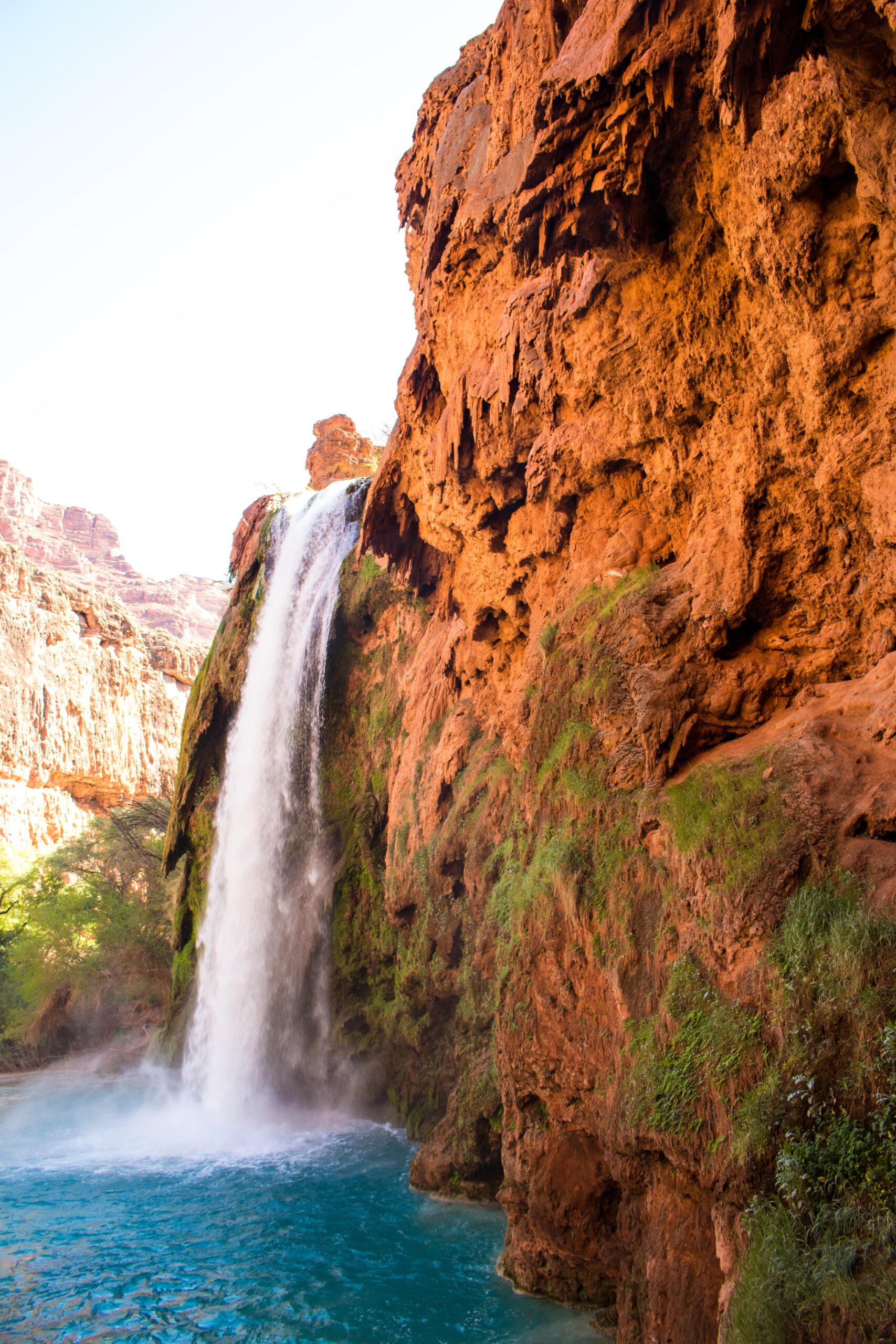
Alaska Northern Lights: How To See Them (The Ultimate Guide)

Wanderlust and an ever-growing bucket list? We’ve all seen the stunning photos and movies of dancing green lights in the sky, and wow are they amazing. Most of us want to experience the Northern Lights someday for one reason or another! And if you happen to be in the vicinity of the Alaska Northern Lights, then this is definitely a sight you shouldn’t miss.

Seeing the magical Northern Lights is a once-in-a-lifetime experience. These kaleidoscopic ribbons of brilliant light illuminate the night sky during the year’s coldest months.

Many Americans mistakenly believe they must fly to Norway or Iceland to see the solar-powered event when encountering the Northern Lights, but this is not true. You can see it right here in the United States. In inland Alaska, the multicolored lights are visible on 80% of clear evenings during optimal viewing season!

In this article, you’ll find all of the information and travel advice you need to maximize your chances of seeing the Alaska Northern Lights any time of year.

First Off: What Causes Northern Lights?

It’s helpful to know what actually creates the Alaska Northern Lights in order to figure out how you can easily see them.

alaska northern lights
unsplash.com

The lights seen in the night sky are caused by activity on the sun’s surface.

Solar storms on our star’s surface spew forth massive clouds of electrically charged particles. Some of these particles may crash with the earth if they travel for millions of miles.

However, some become caught in the earth’s magnetic field and speed up their descent to the poles, where they burn up in the atmosphere. This explains why the magnetic equator has the greatest concentration of auroral activity.

The atoms and molecules in the earth’s atmosphere are heated when these particles collide. Excitation is the scientific term to describe this process, although it’s more like heating a gas and making it light.

So when we’re looking at the Northern (or Southern) lights, we are witnessing atoms and molecules in our atmosphere interacting with particles from the sun. The lines of force in the earth’s magnetic field generate the aurora’s distinctive wavy patterns and light “curtains.”

Typically, the aurora’s lowest point (closest to the earth) is roughly 80 miles above the earth’s surface. The top of a display, or the lights that are furthest away from the earth, can reach several thousand miles above the planet.

What Produces The Aurora’s Many Colors?

When heated, many gases emit a variety of colors. It’s nitrogen and oxygen, the two most abundant elements in the earth’s atmosphere, that create the aurora’s colorful light show.

The green in the aurora is typical of oxygen, whereas tints of purple, blue or pink are created by nitrogen.

Oxygen at extreme altitudes interacts with sun particles to produce a beautiful ruby red color that we sometimes glimpse. This only happens when the aurora is exceptionally intense.

When Do The Northern Lights Appear In Alaska?

So now let’s get down to it: how to see the Northern Lights in Alaska!

Observing the Northern or Southern Lights with your bare eyes will be tough if you don’t have a clear night. You’ll definitely want to leave a few nights available based on the weather since a cover of clouds will hurt visibility.  must be at a clear night sky. Additionally, rural locations are superior to cities since they don’t suffer from light pollution.

Because the sun is now at solar minimum, we are less likely to see full-blown auroral events than when the sun is at a solar maximum. There will, however, be nightly displays of the northern lights until maximum solar returns in 2024.

The typical aurora season runs from August 21 to April 21 each year.

However, because of the earth’s tilt relative to the sun, displays of the northern lights tend to increase around the equinox months of September, October, and March, when the earth’s magnetic field is in sync with the solar wind.

March is considered the best time to observe the northern lights since clear skies are more common in Alaska during spring. Note that the best time to see the full-blown dancing lights can vary depending on your location.

If you can locate a dark and clear sky, stay on the lookout from sundown onwards, and you could get to witness an aurora. According to the Geophysical Institute, the ideal time to observe the aurora is at approximately midnight, give or take an hour. But they can occur at any time.

And don’t worry if you’re not specifically in Alaska during March. You can still have a chance to see the Northern Lights, especially if you head to a good location.

Where To See Northern Lights?

While the Fairbanks Alaska Northern Lights seem to be the most common, there are actually a few different places in Alaska to catch a glimpse of the Aurora Borealis.

In Alaska, you can see the northern lights almost anywhere. However, they are more visible farther north.

This list is updated for the 2022/2023 season — we’ve compiled a list of the best sites based on frequency, quality, and accessibility to guarantee you have a good chance of seeing the celestial ballet.

1. Fairbanks, Alaska

alaska northern lights
https://wrldtrip.tumblr.com/

Fairbanks is one of the most incredible spots to observe the northern lights since it’s positioned just beneath the Auroral Oval. This ring-shaped zone extends above the earth’s geomagnetic north pole, the epicenter of aurora activity.

However, Fairbanks Alaska is also a great option to see the Northern Lights because there are so many different hotels and tours that cater specifically to viewings. It’s definitely the best place for a novice to head!

During the aurora season (August 21 to April 21), visitors can expect to view the lights on around four out of every five clear evenings. Taking a trip on the Riverboat Discovery or gold panning are two more options for tourists in the late summer.

For a joyful Christmas experience (if it happens you come in December), visit the Santa Claus House in the North Pole (about 13 miles southeast of Fairbanks). Visitors can take in the unique ice sculptures at the World Ice Art Championships in February and March and a dog sledding excursion.

Reserve lodgings at the luxury Aurora Villa for good odds of aurora viewing. This is a great place to spend a week if you want the maximum chance possible to catch a glimpse of the Fairbanks Alaska Northern Lights!

Keep in mind: Fairbanks isn’t technically the best place to see the Northern Lights in Alaska, but it’s a good option. Fairbanks seems to be much more accessible than other spots in Alaska which is why it’s so popular with tourists who want glimpse of the Aurora Borealis.

2. Far North, Alaska

alaska northern lights

Despite its remoteness, the Alaskan Arctic is worth a trip to experience the seascapes, tundras, and mountains of the Brooks Range.

Nome is the closest city to the area where you can see the Alaskan Northern Lights. With a rich history dating back to the days of the Gold Rush and amazing scenery, Nome is a coastal town located along the Bering Sea.

You can also travel to Utqiagvik, the northernmost town in the United States. Visit Utqiagvik to learn about the traditional culture of the indigenous I*upiaq, who make up the majority of the town and operate the I*upiaq Heritage Center.

Take the 414-mile Dalton Highway from Fairbanks, or fly into Fairbanks and connect on to Nome or Utqiagvik.

3. Anchorage, Alaska

alaska northern lights

Anchorage is the largest city in Alaska and is a great place to see the Northern Lights. The Northern Lights can be seen right here in town!
If you prefer to escape Anchorage, Alyeska Resort is 45 minutes outside the city and a great place to keep an eye out for auroras while exploring the wilderness.

4. Coldfoot, Alaska

alaska northern lights

Coldfoot is an isolated town located on the Dalton Highway at the Brooks Range foothills. It’s one of the best places in Alaska to see the Northern Lights.

The town has a population of ten people and is only accessible by car, bus, or foot. There are no hotels in Coldfoot, but there are campsites available.

Coldfoot is also home to the Arctic Chalet, a restaurant and lodging facility that offers aurora viewings during its operating season (mid-September to mid-May).

5. Girdwood, Alaska

Girdwood is a town located about 40 minutes south of Anchorage. It’s in a valley at the base of the Chugach Mountains and is known for its moderate temperatures and alpine scenery.

The Alyeska Resort is located in Girdwood and is a great place to see the Northern Lights. The resort offers Northern Lights viewing tours and has been designated as an “Aurora Friendly” resort by the International Dark-Sky Association.

6. Chena Hot Springs, Alaska

alaska northern lights
www.instagram.com/aroundq/

Chena Hot Springs Resort is a great place to see the northern lights, especially because of their efforts to be “aurora friendly.” This means they take measures to reduce light pollution in the area so the Northern Lights are more visible.

The resort also offers an aurora viewing package which includes a night of lodging, a tour to see the northern lights, and breakfast the next morning.

A Railway Adventure in Alaska

If you’d rather travel while viewing the Northern Lights in Alaska then consider the Railway Adventure. It’s a ton of fun!

alaska northern lights

Vacations by Rail’s six-day excursion explores the rough and expansive grandeur of The Last Frontier aboard the Alaska Railroad’s Aurora Winter Train. From your seat or the Vista Dome Car on the train traveling between Anchorage and Fairbanks, you can enjoy stunning views of the surrounding landscape.

This vacation package offers overnight stays in Anchorage, Fairbanks, and the isolated Bettles Lodge. The Bettles Lodge, located 35 miles above the Arctic Circle, provides visitors with some of the most incredible views of the aurora borealis anywhere.

During the daytime hours, try out other Alaskan activities such as exploring the area by snowmobile or gear up and go ice fishing. You can even try your hand at dog mushing with your team of Alaskan huskies. This adventure is offered between October and April.

Two nights at Bettles Lodge, five meals, Arctic apparel, and equipment, plus additional activities like cross-country skiing and guided snowshoe expeditions are all included in the price.

Tips For Chasing Northern Lights

After narrowing the list of prospective sites and determining the optimal time to visit, it’s time to learn about the best methods to watch the Northern Lights, including how to maximize your chances of viewing them.

The Alaska Northern Lights are pretty unpredictable. You can barely foresee when and where they will occur. Here are some tips to help make sure you get a solid viewing!

1. Regular Weather Checks

You can count on two things to see the northern lights: the weather and your luck. The weather can be your savior or worst enemy. There are two significant players here:

– Solar Activity

You can only witness the Northern lights when there is solar activity in your location, which means that the solar particles impact the atmosphere and produce light effects. Scientists use real-time data on solar winds to develop an Ovation Map for this purpose, and they update it regularly (thanks to advancements in technology).

With this map, you can monitor places from where the aurora can be visible during a period. The model’s Kp measure also informs us how powerful the anticipated aurora will be. If the sky is clear and Kp> 2 is present, you have a good chance of seeing auroras.

The Kp index, used by scientists to gauge the overall chance of visibility, ranges from 0 to 9. The bigger the number, the better the probabilities (anything over a four is considered “high activity”).

– Cloud Coverage

There must be clear, non-cloudy skies to view the lights with the naked eye since they are located well above the cloud cover. Even if the sun is shining brightly, clouds will obscure your vision. therefore you will also need some Cloud-God benediction

There’s no need to be put off by the difficulty of becoming an astronomer or a weather specialist; there are apps for both.

2. Use Aurora Forecast

Aurora hunters rely on SolarHam’s three-day geomagnetic forecast. You can use the Aurora Forecast app to determine whether or not they will see the Northern Lights based on their location relative to the Arctic Circle (red means the Northern Lights are almost certainly happening directly above you).

The interface of the app is straightforward. You can specify your location, and it gives you the cloud covering and sun activity in a specified region. It indicates the Kp value, cloud coverage, and viewing likelihood. It works super well!

The Space Weather Prediction Center of the National Oceanic and Atmospheric Administration is also an excellent source for short-term forecasts of Northern Lights activity. There is even a 27-day aurora borealis prediction at the University of Alaska Fairbanks Geophysical Institute in Fairbanks.

3. Book A One Week Stay

Try to remain in these destinations for a week to optimize your chances and eliminate bad-weather days. Typically a week is excellent, with at least three days devoted to viewing the lights directly.

4. Examine Hashtags and Photo Sources

We spent some time looking at the best Aurora photographs posted on Facebook by travel firms that provided Northern Lights viewing trips and tracked the location of their pictures.

Tracking photos submitted by top photographers on 500pix.com will help you locate potential places. The Instagram hashtags #aurora or #northernlights can also be checked, but notice that they often feature the prominent city name.

It’s best to look a week or two before you’re trying to spot the Alaska Northern Lights since the variables change super often. In my opinion, this is one of the quickest ways to stay informed in real-time!

5. Find A Good Tour Operator

The most significant suggestion for someone who wants to go on a road trip by yourself is to pay for the agencies if you can afford it.

These agencies have so many distinct aurora viewing camps in various places surrounding a city, and they have their agents continually scanning the sky. This network makes it simple for them to communicate if the Northern Lights are observed in one area, and they will swiftly drive you to the proper spots.

Alaska Northern Lights Excursions:

Think of it as a mission. It is one of nature’s most spectacular events that you are attempting to watch. To find the aurora, one must be persistent and relentless. It’s a great experience! It’ll be worth it in the long run.

You’ll have to stay up late. The hours of 10 p.m. to 3 a.m. are the most popular for tours. Tour operators often provide oversized parkas, bunny boots, warm drinks, and little food. You can request a wake-up call in a lodge if you can’t keep your eyes open. You’ll get a good night’s sleep the following day, as the sun doesn’t rise until 10 or 11 a.m. in the winter. Dog sledding or snowmobiling could be a pleasant afternoon winter sport for you. Return to your lodge or hotel for an early nighttime snooze, and then get ready for more!

The following are some of the best excursions in Alaska to view the aurora borealis:

Lodges and Overnight Tours

Far beyond the Arctic Circle, Northern Alaska Tour Company provides 3-day/2-night (and longer) excursions from Fairbanks to Coldfoot Camp. It is a great place to get a glimpse of the Aurora Borealis.

Iniakuk Lake Wilderness Resort, a fly-in luxury wilderness lodge within Gates of the Arctic National Park, provides one of Alaska’s most unique opportunities to watch the northern lights.

One hour from Fairbanks is Borealis Basecamp, where you can reserve an overnight stay in a transparent igloo.

Once you reach Fairbanks, you’ll continue north, stop at Talkeetna along the route, and watch for the aurora borealis. From Anchorage, Salmon Berry Tours provides six-day/five-night trips. Wild Journeys Alaska offers unique, private multi-day trips lasting three or more nights from Anchorage.

Enjoy three nights of aurora watching as well as entertaining daytime activities. Each day has an aurora prediction, so you can choose which three nights you want to follow the lights.

Tour in the Evening

From Fairbanks: A northern lights viewing area called Aurora Pointe is about 15 minutes from downtown Fairbanks. While waiting for the lights to come on, you can relax in a lovely, warm room with complimentary coffee, tea, and locally-sourced snacks.

With Alaska Wildlife Guide, you can depart from Fairbanks and enjoy a dip in Chena Hot Springs while searching for the aurora borealis.

With Northern Alaska Tour Company, you can witness the Aurora Borealis in the furthest reaches of the Arctic Circle. Make your choice between driving and flying.

Get out on the ice with Rod’s Alaskan Guide Service for a memorable night of fishing. You can cast your line from a cottage overlooking the lake while sipping on a cup of coffee or tea. If the aurora happens to occur, the wide-open perspective is ideal.

From Anchorage: On Alaska Photo Treks’ Anchorage Aurora Quest, you’ll photograph snow-capped mountains, frozen landscapes, animals on snowy pathways, city lights reflecting on water at dusk, and maybe the Northern Lights!

Leaving Anchorage (or Wasilla/Palmer) between 9 and 11 p.m., you’ll spend the following seven hours searching for the aurora borealis.

Final Thoughts

Northern light viewing is undoubtedly a once-in-a-lifetime event for those not fortunate enough to reside close to its regions. We hope that this guide will be helpful to you.

We have no control over the weather factors, so you can only pray that the weather cooperates on the day of your visit. Given this, you still can increase your chances if you remain in these regions for a more extended amount of time to discover some lovely weather days.

15+ Top Lakes In Massachusetts To Visit

Massachusetts is the 7th-smallest state that consists of coastal plains, hills, mountains, and metropolitan areas. Massachusetts also has a wealth of natural beauty, including several breathtaking lakes.

There are over 3,000 ponds and lakes in Massachusetts. Beautiful waterfalls and calm lakes provide the ideal backdrop for live entertainment and fine dining. There are so many different natural environments around Massachusetts that aren’t well-known but we’re here to change that!

The lakes and reservoirs in this area offer you many outdoors and magnificent views to spend a day or even your whole vacation. If you’re visiting Massachusetts or even if you live here, you’ll definitely want to check out some of these gorgeous bodies of water.

Here are some of our favorite lakes in Massachusetts that can’t be missed!

16. Cochituate Lake

Best Lakes in Massachusetts for swimming, boating & more: Cochituate Lake
pinterest.com

Cochituate is a 635-acre Great Pond situated at the confluence of Framingham, Natick, and Wayland. Averaging 19 feet deep, the SouthernBasin has the lake’s deepest point at 69 feet, making it the biggest at 257 acres.

Except for the southern part of the south basin, which has significant portions of sand, the pond bottom is mainly made of mud and gravel. The water’s clarity ranges from 5 to 7 feet, making it ideal for growing aquatic flora. You won’t want to swim in certain areas of this lake.

However, there is a super nice beach at this lake. Cochituate State Park contains most of the local beachfront, largely untouched by development while surrounded by densely populated neighborhoods. Recreational use is at its peak during the summer months and it gets really crowded!

For many years, it served as a water reservoir for the city of Boston. Today, however, it is one of Massachusetts’ top recreational destinations. In the summer, you can enjoy water sports like swimming, boating, fishing, and sailing, as well as hiking on the area’s many trails. There are many places to stop for a picnic or a grill along the beach.

If you choose to fish in this lake, Chain Pickerel, Common Carp, White Perch, Brown Bullhead, White Sucker, American Eel, Black Crappie, Swamp Darter, and Golden Shiner are among the fish species you can discover here.

Cochituate Lake is well-known in Massachusetts for many reasons. It’s kind of a whole destination all by itself, offering swimming, fishing, nature-watching, hiking, and more, but it’s also pretty centrally located to some major Massachusetts cities.

15. Monomonac Lake

Best Lakes in Massachusetts for swimming, boating & more: Monomonac Lake

This artificial lake is on the boundary between Rindge and Winchendon. The damming of the North Branch of the Millers River, a tributary of the Connecticut River in New Hampshire, transformed a little pond into the reservoir you see today.

The average depth of Monomonac Lake is three meters. It is located at an altitude of 318 meters above sea level. The lake is mainly in New Hampshire, although people from both states come to the lake to relax and enjoy it.

In this warm water fishing area, you can target a wide variety of fish including chain pickerel, bass, black crappie, and bluegill. Canoeing is a popular activity here as well.

New Hampshire’s fishing rules apply to Monomonac Lake. Since this lake is 592-acres, only licensed anglers from Massachusetts or New Hampshire can access it.

This is definitely a smaller, less-popular lake that’s great for when you want to get away and have some privacy. We feel that it’s better for fishing and nature-watching than swimming.

14. Onota Lake

Best Lakes in Massachusetts for swimming, boating & more: Onota Lake

The 19th and 20th-century vacation houses on Onota Lake’s 2.5 square kilometer shoreline have made it a popular tourist destination. It is a beautiful lake that has been a popular summer vacation for many decades. Seriously – this area is stunning!

Onata Lake is located in Western Massachusetts. The City of Pittsfield owns and manages Onota Lake, a 617-acre lake wholly inside the city limits. Residents of the Berkshires and tourists appreciate the lake’s many recreational activities.

Swimming, sailing, water skiing, and fishing are all popular activities on Onota Lake. Burbank Park is accessible all year and has a boat launch, picnic spaces, a walking route, and a beach.

As a result of its position, many anglers, swimmers, and sailors visit this lake. Despite the traffic, the lake is in excellent shape, with a water clarity at 17 feet depth.

In terms of depth, the maximum is 66 feet, while the average is approximately 22 feet. Low-depth aquatic flora is numerous and very thick.

In this lake, you’ll find a wide variety of fish including northern pike, rainbow trout, chain pickerel, white perch, bluegill, pumpkinseed, brown bullhead, black crappie, carp, and rock bass. Other species include golden shiners, white suckers, and rainbow smelt. It’s a great spot for some Massachusetts lake fishing!

In addition to 75 parking spaces, the ramp can handle any trailered boat. In one of the best fishing spots, you’ll find a cement fishing pier as well.

Whether you want to spend a day on the boat, swim, or observe nature, Onata lake has it all. We recommend spending a weekend in the area for the full effect!

13. Boon Lake

Best Lakes in Massachusetts for swimming, boating & more: Boon Lake
lakeboon.wordpress.com

Boon Lake is a 66-hectare lake located in eastern Massachusetts. Matthew Boon, a native and early explorer from Charlestown, Massachusetts, inspired the lake’s name.

The lake’s average depth is 11 feet. It is divided into many basins and connected by thin, navigable canals.

The lake has four basins, all of which are vital to the villages of Stow and Hudson. It has been a favorite summer vacation destination for Bostonians for generations, with thousands flocking to the area.

For those who like to relax on the water, there’s a specific area to swim, barbeque, and spend time on the water. During the summer months, the town beach is available to the public. There are also summer programs for children and a swimming class nearby. It definitely gets busy in the warmer months because it’s so close to the city!

If you fish, Chain Pickerel and sunfish are plentiful in the easternmost basins because of the abundance of plant beds and coarse woody debris. You can catch Black Crappie, Perch, and Largemouth Bass in the more prominent and deeper basins.

Horseshoe Pub and Restaurant and Rail Trail Flatbread Co. in Hudson are great options for a meal before or after your Boon Lake excursion. We love how this lake is so close to the city because it can give you a taste of nature along with an urban vacation!

12. Wyola Lake

Best Lakes in Massachusetts for swimming, boating & more: Wyola Lake

Wyola Lake is a tiny lagoon located near Shutesbury, Massachusetts. Aside from boating, fishing, and swimming, the reservoir is a popular destination for various recreational activities. It’s a terrific area to canoe or boat.

In the winter, visitors to the park go skiing or snowmobiling – there’s a lot of gorgeous terrain surrounding the lake.

The lake has a secured beach and many picnic areas, all with charcoal grills, to relax and enjoy the crystal blue water. There is a volleyball court, a horseshoe pit, and two manicured fields for children to play in. Wheelchair users will appreciate the accessible parking and waterfront walkway.

Stocked trout are plentiful at Lake Wyola, making it a great place to fish. Anglers can also catch largemouth bass (up to 5 pounds) and chain pickerel in the lake’s vegetated regions. Despite the presence of Smallmouth Bass, they are in reduced numbers.

Non-motorized boats are welcomed. There is a public boat launch at the eastern end of the lake with excellent bass and trout fishing facilities.

If you’re looking for a quiet lake with a local town community then Wyola is definitely your spot. However, it’s not much of a tourist destination, though it’s perfect for anyone who wants a little privacy.

11. Otis Reservoir

Best Lakes in Massachusetts for swimming, boating & more: Otis Reservoir

One of the most prominent recreational water bodies in the state, Otis Reservoir is located in Western Massachusetts. It covers 1,100 acres and has 30 miles of coastline. There is a DEM boat ramp at the forest’s entry, and powerboating is allowed.

The Otis Reservoir’s western side is home to Tolland State Forest’s 90 campsites. Many campsites are right on the water’s edge, making them ideal for tent and trailer campers. The roughly 4,900-acre State Forest has various trails for summer and winter activities. Swimming, boating, water-skiing, and sailing are all popular activities on the water.

Most anglers visit Otis to pursue the stocked trout that the Division of Fisheries and Wildlife has released for capture. Most are caught by trolling tiny spinners and spoons or still-fishing the bottom with dough-baits or worms from a boat or shore. A fall stocking of fewer but larger trout in late September and early October brings back the best fishing for these trout.

Yellow perch, smallmouth bass, and black crappie are popular ice fishing targets, although chain pickerel are hard to come by in large quantities. Trophy tiger muskies are possible, but they’re rare.

Locating a secluded area free of water skiers and speedboats is a considerable challenge – this is a popular spot. If you want the full-on New England lake experience, head to Otis Lake’s campsite for the week.

10. Chaubunagungamaug (Webster) Lake

Best Lakes in Massachusetts for swimming, boating & more: Chaubunagungamaug (Webster) Lake
patch.com

Chaubunagungamaug Lake, also known as Webster Lake, is one of the most beautiful bodies of water in Massachusetts.

While it’s close to Connecticut, this picturesque site also happens to be Massachusetts’ second biggest natural lake. The lake’s 27-kilometer coastline covers 584 hectares. It’s so large that we call it the “Great Pond” around here!

Due to two marinas on the lake, it is an excellent spot for boating, swimming, and fishing. Largemouth bass and black crappie are among the species found in the lake. Additionally, it’s a popular tourist attraction because of the abundance of wildlife you can see when strolling along its Walkabout Trail.

Stave & Still or Samuel Slater’s Restaurant in Webster are great places to dine after a day at the lake.

If you have an opportunity to rent a summer cottage on Webster Lake then we highly recommend that you take it! The lake is incredibly gorgeous but is also a really fun time, especially in the summer.

9. Crystal Lake

Best Lakes in Massachusetts for swimming, boating & more: Crystal Lake

The Newton Center Baptist Church previously used Crystal Lake for baptisms, which is why this body of water used to be called Baptist Lake. Crystal Lake (formerly Baptist Lake) got its new name from the industrial ice harvesting that took place there in the nineteenth century.

Homes and tiny parks ring the coastline of Crystal Lake nowadays. Lifeguard training and swimming classes are available at this popular swimming site. It’s a great spot for families!

The lake’s west bank is also a popular fishing spot for anglers, and the fishing pier is quite busy in the summer. On the east end of the lake, near the municipal beach, an additional public beachfront is accessible for angling.

Crystal is a bass-and-panfish-friendly body of water. Anglers may catch a few good-sized basses as well as the rare prize bass while out on the water. However, the sunfish are small but plentiful. We have the most fun catching sunfish here.

Before leaving the lake, make sure your boat, trailer, and other equipment are free of visible plant matter. The water can get pretty dense!

While this is a smaller lake and isn’t really a destination, it’s a great spot for city folk who want to spend a day on the water.

8. Quinsigamond Lake

Best Lakes in Massachusetts for swimming, boating & more: Quinsigamond Lake

To experience one of the most excellent lakes in Massachusetts, go to Quinsigamond Lake near Worchester. It is a 772-hectare lake home to eight privately-owned islands.

You can swim, fish, kayak, sail, and barbeque at Quinsigamond State Park in Worcester. Additionally, you’ll find one of the top rowing courses in the world, which measures 2,000 meters long.

Family-friendly amenities include a swimming pool and a playground. It’s definitely set up to be super accessible.

There are two locations on the western coast of Quinsigamond State Park; both are family-friendly, and both provide bathroom facilities.

The two boat ramps make it easy for those who like boating to go out on the lake. Also, because it’s in the middle of town, you won’t have to search far for somewhere to stay, eat, or shop. It’s really close to a lot of fun non-water activities.

This Massachusetts lake has year-round fishing opportunities, including ice fishing, but be aware that this is a big lake that will be one of the slowest to freeze over. Water temperatures below 55℉ are ideal for trout and salmon to be most active.

The lake is stocked with Brown, Brook, and Rainbow trout (spring and fall) and Broodstock Atlantic Salmon in late fall by mass wildlife. In specific years, Northern Pike and Tiger Muskie are supplied based on the availability of these fish species.

This lake is definitely more of a sightseeing or fishing lake and less of a swimming spot. We recommend checking out some of the local restaurants for a bite by the water.

7. Quabbin Reservoir

Best Lakes in Massachusetts for swimming, boating & more: Quabbin Reservoir
pinterest.com

Summer in western Massachusetts isn’t complete without a trip to the Quabbin Reservoir, no matter how long you’ve lived in the region. The Quabbin Reservoir has some of the most stunning landscapes in the world. There are 181 miles of beachfront here, and it’s well-known as one of New England’s most idyllic spots for strolling, hiking, and picnics.

Due to an increasing need for freshwater, the Quabbin Reservoir was constructed in the 1930s in the Swift River Valley. When Nani-Quaben (Naniquaben), a Native American chief, gave the Quabbin its name, it was a reference to the area’s abundance of water. Four settlements had to be relocated to accommodate the new water supply as part of the construction process.

The Quabbin Reservoir is still one of the most significant reservoirs in North America, providing safe drinking water to millions of people in Massachusetts. Nearly 40 square miles and 412 billion gallons of water make it the largest reservoir in the United States.

The pool, of course, provides much more than pure water. The Quabbin also offers a wide variety of recreational activities.

There are hiking, walking, and bike routes around the Quabbin Reservoir. A picnic in one of the several serene areas is a beautiful way to spend time together. Another favorite pastime is bird viewing since the reservoir is home to various species, including the rare bald eagle.

The abundance of fish in the Quabbin also makes it a fantastic area to go fishing. On the other hand, fishing is only permitted during the official fishing season, which runs from April to October.

You can’t swim here, but the picture opportunities and views make Quabbin totally worth a trip.

6. Ashmere Lake

Best Lakes in Massachusetts for swimming, boating & more: Ashmere Lake
pinterest.com

You’ll discover one of the most beautiful lakes in Massachusetts in Berkshire County. Seriously: this lake is not to be missed!

Ashmere Lake, a 287-acre body of water on the border of Hinsdale and Peru along Route 143, is divided the lake into two basins, with a trench allowing small boats to travel between them.

Near the dam in the southern basin, Ashmere Lake’s depth rises to a whopping 24 feet. There are significant regions of rock and debris in the western and southern parts of the south of the basin’s bottom that are mostly mud.

Other than Ashmere Lake State Park, the southern side of the South Basin has a modestly developed shoreline, with a few buildings along the beach.

There’s a lot of recreational activity around Lake Ashmere. Warm water makes fishing a favorite pastime for visitors to the lake. The fish species you can find in the lake includes yellow perch, black crappie, and brown bullhead. The lake is also famous for kayaking, canoeing, and water skiing.

Camp Danbee and Camp Taconic are two summer camps situated on the shoreline. Along the coast, you’ll find plenty of trees and comfortable vacation cottages available for private rental.

Enjoy the beautiful surroundings of Ashmere Lake while savoring some of the best local cuisines. Ozzie’s Steak & Eggs in Hinsdale is a good option if you’re in the mood for some home cooking.

Overall, Ashmere is a great tourist destination if you want to spend a week by the water!

5. Attitash Lake

Best Lakes in Massachusetts for swimming, boating & more: Attitash Lake
pinterest.com

Located approximately a mile and a half northeast of Merrimack City, Attitash Lake is a 373-acre expansion of Great Pond. Except at the entrance and outflow coves, the water’s surface is primarily free of aquatic plants due to the area’s sandy and gravelly composition. Nearly all of the beachfront has been converted into residential areas.

Tourists and people from all over Massachusetts flock to Essex County’s Attitash Lake during the summer months. It is a gorgeous lake surrounded by houses, boat docks, and two fantastic beaches.

The lake offers year-round fishing opportunities, making it one of the most incredible spots in the state for the sport. During the warm months of the year, it’s common to go boating, swimming, and do other water sports.

Fishermen and boaters have access to ramps and parking at the lake’s edge thanks to Fishing and Boating Access.  After a day on the lake, travel to Merrimac Town Forest for a scenic trek in the woods. The Cobbler’s Brook Trail, the Red Oak Hill Trail, and the Long Hill Trail are worth exploring.

4. Massapoag Lake

Best Lakes in Massachusetts for swimming, boating & more: Massapoag Lake

There is a pristine natural lake in the town of Sharon called Massapoag Lake, known for its clear, gorgeous water. Besides fishing, swimming, sailing, or ice fishing, this 353-acre lake is a great spot to relax and unwind.

During the cooler months, the secluded beach is a great place to cool down without fighting the crowds at more crowded locations. Regardless of the season, Massapoag Lake is a must-see in Massachusetts.

Since the 18th century, Massapoag Lake has been used for ice production. Today, the lake is a popular summer destination, with resorts, hotels, and cottages all around it. This lake is a popular ice fishing destination in the winter and transforms into a spectacular display of foliage in the fall. Really – any season is amazing!

Massapoag Lake has a maximum depth of 48 feet and an average depth of 16 feet. The water is translucent up to a depth of around 10 feet. Most of it is gravel and debris, but there are many boulder-strewn sections near the surface marked with buoys.

Massapoag Lake is an excellent fishing spot for both large and smallmouth bass. You should concentrate your efforts in the boulder-strewn areas of the lake, as these fish often congregate in and around underwater cover and structure.

Fish for yellow and white perch with bass near structure, but you can also catch them down the coastline on occasion. Among the weeds and coves of the pond, you can discover Chain Pickerel.

You can access the shoreline on town property at the southern end of the lake off Lakeview Street. There is a concrete boat ramp and associated parking space at Memorial Park off Pond St. on the northern shore of the pond. For a charge, the city offers passes that allow trailered boats to be parked and launched in certain spots.

We love Massapoag Lake in the summer because it’s a bit quieter but is still one of the destination lakes in Massachusetts.

3. Quannapowitt Lake

Best Lakes in Massachusetts for swimming, boating & more: Quannapowitt Lake

Located in the town of Wakefield, Quannapowitt Lake was initially known as Reading Pond. The lake is one of the most famous in the greater Boston region and is surrounded by a beautiful location for running, cycling, in-line skating, and other recreational activities.

Quannapowitt Lake’s 3.3-mile circular path is ideal for jogging, biking, or running. The paved, mainly flat track, is suitable for all ages and levels, and it is also accessible to wheelchairs and strollers.

The route is adorned with abundant wildflowers during the spring and summer, making it a popular destination for tourists. As a result, it is a well-known venue for races of all distances, from 5 kilometers to marathons.

For those looking to go out on the water, Quannapowitt Lake is an excellent option. After a hard day at the office, take a short trip on the water with your kayak or canoe from the tiny boat launch and sandy area.

The Wakefield Boathouse offers a variety of watercraft rentals, including kayaks, paddleboards, and pedal boats, while the Quannapowitt Yacht Club teaches sailing. The club provides sailboats, dinghies, sailing for youngsters, racing, and regional regattas.

There are three parks around Lake Quannapowitt where you can play Frisbee, have a picnic, or sit back and read a book. On the Quannapowitt Parkway, you can quickly locate Colonel Connelly Playground and Gertrude Spaulding Park.

Quannapowitt Lake is a beautiful place to sit back and enjoy the scenery. However, the lake is contaminated, making it impossible to fish here, and you definitely can’t swim. It’s more of an observational spot.

2. Walden Pond

Best Lakes in Massachusetts for swimming, boating & more: Walden Pond

Walden Pond was formed 10,000 years ago by glaciers receding. Near Concord, Massachusetts, it is part of Walden Pond State Reservation, which is protected from development.

Henry David Thoreau lived near the northern bank of the lake and wrote several times about it in his book ‘The Ponds’. The film production company Walden Media takes its name from the lake.

Walden Pond is a popular place to swim, boat, fish, and picnic. Nearby parks offer camping, hiking, and hunting.

To get a feel for the simple way of life Thoreau promoted, head to the reproduction of his cottage as soon as you arrive. Then, take the path that follows the coast of Walden Pond.

This 100-foot-deep swimming pool is a kettle lake, created when a giant block of ice broke away and was left in its place after the last Ice Age. The water is still warm enough to wade in at the nearby beach in early October.

An accessible boat ramp off Route 128 is open daily from 5 AM to 5:30 PM for those who choose to bring their canoes or kayaks, with extra parking across the street for when the area gets crowded. Rental boats from Charles River Canoe & Kayak can be delivered to Walden Pond at your convenience.

There are no restrictions on using any non-gas-powered watercraft on Walden Pond. You can fish for trout from a boat or along the shoreline.

If you want to follow Thoreau’s example and spend your vacation in the great outdoors, you’ll have to travel a bit. Walden Pond State Reservation does not allow overnight camping. Among the options for camping in the area are Berry’s Grove Campground, Hanscom Air Force Base FamCamp, and Spacious Skies Minute Man Campground.

We 100% recommend checking out Walden Pond for the history alone! However, it’s also a nice place to see some wildlife and take a dip.

1. Laurel Lake 

Best Lakes in Massachusetts for swimming, boating & more: Laurel Lake 

At the top of our list Laurel Lake, one of our absolute favorite lakes in Massachusetts. Between Lee and the western terminus of the Jacob’s Ladder Trail, Laurel Lake is a popular destination for both hikers and campers in Western Massachusetts. It’s worth the drive to get out there!

Visit Sandy Beach, a peaceful lakeside beach nestled in a secluded cove to cool down in the lake. A boat launch is accessible for your use, so bring your canoes and kayaks and enjoy some lake time.

This family-friendly swimming hole’s water is always refreshingly cool during the hottest summer days. Relax on your favorite beach chair or spread out on a blanket on the sand. Concessions are provided at the lakeside refreshment stand if you are hungry.

Picnic tables and charcoal grills are tucked away in the woods beside the lake if you need a respite from the heat. There are bathrooms available in the building for your relief. The Pine Grove General Store is also an excellent place to fill up on food and beverages.

In addition to swimming and boating, you can also pull out the fishing gear and explore the park’s many trails, including a piece of the famed Appalachian Trail.

Take a 10-minute journey to Twirly Top for the ideal finale of your day. The soft-serve ice cream at this neighborhood staple has been around for more than six decades.

While visiting Laurel Lake and Pine Grove Furnace State Park, take advantage of the neighboring hotels and B&Bs available to extend your Weekend Easy getaway. Camping in the park’s campgrounds or renting the two-story Paymaster’s Cabin if you want more contemporary facilities are your two options.

If you want to spend at least a few days at one of the best lakes in Massachusetts, you should definitely consider Laurel Lake. It literally has it all!

Hopefully, this post gave you some ideas for the best Massachusetts lakes to check out this summer!

These bodies of water are the most incredible in the state due to their spectacular scenery, tranquil atmosphere, and year-round pleasure.

After learning about the top lakes in Massachusetts, which one will you visit first?

Hiking Flume Gorge In New Hampshire: The Ultimate Guide

Are you hiking the infamous Flume Gorge in New Hampshire to get a look at one of the most beautiful waterfalls in New England? This ultimate guide will cover absolutely everything you need to know for an awesome day!

New Hampshire is definitely one of my favorite states in the US because the nature and views are just gorgeous. To be totally fair, this state is stunning during all seasons, but I especially love the summers because we get to hike to some of the coolest spots.

This last summer, we revisited Flume Gorge, one of our favorite hikes/waterfalls in New Hampshire. And let me tell you: this waterfall is not to be missed!

This was my third time visiting the Flume Gorge in New Hampshire as a fully grown adult (though it was a favorite of mine during college) and it honestly gets better every time I see it.

The views are gorgeous and it’s a great workout. The hike is easy but still feels like you’re doing something cool and dangerous.

Flume Gorge is a natural wonder located in the Lincoln, NH area. This 800-foot gorge is packed with stunning waterfalls, making it the perfect destination for a day of sightseeing. If you’re visiting New Hampshire for the first time (or even if you’re a seasoned local), Flume Gorge is a must-see, offering historic covered bridges, cascading waterfalls, and an 800 ft-long gorge.

I’ve put together this guide to provide some detailed information that comes from firsthand experience. I hope this helps you enjoy your trip and get the most out of visiting the beautiful Flume Gorge!

If you’re planning to hike, I recommend getting the AllTrails app or heading to the site for the most updated hiking info.

What Is Flume Gorge In New Hampshire?

flume gorge new hampshire

Flume is a narrow gorge covered with moss and towering granite walls. It’s insanely tall (over 90 feet in some places) and narrow, creating really dramatic views. It’s basically New Hampshire’s equivalent of a crater and is actually prehistoric!

Visitor boardwalks provide access to the narrowest sections of the gorge, which contain waterfalls, boulders, and pools.

Additionally, Flume Gorge offers two charming covered bridges, sections of tranquil forest trail, and incredible observation decks/viewpoints to check out the mountains.

You don’t have to be a mountaineer to enjoy Flume Gorge’s 2-mile loop. Just make sure to arrive early to avoid foot traffic, especially in the narrow gorge section.

When To Visit Flume Gorge:

flume gorge new hampshire

If you want to see seriously dramatic waterfalls then consider visiting Flume Gorge during the spring or summer. Sometimes, the waterfalls dry up in the late summer/early autumn so you won’t get the full effect.

However, you can see great waterfalls depending on the rainfall. I recommend that you do some research if you really want to visit later in the year. We’ve been once in the autumn and the waterfall was still pretty mind-blowing!

While the falls are usually better in the earlier months, you may want to hike the trail during the fall to see the foliage. Once the leaves start turning the observation points are much more dramatic, especially once you’ve passed the waterfall area.

So it really depends on what you want to see. Are you more excited to check out insane waterfalls? Go in the spring/early summer. Want to see gorgeous New England foliage? Your best bet is to visit Flume Gorge in the fall.

While you technically can visit NH’s Flume Gorge in the winter (it’s open all year), I would recommend against it. There’s no staff on-site and the climb is at your own risk. And trust me: the stairs are slippery enough in the summer!

The flume gorge is open from May 10th to October 20th with staff. You definitely wouldn’t want to go in the winter anyways; those stairs would be insanely slippery.

The typical hours are:

  • 5/10-6/30 8:30am-5pm
  • 7/1-9/2 8:30am-5:30pm
  • 9/3-10/20 8:30am-5pm

Around 1pm was the perfect time for us to arrive. The midday heat wasn’t a problem since the day was slightly cooler (high 70s).

Tickets & Prices:

flume gorge new hampshire

As of right now, the ticket prices are:

  • Ages 13+: $18
  • Ages 6-12: $16
  • 5 & Under: FREE w/ paid adult.

* All rates and dates are subject to change.

BTW, pets aren’t allowed in the Flume Gorge (past the ticket desk) but are allowed in nearby parks.

You’ll need to reserve tickets ahead of time, at least right now, through the New Hampshire State Parks.

If you don’t reserve tickets you may not be able to enter. They’re pretty strict due to the last few years, so you can’t just show up anymore. Make sure you book ahead since peak season fills up really quickly!

Flume Gorge Directions & Parking:

Flume Gorge is located near Lincoln, New Hampshire, along the Daniel Webster Highway.

It is located only 6 miles from nearby Artists Bluff, as well as 7 miles from the beginning and end of Kancamagus Highway.

Flume Gorge is really easy to find (it’s right off I-93). There’s plenty of parking available right outside the visitor center.

the flume gorge // the flume trail // the basin nh

Flume Gorge is a beautiful and popular spot in the White Mountain National Forest. During the weekends, it can get quite crowded, so try going on the early or later end.

12pm is the worst time to try and park because it’s when all the families from the morning and the afternoon are hiking the trails. Ticket lines can also be longish on the weekends, so plan to wait for a bit.

You’ll need to go through the visitor center before beginning your hike. The Flume Gorge Visitor Center has a cafe that sells snacks and ice cream, a gift shop, an information center, and a variety of displays from the 1800’s that are fun to check out.

There are also (super clean) bathrooms available that you’ll need to hit before you actually go through the ticket line. Once you purchase tickets you’re through the center, so do all of your sightseeing before joining the ticket line.

the flume gorge // the flume trail // the basin nh

The Hike On the Flume Trail:

  • Distance: 2 miles
  • Elevation: 500 ft gain
  • Hike Type: Loop
  • Hike Time: 1.5 – 2 hours
  • Dogs/Pets: Not permitted

This is an easy loop hike – you go up the Gorge and then around, so your main views are towards the beginning of the hike.

First, it’ll look like you’re simply hiking a regular mountain with only a few small streams like this one.

Check out more about the hike here.

flume gorge new hampshire

The loop that leads to Flume Gorge NH isn’t really a hike since it’s not long. Flume trail has a total distance of about 2 miles and a lot of the trek is uphill, though it isn’t long enough to feel like a workout.

flume gorge new hampshire

A lot of young kids made the trip on their own (without being carried). The hike would be difficult for anyone with a disability since the entire walk by the waterfall is wooded stairs. The hike is also not stroller-friendly.

the flume gorge // the flume trail // the basin nh

Along the way, there are so many picturesque photo spots! Before you reach the falls, you’ll begin to hike uphill. At some point, you’ll start walking on wooden boards, then you’ll reach the wooden stairs. This is the main part of the falls where you’ll have the best views.

Watch out – the stairs get really slippery! I recommend treading carefully since the rapids and falls are extremely strong right below the staircase.

But I promise you, it’s totally worth it, even if you’re scared of heights. FYI, the boards are inspected yearly and look brand new – they’re completely safe to walk on.

I really enjoyed the hike. It felt much more rural than other hikes in the area, and we saw a lot of critters (luckily, no bears!). You definitely feel like you’re actually in the wilderness, even if there are a lot of people around during the weekends.

Once you see the falls, you’ll continue with the rest of the loop to come back down. The elevation goes up really quickly (though it’s only about 500 feet) and the waterfall views are all in the beginning, then you have the rest of the hike to check out the mountainous scenery. It’s a bit more leisurely after you get off the stairs.

The Flume Gorge New Hampshire Falls

You’ll start to see the falls once you walk past Table Rock (a massive granite structure from the last ice age).

The narrow path grows much narrower after the first part of the hike, and the walls on either side grow much taller. Right away, you may feel mist. In comparison to the temperature outside near the lodge, this part of the walk was insanely cool!

flume gorge new hampshire

One huge piece of advice for anyone who wants to take photos (like me) is to hold on to your phone! Since I’ve lost my phone more times than I can count, this seemed like a perfect opportunity, especially while leaning over the railing to take photos.

For those of you who use professional cameras, you’ll definitely want to invest in some water-resistant equipment before seeing the Flume Gorge. There’s literally no avoiding the massive amounts of mist during this part of the climb

As you climb the stairs, you will see the largest part of the Flume (Avalanche Falls is 45 feet high!). It was cool to almost literally be a part of the falls while climbing the stairs, but I wish I had more time to stop and see it. If you go when the walk is busy then you’ll have to keep moving along during this part. Just another reason to try and see the Flume during the week!

the flume gorge // the flume trail // the basin nh

Once you get to the top and go around the corner, the views aren’t as great, but you’ll be able to check out some of the smaller streams and waterfalls at your leisure – you can stop as much as you’d like.

There’s also an observation deck right around the corner that we spent a few minutes on. You can’t really see the falls from the observation deck (strangely enough) but the sounds and atmosphere are just so cool.

I recommend that you get a look as much as possible while you’re climbing the stairs because that’s definitely the best view of the falls. You can’t go back down after, so you may be disappointed if you hurry through and realize that was the main event.

the flume gorge // the flume trail // the basin nh

Once you start to walk back, you’ll see the Liberty Gorge Cascade. These falls are smaller but do offer the opportunity to sit and observe the water. They’re really beautiful to see from above!

the flume gorge // the flume trail // the basin nh

There are also some great spots to grab a group photo up near the observation deck. Seriously – the views of the mountains are insanely gorgeous!

the flume gorge // the flume trail // the basin nh

The Pool

If you continue along the Flume trail after visiting the falls, you will be able to see the pool from hundreds of feet above.

It is surrounded by massive cliffs (which you’ll be standing on) and can reach a depth of 40 feet in some places! This pool was created during the Ice Age and is extremely cold (not that we’ve ever swum in it).

Since you are so high up, this is a small area with some cool views. If you are looking to take a break from the sun, this area is a great place to hang out.

the flume gorge // the flume trail // the basin nh

The Covered Bridge

What New Englander doesn’t love a good old covered bridge? Flume Gorge has two gorgeous covered bridges. The largest red bridge can even accommodate large trucks and buses!

flume gorge new hampshire

We also enjoyed seeing the smaller covered bridge. It’s only for foot traffic and is walkable, or you can choose to find this observation point (also on the loop) and take photos.

Don’t worry about missing anything – you’ll come across every interesting point on the loop! It’s super self-explanatory once you get past the falls.

The Wolf & Bear Dens

As soon as you reach the top of the stairs, you’ll find the bear den. If it isn’t too crowded, it is actually pretty cool to check out, especially because you can hear the waterfall right behind you. This used to be a bear den, but it’s now more of a tourist attraction.

You’ll come across a wolf den later on during your hike (after crossing the covered bridge). Checking it out is more challenging. While most of it can be walked through, at some point you will need to crawl on your hands and knees.

You can continue on the path around the wolf den to meet up with your group if you don’t like tight spaces. I highly recommend checking it out if you aren’t claustrophobic: it was really cool!

The Shuttle

If you do not want to hike the Flume trail the entire way up, you can take a shuttle up part of the way to see the waterfall. Keep in mind that you will still need to climb the stairs – nothing can be done about it.

If you need to, you can skip the beginning and end of the hike with the shuttle. Although we didn’t take it, it would be a great idea for those with trouble traveling or for families with young children.

Where to Swim:

There are very strict rules about not swimming during the 2-mile loop, and for good reason: the rapids are insane! There isn’t a good spot for swimming during the self-guided tour, which is why the signs were up. So no, you can’t swim at Flume Gorge (sadly).

But, there are lots of great swimming spots right near this area! After driving across the street we found a swimming spot literally right off the road in the Basin. Parking is easy (it’s right off the highway) and you only have to walk about 20 yards to get to the swimming hole.

Remember that the water is freezing! Taking a quick dip in this clean and refreshing body of water on a hot day is definitely worth the trip, even if you don’t plan to stay in it for a long time. Plus, it’s good for your hair!

Here are our two favorite spots for swimming near Flume Gorge in New Hampshire:

The Basin:

A large pothole of the Pemigewasset River, The Basin is located in Franconia Notch State Park. It measures 30 feet wide and 15 feet deep. Henry David Thoreau stood in 1839 watching the water cascade into the pool created over 25,000 years ago, when glaciers melted during the last Ice Age.

The swimming hole that’s adjacent to the Basin can now be accessed by a short hike (really more like a few yards). During a hot summer day, the water is always clear and refreshing.

You can park right across the street from Flume Gorge and walk out to the Basin. This is our favorite little swimming spot in the afternoons because it’s usually very private. 

Georgiana Falls:

Lincoln’s Georgiaiana Falls is a little-known hiking and swimming hole near Hanson Farm Road. 1.6 miles of dirt trails surround this relatively easy hike.

At the base of the 30-foot waterfall, you’ll find a cool swimming hole. In the middle of the summer, the water might not be deep enough to actually go swimming, but it’s perfect for dipping your feet in while enjoying a picnic in the park.

History of Flume Gorge

the flume gorge // the flume trail // the basin nh

Aunt Jess Guernsey discovered the Flume Gorge in 1808 (apparently she was there with her nieces and nephews), but it was actually formed around 200 million years ago during the Jurassic Period.

During the formation of the Gorge, the rocks were molten and liquid, but hardened and eroded over time to form the Gorge. Today, the Gorge is still getting deeper.

Despite its creation of the Pool and Table Rock, the Ice Age did little to alter the Gorge itself.

flume gorge new hampshire

FAQs About Hiking The Flume Gorge in NH:

flume gorge new hampshire

What are the hiking trails available at Flume Gorge Basin?

Flume Gorge Basin offers several hiking trails that allow visitors to explore the beautiful natural surroundings. Here are the main hiking trails available at Flume Gorge Basin in New Hampshire:

Flume Gorge Trail: This is the main and most popular trail at Flume Gorge Basin. It’s a 2-mile loop trail that takes you through the stunning Flume Gorge, where you’ll encounter wooden walkways, waterfalls, and scenic views. The trail is well-maintained and suitable for most fitness levels.

Liberty Gorge Trail: This trail is an extension of the Flume Gorge Trail and adds an extra half-mile loop. It offers a less crowded experience and takes you deeper into the forest, providing a peaceful and serene atmosphere.

Poolside Trail: This trail is a short, easy loop trail that branches off from the Flume Gorge Trail. It leads to a tranquil pool surrounded by trees and is a great spot to rest and enjoy the natural surroundings.

Rim Path Trail: The Rim Path Trail is a one-way trail that runs parallel to the Flume Gorge Trail and offers a different perspective of the gorge. It provides elevated views and connects back to the main trail.

It’s important to note that the Flume Gorge Trail is the primary trail for experiencing the gorge’s beauty, while the other trails provide additional options for exploration and variation in the hiking experience.

How long does it take to complete the hike at Flume Gorge Basin?

The time it takes to complete the hike at Flume Gorge Basin can vary depending on individual walking pace, the amount of time spent exploring and taking in the scenery, and the trail chosen. Here are some general estimates for completing the main Flume Gorge Trail:

Flume Gorge Trail: The 2-mile loop trail typically takes around 1.5 to 2 hours to complete at a leisurely pace, allowing time to enjoy the gorge, waterfalls, and other points of interest along the way.

If you choose to extend your hike by including the Liberty Gorge Trail or the Poolside Trail, you can expect to add an additional 15-30 minutes, depending on your pace and the time spent at each location.

It’s always a good idea to plan extra time for breaks, photography, and exploration to fully enjoy the natural beauty of Flume Gorge Basin.

What is the best time of year to hike Flume Gorge Basin?

The best time of year to hike Flume Gorge Basin in New Hampshire depends on your preferences and the kind of experience you are seeking. Here are some considerations for each season:

Spring (March to May): Spring offers mild temperatures and blooming vegetation. The trails may be less crowded during weekdays. However, some parts of the trail may have snow or ice remnants in early spring, so it’s important to check trail conditions before heading out. I recommend hiking in late spring.

Summer (June to August): Summer is the peak tourist season for Flume Gorge Basin. The weather is generally warm, and the trails are typically clear. However, this also means more visitors, especially on weekends and holidays. Consider visiting on weekdays or early in the morning to avoid crowds.

Fall (September to November): Fall is a particularly popular time to visit Flume Gorge Basin due to the stunning foliage. The surrounding forests transform into vibrant shades of red, orange, and yellow. The weather tends to be cooler, and the trails can be less crowded, especially during weekdays.

Winter (December to February): Flume Gorge Basin may have limited accessibility or be closed during the winter months. Heavy snowfall and icy conditions can make the trails hazardous. However, if you’re an experienced winter hiker and the trails are open, you can enjoy a serene and picturesque winter landscape.

Overall, the most crowded times at Flume Gorge Basin are during weekends and the summer months. If you prefer quieter experiences, visit on weekdays, early mornings, or during the shoulder seasons of spring and fall.

Can I bring food or drinks on the hiking trails at Flume Gorge Basin?

Yes, you can bring food and drinks with you on the hiking trails at Flume Gorge Basin. While there are no specific restrictions mentioned regarding outside food or beverages, I recommend being mindful and only bringing an amount that’s comfortable to carry.

With that being said, I also highly recommend packing lots of water and some protein-dense snacks!

Can I take photographs during the hike at Flume Gorge Basin?

Yes, you are generally allowed to take photographs during your hike at Flume Gorge Basin. Photography is a popular activity, as the area offers beautiful natural landscapes, waterfalls, and the iconic Flume Gorge itself. You can capture memories of your visit and enjoy the scenic views.

What Should I Wear To Flume Gorge in NH?

The classic New Hampshire hiking look is definitely athletic gear. You’ll want to wear cute athletic shorts, a good top, and bring plenty of layers. You’ll also see plenty of people wearing baseball hats.

As far as brands go, Patagonia is the it brand here. You’ll also see plenty of Nike and Adidas sneakers. You want to rock the serious hiking look if you want to look like a local. Don’t forget a nice pair of sunglasses!

Are there any nearby attractions or points of interest to explore after hiking at Flume Gorge Basin?

There are several nearby attractions and points of interest to explore after hiking at Flume Gorge Basin in New Hampshire. Here are a few of my favorite spots:

Franconia Notch State Park: Located adjacent to Flume Gorge Basin, Franconia Notch State Park offers a range of attractions. You can visit Echo Lake for swimming and picnicking, take a scenic drive along the Franconia Notch Parkway, hike the popular trails of Mount Pemigewasset (Indian Head), or hike Mount Lafayette.

Cannon Mountain Aerial Tramway: Ride the Cannon Mountain Aerial Tramway, located within Franconia Notch State Park, for breathtaking panoramic views of the White Mountains. At the summit, you can explore observation decks, hiking trails, and enjoy a meal at the summit restaurant.

The Lost River Gorge and Boulder Caves: Just a short drive from Flume Gorge Basin, you’ll find the Lost River Gorge and Boulder Caves. Explore a network of boardwalks and caves that wind through a gorge, offering opportunities to observe unique geological features and natural beauty.

Explore the Shops and Cafés of Lincoln: The town of Lincoln, located near Flume Gorge, has a charming downtown area with a variety of shops, boutiques, and cafés. Take a leisurely stroll, browse through unique shops, and stop for a cup of coffee or a snack at one of the local cafés. Click here to check out some of our favorite restaurants in Lincoln!

Relax by the Pemigewasset River: Find a peaceful spot by the Pemigewasset River, which flows through Franconia Notch State Park. Bring a blanket or a folding chair, sit by the riverbank, and enjoy the tranquil sounds of flowing water. It’s a great way to unwind and connect with nature.

Visit a Local Brewery or Winery: If you’re interested in craft beer or local wines, you can check out some of the breweries and wineries in the area. Relax with a pint of locally brewed beer or sample wines made from locally grown grapes while enjoying the laid-back atmosphere. Our favorites include Woodstock Inn Brewery, One Love Brewery, Seven Birches Winery, and White Mountain Winery.

Mount Washington: For those seeking a more challenging hiking experience, consider venturing to Mount Washington, the highest peak in the northeastern United States. The mountain offers various trails of different difficulties, including the famous Tuckerman Ravine Trail. Alternatively, you can drive up the scenic Mount Washington Auto Road or take the historic Mount Washington Cog Railway to reach the summit.

White Mountain National Forest: The White Mountain National Forest is a vast area with numerous hiking trails, scenic drives, and outdoor recreational opportunities. Explore the pristine wilderness, visit picturesque waterfalls like Sabbaday Falls or Arethusa Falls, or enjoy activities such as camping, fishing, or wildlife watching.

Enjoy Scenic Drives: The White Mountains region offers scenic drives with stunning views. Consider driving along the Kancamagus Highway (NH Route 112) or the Franconia Notch Parkway. These routes showcase breathtaking vistas, foliage (in the fall), and picturesque landscapes, allowing you to relax and take in the beauty of the area.

Are there any accommodations or camping options available near Flume Gorge Basin?

There are plenty of places to stay! While this area is more remote, it’s still geared towards tourism, especially in the summer.

Campgrounds: There are several campgrounds in the area where you can pitch a tent or park an RV, including Lafayette Place Campground and Cannon RV Park. These campgrounds provide facilities such as restrooms, showers, and picnic areas.

Lodges and Resorts: If you prefer a more comfortable stay, there are lodges and resorts in the vicinity of Flume Gorge. Examples include The Franconia Inn, Indian Head Resort, and Woodwards Resort, which offer a range of amenities such as comfortable rooms, dining options, and recreational activities.

Vacation Rentals: There are vacation rentals available in the nearby towns of Lincoln and Franconia, which offer options for cozy cabins, chalets, or condominiums. Websites like Airbnb and VRBO can help you find suitable accommodations in the area.

Hotels and Motels: Various hotels and motels are located within a short distance from Flume Gorge Basin. Options include The Franconia Notch Motel, Days Inn by Wyndham Lincoln, and The Lodge at Lincoln Station. These establishments offer comfortable rooms and convenient access to the hiking trails.

Make reservations in advance, especially during peak tourist seasons, to ensure availability.