21+ Best Things To Do In Salisbury MA

Looking for the best things to do in Salisbury Massachusetts? Whether you’re going to Salisbury in the summer or winter, there are plenty of fun activities available!

Salisbury Massachusetts has an old-school, townie vibe that’s really fun if you’re looking for a good time! As a kid, I always loved heading to the arcades in the summer. Salisbury fills up quickly during the warm months with vacationers and it’s a real trip!

There may not be as many things to do in Salisbury MA as there are things to do in Newburyport, but there are still plenty of fun activities.

Here are the top things to do in Salisbury Massachusetts that you won’t want to miss!

21. Spend A Day At Salisbury Beach State Reservation

 The best things to do in Salisbury Massachusetts: Spend A Day At Salisbury Beach State Reservation
tripadvisor.com

One of the most popular attractions in Salisbury MA, this state park offers a pristine beach, scenic picnic areas, and excellent fishing opportunities. You can take a dip in the Atlantic Ocean, sunbathe on the sandy shores, or explore the trails that wind through the nearby dunes.

Salisbury Beach reservation is huge and is definitely perfect for a full day of fun. You will need to pay to enter (ticket prices depend on the time of year) but won’t have trouble finding a spot on the beach. While the waves aren’t as rough as the nearby Plum Island, you still need to be careful of the undertow occasionally.

While we love heading to the reservation for a beach day, there’s also a campground if you’re more of an overnight person.

If you’d prefer not to pay, then you can head to the beach accesses (the beach that’s only accessible behind homes down the strip) and try your luck with on-street parking. But there won’t be any amenities, so you’ll need to bring your own chairs, food, drinks, etc.

20. Walk The Salisbury Point Ghost Trail

The best things to do in Salisbury Massachusetts: Walk The Salisbury Point Ghost Trail
flickr.com

Looking to take a mini hike? Head to the Salisbury Point Ghost Trail.

At Bartlett St. crossing, there is a parking area located 1.8 miles west of Lion’s Park. The trail is a well-maintained, hard-packed stone dust trail that can be walked or biked. In the early Spring, you will see native wildflowers as you pass through beautiful woodlands.

The route is named for the “ghost” trains that routed early automobile bodies from Fisher Body in Amesbury to Boston, Detroit, and New York in white muslin shrouds.

In addition to passenger service, people were able to travel throughout New England by rail from the Salisbury MA rail line. Passenger service ended in 1936.

While there isn’t much actually spooky about this trail, it’s really gorgeous during the summer! This is one of the best things to do in Salisbury Massachusetts for nature lovers.

19. See A Concert At The Blue Ocean Music Hall

The best things to do in Salisbury Massachusetts: See A Concert At The Blue Ocean Music Hall
facebook.com

This intimate music venue is located right on Salisbury Beach and hosts a wide range of concerts and events throughout the year. You can enjoy live music while taking in the stunning ocean views.

The Blue Ocean Music Hall has concerts year-round as well as other events like well-known comedians, medium readings, etc. Tickets are usually quite affordable. This is always a fun night out, especially if you get a group together! I recommend making a reservation at Seaglass (the gorgeous restaurant right next door) for dinner before your event.

Check out upcoming tickets here.

18. Eat Outdoors At Surfside Beach Bar And Grille

The best things to do in Salisbury Massachusetts: Eat Outdoors At Surfside Beach Bar And Grille
facebook.com

If you’re looking for a delicious meal and great people-watching, head to Surfside Beach Bar & Grille. This popular spot serves up surf and turf dishes, along with classic beach fare like fresh seafood and burgers. After your meal, take a stroll on the boardwalk or relax at one of their outdoor seating areas.

We absoluely love eating on the huge deck and listening to live music! This spot is literally right on the ocean. It has a casual, beachy vibe that’s so fun in the summer. Don’t miss out on the frozen drinks!

17. Spend An Afternoon At The Arcades

The best things to do in Salisbury Massachusetts: Spend An Afternoon At The Arcades
salisburybeachmass.com

The arcades of Salisbury Beach are always a good time. Whether you’re playing classic arcade games or trying your hand at the claw machines, there’s something for everyone. Plus, you’ll get to take in the views of the ocean while playing! We recommend heading to Joe’s Playland right in downtown Salisbury MA.

This is the perfect place to have some family fun – but make sure you bring some change because tokens are needed to play the games. It’s definitely worth it though, as you can win prizes at many of the games. Plus, there is plenty of good food in this area so you don’t have to worry about going hungry!

Keep in mind that nothing here is super upscale, but that’s all part of the charm.

16. Have A Fancy Dinner At Seaglass Restaurant & Lounge

The best things to do in Salisbury Massachusetts: Have A Fancy Dinner At Seaglass Restaurant & Lounge
tripadvisor.com

If you’re looking for a more upscale night out, head to Seaglass Restaurant and Lounge. This elegant eatery is located right on Salisbury Beach and offers stunning ocean views with every meal. The menu has a wide range of seafood dishes, from sushi to filet mignon.

This restaurant makes for the perfect date night spot. It’s cozy and secluded, but also offers enough space for larger dinner parties. Make sure you make reservations ahead of time because it gets pretty busy in the summer! You might want to dress up a bit since the atmosphere is more formal. This is one of our favorite spots during all four seasons – it’s gorgeous in the summer and so cozy in the winter.

15. Grab A Bite At The Deck Restaurant

The best things to do in Salisbury Massachusetts: Grab A Bite At The Deck Restaurant
facebook.com

The Deck Restaurant is a great spot for a casual meal. The outdoor deck overlooks the Merrimac river, making it the perfect place to relax and enjoy some classic seafood dishes while taking in the stunning waterfront views. Their menu has something for everyone – whether you’re looking for burgers or salads, you’ll definitely find something that suits your tastes here.

The Deck is a really fun casual spot during the summer. There are multiple decks to choose from and it’s always a party scene! There’s sometimes live music, too. We recommend sipping on a beer, enjoying some fried food, and taking in the classic New England scenery.

While this spot isn’t located right in downtown Salisbury MA, it’s only a short drive away and is directly across from downtown Newburyport (where there are also tons of fun restaurants). It’s definitely worth the drive – it’s one of the most fun spots right now!

14. Check Out Nearby Plum Island

The best things to do in Salisbury Massachusetts: Check Out Nearby Plum Island
tripadvisor.com

Plum Island is a great spot for a day trip. It’s only about 20 minutes outside of Salisbury and offers stunning views of the Atlantic Ocean. You can drive along the oceanfront, exploring lighthouses and beaches as you go. There are also plenty of restaurants to choose from if you want to stop for lunch.

This 10-mile stretch of coastline is a great way to spend the day. You can also explore the island’s nature trails and wildlife sanctuaries if you’re looking for something more low-key. Make sure you bring your camera – there are some beautiful views here!

13. Get Beach Pizza At Tripoli’s or Cristy’s

The best things to do in Salisbury Massachusetts: Get Beach Pizza At Tripoli's or Cristy's
facebook.com

Beach pizza is a classic and you have to try it when in Salisbury! There are two main spots – Tripoli’s and Cristy’s. Both offer delicious, square-styled beach pizzas with wood-fired crusts and flavorful toppings. These are a must-try when you’re in town!

Cristy’s is right in the downtown area (it’s outdoor counter service) while Tripoli’s is a short drive away. Beach pizza is a classic in Salisbury Massachusetts – locals will have fights over which place is better!

12. Go To The Salisbury Farmer’s Market

The best things to do in Salisbury Massachusetts: Go To The Salisbury Farmer's Market
facebook.com

The Salisbury Farmer’s Market is a great spot to get some local produce, baked goods, and crafts. This market runs every Thursday afternoon in the central downtown area and has been a local favorite for years.

You can find everything from farmstead cheeses to fresh herbs here. It’s also a great spot to find handmade cards and jewelry. If you’re looking for something unique, this is definitely the place to go!

The Salisbury Farmer’s Market is a great way to spend an afternoon – you can get some fresh goods while also getting a chance to meet some of the locals. It’s definitely worth checking out!

11. Check Out The Flowers At Pettengill Farm

The best things to do in Salisbury Massachusetts: Check Out The Flowers At Pettengill Farm
facebook.com

Pettengill Farm is a historic flower farm located about 5 minutes outside of Salisbury Center. The farm offers incredible greenhouses, gardens, and even flower classes.

The flower gardens are open to the public and are absolutely stunning. If you’re looking for some beautiful photo spots or just need to get away from it all, this is the place to go. There are countless different types of flowers here and the views are incredible. If you’re looking for something beautiful and peaceful, Pettengill Farm is a must-see!

10. Get Acai Bowls On The Beach At Groundswell Surf Café

The best things to do in Salisbury Massachusetts: Get Acai Bowls On The Beach At Groundswell Surf Café
facebook.com

Looking for things to do in Salisbury around lunchtime? Groundswell Surf Café is a great spot for a quick snack or meal. It’s located right on Salisbury Beach and offers a wide selection of acai bowls, smoothies, sandwiches, and more.

The beach location makes this café the perfect spot to enjoy some delicious snacks while taking in the stunning ocean views. You can quite literally enjoy your bowl with your feet in the sand! Groundswell has a real Cali vibe that’s so much fun. If you don’t have a lot of time then this is one of the best things to do in Salisbury to get a feel for the downtown!

9. Meet The Locals At The Hideaway Pub

The best things to do in Salisbury Massachusetts: Meet The Locals At The Hideaway Pub
google.com

Looking for a true local bar? Look no further than The Hideaway Pub. This is a great spot to grab a beer, catch up with friends, and chill out in the AC.

The Hideaway has been around for years and it’s become an institution in the Salisbury area. It quickly became the favorite watering hole for locals after opening its doors. So grab a pint and strike up a conversation with the friendly locals.

The Hideaway is located right across the street from the beach, making it an ideal spot for anyone staying at a home along the water.

8. Spend The Day At Hampton Beach

The best things to do in Salisbury Massachusetts: Spend The Day At Hampton Beach
tripadvisor.com

Hampton Beach is one of the most popular beaches in New England. It’s only about ten minutes away from Salisbury and offers plenty of activities like fishing, swimming, boating, lounging on the beach, or surfing. But more important, Hampton Beach is home to a strip that is almost as eclectic as the Jersey Shore.

Here, you’ll find general stores with fresh seafood, classic arcades, and plenty of bars where you can grab some drinks and dance the night away.

We recommend checking out the local restaurants for super fresh seafood, heading to Bernie’s Beach Bar for a casual afternoon of frozen drinks and cornhole, and listening to live music.

No matter what your style, Hampton Beach has something for everyone! It’s definitely packed during the summer so expect to see all types of people.

7. Enjoy An Italian Meal At Capri Seaside Italian Grille

The best things to do in Salisbury Massachusetts: Enjoy An Italian Meal At Capri Seaside Italian Grille
facebook.com

Capri Seaside Italian Grille is a classic Italian restaurant located right at Salisbury beach. They offer fresh seafood and pasta, brick-oven pizzas, and delicious Italian desserts.

The restaurant’s location makes it the perfect spot for a romantic evening. It’s also one of the best things to do in Salisbury during the winter because it’s so cozy inside! If you need to get away from the sun, head to Capri for some delicious food.

6. Drive The Coast Up New Hampshire

The best things to do in Salisbury Massachusetts: Drive The Coast Up New Hampshire
tripadvisor.com

New Hampshire is known for its beautiful coastline and Salisbury is the perfect starting point. Take a drive up the coast to enjoy some stunning ocean views, quaint towns, and local eateries.

Be sure to check out Rye Beach, Hampton Beach State Park, Wallis Sands State Park, and Odiorne Point State Park. You’ll find plenty of places to stop and explore along the way. With its stunning views, dramatic cliffs, and white sand beaches, this drive is one of the best things to do in Salisbury.

5. Experience Art At The Salisbury Art Stroll

The best things to do in Salisbury Massachusetts: Experience Art At The Salisbury Art Stroll
facebook.com

The Salisbury Art Walk takes place every year in April. During that time, various galleries and venues throughout Salisbury open their doors to showcase local art from painters, potters, sculptors, photographers, jewelry makers, glass blowers, and more.

This is a great way to connect with the local arts community as you check out unique pieces of art that are sure to inspire. Plus, it’s free! This is a great activity for anyone looking to spend an afternoon exploring the city.

4. Explore The Salisbury Historical Society

The best things to do in Salisbury Massachusetts: Explore The Salisbury Historical Society
facebook.com

This museum and research center offers a glimpse into the past. You can learn more about local history and discover artifacts from the area’s first inhabitants. The Salisbury Historical Society also hosts occasional events, so be sure to check out their website for more information.

The Salisbury Historical Society is a great place to learn more about this little coastal town. They have interesting exhibits with plenty of information, and knowledgeable staff who are happy to answer any questions you may have. Plus, they’re open year-round so it’s always a great day trip idea!

3. Go On A Whale Watch

The best things to do in Salisbury Massachusetts: Go On A Whale Watch
newburyportwhalewatch.com

Salisbury is home to some of the best whale-watching spots in the world. Head out on a boat and you might spot gray whales, humpback whales, fin whales, or several other species.

Whale-watching tours are available all summer long, so book one today! You’ll get to enjoy the stunning views while learning more about some amazing creatures. This is definitely one of the top things to do in Salisbury Massachusetts!

We recommend departing from downtown Newburyport, which is just a short drive away. There are tons of fun things to do in Newburyport as well as Salisbury, but whale-watching is top of the list for both places!

Click here to check out some of the local whale-watching boats.

2. Go To The Movies

The best things to do in Salisbury Massachusetts: Go To The Movies
google.com

Rainy day? No problem! There’s a huge movie theater in Salisbury that’s super popular. It’s a great spot to catch the latest blockbuster or an independent film – and it’s also reasonably priced.

Take a break from sightseeing and head to the theater for some quality entertainment! Plus, it’s conveniently located near the highway in Salisbury (the other popular area as compared to downtown) so you won’t have to drive too far.

You can head either to Vision Max theater or Cinemagic. We like both depending on what’s showing! This is definitely one of the best things to do in Salisbury on a rainy day.

1. Play Mini Golf

The best things to do in Salisbury Massachusetts: Play Mini Golf
google.com

There’s nothing quite like a game of mini golf on a beautiful summer day. At mini golf, you can challenge your friends and family to a friendly competition.

The Captain’s Corner is definitely the place to be. It’s a cute little small-town mini golf center with plenty of room, ice cream, and running water. Plus, it’s open all summer long which makes it a great spot for a day trip.

So grab your putter and head to Captain’s Corner for some mini-golf fun! It’s the perfect way to spend an afternoon with friends or family.

Whether you’re looking for a relaxing day at the beach, a scenic hike, or a spooky adventure, Salisbury, MA has something for everyone. With its charming small-town atmosphere and endless attractions, it’s the perfect destination for your next getaway.

Hiking Flume Gorge In New Hampshire: The Ultimate Guide

Are you hiking the infamous Flume Gorge in New Hampshire to get a look at one of the most beautiful waterfalls in New England? This ultimate guide will cover absolutely everything you need to know for an awesome day!

New Hampshire is definitely one of my favorite states in the US because the nature and views are just gorgeous. To be totally fair, this state is stunning during all seasons, but I especially love the summers because we get to hike to some of the coolest spots.

This last summer, we revisited Flume Gorge, one of our favorite hikes/waterfalls in New Hampshire. And let me tell you: this waterfall is not to be missed!

This was my third time visiting the Flume Gorge in New Hampshire as a fully grown adult (though it was a favorite of mine during college) and it honestly gets better every time I see it.

The views are gorgeous and it’s a great workout. The hike is easy but still feels like you’re doing something cool and dangerous.

Flume Gorge is a natural wonder located in the Lincoln, NH area. This 800-foot gorge is packed with stunning waterfalls, making it the perfect destination for a day of sightseeing. If you’re visiting New Hampshire for the first time (or even if you’re a seasoned local), Flume Gorge is a must-see, offering historic covered bridges, cascading waterfalls, and an 800 ft-long gorge.

I’ve put together this guide to provide some detailed information that comes from firsthand experience. I hope this helps you enjoy your trip and get the most out of visiting the beautiful Flume Gorge!

If you’re planning to hike, I recommend getting the AllTrails app or heading to the site for the most updated hiking info.

What Is Flume Gorge In New Hampshire?

flume gorge new hampshire

Flume is a narrow gorge covered with moss and towering granite walls. It’s insanely tall (over 90 feet in some places) and narrow, creating really dramatic views. It’s basically New Hampshire’s equivalent of a crater and is actually prehistoric!

Visitor boardwalks provide access to the narrowest sections of the gorge, which contain waterfalls, boulders, and pools.

Additionally, Flume Gorge offers two charming covered bridges, sections of tranquil forest trail, and incredible observation decks/viewpoints to check out the mountains.

You don’t have to be a mountaineer to enjoy Flume Gorge’s 2-mile loop. Just make sure to arrive early to avoid foot traffic, especially in the narrow gorge section.

When To Visit Flume Gorge:

flume gorge new hampshire

If you want to see seriously dramatic waterfalls then consider visiting Flume Gorge during the spring or summer. Sometimes, the waterfalls dry up in the late summer/early autumn so you won’t get the full effect.

However, you can see great waterfalls depending on the rainfall. I recommend that you do some research if you really want to visit later in the year. We’ve been once in the autumn and the waterfall was still pretty mind-blowing!

While the falls are usually better in the earlier months, you may want to hike the trail during the fall to see the foliage. Once the leaves start turning the observation points are much more dramatic, especially once you’ve passed the waterfall area.

So it really depends on what you want to see. Are you more excited to check out insane waterfalls? Go in the spring/early summer. Want to see gorgeous New England foliage? Your best bet is to visit Flume Gorge in the fall.

While you technically can visit NH’s Flume Gorge in the winter (it’s open all year), I would recommend against it. There’s no staff on-site and the climb is at your own risk. And trust me: the stairs are slippery enough in the summer!

The flume gorge is open from May 10th to October 20th with staff. You definitely wouldn’t want to go in the winter anyways; those stairs would be insanely slippery.

The typical hours are:

  • 5/10-6/30 8:30am-5pm
  • 7/1-9/2 8:30am-5:30pm
  • 9/3-10/20 8:30am-5pm

Around 1pm was the perfect time for us to arrive. The midday heat wasn’t a problem since the day was slightly cooler (high 70s).

Tickets & Prices:

flume gorge new hampshire

As of right now, the ticket prices are:

  • Ages 13+: $18
  • Ages 6-12: $16
  • 5 & Under: FREE w/ paid adult.

* All rates and dates are subject to change.

BTW, pets aren’t allowed in the Flume Gorge (past the ticket desk) but are allowed in nearby parks.

You’ll need to reserve tickets ahead of time, at least right now, through the New Hampshire State Parks.

If you don’t reserve tickets you may not be able to enter. They’re pretty strict due to the last few years, so you can’t just show up anymore. Make sure you book ahead since peak season fills up really quickly!

Flume Gorge Directions & Parking:

Flume Gorge is located near Lincoln, New Hampshire, along the Daniel Webster Highway.

It is located only 6 miles from nearby Artists Bluff, as well as 7 miles from the beginning and end of Kancamagus Highway.

Flume Gorge is really easy to find (it’s right off I-93). There’s plenty of parking available right outside the visitor center.

the flume gorge // the flume trail // the basin nh

Flume Gorge is a beautiful and popular spot in the White Mountain National Forest. During the weekends, it can get quite crowded, so try going on the early or later end.

12pm is the worst time to try and park because it’s when all the families from the morning and the afternoon are hiking the trails. Ticket lines can also be longish on the weekends, so plan to wait for a bit.

You’ll need to go through the visitor center before beginning your hike. The Flume Gorge Visitor Center has a cafe that sells snacks and ice cream, a gift shop, an information center, and a variety of displays from the 1800’s that are fun to check out.

There are also (super clean) bathrooms available that you’ll need to hit before you actually go through the ticket line. Once you purchase tickets you’re through the center, so do all of your sightseeing before joining the ticket line.

the flume gorge // the flume trail // the basin nh

The Hike On the Flume Trail:

  • Distance: 2 miles
  • Elevation: 500 ft gain
  • Hike Type: Loop
  • Hike Time: 1.5 – 2 hours
  • Dogs/Pets: Not permitted

This is an easy loop hike – you go up the Gorge and then around, so your main views are towards the beginning of the hike.

First, it’ll look like you’re simply hiking a regular mountain with only a few small streams like this one.

Check out more about the hike here.

flume gorge new hampshire

The loop that leads to Flume Gorge NH isn’t really a hike since it’s not long. Flume trail has a total distance of about 2 miles and a lot of the trek is uphill, though it isn’t long enough to feel like a workout.

flume gorge new hampshire

A lot of young kids made the trip on their own (without being carried). The hike would be difficult for anyone with a disability since the entire walk by the waterfall is wooded stairs. The hike is also not stroller-friendly.

the flume gorge // the flume trail // the basin nh

Along the way, there are so many picturesque photo spots! Before you reach the falls, you’ll begin to hike uphill. At some point, you’ll start walking on wooden boards, then you’ll reach the wooden stairs. This is the main part of the falls where you’ll have the best views.

Watch out – the stairs get really slippery! I recommend treading carefully since the rapids and falls are extremely strong right below the staircase.

But I promise you, it’s totally worth it, even if you’re scared of heights. FYI, the boards are inspected yearly and look brand new – they’re completely safe to walk on.

I really enjoyed the hike. It felt much more rural than other hikes in the area, and we saw a lot of critters (luckily, no bears!). You definitely feel like you’re actually in the wilderness, even if there are a lot of people around during the weekends.

Once you see the falls, you’ll continue with the rest of the loop to come back down. The elevation goes up really quickly (though it’s only about 500 feet) and the waterfall views are all in the beginning, then you have the rest of the hike to check out the mountainous scenery. It’s a bit more leisurely after you get off the stairs.

The Flume Gorge New Hampshire Falls

You’ll start to see the falls once you walk past Table Rock (a massive granite structure from the last ice age).

The narrow path grows much narrower after the first part of the hike, and the walls on either side grow much taller. Right away, you may feel mist. In comparison to the temperature outside near the lodge, this part of the walk was insanely cool!

flume gorge new hampshire

One huge piece of advice for anyone who wants to take photos (like me) is to hold on to your phone! Since I’ve lost my phone more times than I can count, this seemed like a perfect opportunity, especially while leaning over the railing to take photos.

For those of you who use professional cameras, you’ll definitely want to invest in some water-resistant equipment before seeing the Flume Gorge. There’s literally no avoiding the massive amounts of mist during this part of the climb

As you climb the stairs, you will see the largest part of the Flume (Avalanche Falls is 45 feet high!). It was cool to almost literally be a part of the falls while climbing the stairs, but I wish I had more time to stop and see it. If you go when the walk is busy then you’ll have to keep moving along during this part. Just another reason to try and see the Flume during the week!

the flume gorge // the flume trail // the basin nh

Once you get to the top and go around the corner, the views aren’t as great, but you’ll be able to check out some of the smaller streams and waterfalls at your leisure – you can stop as much as you’d like.

There’s also an observation deck right around the corner that we spent a few minutes on. You can’t really see the falls from the observation deck (strangely enough) but the sounds and atmosphere are just so cool.

I recommend that you get a look as much as possible while you’re climbing the stairs because that’s definitely the best view of the falls. You can’t go back down after, so you may be disappointed if you hurry through and realize that was the main event.

the flume gorge // the flume trail // the basin nh

Once you start to walk back, you’ll see the Liberty Gorge Cascade. These falls are smaller but do offer the opportunity to sit and observe the water. They’re really beautiful to see from above!

the flume gorge // the flume trail // the basin nh

There are also some great spots to grab a group photo up near the observation deck. Seriously – the views of the mountains are insanely gorgeous!

the flume gorge // the flume trail // the basin nh

The Pool

If you continue along the Flume trail after visiting the falls, you will be able to see the pool from hundreds of feet above.

It is surrounded by massive cliffs (which you’ll be standing on) and can reach a depth of 40 feet in some places! This pool was created during the Ice Age and is extremely cold (not that we’ve ever swum in it).

Since you are so high up, this is a small area with some cool views. If you are looking to take a break from the sun, this area is a great place to hang out.

the flume gorge // the flume trail // the basin nh

The Covered Bridge

What New Englander doesn’t love a good old covered bridge? Flume Gorge has two gorgeous covered bridges. The largest red bridge can even accommodate large trucks and buses!

flume gorge new hampshire

We also enjoyed seeing the smaller covered bridge. It’s only for foot traffic and is walkable, or you can choose to find this observation point (also on the loop) and take photos.

Don’t worry about missing anything – you’ll come across every interesting point on the loop! It’s super self-explanatory once you get past the falls.

The Wolf & Bear Dens

As soon as you reach the top of the stairs, you’ll find the bear den. If it isn’t too crowded, it is actually pretty cool to check out, especially because you can hear the waterfall right behind you. This used to be a bear den, but it’s now more of a tourist attraction.

You’ll come across a wolf den later on during your hike (after crossing the covered bridge). Checking it out is more challenging. While most of it can be walked through, at some point you will need to crawl on your hands and knees.

You can continue on the path around the wolf den to meet up with your group if you don’t like tight spaces. I highly recommend checking it out if you aren’t claustrophobic: it was really cool!

The Shuttle

If you do not want to hike the Flume trail the entire way up, you can take a shuttle up part of the way to see the waterfall. Keep in mind that you will still need to climb the stairs – nothing can be done about it.

If you need to, you can skip the beginning and end of the hike with the shuttle. Although we didn’t take it, it would be a great idea for those with trouble traveling or for families with young children.

Where to Swim:

There are very strict rules about not swimming during the 2-mile loop, and for good reason: the rapids are insane! There isn’t a good spot for swimming during the self-guided tour, which is why the signs were up. So no, you can’t swim at Flume Gorge (sadly).

But, there are lots of great swimming spots right near this area! After driving across the street we found a swimming spot literally right off the road in the Basin. Parking is easy (it’s right off the highway) and you only have to walk about 20 yards to get to the swimming hole.

Remember that the water is freezing! Taking a quick dip in this clean and refreshing body of water on a hot day is definitely worth the trip, even if you don’t plan to stay in it for a long time. Plus, it’s good for your hair!

Here are our two favorite spots for swimming near Flume Gorge in New Hampshire:

The Basin:

A large pothole of the Pemigewasset River, The Basin is located in Franconia Notch State Park. It measures 30 feet wide and 15 feet deep. Henry David Thoreau stood in 1839 watching the water cascade into the pool created over 25,000 years ago, when glaciers melted during the last Ice Age.

The swimming hole that’s adjacent to the Basin can now be accessed by a short hike (really more like a few yards). During a hot summer day, the water is always clear and refreshing.

You can park right across the street from Flume Gorge and walk out to the Basin. This is our favorite little swimming spot in the afternoons because it’s usually very private. 

Georgiana Falls:

Lincoln’s Georgiaiana Falls is a little-known hiking and swimming hole near Hanson Farm Road. 1.6 miles of dirt trails surround this relatively easy hike.

At the base of the 30-foot waterfall, you’ll find a cool swimming hole. In the middle of the summer, the water might not be deep enough to actually go swimming, but it’s perfect for dipping your feet in while enjoying a picnic in the park.

History of Flume Gorge

the flume gorge // the flume trail // the basin nh

Aunt Jess Guernsey discovered the Flume Gorge in 1808 (apparently she was there with her nieces and nephews), but it was actually formed around 200 million years ago during the Jurassic Period.

During the formation of the Gorge, the rocks were molten and liquid, but hardened and eroded over time to form the Gorge. Today, the Gorge is still getting deeper.

Despite its creation of the Pool and Table Rock, the Ice Age did little to alter the Gorge itself.

flume gorge new hampshire

FAQs About Hiking The Flume Gorge in NH:

flume gorge new hampshire

What are the hiking trails available at Flume Gorge Basin?

Flume Gorge Basin offers several hiking trails that allow visitors to explore the beautiful natural surroundings. Here are the main hiking trails available at Flume Gorge Basin in New Hampshire:

Flume Gorge Trail: This is the main and most popular trail at Flume Gorge Basin. It’s a 2-mile loop trail that takes you through the stunning Flume Gorge, where you’ll encounter wooden walkways, waterfalls, and scenic views. The trail is well-maintained and suitable for most fitness levels.

Liberty Gorge Trail: This trail is an extension of the Flume Gorge Trail and adds an extra half-mile loop. It offers a less crowded experience and takes you deeper into the forest, providing a peaceful and serene atmosphere.

Poolside Trail: This trail is a short, easy loop trail that branches off from the Flume Gorge Trail. It leads to a tranquil pool surrounded by trees and is a great spot to rest and enjoy the natural surroundings.

Rim Path Trail: The Rim Path Trail is a one-way trail that runs parallel to the Flume Gorge Trail and offers a different perspective of the gorge. It provides elevated views and connects back to the main trail.

It’s important to note that the Flume Gorge Trail is the primary trail for experiencing the gorge’s beauty, while the other trails provide additional options for exploration and variation in the hiking experience.

How long does it take to complete the hike at Flume Gorge Basin?

The time it takes to complete the hike at Flume Gorge Basin can vary depending on individual walking pace, the amount of time spent exploring and taking in the scenery, and the trail chosen. Here are some general estimates for completing the main Flume Gorge Trail:

Flume Gorge Trail: The 2-mile loop trail typically takes around 1.5 to 2 hours to complete at a leisurely pace, allowing time to enjoy the gorge, waterfalls, and other points of interest along the way.

If you choose to extend your hike by including the Liberty Gorge Trail or the Poolside Trail, you can expect to add an additional 15-30 minutes, depending on your pace and the time spent at each location.

It’s always a good idea to plan extra time for breaks, photography, and exploration to fully enjoy the natural beauty of Flume Gorge Basin.

What is the best time of year to hike Flume Gorge Basin?

The best time of year to hike Flume Gorge Basin in New Hampshire depends on your preferences and the kind of experience you are seeking. Here are some considerations for each season:

Spring (March to May): Spring offers mild temperatures and blooming vegetation. The trails may be less crowded during weekdays. However, some parts of the trail may have snow or ice remnants in early spring, so it’s important to check trail conditions before heading out. I recommend hiking in late spring.

Summer (June to August): Summer is the peak tourist season for Flume Gorge Basin. The weather is generally warm, and the trails are typically clear. However, this also means more visitors, especially on weekends and holidays. Consider visiting on weekdays or early in the morning to avoid crowds.

Fall (September to November): Fall is a particularly popular time to visit Flume Gorge Basin due to the stunning foliage. The surrounding forests transform into vibrant shades of red, orange, and yellow. The weather tends to be cooler, and the trails can be less crowded, especially during weekdays.

Winter (December to February): Flume Gorge Basin may have limited accessibility or be closed during the winter months. Heavy snowfall and icy conditions can make the trails hazardous. However, if you’re an experienced winter hiker and the trails are open, you can enjoy a serene and picturesque winter landscape.

Overall, the most crowded times at Flume Gorge Basin are during weekends and the summer months. If you prefer quieter experiences, visit on weekdays, early mornings, or during the shoulder seasons of spring and fall.

Can I bring food or drinks on the hiking trails at Flume Gorge Basin?

Yes, you can bring food and drinks with you on the hiking trails at Flume Gorge Basin. While there are no specific restrictions mentioned regarding outside food or beverages, I recommend being mindful and only bringing an amount that’s comfortable to carry.

With that being said, I also highly recommend packing lots of water and some protein-dense snacks!

Can I take photographs during the hike at Flume Gorge Basin?

Yes, you are generally allowed to take photographs during your hike at Flume Gorge Basin. Photography is a popular activity, as the area offers beautiful natural landscapes, waterfalls, and the iconic Flume Gorge itself. You can capture memories of your visit and enjoy the scenic views.

What Should I Wear To Flume Gorge in NH?

The classic New Hampshire hiking look is definitely athletic gear. You’ll want to wear cute athletic shorts, a good top, and bring plenty of layers. You’ll also see plenty of people wearing baseball hats.

As far as brands go, Patagonia is the it brand here. You’ll also see plenty of Nike and Adidas sneakers. You want to rock the serious hiking look if you want to look like a local. Don’t forget a nice pair of sunglasses!

Are there any nearby attractions or points of interest to explore after hiking at Flume Gorge Basin?

There are several nearby attractions and points of interest to explore after hiking at Flume Gorge Basin in New Hampshire. Here are a few of my favorite spots:

Franconia Notch State Park: Located adjacent to Flume Gorge Basin, Franconia Notch State Park offers a range of attractions. You can visit Echo Lake for swimming and picnicking, take a scenic drive along the Franconia Notch Parkway, hike the popular trails of Mount Pemigewasset (Indian Head), or hike Mount Lafayette.

Cannon Mountain Aerial Tramway: Ride the Cannon Mountain Aerial Tramway, located within Franconia Notch State Park, for breathtaking panoramic views of the White Mountains. At the summit, you can explore observation decks, hiking trails, and enjoy a meal at the summit restaurant.

The Lost River Gorge and Boulder Caves: Just a short drive from Flume Gorge Basin, you’ll find the Lost River Gorge and Boulder Caves. Explore a network of boardwalks and caves that wind through a gorge, offering opportunities to observe unique geological features and natural beauty.

Explore the Shops and Cafés of Lincoln: The town of Lincoln, located near Flume Gorge, has a charming downtown area with a variety of shops, boutiques, and cafés. Take a leisurely stroll, browse through unique shops, and stop for a cup of coffee or a snack at one of the local cafés. Click here to check out some of our favorite restaurants in Lincoln!

Relax by the Pemigewasset River: Find a peaceful spot by the Pemigewasset River, which flows through Franconia Notch State Park. Bring a blanket or a folding chair, sit by the riverbank, and enjoy the tranquil sounds of flowing water. It’s a great way to unwind and connect with nature.

Visit a Local Brewery or Winery: If you’re interested in craft beer or local wines, you can check out some of the breweries and wineries in the area. Relax with a pint of locally brewed beer or sample wines made from locally grown grapes while enjoying the laid-back atmosphere. Our favorites include Woodstock Inn Brewery, One Love Brewery, Seven Birches Winery, and White Mountain Winery.

Mount Washington: For those seeking a more challenging hiking experience, consider venturing to Mount Washington, the highest peak in the northeastern United States. The mountain offers various trails of different difficulties, including the famous Tuckerman Ravine Trail. Alternatively, you can drive up the scenic Mount Washington Auto Road or take the historic Mount Washington Cog Railway to reach the summit.

White Mountain National Forest: The White Mountain National Forest is a vast area with numerous hiking trails, scenic drives, and outdoor recreational opportunities. Explore the pristine wilderness, visit picturesque waterfalls like Sabbaday Falls or Arethusa Falls, or enjoy activities such as camping, fishing, or wildlife watching.

Enjoy Scenic Drives: The White Mountains region offers scenic drives with stunning views. Consider driving along the Kancamagus Highway (NH Route 112) or the Franconia Notch Parkway. These routes showcase breathtaking vistas, foliage (in the fall), and picturesque landscapes, allowing you to relax and take in the beauty of the area.

Are there any accommodations or camping options available near Flume Gorge Basin?

There are plenty of places to stay! While this area is more remote, it’s still geared towards tourism, especially in the summer.

Campgrounds: There are several campgrounds in the area where you can pitch a tent or park an RV, including Lafayette Place Campground and Cannon RV Park. These campgrounds provide facilities such as restrooms, showers, and picnic areas.

Lodges and Resorts: If you prefer a more comfortable stay, there are lodges and resorts in the vicinity of Flume Gorge. Examples include The Franconia Inn, Indian Head Resort, and Woodwards Resort, which offer a range of amenities such as comfortable rooms, dining options, and recreational activities.

Vacation Rentals: There are vacation rentals available in the nearby towns of Lincoln and Franconia, which offer options for cozy cabins, chalets, or condominiums. Websites like Airbnb and VRBO can help you find suitable accommodations in the area.

Hotels and Motels: Various hotels and motels are located within a short distance from Flume Gorge Basin. Options include The Franconia Notch Motel, Days Inn by Wyndham Lincoln, and The Lodge at Lincoln Station. These establishments offer comfortable rooms and convenient access to the hiking trails.

Make reservations in advance, especially during peak tourist seasons, to ensure availability.

22+ Best Hikes In Boulder, Colorado To Do This Year

Boulder, CO, is located at the foothills of the Rocky Mountains. This city has no shortage of outdoor experiences or wildlife.

In addition to mountain biking and rock climbing, Boulder is home to an abundance of hiking trails. The trails in Boulder are filled with families, friends, and solo hikers on any day of the week.

To help you pick the best one for you, we’ve listed some of the best hikes in Boulder, CO. Some are easy, some are difficult, but all of them are sure to have beautiful sights!

22. Fowler Trail

4 miles | Easy | 433 Foot Elevation Change

Top-rated hike near Boulder, Colorado: Fowler Trail

The Fowler Trail is one of the easy hikes in Boulder and is located in the Eldorado Canyon State Park. This family-friendly hike is the perfect option to see wildlife and watch rock climbers while taking in the beautiful view of the surrounding canyon.

Dogs are welcome on the trail; just make sure to keep them on leash. There is a parking area at Rattlesnake Gulch Trailhead where the hike begins.  

This trail can be hiked year-round – just make sure to watch out for ice!

21. McClintock Trail Hike

1.9 miles | Easy | 419 Foot Elevation Change

Top-rated hike near Boulder, Colorado: McClintock Trail Hike

The McClintock Trail Hike is one of the easy hikes in Boulder, and the best time to visit is definitely in the summer.

This hike is an all-skill level hike that boasts lush greenery, wildflowers, and a variety of shrubs and flowing grasses throughout the summer. The landscape is also dominated by pine and some deciduous trees.

Along the hike, you’ll catch a glimpse of the Flatirons. Unfortunately, this is not a dog-friendly hike, so leave your furry friends at home.

20. Ceran St. Vrain 

3.8 Miles | Easy | 807 Foot Elevation Change

Top-rated hike near Boulder, Colorado: Ceran St. Vrain 

Ceran St. Vrain is another one of our favorite easy hikes in Boulder, CO, full of beautiful scenery and wildlife. This hike is an easy trail through the forest that will shade hikers on even the sunniest days.

The trail follows South St. Vrain Creek for most of the hike through dense pine forests, patches, and wildflowers. Finally, the trail ends and connects with National Forest System Road 252.1. The way back on Ceran St. Vrain trail is uphill but only a gentle incline.

The Ceran St. Vrain trail includes a few unofficial backcountry campsites once you cross the footbridge over the creek if you are interested in an overnight stay.

19. Sawhill Ponds

1.6 Miles | Easy | 22 Foot Elevation Change

Top-rated hike near Boulder, Colorado: Sawhill Ponds

The trail at Sawhill Ponds is one of the best hikes in Boulder, CO. It is incredibly unique because it circles a wetlands habitat that you do not usually find in the plains of Colorado. Yet, surprisingly, the ponds are human-made. The Sawhill Ponds are against a backdrop of plains and rising foothills and indeed a sight to enjoy.  

Sawhill Ponds provide a mix of plant and animal life that can interest anyone. Coyotes and foxes hunt in the nearby plains, birds, and insects use the trees as shelter, and waterfowl enjoy the ponds. The trail is another one of the easy hikes in Boulder and an enjoyable one, perfect for a relaxing afternoon or bird-watching.

18. South Boulder Creek Trail

6.6 Miles | Easy | 170 Foot Elevation Change

Top-rated hike near Boulder, Colorado: South Boulder Creek Trail

This easy trail in Boulder is well-known for all skill levels and is located in East Boulder Community Park. This trail includes a cement path and a gravel path in areas and accessible parking spaces off of Baseline Road on the north end of the trail.

The best part of this hike is the number of wildlife visitors reported seeing. While this hike won’t take you through the mountains or the forest, you might have a chance to see a mountain lion, but it’s more likely you will see an abundance of deer, cows, smaller birds, and even a stray coyote.

This trail is easily connected to several other trails nearby.   

17. Enchanted Mesa Trail

1.9 Miles | Moderate | 344 Foot Elevation Change

Top-rated hike near Boulder, Colorado: Enchanted Mesa Trail

The name Enchanted Mesa Trail makes this hike sound like a magical journey, and this less crowded trail with its Ponderosa pines, wildflowers, and wildlife will definitely provide a fun adventure if you are looking for a short but moderate hike near Boulder.

The Enchanted Mesa trail is located in the Ridgway State Park and is one of the best hikes in Boulder if you want a great view of the Enchanted Mesa, Ridgway Reservoir, and the surrounding mountains. Once you’re on the trail, you’ll be able to see Mt. Sneffels in the distance!

This is definitely one of the best hikes in Boulder that everyone should experience for the views alone.

16. Red Rocks Trail

1.3 Miles | Moderate | 393 Foot Elevation Change

Top-rated hike near Boulder, Colorado: Red Rocks Trail

This short one-mile loop is a unique getaway that offers scenic views of Boulder and massive rock formations, not to be confused with Red Rocks in Denver. This is the perfect hike if you are interested in bouldering or just want to admire the giant rocks that jut out of the ground to transform the landscape. 

There is also an option to add an additional .8 mile to the hike by taking the Anemone trail to the west, adding a further 400ft elevation change that will provide views of the City of Boulder, Red Rocks Park, and the Colorado Front Range. 

15. Green Mountain West Trail

4 Miles | Moderate | 721 Foot Elevation Change

Top-rated hike near Boulder, Colorado: Green Mountain West Trail
bouldercolorado.gov/

The Green Mountain West Trail was recently rerouted in 2019 and is one of the best hikes in Boulder to catch the incredible sunsets Colorado has to offer.

This trail offers stunning views that show foothills, plains, and mountains. Once hikers make it to the summit, a summit marker will help find the peaks in the surrounding mountain ranges.

Additionally, this hike is the best spot to grab the perfect Instagram photo for a shorter distance. 

14. Mallory Cave Trail

3.4 Miles | Moderate | 803 Foot Elevation Change

Top-rated hike near Boulder, Colorado: Mallory Cave Trail

A pleasant surprise on this list is that Boulder has a bat cave! It’s not the most leisurely hike to access it, but it is filled with challenging climbs, pine forest, and stunning views. 

While the cave itself is closed to protect the Townsend Big-Eared Bats, visitors can still admire the cave from the outside at the end of the trail. The climb up to the cave’s gate is closed April 1 – October 1 each year to protect the rare bat colony from a fungal infection. This is definitely the best hike in Boulder, CO, if you love a challenge and want to try to catch a glimpse of the bats.

13. Eldorado Canyon Trail

6.6 Miles | Moderate | 1,994 Foot Elevation Change

Top-rated hike near Boulder, Colorado: Eldorado Canyon Trail

The Eldorado Canyon Trail is a year-round trail located in Eldorado Canyon State Park.

While the park has an $8 entrance fee, it is worth visiting for the fantastic views and challenging climb. In addition, many people use the trails for horseback riding and snowshoeing in the winter. 

The State Park is one of the three major rock-climbing areas in Boulder so you might see a few people dangling from the rocks but it makes for an interesting hike.  Other hikers have reported seeing rattlesnakes close to the trail so make sure to be aware of your surroundings.

12. Flagstaff Mountain

5.4 Miles | Moderate | 1,430 Foot Elevation Change

Top-rated hike near Boulder, Colorado: Flagstaff Mountain

Flagstaff Mountain is along the Front Range of the Rocky Mountains and features several hiking trails. The main Flagstaff Mountain trail is a convenient hike that takes you from the bottom to close to the summit.

While this is not the location for a quiet hike, it is close to the city and the best hike in Boulder for a trail run, hike, or bike ride. 

This is another hike where dogs are not allowed, so be sure to keep your furry friends at home for this one.

11. Gregory Canyon

3.6 Miles | Moderate | 1,197 Foot Elevation Change

Top-rated hike near Boulder, Colorado: Gregory Canyon

This moderate trail hike around Gregory Canyon is filled with wildflowers and a beautifully forested mountainside. Gregory Canyon is only 2 miles from downtown Boulder, and this untouched beauty will give you that authentic wilderness feel.

The Gregory Canyon trail makes a whole 3.6-mile hike if done as a loop. Black bears and mountain lions inhabit this area, so keep your eyes out for wildlife!

10. Lion’s Lair Spur Trail

4.1 Miles | Moderate | 810 Foot Elevation Change

Top-rated hike near Boulder, Colorado: Lion's Lair Spur Trail
https://bouldercolorado.gov/

This trail is a new addition to Boulder’s trail network, as it was recently completed in 2014. Keep in mind that no dogs are allowed here. This trail will take you through a series of switchbacks through the Ponderosa forest.

As you ascend the trail, you can enjoy the view of high peaks in the distance. Then, either return the way you came or make a longer loop by following the other trail options down.  

The trail got its name from the Mountain Lions that live nearby. It is one of the more frequent areas to spot mountain lions; it’s rare, but keep your eyes out!

This is one of the better easy hikes in Boulder if you want a bit of a challenge but aren’t an experienced hiker.

9. Lost Lake via Hessie Trail

4.4 Miles | Moderate | 807 Foot Elevation Change

Top-rated hike near Boulder, Colorado: Lost Lake via Hessie Trail

The trailhead to Hessie Trail is about a 30-minute drive from Boulder but definitely worth it if you are looking for a challenging hike with an alpine lake at the end. The trail is rocky in spots, gains elevation quickly, and takes you through a pine forest.

Once you reach the emerald alpine lake, you are welcome to swim in it if you so choose! There are also eight lakeside campsites available on a first-come, first-served basis.

8. Walker Ranch Loop

7.9 Miles | Moderate | 1,610 Foot Elevation Change

Top-rated hike near Boulder, Colorado: Walker Ranch Loop
https://bouldercolorado.gov/

The Walker Ranch Loop is a hiking and mountain biking trail that traverses through Walker Ranch Park and part of El Dorado Canyon State Park. The trail is primarily gravel and loose dirt, and you may even pass a horseback rider or two on your journey.

This moderately challenging hike will provide hikers with an abundance of sights, including forests, a rocky canyon, and distant views of the Continental Divide and Gross Reservoir Dam.

7. Mount Sanitas

3.2 Miles | Moderate to Difficult | 1,256 Foot Elevation Change

Top-rated hike near Boulder, Colorado: Mount Sanitas

Mount Sanitas is a “must-do” hike on several Boulder hiking lists, including Alltrails. The Centennial trailhead is accessible from downtown Boulder and is genuinely one of the best hikes in Boulder CO to do when you’re in town.

This trail is steep, with a few high steps on logs and boulders. Don’t be tricked into thinking you reached the summit early – there are a few false summits.

Still, once you finally reach the true summit, you will have unobstructed views of the city of Boulder and partially obstructed views of Indian Peaks to the west.

6. Royal Arch

4 Miles | Difficult | 1,492 Foot Elevation Change

Top-rated hike near Boulder, Colorado: Royal Arch
dailycamera.com/

While it is only a short hike, the destination of the Royal Arch is a favorite among tourists and locals alike.

Before even beginning, the trail hikers are greeted by views of the towering Flatirons in the distance. Once you enter the woods, prepare for a steep and steady climb through pine forests as you make your way to the arch.

Once you finally make it to the top, you’ll be able to enjoy nature’s creation in its fullest glory. 

5. First and Second Flatirons Loop

2.4 Miles | Difficult | 1,400 Foot Elevation Change

Top-rated hike near Boulder, Colorado: First and Second Flatirons Loop

The Flatirons are one of the first things you see as you head into the Boulder valley from Denver that are genuinely the icons of Boulder.

This is the best hike in Boulder if you want to experience the Flatirons in a short but challenging hike.

The trail runs steeply uphill from the start, and you may want to take frequent breaks on your way up, but there you will have plenty of flatiron views, wildflowers, and prairie grasses to admire.

4. Bear Peak Trail

7.8 Miles | Difficult | 2,880 Foot Elevation Change

Top-rated hike near Boulder, Colorado: Bear Peak Trail
bouldercolorado.gov

Bear Peak is Boulder’s second tallest peak at 8,461 feet high. If you’re up for the challenge, you’ll find yourself hiking through lush evergreen forests to the summit, which will surprise you with amazing views of the Front Range peaks and views of the cityscape.

Many reviewers on the hiking forums recommend doing this hike clockwise for a less strenuous journey – either way, this may be one of the best hikes in Boulder for 360-degree views.

3. Boulder Skyline Traverse

29.9 Miles | Quite Difficult | 10,380 Foot Elevation Change

Top-rated hike near Boulder, Colorado: Boulder Skyline Traverse

The Boulder Skyline Traverse is the most challenging hike on the list and a favorite among backpackers and serious trail runners, but it is the best hike in Boulder for traversing five of the tallest mountains.

These mountains include South Boulder Peak (8,549 ft), Bear Peak (8,459), Green Mountain (8,150 ft), Flagstaff Mountain (6,983 ft), and Mt. Sanitas (6,843 ft). 

The system of well-maintained and connected trails throughout the area will keep you moving on your hike through a variety of ecosystems, ranging from grassland to pine forests and mountain streams. 

2. Chasm Lake

8.4 Miles | Difficult | 2,450 Foot Elevation Change

Top-rated hike near Boulder, Colorado: Chasm Lake

Chasm Lake is the only hike on our list in Rocky Mountain National Park. This hike will take you above the tree line so make sure you are prepared for the elements. Chasm Lake is the best hike in Boulder, Co, if you want to traverse several of Boulder County’s life zones.

The hike begins in the woods at the trailhead, and you’ll pass a few streams where eventually you will find in the Sub-Alpine surrounded by “stunted wood” trees, also known as Krumholz.

You will find yourself in the Alpine for the last section of your hike, where you may find some wildflower patches. This hike is more of a gradual climb.

1. South Boulder Peak

8 Miles | Difficult | 2,880 Foot Elevation Change

Top-rated hike near Boulder, Colorado: South Boulder Peak
bouldercolorado.gov

There are several ways to hike to the South Boulder Peak – the Mesa Trail to the west is the most heavily trafficked trail, but for our recommendation, we suggest starting from the Towhee Trail.

You’ll begin your hike in the foothills of Townee Trail and connect to Shadow Canyon Trail until you reach the top of South Boulder Peak. It’s well worth the over 2,000-foot elevation change for the total panoramic views you’ll get at the top!

Pikes Peak is visible to the south, Mount Evans to the southwest, you’ll be able to see the full Indian Peaks range, and Longs Peak in the northwest. This hike is another one of Boulder’s best hikes, for panoramic views.

You won’t want to miss this hike for your next Instagram photo set!

Hiking Tips To Keep In Mind

1. Leave No Trace – When hiking and enjoying nature, be sure to take all of your trash out with you and not leave any garbage behind on the trail. Another part of “Leave No Trace” is making sure that you leave everything as you found it.  Make sure to not disturb any habitats or any natural areas.

2. Pack Enough Water – You can never have too much water when you are out on the trail!  Make sure that you have enough for the distance of your hike.

3. Sun and Bug Protection – You will be likely to encounter pesky bugs while hiking, so make sure to utilize bug spray or use protective clothing before you hit the trail.  The same goes for sun protection! Nobody enjoys leaving a fun hike with a sunburn.

4. Trail Maps – Many ranger stations or visitor centers offer trail maps, but it is recommended that you have one with you while hiking.  There are many apps available like Alltrails to help you on your adventure.

5. Parking – Many of these trails are highly trafficked and popular.  Make sure to do some additional research before showing up to make sure you have a place to park.  The reviews on Alltrails are a great place to start as other users leave helpful suggestions for additional parking locations.

The Top 20+ Campgrounds In Oregon To Check Out Right Now

Oregon’s diverse landscape, which includes coastal beaches, high hills, lush flora, and rolling fields, makes for an unforgettable camping experience.

Imagine yourself resting quietly in the moonlight, lulled to sleep by the soothing sound of the surf. Or, if you’re into more adventure pastimes, motorcycle riding, water sports, and day snowshoeing are just a few of the popular activities among Oregon campers. Seeing waterfalls, boating on the lake, and discovering tidal pools are some of the other popular attractions.

All of Oregon’s top campgrounds provide bonfires, skillet breakfasts, and opportunities to sleep under the stars. Whether you want to camp by the ocean or experience being totally alone in a lush forest, Oregon campgrounds have it all!

Today I’m covering some of our favorite campgrounds in Oregon. Hopefully, this list helps you book your next trip!

Is There Any Free Camping In Oregon?

Yes! Oregon allows a lot of free camping opportunities, and it’s a nice way to view the attractions. Throughout the year, free camping is permitted in State and National Reserves without the need for a ticket or prior state authorization.

Top 23 Campgrounds In Oregon Right Now:

The best campgrounds in Oregon are listed below with lots of details to help you pick your next camping spot!

23. Mazama Village Campground, Crater Lake National Park

Crater Lake National Park - Campgrounds In Oregon

Mazama Village Campground is the most popular place to stay overnight in Crater Lake National Park.

With a simple drive or uphill hike, Mazama Village campers may discover the breathtaking grandeur of Crater Lake’s southwest side. The view from this vantage point explains why this historic caldera is a favorite tourist site in Oregon.

From June through September, the campground is open. I find that all 200 campgrounds may be fully occupied for the whole summer season, with many already rented before the season begins, so you’ll want to book really early. Spaces can be booked up to six months in advance.

Mazama’s popularity stems from its vast campgrounds right on the edge of lots of attractions, but it’s the access to the neighboring caldera that draws international notice.

Mazama Village Campground, Crater Lake National Park - Campgrounds In Oregon
Source

RVs and tent campers are both welcomed at Mazama Village’s campgrounds. Every site has clean restrooms and running water, and the community grocery store is only a short walk away.

A hiker/biker site in the campground is popular in the late summertime with long-distance hikers on the Pacific Crest Trail.

22. “The Camp” In Bend

The Camp in Bend - Campgrounds in Oregon

Bend, located in central Oregon, is surrounded by mountains, dry plains, and deep woodlands.

Bend offers a variety of thrilling activities, including river cruises on the Deschutes River, as well as visits to the lava butte and the Newberry National Volcanic Monument. Visitors can also go skiing at the Mount Bachelor ski area. Nearby, Smith Rock is a popular rock climbing spot.

Mountain biking trails, in addition to hiking paths, enable visitors to explore the natural beauty of this bend. The Deschutes National Forest’s cascading lake’s lovely detour route is popular with visitors.

Tumalo Falls is a one-of-a-kind waterfall located about ten miles from the bend. It requires approximately four hours and twenty-five minutes to drive from Oregon to Bend, and it costs around twenty-five US dollars.

The Camp in Bend - Campgrounds in Oregon

So you can see why visitors love Bend: there’s a ton to do here! I definitely recommend checking out The Camp, which is one of Bend’s newer Oregone campgrounds. It’s super upscale, offering restored vintage trailers and RV sites, and has the hipster Oregon vibe that we personally love.

21. Paradise Campground, Willamette National Forest

Paradise Campground, Willamette National Forest - Campgrounds in Oregon

Crystal pure waterways, natural beauty, and magnificent blue pools of water may be seen along the McKenzie River’s beaches in the Willamette Valley. Here you will find Paradise Campground, which is considered one of the best Oregon campgrounds.

One of the main attractions of this gorgeous landscape water corridor is trekking the 26.4-mile McKenzie River National Recreation Route, one of Oregon’s coolest walking paths.

Paradise Campground is the closest place to pitch a tent near the McKenzie River’s commotion. The Oregon campground lies near McKenzie Bridge, near the National Recreation Route’s southern rail station.

Its name accurately describes the campground’s surroundings. Almost all of the sixty-four campsites at Paradise, which were built by the Civilian Conservation Corps in the 1930s, offer vistas of the water, while the remainder is tucked peacefully into the surrounding thick jungles.

The campground only allows tents and RVs that are less than forty feet long and does not provide hookups. Toilets and drinking water are available in both camping loops.

20. Joseph H. Stewart State Recreation Area Campground

Joseph H. Stewart State Recreation Area Campground - Campgrounds in Oregon

This campsite and picnic spots were inspired by the Lost Creek Reservoir, a massive tributary of the Renegade River in Southern Oregon.

The campsite is thirty kilometers from Medford’s different shows. On Joseph H. Stewart’s site, there are over 200 campers with bubble baths, safe drinking water, and sewage systems. Electricity and water are available in many areas, and the park accepts both RVs and tent visitors.

The picnic journey is rounded out by several attractions such as a fishing pier, picnic areas, and weekend summer events. Water sports, hunting, and bathing in the chilly seas are all available to guests at Joseph H. Stewart.

A 12-mile network of climbing and biking trails is also accessible from the campsite. Joseph H. Stewart is a busy venue all year, especially during the summer like many other Oregon campgrounds, so consider booking well in advance.

19. Lost Lake Campground and Resort

Lost Lake Campground and Resort - Campgrounds in Oregon

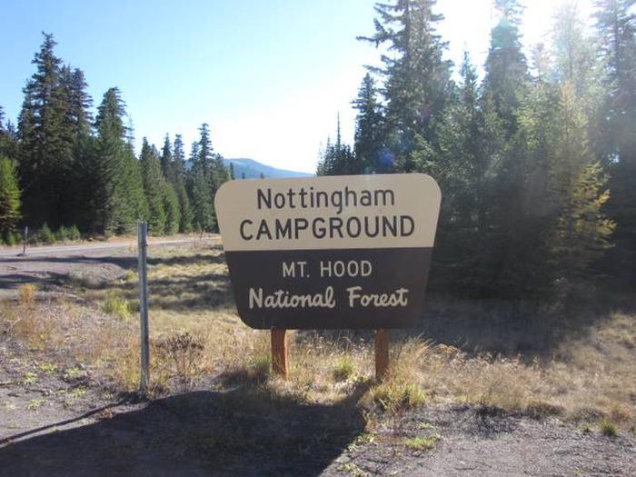
There’s a reason why Lost Lake Campground is so well-known. The Mt. Hood National Forest is situated between Lost Lake and Mount Hood’s glacier, which is world-famous for skiers. There are games for all ages here, as well as breathtaking views.

Among the amenities are hiking and biking trails, an old-growth pathway adjacent to the campsite, and water access with boat and canoe rentals. Hunting, skiing, or an excursion to one of the nearby geysers are all available activities.

The campground, which is adjacent to a hotel, caters to groups, families, and individuals, as well as offers rental cottages, yurts, and guest accommodations.

Mt. Hood, the Columbia River Gorge, and the Western Antique Airplane & Automobile Museum are just a few of the nearby tourist attractions.

18. Crater Lake National Park

Crater Lake National Park - Campgrounds in Oregon

In this wonderful nature reserve, there are two distinct Oregon campgrounds as well as various hiking trails. Two campgrounds are located in the forests around Crater Lake and are only open during the summer.

Mazama and Lost Creek Campground are both fantastic spots to visit if you want to take in the stunning views of Crater Lake and the surrounding terrain and fauna.

Mazama Campground takes reservations and has RV and tent camping available.

At Lost Creek Camping Ground, only campsites are available on a first-come, first-served basis.

The nearby attractions include Crater Lake, Whitehorse Falls, and the Pinnacles Overlook Hike.

17. Silver Falls State Park

Silver Falls State Park - Campgrounds in Oregon

This Oregon state park, which spans over nine thousand acres, offers over thirty-five miles of hill cycling, running, and horseback riding opportunities.

The park is made even more beautiful by the well-known Trail of Ten Falls, which crosses many streams and leads through the forests to a river. This Oregon campground offers tent sites, RV spaces, cottages, a horse campsite, and group tent and RV campers.

During the daytime, there is an off-leash area in the Park for dogs. Both your horses and your pets are welcome. Hot showers and restrooms are available.

16. Coldwater Cove Campground

Coldwater Cove Campground - Campgrounds in Oregon

The Cold Water Cove Campground is located in the Willamette National Forest. This well-known Oregon campground offers views of the vivid blue Clear Lake and historic lava plains. Campfire spaces, vault bathrooms, and fresh water are all available.

The water activities at Cold Water Cove Campground are spectacular during the day! Seriously, they can’t be missed. In the evening, listen to a wildlife talk in the Clear Lake Day Use Areas pavilion. Santiam Wagon Road Trail, Clear Lake Trail, and Sahalie Falls are just a few of the nearby attractions if you want to get off this campground, though it really isn’t necessary because this area is just so beautiful.

15. Oregon Dunes National Recreation Area

Oregon Dunes National Recreation Area - Campgrounds in Oregon

The Dunes Nature Park in Oregon is located south of Florence. The beach topography continues for forty miles down the Pacific Ocean’s shore before nearing the cross-bay.

The dunes are massive and wind-shaped, providing a unique walking experience that you won’t find anywhere else. If you love sand, then you have to visit this Oregon campground!

 Other places worth seeing are the Heceta Head lighthouse and Cape Perpetua. Amazon lodging is available in the Jessie M. Memorial State Park, which is located on the Oregon beach. 

This is one of my favorite campgrounds on the Oregon coast because the views are incredible!

14. Columbia River Gorge National Scenic Area

Columbia River Gorge National Scenic Area - Recreation

The National Tourist Reserve of the Columbia River Gorge is located where the Columbia River flows across the cascade falls. The George was established here as the Oregon-Washington border and is accessible via the Columbia River Highway and Interstate 84 area.

Camping, hiking, and horseback riding are all available in this campground.

Columbia River Gorge National Scenic Area, Oregon - Recreation.gov

This is considered to be one of the world’s most beautiful sites. Multnomah Waterfall in Oregon is the highest of several waterfalls created by the Columbia River.

Columbia River Gorge National Scenic Area Oregon | Tickets & Tours - Tripadvisor

On Multnomah Creek, the waterfall is located between Dodson and Corbett in Oregon, USA. And standing at sixty-two feet tall, the waterfall cascades over two layers of basalt rocks is is absolutely stunning to experience.

This is definitely one of the best campgrounds in Oregon if you’re looking for incredible views.

13. Washington Park, Portland

Guide to Washington Park in Portland | ViaSource

There are other lovely gardens and playgrounds in Oregon, but none are as lovely and full as Portland’s Washington Park.

Next to the beautiful Portland Japanese garden is the international rose test garden, which is situated within the park grounds. All of these parks and gardens demonstrate exceptional horticultural knowledge.

The park provides travelers with a variety of exciting experiences like hiking trails, campgrounds, and a variety of nearby attractions. Some of these include the Oregon Zoo, the Portland Children’s Museum, and Washington Park.

Tourists can reach this location through MAX light rail, Portland’s structured light-rail system that connects metropolitan cities to the downtown center, which is just two miles west of downtown.

12. Mt. Ashland Campground

Mt. Ashland Campground - Campgrounds in Oregon

Mt. Ashland Campsite is a peaceful haven full of blooms, butterflies, and birds, located close to the little town of Ashland but far enough away to provide a truly mountain camping experience.

The Pacific Crest Trail and the Siskiyou Crest, America’s second-longest trail, are both accessible from the campsite. Although you may see a few hikers going by, it is usually not very crowded. This is one of the best campgrounds in Oregon for privacy.

11. Little Crater Campground, Newberry Volcanic Monument

Little Crater Campground, Deschutes National Forest - Recreation.gov

The Mini Crater Lake Campsite, located in the Deschutes National Forest’s Newberry Volcanic Reserve and facing Paulina Water, features ground, lake, and rock pools amenities.

While the waters are too cool for long swimming, the 49 campsites all have beautiful scenery of Paulina Lake and the surrounding volcanic environment, and it’s a famous place for sailing and hunting. On warm-weather weekends, the campsites at Little Crater add up fast.

Deschutes National Forest - Newberry National Volcanic Monument - Deschutes NF

The trailhead for one of Oregon’s top thermal baths is located at the campground’s extreme, and the two-mile coastal stroll to Paulina Hot Springs is a lovely portion of the trip. Vault toilets and potable water are accessible at the campground.

10. Cape Lookout State Park, Tillamook

Cape Lookout State Park - Oregon State Parks

Cape Lookout State Park, located in the heart of the Three Capes Scenic Route, exemplifies the amusement to be had on the country’s edge.

On the cape, there are about 200+ campgrounds and a handful of cabins for multi-day visits. The campgrounds also offer easy accessibility to the seaside and other breathtaking scenery.

Tent camping is permitted at the majority of the Cape Lookout Campground’s sites, while RV travel is permitted at around 38 of the campground’s places. There are hot showers, flushing toilets, and potable water close at every location.

Cape Lookout State Park Photograph by David L Moore

Pet-friendly yurts and cabins are hidden neatly into the natural surroundings at the park.

The easiest approach to experience the coastal forest zone from the campground is to take the Cape Lookout Trail. To the north, the untamed Netarts Spit offers a tranquil hike. At the state park, surf fishing is a widely known activity. Each evening, the changing light and color of Cape Lookout create a breathtaking sight.

This is by far one of the best campgrounds in Oregon on the coast. If you’re an ocean lover then this is definitely your spot!

9. Harris Beach State Park, Brookings

Harris Beach State Park - Oregon State Parks

Harris Beach State Park, which exemplifies the rough aspect of the southern Oregon coast, provides access to beautiful sea stacks, a cliffside vista, and one of Oregon’s best beaches.

Harris Beach is the southernmost state park campground on the coast, with approximately 150 campsites suitable for tents, RVs, cyclists, and backpackers. From the campground, a short trail leads to a large day-use area and the seashore. A playground, beach picnic area, and green space are all part of the day-use facility.

Lone Ranch Beach and the beginnings of the Samuel H. Boardman Tourist Trail, both a short drive north of the campground, are well worth seeing. A bicycle track goes to Brookings in the opposite direction, where cafes, supermarkets, and other city amenities can provide some cultural stimulation.

8. Natural Bridge Campground, Rogue River-Siskiyou National Forest

Natural Bridge State Resort Park | Ky Parks

Natural Bridge Campground is a great base camp for exploring the Rogue River and Siskiyou National Forests, and it’s only 15 minutes from Crater Lake National Park’s West Gate.

The campground has 17 campsites that are available on a first-come, first-served basis. Each campsite has community vault toilets and campers must provide their drinking water.

Natural Bridge Campground is close to Crater Lake and other neighboring sights, making it an easy day excursion. The current, which flows alongside the Wild and Scenic Rogue River adjacent to the campground, vanishes underground through a 250-foot lava tube, forming a unique bridge and the park’s namesake attraction.

7. Strawberry Campground, Malheur National Forest

Strawberry Lake (Oregon) - Wikipedia

This campground stands at the gateway to the lovely Strawberry Mountains Forest, hidden away in the Blue Mountains of eastern Oregon.

This camp is famous for hikers hiking the Strawberry Basin Trail early the following day, with 10 sites accessible on a first-come, first-served system, each at fair pricing.

All nighttime visitors have access to clean drinking water and a solitary vault toilet. Strawberry Campground is typically empty even in the summertime, even after the appeal of the nearby nature reserve.

Setting up a backpacking camp a mile down the Strawberry Basin Trail is another option for exploring the area.

6. Nehalem Bay State Park

Nehalem Bay State Park

Nehalem Bay State Park is only a few kilometers south of Manzanita. This beautiful camping location is on a four-mile-long beach! It separates the Pacific Ocean from Nehalem Bay. This is a once-in-a-lifetime experience that the whole family will love.

https://stateparks.oregon.gov/

RV, sleeping bag, and yurt guests are welcome at the camping ground. There are Eighteen yurts for lease at the campground, as well as 260 electrical camping sites. On an isolated dune, there’s no better spot to breathe in the sea air. The cost of a yurt is $50.

5. Cape Blanco State Park

Cape Blanco State Park is in the far western part of Oregon. This is an excellent choice if you want a campground with plenty of open space and few people.

There are almost eight miles of hiking paths to keep you active and engaged. Not to mention the breathtaking seaside vistas from the countless hiking paths. The sight of the Cape Blanco Lighthouse is one of my favorite aspects of this large campground. When you combine all of that with a crackling bonfire, you’ve got me sold.

Cape Blanco State Park

This campsite is ideal for camping in tents and RVs. There are no bookings available, so get there early! With 52 electricity sites available, it’s a first-come, first-served renting situation. A one-night stay costs $24.

4. Port Orford RV Village

PORT ORFORD RV VILLAGE - Campground Reviews (OR) - Tripadvisor

This campsite caters to RV campers. The dunes are only 2 km away, lying just off the Oregon coast!

Port Orford RV Village - Home | Facebook

There is lots of quiet, beauty, and seclusion in this village. In addition, they provide fantastic attractions such as free WiFi, a game area, and lots of picnic tables. Aside from the beach, neighboring attractions include the Prehistoric Gardens and the Cape Blanco Lighthouse.

(If you have a history or science buff in your family, the Prehistoric Gardens are a must-see!) Check out the Port Orford RV Village right now! It costs $40 to rent an RV.

3. Wright’s for Camping

Wright's for Camping - Reviews & Photos (Cannon Beach, OR) - Campground - Tripadvisor

Wright’s is a family-owned and family-oriented campsite just across the famed Cannon Beach and Haystack Rock. Who wouldn’t wish to spend the night out near the set of The Goonies movie?

Wrights Lake, Eldorado National Forest - Recreation.gov

Only tents are permitted at this campground, which includes 22 camping spaces. The campground provides a relaxing outdoor experience by providing bubble baths, drinks, and a washing facility.

2. Honey Bear by the Sea

Home - Honey Bear By the Sea RV Resort

Honey Bear by the Sea is one of the largest seaside campgrounds on the Pacific Coast. The sites are absolutely stunning and it will sure make a mark on your list!

It features a beautiful RV complex with over fifty acres to explore, as well as a lovely campsite.

Honey Bear by the Sea RV Resort & Campground Reviews updated 2022

In addition to the sandy beaches and enticing Pacific surf, you’ll find trickling creeks, wide-open meadows, natural hot springs, and lovely wood trees. This is a holiday that is well worth your time and money.

1. Mount Hood National Forest

Mt. Hood National Forest, Oregon - Recreation.gov

Mount Hood, at 11,239 feet above sea level, is a prominent component of Oregon’s landscape.

On its peaks, you’ll find winding hiking trails like the Timberline Trail and the Mount Hood Ski Bowl choices. Mount Hood’s scenic loop highlights the natural beauty of the area. This hill is home to Timberline Lodge as well as the government camp’s memorial village.

Nottingham Campground, Mt. Hood National Forest - Recreation.gov

This mountain range is surrounded by the Mount Hood National Forest, which provides access to hot streams and waterfalls for visitors. Public transportation, personal transportation, and taxi services are all available to get you to this site.

Mt. Hood National Forest - Camp Creek Campground

The Mt. Hood express transportation system is a public bus that runs seven days a week and stops at several destinations, including the Mt. Hood National Forest. Feel free to check out their website to purchase tickets in advance!

Top 22+ Hikes In Phoenix Arizona To Check Out Right Now

You’ve come to the perfect location if you’re new to the Phoenix region or simply want to try out some new trails. Hiking in Phoenix can be fun, but it can also be dangerous and even deadly if you aren’t careful, especially during the summer months when temperatures spike.

This hikes list will help you locate the greatest spots to explore the great outdoors near Phoenix, Arizona, with everything from short and easy trails to more challenging hikes that will get your heart beating and leave you feeling accomplished.

So buckle up your shoes, double knot your hiking boots, and get ready to explore!

There are numerous excellent hikes in Phoenix and the surrounding area that are ideal for spending time with friends and family, getting some exercise, and viewing the environment.

Below is our selection of the best 20+ hikes to check out in Phoenix, AZ right now.

22. Camelback Mountain

hikes in phoenix, arizona hiking

Camelback Mountain is a stunning 2,704-foot peak located just north of metropolitan Phoenix, Arizona. It has stunning panoramic views of North Central and Downtown.

Ascend Camelback Mountain via Echo Canyon Trailhead, which begins at 3100 feet above sea level and ends at 1,400 feet above sea level, for a delightful hike that delivers a punch.

That may sound difficult, but don’t you worry: you probably will not be alone on the trip up to the top. Camelback Mountain is well known in the region and attracts over 800,000 visitors each year. This is a super popular spot for hiking in Phoenix!

To get to the top, either follow the Summit trail from the bottom to the top or the Cholla trail from the bottom to the halfway point, then turn around and finish the final half on the Summit Trail.

21. South Mountain Park

hikes in phoenix, arizona hiking

This popular hiking spot is only a few miles from downtown Phoenix and is ideal for running, hiking, and biking.

South Mountain Park, with its 1,300 acres, contains a little bit of everything, from lush meadows to rugged peaks. There are pathways to suit your needs, whether you’re searching for a relaxing stroll or a strenuous climb.

20. Piestewa Peak

hikes in phoenix, arizona hiking

Piestewa Peak, one of Phoenix’s top frequent hikes, is within easy driving distance of downtown and offers spectacular views of both downtown and Camelback Mountain.

This climb is ideal for beginners who want to overcome their fear of heights. It is also one of the best Phoenix hikes.

It can get very crowded on weekends as one of Phoenicians’ favorite hangouts, but if you stick around long enough and explore, some wonderful paths will take you away from everyone else. Keep your eyes peeled for some enjoyable sidewalks with spectacular sights.

19. Echo Canyon Trailhead

hikes in phoenix, arizona hiking

Echo Canyon is a great place for hiking and mountain biking, and it’s only a mile from North Mountain Park.

At 30th Avenue and Camelback Road, there is a trailhead. Parking, restrooms, water, and picnic tables are all available at the park, which is open from 7 a.m. to sunset.

This is an absolutely stunning hike that we definitely recommend! Just remember to bring lots of water because most months you’ll see temperatures of 75 degrees or (much) greater during the day.

18. Usery Pass Trailhead

hikes in phoenix, arizona hiking

Usery Pass Trailhead is one of our favorite hiking trails near Phoenix, located just west of Apache Junction, Arizona.

It not only offers a fantastic view of the Mummy and the Superstition Mountains, but it also allows hikers to visit Usery Mountain, Regional Park. Hikers will be able to observe some ancient petroglyphs left by local natives from a long time ago from the Usery Pass Trailhead.

This is a relatively simple hike that most of us can accomplish without too much sweat. We loved it!

17. Blue Ridge Loop Trailhead 

hikes in phoenix, arizona hiking

Andrew Fulks, one of Tuleyome’s founders, loves this hike because it was one of the first he did in the area and the panoramic views are spectacular.

Keep in mind that this terrain is difficult to navigate and quite steep. This trail is best hiked in the spring when temperatures aren’t too hot. It’s over 10 miles long so it’s definitely a great workout and is a hike in Phoenix that you should thoroughly prepare for.

On Rayhouse Road, cross the low water bridge, then turn left and pass through the yellow gate with the sun-shaped pattern on the fencing. You’ll arrive at a little clearing through this access road. The metal sign indicating the Blue Ridge Trail will be on your right.

16. Pinnacle Peak Park

hikes in phoenix, arizona hiking

Pinnacle Peak Park is situated on Pinnacle Peak Road near Hayden Road, north of central Scottsdale AZ. This route offers stunning views of Camelback Mountain, one of Scottsdale’s most recognized attractions, and is available every day from 6 a.m. to 8 p.m.

The 1.8-mile circular track climbs 600 feet up and down hills and has a variety of landscapes, including desert plants and water features. Wildflowers will also bloom at different periods of the year.

All ages are permitted, but dogs are not permitted on paths marked as no dogs allowed (which are most paths). There are no facilities or drinking water within walking distance of these paths, so bring plenty of water and wear comfortable shoes.

It should take roughly two hours to complete the hike round trip. It’s a fun little hike near Phoenix with gorgeous views if you don’t want to spend the whole day on a trail!

15. Cholla Trailhead

hikes in phoenix, arizona hiking

Cholla Trailhead is one of Phoenix’s oldest trailheads, located near Desert Ridge, I-17, and Loop 101. It is a fantastic first hiking experience for newbies, offering a break from urban development and a chance to escape into nature for a few hours.

It’s ideal for hikers of all abilities, with plenty of shade and breathtaking vistas.

Make sure you don’t miss out on Mother Nature’s work of art — simply keep an eye out for cactus along the road. There are wonderful sights to be viewed at every turn if you can get past these nasty little suckers (and they will pinch you, so be careful).

Cholla Trailhead is well worth visiting, especially if you’re not a super experienced hiker but want to experience some of Arizona’s natural life.

14. Ledge Loop Trailhead

hikes in phoenix, arizona hiking

The Ledge Loop Trail is a moderate climb that rewards you with spectacular vistas of Camelback Mountain, rich vegetation, and little stream-fed ponds.

If you don’t feel like doing the complete loop around both peaks, you can do an out-and-back hike that includes a portion of the Goat Camp Trail.

Within Camelback Mountain State Park, this trailhead is located shortly before sunrise point. You can also access these routes from Echo Canyon Park or Piestewa Peak, but please follow any park laws to help protect these popular hiking spots as there are a lot of conservation efforts here.

These massive boulders are well-known among hikers, but they’re also well-known among locals who enjoy photographing the dramatic rocks against sunsets and other backdrops.

13. Boyce Thompson Arboretum

hikes in phoenix, arizona hiking

One of my favorite hikes in Phoenix is the Boyce Thompson Arboretum. It includes numerous routes, some of which are more difficult than others but all of which provide spectacular views and an understanding of Arizona’s plant life.

You’ll find desert-like landscapes as well as enormous swathes of forested areas in this diverse landscape.

And what if you don’t have enough time to go on a whole hike? It’s no problem. You can always take a nice drive through it— We think it’s best seen from a car because you can take it all in.

Because of its high height of over 5,000 feet, the sky is generally clear, making this one of the best hikes in Phoenix any time of year. Bring plenty of water and begin your hike early in the morning; it can get exceedingly hot in the afternoon (nearly 120 degrees Fahrenheit).

12. Hidden Valley Nature Center

hikes in phoenix, arizona hiking

This park has fantastic views of Camelback Mountain and plenty of hiking trails to explore. It’s ideal for hikers of all levels.

However, keep in mind that some of these trails are quite steep. This is definitely one of the steepest hikes in Phoenix.

On your way up, don’t forget to stop at their wildflower garden. Plan to hike for at least two hours and pack lots of water, as well as sunscreen, hats (plus points if they have a brim), bug spray, and any other essentials.

We believe you will agree that Hidden Valley Nature Center is one of the best Phoenix hikes and it should not be missed. You’ll enjoy an energizing ascent through their nature center while hiking their many trails surrounded by different vegetation, such as saguaro cactus or scrubs.

11. Lost Dutchman State Park

hikes in phoenix, arizona hiking

The Dutchman’s is popular among rock climbers, mountain bikers, bird watchers, and hikers of all kinds.

At an elevation of more than 5,200 feet, it’s an uncrowded path where you may spend as much time as you wish without running across anybody else. There are lots of spots to stop for a rest, and the views are spectacular.

It takes roughly two hours to climb either way, regardless of where you start. Multiple pathways intersect Lost Dutchman; if one becomes too busy, simply switch to another until everyone disperses. This is a great spot for varied hiking in Phoenix.

10. Lost Lake Park, Cave Creek

hikes in phoenix, arizona hiking

Another one of the great hikes in Phoenix Arizona is Lost Lake Park, and it’s open all year long. This track has a low elevation rise, making it perfect for beginner hikers who are just starting.

It’s a fun day trek to do with friends or family, or even by yourself. There are some amazing rock climbing opportunities along a wall on the right side of Lost Lake; however, if you decide to go bouldering here, make sure you have a spotter.

Cave Creek has nearly 150 miles of trails that cover a variety of terrain types such as peaks, canyons, and washes. Within Cave Creek Regional Park, there is a 91-year-old enormous sequoia tree known as Centennial Tree. This is one of the best hikes in Phoenix to view a ton of awesome nature!

9. Bell Rock Pathway

hikes in phoenix, arizona hiking

Bell Rock Pathway is a short and lovely hike located just north, northeast of downtown Scottsdale. It’s about a 1.5-hour drive up i-17.

Hikers will be awestruck by stunning views of Bell Rock and nearby sites like Camelback Mountain and Pinnacle Peak while traveling along a single trail for about one mile.

Locals advocate hiking early or late to avoid crowds, as this is a popular tourist destination. We highly recommend this one even if you have to come mid-day!

8. The Trans-Canyon Trail 

hikes in phoenix, arizona hiking

The Trans-Canyon Trail, which runs from Grand Canyon Village’s North Gateway Trailhead to Hermit’s Rest on the South Rim near Mather Point, is more than 50 miles long. Bring some water.

The Trans-Canyon Trail runs through lush foliage. Having been built by US Forest Service volunteers over years of hard work, be prepared to enjoy the seasonal wildflowers and unspoiled wilderness territory that is absolutely spectacular, yet relatively unfamiliar to most visitors. We hope you enjoy it!

7. Mescal Mountain Loop Trail

hikes in phoenix, arizona hiking

Mescal Mountain Loop Trail is the best hiking trail around Phoenix, Arizona. We highly recommend it! With about a 2-hour drive north on i-17 from Phoenix, you should be here in no time.

The hike itself is about a 6.4-mile out-and-back trip with a 1,335-foot elevation gain. It’s one of the best intermediate hikes in Phoenix.

Just outside of Fountain Hills, Arizona, the Mescal Mountain Loop Trail takes you on an excellent journey through magnificent pine forests and along gorgeous rolling hills. Mescal Mountain is a terrific place to visit if you want to enjoy great views on one of your favorite hikes in Phoenix. 

6. Roosevelt Lake

hikes in phoenix, arizona hiking

Take a picnic at Roosevelt Dam Overlook where the views are definitely worth the trek. Situated about 2 hours east of Phoenix AZ, you won’t want to miss this stunning view.

This climb reaches a height of 2,704 feet, making it one of Arizona’s highest spots! However, we recommend hiking this one on a weekday because on weekends you should expect to see a lot of people.

Lastly, as a bonus, you’ll have plenty of fun burning off some hard-earned calories by shopping or dining at Kierland Commons in North Scottsdale or Old Town Scottsdale on your way out from Roosevelt Dam Overlook. Here you will find more than 250 art galleries and boutique shops that we absolutely enjoyed!

4. Western Ave

hikes in phoenix, arizona hiking

Views of Camelback Mountain and McDowell Mountain can be found on this climb. Although Western Ave. is rated as easy, there are numerous ups and downs along the way that can make it appear more difficult than anticipated.

Even though most of Western Ave. has a broad, gravel trail, hikers frequently see horseback riders on their way up or down. We consider this one of the best Phoenix hikes!

Western Ave. is one of Arizona’s most popular hiking paths for novices and veterans alike due to its easiness and accessibility. In fact, it’s one of the best easy hikes in Phoenix that still has some variety, so it’ll be enjoyable for all levels.

Both sides of Western Ave. are bordered by two of Phoenix’s most well-known communities, Arcadia and Biltmore, making hiking en route simple from various sections of the city.

3. Tonto National Forest, AZ – Lost Dutchman State Park

hikes in phoenix, arizona hiking

Lost Dutchman State Park is home to one of my favorite walks. This park takes you on a journey through a natural beauty filled with high hills and deep canyons.

The hike is scenic and includes an old gold mine to explore if you have time. I recommend keeping on the route because there are rattlesnakes in some areas that off-trail hikers may encounter. But don’t worry – you’ll still see incredible views right from the trail!

This is a moderate hike (not too difficult) that’s really fun because it’s filled with both culture and adventure.

2. Tempe Town Lake Walking Path

hikes in phoenix, arizona hiking

Tempe Town Lake is one of Tempe’s most popular attractions. There are numerous attractions and sports you can try, including canoeing and paddleboarding, as well as rowing, fishing, and kayaking. The lake also attracts a variety of birds and serves as year-round habitat for ducks.

The Tempe Town Lake Trail is a one-mile stroll around the lake, which also features cycling routes. It’s a popular hangout for college students and young professionals, but it’s also bustling with joggers and dog walkers throughout the day.

If you want to enjoy some peace while hiking, go on weekdays or early in the morning. This is a perfect hiking route in Phoenix for beginners or anyone who is looking for more of a casual stroll.

1. Papago Park

hikes in phoenix, arizona hiking

Papago Park is a wonderfully unique location that is ideal for hikers in Phoenix. And it’s located right in the city!

It’s also one of America’s largest urban parks, with 4,210 acres dedicated to some of Arizona’s best trails and natural monuments (including some fantastic hiking). While exploring you’ll find the Papago Amphitheater, the William C Elliot Memorial, and if you have time you could even check out the Phoenix Zoo!

If you’re planning on hiking in the Phoenix area, make sure to stop at Papago Park. It’s a classic for a reason!

20+ Best Hikes In Sedona, Arizona That You Won’t Want To Miss

Whether you are an experienced hiker looking for new challenging adventures or a beginner that is looking for your first hiking trip spot, Sedona Arizona is the place to go. There are so many wonderful hikes in Sedona, with incredible views, that it’s hard to choose!

The famous vortex and red rocks area is considered a true paradise for hikers as it’s home to more than 200 trails and paths. However, there are plenty of awesome hikes in Sedona for all levels, offering all sorts of sights.

Today we present you with our absolute favorite 20+ hikes in Sedona, from the most famous landmarks to the hidden gems of Sedona! You’ll definitely want to check out these really popular hikes if you’re staying in the area.

How To Make Your Hike Memorable:

Sedona is one of the best places in the United States when it comes to hiking, but planning ahead is still crucial to making the best out of your trip!

Parking lots tend to get full very quickly as everyone usually gets to a hike via car. Our advice is to know where you want to go and plan ahead so that you will be able to park and start your hike in the morning when the site is less crowded. The earlier the better!

Otherwise, plan a smaller/shorter hike later in the afternoon, especially when the days are longer. Most parking lots begin clearing out after 12pm.

Always remember to bring water with you. The majority of Sedona hikes don’t have water facilities along the way and the sun can be very hot especially during summertime. Seriously: it can get dangerous pretty quickly.

When planning your hike always make sure to check if the site you are going to visit requires the red rock pass. This is a purchasable pass that allows you to visit specific sites and support the local maintenance of this area. The pass cost ranges from 5 dollars for a daily pass up to 20 dollars for a weekly pass.

It’s definitely worth it to buy these passes before you go! Some places won’t even let you park without the pass, while others will charge you 3x what you would have paid.

20. Cathedral Rock Hike

Explore 20+ Best Hikes in Sedona, Arizona: Cathedral Rock Hike

This is one of the most scenic trails that you will find in Sedona. The Cathedral Rock hike offers great views of famous landmarks such as Bell Rock and Courthouse, making it popular for a reason. The views are some of the best in the area!

When approaching this hiking trail consider that it may be tricky and tough in certain parts. However, it’s only a one-mile-long roundtrip and the elevation gain is around 500 feet.

The trailhead is located halfway down Back O Beyond Road, off Highway 179, between Sedona and the Village of Oak Creek. I definitely recommend that you check out this Sedona hike if you’re at all athletic – it’s really one of the first you should do as a hiking enthusiast!

19. Doe Mountain

Explore 20+ Best Hikes in Sedona, Arizona: Doe Mountain Trail

If you are looking for a less crowded spot to hike then the Doe Mountain hiking trail is a good choice. 

Most of this trail’s 430 feet elevation gain is spread along the first 0.7 miles which makes this a perfect trail for beginners. It’s one of the best easy hikes in Sedona that still has a lot of lovely perks!

The trail gives you incredible views of many Sedona Red Rocks landmarks such as Bear, Maroon, and Wilson mountains, Loy, Boynton, and Secret Canyons. It’s a great place to start if you’re not feeling up to the Cathedral Rock Hike.

You will find the trailhead of this hike about 36 miles from Flagstaff.

18. Boynton Canyon

Explore 20+ Best Hikes in Sedona, Arizona: Boynton Canyon Trail

Although this is one of the best easy hikes in Sedona Arizona, the Boynton Canyon hike trail is well known for its outstanding scenery.

This trail is perfect for those who are looking for a very easy walk around the red rocks of Sedona as it’s one of the easier trails to walk. It’s 7 miles roundtrip with 800 feet of elevation gain.

The beauty of this trail is enriched by its spiritual value as it has been recognized as one of the top vortex energy sites. If you’re looking for spiritual hikes in Sedona then this is definitely the first place you should check out.

When hiking this trail, keep an eye out for the local flora and wildlife as this is one of the best spots for birdwatching too! This trail really has it all and is so easy that there’s no excuse not to try it.

17. Soldier Pass Trail

Explore 20+ Best Hikes in Sedona, Arizona: Soldier Pass Trail

The Soldier Pass trail is an intermediate-level hike that will give you the chance to fully embrace nature as it’s one of the less crowded trails in Sedona, specifically in the Red Rock Mountains area.

This is a 6-mile-long loop trail with an altitude gain of 800 feet that has a unique look on the famous Devil’s Kitchen landmark.

If you are looking for an immersive personal experience with nature then we highly suggest you add a mile-long detour to Soldier Cave when you find yourself at the last fork in the road.

16. West Fork Hike

Explore 20+ Best Hikes in Sedona, Arizona: West Fork Hike

West Fork hike is one of Sedona’s most visited trails and it’s the perfect example of how widely the landscapes around this area can be different. You will find so many green and woody areas while walking beside beautiful canyon walls!

This trip is a 7-mile roundtrip with an elevation gain of 500 feet and is very accessible to every kind of hiker, but you do have to cross the stream in several places, so a good pair of waterproof shoes is going to be useful.

If you’re looking for hiking in Sedona with beautiful views and an easy-to-intermediate trail, plan to check out West Fork.

15. Fay Canyon

Explore 20+ Best Hikes in Sedona, Arizona: Fay Canyon Trail

If you are looking for an easy walk through Sedona’s wonderful red rocks then the Fay Canyon trail is what you are looking for.

It is a 2.6-mile roundtrip with an elevation gain of 390 feet, rich with many beautiful spots.

Many visitors usually don’t know that this path is home to an incredible natural arch that is located just half a mile up the trail. This looks just like a regular rock overhang, but once you take a closer look you’ll be astonished by this red rock formation.

This trail allows enjoying a very typical Sedona landscape with some hidden gems along the way such as hidden canyons and desert plants. It’s one of the coolest secret Sedona hikes for hidden spots!

14. Birthing Cave 

Explore 20+ Best Hikes in Sedona, Arizona: Birthing Cave Trail

The Birthing Cave hiking trail is probably one of the less-known spots in the Sedona area and it is the best place to go to if you want to feel a strong connection with nature.

It is a 2-mile roundtrip with a 300 feet elevation gain. The trail is a relatively easy hike, with a wide and flat path, making it an accessible walk to many.

Once you have meandered through the majority of this Sedona hike, you’ll start to see the peak of the cave poke around the corner.  The cave interior has a unique heart shape, its ceiling curves up to a point, with the cave’s base also coming to an end.

This is one of the best hikes in Sedona to really feel a spiritual connection. Something about the formation of the rocks allows for a massive spiritual vortex. We’ve brought friends here who didn’t believe in anything spiritual (like, at all) and even they could feel it. It’s that strong!

13. Bell Rock Climb 

Explore 20+ Best Hikes in Sedona, Arizona: Bell Rock Climb

This is one of the most popular hiking trails in Sedona as it gives you the possibility to climb one of its most famous and spectacular landmarks.

With a 3.6-mile-long trail and a 400-foot altitude gain, this hike is great for every kind of hiker since it’s up to you how far you want to go up on the climb. But I will say: the views of the landscape from the upper levels of Bell Rock are definitely worth a little extra walk.

The first 0.25 miles of this Sedona hike are marked with trail signs and wire that are filled with rock but as you head higher onto Bell Rock, the wire baskets disappear. You can continue to go up following your route (the climb is not marked) as long as you know where you’re going. I recommend checking out a map ahead of time.

12. Devil’s Bridge 

Explore 20+ Best Hikes in Sedona, Arizona: Devil's Bridge 

The Devil’s Bridge path is probably one of Sedona’s best hikes and one of the most popular. This incredible landmark is the largest natural sandstone arch in the Sedona area.

The hike is a 1.8-mile roundtrip with a 400-foot elevation gain and is a great trail for every kind of hiker. The path is smooth and clear as it was originally built for jeep tours, making it really easy to walk.

You can either look at the Devil’s Bridge from a lower point of you or take that last climb and walk across it and have a unique view of the panorama. This is one of the best easy hikes in Sedona with incredible views. Seriously, this has to be the easiest hike anywhere.

If you’re totally afraid of exercise but still want the views then this is by far one of the best hiking trails in Sedona!

11. Airport Mesa Loop Trail 

Explore 20+ Best Hikes in Sedona, Arizona: Airport Mesa Loop Trail 

The Airport Mesa is located in the south of Sedona. This trail makes a loop on its upper rim; from there you will be able to see many red rock famous landmarks such as Cathedral Rock, Bell Rock, Courthouse Butte, Munds Mesa, Thunder Mountain, and the town of Sedona.

This is a very easy 3-mile-long loop hike with a 400 feet elevation gain, however, if you don’t want to go all the way up, hike the short spur trail up to the top of the Summit Trail for awesome views over Sedona.

10. Courthouse Butte Loop Trail

Explore 20+ Best Hikes in Sedona, Arizona: Courthouse Butte Loop Trail

The Courthouse Butte Loop Trail is a moderate 3.9-mile loop trail that takes you to two of Sedona’s most prominent rock formations, Courthouse Butte and Bell Rock. 

You will have to take the Bell Rock trailhead to start, but then at the first fork continue north and you will get into the actual trail.

This is the perfect hike for beginners offering great views of Sedona’s landmarks, easy paths, and an abundance of wildlife.

9. Adobe Jack Trail

Explore 20+ Best Hikes in Sedona, Arizona: Adobe Jack Trail

The Adobe Jack Trail is one of the newest trails in the Sedona area with fantastic red rock views and a path that will lead you to a creek bed.

This is a 4-mile-long trail with an elevation gain of 167 feet which is best for intermediate hikers.

The trail is immersed in the natural red rock area but it also dips in and out of small green areas.  As you get lower, it may get a little rougher and rockier, but this is an overall doable trail that is perfect for those who are looking for a more sporty experience.

8. Schuerman Mountain Trail

Explore 20+ Best Hikes in Sedona, Arizona: Schuerman Mountain Trail

The Schuerman Mountain Trail is one of the best trails in Sedona if you are looking for a less-crowded but still visually stunning hike.

This 2-mile-long trail starts at Sedona High School with a moderate uphill for about half a mile before reaching the rim.

Schuerman is more mesa than a mountain and in fact, as you climb to the top of the mountain, you will be able to get some impressive views of the Verde Valley.

7. Broken Arrow Trail

Explore 20+ Best Hikes in Sedona, Arizona: Broken Arrow Trail

Although very popular, the Broken Arrow trail is the perfect hike for beginners who want to experience an immersive walk in the Red Rock area.

The trail is about 4 miles long and very easy to follow as it is also accessible for Jeep tours. There’s a gentle climb up a wide valley, lined on both sides by beautiful eroded red rock cliffs.

The uphill ends at the Chicken Point low pass, which has good views south towards Oak Creek village, and north to Sedona and the high mountains beyond.

This is one of the best hiking trails in Sedona for those of you who want an easy hike that still takes a few hours.

6. Wilson Mountain 

Explore 20+ Best Hikes in Sedona, Arizona: Wilson Mountain Trail

This trail is one of the most visually stunning paths that you can find in the Sedona area as it offers beautiful views of the Oak Creek Canyon.

This is a hard hike since it goes up 2300 feet in the first mile, so you may need to plan a whole day to accomplish this mission. However, the views you will get from this hike are going to be worth the effort.

Keep in mind that it may be hot during the summer so remember to have some water with you. Just north of Encinoso Picnic Area, 3 miles up canyon from Midgley Bridge, you can take an alternate route which is a lot cooler than the others if you’re doing this trail on an especially warm day.

5. Dawa Trail 

Explore 20+ Best Hikes in Sedona, Arizona: Dawa Trail

The Dawa hike is a 2.6 miles loop trail close to Doe Mountain interwoven with 3 other trails. 

It is a great walk for beginners as its elevation gain sits around 150 feet; it is considered more of a nature walk than an actual hike since it’s very easy to spot local wildlife on the path.

This loop trail has many great spots for incredible views and along the way, you will be able to find a beautiful evergreen forest that will open up to spectacular views of the surrounding red rock mountains.

4. Lower Chimney Rock Trail 

Explore 20+ Best Hikes in Sedona, Arizona: Lower Chimney Rock Trail 

This is the best choice if you’re looking for an easy hike in Sedona, close to downtown, and if you don’t have much time to spend walking.

The Lower Chimney Rock trail is a great way to experience the typical red rock landscape in Sedona because the trail shares its head area with Thunder Mountain, Little Sugarloaf Summit, and Chimney Rock Pass Trails, allowing you to get great views.

This is one of the best hiking trails in Sedona to check out if you don’t have a lot of time and want to stay close to the city.

3. Pumphouse Wash Trail 

Explore 20+ Best Hikes in Sedona, Arizona: Pumphouse Wash Trail 

If you are looking for a more adventurous type of hike the Pumphouse Wash trail is definitely what you are looking for!

This is one of the best hikes with water in Sedona as there are lots of boulder hopping opportunities and cool natural pools.

Although is not properly marked and flat, the trail is pretty doable and fun to walk. It’s totally up to you how far to walk as there’s not an official ending point.

2. Sketch-Ridge Loop TrailExplore 20+ Best Hikes in Sedona, Arizona: Sketch-Ridge Loop Trail

The Sketch-Ridge Loop Trail is a beautiful easy to moderate hike from a ledge on the eastern rim of Carroll Canyon. 

With a 285-foot elevation range and a roundtrip of 2.6 miles long, this trail offers amazing views of iconic red rock formations such as Bell and Courthouse Butte among many others like the Scorpion Pyramid.

The local flora is very abundant on the trail itself, especially during springtime.

1. Smoke Trail

Explore 20+ Best Hikes in Sedona, Arizona: Smoke Trail

This hike is very easy yet incredibly enjoyable for every kind of hiker as it follows the flowing waters of Oak Creek and offers a great view of the beautiful Cathedral rock in the distance.

The trail takes you through a green lush wooded area with is great during hot summer days. With a length of 0.5 miles, this path is a great choice for a relaxing nice walk.

If you’re looking for more secret hikes in Sedona, then you should definitely check out Smoke Trail. It’s usually not too crowded since not many people know about it!

15+ Best Hikes In Rocky Mountain National Park Right Now

Rocky Mountain National Park boasts more than three hundred miles of hiking trails. Whether you’re a family traveling with young kids or an enthusiastic peak collector, there is a little something for your whole group here, from flat lakeside strolls to steep mountain climbs. Everyone enjoys at least one of the hikes in Rocky Mountain National Park!

Choosing which trails to hike in Rocky Mountain National Park can be as overwhelming as ever if you’re currently planning a visit. With a short visit, you can experience quite a few of them, especially if you choose trails that are short and sweet.

A few of the best hikes in Rocky Mountain National Park include walks along meadows in search of awe-inspiring alpine lakes to trails that challenge you to summit a Colorado fourteener.

Are These Hikes In Rocky Mountain National Park Safe?

hikes in rocky mountain national park

These hikes are all safe if you use common sense. Don’t do anything risky or stupid! If you have to ask yourself whether something is dangerous or not, it probably is. Always bring a buddy with you.

You should also be aware of the elevation. Beware that the air is thinner at higher altitudes (and some of these hikes have insane altitudes), so take it easy and breathe deeply if you aren’t acclimated yet.

The Best Hikes in Rocky Mountain National Park

Here are the top hikes in Rocky Mountain National Park right now!

15. Emerald Lake

hikes in rocky mountain national park

It is for all the right reasons that the Emerald Lake trail is one of Rocky Mountain National Park’s most popular hikes. There’s something magical about this hike that is both accessible to most hikers and accompanied by gorgeous alpine scenery the entire way.

My favorite part? While hiking, you’ll pass three picture-perfect alpine lakes (Nymph Lake, Dream Lake, Emerald Lake), giving you plenty of opportunities to take a break.

In addition to the three main lakes, you can also choose to go the extra mile (literally) to see Lake Hayiaha. It adds an extra mile to the trek (and another one on the way back), but if you’re still hungry for more mountain delights, it’ll be well worth it.

14. Bridal Veil Falls

hikes in rocky mountain national park

There aren’t many waterfalls in Colorado even though the state is known for its natural beauty.

Are there exceptions to the rule? In Colorado, Bridal Veil Falls offers an unusual sight with its 20-foot cascade.

This 6.1-mile hike takes around 3 hours to complete. A moderately difficult trail, it follows Cow Creek and offers plenty of wildlife sighting opportunities (watch out for elk and mule deer) as well as beautiful aspens and meadows to keep you entertained along the way.

This is one of the best hikes in Rocky Mountain National Park if you really want to experience all the elements in nature!

13. Sky Pond

hikes in rocky mountain national park

The Sky Pond Hike is a great alternative for those who want to put their legs to the test if the Emerald Lake Hike is too easy for you.

With views of dramatic valleys, Sharkstooth and Taylor Peaks, and two dreamy alpine lakes, this 8-mile hike isn’t for the faint-hearted, but the views every step of the way are just stunning.

Read More: Hike to Sky Pond in Rocky Mountain National Park 

12. Long’s Peak via the Keyhole Route

hikes in rocky mountain national park

Interested in a true challenge? Longs Peak, the mountain at the top of Rocky Mountain National Park, might just be the most iconic mountain in the entire state.

If you want to put your hiking skills to the test, the Keyhole Route is the best route to take. However, there are several routes that can help you conquer this popular Colorado 14er (some easier than others).

On Longs Peak, there is a trail called the Keyhole Route that is a 14.5 mile (out and back) hike rated as extremely difficult due to its 4,991 foot elevation gain. While climbing, you will encounter steep cliffs, vertical rock faces, and loose rocks. The summit is also reachable only by scrambling, which makes it challenging for hikers of all levels.

You should not take this hike lightly. Previous hiking experience is a must, as is wearing a helmet. Make sure that the weather conditions are suitable for summiting before starting the hike.

11. Bear Lake

hikes in rocky mountain national park

While this easy hike is known as being the most manageable in Rocky Mountain, it doesn’t take anything away from the breathtaking views.

Despite the short nature of the trail (less than a mile long), you will get to enjoy views of nearby peaks as well as Bear Lake, a stunning body of water sure to leave you breathless.

Brear Lake trail is a stroller- and wheelchair-accessible trail, making it one of the most family-friendly hikes in Rocky Mountain National Park.

10. Chasm Lake

hikes in rocky mountain national park

Rocky Mountain seems to be king when it comes to picture-perfect, dreamy alpine lakes, which is why every hike on this list involves a lake. Chasm Lake is another hike that should be on your hiking list, especially if you’re in the mood for a long hike.

Along with the alluring lake at the end of the hike, the entire hike is filled with charm, and you’ll stop several times to enjoy the scenery along the way. A 7.7-mile trail that takes you by vistas of Long’s Peak, an amphitheater of rock formations, and a delightful waterfall can give you a pretty good idea of what to expect!

9. Sprague Lake

hikes in rocky mountain national park

One of the most popular short hikes in the park is to Sprague Lake, located off Bear Lake Road. Around this lake there is a handicap-accessible hiking trail.

Looping around the lake, this trail is 0.5 miles long. Hiking this trail is possible at all hours of the day, and there is always something new to see. Your party will enjoy the flat trail at Sprague Lake – it’s good for all athletic abilities!

Picnic tables and benches are nearby where you can enjoy the view while enjoying a picnic lunch. It’s a great place to watch the sunset as the colors in the sky light up behind the mountains. The park’s Eastern area is suitable for a half-day visit.

8. Loch Lake

hikes in rocky mountain national park

As you climb gradually through a spruce forest, you will come to Alberta Falls. The falls are not easy to see from the trail – climb the rocks straight ahead to get a better view.

After you ascend past the falls, you’ll begin to notice two things. For one thing, the number of people on the trail will drop by 85%. Secondly, the forest will begin to gradually change and get a lot thicker. Before reaching the Loch, you’ll have to traverse a few switchbacks.

In my experience, the side of the lake that you’ll find yourself first on is constantly windy, so you may want to move to the other side of the lake and take a few moments to enjoy the views before returning. While this is one of the more difficult hikes in Rocky Mountain National Park, the views are insanely gorgeous.

7. Nymph Lake

hikes in rocky mountain national park

From the Bear Lake Trailhead, Nymph Lake is an easy hike. It takes a little more than a mile to walk to and from Nymph Lake. Water lilies are frequently seen in the lake, making it a really gorgeous natural area. Whenever we go to another lake in the park, we often stop here first.

There is no better place to kick back, relax, and enjoy the views of the mountains than Nymph Lake. Despite the busy nature of the trail, there will be areas where you can sit and take in the view of this beautiful lake.

When hiking to Dream Lake, you will first come across Nymph Lake. I definitely recommend that you stop for a few moments to enjoy its beauty!

6. Dream Lake

hikes in rocky mountain national park

From the Bear Lake Trailhead, Dream Lake is an easy hike. It is the most photographed lake in the park.

The trail is about 2 miles roundtrip. It’s a short trek with a 426-foot elevation gain that’s great for beginners.

The hike passes Nymph Lake, which I highly recommend taking a glance at (it’s beautiful). After you arrive at Dream Lake, walk around the lake, sit on the perfect rock, and enjoy a snack.

hikes in rocky mountain national park

Trails leading to Dream Lake can also be crowded, so try to avoid hiking during peak hours of the day. Hiking to Emerald Lake or Lake Haiyaha is also an option if you want to hike more than a couple of miles once you’ve arrived.

This is definitely an ideal route if you have only one day to hike Rocky Mountain National Park!

5. Irene Lake

hikes in rocky mountain national park

Near Grand Lake, on the west side of the park, is the Irene Lake Trail. With an elevation gain of 85 feet, this trail is a 0.8-mile loop.

The parking area near the trailhead has restrooms and picnic tables.

In summer, there are beautiful wildflowers everywhere – they provide a colorful backdrop to the lake. If you are interested in bird watching, be sure to bring your binoculars. Plus, it’s not uncommon to see moose on this side of the park.

From the parking area, look across Trail Ridge Road to see Sheep Rock. It is often here that you can see Bighorn Sheep, which are frequent visitors to the park.

4. Black Lake

hikes in rocky mountain national park

The trail to Black Lake crosses Loch Lake/Sky Pond and then turns left just before the Loch just before the Black Lake.

Two other lakes will be seen on your way – Mills and Black Lake – the latter being 2.8 miles beyond the turnoff. Black Lake is particularly beautiful.

Having said that, if you only have time for one hike, I would recommend Sky Pond. But don’t get me wrong: Black Lake is a beautiful place for hiking in Rocky Mountain National Park! However, it’s a bit shorter/easier so not everyone will feel “done” after hiking to Black Lake.

The waterfall scramble on the way to Sky Pond may scare you, so this is the next best thing.

3. Alpine Ridge Trail

hikes in rocky mountain national park

Near the Alpine Visitor Center on Trail Ridge Road is the 0.7-mile out-and-back Alpine Ridge Trail.

As this trail reaches a height of more than 12,000 feet, I do not recommend this short hike until you have acclimatized to the elevation. It’s definitely one of the more difficult hikes in Rocky Mountain National Park.

While ascending the stairs near the Alpine Visitor Center, you should take in the view. It’s really stunning for the athletically-inclined.

You must remain on the trail at all times because the surrounding tundra is not a place for wanderers. Trust me on this! The climb is dangerous enough as-is due to the elevation.

The more steps you take as you ascend, the more likely you are to get winded – the elevation gain is 147 feet! Take it as slow as needed.

Winter hats and coats are recommended, as it is going to be cold at the top. But your climb will be a talking point for years to come because of the 360-degree view from the top!

2. Lily Lake

hikes in rocky mountain national park

In the east of the park, Lily Lake is a 0.8-mile loop trail. Enjoy the views as you stroll – they’re incredible!

Accessible to wheelchairs, the trail offers incredible views over the lake and bird watching opportunities. In some places, there is a boardwalk in addition to the dirt and gravel trail surface.

For a bit more of a challenge, you can take the Lily Ridge Trail. The view of the mountains will be even better if you hike a little further.

After a long hike or other outdoor activity, Lily Lake is the perfect place to relax and unwind. Wildflowers and birds can be seen in abundance at Lily Lake in the park.

Picnic tables and nearby toilets are also available. Visit the lake at sunset when it is stunning and the crowds have dispersed.

1. Mount Ida

hikes in rocky mountain national park

As you descend into the valley on the west side of the park, you will find this hike along Highway 34 on the south shore of Poudre Lake.

Since this trail is only accessible during the late spring and summer, it will only be accessible from the east side of the park. In November and May, it will be snowy if you enter from Grand Lake.

While the mileage might not seem that bad, the elevation is almost certainly going to make it seem ten times harder because you will be climbing upwards of 10,500 feet. By the end, you’ll get to 13,000 feet, which is extremely high.

If you’re coming from somewhere near sea level, do not attempt this hike the first day! Make sure you’re acclimated to the elevation.

The benefit of hiking at that elevation is that you’ll be above the treeline most of the time, which allows you to experience breathtaking views of the surrounding mountain peaks.

When you do this hike in the summer, as you’ll be above the treeline, be sure to finish by noon to avoid lightning storms that happen almost every day during the peak summer season.

What You Should Know Before Visiting Rocky Mountain National Park:

Buy The Right Pass: You will have to pay at least $20 for entry a day, and $30 for entry that is good for seven days. If you plan to visit multiple National Parks in the next year, consider investing in an America the Beautiful Pass, which costs $80 and includes 3 visits to National Parks, National Forests, or National Recreation Areas.

Watch Out For The Altitude: The altitude in Grand Teton is insane – it’s above 8,200 feet most of the time, meaning if you go hiking you’ll get to above 10,000 feet. Stay hydrated and take it easy on your first day.

It Gets Sunny: It feels like the heat is stronger in the mountains. Maybe being that much higher makes a difference? Remember to use sunscreen or bring a hat.

Pack The Right Gear: Before you go hiking in Rocky Mountain National Park, make sure that you have the right gear. For example, it will be a good idea to bring a map if you plan on going off-trail. Also, don’t forget your sunscreen and bug spray. You will also want to bring a day pack or backpack with enough water, a rain poncho or jacket, a first-aid kit, and snacks so you can go at your own pace. We always bring a few beers along but that’s a personal choice!

Plan For The Weather: Be sure to check the weather before you go on a hike. If it’s going to be sunny, make sure that you have sunscreen and/or a wide-brimmed hat with you! You will also want to bring an extra layer in case the weather changes suddenly, which is pretty common on these hikes in Rocky Mountain National Park.

Be Aware Of The Wildlife: Sometimes, you might find some wildlife hanging out by the trail. Don’t freak out! You should always keep your distance though, so use your best judgment when it comes to this. If an animal does approach you, calmly back up and move off the trail until it moves away from you.

Know When To Go: Most of these trails in RMNP are closed from December 1st – July 31st, so keep that in mind when planning your trip.

Parking Is Tough: In the fall, most lots are completely full by 7am. Yikes. From each of the trailheads, at least 4-5 highly trafficked hiking trails depart. Luckily, you can park at the Bear Lake Road park and ride, and a complimentary shuttle will whisk you to the trailheads. It’s even possible to ride the hiker shuttle to the Estes Park Visitor Center without having to worry about parking in the park.

East Versus West Sides: Alpine Ridge Road, which closes for the winter, connects the less-visited east and west sides. There is no better place to drive through Rocky Mountain National Park than above the treeline into the alpine tundra, where you can see the surrounding Rocky Mountains from above. This drive will lead you to the west side, or you can access it via Grand Lake. You can see wildlife, including moose, if you hike the Green Mountain Trail to Big Meadow.

Best Time To Go: There is no BAD time to hike in Rocky Mountain National Park, but if you want fewer people on the trails, I recommend coming during the week or during winter/spring.

With over 300 miles of trails winding through dense forests and open ridges to alpine tundra, Rocky Mountain National Park has trails for all levels.

This list of the best hikes in Rocky Mountain National Park should help you create your own hiking itinerary. Despite the fact that there are nearly enough trails to dedicate an entire year to hiking here, these are some great ones to get you started!

12+ Amazing National Parks In Florida To Visit Right Now

If you need a little time to get away from the hustle and bustle of everyday life, there is no better place than the National Parks in Florida. With some of the most beautiful views and natural habitats in America, these parks are sure to be a breath of fresh air!

Many of the most popular national parks in Florida offer visitors a chance to escape the hustle and bustle of everyday life and explore some of the most beautiful views and natural habitats in America. With everything from stunning caverns and botanical gardens to mesmerizing flowing rivers and untouched islands, national parks in Florida offer something for everyone.

From kayaking through mangrove mazes to spotting alligators on glass-bottom boats or going in search of the next island on a park that’s 99 percent water, here’s a look into some of the most unbelievably unique national parks in Florida you need to see to believe.

So put on your hiking shoes, grab your camera, and explore one (or all) of these 10 best national parks in Florida today!

Incredible National Parks in Florida You Won’t Believe Exist:

Here are the top Florida National Parks to check out right now!

12. Biscayne National Park

Amazing national parks in Florida: Biscayne National Park

Biscayne National Park is a great place to visit if you’re looking for a beach and nature combo. Located in the alluring Florida Keys, Biscayne National Park is 95% underwater, which pretty much means you need to go below the surface to truly experience it.

If you’re not a fan of getting wet, you can explore Biscayne National Park by booking a glass-bottom boat tour. This will give you the chance to see under the surface and explore all that the park has to offer.

95% of the park is set underwater, but the remaining 5% that’s on land is still worth exploring! The islands spread throughout the park have trails for hikers to enjoy as well as wildlife sightings and beautiful sunsets.

There is no entry fee for this national park in Florida.

11. Everglades National Park

Amazing national parks in Florida: Everglades National Park

The Everglades National Park is a hugely popular park in Florida. It is well-known for its wilderness and array of ecosystems. The park is home to mangroves, marine, coastal lowlands, and over 15 million acres!

The alligators are the keystone species of the Everglades National Park, which is home to a variety of wildlife. However, the entire park is home to an incredible variety of wildlife. In fact, Everglades is the only place on the planet where alligators and crocodiles co-exist!

The Everglades National Park is a vast and unique place, full of different kinds of wildlife that you can’t find anywhere else. While most people explore the park by going on a scenic drive, the best way to get close and personal with the nature around is by hiking a few trails. The Eco Pond Trail is great for flamingo sightings and the Anhinga Trail is another incredible pick if you’re brave enough to encounter alligators up close.

Another must is booking a boat tour in the Gulf Coast area to get to know the life around Everglade’s water. You’ll get to see manatees, dolphins, and other marine life in their natural habitats. There’s no better way to experience this beautiful park.

The park’s dry season, which lasts from November to March, is the most popular time to visit due to the warm winter weather and the variety of wading birds and their predators that migrate to the park during that time.

The National Park Service offers a variety of passes that allow visitors to enjoy national parks for free or at a discounted price. The $30 entrance fee is valid for seven consecutive days and applies to cars. The fee for people walking around the park or cycling is $15, but children ages 16 and younger are free of charge. There are also a variety of passes available that offer free or discounted admission to national parks.

10. Dry Tortugas National Park

Amazing national parks in Florida: Dry Tortugas National Park

Dry Tortugas National Park is proof that you don’t need to jet set to the Maldives or Bora Bora to find paradise-like beaches. Situated just off the coast of Key West, this park is made up of a few small islands and is renowned for its crystal-clear turquoise waters and palm-fringed beaches.

Snorkeling and diving are popular activities in the park, as are kayaking and camping. Whether you’re looking to sunbathe on the beach, explore the marine life underwater, or just relax in a hammock with a good book, Dry Tortugas National Park is definitely worth a visit.

The Dry Tortugas are a group of small islands located in the Gulf of Mexico, about 70 miles west of Key West. The islands are home to some of the best coral reefs in the country, making them a popular destination for divers and snorkelers. The park is also home to a variety of birds, including herons, egrets, pelicans, and ospreys.

The islands are only accessible by ferry or seaplane, and because most people can’t be bothered to endure the journey, your chances of getting it all to yourself are pretty high.

Dry Tortugas National Park is 99% water, with the remaining 1% constituting seven small islands spread all over. While visiting, you can snorkel in search of untouched coral reefs, find the colors of the rainbow in the sea life, or simply count how many different species of animals you can find in the depths below (sharks, sea turtles, coral, lobsters, octopus, and tropical reef fishes, to name just a few!)

Dry Tortugas National Park is a great place for snorkeling and diving. The park consists of seven small islands, and 99% of the park is made up of water. The remaining 1% is made up of the seven small islands. While visiting the park, you can find coral reefs, sea turtles, sharks, and many other types of sea life.

My favorite part of the Dry Tortugas National Park in Florida is the clear waters and the beautiful beaches. It’s a great place to go snorkeling, diving, kayaking, and camping, but it’s definitely worth a visit if you’re a water lover!

The Yankee Freedom III ferry from Key West is a great way to visit Dry Tortugas National Park. The ride is about 2 hours and 15 minutes but can be a bit rough, so if you are prone to motion sickness, you may want to try the Key West Seaplane Adventures which only takes about 40 minutes.

The best time to visit this national park in Florida is May through October for weather and snorkeling. Do keep in mind this is hurricane season, so make sure you check the park’s official website in case of any closures due to severe weather conditions.

9. Gulf Islands National Seashore

Amazing national parks in Florida: Gulf Islands National Seashore

Stretching along the Gulf Coast from western Florida and into Mississippi, this national park encompasses emerald-colored beaches with a Mediterranean-like climate paired with an array of historical forts and sites that tell stories from way back. 

White sugar sand and sparkling turquoise waters of the Gulf of Mexico, provide the ultimate relaxation without crowds of people or development. The beauty of the Florida side of the Gulf Islands is found in the miles of pristine shores, many of which are completely unspoiled and absolutely uncrowded. Seriously, thanks to the expansiveness of the place, finding yourself a spot to enjoy the views in complete solitude is a pretty easy feat. 

Another highlight for those who enjoy exploring on foot is the mezzanine of trails leading to mountain top viewpoints, lighthouses, and forts that act as reminders of the First Nations and pioneer past. 

This National Park in Florida is home to an abundant ecosystem that is teeming with wildlife. You can find osprey, great blue herons, dolphins, sea turtles and so many more.

There are numerous activities to do at this National Seashore. Do not miss swimming, or snorkeling in the crystal-clear waters where you can see lots of fish, crabs, starfish, and sand dollars. You can also fish, kayak, boat, bike, camp, or join a ranger for a nature tour.

If you are into history then make sure to check out the three forts within the National Seashore built to fortify Pensacola Harbor: Fort McRee, Fort Pickens and Fort Barrancas.

Entrance fees ($15 per person) are needed at the Fort Pickens Area, Okaloosa Area, Perdido Key Area, Opal Beach at the Santa Rosa Area, and the Fort Barrancas Area. Eighty percent of the fees are used to improve facilities at this beautiful park.

Feel free to visit this national park during any season – it’s a great year-round spot!

8. Big Cypress National Preserve

Amazing national parks in Florida: Big Cypress National Preserve

The Big Cypress National Preserve is a beautiful national park in Southern Florida that is home to amazing bird watching, hiking, camping, and scenic drives. The park is open year-round and offers a variety of activities for visitors to enjoy.

The park has a variety of habitats that are home to interesting plant and animal life. There are two scenic drives, the 27-mile Loop Road and the 17-mile loop including Turner River, Wagonwheel, and Birdon Roads. These drives take you through different habitats with interesting plant and animal life.

There are also plenty of activities available in the park. You can go hiking, biking, fishing, and kayaking. The park also has a visitor center with exhibits on the natural and cultural history of the area.

The best time to see alligators in Florida is from December to May. However, they may be seen year-round. Ranger-led programs allow you to explore and learn more about the national park and the ecosystems within it, which is really cool for all ages!

The park doesn’t have an entrance fee, but there is an annual fee of $100 for an off-road vehicle permit. If you’re camping overnight, the prices vary based on different parts of the park.

7. Castillo de San Marcos National Monument

Amazing national parks in Florida: Castillo de San Marcos National Monument

The Castillo de San Marcos National Monument is located in Northeast Florida in St. Augustine and is open year-round. This national monument offers the opportunity to explore a historic Spanish fort.

This Spanish fort was built to protect Spain’s claims in the New World from enemies. It is a treasure of 17th century St. Augustine and has played a role in the early history of the US.

Castillo de San Marcos is a historic fort that protects the city and shares its history. It is worth checking out for when the park hosts historic weapons demonstrations – it’s amazing to see the cannons being fired! This is one of my favorite historical national parks in Florida because these demonstrations are so interactive.

The fort is the only 17th-century military structure that is still standing in the United States. It began construction in 1672 on the Castillo (Castle). The fort was built as a star-shaped fort with coquina, a mixture of broken shells and sand bound by calcium carbonate.

The Castillo has survived being hit by cannons during the period when Spain and England were at war because of its very special construction material – Coquina. It actually absorbs hits, like clay, instead of shattering.

The entrance fee for adults is $15 and the entrance fee for children is free of charge. Any tickets purchased can be used for seven [consecutive] days.

6. Canaveral National Seashore

Amazing national parks in Florida: Canaveral National Seashore

This national park is located on the Atlantic coast, between New Smyrna Beach and Titusville on the barrier island near Cape Canaveral, and is known for its beautiful beaches, dunes, and forests. It’s a great year-round place to go fishing, hiking, swimming, and bird watching.

The seashore at this park is close to perfect, as it is untouched by development. Visitors come to explore the barrier island beaches, dunes, and wetlands. The beach provides a place to reflect and unwind, where tranquility abounds. You can explore 24-miles of undeveloped beaches, sunbathe, and relax.

The biodiversity at this National Park in Florida is unparalleled, with over 1 thousand species of plants and animals documented. From five different types sea turtles to manatees (and even more!), there are plenty who call it home!

The seashore also has extensive salt marshlands which provide habitat for these magnificent creatures as well. so if you’re looking for an educational trip that will take your breath away without ever feeling too far from nature then head down to this national park!

The Black Point Wildlife Drive is one of our favorite places in the park and offers a great opportunity to see a variety of animals, including endangered species. There is also a wide variety of plants that can be found in the park.

We saw 8 manatees during our last visit to Haulover Canal State Park! In fact, this is one of the best national parks in Florida to check out if you want to easily see manatees.

Every time you drive the loop, different birds can be seen. The wading bird population is great – we spotted wood storks and roseate spoonbills alongside egrets or herons as well. There’s also plenty of Bald Eagles around; they’re pretty common here in Florida scrub-jay habitat.

To get into the parks, you can either buy a pass from Apollo Beach or Playalinda.

5. De Soto National Memorial

Amazing national parks in Florida: De Soto National Memorial

The De Soto National Memorial is a historical site in Florida that commemorates the landing of Conquistador Hernando de Sicco’s army. The soldiers, hired mercenaries and craftsmen, came to find gold but they also wanted to conquer new territories for Spain.

The Conquistador died on May 21st 1542. His remaining group members made their way to Mexico City where they founded an important historical colony, but they never found gold.

This national park is a living history camp where you can interact with rangers and volunteers dressed in period clothing while telling historical tales.

There are also craft demonstrations, outdoor activities like kayaking on the lake or hiking through nature trails for those who want an up-close look at some native plants!

Whether you’re a nature lover, fisherman or just looking for some peace and quiet, there are outdoor activities for everyone. You can also experience ranger-led that get you up close and personal with nature.

The De Soto National Monument is a great place to visit if you’re looking for a free national park in Florida since there is no entrance fee.

4. Fort Caroline National Memorial

Amazing national parks in Florida: Fort Caroline National Memorial

Fort Caroline is a National Memorial (located in Northeastern Florida in Jacksonville) that not only preserves history, but brings it alive with informative and educational tours. Along your journey through the grounds you’ll see historical reenactments of life in colonial times which is super fun and informative!

The Timucuan Preserve is home to a 1/3 scale reconstruction of Fort Caroline, which memorializes the short-lived French presence in sixteenth century Florida.

Kids can earn their Junior Ranger Badges on this property and there are both short or long nature trails for you to explore as well!

Be sure to keep your eyes peeled when exploring this preserve because dolphins often jump right into the St Johns River!

The Fort Caroline National Memorial does not require any entrance fee so it’s a great free national park in Florida to check out.

3. Fort Matanzas National Memorial

Amazing national parks in Florida: Fort Matanzas National Memorial

Fort Matanzas is a historic watchtower fort located in northeastern Florida, just 14 miles south of St. Augustine and an is ideal place for exploration: there are hiking trails that wind throughout its grounds as well as beaches where you can find seashells or bird watching with all your senses on full alert!

The picturesque structure built of coquina is a great example of the ingenuity and creativity that came with building early forts.

Fort Matanzas was a Spanish fort built to protect against British troops who wanted access into St. Augustine via the nearby inlet, Matanzas Cove. During the construction of this new defense system though England tried to invade many times but never succeeded because their ships were repelled before they even got on land.

Visitors to this historic site will be thrilled with the many adventures offered, including boat tours that provide an unforgettable perspective of St. Augustine’s best beach. Visitors can also become Junior Rangers and explore nature trails or take part in fishing expeditions along both river banks as well as at sea!

There is only one way to get to this National Park in Florida and that is by boat. Head to the visitor’s center to reserve tickets for the ferry.

There are no fees for the ferry or for admission to the monument, but you can only reserve passes on a first-come-first-serve basis so it’s best to show up early!

2. Timucuan Ecological & Historic Preserve

Amazing national parks in Florida: Timucuan Ecological & Historic Preserve

Timucuan Ecological & Historic Preserve is located in Jacksonville and it houses a fascinating collection of historic sites.

The preserve has 46,000 acres where you can explore both history and natural beauty with visits to the Kingsley Plantation for insight into slavery and freedom, or visits to Fort Caroline National Memorial which offers an immersive experience through storytelling techniques such as reenactments.

The national park is a 600-acre haven for nature lovers in Florida. From forest trails to wetlands, this beautifully preserved area has it all! You can also learn more about science and ranger-led programs that showcase its rich environment through informative event giveaways or talks given by scientists who work at parks across America

It is not often you get to visit an African American historical beach, so you should definitely check out the beach at the national park. The historic American Beach was founded in 1935 so that, during segregation, black people could have their own resort-like setting. It’s not only gorgeous but is filled with history!

There is no entrance fee at this park – it’s by far one of my favorite free national parks in Florida to visit.

1. Gullah/Geechee Cultural Heritage Corridor

The Gullah/Geechee Cultural Heritage Corridor is one of the most fascinating National Parks in Florida.

If you’re looking to get away from it all, this natural wonder offers an opportunity for solitude and reflection with its beautiful nature trails that wind through old-growth forests filled will rare wildlife like red-bellied turtles or bonneted bats!

The Gullah/Geechee are descendants of Central and West Africans who were brought to America through the Transatlantic Slave Trade. Jacksonville remains home for many large communities with this unique culture, which has evolved over centuries in response to oppression by European powers like Britain or France during colonial times.

The Gullah/Geechee people are an interesting and unique group of individuals. They have preserved their traditional culture despite the influx in population from other areas.

The old traditions live on among this generations’ youth who carry them forward with pride while adapting new ways when needed too but always keeping somewhere personal at heart – whether it be through music (guitar), food habits (fishing) family recipe recipes passed down verbally.

To learn about the Gullah/Geechee people and their culture, consider visiting many different areas. There isn’t one entrance or visitor center for this enriching place!

Hopefully, this list of amazing national parks in Florida helped you craft the perfect bucket list for your trip!

While some of these parks are easier to get to than others, each and every single park in this list is vastly different from the last and worth visiting even if you already think you’ve seen it all.