The 20 Most Beautiful Mountains In Oregon

Looking for the most beautiful mountains in Oregon? Today we’re sharing the top 20 peaks you won’t want to miss!

Oregon is a state of great natural beauty, with stunning landscapes that include rugged coastlines, lush forests, and towering peaks. Among these natural wonders, the mountains of Oregon stand out as some of the most breathtaking and awe-inspiring.

From the snow-capped peaks of the Cascade Range to the rugged terrain of the Wallowa Mountains, there is no shortage of majestic mountains to explore in Oregon.

In this post, we will take a closer look at the 20 most beautiful mountains in Oregon, each with its own unique features and stunning vistas that are sure to leave a lasting impression on any visitor.

So grab your hiking boots and get ready to discover the beauty of Oregon’s mountains!

20. Mount Thielsen

The 20 most beautiful mountains in Oregon

Nestled in the Southern Oregon Cascades, Mount Thielsen is a stunning peak that boasts a distinctive horn-like shape. Situated just north of Crater Lake, the mountain’s most striking feature is its nearly vertical 2200-foot north and east sides, which give it the appearance of a great spire rising dramatically from the surrounding terrain. At the summit of Mount Thielsen, this unique characteristic is particularly pronounced, making it an irresistible destination for hikers and nature enthusiasts alike.

As the most often hit High Cascade peak, Mount Thielsen has earned the name “the lightning rod of the Cascades” for the spectacular spire form it has, as well as its prominence among the region’s other mountains and the unpredictable weather it experiences.

Mount Thielsen, despite its fearsome look, is a relatively easy climb. The West Ridge is a thrilling route that isn’t too difficult but has just enough exposure to get your heart racing. At the summit, a spectacular spire soars majestically into the sky.

Atop the mountain, you feel as if you’re floating over the lush woods of Oregon’s Cascade Mountains, which seem to fall out in every direction. Mount Shasta is visible to the south on a clear day, while the Three Sisters are evident to the north. The only site outside of Crater Lake National Park where you can view the waters of Crater Lake is Mount Thielsen.

The Mount Thielsen Trail is the most popular trail to Mount Thielsen’s summit. It is 4 miles from the PCT intersection, where you can begin your West Ridge hike. After 5 miles, you’ll arrive at the summit.

19. South Sister

The 20 most beautiful mountains in Oregon
traveloregon.com

There is another equally gorgeous approach to Moraine Lake halfway up the mountain. Mount McLoughlin is visible from this lower route. You can view half of the state from the peak, a broad, snowy crater with a lake. Sometimes, the peak creates a small snowstorm and a cloud of whiteouts.

It’s truly magnificent!

The trail to the summit of Oregon’s third-tallest mountain, South Sister (also known as Charity), is open to the public. South Sister’s trek to its 10,358-foot summit can be strenuous, but it’s also one of Central Oregon’s most popular hikes because of its spectacular views.

The hike to South Sister’s peak climbs 4,900 feet in six miles, making it one of the most demanding in the world. The difficulty in breathing that comes with such a high elevation rise isn’t what made South Sister the most challenging; instead, it is the exceedingly rough terrain.

The course is challenging because of its rock and sand composition. Sand and pebbles of various shapes and sizes, from tennis balls to gumballs, are strewn throughout the ground. Then there are the hastily positioned big stones that can collapse at any time with only a shove or a misstep.

18. Smith Rock Group

The 20 most beautiful mountains in Oregon
smithrock.com

In the distance from Terrebonne, you can see the Smith Rock Group, a large, free-standing rock “island.” Its most prominent rocky summits are Smith Summit (the highest spire), The Platform, and The Arrowpoint.

This formation is encircled on three sides by the Crooked River: east, south, and west. When comparing elevations, asterisk Pass is just north of Smith Rock Group and Christian Brothers. The Smith Rock Group has considerable sections of excellent grade rock; however, most are choss. Seeing the structure from the east rather than the west makes it seem considerably more intimidating.

It is possible to climb to the top from the east side, although most routes meet weak rock for at least one pitch. It’s rare to find a ‘walk-up’ route to any higher peaks on the west side, but East Smith Summit is an exception since it’s only accessible through the East Wall 5.8 X.

Summer and winter are too hot and snowy respectively to climb the Smith Rock Group, making spring and fall the best seasons to visit. However, some routes may be closed during the breeding season due to falcon nests. Despite the challenges, the Smith Rock Group is a must-visit destination for any adventurer looking to explore the mountains in Oregon.

17. Brandy Peak

The 20 most beautiful mountains in Oregon
alltrails.com

It is one of Oregon’s lesser-known coastal mountain summits, situated between the Pacific Ocean and I-5, its primary north-south route. Despite this, this peak attracts more than just residents and hunters. Do you want to know why?

Among the 73 Oregon Prominence Peaks, Brandy is the ninth-highest point in the state’s coastal region. During the summer months, hikers can enjoy breathtaking landscapes of wildflowers and animals along Bear Camp Ridge.

Squirrel Camp, located under Brandy Peak, is accessible through a 4-mile hike. Hikers and climbers who reach the peak of Brandy Peak will discover a red can in which to place their names.

To get through, take Interstate 5 north to Merlin Exit 61, then follow Merlin / Galice Road to Galice Creek Access Road 34-8-36 from Grants Pass, OR. Continue up this road for another 21 miles to the trailhead at Forest Roads 2300 and 2308. Roughly 4.0 miles down Forest Road 2308 lies the Brandy Peak trailhead.

16. Fort Rock

The 20 most beautiful mountains in Oregon

In Oregon, visitors won’t discover much in ancient history. The oldest structures are from the 1850s; thus, no ancient temples or Neolithic homes exist.

But there is Fort Rock, a temple-like structure created by nature and its collection of human relics.

For a rock structure in central Oregon’s high desert that rises to almost 200 feet in height and spreads to about 4,500 feet in circumference, the appellation “Fort Rock” seems appropriate. However, the rock’s formation is considerably more intriguing than a fort’s construction.

Fort Rock is a relic of a Pleistocene volcano that Fort Rock Lake formerly surrounded. Thousands of years ago, there was once a Paiute resting site at the peak, but it has since been lost to history.

An easy ascent to this location is made possible by the low altitude. In the spring, avoid climbing Fort Rock due to nesting holes. Hikers can reach the top trailhead by heading west from the parking lot and then north on the route that leads there. The average hike is about 2 miles long.

Fort Rock Cave, a National Heritage Site, is another attraction site near Fort Rock. You can enjoy guided tours of this National Heritage Site.

15. Alvord Peak

The 20 most beautiful mountains in Oregon
oregonhunters.org

Alvord Peak, the southernmost summit of the Steens Range, rises out of the arid wastelands of Southeast Oregon. The 7132-foot peak of this basaltic mountain is reached via a steady ascent from Long Hollow and Road Canyon in the west, followed by a 3000-foot drop into the desolate Alvord Desert in the east.

Like Steens Mountain, Alvord Peak is a “Basin and Range” terrane feature, a fault block upthrust along the same rim as Steens and Pueblo Mountains. On the western edge of the now-dry Catlow Valley, the Catlow Rim marks the former coast of an inland sea.

If you appreciate wooded wilderness, this may not be the top for you. This area lost most of its sagebrush cover during the 2006 wildfires, leaving many mountains looking desolate and lifeless. There are no trees on Alvord Peak; not even Junipers can be seen within a few hundred feet of the peak.

If you summit Alvord Peak during the summer months, make sure to pack water, there are no water sources in the region. At 7132 feet, Rattlesnakes can be a problem; thus, the best time to trek Alvord Peak is in the winter to avoid encountering one.

Alvord Peak is between Steens and Pueblo Mountains. From Frenchglen, take Highway 205 south for 42 miles to Long Hollow Summit at 5608 feet. On the north side of the roadway is a rock pit; park and start your trek if no one is around.

14. Crane Mountain

The 20 most beautiful mountains in Oregon
summitpost.org

Over 8,000 feet, Crane Mountain is one of 80 peaks in Oregon that are so tall. Among the 73 Oregon Prominence Peaks, it ranks 39th. On a clear day, you can see Mount McLoughlin and Mount Shasta in the distance, as well as Goose Lake.

Only cars with high clearance and four-wheel drive can approach the Crane Mountain trailhead at the end of a difficult road. Before you reach Crane Mountain Lookout, you’ll start to see the path. Between the trailhead and the trail’s highest point, which is not the mountain’s summit, it’s a 4-mile round trip hike.

The lowest half of Crane Mountain’s trails are challenging, no matter which path one chooses. Camping at Crane Mountain Pond’s campgrounds makes it possible to extend your climb up Crane Mountain into a more extended adventure. You can hike the path leisurely, even with minor children, but keep in mind some steep portions and challenging rock scrambles.

Route 8 in Johnsburg leads to Garnet Lake Road, which becomes a gravel road and then leads to the hiking route. After a T-intersection, turn left into Putnam Cross Road and immediately take a left onto Ski Hi Road. Take the second right after Ski Hi Road to get to the trailhead.

13. West Pueblo Ridge

The 20 most beautiful mountains in Oregon
flickr.com

The Pueblo Mountains in Southeast Oregon conceal one of the region’s natural high-altitude treasures. The vast majority of the Pueblo Mountain Range is comprised of the significantly westward-inclined escarpment known as the West Pueblo Ridge.

One of Oregon’s 100 tallest peaks, and the fourth-highest point in Southeast Oregon, this peak has a prominence of more than 1500 feet at an elevation of 8420 feet. The Desert Trail Association publishes a guide to the weakly designated path that spans the range from south to north and runs along the West Pueblo Ridge. The mountain’s east and west ridge walks are 2nd-class, while the east scramble is 3rd-class.

In addition to the Steens Basalt covering much of Southeast Oregon, the Pueblo Mountain Range has vast quantities of much older metamorphic rock that can be seen along the east-facing escarpment and as pinnacles cutting from ridgelines in the Pueblo Range.

A comparatively small fault tilt like the Pueblo Range, slanted higher than the significant tilts like Steens Mountain and Abert Rim, accounts for its 8000+ altitudes.

12. Marys Peak

The 20 most beautiful mountains in Oregon
tumblr.com

With 4,097 feet, Marys Peak is the highest point in Oregon’s Coast Range and the most visible peak west of Corvallis. On a clear day, you can spot the Pacific Ocean to the west and several of the Cascade peaks to the east all over the Willamette Valley from Marys Mountain Day Use at the summit of the mount.

Meadowedge Trail, East Ridge Trail, North Ridge Trail, Summit Trail, and Tie Trail are hiking alternatives. Cross-country skiing, snowshoeing, and other non-motorized winter activity are possible when there is snow. The route to the day-use zone, on the other hand, is not maintained for winter vehicles, so use caution.

Marys Peak has been declared a Scenic Botanical Area because of its rich, distinctive landscape and vegetation. A rare Noble fir forest surrounds Marys Peak’s lush, undulating meadows. In the spring and summer, the open fields provide a haven for a wide variety of wildflowers. The wildflower displays in the meadow and rock gardens alter late spring and summer.

In 2015, the Siuslaw National Forest initiated a meadow restoration effort on Marys Peak. They carefully remove trees and replace them with native species as part of their continuous endeavor to restore gorgeous views and historic meadows.

11. Mount Jefferson

The 20 most beautiful mountains in Oregon

Mount Jefferson is the second-highest mountain in Oregon. Because its top pinnacle needs Class 4 climbing on highly steep, generally ice-encrusted rock, some regard it as the most challenging higher volcanoes (over 10,000′).

Mount Jefferson is one of the 57 ultra-prominent summits in the continental United States, with a prominence of over 5,777 feet, and is one of only four peaks on this list from Oregon. Mount Hood, Sacajawea Peak, and South Sister are the other three, with 7,679, 6,388, and 5,588 feet, respectively.

Along with its prominent location, Mount Jefferson lies on the Jefferson-Linn county line and serves as the county highpoint for both counties, making it a “Two-Fer” county highpoint.

Mount Jefferson is an almost undoubtedly extinct stratovolcano that erupted between 40,000 and 50,000 years ago. It can be accessible from Oregon State Highway 22 through U.S. Forest Service roads and trails.

Depending on the path to be climbed, there are two major approaches. You can reach them through the Pamelia Lake and Jefferson Park routes. However, the Whitewater Trail is the most direct way to Jefferson Park. Start at the Pamelia Lake Trailhead if you plan either the South Ridge or Southwest Ridge routes.

10. Grass Mountain

The 20 most beautiful mountains in Oregon
alltrails.com

It is one of Oregon’s 73 prominence peaks with a height of 2163 feet, placing it at the 56th spot on the list. However, the mountain has a site where individuals were seen smoking some. As someone who enjoys prominence peak chasing, you’ll find the material here to be of great use.

Don’t forget to pack some snowshoes if you’re planning to snowshoe in late winter or early spring.

You can locate Grass Mountain in the coastal mountains southwest of Corvallis, not far from Mary’s Peak. It’s not a challenging climb, but it’s around 6 miles long and gains about a thousand feet in elevation, making it suitable for your kid’s first hiking experience.

For the most part, you’ll be hiking through dense forests, with a bit of respite to enjoy a view of a grassy area at the top of the mountain. A lookout initially maintained watch over the region, but trees now obscure the view in all but one direction.

You can still see concrete footings here. The highest point is a rock located just north of the concrete foundations.

9. Humbug Mountain

The 20 most beautiful mountains in Oregon
reddit.com

Humbug Mountain is Oregon’s highest peak on the Pacific Coast.

Coastal mountain climbs are among the most popular in the area. It boasts a marine environment with mild temperatures due to its position.

Summer is the driest season, yet it seldom gets too hot. Temperatures drop significantly during the winter months, even at the highest altitudes. With its old-growth forest and steep terrain, the mountain’s north side offers access through Brush Creek Drainage, which makes cross-country hiking difficult. There are treacherous, slick, and steep slopes on the mountain’s ocean side.

From the parking lot, it’s easy to find the trailhead.

You can reach Humbug Mountain’s 1,765-foot top via a 5.5-mile climb that gives views of the ocean to the south. Additionally, the park is also home to the Oregon Coast Trail.

Hikers can enjoy incredible ocean views along this worn, paved path that has been restricted to automobiles for a long time.

8. Bullrun Rock Monument

The 20 most beautiful mountains in Oregon
flickr.com

In addition to Table Rock and Monument Rock, Bullrun Rock Monument is one of three glacially sculpted mountains that make up Monument Rock Wilderness. At just around 7,900 feet, Bullrun Rock is the tallest mountain and has the most fabulous views of the three.

Many subalpine and Douglas-fir trees dot the landscape, and many rock outcroppings are ideal for bouldering and rock climbing. Because of their rarity, these peaks provide a tranquil atmosphere to those who ascend them. To reach Bullrun from Bullrun Creek, climbers can follow a trail that starts there. It’s about a 2-mile hike.

You can reach Bullrun Rock through a short but strenuous ascent up the southwest face of the rock, which leads to a small summit ridge and a 150-foot sheer cliff on the other side. The sagebrush desert and Ironside Mountain’s blackened summit cone are visible toward the southeast.

The trek to Bullrun Rock is 2 miles across the top meadow, indicated by a faint and sometimes absent track.

7. Middle Sister

The 20 most beautiful mountains in Oregon

Inexperienced climbers can have a satisfying alpine experience on the Middle Sister, the lowest of the Three Sisters (North Sister and South Sister). In addition to the Pole Creek Trailhead, the peak can be accessible by crossing Hayden Glacier from the east. From this vantage point, you’ll get panoramic views of the surrounding Cascades.

In 2012, Pole Creek Trailhead was the starting point of a massive forest fire, and the area remains dangerous. Taking this route will take you past a stretch of the burn where the vegetation is just starting to recover, and there is minimal shelter.

Hayden Glacier is the shortest and most direct way up the mountain for experienced glacier explorers. Follow the North Sister path up to Collier Glacier’s summit, then climb around Prouty Point and into the saddle where Hayden and Renfrew’s glaciers meet. To reach the top, you’ll have to negotiate a series of rocky scrambles.

Depending on the time of year you choose to climb this mountain, the circumstances might vary drastically. As late as mid-August, crampons and an ice ax are essential for climbing the mountain’s harder upper reaches.

It is possible to summit without crampons and an ice ax between mid-August and October. The last steep stretch of the Middle Sister, on the other hand, is made up of precarious rock, making the ascent to the summit somewhat perilous. Slow down and pay attention to your balance.

6. Odell Butte

The 20 most beautiful mountains in Oregon
alltrails.com

If you’re driving through Oregon’s Eastern Cascades, you may not even see this conical summit that is thickly wooded since it lacks any notable features.

The lookout placed atop the mountain is visible from Route 58, and what’s more, it’s still an operational lookout that’s manned and maintained. In the minds of many who “collect,” this is one of the essential lookouts to find in good condition.

This mountain, situated south of Bend, Oregon, is not challenging, but it is significant to those actively attempting to climb all of Oregon’s 75 prominence peaks. Odell Butte is on the #53 on the prominence list, having a prominence of 2192 feet, despite only 73 of the list’s summits having the required 2000 feet of prominence. It is one of the several volcanic cones that dot this region of Oregon.

A road connects to the peak, but it is gated at the top, necessitating a mile-long climb to the top to claim this one. Getting to the highest point requires a little scrambling through some rocks near the viewpoint, which features a benchmark. Aim for the highpoint without utilizing the lookout structure unless the lookout gives permission.

Related: The Top 14 Restaurants in Bend, Oregon

5. Carpenter Mountain

The 20 most beautiful mountains in Oregon
youtube.com

Carpenter’s prominence of 2,029 feet makes it one of 73 mountains on the list of Oregon Prominence Peaks. It has an active lookout, much like Odell Butte. Visitors should park along the Carpenter Peak Trail to access the trail leading to the top.

A magnificent one-mile path with an elevation gain of 1,000 feet awaits them from there. During the last 600 feet of the route, which is steep and rocky, the course becomes moderately challenging. Located atop a volcanic pinnacle, the Carpenter Mountain Lookout provides breathtaking views of Cascade Crest, Wolf Rock, Three Fingered Jack, the Three Sisters, Mount Jefferson, and the Mount Washington Range.

Short yet spectacular rock formations amaze tourists every time they see them on the trail.

You cannot use the lookout during the fire season.

4. Indian Creek Butte

The 20 most beautiful mountains in Oregon

Indian Creek Butte, located on Strawberry Mountain’s west face, rises to 7886 feet above sea level and is the highest point in the Strawberry Mountain series that runs east to west. When seen from the south on the way in, Indian Creek Butte forms a striking skyline at just 1300 feet shorter than its eastern neighbor.

There are elk, pine martins, and peregrine falcons in plenty on the south face of the Strawberry Wilderness, covered with high-altitude wood. The Pine Creek track follows the mountain’s ridge until it reaches the summit block, making it the best option for anyone seeking to reach the peak.

In places, if you look down into the Indian Creek drainage, you can see young ponderosa pine trees emerging from what seems to be a burned-out wasteland on the northern face. You can view a little meadow of wild onions near the head of Indian Creek, unaffected by forest fires if you take the alternate path up Indian creek.

The Pine Creek Trail, which crosses the Strawberry Mountain Range, is the best way to get to Indian Creek Butte. There are two ways to get to this trail: from the south or north side mountain range. The Pine Creek Trail is the quickest and most accessible path, even if many additional options, such as the Table Mountain or Indian Creek Trails. Both routes have a one-way distance of around 5.5 miles; alternative paths are somewhat longer.

3. Prairie Mountain

The 20 most beautiful mountains in Oregon

Prairie Mountain is the 47th most prominent peak in Oregon, with 3,426 feet. The Grass Mountain, situated across a valley from Alsea and its river, is visible from the summit of this mountain. The OPP has Grass Mountain on their radar as well.

There are two summits on Prairie Mountain, one on the east and one on the west. If you want to be sure that you’ve climbed both of these peaks and reached the highest point, many people recommend that you go up both. Hiking both in one day is recommended by many peak baggers since they are both tough yet doable. Both trails are more than four miles long.

It is a half-day family-friendly trek located about 45 minutes from downtown Calgary. Trek over this fantastic outdoor area with steep, gradual climbs and huge grassland and mountain scenic sights.

Add birding in the summer or snowshoeing in the winter to your trip.

2. Pearsoll Peak

The 20 most beautiful mountains in Oregon

Pearsoll Peak is one of the 73 Oregon Prominence Peaks and is ranked 28th on the state’s list. Hiking up Pearsoll Peak is best done in the spring or fall when the weather is mild. Windy weather conditions and high summer heat make reaching the peak almost tricky. There are many routes to the trailhead, but the McCaleb Ranch path is the most popular.

Clear days allow hikers to view the Pacific Ocean, California’s border, and Mount McLaughlin on a clear day from the top of the mountain. You can lease the peak’s highest lookout, Pearsoll Lookout, for overnight stays by making a reservation in advance. The vista from the summit of Pearsoll Peak is definitely worth the climb.

The trailhead at Chetco Pass leads to a network of rugged mining roads, all of which are currently closed to vehicles due to a wooden barrier that surrounds the region. To go around the fence, you’ll have to walk around the end of it. Taking a northern path from the pass is your goal.

As the road climbs north, keep following it. After taking a right turn, the route ascends steeply to the left before taking a switchback turn back right. In June, wildflowers bloom in this region.

1. Eagle Cap

The 20 most beautiful mountains in Oregon

Hikers go to Eagle Cap in northeastern Oregon because it’s one of the state’s best climbing spots. Eagle Cap Wilderness is known as its “crown treasure in the Wallowa Mountains.”  Lake Basin, a popular photographing location in the state, is only a short distance from the peak, which offers stunning views of the mountain and its reflection.

Getting to the Wallowa Mountains’ central summit is not for the faint of heart.

Eagle Cap, the Wallowa Mountains’ rock node at 9,572 feet, gives rise to eight valleys extending outward. Despite its lack of height, Eagle Cap’s 360-degree vista is unparalleled, and a well-graded route rises to the top from the East Lostine River meadows.

Many hikers choose to spend the night on the trail, allowing them to savor the experience fully. The best time to hike Eagle Cap is from July through October.

A two-day excursion is necessary if your objective is to reach the top. Spend the day in the Lostine Meadows or Mirror Lake to better look at the cliff-edged summit.

On the trails and in the campsites, groups must not exceed 12. At least 100 feet away from lake coastlines, horses must be grazed at least 200 feet away, and campfires are prohibited within a quarter-mile of Mirror Lake.

The 14.8-mile round-trip climb to Mirror Lake rises 2,020 feet in elevation, making it challenging to complete in a single day. If you’re going to Eagle Camp, you’ll need at least two days to cover the 19.8-mile trek, which raises 4,000 feet in altitude.

Tips for a Safe Mountain Adventure

So, if you’re planning a vacation to the mountains, here are some things to consider:

  1. First, Check the Weather. Ascertain your destination since weather conditions in mountainous areas can change rapidly.
  2. Dress Appropriately: If you’ve checked the forecast for the weather, you’ll also know what clothing and shoes to wear to be warm and comfortable. In general, sturdy shoes, thermals, and a lightweight down feather jacket should work unless you’re traveling to an icy location.
  3. Use Cash Instead of Your Credit Card: ATMs may not operate in distant regions such as mountain communities. Remember that many tiny eateries and shops only take cash, so bring enough with you if you want to visit any local eateries or shops to pick up some souvenirs (which you should!).
  4. Take Just What You Need and Plan: You’ll have to lug around whatever you’ve packed into your luggage all by yourself. So, you must pack just the clothes and equipment you need for your journey.
  5. Obtain Basic Health Insurance: Even if you don’t go out of your way to take risks, any mountain journey is a pretty risky business. We hope it doesn’t happen, but some hazards include – sprains, joint pains, fractures, breathing problems (due to higher altitudes), or even just food poisoning from something you ate.
  6. Enough Food and Water: You must remain hydrated and eat enough food to maintain your energy level. Include protein bars, dried fruits, and ready-to-eat snacks in your pack. Additionally, you should bring a refillable water bottle to ensure that you have adequate water. Carry plenty but not too much, since you need to travel light.
  7. Bring Some Handy Essentials: You will need a few necessities to have a flawless and delightful mountain adventure experience. It contains essentials such as hygiene, sunglasses, sunscreen, a power bank, and maybe a torch and a map (to avoid draining your phone’s battery!).

The Oregon mountains offer a wealth of natural beauty and adventure for anyone looking to explore the great outdoors. From the rugged terrain of the Wallowa Mountains to the snow-capped peaks of the Cascade Range, there is no shortage of stunning landscapes to discover. Each mountain range in Oregon has its own unique features and attractions, making it easy to find the perfect destination for any type of outdoor enthusiast.

Whether you’re an experienced climber looking to tackle challenging routes or a casual hiker seeking a scenic stroll, the Oregon mountains have something for everyone. With miles of trails to explore, breathtaking vistas to admire, and endless opportunities for outdoor recreation, it’s no wonder why the mountains in Oregon are such a popular destination for adventurers and nature lovers alike.

But the beauty of the Oregon mountains goes beyond their physical features. These mountains are also home to diverse ecosystems and wildlife, providing a vital habitat for many species. From the lush forests that blanket the slopes to the crystal-clear streams that flow through the valleys, the natural wonders of the Oregon mountains are truly awe-inspiring.

In addition to their natural beauty and ecological significance, the Oregon mountains also hold a special place in the hearts of many people. For generations, these mountains have inspired artists, writers, and adventurers alike, and continue to capture the imaginations of people from all walks of life.

In short, the Oregon mountains are a true treasure, offering endless opportunities for exploration and adventure. So whether you’re a seasoned mountaineer or a first-time hiker, be sure to add the mountains in Oregon to your list of must-visit destinations. You won’t be disappointed!

Ultimate Guide To Kanarra Creek: The Kanarra Falls Hike

Looking to do the Kanarra Falls hike? Today we’re sharing everything you need to know about hiking in Kanarra Creek!

Kanarra Creek is a beautiful narrow canyon located in BLM land just north of Zion National Park’s Kolob area and to the east of Kanarraville’s Hurricane Cliffs. The 600-foot hike through this attraction provides an extraordinary trekking experience in Utah.

What was once an undiscovered gem, the Kanarra Falls hike has become a hotspot for outdoor enthusiasts. Unlike the nearby Zion Narrows, it’s smaller and less crowded, making for a more enjoyable slot canyon climb.

A trip to Kanarra Falls Utah offers a slot valley with river crossings, stairs, and boulders to ascend, two waterfalls, and stunning scenery. Don’t miss the opportunity to journey through the river and witness a spectacular waterfall nestled amid towering canyon walls.

To make the most of your visit to Kanarra Creek, read on for everything you need to know about the Kanarra Falls hike!

Quick Peek at Kanarra Falls Hike 

The Kanarra Falls Hike | Visiting Kanarra Creek in Utah

Highlights: Two waterfalls cascade down a beautiful slot canyon. Same landscape as Zion Narrows but with fewer visitors due to the permit system.

Distance: 4 miles out-and-back

Difficulty: Moderate

Elevation Gain: around 700 feet

Trail: Dirt, water, rock

Trailhead Location: Just east of Kanarraville, UT, the trailhead for Kanarra Creek can be found at the end of E 100 N St. The trailhead is in a large parking lot that is simple to discover. Restrooms, picnic tables, and water for post-hike clean-up are available at the trailhead.

Hiking Time: 3-5 hours

Permit Info: To hike Kanarra Creek, $12 hiking permits per person are required.

Restrictions:

  • There are only 150 hikers allowed to Kanarra Creek daily. Without the permission system, this spot could grow fairly crowded, detracting from the experience while endangering the area’s natural splendor. The limit of people per group is eight.
  • You must obtain a permit to become one of the lucky 150. Permits cost $12 each and can be purchased online for four-year-olds or older. However, these tickets usually sell out weeks in advance due to the hike’s popularity, so hurry!
  • Dogs at Kanarra Falls are not allowed. The Kanarra Creek watershed is Kanarraville’s primary source of drinking water, and dog waste can contaminate it.

How To Get Permits for the Kanarra Falls Hike

The Kanarra Falls hike has become a highly sought-after attraction, especially on weekends from spring through fall. However, due to its recent surge in popularity, a permit is now required to access the trail. While the cost of the permit may seem a bit steep for a short day trek, it serves as an effective crowd control measure by limiting the number of hikers allowed each day.

To secure a permit, you can purchase them online or at the trailhead. However, it’s important to note that these non-refundable tickets sell out quickly and cost $12 per person. We strongly recommend purchasing your permit in advance to avoid disappointment.

If you do purchase a permit in advance, be sure to print or save a copy as you’ll need to present it to a kiosk attendant at the trailhead. Additionally, it’s worth noting that the permits for the entire year go on sale in January or February.

Things To Consider…

Here are things to consider when you hike Kanarra Falls!

Weather Condition

If you’re planning on hiking Kanarra Falls in Utah, it’s important to take the same safety precautions as you would for the Narrows. Flash floods are a significant concern during the summer months, particularly in July, August, and September when afternoon thunderstorms are more likely. This applies not only to Kanarra Falls but to other slot canyons as well.

Before starting your hike, make sure to check the weather forecast. If there’s any chance of rain or storms, it’s best to avoid Kanarra Falls altogether. Even if the rain is kilometers away, the slot canyon can still be vulnerable to floods.

It’s worth noting that Kanarra Falls may be closed if there’s a possibility of severe rain or thunderstorms. Therefore, it’s crucial to check the weather before embarking on this hike.

Leave No Trace

It would be best to treat the hikes in Kanarra Creek as your backyard. Follow “leave no trace” principles anytime you venture into the great outdoors.

In general, you should try leaving this region and trail in better shape than when you arrived. Stick to approved paths if there are any, use public restrooms to avoid contaminating water sources, and take out everything you bring on the trail with you.

We’re fortunate that the Kanarra Falls Hike is still available to the public, particularly given its popularity and closeness to Zion National Park. Tourists or hikers will lose access to this trail if it is not maintained correctly.

When to Hike Kannara Creek

The Kanarra Falls Hike | Visiting Kanarra Creek in Utah

Regardless of the time of year, there are a few things to remember when visiting Kanarra Falls in Utah.

Here’s what you can expect during each season:

Spring: Spring is an excellent time to visit Kanarra Falls Utah as the weather is mild, and the water levels are typically low. This means you can enjoy the hike without worrying about flash floods, and the scenery is lush and green.

Summer: Summer is the busiest time to visit Kanarra Falls Utah, but it’s also the riskiest due to the increased chance of flash floods. If you do decide to visit during the summer, be sure to check the weather forecast and avoid hiking if there’s any chance of rain or storms.

Fall: Fall is an excellent time to visit Kanarra Falls as the crowds start to thin out, and the weather is still mild. The fall foliage adds a beautiful touch to the scenery, making it a great time for photography.

Winter: Winter is a quieter time to visit Kanarra Falls, but it’s also the coldest. The trail can be icy and slippery, so be sure to wear appropriate footwear and take extra caution. However, the snow-covered scenery can be truly breathtaking, making it a great time for photography.

Getting to the Trailhead

The Kanarra Creek Trailhead near Kanarraville, Utah, serves as the starting point for the Kanarra Falls trek. Cedar City, St. George, and Zion National Park are all within an hour’s drive away, and the trailhead is conveniently located just off I85.

Parking at the Trailhead

The parking area and road to the trailhead are concrete, making it accessible to any car. It is easy to find a parking spot, and there is lots of room, but if you are hiking on the weekend, things might be slightly different. Parking places for RVs are not available at this location.

Park only in the approved spots. If the area is highly congested, be considerate and avoid parking in front of people’s homes or on their land.

If the parking lot at the Kanarra Falls trailhead is full, there are a few other options for parking:

Overflow Parking: There is an overflow parking lot located about 0.3 miles west of the trailhead on E 100 S. This lot can accommodate around 50 vehicles and is available on a first-come, first-served basis.

Shuttle Service: During peak season, a shuttle service is available from Kanarraville to the trailhead. The shuttle service operates from 8:00 am to 4:00 pm and costs $15 per person. The shuttle picks up passengers at the Kanarraville Town Park, which is located at 60 S 100 E.

Hiking Kanarra Creek

There is a lot to grasp and do along Kanarra Creek, a beautiful little canyon that you can walk for up to six hours at a leisurely pace. Depending on how far you want to go in the canyon, you can experience a worthwhile adventure and glimpse of rewarding scenery.

The Beginning of the Hike

The Kanarra Falls Hike | Visiting Kanarra Creek in Utah

The beginning of the Kanarra Trail is a dry and straightforward half-mile section. The trailhead is located just a short walk and set of stairs away from the parking lot. Once you arrive, you’ll find the ticketing or check-in booth on the other side of the gate. A friendly ranger will greet you here and scan your ticket or help you purchase one if needed. They will also provide you with general information on the trail and the potential dangers you may encounter.

Once you’ve checked in, you’ll begin your hike by walking up an uphill gravel road for less than a quarter-mile. After this point, the trail becomes a compacted dirt path. A pit toilet is located less than a third of a mile in, which you can use if needed. However, be prepared to get your feet wet as the first river crossing is immediately after the restroom. While it’s technically possible to skip across some of the rocks, we don’t recommend it as the terrain is slippery, and there’s a nearby waterfall/drop-off.

After the river crossing, the trail is dry and easy, with only modest inclines, until you reach “the fork.” Here, the trail splits into a river path and a dry path. While the water is chilly, many people choose to walk through it in the summer to cool down. However, whichever path you choose, you’ll be in and out of the water throughout the trek. It’s impossible to stay completely dry or on the river path the entire time due to the various obstacles on the trail.

The Middle Section of the Hike

About a mile from the wet and dry trek lies the most challenging part of the Kanarra hike. The terrain can be erratic, and some hikers have complained about the unmarked path. However, with basic navigational abilities, it’s relatively easy to navigate your way around.

As you walk through the woods, you’ll be following a river in a canyon. While the path is straightforward, you’ll need to decide when and how to cross the river, which can be time-consuming. On the dry stretches of the trail, you’ll encounter some stones to scramble over, along with a few small parts of the route that require careful footing.

It’s crucial to take extreme caution during this part of the hike, especially when crossing the river. The riverbank is rocky, and it’s easy to lose your balance and injure yourself. Additionally, there are some slick descents and challenging footing to be encountered, so it’s important to stay alert and focused.

The Narrows and the First Waterfall

The Kanarra Falls Hike | Visiting Kanarra Creek in Utah

After hiking 1.6 miles, you’ll encounter the mini-narrows in along the Kanarra Falls hike. As the canyon closes in around you, your only option is to walk through the river, which can be a harrowing experience depending on the current weather conditions.

Be sure to watch your step on this brief stretch and exercise caution. As you approach the first waterfall, the flow of the river will pick up speed, and the sound of the waterfall will grow louder and louder.

The first waterfall is a picture-perfect sight that you may have seen in countless Instagram shots. At this point, you can take a few photos and turn back, or you can climb the ladder to the next level.

The ladder is made of wood with metal attached to it, and it’s important to use the rope to stay balanced when climbing up or down. This is especially helpful for those who may be less coordinated. Proceed with extreme caution and take your time on the ladder.

The Boulder

The Kanarra Falls Hike | Visiting Kanarra Creek in Utah

After crossing the first waterfall, you’ll face another challenge on the Kanarra Falls hiking trail. To avoid a large boulder, you’ll need to scale a log that’s linked to a rope.

Once you’ve reached the summit, the trail reopens, eliminating the need to wade through the water. Instead, take the path that runs parallel to the creek.

Natural Pool

The second highlight of the Kanarra Falls hiking route is the natural water slide, which is located about 0.2 miles from the summit. This spot is one of the most popular on the trail, thanks to its brief drop down the rocks into a small pool of water.

Finding the water slide is easy as long as you’re in the right place. Take some time to marvel at this cool feature before continuing on to the second waterfall.

Second Waterfall

As you approach the second waterfall, the trail will begin to narrow again, and the water levels will be at their highest point. However, you won’t have to go into the water, so there’s no need to worry.

At this point, the water is roughly shin-deep, and the Kanarra Falls trail ends at the second waterfall. While some climbers have attempted to ascend the waterfall, it’s important to note that this spot is hazardous for hikers to venture into, as it can be challenging for rescuers to reach those in need.

Before heading back, take a few minutes to admire the stunning vista and snap some photos. To exit the slot canyon, you’ll need to backtrack and follow the same trail back to the Kanarra Falls parking lot.

What To Do Before or After Kanarra Creek

You might want to check out these nearby locations if you’re looking for something to do before or after your hike.

Food

Linski’s Grill and Hotel: This restaurant in Kanarraville offers American cuisines in every meal of the day. It is an ideal place to go before and after you hike Kanarra Creek, located near the trailhead. The grill provides various delicious foods, such as burgers, burritos, sandwiches, fries, etc., at affordable prices.

Centro Woodfired Pizzeria: This restaurant provides guests with genuine thin-crust wood-fired pizza made with the best ingredients. It offers a wide assortment of craft beer and wine from throughout the country and the world. Centro is great for hanging out or relaxing after a tiring hike on Kanarra Creek, located in Cedar City. Some of the bestsellers in this restaurant are Arugula Salad, Fennel Sausage, Summer Salad, Bruschetta, and more.

The French Spot: Offering vast French and European cuisines, this café at Cedar City makes a great place to go before or after a long adventure at the Kanarra Falls. You can get or replenish energy in this place if you are about to or after trekking Kanarra Creek and other nearby hikes. Their croissant is a must-try

Hermie’s Drive-In: This institution in Cedar City is known for grilling southern Utah’s delicate burgess and finest ice creams. The restaurant offers various burgers, sandwiches, tacos, chips, and more. You can visit this decades-old restaurant to unwind before or after your trip to Kanarra Creek.

Coffee and Sweets

Kanarra Falls Snackery: Comfortable, pleasant, and cozy, the Snackery is a food shack. Enjoying a delicious meal, drink, or ice cream here after a thrilling climb, town drive, or staying at one of the nearby campgrounds is a must after any of these activities. The setting is rustic and welcoming!

Grind Coffee House: Located in the heart of Cedar City’s historic district on Main Street. The Thorley Building this cafe provides triple-certified organic coffee. In addition to a wide variety of food and drink options, it offers Vegan, Gluten-Free, and Keto alternatives. Their coffee will give you the energy you need for the hike, and it is also a great place after finishing a long cold walk in the Kanarra.

Activities

Zion National Park: A visit to the nearby Zion National Park is one of the best things to do before or after hiking Kanarra Creek. This park is a sprawling canyon land in the southwest corner of the state of Utah, bordered by the counties of Washington, Iron, and Kane. The Virgin River and its tributaries are found within its 232 square miles of high plateaus and narrow, plunging sandstone gorges. More than one thousand feet tall, Zion is also home to pine forests and a wide variety of flora, including hanging gardens, adorned with vibrantly colored flowers.

Kolob Canyons: Kolob Canyons are Zion National Park’s best-kept secret. They’re in the park’s northwest quadrant. Finger Canyons, 65 miles west of Zion Canyon’s red rock splendor, include stunning panoramas and rainbow-hued rocks. It is a haven of quiet, nature, and solitary pathways. The pleasant summer temperatures at Kolob, which are over 2,000 feet higher than Zion Canyon and 10 degrees cooler, are a gift for tourists. It’s a terrific attraction to see before or after Kanarra Creek.

Kolob Terrace: From Virgin, travel Kolob Terrace Road north to Zion’s “Kolob Terrace,” a less-visited location. The Terrace to Lava Point is a beautiful site overlooking golden valleys and the North and South Guardian Angels in the distance. You’ll find the Left Fork of North Creek on the Kolob Terrace, nicknamed “the Subway.” Lava Point, Zion National Park’s highest point, allows rustic camping. Due to a lack of plows in winter, you cannot access the highest areas of Kolob Terrace Road. You have many options in this region of Zion, which you can combine before or after a hike in Kanarra Creek.

Where to Stay Near Kanarra Creek

There are various housing options to choose from, based on your needs and desires. This list of lodging alternatives is the closest to Kanarra Creek, where you can stay comfortably before or after your hike.

Abbey Inn & Suites

Cedar City, Utah’s Abbey Inn hotel sits between Zion National Park and Cedar Breaks National Monument. Each of their 83 new elegant rooms and suites features HD television and free high-speed Internet access, and the hotel is very welcoming.

The steaming hot breakfast buffet is provided free of charge each morning and consists of items such as scrambled eggs, sausage and bacon, and a variety of other breakfast favorites. A 42-inch flat-panel TV, microwave, refrigerator, coffee maker, and ironing board round up the list of further perks.

It is a great place to have a pleasant time while trying Kanarra Creek and other Utah attractions.

La Quinta Inn & Suites by Wyndham Cedar City

This Cedar City La Quinta Inn & Suites Del Sol hotel offers luxurious accommodations with pillow-top beds for the ultimate relaxation. Each room has a 40-inch HD screen with HD Direct TV programs to keep you entertained.

You can stay connected to your virtual mobile devices thanks to free high-speed internet. Voice messages and local free calls keep you connected to your friends and family back home. For your convenience, a computer with printing and faxing features is available in the business center.

They have a massive exercise center at your disposal to help you stay on top of your fitness goals. You may get some exercise or relax with the family in the heated indoor pool and Jacuzzi. There are snacks at the Bright Side Market in the hotel if you feel hungry and don’t want to leave the property.

Overall, staying in this place will make you feel at home for its several features and amenities. Being just around 10 miles from Kanarra Creek, La Quinta is a great lodging option you can consider to have a good time on your trip.

Best Western Plus Cedar City

A little something more is always available at the Best Western Plus Cedar City. The Best Western Plus Cedar City hotel in Cedar City, UT, stands out among the city’s other lodging options because of its modern amenities and intelligent design.

If you’re a  traveler, you’ll be pleased to know that all of their guest rooms come with an ample work area, comfortable beds, and complimentary Wi-Fi. Each accommodation has an in-room mini-fridge, perfect for storing beverages and food for long-term visitors.

While on the road, you can keep up your exercise program by using their in-house gym facilities.

Best Western is an excellent option to unwind before or after a long day of Kanarra Creek hike. You can enjoy several property amenities and advantageous room features at the best value.

Magnuson Hotel Cedar City

Approximately 12 miles from Kanarra Creek, you can find this ideal and budget-friendly hotel in Cedar City.

M-Star Cedar City’s guest rooms have a flat-screen TV, conditioning systems, a fridge, and complimentary Wi-Fi throughout the property.

Some of the hotel’s features are a 24-hour front desk and quick check-in and check-out options, which are also available. Guests can also take advantage of the hotel’s complimentary breakfast. Guests can take advantage of free parking as a bonus.

Additionally, this place is near different Utah landmarks such as Gerald R. Sherratt Library, Cedar City Utah Temple, and more.

Magnuson is also an excellent option for other activities rather than Kanarra Creek. It is also nearby Artisans Gallery, Southern Utah Museum of Art, Veterans Park, and more to spend more time traveling around Utah.

This hotel is an excellent place to rest before and after you venture to Kanarra Creek, as you can complement your hike with nearby activities and attractions that you can choose to do.

Essentials When Hiking Kanarra Creek

The Kanarra Falls Hike | Visiting Kanarra Creek in Utah

Ensure the following items to make the most of your hike to Kanarra Falls.

Grippy Shoes: This walk can be challenging because most hikes are on uneven, slippery surfaces. Wear hiking shoes or footwear that are both comfortable and reliable. A shoe that provides ankle support is helpful when you have weak ankles.

Hiking Poles: If you’re not used to trekking on rocky or uneven terrain, hiking poles can come in handy to keep you steady while you cross the river and climb over the rocks.

Drybag: Ensure to safeguard your devices from the creek water because you’ll be wading through it. Using a dry bag is the ideal way to accomplish this. If you dropped your luggage in the water, you could ruin your cameras, phones, and other valuables.

Water: Carry adequate water on whatever hiking trail you choose, just like on any other. Remember that the more time you spend hiking and the hotter it becomes, the more water you’ll need. To avoid drinking from Kanarra Creek, bring more water, especially during summer hikes.

Layers: Kanarra Falls can feel like a refreshing oasis during the sweltering summer heat because of its high canyon walls. Layers are a must when traveling.

Other Things To Pack To Kanarra Creek

  • Day pack
  • Snacks
  • Sunscreen
  • Hat
  • Camera
  • Extra layers depending on the weather
  • Extra lightweight shoes
  • First aid kit

Best Tips for Visiting Kanarra Falls

Check Operation Hours: During the spring, summer, and fall, the trail to Kanarra Falls is available from dawn to dusk for visitors. In winter, business hours are significantly lesser. If there is a chance of severe rain or a thunderstorm, be mindful that the trail may be closed quickly.

Do Not Bring Small Children: A family-friendly trek, the Kanarra Falls trail does not necessitate the use of specialized equipment to explore the canyon. Bringing little children on the trip is still not recommended for the sake of the younger hikers. It is possible to encounter slippery, unstable homemade ladders, uneven surfaces, and locations where you may have to climb over obstructions.

Utilize Restroom Facilities: There are two restrooms along the route. In addition to the trailhead restrooms, there is one vault toilet just before the Kanarra Falls signpost (0.8 miles).

While visiting Kanarra Falls, these are the only facilities you should use. You must take out with you anything you carry. Don’t be irresponsible who leaves behind rubbish.

Do Not Entirely Rely on Cell Service: While climbing the Kanarra Falls trek, remember that you may not always have cell phone reception. No matter how often a signal appears, do not use your smartphone for directions or other information. This hike is a great time to unplug from the rest of the world and appreciate the beauty of nature.

Hike at Your Own Risk: The path presents various challenges throughout the year. The Kanarra Falls trek is challenging, so use your best discretion and decide how far you want to go depending on your skills, strengths, and comfort level.

Kanarra Creek Falls Frequently Asked Questions

How Strenuous Is This Hike in Kanarra Creek?

The Kanarra Falls hike is considered moderate in difficulty due to the need to cross or wade through water. As a result, it’s essential to be prepared to get wet! While the water may be ice-cold initially, you’ll soon acclimate to it.

To navigate the slippery rocks, it’s important to wear shoes with plenty of traction. Opt for grippy shoes that offer rock protection and a comfortable fit in the water. These shoes are ideal for the hike, whether you’re in or out of the water.

How Deep Is the Water?

There is an average depth of 8 to 12 inches across the trail. Remember that this depth can vary greatly depending on the season and weather.

When Should I Purchase My Permits?

The number of people using the route is steadily rising. We suggest purchasing your tickets at least two months in advance if you know exactly when you’ll be traveling.

Since the number of people each day is limited, it is better not to try getting tickets on-site as you might run out of them.

Is Kanarra Creek Worth a Tour From Zion National Park?

Kanarra Creek is a great trek and is worth it. As an alternative to The Narrows, we highly recommend this hike in a Utah slot canyon. Since it is a slot canyon, be mindful of the weather condition. Heading out on a hike like Kanarra Creek is vulnerable to flash floods.

Is swimming allowed at Kanarra Falls?

While swimming is technically allowed, the water in the canyon can be cold and the flow can be strong, especially during certain times of the year. Use caution and assess your swimming abilities before getting in the water.

Are dogs allowed on the trail?

Dogs are generally not allowed on the Kanarra Falls trail. This rule is in place to protect the sensitive environment of the canyon and to ensure the safety of both hikers and animals.

When is the best time to hike to Kanarra Falls?

The best time to hike to Kanarra Falls is during the spring and fall when temperatures are more moderate. Summer can be hot, and flash floods are a risk during heavy rain. Check weather forecasts before heading out.

Are there restroom facilities along the trail?

There are no restroom facilities along the trail. Make sure to use the restroom before starting your hike in Kanarraville town.

Are there any safety tips I should be aware of before hiking to Kanarra Falls?

Absolutely. Here are some safety tips: Stay updated on weather forecasts as flash floods are a risk in slot canyons. Wear appropriate footwear with good traction, as rocks can be slippery. Stay hydrated, and bring extra water, as the hike involves walking through water. Avoid hiking if there is a risk of thunderstorms in the area.

How long does the hike to Kanarra Falls usually take?

The duration of the hike can vary depending on your pace and the time you spend at the falls. On average, the hike takes around 3 to 5 hours. Plan for extra time if you’re a beginner hiker or if you want to thoroughly enjoy the scenery.

Are there any restrictions on photography during the hike?

Photography is generally allowed, and the canyon’s unique features make for great photo opportunities. However, be respectful of other hikers and the environment. Use of tripods might be limited in narrow sections to ensure smooth passage for all hikers.

Can I hike to Kanarra Falls alone, or is it recommended to go with a group?

While hiking solo is possible, it’s recommended to go with a group, especially if you’re unfamiliar with the trail or the area. Hiking with others enhances safety and can be more enjoyable. If you do hike alone, let someone know your plans and expected return time.

Are there any nearby attractions I can visit after the hike?

Kanarra Falls is located in close proximity to other popular destinations in Utah. You might consider exploring Zion National Park, Cedar Breaks National Monument, or the town of Kanarraville itself. Each of these places offers unique natural beauty and recreational opportunities.

Can I camp overnight at Kanarra Falls?

Overnight camping is generally not allowed at Kanarra Falls due to its popularity and limited resources. However, there are nearby campgrounds and accommodations available in Kanarraville and the surrounding areas.

Is the trail well-marked and easy to follow?

The trail is moderately well-marked, but it’s still a good idea to bring a map or use a GPS device, especially if you’re not familiar with the area. Pay attention to markers and signs, and consider downloading a map or trail guide before setting out.

The Kanarra Creek hike is a short yet enjoyable hike you should not miss. Due to its proximity to Utah’s magnificent National Parks, it is well worth the detour. The trail will take you through the tight, high canyon walls that make it unique.

The challenging and fun adventure here is gratifying that you will be witnessing the stunning scenery of Utah, from various rock formations to not just one but two waterfalls. We hope this post helps you prepare for your trip to hiking Kanarra Creek. Enjoy and stay safe!

21 Gorgeous Waterfalls In New York To See

If you’re looking for the MOST beautiful waterfalls in New York then read on as we share our 21 favorites and how to get to them.

Did you know that the state of New York is home to some of the most breathtaking waterfalls in the country. From the iconic Niagara Falls to the lesser-known but equally impressive cascades scattered throughout the state, there’s no shortage of natural wonders to explore.

Whether you’re an avid hiker or simply looking for a scenic spot to relax and unwind, these 21 waterfalls are sure to leave you in awe. So grab your camera and let’s dive into the beauty of New York’s waterfalls!

21. Niagara Falls

The best waterfalls in New York: Niagara Falls

Location: Niagara Falls, Western New York

No list of top waterfalls in New York would be complete without the iconic Niagara Falls. Spanning the border between the United States and Canada, these majestic falls are a true natural wonder, captivating millions of visitors each year.

What It Looks Like: Comprising three waterfalls—American Falls, Bridal Veil Falls, and the mighty Horseshoe Falls—Niagara Falls collectively boasts a breathtaking display of power and beauty. The falls’ immense volumes of water thunder down with a force that can be felt from a distance, creating a mesmerizing spectacle.

Hike: The area around Niagara Falls offers various viewpoints, attractions, and walking paths. Visitors can explore observation decks, boat tours, and hiking trails that provide incredible views of the falls. The Niagara Gorge Trail System allows for immersive hikes along the rim of the gorge, offering unparalleled perspectives of the falls.

Height: The combined height of the American Falls and Bridal Veil Falls is about 176 feet, while the Horseshoe Falls stands approximately 167 feet high.

Additional Information: Niagara Falls is not only famous for its natural beauty but also for the vibrant tourist scene that has developed around it. From boat tours that take you right up to the falls to a range of entertainment options and local cuisine, Niagara Falls is a bustling destination that offers both natural marvels and a vibrant atmosphere.

As one of the world’s most famous waterfalls, Niagara Falls stands as a testament to the sheer power and grandeur of nature. Its colossal size and captivating beauty continue to draw visitors from around the globe, making it a must-see destination for anyone exploring the wonders of New York.

20. Letchworth State Park

The best waterfalls in New York: Letchworth State Park

Location: Castile, Western New York

Letchworth State Park is renowned for its striking resemblance to the Grand Canyon, earning it the moniker “The Grand Canyon of the East.” Nestled along the Genesee River, this park is home to not one, but three majestic waterfalls: Upper Falls, Middle Falls, and Lower Falls. The Middle Falls is the most iconic, with a horseshoe shape and a sheer drop of about 107 feet.

Hike: The Gorge Trail offers a moderate hike along the rim of the gorge, providing captivating views of all three waterfalls. The trail spans approximately 7 miles and is suitable for various skill levels.

19. Taughannock Falls State Park

The best waterfalls in New York: Taughannock Falls State Park

Location: Trumansburg, Finger Lakes Region

Taugannock Falls is a true spectacle of nature, boasting a stunning 215-foot plunge. This waterfall’s unique feature lies in its towering height, making it one of the tallest single-drop waterfalls east of the Rocky Mountains.

Hike: A short, well-maintained trail leads visitors to a prime viewpoint for observing the falls. The total hike is around 1.5 miles, making it accessible for families and casual hikers.

18. Kaaterskill Falls

The best waterfalls in New York: Kaaterskill Falls

Location: Catskill Mountains, Eastern New York

Kaaterskill Falls is a two-tiered marvel that collectively drops a total of 260 feet, making it one of the most famous waterfalls in New York. The upper falls plummet around 175 feet, while the lower falls add another 85 feet of cascading beauty.

Hike: A moderately challenging hike, the trail to Kaaterskill Falls is approximately 1.5 miles round trip. The path offers mesmerizing views of the falls from different angles, culminating in an awe-inspiring sight at the base.

17. Buttermilk Falls State Park – “Natural Tranquility”

The best waterfalls in New York: Buttermilk Falls State Park – "Natural Tranquility"

Location: Ithaca, Finger Lakes Region

Buttermilk Falls offers a serene and tranquil escape, with a series of cascades that tumble a total of 165 feet. The falls are surrounded by lush greenery, creating a picturesque setting.

Hike: The Gorge Trail offers a moderate hike through woodlands and rocky terrain, covering roughly 1.5 miles round trip. The trail follows the course of the stream, allowing hikers to admire the falls from various vantage points.

16. Watkins Glen State Park

The best waterfalls in New York: Watkins Glen State Park

Location: Watkins Glen, Finger Lakes Region

Watkins Glen State Park showcases a series of enchanting waterfalls nestled within a stunning gorge. The park’s centerpiece, Rainbow Falls, plunges around 18 feet into a sparkling pool below.

Hike: The Gorge Trail spans approximately 2.5 miles, guiding visitors through 19 waterfalls and captivating rock formations. The trail is moderately strenuous, rewarding hikers with magnificent views along the way.

Check out our full guide to visiting Watkins Glen State Park here.

15. Roxbury Falls

The best waterfalls in New York: Roxbury Falls

Location: Catskill Mountains, Central New York

Roxbury Falls is a hidden gem nestled within the Catskill Mountains. This serene waterfall features a 50-foot drop that cascades over a rocky ledge, creating a soothing atmosphere perfect for relaxation.

Hike: The trail to Roxbury Falls is relatively short, around 1 mile round trip. The path winds through lush woods, leading to a viewing area where you can enjoy the peaceful ambiance of the falls.

14. Chittenango Falls State Park

The best waterfalls in New York: Chittenango Falls State Park

Location: Cazenovia, Central New York

Chittenango Falls presents a splendid display of nature’s artistry, with a 167-foot waterfall that tumbles over striking shale cliffs. The surrounding gorge is equally captivating, showcasing the geological wonders of the region.

Hike: The Gorge Trail spans approximately 1 mile and offers a moderate hike through the gorge. Hikers can enjoy breathtaking views of the falls and the picturesque landscapes that encompass the area.

13. High Falls Gorge

The best waterfalls in New York: High Falls Gorge

Location: Wilmington, Adirondack Mountains

High Falls Gorge is a place of adventurous beauty, featuring four distinct waterfalls along the Ausable River. The main attraction, High Falls, drops a stunning 70 feet amidst a backdrop of lush Adirondack forest.

Hike: The trail system at High Falls Gorge is well-maintained and allows visitors to explore the falls from various angles. The total trail length is approximately 1 mile, offering both leisurely and educational experiences.

12. Bridal Veil Falls

The best waterfalls in New York: Bridal Veil Falls

Location: Tannersville, Catskill Mountains

Bridal Veil Falls lives up to its name with its graceful, cascading beauty. This 120-foot waterfall gently flows down a rocky slope, resembling a delicate bridal veil.

Hike: The hike to Bridal Veil Falls is relatively short, about 0.5 miles round trip. The trail offers a peaceful stroll through the forest, leading to an open area where you can admire the falls up close.

11. Eternal Flame Falls 

The best waterfalls in New York: Eternal Flame Falls 

Location: Orchard Park, Western New York

Eternal Flame Falls offers a unique twist with a natural phenomenon—a perpetually burning flame behind the waterfall. The flame is fueled by a natural gas seep, creating a mesmerizing sight against the backdrop of a 30-foot waterfall.

Hike: The trail to Eternal Flame Falls covers roughly 1.5 miles round trip. The hike involves some challenging terrain, but the allure of witnessing fire and water unite in nature is well worth the effort.

10. Hector Falls

The best waterfalls in New York: Hector Falls

Location: Hector, Finger Lakes Region

Hector Falls graces the shores of Seneca Lake with its splendid presence. This multi-tiered waterfall descends around 165 feet in a picturesque setting that perfectly captures the essence of the Finger Lakes.

Hike: The view of Hector Falls is easily accessible from the road, allowing you to admire its beauty without an extensive hike. The falls can be seen from various angles, making it a great stop for a leisurely sightseeing drive.

9. Indian Head and Rainbow Falls 

The best waterfalls in New York: Indian Head and Rainbow Falls

Location: Ausable Chasm, Adirondack Mountains

Indian Head and Rainbow Falls offer a double delight within the Ausable Chasm. Indian Head Falls drops around 20 feet, while Rainbow Falls, known for its colorful spray, plunges approximately 70 feet.

Hike: The chasm offers guided tours that allow you to experience both waterfalls up close and personal. The tour includes a series of well-maintained trails and bridges, offering breathtaking views of the falls and the chasm’s unique rock formations.

8. Grimes Glen

The best waterfalls in New York: Grimes Glen

Location: Naples, Finger Lakes Region

Grimes Glen is a well-kept secret nestled in the Finger Lakes. This charming waterfall features a series of small cascades that collectively create a soothing and tranquil atmosphere.

Hike: The trail through Grimes Glen is relatively short, about 0.5 miles round trip. The path involves walking in the creek itself, so wear appropriate footwear. The natural beauty and peaceful ambiance make it a hidden treasure worth exploring.

7. Lucifer Falls

The best waterfalls in New York: Lucifer Falls

Location: Robert H. Treman State Park, Finger Lakes Region

Lucifer Falls is a captivating centerpiece within Robert H. Treman State Park. This waterfall plunges around 115 feet through a narrow gorge, creating an enchanting spectacle of nature’s power.

Hike: The Gorge Trail provides an immersive experience as it winds along the creek, offering views of Lucifer Falls and other smaller cascades. The trail is approximately 2.5 miles round trip and offers a moderately challenging hike.

6. Split Rock Falls

The best waterfalls in New York: Split Rock Falls

Location: Elizabethtown, Adirondack Mountains

Split Rock Falls is a serene oasis tucked away in the Adirondack wilderness. The falls consist of two tiers, with the upper tier dropping around 30 feet and the lower tier cascading down the rocks.

Hike: The trail to Split Rock Falls is moderately short, about 1 mile round trip. The path takes you through lush forest and rocky terrain, leading to a tranquil spot where you can unwind by the falls.

5. Little Stony Point Falls

The best waterfalls in New York: Little Stony Point Falls

Location: Cold Spring, Hudson Valley

Little Stony Point Falls offers a secluded retreat for those seeking tranquility. This gentle waterfall flows over a rocky ledge, creating a soothing ambiance that complements the surrounding lush greenery.

Hike: The trail to Little Stony Point Falls is relatively short, around 1.5 miles round trip. The path meanders through woodlands and along the riverbank, providing a peaceful journey to this hidden gem.

4. Cascade Falls 

The best waterfalls in New York: Cascade Falls

Location: Adirondack Mountains, Keene

Cascade Falls lives up to its name with a stunning cascade that descends around 150 feet, surrounded by the scenic beauty of the Adirondacks.

Hike: The trail to Cascade Falls is part of the popular Cascade Mountain trail. The hike is moderately challenging, covering around 4.8 miles round trip. Along the way, you’ll be rewarded with breathtaking vistas and the majestic sight of Cascade Falls.

3. Roaring Brook Falls

The best waterfalls in New York: Roaring Brook Falls

Location: Keene Valley, Adirondack Mountains

Roaring Brook Falls is a testament to the dramatic beauty of the Adirondacks. This impressive waterfall plunges around 300 feet, making it one of the tallest falls in New York.

Hike: The trail to Roaring Brook Falls is relatively short, approximately 0.6 miles round trip. The trail leads to a viewing area where you can appreciate the grandeur of the falls and the surrounding wilderness.

2. Hannacroix Creek Preserve Falls

The best waterfalls in New York: Hannacroix Creek Preserve Falls

Location: New Baltimore, Hudson Valley

Hannacroix Creek Preserve Falls offers a peaceful oasis where nature’s beauty takes center stage. The falls cascade over a rocky slope, creating a serene backdrop for relaxation.

Hike: The preserve offers a network of trails, including one that leads to the falls. The hike is around 2 miles round trip and takes you through woods and meadows, allowing you to reconnect with nature before reaching the tranquil falls.

1. Awosting Falls

The best waterfalls in New York: Awosting Falls

Location: Minnewaska State Park Preserve, Hudson Valley

Awosting Falls is a picturesque gem nestled within the Minnewaska State Park Preserve. This 60-foot waterfall gently spills over a rocky ledge into a serene pool below.

Hike: The hike to Awosting Falls is roughly 2.5 miles round trip, providing a scenic journey through the park’s landscapes. The trail takes you past stunning views and ultimately rewards you with the serene beauty of the falls.

What is the best time of year to visit these waterfalls in New York?

The best time of year to visit the waterfalls in New York depends on what you’re looking for.

In general, spring and early summer are the best times to see the waterfalls at their fullest and most impressive, as the snowmelt and rainfall from the previous season create a surge of water flow. However, this also means that the trails and viewing areas may be more crowded during this time.

If you’re looking for a quieter experience, the fall can be a great time to visit, as the autumn foliage adds a stunning backdrop to the waterfalls.

Winter can also be a beautiful time to visit, as some waterfalls freeze over and create a unique winter wonderland scene. However, keep in mind that the trails may be icy and slippery during this time, so be sure to take proper precautions.

Camping Near New York Waterfalls:

These are some of our favorite campgrounds near New York waterfalls.

Watkins Glen State Park Campground – Located in the Finger Lakes region, this campground offers easy access to the stunning Watkins Glen State Park waterfalls. The campground features tent and RV sites, as well as cabins and cottages for rent.

Letchworth State Park Campground – Known as the “Grand Canyon of the East,” Letchworth State Park boasts three major waterfalls and numerous smaller cascades. The campground offers tent and RV sites, as well as cabins and lodges for rent.

Buttermilk Falls State Park Campground – This campground is located near the beautiful Buttermilk Falls, which features a natural swimming hole and several cascades. The campground offers tent and RV sites, as well as cabins and cottages for rent.

North-South Lake Campground – Located in the Catskill Mountains, this campground offers easy access to the stunning Kaaterskill Falls. The campground features tent and RV sites, as well as cabins and cottages for rent.

Ausable Chasm Campground – This campground is located near the Ausable Chasm waterfalls, which feature stunning rock formations and cascades. The campground offers tent and RV sites, as well as cabins and cottages for rent.

Niagara Falls Campground – This campground is located just minutes from the iconic Niagara Falls, one of the most famous waterfalls in the world. The campground offers tent and RV sites, as well as cabins and lodges for rent.

Taughannock Falls State Park Campground – This campground is located near Taughannock Falls, which features a 215-foot waterfall and stunning gorge views. The campground offers tent and RV sites, as well as cabins and cottages for rent.

Hickory Hill Family Camping Resort – Located in the Adirondacks, this campground offers easy access to the beautiful Indian Head and Rainbow Falls. The campground features tent and RV sites, as well as cabins and cottages for rent.

Allegany State Park Campground – This campground is located near the stunning Allegany State Park waterfalls, which features several cascades and a beautiful gorge. The campground offers tent and RV sites, as well as cabins and cottages for rent.

Chenango Valley State Park Campground – This campground is located near the Chenango River and features easy access to the beautiful Chenango Valley State Park waterfalls. The campground offers tent and RV sites, as well as cabins and cottages for rent. In addition to the waterfalls, the park also offers hiking trails, fishing, and other outdoor activities.

What Are The Best Waterfalls In New York For Families?

If you’re traveling with young kids then you won’t want any hikes that are too intense. Here are the best New York waterfalls to visit with little kids.

Taughannock Falls State Park – Located near Ithaca, Taughannock Falls State Park features a stunning 215-foot waterfall that is easily accessible for families. The park offers several hiking trails, including a kid-friendly trail that leads to a viewing platform overlooking the falls. In addition to the waterfall, the park also features a playground, picnic areas, and swimming areas in the nearby Cayuga Lake.

Watkins Glen State Park – Known for its stunning gorge and numerous waterfalls, Watkins Glen State Park is a must-visit destination for families. The park features several hiking trails, including a kid-friendly trail that leads through the gorge and past several waterfalls. The park also offers picnic areas, a playground, and swimming areas in the nearby Seneca Lake.

Letchworth State Park – Known as the “Grand Canyon of the East,” Letchworth State Park features three major waterfalls and numerous smaller cascades. The park offers several hiking trails, including a kid-friendly trail that leads to a viewing platform overlooking the Middle Falls. The park also features picnic areas, playgrounds, and swimming areas in the nearby Genesee River.

Overall, these waterfalls offer stunning natural beauty and plenty of opportunities for families to explore and enjoy the outdoors. Be sure to bring plenty of water, snacks, and sunscreen, and always follow posted signs and warnings to ensure a safe and enjoyable visit.

More FAQs About The Best Waterfalls In New York:

Are there any waterfalls in New York that are wheelchair accessible?

Yes, there are several waterfalls in New York that are wheelchair accessible or have designated viewing areas for those with mobility issues. Some examples include the Lower Falls at Letchworth State Park, the High Falls Gorge in the Adirondacks, and the Lower Falls at Buttermilk Falls State Park. It’s best to check with each individual waterfall’s website or contact them directly to inquire about their accessibility options.

How long does it take to hike to the waterfalls in New York?

The length of time it takes to hike to the waterfalls in New York varies depending on the location and trail difficulty. Some waterfalls, such as Niagara Falls and Taughannock Falls, are easily accessible and require little to no hiking. Others, such as Kaaterskill Falls and Buttermilk Falls, require a moderate to strenuous hike to reach. It’s best to research each individual waterfall’s location and trail difficulty before visiting and plan accordingly.

Which waterfall areas allow swimming?

While swimming in the waterfalls in New York is generally not recommended due to safety concerns, there are some waterfall areas that allow swimming. For example, Watkins Glen State Park and Taughannock Falls State Park both offer swimming areas in nearby lakes. Additionally, some smaller cascades and pools near waterfalls may be suitable for swimming, but it’s important to exercise caution and follow all posted signs and warnings. It’s best to check with each individual waterfall’s website or contact them directly to inquire about their swimming policies and safety guidelines.

New York’s waterfalls are truly a sight to behold. From the thundering power of Niagara Falls to the serene beauty of Kaaterskill Falls, each waterfall offers a unique experience that is worth exploring. Whether you’re a native New Yorker or visiting the state for the first time, make sure to add these stunning waterfalls to your bucket list.

So pack your bags, lace up your hiking boots, and get ready to discover the natural beauty of the waterfalls in New York. With so many incredible options to choose from, you’re sure to find a waterfall that will take your breath away. Don’t miss out on the opportunity to witness the majesty of these natural wonders – plan your trip to the waterfalls in New York today!

Ultimate Guide To Lookout Mountain Colorado: Hiking & Things To Do

Lookout Mountain in Golden, Colorado, is just a few miles from the city center. It offers some relatively easy hikes with truly incredible views!

Lookout Mountain is an ideal trek for first-timers, families, and visitors to the area. Trail conditions are generally favorable on Lookout Mountain’s packed dirt trails. Due to its proximity to Denver, Lookout Mountain is a trending hiking destination.

There are tons of things to do, see, eat, drink, and experience on Lookout Mountain. You can access vast forests, laid-back mountain towns, tall peaks, and other attractions as you hike the summit. This location is also ideal for longer overnight trips and weekend outings because of the various activities it offers.

If you plan to hike Lookout Mountain in Golden Colorado (one of the cutest small towns in Colorado) and are curious about the other things to do in this area, you are in the right place!

Here’s absolutely everything you need to know not only about hiking Lookout Mountain in Denver, but also the best things to do on the mountain.

What You Need To Know About Lookout Mountain In Denver

Highlights: Several trail systems heading to a summit that offers incredible vistas and historical treasure

Distance: 6.9 miles out and back

Difficulty: Easy to Moderate

Elevation Gain: Around 1800 feet

Trail: Dirt, rock

Hiking Time: 2-3 hours

Permit Info: Hiking Lookout Mountain does not require any permit.

Golden, Colorado’s Lookout Mountain is a 110-acre outdoor enthusiast’s playground about 20 minutes west of Denver. Open Space of Jefferson County maintains and provides an accessible entrance.

Overlooking downtown Golden, Colorado’s Lookout Mountain sits over  7,300 feet above the ground. A trip to the top, whether by foot or car, is well worth the effort due to the area’s natural beauty and the stunning views it offers.

You can see the rocky mountains and Denver in all their glory atop this mountain.

The local Ute Indian Tribe, the area’s first known occupants, used this peak as a lookout. Even now, its towering statue above the surrounding landscape lends validity to its moniker.

Lookout Mountain has long been essential to Golden’s recreation, transportation, water system, and telecommunications infrastructure.

Bicyclists, rock climbers, and hikers flock to the area because of the numerous paths it offers. You can walk, bike, or drive to the top to check out these views.

Those looking for a paved road with elevation gains might ride Lookout Mountain Road. As the winding road approaches Highway 6, drivers should keep an eye out for bicyclists. The Chimney Gulch/Lookout Mountain track, which begins on Highway 6 and ascends Lookout Mountain, is suitable for mountain biking.

It’s also an excellent place for rock climbers to find bolted routes that range in difficulty!

At the summit of Lookout Mountain Colorado, tourists can take a panoramic view of Denver. Both Buffalo Bill’s burial and memorial Museum are atop the mountain and are both famous things to do in the area. William F. Cody, the legendary buffalo hunter and star of the Wild West Show, lived in the Museum’s exhibits.

Directions to Lookout Mountain

There are numerous ways to go to Lookout Mountain in Golden, Colorado, and numerous trailheads when hiking the mountain. Here is a couple of them:

Windy Saddle Park

Windy Saddle Park is set in Golden, Colorado, just a short drive from Lookout Mountain. The antennae on this mountain are visible if you’ve ever traveled westward from Denver to the mountains.

Windy Saddle Park, on the north slope of Lookout Mountain, is roughly a 30-minute drive from Denver and offers three hiking paths for the more daring among you.

On the weekends, this park is likely to be crowded with other adventurers looking for a breath of fresh air. Don’t be deterred by this. You’ll find the peace you’re looking for within a quarter-mile of the parking lot, and you’ll have the companionship of other hikers if you’re worried about being alone in the woods.

On any given day, you can choose from various paths in Windy Saddle Park, which is the park’s most appealing feature.

Chimney Gulch Trailhead

If you want to hike from Chimney Gulch Trailhead, just off 6th Avenue (Highway 6) in Golden, Colorado, turn onto 6th Avenue and head toward Clear Creek Canyon Road. Look for a little dirt parking lot next to the Colorado School of Mines Football field.

On the western edge of 6th Avenue are two tiny open dirt parking lots (Highway 6). Approximately 20 automobiles can fit in each parking space. At the trailhead, there are no restrooms available.

If you’re having difficulties finding parking, seek the Colorado School of the Mines baseball and football grounds, and the two lots will be on the other side of the road. You won’t find any restrooms in the parking lot.

Best Time to Hike Lookout Mountain

You can hike Lookout Mountain each day of the year, but there are a few things to remember when trekking to the mountain’s summit.

Winter

Lookout Mountain can be both magical and dangerous during the winter months. Although the trails are quieter than in summer, your adventure will be challenging. It is worth the challenge, as you can picture breathtaking vistas in thin sheets of snow.

Spring

With the season becoming warmer, a hike to Lookout Mountain during spring is another beauty. You can see green trees and other surrounding views from the top of the mountain. Unlike winter, the trail will start to have more people like tourists and hikers flock.

Summer

Lookout Mountain has been a prevalent destination for months. During this warmer time, many people enjoy the picturesque sceneries and other activities in the area. But it would help if you were watchful during these times, as wild animals can linger across the trails.

Fall

The fall season also sees many visitors in the area. You can witness breathtaking views in different colors. While on the trail, be careful of the slippery leaves and other branches on the ground.

Ways To Go up the Lookout Mountain

Hiking Lookout Mountain in Golden, Colorado and the best things to do on Lookout Mountain
alltrails.com

There are two ways to go up Lookout Mountain; driving and hiking. Regardless of your preferred method, accessing the summit will give you the most scenic routes along the way. Here are the two forms of going up (and down) Lookout Mountain!

Roads on Lookout Mountain

The 7,377-foot peak of the Front Range west of Denver is a must-see. The Ute tribe occupied the mountain long before the surrounding settlement of Golden was formed and utilized it as a vital viewing point. These plains extend eastward for miles in every direction, making it a popular tourist spot.

There are several hiking trails, road cycling routes, and a winding, steep road to cycle on the mountain, all of which you can explore. The Lariat Loop, built-in 1913, is a 4.6-mile switchback with 56 twists that ascends from 2,000 feet to Buffalo Bill’s burial at the mountain’s summit.

“Buffalo Bill” Cody is buried at the peak of this mountain, making this mountain a must-see for anybody interested in American history. Baptized the day before he died at the Denver Cathedral, Cody is a well-known soldier and a showman.

The decision to bury Cody at the summit of Lookout Mountain came after he told his wife of his desires. Additionally, the Buffalo Bill Museum, which aims to preserve his story-worthy legacy, is situated on the mountaintop.

Lookout Mountain Road begins on the west side of 19th Street, just west of 6th Avenue. For around 2 miles, there is a marked cycling path. Bikers, pedestrians, hikers, longboarders, and those heading to the Lookout Mountain hang gliding and paragliding site all utilize the road frequently.

Trails on Lookout Mountain

Starting from the city, the Lookout Mountain Trail will soon have you hearing nothing but birdsong and crunching earth beneath your feet and a few mountain bikers passing by. The trail will eventually take you through an evergreen, but first, you’ll see hectares of valleys that arise out of nowhere.

Even while the Lookout Mountain Trail is only a few miles long, it’s packed with numerous side trails worth exploring if you have the time. There is a bifurcation in the path after passing a rockslide.

Although there is no marking at this point, Lookout Mountain Trail ascends and turns right. To avoid becoming lost, you should backtrack if you encounter an unusually high concentration of loose rock on this well-traveled trail.

You can see the fantastic view of Golden from an open ridge after following the fork. As it winds down Colorow Road, the Lookout Mountain Trail eventually arrives at the Lookout Mountain Nature Center & Preserve.

As a result of turning back at the nature center, you’ll be able to explore additional side trails and their associated views. Whatever direction you take, this private excursion outside the city will not disappoint you.

Hiking Lookout Mountain via Chimney Gulch Trail

 Hiking Lookout Mountain in Golden, Colorado and the best things to do on Lookout Mountain
alltrails.com

Predominantly dirt and grass covered the first several kilometers of the route, which was regular high desert hiking. It’s never an entertaining experience to have to cross a road when hiking. You’ll come across roadways which you should have driven up.

Each time the Gulch Valley Trail intersects the Lookout Mountain Road, there is a parking place.

The second parking lot is located approximately an hour and a half into the walk (about 1.5 miles from Lookout Mountain summit.) The most excellent sights of the day were immediately outside the parking lot.

You can see the views of distant mountains and Clear Creek Canyon directly below.

It was a significant change of scenery in the first few miles of the trail, conquered by aspen and pine trees. About fifteen minutes later, you’ll reach the summit, where the views are stunning.

If the climate permits, you can spend some time at the summit. Mountains and other landscapes can be visible in the distance.

However, if furious clouds begin to form, you can only have a few minutes left at the summit. Leaving the area and heading down the mountain is preferable when the weather gets bad.

You can come across various wild animals as you descend the mountain. Rattlesnakes and deer are typical sights in the area. As you walk your way down, exercise extreme caution.

Hiking Lookout Mountain via Windy Saddle Lookout Mountain Trail

Hiking Lookout Mountain in Golden, Colorado and the best things to do on Lookout Mountain
alltrails.com

The Lookout Mountain Trail begins at the Windy Saddle and ascends to the Lookout Mountain Nature Center via an evergreen forest. Weekends are the busiest times to climb the path, with most hikers congregating at the trail’s beginning and ending overlooks.

To get to the Beaver Creek Trail, take the trail west from Windy Saddle. After skirting the ridge, the trail enters the forest. Take a right here and head up the hill—the path here follows moderate switchbacks through the woodland with numerous lookouts.

Continue upward beyond the intersection with the Buffalo Bill Trail on the right. Look at your request as you approach the Lookout Mountain Nature Center’s gate, and you’ll see a bench-shaped granite outcrop.

This outcrop offers the most pleasing view, and a short trail leads down to it. Turn around at the Lookout Mountain Trailhead and return directly to the Windy Saddle along the path you took to get here.

Other Activities To Do on Lookout Mountain

There are plenty of other activities that you can do on Lookout Mountain. Here are some of the best things you can do in the area.

Buffalo Bill Museum and Grave

Hiking Lookout Mountain in Golden, Colorado and the best things to do on Lookout Mountain
google.com

William F. “Buffalo Bill” Cody’s legacy lives on at the Buffalo Bill Museum and Grave, a Denver-owned and operated complex.

“Buffalo Bill” Cody’s tomb and surrounding facilities on Lookout Mountain Park are maintained by the National Park Service; it collects and cares for objects associated with Cody’s life and times from 1846 to 1917, and it documents Cody’s continued impact on American culture.

Cody rested at Lookout Mountain Park in Lookout Mountain, Wyoming, where he passed away in 1917. A close acquaintance tells Mrs. Cody and other family members that he had requested to be put to rest on Mount Cody in the Great Plains.

Johnny Baker established the Buffalo Bill Memorial Museum near Buffalo Bill’s final resting place in 1921. The Museum’s relics accumulated throughout his career and resulted from the friendships he made while performing in the Wild West.

Even though she passed away and lay next to her husband just weeks before the Museum opened, Mrs. Cody donated many artifacts. However, the Bakers owned the antiques and Museum, not Denver’s city.

Using the name of Cody’s hunting lodge in Yellowstone Park, they renamed the building “Pahaska Tepee.”

The Buffalo Bill Museum is home to some year-round displays and a special temporary exhibit dedicated to Buffalo Bill’s life and times. In addition to Buffalo Bill’s birthday celebration in February, the location hosts a variety of other festivities throughout the year.

Buffalo Bill’s tomb is the Museum’s most important exhibit and the focal point of its special events. This place is just 30 minutes from downtown Denver, where you can enjoy the fresh mountain air, feel the Ponderosa Pines, and see animals.

Lookout Mountain Nature Center and Preserve

Hiking Lookout Mountain in Golden, Colorado and the best things to do on Lookout Mountain
google.com

The naturalists and educators at Lookout Mountain Nature Center are committed to fostering a lifelong love of nature. Visitors can tour the foothill’s habitat using a series of interactive exhibits.

There is a hands-on play area and an observation room for the children to enjoy. Every season, the Nature Center provides free naturalist-led programs for people, families, and groups of all sizes. Guests can also take a meander through the nature preserve while they are there.

The Beaver Brook Trail connects Windy Saddle Park and Genesee Park to the north and south for hikers only. Instructional Methods give a variety of events throughout the year on various topics related to the natural history, plants, and history of the county.

Interactive displays, hiking paths, an observation room, and more await nature lovers at the Lookout Mountain Nature Center and Preserve. Mountain lions, bobcats, and elk roam the 110-acre park you can see, which is also a great experience in the area.

Tiers of Zion

Hiking Lookout Mountain in Golden, Colorado and the best things to do on Lookout Mountain
mountainproject.com

Tiers of Zion is a distinctive location along Clear Creek Canyon. It is a beautiful summertime crag since it is located on Lookout Mountain’s north face and is shielded from the traffic noise many of the other famous cliffs in the canyon suffer.

Slab and face climb leads up to airy perches overlooking tranquil woodlands filled with willows, wildflowers, and much wildlife in the Golden region.

While paragliding, you can see vultures, raccoons, and perhaps a golden eagle circling above, and hummingbirds will accost you as you ascend in the spring and summer.

There isn’t a city or house in sight from the broad vistas to the west surrounding Clear Creek Canyon. Although it is only a few blocks from downtown Golden, it feels like a world apart from the traffic and bustle of the canyon.

When climbing or belaying, it can be challenging to see your partner or your next hold if the sun is directly overhead during the day, especially if you’re on the Lower Tier in the summer when the ridgeline blocks the sun from shining directly down the routes.

Cell phone reception is generally good in the area. The earth in the Lower Tier descends abruptly after a thin swath follows the bottom of the walls. There are fewer shrubs, more gravel, and even less flat ground in the Upper Tier, making it much less inviting to groups congregating at the foot of climbs.

The Tiers’ upper and lower layers naturally break into multiple unique faces. From the main trail, you can get to both of them. If you’re at one level and have to get to the other, walking backward to the trail connection is best rather than scrambling between them.

Hang Gliding and Paragliding

Hiking Lookout Mountain in Golden, Colorado and the best things to do on Lookout Mountain
tripadvisor.com

Paragliding, like hang gliding, is a popular technique to get a bird’s eye view of the planet. Several locations provide year-round tandem paragliding flights, while others are only open for a limited time each year. The most admirable part is that you can take pictures while gliding with your camera.

Colorado is one of the most charming states in the union. Because there is so much natural beauty, getting a bird’s eye view is sometimes the best option. These two activities, paragliding and hang gliding, are among the most memorable in the world.

If you’re not afraid of heights, or even if you are, try one of these unusual activities a shot. Once you’re back on solid ground, you’ll cherish the memories and savor the exhilarating ride back down. This season, make a reservation for a tandem hang glide or paragliding flight.

All around the state, paragliding companies are available. If the weather is good, flights can last anywhere from ten to twenty-five minutes, depending on the location of your launch.

Instructors who have been flying for a long time will ensure that your flight is as enjoyable as possible. They use a parachute-like canopy to glide through the air.

As you soar above the Lookout Mountains, you can capture breathtaking images with your camera. From May to September, summertime is when most people go paragliding, but it’s possible to do it all year round in specific locations.

Tandem paragliding is available in several sites, including Aspen, Boulder, Glenwood Springs, Golden, Telluride, and Vail.

In Colorado, hang gliding is less prevalent than paragliding, but it’s still a unique experience that takes you to new heights. A bird-like flying provides the safest and most convenient way to see this phenomenon.

Tips on Hiking Lookout Mountain

Hiking Lookout Mountain in Golden, Colorado and the best things to do on Lookout Mountain
alltrails.com

Dog Friendly: Lookout Mountain is dog-friendly and great place to take your puppy for a walk. Be alert for snakes, especially in the summer, when rattlesnakes are common.

Loop Hike: Lookout Mountain is a one-way hike, but if you want to go further, there are other nearby hiking paths you can take.

Rattlesnakes Awareness: Rattlesnakes in the spring and early summer months are frequent on Lookout Mountain. If you’re hiking or planning to go off the beaten path, you’ll want to be aware of these hazards. Despite their relative lack of venom, rattlesnakes pose a severe threat to humans and their pets if they are not faced seriously.

Rest in Parking Areas: You can always park at one of the two pull-offs on the route to the summit if 7 miles is too long. The bottom parking lot is .85 miles away, while the upper parking lot is 2.32 miles away. You can shorten the hike by parking at both locations with limited parking capacity. The second parking lot has the most incredible views, hands down.

Best Views for Pictures: The spectacular views of the hike can be seen directly off the parking area of the second parking location. Photographing the sunrise or sunset from Lookout Mountain would be possible. Looking out across the plains from the summit of Lookout Mountain is a great place to take photos because of the mountain’s thick cloud cover. Of course, you must exercise caution, but if you are taking pictures of a lightning storm, you are probably no stranger to the experience.

Things To Consider When Hiking Lookout Mountain

Lookout Mountain in Colorado
tripsavvy.com

These are the things that you should consider before hiking Lookout Mountain in Colorado.

Wildlife

Colorado’s Front Range includes the grassland prairie, the pinyon-ponderosa forests, and the mountains, all of which sustain various amphibians, birds, mammals, and reptiles.

A few of the wildlife that calls the Front Range of the Rocky Mountains home: Rabbit, hare, prairie, dogs, fox, coyote, badger, bobcat, mule deer, elk, black bear, and mountain lion.

When you hike up the mountain, there is a possibility of encountering wild animals. Ensure that their ecosystems will not be affected by your hike and protect yourself!

Leave No Trace

Since the Lookout Mountain in Colorado is home to many wild animals and is famous to tourists and hikers, it is wise to keep the area as it is when you first arrive. Pick up whatever you bring out as you continue up the mountain.

Stick only to designated trails and keep out of sensitive and native areas. Clean up any recyclables and trash that you bring with you. You can put it in the designated bins along the route to preserve the site.

Use of Trail

The trail of Lookout Mountain in Colorado is accessible to bikes. We recommend keeping bikes under control and at a safe speed. Stick only to the bike lanes and do not wander off the course.

Be polite to residential neighbors. Be aware of your noise levels, especially when it is dark.

Lodging Options Near Lookout Mountain in Colorado

Hiking Lookout Mountain in Golden, Colorado and the best things to do on Lookout Mountain
booking.com

Options for housing can vary widely depending on your demands and aspirations. Before or after your trek on Lookout Mountain, you can stay at one of these neighboring lodges or utilize some campsites if camping is what you prefer.

Golden Gate Canyon State Park

Golden Gate Canyon State Park, located about 30 miles from Denver, has two campgrounds with electricity hookups and tent sites, stocked fishing ponds, and picnic areas.

You can see one hundred miles of the continental divide from the Panorama Point Scenic Overlook. You can hold workplace picnics, weddings, family reunions, and everything at the state park’s extensive group facilities.

In addition to camping, Golden Gate Canyon State Park has five cottages and two yurts for tourists. For the first time in Colorado State Park’s history, the park began leasing out guest cottages in 2008.

Cross-country skiing, sledding, snowshoeing, ice fishing, and ice skating are all popular winter activities. Golden Gate Canyon State Park’s extensive network of hiking paths caters to all skill levels.

The usage of animal footprints denotes the trailheads of Golden Gate Canyon’s twelve different paths, each with its unique name and designation. The main park roads lead right up to the trailhead parking lots. On the park’s multi-use trails, mountain bikes, and horses are welcome.

Nott Creek trailhead near Red Barn Group Picnic Area and Kriley Overlook above Kriley Pond have plenty of parking for horse trailers.

Golden Gate Canyon State Park is a brilliant option to stay to do plenty of activities in the area other than hiking Lookout Mountain in Colorado.

The Eddy Taproom & Hotel

The Eddy Taproom & Hotel gives locals and visitors a place to meet up with old and new friends, unwind after a long day of exploring, and enjoy each other’s company in a lively and vibrant atmosphere.

Eddy is an excellent location for a pre-adventure base camp outside Denver, nestled at the bottom of the mountains. Mile-high walks and long days are celebrated with BBQ feasts, while the strains of urban life are set aside owing to spectacular mountain sunsets in this mountainous paradise.

Rental bicycles, fitness centers, and other forms of entertainment are available on-site. There is a coffee shop, full bar, snack bar, and restaurant on-site for guests to enjoy. Air conditioning and high-speed wireless internet are available in every room at this hotel.

This housing option also provides a refrigerator, hair dryer, and mini bar as additional conveniences. The Eddy Taproom & Hotel is a great place to stay after climbing Lookout Mountain in Colorado if you want to relax or do more.

Clear Creek RV Park

1400 10th Street is the location of the City of Golden’s small, welcoming RV park. It has a country-like atmosphere and is close enough to Golden’s historic center to be easily accessible on foot.

Large, clean toilets, shower stalls, and laundry facilities are available at the RV park year-round. There are 22 full hookups and 11 50-amp electric-only sites available.

RV Park Clear Creek Enjoy the peace and tranquility of Clear Creek’s banks while still only a short distance from downtown through the Clear Creek Trail. Within only 20 minutes from downtown Denver, Clear Creek RV Park allows quick access to Central City and Blackhawk.

If you like to be close to downtown and enjoy what it offers before or after hiking Lookout Mountain in Colorado, Clear Creek is the perfect place to lodge.

Dove Inn

The Dove Inn, a Golden institution with a new design and an ancient character, is located at the base of the Rocky Mountains and only steps from the historic downtown.

It has just completed a renovation of its exquisite 1866 10-room mansion to include all of the modern conveniences guests expect while keeping the home’s original Victorian charm. The Dove Inn employs a service paradigm that is mainly unseen from view.

In a typical continental breakfast, you’ll find things like yogurt, granola, and pastries on the menu. The hotel’s breakfast is composed of primarily locally sourced ingredients, and the coffee is roasted on-site by some of the most excellent roasters in town.

While the hotel is happy to assist guests with additional necessities, it prefers to keep itself out of the guests’ way. A stay in this beautiful hotel will allow you to enjoy the property as if it is your own.

Hampton By Hilton Denver West/Golden

Located in historic Golden, the Hampton by Hilton Denver West/Golden is just a short drive from the city’s most popular attractions.

Travelers on business or pleasure will appreciate the hotel’s amenities: complimentary hot breakfast and Wi-Fi, an indoor swimming pool, business facilities, and a fitness center.

Among Golden’s hotels, the Hampton Inn Golden is one of the best-kept secrets. While in Denver on business or for pleasure, the Hampton Inn by Hilton Denver West Golden is a terrific spot to unwind and take in the sights and sounds of the Rocky Mountains.

Its proximity to Colorado attractions such as Fossil Trace Golf Course, Red Rocks Park and Amphitheater, Colorado Mills Mall, the Coors Brewery Tour, American Mountaineering Museum, the Colorado School of Mines, Dinosaur Ridge, Bandimere Speedway, and Blackhawk Geoservices makes it great for visitors.

You can also enjoy leisure activities near the hotel, such as hiking, golfing, and fishing.

Some of the few perks offered by this 121-room Golden, Colorado hotel are a 37″ LCD TV with top-quality movie channels, a labor desk with an adjustable lamp, an additional laptop-sized desk for guests to use, and free high-speed internet access.

A stay in this hotel will not just shelter you before or after your hike on Lookout Mountain in Colorado, but it will also bring and give you access to other activities you can enjoy while in the area.

The Silk Pincushion

There is much to be found in the Silk Pincushion’s features!

There is a wide range of activities, from resting on the weekends to attending business meetings and holiday parties. It features a carriage dwelling suite with a kitchenette, three gorgeous Victorian-themed guest rooms, and a modern-themed room.

You can experience the comfort of your home in every hotel suite. With complimentary soaps and shampoos, you’ll be able to wash your face and hair in the privacy of your bathroom.

Their lovely and spacious dining area is where you’ll be able to enjoy a hearty breakfast. Access to the client portions of the house is available via a numeric code. Free Wi-Fi is accessible in all guest rooms and the entire property.

Equipment and accessories can also help you with your sewing and quilting. Sewing machine components and accessories can be found here, including needles, fabric, rulers, and more.

The company’s team, who are more than delighted to assist you with your endeavors, will punctually address any queries or concerns you have.

Located about 1.5 miles from Lookout Mountain, this motel is ideal for preparing or resting before or after a journey to the mountain’s summit.

Final Thoughts

Lookout Mountain is a must-see in Golden, Colorado if you’re seeking activities involving the great outdoors. The mountain’s steepness and difficulty make it ideal for people who want to challenge themselves and enjoy breathtaking views at the top. You can reach the peak by foot, bicycle, or car.

For those who prefer to drive, there is a road ascending to the summit. As you reach the pinnacle, you’ll witness awe-inspiring views. You can also enjoy other activities other than hiking. You can start by exploring a museum to paragliding!

Save this article if you plan to hike Lookout Mountain in Golden, Colorado, to get ideas you can include in your itinerary on this area!

Looking for more day activities near Golden? We recommend heading to Idaho City for mining tours or checking out Central City for a seriously old-world Colorado vibe!

31+ Incredible State Parks In Maine You Can’t Miss

Looking to venture to the most gorgeous state parks in Maine? Here are the parks you simply can’t miss!

It’s no secret that Maine is stunning. And the state has a slew of charming state parks perfect for various family-friendly activities. Most provide hiking and biking routes that people of all fitness levels can access.

Some people are fortunate enough to live near water, whether the ocean or a lake, where they can enjoy a relaxing swim or sunbathe. You can assure that the views and landscapes in Maine’s State Parks will be spectacular, ranging from the high highlands and crystal clear lakes to the rugged southern shore.

And don’t be stressed about the cold; many of these parks look their best when they’re snow-covered. Spend some time getting to know them, whether on snowshoes, skis, or even a walk.

If you’re looking for things to do in Maine then you’ll definitely want to check out one of these awesome state parks. For your next adventure, we’ve compiled a list of Maine’s most amazing state parks. Here are our top 13 Maine state parks, along with details on what to expect at each!

13. Peaks-Kenny State Park

The Most Amazing State Parks In Maine
google.com

Peaks-Kenny State Park, located on the banks of Sebec Lake, is a tranquil retreat for day visitors and overnight campers. Activities here include boating, fishing, swimming, hiking, and picnicking. It’s easy to relax and unwind at the campground’s 56 campsites, nestled amid majestic trees and huge glacial stones near the lake.

Nearby attractions include Moosehead Lake, the Appalachian Trail, Baxter State Park’s southern end, and other natural wonders. The Park’s 839 acres are located in the Central Maine Highlands, a region known for its natural beauty and recreational options.

Sebec Lake’s basin was carved out by a massive ice sheet that blanketed Maine some 15,000 years ago. For thousands of years, glaciers covered the area, melting the earth and creating a deep basin where the lake currently sits.

You can enjoy more than a mile of beachfront on Sebec Lake in the Park. It provides stunning views of Borestone Mountain’s 1600-acre nature refuge and its summit route from a sandy bathing beach served by summer lifeguards.

Wildlife watchers and anglers looking for cold-water species like landlocked salmon and lake trout will enjoy Sebec Lake’s clear and deep waters, which extend for 10 kilometers (togue). Upon arrival, camping guests can bring their canoes or rent one from the facility.

You may launch your boat at Greeley’s Landing, where Route 153 terminates at Sebec Lake (about two miles from the campsite).

It’s also possible to experience old-growth hardwood woods, hemlocks, and pines on the Park’s ten miles of moderate hiking paths.

12. Wolfe’s Neck Woods State Park

The Most Amazing State Parks In Maine
tripadvisor.com

Despite being just five minutes from the heart of Freeport’s shopping district, Wolfe’s Neck Woods State Park offers a calm escape into the wilds of nature. Climax white pine and hemlock woods are found throughout the Park, salt marshes, rugged shorelines, Casco Bays, and Harraseeket Rivers.

There is something for everyone at Wolfe’s Neck Woods State Park, whether you’re looking for a place to get some exercise, a quiet area to have a picnic or a place to learn something new with a group. The Park has five miles of walking routes, including a wheelchair- and stroller-accessible path, but you can always find a space to relax, read, or dine on the coast, in the mowed field, or at a picnic site.

For a charge, visitors can book the picnic shelter, which seats 60 people and has a charcoal grill, bathrooms, and a drinking fountain. Groups of all ages are welcome and can take advantage of the free guided tours with advance notice.

On adjacent Googins Island, ospreys are the Park’s most famous inhabitants. Summering on the island and migrating to South America every fall, this elegant and graceful bird has an interpretative panel along its path that details its life cycle. It is possible to see newborn birds on their nests via high-powered lenses on a nature walk led by the Park Naturalist.

An informative panel describes the nearby islands of Eagle, Cousins, and others along Maine’s famed Casco Bay Trail, a major tourist attraction. After exploring the Park’s trails, you can stop for a picnic or a group barbecue beneath the shade of the Park’s new oak trees.

11. Aroostook State Park

The Most Amazing State Parks In Maine
google.com

With a gift of 100 acres from residents of Presque Isle in 1938, Aroostook State Park became Maine’s first State Park. The Park’s current area is around 800 acres, including the twin peaks of Quaggy Jo Mountain and Echo Lake shoreline.

At Echo Lake, tourists will find picnic tables and grills available for use, along with plenty of space to lounge in the sun. The lake is a magnificent place to cool down in the sun, and there are bathrooms nearby if you need them. Nearby bathrooms make the day-use facility completely accessible.

The dock and launch area is accessible to boaters and anglers. The cost of renting a canoe or paddleboat includes life jackets and paddles.

Thirty woodland campsites with picnic tables and fire rings are available in Aroostook State Park’s campground.

These campsites can accommodate tents or camping trailers. Next door to the campsite host, there is a hot shower and a kitchen pavilion with lights and running water on the camp road. The locations of the restrooms and water spigots are handy.

Quaggy Jo Mountain has 3-mile  hiking trails that lead to view areas high above the campground. Your kids can have some fun on the modest playground.

Enjoy 20 miles of single-track mountain bike trails at the Nordic Heritage Center, an outdoor leisure center open all year long. In addition, the lodge is available to all visitors and has a sauna, bathrooms, and showers.

10. Ferry Beach State Park

The Most Amazing State Parks In Maine
google.com

In Saco, between Old Orchard Beach and Camp Ellis, you’ll find Ferry Beach State Park along Maine Route 9. This 100-acre region, which gives a panoramic view of miles of white sand beaches between the Saco River and Pine Point, has a unique stand of Tupelo (black gum) trees.

This State Park is a less-crowded alternative to Old Orchard Beach because of its 117-acre length of white, sandy beach. You can trek along the Tupelo Trail, a 0.4-mile route that takes them through a big stand of the Park’s iconic Tupelo trees.

Highways were rare north of Boston until the advent of beaches, which offered a reasonably safe and convenient mode of transit for commuters. Ferry Beach State Park got its name from the neighboring Saco River ferry crossing that serviced beachgoers.

There are restrooms, showers, and even a change area in the facility. There are several well-known Maine beaches without bathrooms, in case you were unaware. A shady canopy of trees shelters a large group picnic area with several picnic tables.

For a summer birthday celebration, this is the ideal location. If you don’t have cash or a park permit, the ranger station accepts debit cards.

Remember that a park permit is a must here!

The Nature Center, near to the parking lot, deserves special mention. It is a pleasure and a rarity among the beaches you’ve probably seen at any State Park.

It’s a type of place where you might quickly lose yourself for an hour. Adults and children will be entertained even if the weather is less than ideal.

9. Camden Hills State Park

The Most Amazing State Parks In Maine
tripadvisor.com

Camden Hills State Park is situated in Camden, Maine, close to the city’s downtown area. It’s a 1.5-mile walk from the Inn. Many tourists start their day with a stroll around downtown, drinking coffee and people-watching, before making their way to Camden Hills State Park for the afternoon. From 9:00 am until sunset, this Maine state park is open year-round.

Mount Battie Trail is the most popular trail in Camden Hills State Park. Ascendants of Mount Battie will be rewarded with spectacular vistas of Camden and Penobscot Bay. Remember to bring your camera to take in all that beauty! These stunning sights are all yours to enjoy on this 1.1-mile-long route!

There are several different hiking paths in Camden Hills State Park for both beginner and expert hikers. It’s the Mount Megunticook Trail that comes in second place. Compared to Mount Battie Trail, this trail is a little more challenging to climb.

Among the many trails in Camden Hills State Park, some of our favorites are the Ridge Trail, Slope Trail, and Zeke’s Trail.

There is something for everyone at Camden Hills State Park! Activities like birding and horseback riding are available to guests depending on the season. Off-road riding, cross country skiing, and snowmobiling are great options for those who want a more physically demanding activity.

After a long day of hiking in Camden Hills State Park, relax at the Camden Maine Stay Inn. Guest rooms at the Camden, Maine, B&B are tastefully decorated and have high-end facilities, as well as communal spaces. A beautiful park-like garden and delicious daily breakfast are included in every overnight stay at the Inn.

8. Grafton Notch State Park

The Most Amazing State Parks In Maine
tripadvisor.com

Take in the breathtaking views and embark on a wilderness hike across the stunning mountain peaks and canyons at this State Park!

All year round, Grafton Notch State Park is one of the most popular state parks in Maine for outdoor enthusiasts, located in the Mahoosuc Range of mountains, one of the most beautiful in Maine. Twelve of the AT’s most difficult miles are located here, making it a popular destination for backcountry hikers. On the Old Speck (4,180 feet) route, hikers can enjoy breathtaking views of the surrounding area.

You can glimpse some of the most spectacular waterfalls and gorges in the world by taking short hikes. Numerous pull-offs along the Grafton Notch Scenic Byway showcase notable natural features. Peregrine falcons, many songbirds, and northern forest species can all be found at its Maine Birding Trail.

Visitors often see giant creatures at lower levels, even right along Route 26. Deer, bear, and grouse are also targets for hunters.

It’s also a great time to go snowshoeing, cross-country skiing, and snowmobiling in the winter here. From Andover to Trail 18 in New Hampshire, the popular snowmobile routes ITS 82 pass through this area.

There is a 9,993-acre Ecological Reserve established by the State of Maine to preserve vulnerable ecosystems in their original state and monitor ecological changes over time in the Mahoosuc Public Lands. It has a subalpine tarn, Speck Pond, and a variety of unique plant and animal life.

The Mahoosuc Public Land Unit in Maine is managed by the Maine Division of Parks and Public Lands for timber harvesting. The forest management methods used on public lands are eco-friendly and contribute to their upkeep.

7. Lamoine State Park

The Most Amazing State Parks In Maine
google.com

Near Bangor, at Lamoine State Park, you’ll find a statue of Paul Bunyan and the Maine Discovery Museum. Ellsworth is the place to go if you want to visit the Telephone Museum or Birdsacre Stanwood Homestead Museum & Wildlife Sanctuary. Only 10 miles northeast of the Park, this little village is renowned as the “Gateway to Downeast Maine.”

But Mount Desert Island’s Acadia National Park is one of the area’s most popular attractions. To the south of Bar Harbor Road, you’ll find an abundance of family-friendly attractions. The activities available to tourists are whale-watching, horseback riding, hiking, live entertainment, boating, and mountain-climbing.

If you’re planning an RV trip at Lamoine State Park, don’t forget to bring your beach gear; the Park’s beach extends for miles. If you’re going to be at the beach, get a pail and shovel so that you can search for clams, construct a sandcastle, or jump in the ocean.

Because the water is shallow at this beach, it is not as chilly as other beaches. If relaxing in the sun and warm water isn’t enough for you, take in the view of Mount Desert Island from the beach.

Although Lamoine State Park does not have many hiking paths, the 1.3-mile Lamoine State Park Campground Trail is a fantastic place to exercise, walk the dog, or take the kids on an adventure.

A trip in the woods can teach you a lot about nature, but if your kids become bored, a treehouse is a great place to occupy them. There is indeed a treehouse, and you should use it with your kids.

If you can’t locate what you’re seeking at Lamoine State Park, walk over to the island, and you’ll be sure to find it.

6. Bradbury Mountain State Park

The Most Amazing State Parks In Maine
alltrails.com

Bradbury Mountain State Park, located on the southern coast of Maine, has breathtaking views of Casco Bay and an extensive hiking trail network. The mountain is encircled by many acres of thick forest, making it one of the state’s best natural beauties.

Explore the Park and take in all of Maine’s natural beauty on foot. You’ll never run out of things to do since there are more than  21 miles of trails to choose from. It’s not only hiking and running that you can do at this Park; you can also go mountain biking, horseback riding, and even snowmobiling on the trails. You’ll also be able to see a wide variety of birds, including hawks that migrate every spring.

Several hiking routes wind their way around Bradbury Mountain State Park and its surroundings.

If you’re up for some challenging ascents, look no further. Take the Summit Trail to the peak of Bradbury Mountain for spectacular views. A 3-mile journey can easily be turned into a 10-mile one by connecting with other paths in the Park.

While the hiking is lovely all year round, the peak season is April through October. The best time to visit this Park is in the fall when the foliage is at its most vibrant.

The paths are shared with hikers and have numerous abrupt curves, so be careful if you intend snowmobiling. Because the Park does not provide snowmobile rentals, you’ll need to make arrangements ahead of time to secure your own.

All of the Park’s pathways are within walking distance to the Park’s 35 campsites. No matter how long you stay, there are always new things to discover at Bradbury Mountain State Park.

5. Reid State Park

The Most Amazing State Parks In Maine
pinterest.com

Reid State Park illustrates the variety of the Maine coastline, from Griffith Head, a rocky outcropping, to sandy beaches, dunes, and a tidal lagoon. The Park has a wide variety of settings for visitors to explore and enjoy.

There are two primary parking lots for Griffith Head and Todd’s Point. In both parking areas, there are shower and restroom facilities.

There are few beaches in Maine as long and broad as Mile and Half Mile at Reid State Park. Beaches are attractive recreational areas, but they also serve as critical breeding and feeding sites for endangered species such as the least tern and piping plovers. There are fewer substantial dunes in Maine than beaches along the coast.

There’s a tidal lagoon behind the beaches. The lagoon’s tranquil waters are usually warmer, provide a protected swimming area ideal for small children, and offer paddling possibilities.

You can visit The Geology of Mile and Half Mile Beaches for geological exploration of the coastline.

It’s possible to see the lighthouses on Seguin Island and The Cuckolds from Griffith Head, a rocky promontory overlooking the Park. Other attractions include Damariscove (a significant fishing hamlet in Colonial times), Outer Head (a tern refuge), and Southport (the home of scientist Rachel Carson, author of Silent Spring). You can enjoy all of these islands from the mainland.

At least from sunrise to sunset, every day of the year is a good day to visit.

4. Sebago Lake State Park

The Most Amazing State Parks In Maine
google.com

Sebago Lake State Park, one of Maine’s original five state parks and a popular destination for RVers, is only a short drive from the scenic resort town of Naples. A 45-acre lake, Sebago Lake, was formed by ancient rivers and glaciers millions of years ago, and the Park’s history begins then.

Since its initial opening in 1938, the Park has evolved to become one of Maine’s most popular RV-friendly destinations. There are more than 1,400 acres of land in the Park, which encompasses a variety of habitats, such as bogs, wetlands, and woodlands. If you’re looking for a fast weekend getaway, this is the place to go.

Spend your vacation at Sebago Lake State Park in an RV where swimming, boating, picnicking, hiking, skiing, participating in nature programs, and exploring the Park’s nature center are all available. Visitors of all ages travel to Sebago Lake State Park year-round because they can find everything they’re looking for.

Snowshoeing is permitted on all trails, but skiing is not. Even if you’ve already hiked the paths in the summer, the landscape changes dramatically as the snow thaws. It’s a good idea to carry your snowshoes if you want to go snowshoeing while on vacation in an RV.

Camping at Lake Sebago State Park is a breeze with hundreds of RV-friendly sites with water and electric connections. Your RV vacation at the Park will be refreshing, rejuvenating, and an experience you won’t forget. All campers are welcome at this campsite, from first-time campers to seasoned veterans. Dogs are permitted on the beaches; however, pets are not allowed on the campground.

3. Birch Point State Park

The Most Amazing State Parks In Maine
google.com

It is challenging to find Birch Point Beach State Park because of its location in the mid-coastal area of Maine. On the western side of Penobscot Bay, just south of Ash Point near Owls Head, Maine, is a little peninsula that borders Mussel Ridge Channel.

It can be challenging to track down, but the effort is worth it. Birch Point Beach State Park has some of the most beautiful views in the mid-coastal area. The Mussel Ridge Channel has a crescent-shaped beach located between two rocky regions. There is a wide-ranging view of all the islands in Penobscot Bay from this location.

Because this is a day-use only location, there’s no need to bring your camping supplies. But visitors to this Park typically participate in a broad range of activities. Swimming in Penobscot Bay’s sometimes chilly but always-refreshing waters is a favorite. Since no lifeguards are stationed here, it’s usually best to exercise caution.

Shore fishing for saltwater rock bass or mackerel in season is also a popular pastime at this site. Enjoy a peaceful picnic, go shell hunting, or sit back and take in the local fauna while you’re here.

Hundreds to thousands of images have been taken there throughout the years, making it a favorite destination for photographers.

Despite its small size, the Park is free to visit for as much or as little time as you choose. Locals know about this quiet Park since it isn’t on the main road. The only method to get into the Park is to drive through an open gate at the end of a gravel road.

2. Rangeley Lake State Park

The Most Amazing State Parks In Maine
google.com

Rangeley State Park is one of the most well-known tourist sites in Maine. It is part of a governmental program to protect natural areas that are yet undeveloped while also making them accessible to the public. Lakeside campground, located on Rangeley Lake, provides RV campers and leisure seekers with panoramic views of the lake’s water.

Rangeley Lake’s trout and salmon fishing is a powerful lure for seasoned anglers. Although trout and salmon fishing attracts visitors worldwide, inexperienced anglers can find plenty of fishing chances in the area. Try your luck at catching a brook trout, yellow perch, or landlocked Atlantic salmon by fishing from the shore or in the water.

You can utilize the Park’s boat launch or hire a boat from neighboring marinas or rental shops for anglers who don’t own a boat. Catch and release restrictions must be followed by non-residents over the age of 12 and residents over 16 who want to fish.

The Park also has several minor hiking routes that meander through the woods for those who like the great outdoors. The Moose Corridor Trail is only 0.75 miles long, but it’s plenty to get hikers’ hearts pumping. It begins at the park entrance and finishes close to the contact station.

The beach walk connects with the boat launch by an unidentified track. On this 0.9-mile trek, hikers can explore the Park’s woodland areas around the lake. The Rangeley Lakes Heritage Trust can provide you with information about hiking routes beyond the State Park’s limits if you’re looking for a more challenging or long trek.

1. Baxter State Park

The Most Amazing State Parks In Maine
google.com

Unlike any other state park, Baxter State Park stands apart. Located in northern Maine, the Park encompasses a mountain range dominated by Katahdin, the state’s tallest peak. Percival P. Baxter gave this Park to the people of Maine as a gift; hence it’s not a “State” Park.

Percival P. Baxter saw land and animals as the most critical resources, with humans occupying a secondary position. As a result, Park management is making a concerted effort to meet this crucial resource-first and people-second criterion.

It’s a camper’s dream come true in Baxter State Park. Several lodging options are available in this Park, from rustic cabins to isolated wilderness locations.

Visitors to Baxter State Park can choose from ten campgrounds, several far from the Park’s main entrance. Tent sites, bunkhouses, cabins, and Adirondack-style lean-to shelters are available camping options.

Hikers can find both charm and adventure in Baxter State Park’s 220 miles of hiking paths. You can find numerous trails, from easy treks through the wooded areas to arduous scrambling on narrow granite slopes above the timberline.

Aside from hiking, Baxter State Park’s paddling options are among the best in the area. You can set up camp by canoe on Matagamon Lake and South Branch Pond. For skilled canoeists, Webster Stream is a popular canoeing route. Paddling is one of the ideal ways to explore the surrounding mountains, and it’s also a great way to see wildlife.

Baxter State Park’s fauna is a major draw for many tourists. For many of Maine’s larger animal species (such as bears and lynx), the Park is their natural habitat. It’s possible to see a wide variety of rare and exciting bird species when birdwatching. There are 857 plant species in the Park, including the state’s highest concentration of endangered and rare species.

State Park Safety Tips

Even though each Park has its own set of rules governing the safe handling of food, fire, and animals, there are specific general guidelines to follow. Prepare yourself for your excursion to the woods by reading these essential State Park safety tips.

Keep Your Distance from Wildlife

Keep your wanderlust at a safe distance, even if it’s the reason you’re out in the woods. Allow wildlife, such as bears and mountain lions and squirrels and chipmunks, to be wild and free. Doing so might save you from a potentially life-threatening incident and perhaps a trip to the hospital.

Observe the Park’s Fire Prevention Policy

If you’re visiting a park in a dry region of the nation, be sure to read the Park’s fire regulations before you enter. As a camper, you are responsible for protecting the animals and homes of those who live near you. Wildfires have been sparked by unattended campfires, spreading to hundreds of acres of land.

Stay Safe While Hiking in State Parks

Are you hiking at a State Park? Use the marked routes only. The most popular and safest trails are listed on the guide maps. You should always go hiking with a friend so that if one of you is harmed, the other can obtain aid. When trekking, be sure to have enough water and food if you get lost. Make sure you’re prepared for any weather by dressing in layers and wearing appropriate footwear and clothing.

Know Your Stuff

If this is your first time in the Park, we don’t expect you to know all the trails. Keep a few paper maps in your bag for reference. If your map app or GPS fails, you’ll need a safety plan in place. Think like you’re in the pre-digital world and bring non-digital tools like a compass, map, and watch. Some of the more experienced hikers even carry GPS beacons in an emergency.

Camping Food Storage Caution

There are strategies to keep your food that you’ll need to know whether you’re a rookie camper or a seasoned one. There may be significant differences in the food rules at each Park you visit, so make sure you ask ahead of time. In some instances, bear canisters or tree-hangings are required to keep food safe. Observing animals up close or from a distance might depend on how well you guard your food.

Want to see more fun in Maine? Visiting Maine’s state parks is an excellent place to find out more about this beautiful state and the best ways to take full advantage of all it has to offer! This list of the most amazing state parks in Maine can help you plan your trip.

15+ Must-See Gorgeous Lakes In Yosemite

There are some truly beautiful lakes in Yosemite that you don’t want to miss. Whether you’re looking to hike to a lake with epic views or swim in an easily accessible lake, we’ve got a spot for you on this list!

Yosemite is located deep in California’s Sierra Nevada mountains and is home to Yosemite National Park. In terms of popularity, it’s second only to Yellowstone. The sculpted granite walls, spires, domes, and gables entice visitors, who also come to hear the roar of the waterfalls.

This park has one of the world’s tallest falls and supports 400 species of fauna, making it a vital habitat.

Within the national park, there are several opportunities for outdoor activity. Several paths go to various lakes and natural views, making it a haven for outdoor enthusiasts.

The lakes in Yosemite provide a wide variety of outdoor activities and breathtaking scenery for you to enjoy. Don’t miss these top 15 gorgeous lakes in Yosemite on your next lakeside adventure!

15. Tenaya Lake

The Top Most Gorgeous Lakes In Yosemite
unsplash.com

Tenaya Lake is situated in Yosemite’s high country, or alpine zone, of Yosemite National Park, between Yosemite Valley and Tuolumne Meadows. It has an elevation of 8,150 feet above sea level.

Kayaking, boating, swimming, and even sunbathing are all popular activities here, so it’s known as the “Jewel of the High Country” by some.

Tenaya Lake has a medium level of thronging. Because it’s so far from Yosemite Valley and less popular than other water sites like Yosemite or Bridalveil Falls, Tenaya Lake can be on the quieter side. However, don’t expect to be the only one there – it’s gorgeous and is definitely a destination.

Tenaya Lake has three granite mountains on each side, making it a mile long. One drawback: Tioga Road runs along the lake’s northern shore.

You might encounter difficulties if you want to cross the lake’s outflow on the western bank in spring and early summer. The route includes wading across the lake’s entrance and outflow, then strolling beside Tioga Road on the north shore. The whole journey, however, is well worth it.

If you want the most incredible views of Tenaya Lake in the shortest amount of time, park near the lake’s western side and walk south along the coastline until you reach the lake’s exit. You can see the stunning mountain vistas without putting in any effort.

You can get to the lake by taking Tioga Road for 31 miles east from Yosemite Valley’s Highway 120, which will lead you to the Crane Flat turn-off onto Tioga Road. From there, the lake is right alongside the road and difficult to miss. The lake is 15.5 miles west of Yosemite’s east entrance near Tioga Pass.

14. Cathedral Lakes

The Top Most Gorgeous Lakes In Yosemite
unsplash.com

The Cathedral Lakes are two lakes on one trail in Yosemite National Park. The lower lake is 9,288 feet above sea level, while the upper lake is 9,585 feet. The lakes are about a mile southwest of Cathedral Peak and two miles east-northeast of Tenaya Lake, with Tresidder Peak nearby.

Hikes beginning from the Tuolumne Meadows area are some of the most popular in the Tioga Road region, and this one is no different, with a large crowd expected. John Muir Trail is part of the renowned trail, and you’ll likely see other hikers along the main route and at Lower Cathedral Lake (a half-mile diversion off the Muir trail). Hiking up into the Yosemite high country, you will find folks who are considerably happier and friendlier than you would find in a place like your workplace.

A high level of scenery awaits you here—one of Yosemite’s most stunning High Sierra lakes in Lower Cathedral Lake. There are three mountains around it: Cathedral Peak on the east, Echo Peak on the south, and Tresidder Peak on the north.

After the swamp crossing, a big rock shelf on the smaller lake’s eastern shore is gorgeous and restful.

The Tioga Road is usually open from June through October, making it a great time to visit. Early in the season, expect swampy conditions, and towards the end of the season, be ready for cold and storms.

You can reach the trailhead by car from Tioga Road, located at Tuolumne Meadows’ westernmost tip. Road 120 at Crane Flat is 38 miles east, while Tioga Pass is 9 miles west of this location.

Cathedral Lake is one of the most popular lakes in Yosemite and is definitely where we recommend starting! However, be prepared for some serious crowds, especially on warm days.

13. Young Lakes

The Top Most Gorgeous Lakes In Yosemite
alltrails.com

Two trails (6 miles long each) lead to the Young Lakes, a great day hike spot near Tuolumne Meadows. The western trail is less attractive, mainly passing through dense forest, but the eastern course opens up to stunning views of the Ragged Peak range, granite mountains, and Alpine meadows. The lakes themselves are nestled beneath these spectacular peaks.

The route ends at the shore of the biggest area of the lake, but you can locate these two peaks (rising above the lake) by going along a shorter track, which ascends a little farther east. Several notable peaks are visible from the path: Sheep Peak, North Peak, and Mt. Conness.

The short side road to Soda Springs and Parsons Memorial Lodge, a popular destination in Tuolumne Meadows, is the starting point for both paths to the Young Lakes. There are two ways to get to Dog Lake and Lembert Dome from the Glen Aulin Trail: the eastern route, which begins at the Soda Springs road intersection, and the western path, which branches north after one mile of the Glen Aulin Trail.

There is a junction around 5.5 miles, and the lower lake is a mile further. On the east side of Ragged Peak, towards the upper end of Dingley Creek, large meadows provide wide-ranging, long-distance viewpoints, making it a more picturesque route.

12. Lukens Lake

The Top Most Gorgeous Lakes In Yosemite
alltrails.com

At an altitude of 8,230 feet, you can find Lukens Lake along Tioga Road at the park’s west end. Lukens Lake, surrounded by dense pine and fir trees, is one of Yosemite’s less beautiful lakes (compared to other lakes in this list).

It lacks the magnificent mountain background in the High Sierras to the east. Instead, the primary attractions are the flowery meadows along the trail, the water’s stillness, and the deep woodland.

You can expect a medium level of thronging here. At the lake, it’s not unusual to see a group of people, despite this being one of the less impressive lakes, mainly because it’s closer to the campgrounds.

If you’re traveling the long route, the closest restrooms are at the White Wolf campsite, which is 1.9 miles west and 1.1 miles north of the trailhead.

Through paths, you can access Lukens Lake from the highway or White Wolf Campground. The trail to Lukens Lake winds through a mature forest before dropping to the water’s edge. There is a mild elevation change on the courses, making for an enjoyable trek.

There is plenty of room for parking at a pullout on Tioga Road. When the wildflowers bloom in early June, it’s a great time to come.

If you go a long way, you can find a restaurant and a snack store at White Wolf Lodge, right across the road from the trail start.

11. Mirror Lake

The Top Most Gorgeous Lakes In Yosemite
iliketowastemytime.com

As Bald Mountain approaches during your hike, you’ll see Mirror Lake. On a clear day, you’ll see a lake and surrounding cliffs from here. Only non-motorized boats are permitted, making the site ideal for canoeing, kayaking, and fishing.

The picturesque attractions include the pool at Mirror Lake and the vista of Mt. Watkins (8,500 feet), which rises over the extreme north end of Tenaya Canyon.

Open year-round, it features an easy-to-moderate trail. There are informative exhibits about the local animals and plants along its tracks. You can see wildflowers from your campsite, set in a wooded area. It’s also possible to go hiking, biking, horseback riding, or see animals while you’re here.

Expect serious crowds at Mirror Lake, especially during the summer. It’s easily one of the most crowded lakes in Yosemite, mainly because it’s a great swimming hole.

If you’re a swimmer, the best time to visit is when the weather is hot. The route is still available in the winter, but the crowds aren’t as bad as in summer.

The trailhead is located at the easternmost tip of Yosemite Valley and is well-signposted. Hike east from Curry Village or the Ahwahnee Hotel via the trailhead shuttle or on foot from either location to get there.

10. Dog Lake

The Top Most Gorgeous Lakes In Yosemite
alltrails.com

Dog Lake is nestled in a wooded valley with a backdrop of granite peaks and towering domes in the background. Although, despite its lack of grandeur, this lake is still beautiful and one of the most accessible in the park since it is only 1.4 miles off Tioga Road. The story behind Dog Lake’s name is one of its most appealing aspects.

In this area, evergreen trees encircle lakes surrounded by mountains and meadows. In 1898, the US Geological Survey sent Robert Marshall here to retrieve an abandoned sheepdog and her litter of pups, giving the lake its name. You won’t be able to see any dogs here now, though. They’re permitted in Yosemite’s constructed sections but not on the park’s unpaved paths.

Even though the lake isn’t as awe-inspiring, the short climb to get there is worth it.

From June through October, Tioga Road is open. There are generally many people around since the trek is so short. It’s definitely one of the most popular Yosemite lakes due to the ease of the trek.

To get there, you must first travel Highway 120 ten miles from Yosemite Valley to the Crane Flat turn-off onto Tioga Road, and then follow Tioga Road 40 miles east. The trailhead is located 7 miles west of Yosemite’s east entrance at Tioga Pass.

Many hikers combine the Lembert Dome trek with the one at the trailhead because of the nearby parking lot. You can find a trailhead for this path east of Tuolumne Meadows.

9. Ostrander Lake

The Top Most Gorgeous Lakes In Yosemite
alltrails.com

At an elevation of 8,500 feet, Ostrander Lake is a picturesque alpine lake surrounded by the High Sierras peaks. Skiers undertake the 10-mile trek from Badger Pass in the winter to take in the views.

Ostrander Lake is a typical High Sierra mountain lake with a granite shoreline that adds to its allure. First, you’ll walk through meadows and streams, and if you’re there at the proper time of the year, you’ll see more wildflowers than you can count – not only in the meadows and along the stream banks all over the route. After a short distance, you’ll come to a wide-open area with views of the backside of Half Dome and the surrounding peaks.

This lake has a moderate hike. There is a lot of elevation in the second part of the path, but at least you’ll be able to warm up with some enjoyable walking through meadows before that happens.

The trek to the lake is just 12.4 miles round-trip in the summer. This hike is at its busiest during June and July when the meadows and stream banks are blanketed with vibrant wildflowers.

8. Hetch Hetchy Reservoir

The Top Most Gorgeous Lakes In Yosemite
rove.me

The first sights of Hetch Hetchy Valley are when you round the bend and glimpse the dance of light on water. You can see water cascading from rocky heights hundreds of feet downhill. In the spring and early summer, you will hear the roar of the falls.

Hetch Hetchy Reservoir’s deep motionless water reflects sunlight, clouds, and the bold shadows of the surrounding mountains in the foreground. As John Muir put it, “a great landscape garden, one of Nature’s rarest and most beautiful mountain temples.” Hetch Hetchy Valley is one of these temples. It’s truly a beautiful sight!

When Yosemite Valley is bustling with tourists in the summer, Hetch Hetchy provides a welcome respite. Only a tiny percentage of Yosemite’s tourists make the trek to this remote park area.

You won’t find any Starbucks or RVs on the road here. A valley that’s been likened to Yosemite Valley in size is instead the star of this stunning landscape. It’s ideal for anybody who enjoys seeing new places and wants a quiet nature hideaway.

Hetch Hetchy gets very few tourists, but the hike to Wapama Falls is where most congregate. To begin, cross the O’Shaughnessy Dam and go east along the reservoir’s shoreline. You can view the water and Kolana Rock from the pleasantly sloping ground, a 2,000-foot-tall cliff.

Also, it is part of Yosemite National Park, although the park’s entrance is located at a distinct location. Just beyond the Big Oak Flat Entrance gate and 12.5 miles east of the little town of Buck Meadows, turn north along Evergreen Road to go to Hetch Hetchy. You can reach Hetch Hetchy Reservoir in 16.5 miles by driving up the ancient Hetch Hetchy railroad grade, which passes via many remote routes.

7. Evelyn Lake

rove.me
alltrails.com

A typical above-the-tree-line pure water lake, Evelyn Lake, is 10,330 feet north of the Vogelsang High Camp plateau and has sandy beaches where you can dip or bathe your toes.

Evelyn Lake has a 350-foot slope to the south, so tourists can’t see Vogelsang or Parsons peaks, but they can see the Gaylor Peaks and the white mountain area of Yosemite to the north.

It is possible to reach Evelyn Lake from Vogelsang High Camp via the Rafferty Creek trail or Lyell Canyon by the Ireland Lake trail near Potters Peak and then continue east to reach Evelyn. The second path has a substantially steeper ascent compared to the Rafferty Creek Trail.

South of Evelyn Lake is a distinctive alpine bluff with a tundra-like atmosphere with multiple ponds that feed the lake in the early part of each season. You will see a unique perspective of the peaks above Townsley Lake and all the other peaks in the area from atop the bluffs.

6. Saddlebag Lake

The Top Most Gorgeous Lakes In Yosemite
alltrails.com

When you visit Saddlebag Lake, you feel like you’re at the world’s top. The lake is surrounded by some of the most incredible fishing and trekking opportunities in the Eastern Sierra.

One of the region’s highest-accessible lakes, Saddlebag Lake, is only short from the Tioga Pass entrance to Yosemite National Park.

Access to the 20 Lakes Basin is made possible by the Saddlebag Lake Resort’s water taxi service, which transports guests across the lake’s almost 340 acres. Fishing for brook and golden trout is excellent in the basin.

Saddlebag Creek runs out of the dam and provides excellent brook trout fishing and stunning mountain vistas. Saddlebag Lake and its surroundings are vast and seldom seem crowded, making it an ideal location for a family vacation.

It is roughly 12 miles from highway 395 and highway 120 to Saddlebag Lake Road. You can reach the lake in about three miles by following the route.

5. Cherry Lake

The Top Most Gorgeous Lakes In Yosemite
fs.usda.gov

Cherry Lake, the Stanislaus National Forest’s biggest lake, is located in the Groveland Ranger District just outside Yosemite National Park. Dion R. Holm hydropower units are powered by the reservoir lake, which provides drinking water for the San Francisco region.

The lake is a popular summer destination for fishing, boating, and water sports. It’s open year-round; however, the road leading to it can be blocked during the winter months.

Cherry Creek’s branches run southwest from the Emigrant Wilderness and feed Cherry Lake. As far as whitewater rafting goes, Cherry Creek has some of the most challenging whitewater in the United States.

The Andresen Mine Trail is a moderate 4.5-mile climb that rises from 2100 feet to 1900 feet in elevation. It starts at the foot of the bridge. You can drive to Cherry Lake Road one mile beyond the Kirkwood Powerhouse. Take a left onto 1S23Y and park in the middle of the road.

Another hiking trail, the North Mountain Trail, is a challenging trek with a 2,500-foot ascent over three miles. You will see an abandoned fire tower at the trail’s ridge path. You can drive to Cherry Lake Road about 5 miles from the District Office. Approximately two miles beyond the Kirkwood Powerhouse, turn right and go up Cherry Lake Road.

The gated road is a mile away on the right-hand side. Ensure you don’t go too close to the gate when you park. Just beyond the locked gate, the trail starts on the right side of the road.

Cherry Valley Campground offers scattered camping on the lake’s southwest coast in its 46 campsites.

4. Townsley Lake

The Top Most Gorgeous Lakes In Yosemite
midsierramusing.blogspot.com

The Vogelsang Region of the High Sierra has Townsley Lake, situated between Fletcher and Parsons Peaks. Like many of Yosemite’s other lakes, it’s known for its crystal clear waters, rocky shores, and sandy floors.

At 10,353 feet above sea level, the lake offers spectacular views of granite mountain ranges and green meadows. The only way to get to Townsley Lake from Fletcher Lake is by an unofficial route that leads to the lake. Over the year, visitors with their fishing gear have carved out pathways.

On the extreme eastern edge of Townsley lake, there is an entirely different lake experience. After a challenging ascent, the Basket Lake sits a few hundred feet above the granite rock field. No one will hear you even if you cry for aid from this height.

Hanging Basket is a deep, frigid lake surrounded by granite spires, making it one of the most peaceful spots you’ll ever find. Swimmers should use care due to the very chilly water.

Backpackers can bypass the Vogelsang base camp location and proceed to Townsley Lake since you can camp around the lake. As a hammock camper, trees were numerous on the North slope, but tree sizes varied, so locating the appropriate spot can take some time.

The trees shrink and dwarf with brutal winters, and the only flatlands appear on the lake’s far eastern shore. There are several rock croppings on the north shore slope where you can find tent sites.

3. Lake Eleanor

The Top Most Gorgeous Lakes In Yosemite
reddit.com

Lake Eleanor, Yosemite’s most prominent natural lake, was enlarged in 1918 by constructing a concrete dam across its eastern shore. This dam was built to provide water to the San Francisco area.

The isolation of Lake Eleanor and its stunning vistas draw visitors to the lake. With 953 acres of surface area, this Yosemite National Park lake is a favorite destination for hikers seeking peace while taking in the beauty of the water shimmering in the sunlight.

You can find Yosemite National Park’s Lake Eleanor northwest of Hetch Hetchy Reservoir on the park’s northern border. Driving to the Cherry Lake Dam and then heading east to the lake are viable options for getting to this spot.

Miguel Meadow and Kibbie Lake are both nearby trailheads. It’s a pleasant hike since there are no high hills. Although it’s a four-mile journey to get to the lake, the reward is worth it.

Fishing is allowed year-round, but the summer months are the most fantastic time to visit Lake Eleanor in Yosemite National Park.

Trolling from a canoe on Lake Eleanor is some of the most incredible fishing, but getting there requires quite a portage. From the beach, you can also catch fish. Anglers can catch rainbow and brown trout. A short distance away, Frog Creek is an excellent place to start.

In Yosemite’s backcountry, you’ll always have the opportunity to encounter animals. Try to observe bald eagles, deer, and even black bears while you’re there.

2. Gaylor Lakes

The Top Most Gorgeous Lakes In Yosemite
alltrails.com

Gaylor Lakes comprises two lakes: the upper Gaylor and the lower Gaylor. A short but challenging climb will take you to the lower Gaylor lake. You can then climb to the upper Gaylor lake from there.

From the start of the trek, the landscape is breathtaking. The trail begins with a challenging ascent, but the rewards are the spectacular views of Dana Meadows and the surrounding mountains, including Dana, Mammoth, and Gibbs.

The view from the top of the pass is stunning, with mountains to the east of Yosemite and the high Gaylor Lakes valley, which has prehistoric air from the peak when you look down on it. There are five lakes in the valley, all gorgeous, and you can glimpse the mountains surrounding Tuolumne Meadows beyond the valley’s horizon. Located above Upper Gaylor Lake, there is also an abandoned 1870s mine.

Compared to Yosemite Valley, the Tioga Road area is a post-Ebola wasteland on weekdays and a bustling tourist destination on weekends. It’ll be easy to identify other hikers in the Gaylor Lakes valley because of the wide-open scenery, but they’ll be dispersed around the basin’s several picturesque sites.

If you’re coming from Yosemite Valley, travel Highway 120 for ten miles to Crane Flat, where you’ll turn right onto the Tioga Road, which will take you 48 miles east to the trailhead.

To get to the trailhead from the east entrance at Tioga Pass, drive through the Yosemite entry gate and immediately turn right into the parking area.

1. May Lake

The Top Most Gorgeous Lakes In Yosemite
alltrails.com

Visit May Lake, which is noted for its short, straightforward climb. To see all the lake offers, you only need one day. Tioga Pass provides access to the lake through a one-mile ascent. It has a lake camp where you can unwind and go fishing.

Like many high lakes in Yosemite, May Lake is situated at the foot of spectacular granite cliffs (Mt. Hoffmann). With its low side giving access to a drop-off overlooking the Tioga Road region to Clouds Rest and Tenaya Lakes, May Lake ranks as one of Yosemite National Park’s most spectacular lake hikes.

If you don’t fly with Horizon Air, you won’t have many opportunities to see Clouds Rest and Half Dome from the air, and the views of the northern wilderness are almost as impressive. There are also some excellent views of May Lake from the Mt. Hoffmann hike. Even though May Lake is lovely, Mount Hoffmann elevates this trip to the next level.

Since it’s a short trek and the May Lake High Sierra Camp is located on the eastern side, you won’t be the only one here. The crowds aren’t as bad as they would be if it were situated directly adjacent to Yosemite Valley, like Mirror Lake.

To get there, you must reach Tioga Road from Yosemite Valley by driving ten miles north on Highway 120 to the Crane Flat turn-off and another 28 miles east to the May Lake turn-off. Take the Tioga Road west for 20 miles from Yosemite’s east entrance at Tioga Pass to the turn-off. The parking facility at the trailhead is 1.8 miles away from the turn-off.

Tips on Visiting Yosemite

Here are some of the tips when visiting Yosemite:

1. Make a Reservation in Advance: Reservations are necessary to drive into Yosemite National Park from May 20 through September 30, 2022, during peak hours (6 am – 4 pm). There will be no first-come, first-served campsites in 2022 since campgrounds will need reservations in advance.

2. Be Patient and Adaptable: Yosemite attracts millions of visitors from April through October. Most people see Yosemite Valley, but other attractions are across the park.

3. Retain the Wild: Respect animals from afar. Never approach, feed, or allow animals to come to you. Getting too near to park animals might be harmful to both of you. Injuries from squirrels and deer outnumber bears and mountain lions in Yosemite. Living around animals exposes you to sickness. Always store food properly and obey speed restrictions.

4. Safely Enjoy Rivers and Falls: Be cautious while near Yosemite’s rivers, lakes, and waterfalls. If you want to cross a river or a stream to cool down, look for a spot with calm water. Choose a site downstream that isn’t near rapids or waterfalls if you’re worried about being carried away by concealed currents. Keep a safe distance from fast-moving water. All it takes is a slip-on wet (or even dry) rock to be carried away.

5. Get Ready for Your Trip: The weather is warming up, and you want to go hiking or climbing. Great! Make sure to prepare and plan ahead of time. Someone should know where you’re going and when they would expect you to return so they can find you. A headlamp or torch (with additional batteries) plus a map and compass are essential for any outdoor adventure.

If you want to get away from the city’s hustle and bustle and spend quality time with your family, consider visiting one of Yosemite’s most gorgeous lakes.

Next: The 15 Best Hikes in San Diego

The 15 Best Hikes in San Diego

If you intend to hike in San Diego, you’ve come to the right place! There are several hiking trails in the area, and we’ll tell you about the best ones in this post.

San Diego is great for people who love the outdoors because of its seashore and laid-back vibe. Even if you don’t surf, there are many ways to enjoy the outdoors in the city. One of them is hiking.

In the city and its neighboring area, there are many different types of terrain, so hikers can find trails that range from easy nature preserves to challenging summit scrambles. 

Torrey Pines State Natural Reserve, Sunset Cliffs, and Los Penasquitos Canyon Preserve are just a few beautiful natural places you can visit and hike. 

You don’t have to go too far from the city to find the best hikes in San Diego, whether you desire a perfect moment by a tidepool or you’re into backwoods trekking. The geography around San Diego makes planning trips for people of all skillset and interests easy. 

It ranges from short walks on rocky cliffs along the ocean to long hikes up mountains and through biodiverse forests. So, wear your hiking boots and try out one of these 15 best hikes in San Diego!

15. Palm Canyon Loop

2 miles | Easy | 295 Feet Elevation Gain

The best hikes in San Diego
alltrails.com

The Palm Canyon Loop trail is a desert oasis. This trail’s end is a natural desert oasis with tall palm trees, sparkling streams, and strange rock formations. More than 450 palm trees from 58 species grow in this tropical oasis.

This trail starts at the Agua Caliente Band of Cahuilla Indians Reservation on S. Palm Canyon Drive.

It is among the best short hikes in San Diego because of its unique scenery. It’s like a little piece of wonderland in the middle of the dry Palm Springs desert.

Since the trail is primarily flat, hikers of all skill levels can use it to get out into nature. Local hikers adore the Palm Canyon Loop path because it’s short, easy, and has a lot of beautiful and colorful scenery along the way.

The average time it takes to hike this loop close to Cathedral City is an hour. And since it is a trendy place for hiking and walking, you’ll probably meet other people while exploring. 

November to July is the best time to visit this trail. Dogs can’t go on this trail, so you’ll have to leave them at home.

Also, remember that there is a fee to get on this trail. As of this writing, there is a $9 admission fee for adults and a $5 fee for children 6 to 12 years old. A $7 price is for seniors aged 62 and up or students.

14. Torrey Pines Beach Trail

2.3 miles | Easy | 364 Feet Elevation Gain

The best hikes in San Diego
alltrails.com

The Torrey Pines Beach Trail is one of the most renowned hikes in San Diego.

It is within the Torrey Pines State Natural Reserve, a 1,750-acre piece of land that looks out over the Pacific Ocean and has several hiking and biking trails.

As the name suggests, the reserve protects Torrey pines, a rare type of pine growing in San Diego and Santa Rosa Island. The reserve’s landscape includes ravines, floodplains, cliffs, and the shore.

This trail has beautiful seaside bluffs that rise high above the rushing water of the Pacific. It’s a flat, easy trail that’s great for hikers of all skill levels, even kids! 

The hike is worth it just for the vast views of the coast, but as a bonus, you’ll also get to walk through beautiful rock structures and wildflower meadows.

Hike at Torrey Pines in the evening so you can watch the sunset over the shore, but mornings can be lovely too because there are fewer people there. There is also not much shade, so if you decide to go, you should bring a hat and sunscreen.

Every day of the week, the reserve is open. Anticipate paying a fee to get in or park. Many people go there to use the beach amenities (not hiking).

If you have time, stop by the Torrey Pines Gliderport for crazy coast views. Also, it’s fun to watch the paragliders take off and land. Equally beautiful are La Jolla Shore Park and Beach. And, of course, walk around La Jolla Village.

13. Bayside Trail

2.4 miles | Easy | 351 Feet Elevation Gain

The best hikes in San Diego
alltrails.com

Cabrillo National Monument has several short trails with great views, like the Bayside Trail. 

This trail is 2.4 miles round-trip and has excellent panoramas of the ocean, Ballast Point, sandstone cliffs, ships, downtown, Coronado Island, Tijuana, plant life, and, if the weather is right, snow on the peaks of the mountains.

Close to the old lighthouse is where the trail starts. Before you get to the lighthouse, you’ll see a sign for the Bayside Trail. It tells you to turn left and follows a paved road to the gravel/dirt route.

This tour is self-guided, with plenty of clear signs that describe the sensitive vegetation, weather, habitat, animal life, etc. There is also a heritage landmark with a flashing beacon shelter and power station built in 1919 and used throughout World Wars I and II.

Apart from that, there are many benches where you can sit and rest, think, enjoy the view, write, or look around at the beautiful nature.

The Southern Maritime Chaparral, which includes cliff spruce, dudleya, and barrel cactus, is also found along the trail. It is another rare and valuable habitat. 

Check out the Visitor’s Center, which has a lot of historical displays, while you are on the property. In the western portion of the United States, there is a lot of information about the voyages of discovery.

The enormous statue of Juan Rodriguez Cabrillo, the initial European to set foot in California, is a must-see. From the viewing area, you can see the landing site.

And don’t forget to continue to the vicinity of the monument with the tide pools. You can walk around the area’s bluffs, coves, and arches on an easy 1-mile trail.

12. Batiquitos Lagoon Trail

3.4 miles | Easy | 30 Feet Elevation Gain

The best hikes in San Diego
alltrails.com

The Batiquitos Lagoon is a coastline wetland and estuary on 610 acres with a drainage area of about 55,000 acres. There aren’t many coastal wetlands left throughout Southern California. As a result, this is a unique area.

The Batiquitos Lagoon Trail is among the best spots to go hiking in San Diego if you like to see animals. This marshy habitat is home to several local species of birds, fish, and plants, which you can discover more about on this trail. 

Expect to see rabbits, mud fowl, lizards, and various bird species.

For families and avid nature lovers, there is a Nature Center next door with a lot of information about the different organisms you can encounter in the lagoon. Also, the lagoon itself is beautiful and worth the hike.

This 3.4-mile (out and back) trail is relatively flat and suitable for strollers. It is an excellent place for an outing, a casual meander, jogging, and sightseeing. Also, the Batiquitos Lagoon trail is free for everyone, and there is a small parking lot at the trailhead.

11. Los Penasquitos Canyon Trail

6.8 miles | Easy | 157 Feet Elevation Gain

The best hikes in San Diego
alltrails.com

San Diego hikers love the Los Penasquitos Canyon Trail because it’s close to the city and suitable for people of all skill levels. The Los Penasquitos Canyon County Preserve is where it is.

The Los Penasquitos Canyon County Preserve is 4,000 acres and goes 7 miles between Mira Mesa, Sorrento Valley, and Rancho Penasquitos. On the trails, you’ll see a small lake, a stream, a waterfall, and groves of oak and sycamore trees.

Trails in the preserve get a lot of use and range in length from 2.5 miles to more than 7 miles. The courses are suitable for pets, and the Los Penasquitos Canyon Trail is among the easy.

It has a waterfall, small cliffs (called “Penasquitos”), and shade, and it’s a good option for families with young children. You can stay on the main path or explore one of the many small trails.

The Los Penasquitos Canyon Trail is among the best places to hike in San Diego because it goes through a vast canyon. Visitors can use this trail for many different things. It goes through wooded areas and immense meadows and ends at a cute waterfall. 

Because hikers, runners, bikers, and other people use this trail, it can get bustling on the weekends. People like that this path is longer and has an easy surface, making it great for a long day of hiking and taking in the sights.

Even though the hike is easy, we recommend bringing a bottle of water and a hat, especially in the summer.

10. Big Laguna Trail

13.3 miles | Easy | 1,240 Feet Elevation Gain

The best hikes in San Diego
alltrails.com

The Big Laguna Trail is a beautiful San Diego hiking trail perfect for a day-long adventure. It is unique in the broader San Diego area as it has rare wildflowers, stunning views of the mountains, and a peacefulness that only Mother Nature can give.

This 13-mile loop is conveniently 13 miles north of I-8 on Sunrise Highway. It goes through oak and pine forests, large meadows, and a clear blue lake during certain times of the year. 

Also, the trail is excellent for exploring with family, friends, or yourself. Horses and people on foot can use it, making it a scenic route for all kinds of adventures. The trail is also an excellent way to learn how to ride a mountain bike!

This trail takes you through many distinct southern California ecosystems, from dense forest canopies to fully open meadows and, in wet years, even an alpine lake. 

Before the Spanish took over the territory in the mid-1800s, the Kumeyaay Indians lived in these mountains for more than 9,000 years. Some heritage places along the path still show signs of their culture. 

The trail is well-used and well-kept and connects to several other courses. Stay on the Big Laguna trail to avoid the more demanding Pacific Crest Trail, or take the Blue Jay or Falcon trails back to the campground for a more leisurely hike. 

Big Laguna can be bumpy and has some good hills, so be ready for good exercise. 

Note that you don’t need a permit to hike the Big Laguna trail, but you need a Forest Adventure Pass for each car you park at certain trailheads. You can buy an adventure pass for $5 per day or $30 per year.

9. Stonewall Peak Trail

3.9 miles | Moderate | 830 Feet Elevation Gain

The best hikes in San Diego
gohikingsandiego.com

The Stonewall Peak trail is a nice challenge for hikers of any level. It is short, has a gentle incline, and offers views for miles. It gives you a beautiful view of Cuyamaca Rancho State Park. 

Along it, several switchbacks direct to the top. Even though the switchbacks can be challenging and tedious, the views from the summit are more than worth it.

The Stonewall Peak Trail is the most famous hike in Cuyamaca Rancho State Park, and it’s easy to see why. There is a climb, but it’s not too hard. At the top is a distinctive bald granite summit with a 360-degree view of high mountain ranges, lakes, and the desert. 

The hike is a short out-and-back, but there are options if you want to create a nice loop with viewpoints of Lake Cuyamaca.

Cuyamaca Rancho State Park is where the Stonewall Peak Trail is, and there is a fee to get in. Park in the lot of the campground, then walk across the street to begin the hike.

From the start, the trail will switch back up the peak’s west side, passing through shrubby and oak trees growing around. During the season, you’ll see a lot of wildflowers, especially ceanothus. You can also see monkeyflower, penstemon, manzanita, and many other flowers.

As the path winds up, views to the west and occasionally the north start to open up. Cuyamaca Peak, Middle Peak, North Peak, the town of Cuyamaca, and Lake Cuyamaca, are all things you’ll see right away.

If you keep going, you will get to the top, where there is a flat area with guard rails around it. You’ll see signs explaining what you’re seeing and pointing out local landmarks.

8. Three Sisters Falls Trail

4.1 miles | Moderate | 984 Feet Elevation Gain

The best hikes in San Diego
alltrails.com

When it’s running, Three Sisters Waterfall, which is roughly 30 minutes south of Julian, is among the best waterfalls in Southern California. It is a group of waterfalls that flow over rocks. Three primary waterfalls make up the three sisters.

The best time to go is after a good rainy season. Even though the area is a beautiful place to visit, keep in mind that it is very steep to get into and out of the canyon. 

You shouldn’t go there if you’re not ready for a more strenuous hike. Also, remember that it can be sweltering, so ensure you have a lot of water, especially during the summer.

The hike starts at a gate that keeps cars from driving onto the dirt road you are strolling. The path then stays flat for about half a mile. Along the way, a small shady area looks like a good place for a picnic.

From there, the path goes downhill and crosses a small creek. Before going around the mountain, you can see several plants if you cross the stream.

As you get closer to the waterfall, the trail gets harder. If you are on this part of the hike, we suggest you use hiking poles.

When you reach the bottom, you’ll be able to follow a small creek to the principal river or stream. And on the base of the first waterfall, you will undoubtedly be amazed by how beautiful this place is. There is a path to the second waterfall and a trail to the third.

It is a great hike that is best after a good rainy season, but you should be careful if you try it.

7. Cedar Creek Falls Trail

5.6 miles | Moderate | 1,050 Feet Elevation Gain

The best hikes in San Diego
flickr.com

Do you want to get wet on a hike? Then it would help if you went on the Cedar Creek Falls trail. This hilly trail in Cleveland National Forest has three places where you have to cross streams that can be deeper than your knees depending on how much rain has fallen recently.

The trail’s end is a pretty waterfall, best seen after it rained. You’ll see beautiful, colorful spots of wildflowers, rock paths, and stunning views along the way.

This trail isn’t good for people who are just starting. During the summer, people often get sick from the heat, especially if they don’t bring adequate water and supplies. Please think about how fit you are before starting. 

From the San Diego River Gorge trailhead or Saddleback Trailhead, the hike to Cedar Creek Falls is a challenging 5.6-mile out-and-back trail that goes through the beautiful backcountry hills of eastern San Diego. 

The trail’s black oak, cedar, and cottonwood trees are a great place to watch birds.

It has beautiful views and is a great way to get some exercise. In the end, a spectacular waterfall and a natural swimming hole drop down. During the summer, the falls usually don’t flow, and the pool at the bottom stays still and grows algae.

The hike is all downwards, but the walkout is strenuous and takes over two miles of steady, moderate uphill hiking with an average grade of 8%.

Those new to hiking or hiking this trail for the first time should try to finish it in the fall, winter, or spring when temperatures are more relaxed, and the risk of getting sick from the heat is lower.

6. Potato Chip Rock Trail (Mt. Woodson)

7.4 miles | Moderate | 2,110 Feet Elevation Gain

The best hikes in San Diego
tripadvisor.com

Potato Chip Rock is a hike that even people who don’t hike want to go on to take a picture. It is in the town of Poway, which is north of San Diego. It is a moderate 7.4-mile hike to a slender rock that people climb on, but it looks like it could break at any moment.

The climb to Potato Chip Rock starts near Poway Lake in Poway. It’s 5 to 10 minutes from the freeway, and if you don’t live in Poway, it costs $10 to park on holidays and weekends if you don’t live there.

A mile of the trail goes around the lake before you approach the start of the track. From there, the top is about 3 miles away.

This trail is in great shape. The forks have numerous signs, and the steep parts have good rock stairs. Along the trail, there are a lot of exciting rock shapes that will make your stroll up fun.

There is only one place that has actual shade while on the trail. It’s a small tree about halfway up, and if it’s hot, it’s a great place to relax. We also suggest that you bring enough water.

As you keep going up, you will have some great views of the ocean, mountains, and cities in the distance.

You’ll notice Potato Chip Rock at the altitude when you’re about a quarter of a mile from the top. The rock is before the top.

This unique rock is the big standout of this hike. To get to the top of this rock, you have to climb up it. It looks scary to stand on, but it doesn’t feel like that until you’re up there.

5. Cuyamaca Peak Loop Trail

7.7 miles | Moderate | 1,834 Feet Elevation Gain

The best hikes in San Diego
pinterest.com

Hiking Cuyamaca Peak takes you to the second-highest point in San Diego County, at 6,512 feet. It’s only 20 feet smaller than the highest peak, but it’s much easier to hike. On a clear day, you can view the surrounding islands and distant mountains from the summit.

Although the hike goes to a pinnacle, it’s not an arduous backcountry trip. Instead, it’s a fantastic hike for a beginner because there aren’t any tricky turns.

As one of the highest points in San Diego County, the Cuyamaca Peak Loop Trail has a lot of great views and beautiful scenery. With its beautiful old trees, expansive views of the valley, and gentle slope, this is one of the best hikes in San Diego for people of all skill levels.

All along the 7.7 miles of this loop trail, parts of the woods give you views of the nearby mountains.

The broader view includes Mt. San Gorgonio, Palomar Mountain, Toro Peak, Mt. San Jacinto, Santa Rosa Mountain, Santiago Peak, Mt. Baldy, San Bernadino Peak, and the remainder of the peaks in the far transverse ranges. 

In the distance, the ocean’s long, cobalt blue arc will sparkle, and Catalina Island will break up the smooth, flat surface.

To the east, the Anza-Borrego desert, which includes the Salton Sea and the Santa Ysidro Mountains, will look like it goes on forever, while to the south, the highs of Northern Mexico will look ominous.

Also, this hike is best on clear fall, winter, or spring days after storms have cleaned up the pollution and haze from the air over San Diego. However, the trails can get very muddy after it rains, so it’s best to use waterproof hiking boots or trekking poles.

4. Corte Madera Mountain Trail

6.8 miles | Difficult | 1,509 Feet Elevation Gain

The best hikes in San Diego
tripadvisor.com

Corte Madera Mountain is a great way to start exploring the Pine Creek Wilderness, a big part of the Descanso District of Cleveland National Forest south of Interstate 8.

Pine Valley Creek and its canyon are the most noticeable parts of the wilderness. You can get a good picture of nature from Corte Madera and its sister peak, Los Pinos Mountain.

Along with great views, Corte Madera’s dramatic south face is home to many birds of prey that nest there, such as hawks, falcons, and golden eagles. Most of the time, these birds nest in the late fall, winter, or early spring.

From the few parking spots on the side of Corral Canyon Road, go past the locked gate and take an old dirt road through a forested area of coast live oaks. 

The trail goes around this peak and down along a dangerous stretch of big granite rocks. You can see the ridgeline from the other edge of the peaklet.

Although the trail is rough and will require your full attention, you will have breathtaking views to the north and south.

The trail ends at a group of rocks right next to the cliff’s edge. There are a lot of places to sit down and take in the fantastic view. When you look west, you’ll see a line of exciting peaks that lead into the shallow canyons along the coast.

Near the summit are a couple of good campsites for backpackers, making this an enjoyable, if dry, place to camp. It is an excellent place to view the sun go down or catch a glimpse of the lights of San Diego as the full moon settles into the sea.

3. Indian Creek Loop 

8.6 miles | Difficult | 1,001 Feet Elevation Gain

The best hikes in San Diego
alltrails.com

The Indian Creek Loop combines parts of several different paths, such as Noble Canyon, Indian Creek, and the PCT, into an 8.6-mile loop with a great variety of landscapes to enjoy.

To get there, take the Sunrise Highway exit off of I-8 east and make a left onto Sunrise Highway. You can park along both sides of the road at the Penny Pines trailhead, about 13.8 miles down Sunrise Highway.

The hike starts on the Noble Canyon Trail, goes downhill on the Indian Creek Trail, and crosses Indian Creek. Then it goes along an old jeep trail until it gets to the Pioneer Mail Picnic Area on the Sunrise Highway. 

From there, take the PCT south to get back to Penny Pines. Most of the way to Garnet Peak from the picnic area is the same trail.

You can view intersections, wildflowers, and incredible views from the trail. The Garnet Peak will be to the east from the start.

After over a mile, the path winds through grassland, scattered pine trees, and chaparral brush. As you keep going, you’ll pass Pine Creek Road and go up a small hill with manzanita on it. After that, there’s a small section of sparse pine trees.

As the trail goes on, it goes downhill, and you’ll reach Indian Creek. If you keep going past the creek, you will see lovely sights of pastures and hills.

The highway will come back into view as you walk along the trail, but many side paths lead to incredible sights. Watch out for animals as you make your way to the trailhead.

2. Whale Peak

8.8 miles | Difficult | 2,113 Feet Elevation Gain

The best hikes in San Diego
alltrails.com

Take a beautiful hike up Whale Peak through the wild desert. This trail is for expert climbers and necessitates a high-clearance vehicle and the ability to find the path.

Apps that help find a way sometimes lead people to the wrong trailhead. After Scissors Crossing, turn onto the initial dirt road after S2, not the second one.

Whale Peak is in San Diego County, California, in the Anza Borrego State Park. The trail is in the Vallecito Mountains, east of Escondido and south of Highway 78. 

Also, it’s not as tall as several of the highest peaks in the nearby mountains, but it’s ranked 68th on California’s Prominence List. You can view the Salton Sea from the top on a day with clear skies.

Whale Peak is an absolute desert apex with all the elegance and remoteness you would expect. The Anza Borrego Desert is famous for its wildflowers and wide range of desert plants. 

Most of the hillsides are with brush and cacti. It has washes, dandelions, palm groves, cacti, and extensive views.

Visitors can also see desert iguanas, chuckwallas, and four types of rattlesnakes, roadrunners, falcons, kit foxes, mule deer, and bighorn sheep. The old Overland & Butterfield Stage Lines went through the area, and you can see a historical marker about them on Hwy. 78.

As you traverse the mountain upwards, the trail will slowly change from a desert to an alpine climate. You’ll pass by a few “false summits” and scramble your way up to the summit. When you get to the top, the views are amazing. 

Do not attempt this trail when the weather is cooler.

1. El Cajon Mountain Trail

11.0 miles | Difficult | 3,579 Feet Elevation Gain

The best hikes in San Diego
alltrails.com

Get ready not to use the stair-master for a week. This epic hike is among the hardest ones in San Diego County. It has a lot of ups and downs that will engage your quads, calf muscles, and glutes until they give up.

Unlike the gym, though, this trip across one of the county’s most mountainous and rugged terrains will reward your hard work with beautiful views and the right to brag.

El Cajon Mountain is one of the more challenging hikes in San Diego. It will tease you with many false peaks and uphill parts on the way up and down. This trail is significant and essential for anyone searching for challenging hikes in San Diego.

It is the pinnacle of a massive block of granite that climbs up just above the town of El Cajon. 

Like nearby Mt. Woodson, Iron Mountain, and Mt. Gower, the geography exhibits numerous instances of exposed granitic that shrunk into smooth, circular shapes through spheroidal weathering.

The hike begins with a smooth rise along a paved road but will soon shift into switchbacks. Don’t start cursing at the switchbacks, though, as they are the only ones you’ll encounter throughout the trail. 

Most of the hike is an up straight steep ascent to the top. Stunning views start about halfway up. On clear days, you can see the Pacific Ocean within that distance.

In Closing

That’s all for our list of the 15 best hikes in San Diego!

As you can see, there is a trail for everybody in San Diego, from the most beautiful walking paths to the highest peaks. With so many options, we’re sure that at least one of these hiking trails in San Diego will appease your hiking itch.

Feel free to pin this post if you want to return to it later. Enjoy hiking!

15+ Must-Do Mount Baker Hiking Trails in Washington

Going hiking on Mount Baker? There are so many incredible hikes on Mount Baker that it’s hard to choose a trail! Here are some of our absolute favorites.

In the Mount Baker Wilderness, hikers will find a profusion of peaks, glaciers, alpine meadows, and a calm blue tarn. As the highest mountain in the North Cascade Range, Mount Baker is a currently active stratovolcano.

In the Puget Sound region, Mount Baker is referred regarded as the “White Sentinel” because of its frequent snowfall. Snowboarders and skiers go to this spectacular mountain, which towers above the US-Canada border, for its ideal conditions for sledding and snowboarding. Summertime on Mount Baker reveals the mountain’s full splendor as an excellent hiking destination.

Here, you’ll find yourself beneath the watchful gaze of the Great White. You’ll frequently see the snowy peaks in the distance as you walk along several trails.

Of course, hiking Mount Baker is popular because of the gorgeous views. Luckily, there are tons of hikes on Mount Baker for every skill level! Read on to see what hikes will work for you.

15. Heliotrope Ridge

5.9 miles | Difficult | 1,988 Feet Elevation Gain

The best hikes on Mount Baker in Washington
10adventures.com

Heliotrope Ridge is a 5.9-mile out-and-back trail accessible in Deming, Washington. Generally regarded as a challenging route, it takes 3 hours and 19 minutes to complete.

This popular trail in the Mt. Baker Wilderness takes you through lush old-growth forest, flower-filled avalanche chutes, and steep moraines before reaching the icy alpine zone. The trail crosses Grouse Creek on a sturdy bridge and climbs slowly through deep woodland. The forest thins out as you rise higher in elevation, and huckleberries abound. The old location of the Kulshan Cabin lies just below the forest line. The landscape is rocky above the tree line, with herbaceous flora and several streams.

You can find a trail junction about two miles from the trailhead. The right fork rises 1,000 feet in a mile to Hogsback Camp, located at the base of the Coleman-Deming ascending route to Mt. Baker’s 10,781-foot summit. If you stay to the left, the trail reaches the most challenging of the route’s stream crossings. If you do not want to cross the stream, you must use the climber’s path to see the glacier.

You’ll come to a lateral moraine produced by retreating glaciers if you continue east after crossing the stream. The Coleman Glacier cascades down Mt. Baker’s sides into a tangle of ice, a spectacular sight from this vantage point. Climbers are often observed honing their ice climbing abilities in the ice blocks (seracs). You should never attempt to climb a glacier without the necessary equipment and expertise.

Along the Heliotrope Ridge Trail, you’ll come across multiple stream crossings. The depth of these streams varies dramatically based on various factors, including snowmelt, recent rainfall, and the time of day. By afternoon, a brook that was readily forded in the morning had turned into a roaring torrent. We strongly suggest bringing your poles when hiking this trail.

14. Table Mountain Trail

2.6 miles | Difficult | 725 Feet Elevation Gain

The best hikes on Mount Baker in Washington
beautifulwashington.com

Pets are not permitted, and the trail is not suggested for little children due to the steep and challenging terrain. Glance up from the trailhead sign to find out why. The trail climbs the face of the vertical knob in front of you.

The course can be dangerous in any weather owing to snow, ice, or loose gravel. Make sure you’re wearing the right shoes and proceed with care. This trail will not appeal to acrophobes.

Start on the top trail, Table Mountain, from the northwest corner of the enormous parking area at Artist Point.

Shortly after, the trail starts as a rock-lined gravel path with its first switchback. It passes past fascinating rock formations on its approach to Table Mountain, where it begins its ascent in earnest.

After climbing 400 feet to the rock’s summit, a small side trail to the right leads to a fantastic view of Heather Meadows and its lovely lakes.

Continue down the somewhat flat “table” top’s south side. The main trail follows the south rim, affording steep vistas down the Chain Lakes Trail and the Swift Creek drainage. Reach the east side of the Table at 1.2 miles for panoramas of Ptarmigan Ridge, Mount Baker, and the Chain Lakes Trail, which lies 400 to 800 feet below.

The trail continues north for another 1.3 miles to a magnificent foreground for views of Mount Shuksan, where two tiny tarns form a lovely foreground. The trail leading north from the tarns is only a scrambling trail that leads to an uphill slope onto the Table Mountain Glacier before dropping precipitously to meet with the Chain Lakes trail 700 feet below.

13. Skyline Divide

9 miles | Moderate | 2,500 Feet Elevation Gain

The best hikes on Mount Baker in Washington
reddit.com

The Skyline Divide, a 6000-foot-high northward extension of Koma Kulshan, turns into a midsummer haven with unmatched mountain scenery and endless floral meadows.

The hike begins at a trailhead kiosk that is well-signposted. Because the path is rather exposed, we recommend applying sunscreen before this hike.

The trail climbs 1500 feet in two miles to reach the ridgeline, so the slope is somewhat steep as you pass through a forest of western hemlock, mountain hemlock, and silver fir. Huckleberries grow late in the hiking season, while foamflower blossoms in the summer.

The dedication to trail maintenance by Washington Trail Association (WTA) has resulted in stairs and turnpikes that can resist up to 5000 pairs of boots every year. Fields of wildflowers blossom as you reach the timberline (elevation 5900 feet), and views of Kulshan appear through the woods.

Kulshan confronts you to the south as you burst out onto a ridgeline hill. The non-volcanic Shuksan, Kulshan’s second wife, lies to the east, while the High Divide is to the north. The trail splits to the left, leading to possible camping spots. Pass through the Mount Baker Wilderness on the right. The journey continues for another 2.5 miles along the gently rising ridgeline, passing through five knolls.

12. Horseshoe Bend Trail

2.4 miles | Easy |  220 Feet Elevation Gain

The best hikes on Mount Baker in Washington
reddit.com

Mount Baker Highway has a hidden beauty that’s low enough to drive year-round and accessible to the entire family. It’s also an excellent site to experience the power of water.

Paddlers and rafters who travel down the North Fork of the Nooksack River, which flows from Mount Shuksan’s glaciers, are in for a wild ride as it cuts past rocks the size of houses and other obstacles in its path.

Take the trail to the left as the roaring river squeezes its way through a tiny ravine. Proceed down a flight of wood stairs leading to the track from the luxury parking area at the river’s side. The trail climbs several stairs in a few hundred yards and enters the more profound and darker wood.

You’ll arrive at an area where a wonderfully positioned seat formerly stood at the river’s side after crossing a log bridge. The bench washed away years ago, but the supports that previously held it are still visible. However, you can still sit on a piece of driftwood and marvel at the Nooksack, which seems to erupt right before your eyes.

You can either continue or turn around at this point. The generally moderate riverbank trail meanders through a forest of gigantic moss-hung firs, hemlocks, and cedars that all but shut out the rain on those gloomy days.

Horseshoe Bend differs from the other trails on this list in that it is open all year round and welcomes pets. This is one of our favorite Mount Baker hikes for the whole family.

11. Goat Mountain Trail

8.2 miles | Difficult | 3,100 Feet Elevation Gain

The best hikes on Mount Baker in Washington
reddit.com

The Goat Mountain Trail is ideal for those who like hiking uphill. The trail starts ascending immediately at the height of 2,500 feet. It levels off and proceeds west over an unusual tiny sidehill ridge, perhaps a lateral moraine or a fault scarp in this geologically confusing terrain, after roughly a dozen switchbacks and one mile of travel.

The cedar snags along the trail are remnants of a massive fire that ravaged the mountainside a century ago. The new firs and hemlocks offer shade, which keeps the understory and brush to a minimum – perfect for trail maintenance! Keep your eyes out for a Western White Pinecone on the trail, which indicates the presence of one of these uncommon trees.

A sign marking the entry to the Mount Baker Wilderness is passed at the 2-mile mark. Keep an eye out for a thin trail going to the east. The “Old Goat Trail,” which connects to an old lookout position, remains unmarked. The lookout is no longer active, but it may interest lookout enthusiasts. Because clouds often obscured the high peaks, several lookouts were established at lower altitudes. Lower lookouts provided a more incredible view in many cases.

Around 2.7 miles, the vistas begin to open up in earnest. Continue up a 5,200-foot bump through meadows to a fantastic outlook. The official trail continues for another half mile up a beautiful ridge crest, ending at 5,600 feet with views of rugged Mounts Sefrit, Shuksan, Baker, and others. The undocumented trail continues for another 0.8 miles and 1,000 vertical feet to the false high point of West Goat Mountain, which stands at 6,600 feet.

10. Winchester Mountain

3.4 miles | Moderate | 1,300  Feet Elevation Gain

The best hikes on Mount Baker in Washington
backpacker.com

The trail up to Winchester Mountain leads to an overlook at 6500 feet with panoramic views in all directions.

While you cannot view the lookout atop Winchester Mountain from the Twin Lakes parking lot, you may be able to glimpse the American flag fluttering from its neighboring flagpole. Similarly, you can see the trail winding from right to left across the treeless southeast slope.

Begin hiking up a somewhat steep trail dotted with blueberries from the trailhead between the two lakes. It swiftly emerges into the open, coming to a quarter-mile intersection with the High Pass trail. Continue straight, passing through several tight switchbacks lined with more blueberries and fireweed. The vistas enhance as you ascend.

The main trail continues straight for a short while before reversing direction to climb the hill immediately above. To the left is the snow path, a complex vertical scramble that should be considered if the circumstances make traversing the slope above too dangerous and you are equipped for snow travel.

From the peak, panoramas to the north are dominated by the High Pass route on Mount Larrabee and Border Peaks. The heads of multiple peaks, including Mount Shuksan and a portion of the Picket Range, are visible to the south and southeast. Mount Baker lies to the southwest, while Tomyhoi Lake and Tomyhoi Peak are northwest. Twin Lakes and the parking lot are located much farther down. There is plenty of space on the peak. Wander around photographing numerous sights or just rest and take in the views before returning.

9. Big Four Ice Caves

2.2 miles | Easy | 220 Feet Elevation Gain

The best hikes on Mount Baker in Washington
rootsrated.com

A large gravel and boardwalk trail leads to views of Big Four Mountain and the snow-covered caverns. This trail is suitable for all hikers.

Begin at the trailhead parking area and walk into the woods. See a big stump on its side, roots facing the trail. You will soon reach a crossroads. In the location of a historic hotel today, just a big chimney remains. A walkway spans a marsh to a green meadow with a picnic place.

Continue straight ahead, crossing the Stillaguamish River on a high-altitude metal bridge. Consider looking down to see the original path.

You’ll soon cross Ice Creek right before it enters the Stillaguamish. The trail continues into the woodland on a moderate incline of gravel and boardwalk.

Admire nature’s might in the wind-snapped trees near the trail. The trail continues onto an open meadow alongside a brook. Now you can see Big Four Mountain and the waterfalls cascading down the rock face. Take a little trek from the mountain to see the trailside wildflowers. Late April brings trillium, valerian, queen’s cup, and vivid pink fireweed.

After that little trail, you can now see the caverns. They are snow caves formed by melting snow, cliff waterfalls, and the wind beneath an avalanche chute. Do not enter or climb the caves! Despite their inviting appearance on a warm day, signs warn of danger.

The trail finishes in a rocky circle to safely see the caverns, Big Four, and surrounding splendor. Take the walkway back to the vehicle, looking for birds, dragonflies, and frogs. Enjoy a picnic and the ruins of a historic hotel.

Bring a blanket and a thermos of hot chocolate if you’re camping nearby to relax on the grass in the meadow and stargaze. The views are just too incredible!

8. Picture Lake

0.5 miles | Easy | 6 Feet Elevation Gain

The best hikes on Mount Baker in Washington
onlyinyourstate.com

Picture Lake is picture-perfect! Grab the camera because you won’t miss an opportunity to snap a shot of this fascinating panorama.

It is an excellent addition to the list at half a mile long. Because it’s so flat, it’s perfect for hikers of all levels.

Picture Lake highlights the beautiful scenery in the Heather Meadows region. The iconic alpine panorama of Mt. Shuksan reflected in Picture Lake is one of the most photographed mountain vistas in North America. The background of mountains, wildflowers, and vibrant plant leaves make this a magnificent, universally accessible family trip.

Summertime installation of sign panels with information and a viewing scope will allow visitors to enjoy the paved viewpoint in all its glory. A place to relax is available on a platform that juts out into the water.

There are no designated accessible sites along Mount Baker Highway at the trail’s north end. However, one designated accessible place is in the paved parking lot off Mount Baker Highway, approximately a mile to the south. It has been identified with a waypoint. A boardwalk (with rails), gravel, or a natural surface is often used as the trail’s surface, and it is at least three feet wide.

This is one of our favorite hikes on Mount Baker for gorgeous water views! Seriously: it can’t be missed.

7. Lake Ann Trail

8.2 miles | Moderate | 1,900 Feet Elevation Gain

The best hikes on Mount Baker in Washington
wta.org

From the trail to Lake Ann, you can see Mount Shuksan’s west face, Fisher Chimney, the Curtis Glaciers, and Mount Baker. Stunning landscapes surround the lake in a rocky basin. You can even hear ice crashing down Mount Shuksan’s face on certain days.

The trail starts from a paved parking area right below Artist Point. Hike downhills through sub-alpine woodland. You’ll soon see a sign indicating you’ve entered Mt. Baker Wilderness.

After leaving the woods, the trail leads to a beautiful alpine basin. The trail descends past boulder fields, dry creek beds, meadows, wildflowers, and clear-flowing streams. It is part of Swift Creek’s headwaters.

You can spot Mount Shuksan and your destination across the basin.

The trail becomes simple, flat, and well-maintained, with vistas of Baker and Shuksan.

When you emerge from the jungle, glance back to your beginning location, and you’ll have views of Artist Point, Ptarmigan Ridge Trail, and Baker. Continue up talus slopes, heather meadows, and rocky basins, listening for pika squeaks and marmot whistles. Enjoy the wildflower displays as your views of Baker fade.

You will pass Lake Ann and come to a T as you continue down. The right trail leads to Lake Ann, with campsites and a climber’s path to the foot of Lower Curtis Glacier, the Fisher Chimney route for Mount Shuksan. The true treasure at this trail intersection is a close-up view of Mount Shuksan’s west face. Enjoy the perspectives before heading down to the lake or the route to Lower Curtis Glacier.

Lake Ann is a beautiful trek with a modest trail, although it may be busy. If you’re thinking about traveling, remember to leave no trace, especially if staying overnight.

6. Excelsior Peak via Damfino Lakes Trail

5.2 miles | Difficult | 1,558 Feet Elevation Gain

The best hikes on Mount Baker in Washington
wta.org

If you want to get your pulse pounding without spending all day mounting traverses, the Damfino Lakes Trail to Excelsior Peak is for you! This is one of our favorite hikes on Mount Baker for anyone who enjoys some serious exercise.

The trail starts in an old-growth forest that is dense enough to give shelter but thin enough to enable filtered sunlight. It connects with the Canyon Ridge trail two-thirds of a mile from the trailhead for a brief rise.

After a quarter-mile of flat ground, the trail ascends again through shaded woodland until it reaches slightly over 5000 feet. The forest gives way to grassy meadows and views of Excelsior Pass at 2.0 miles.

An apparent boot trail leads up to the summit of Excelsior Peak just uphill of the wooden pole. From the parking lot, this straight path is 5.6 miles round trip. Alternatively, the High Divide trail, which runs parallel to the peak, can be followed straight ahead. Follow the High Divide Trail, which slowly ascends through lupine and sedge if you have the time.

This portion of the trail is gorgeous in the fall. Another Divide pass is about a half-mile from Excelsior Pass. A boot route ascends Excelsior Peak from the east on this one. Continue as far as you like along the Divide.

Then, on your way back, climb Excelsior Peak’s boot route to the peak and take in the 360-degree vistas. You can return to the trailhead on a familiar trail by following the west boot way down to Excelsior Pass. Even if you don’t venture farther along the Divide, this suggested loop is just a 6.4-mile round trip, providing plenty of time for additional activities.

5. Bagley Lakes Loop

2.2 miles | Easy | 259 Feet Elevation Gain

The best hikes on Mount Baker in Washington
wta.org

Enjoy a family hike in Heather Meadows!

You can experience two dazzling alpine lakes, wildflowers, a stunning mountain background, and a year-round snowfield on this hike. In late summer, this trail has a fraction of the foot activity of the Artist Point trails.

Bagley Lakes is a loop, but families with young children can choose to travel out and back. Begin at the Bagley Lakes and Wild Goose trails parking lot. Turn right just beyond the trailhead and descend 60 feet to Lower Bagley Lake at the foot of Mount Herman. Hike down the trail that goes along the east side of the lake.

The trail is simple for small ones, and the wildflowers are beautiful. The source becomes a burbling stream for a quarter mile as the vistas of Table Mountain and the cirque below it open out. Cross the stream at Upper Bagley Lake and go along its northwest coast. There are areas to put your toes in the icy water or relax and enjoy the scenery.

The year-round snowfield in the upper half of the lake is ideal for a quick trip. It takes some skill around a stone wall to get there. The kids can toss snowballs, and everyone can observe the braided stream that leads to the lake. It is important to note that no one should play on the snow bridge that spans the brook since it might break.

Use the Chain Lakes trail around Lower Bagley Lake to complete the loop. Some boulders and seasonal streams make it a little more complicated than the trail, but most kids over four can do it. This trail crosses the lake’s outlet through a small dam. Return to the parking lot by turning left after the barrier.

4. Yellow Aster Butte Trail

7.5 miles | Difficult | 2,550 Feet Elevation Gain

The best hikes on Mount Baker in Washington
alltrails.com

Yellow Aster Butte is a popular North Cascades route with views of Canada and vast floral fields. The High Divide Trail climbs the south-facing slopes of Mount Baker Wilderness. Spring and early summer wildflower displays are stunning as you rise. The hillsides become orange, crimson, and yellow in the fall. It is an incredible spot at any time of year and is well-known. We advise early arrival if you wish to camp on the route. Remember that all campsites must be 4 miles from the trailhead tarns.

The route immediately ascends from the trailhead. Hikers heading for Tomyhoi Lake will share the path on this steep climb that reaches about 1500 feet in a little over a mile.

The Puget Lobe’s retreat north sculpted some intriguing rock formations for the geologically inclined. Photographers will enjoy the beautiful vistas of Mounts Baker and Larrabee, the western High Divide, and the Canadian Border Peaks.

A mile and a half from the trailhead is the Yellow Aster Butte intersection. To the left is your destination. Right leads to Tomyhoi Lake, 2.5 miles distant.

The route to Yellow Aster Butte smoothens out as it follows the mountain’s south side. You can relax and enjoy the scenery for about two miles until you reach an unmarked intersection 3.6 miles from the trailhead.

Backpackers should leave their heavy bags at camp. The trail descends to the camping location through tight, steep switchbacks. Day hikers should turn right to reach the top of Yellow Aster Butte. The views from here are breathtaking, with Baker, Shuksan, Tomyhoi, and a slew of other craggy, snow-covered peaks dotting the horizon.

This is one of our favorite hikes on Mount Baker for flowers!

3. Park Butte Lookout Trail

7.2 miles | Moderate | 2,021 Feet Elevation Gain

The best hikes on Mount Baker in Washington
alltrails.com

Park Butte Lookout Trail is a Washington State Snopark utilized for snowmobiling in the winter. While hiking and snowshoeing are always permitted in this region, snowmobilers must share the roadways.

Take in spectacular views of Mt. Baker and its glaciers throughout the trail.

Begin your journey at the Mt. Baker National Recreation Area and make your way to the lovely Schrieber’s Meadow.

On the right, approximately 100 feet from the trailhead, is the Scott Paul Trail intersection.

Continue beyond the fork in the road and into Schrieber’s Meadow’s waist-high huckleberries and heather. This trail stretch offers east-facing views of Survey Point and is a terrific two-mile round trip for families.

After that, you’ll come to Rocky Creek, which may be difficult to cross during seasons of solid flow. The second intersection with Scott Paul Trail 603.1 is reached after the first-mile ascent and switchback through the woodland. Continue down Park Butte Trail to Morovitz Meadows by staying left at the fork. The broad meadows provide vast vistas, making this a popular rest stop.

Stay left at the next intersection to reach the Park Butte Lookout. The next trail intersection is close to Cathedral Camp. Park Butte is on the left at this junction. On the left, the trail levels off and passes over the beautiful Pocket lake. The last half-mile rises sharply to the overlook at 5,400 feet, marking the start of the Mt. Baker Wilderness.

2. Artist Ridge Trail

1.2 miles | Easy | 200 Feet Elevation Gain

The best hikes on Mount Baker in Washington
modernhiker.com

The short hiking season draws a lot of hikers to this stunning trail. This is one of our favorite hikes on Mount Baker for the views!

Accessible for fewer than three months each year, crowds of hikers and tourists go to it when the snow finally starts to melt. The first heather blossoms appear in August, signaling the environment’s fragility, distinguished by elderly and deformed trees, barren patches, and side routes that branch off from the main trail.

On the Artist’s Ridge trail, you can see this. The vistas don’t get much better from elsewhere, and the trek is so short that there is no need to take a shortcut on the way back. If you walk to Huntoon Point, please keep on the graveled path. Leash laws are also required for dogs.

It may be pretty snowy in the Artist Point parking lot, even in late summer. Trail access isn’t always possible because of snowmelt, so climb up onto the ridge (just to your right of the restrooms) before heading out toward Mount Shuksan. If access is possible, turn left onto the trail.

Even though Shuksan and Baker tower over the trail, there are other peaks to the north, including American Border Peak, Mount Larrabee, Goat Mountain, and even Mount Stuart to the south.  The ridge’s twisted trees and stumps show the massive amounts of snow it receives each year. Photographers will love the glacial tarns that dot this terrain. For a fleeting moment in the waning days of summer, tenacious flowers show their buds.

There is little privacy on a bright day here, but hikers coming early in the morning will find the fewest people and the most delicate sunshine for photography.

1. Chain Lakes Loop

6.5 miles | Moderate | 1,820 Feet Elevation Gain

The best hikes on Mount Baker in Washington
alltrails.com

This stunning circular hike has it all: panoramic views of Mounts Baker and Shuksan, as well as the North Cascades, swimming in alpine lakes, and a well-kept trail weaving through meadows and heather. You can’t go wrong with wildflowers in the spring, blueberry bushes for trailside munching in the late summer, or flaming color in the fall.

This description is for two ways of the same loop, both of which provide spectacular vistas and lots of trailside treats. Because this is a loop trek that you can access from three different parking lots, this trip has several possibilities, while some are better than others. There are eight sites here, including four at Mazama Lake and four at Hayes Lake. If you intend to go camping, keep in mind that only authorized areas marked with a tent logo are permitted.

Because certain areas might be difficult to follow, we suggest bringing the app or downloading the map for guidance.

There are several rough and steep portions, so wear strong shoes.  Bring sandals or water shoes since the grounds are rocky if you want to go swimming or merely dip your toes in the lakes.

If you’re driving back from the mountains, make a pit stop at Deming’s Beer Shrine (North Fork Brewery), where the food and drinks, including root-bottled beer, are made perfectly.

16+ BEST Hikes In Acadia National Park

Going hiking in Acadia National Park? With so many awesome trails, it’s hard to know where to start. We’re sharing our absolute favorite hikes in Acadia along with need-to-know info about each trail!

Acadia National Park is a notable Maine attraction where natural beauty abounds. It has pink granite mountains, clean ponds, flowing brooks, stunning sea cliffs, and a sandy beach. Acadia is a dream for every outdoor enthusiast!

The park has 120 miles of hiking trails and 45 km of vehicle-free carriage roads. This path system includes stone bridges, rock stairs, wooden footbridges, and antique cairns. The views are just too stunning!

Acadia’s extensive route network provides a variety of hiking experiences, from strolls along the rocky coasts to challenging scrambles to the summits of stunning granite peaks. There’s something for everyone here.

Here are several beautiful hikes in Acadia National Park that you can try for a successful hiking experience while in the area. Here are our absolute favorites!

16. Wonderland Trail

1.4 miles | Easy | 78 Feet Elevation Gain

The best hikes in Acadia National Park
pinterest.com

Near Bass Harbor, Maine, explore this 1.4-mile out-and-back walk. Usually regarded as an easy path, it takes at least a half hour to complete.

This family-friendly walk leads to attractive sites along the water. While the view is generally level compared to other popular portions of Acadia National Park, this location offers a safer and more relaxing spot to experience Acadia’s rough shoreline.

Wonderland runs southeast through a pine forest to the beach. This trail is a well-kept gravel road and is wheelchair accessible.

Along with parts of the trail, ropes protect the sensitive plants. Soon, the trail reaches the beach, and while the old road loops towards Bennet Cove to the north, feel free to admire the rocky shoreline. All ages enjoy exploring the shoreline and tidepools.

Cross-country skiers, hikers, and snowshoers flock to this area, so expect to run into other visitors while you’re out exploring this trail.

The route is open all year and is excellent to explore anytime. Dogs are allowed but have to be on a leash.

Wonderland is one of the best hikes in Acadia National Park for parents and kids. There are several excellent sites along the coast to enjoy lunch. You can visit one of the neighboring lobster pounds outside the park before or after climbing.

15. Ship Harbor Nature Trail

1.3 miles | Easy | 66 Feet Elevation Gain

The best hikes in Acadia National Park
nps.gov

This 1.3-mile circular trail in Bar Harbor Maine is well worth exploring. It takes about 28 minutes to complete this accessible route. This is one of the best easy hikes in Acadia National Park with gorgeous water views.

The Ship Harbor Trail is a well-maintained and easy-to-follow path that hugs Ship Harbor as it travels southeast through a wooded area. Although the trail has several different options, the one that embraces the waterfront is it’s most beautiful.

When the trail finally reaches the water, it’s time to explore the rocky shoreline that greets you. Wandering down the coast and checking out the many tidepools is a favorite pastime for visitors.

While exploring, you’re almost certainly going to stumble into other people, as this is a trendy spot for outdoor activities such as hiking, trail running, and birding.

Along the journey, attractively designed wildlife displays assist hikers in interpreting their surroundings. The path is like figure eight. Both loops offer different difficulty levels, with the first being wheelchair accessible and the second being more complex.

Like the neighboring Wonderland Trail, Ship Harbor is open yearly for everyone. Leashed dogs are welcome, making it a gorgeous, friendly trail.

14. Day Mountain

2.6 miles | Moderate | 564 Feet Elevation Gain

The best hikes in Acadia National Park
alltrails.com

This 2.6-mile moderately challenging trail takes about 1 hour and 20 minutes to complete.

The Day Mountain Trail goes north through an excellent forested terrain and then enters the park. It is the only Acadia peak with a carriage road to the summit; however, it has more loops and switchbacks than other routes.

As the trail climbs Day Mountain, the landscape improves as more exposed granite allows for excellent vistas. Before reaching the summit, the trail crosses the carriage road three times.

While the peak isn’t as spectacular as some of Acadia’s more prominent peaks, the views are still incredible.

For a short family-friendly trip, you can turn around here. For a longer hike, proceed down the north face of Day Mountain, where the route rejoins the carriage road and crosses the Park Loop Road.

Due to some rugged and root-covered terrain, you’re unlikely to encounter many other hikers or trail runners along the way.

13. Flying Mountain and Valley Peak

1.5 miles | Moderate | 322 Feet Elevation Gain

The best hikes in Acadia National Park
alltrails.com

This moderately challenging Flying Mountain Trail takes about 46 minutes to complete. This is one of the best hikes in Acadia National Park for intermediate hikers seeking gorgeous views.

Flying Mountain is Acadia’s lowest-label summit in the same pantheon as Acadia and St. Sauveur. Despite its diminutive stature, it provides stunning views from the crest and an isolated stretch of shoreline that beckons visitors to unwind.

The Valley Peak Trail, which connects the top of St. Sauveur Mountain to the summit, can be used to make this a more extended trip with even better views over Somes Sound.

The Flying Mountain Trail climbs the peak’s forested south slope in minutes. This trail bends west and drops to Valley Cove, a peaceful oceanside area.

Valley Cove Trail continues north via a boulder field towards Somes Sound. The trail winds through a boulder field, then up and down to avoid obstructions near the coast. Several points along this hike give great views of Flying Mountain.

Take Valley Peak Trail south to St. Sauveur Mountain. This trail offers excellent views of Valley Cove. Take the St. Sauveur Mountain Trail west to the viewless summit sign if you want to be thorough. The east spur offers other magnificent views as the Valley Peak Trail descends.

From Flying Mountain to Valley Peak Trail, the loop trek visits distinct summits and Valley Cove’s beach. This path is more cost-effective than trekking St. Sauveur Mountain Trail via Acadia Mountain Trailhead. You should give this one a try!

12. Beech Mountain

1.2 miles | Moderate | 351 Feet Elevation Gain

The best hikes in Acadia National Park
alltrails.com

This moderately challenging hike in Acadia National Park takes about 43 minutes.

Beech Mountain is a conspicuous peak between Long Pond and Echo Lake with east-facing ridgelines and cliffs. In this section of Acadia National Park, a complex network of routes leads to the mountain’s peak. If you’re hiking Acadia National Park and want various options this is definitely a good hike to choose.

Beech Mountain Loop and Beech Mountain Valley Trail to South Ridge Trail are two nice loop hikes. Both hikes end with Acadia’s famed Beech Mountain fire tower.

The Beech Mountain Trail begins on gentle, forested slopes. Pick the left (eastern) loop for the shortest route to the top at the first trail junction.

Follow the trail up the granite formations. This route may appear challenging, but it’s short, and you’ll soon be at the summit under the Beech Mountain fire tower.

You can stroll up the first set of fire tower steps to enjoy a magnificent view in all directions. Northeast, you can see Acadia Mountain and Sargent Mountain.

You can also choose the Valley Trail for a more extended trip. The valley’s fallen stones make it feel like Jurassic Park. The Beech Mountain South Ridge Trail zigzags up the mountain. Once on the ridge, you’ll have unrestricted views east and west, including a famous climbing cliff.

Both routes offer excellent forest beauty and glimpses of Mansell Mountain and Long Pond to the west. If you’re up for the hike, do both circuits back to back. Alternately, you can go for the third route option, the more isolated West Ridge Trail that starts at Long Pond.

11. Sand Beach and Great Head Trail

1.8 miles | Moderate | 266 Feet Elevation Gain

The best hikes in Acadia National Park
alltrails.com

Sand Beach, Acadia’s lone sand beach, is tucked away in a secluded cove and is popular with locals and tourists, despite the chilly water temperatures.

The Great Head peninsula, located just to the east, boasts cliffs that stand 100 feet above the water on the far side of the peninsula. It’s an excellent 1-2 hour diversion from the beach to take in some of Mount Desert Island’s best stunning coastal areas while hiking the Great Head Trail.

The Great Head Trail ascends the cliffs at the beginning of the hike. On top of the cliffs, the trail levels out and follows the peninsula’s shoreline in an oval loop. There are several available places where you can rest and look at the rock formations along the course.

Great Head’s highest point offers a stunning view at the trail’s eastern end. If you want to feel the ocean’s roar, climb here. Many exposed slabs can fall, so keep the kids away – this is definitely a hike for adults.

To go back to Sand Beach, use the shorter shortcut or continue on your way up along the coastline. Signposts mark both options.

Few other places are available to abandon the track and explore the wild shoreline on the longer loop. Following an ancient dirt road south, the trail returns to Sand Beach in its last section.

The great head is an excellent excursion from Sand Beach. The trail is family-friendly, but the initial climb is challenging. Be careful with children at the Great Head highpoint’s towering, unprotected cliffs!

10. South Bubble Mountain

1.4 miles | Moderate | 492 Feet Elevation Gain

The best hikes in Acadia National Park
alltrails.com

The view of the Bubbles across Jordan Pond from the south side of the pond is one of the most famous in Acadia. South Bubble and North Bubble have paths to their summits, making them some of the best day hikes in Acadia National Park.

Bubble Rock, also known as Balanced Rock, a massive boulder dragged by glaciers and put on a cliff’s edge, is a popular tourist destination in South Bubble. Make sure you watch your kids as you climb up the mountain from the Bubbles parking area to Bubble Rock.

Locate the “Bubbles Divide” Trailhead at the north end of the parking lot and hike west along the well-maintained route.

As the route climbs the valley between North and South Bubble, you’ll cross the North Bubble spur trail on the right, and the South Bubble spur path on the left (south). Follow the South Bubble Trail to its summit.

After a few minutes of hiking Acadia National Park, you’ll notice the trail to Bubble Rock. This site is perfect for snapping photographs and exploring, but the cliffs are dangerous, and a fall might be devastating. Down South Bubble Trail, you may see Jordan Pond and spend lunch before the trail’s core descent.

Take South Bubble Trail to Jordan Pond for extra hiking choices. Scrambling is present on this trail, but it is not overly taxing. It continues through a boulder field to Jordan Pond Trail from the cliffs. This public water supply prohibits swimming and wading.

If it’s your first time hiking Acadia National Park, head to South Bubble and Bubble Rock for the best views. Descending South Bubble Trail to Jordan Pond and climbing North Bubble are two great possibilities.

9. Perpendicular Trail

2.2 miles | Difficult | 889 Feet Elevation Gain

The best hikes in Acadia National Park
alltrails.com

West of Long Pond, Mansell Mountain, and Bernard Mountain have various trails leading to their heights. The Perpendicular Trail is a challenging and scenic route composed of stone stairs that climb Mansell Mountain.

This fantastic hike is on a well-engineered trail with amazing views of Long Pond and Beech Mountain.

Hike the Perpendicular Trail up the endless steps to a boulder field. This path’s efforts and borders seem very intricate. After rising several hundred feet, there are iron rungs and a small ladder, although it’s not open like the Precipice Trail or Beehive Trail.

The trail penetrates Mansell Mountain’s woodland around halfway up. A short spur trail near the summit has a stunning view of Long Pond and Beech Mountain to the east. The course goes through a wooded marsh to the summit sign, with no spectacular views.

The Mansell Mountain Trail, which descends southward from the summit via a scenic vista, is the quickest and easiest way to return to the trailhead. As the route approaches the bottom of the mountain, it finishes at a dirt road/parking lot.

Although this hike doesn’t have much to show, unlike other Acadia summits, you can still have some spectacular perspectives of Long Pond and Beech Mountain. The fantastic work on the path’s construction, which appears to be even more meticulous than usual, makes it stand out!

8. Parkman Mountain, Bald Peak, and Gilmore Peak

2.4 miles | Moderate | 741 Feet Elevation Gain

The best hikes in Acadia National Park
citrusmilo.com

Acadia National Park includes several lesser peaks worth exploring besides Cadillac Mountain and the major ones. Bald Peak, Parkman Mountain, and Gilmore Peak, west of Sargent and Penobscot, offer excellent vistas.

These are all great hikes in Acadia National Park for those who visit quite often and want to see something different!

The complicated route system of Acadia lets you unite these three peaks into a one-day hike. Hikers can see three antique carriage-road bridges in an extended circle.

Follow cairns and markings up Bald Peak’s southwest ridge. Bald peak has few trees covering the countryside; thus, the views are great, especially Upper Hadlock Pond to the south.

After gaining 700 feet, the summit relents and sees Parkman Mountain to the north. Continue north as the trail falls into a valley and ascends to Parkman Mountain for other spectacular views.

The last peak requires additional work. Take the steep and awkward Grandgent Trail east from the Parkman top to descend into an enormous forested valley.

From the valley bottom, take the Great Slide Trail to Gilmore Peak. Gilmore Peak offers excellent views in all directions, especially of Sargent Mountain.

To complete the loop, head to Parkman Mountain and descend the trail. The Parkman Mountain Trail features multiple granite shelves. A lone iron step supports hikers at a steep point near the woodland edge.

This path is a great hike, but there are several variants, like going on the Great Slide Trail or the Maple Spring Trail or continuing to Sargent Mountain. This hike is near Hemlock Bridge, Waterfall Bridge, and Hadlock Brook Bridge.

While the park has more prominent and steeper mountains, this climb is spectacular. The Acadia hike isn’t lengthy, but it’s complex with its highs, lows, and scrambling areas. Be cautious in the steep areas!

7. Beehive Trail

1.5 miles | Difficult | 509 Feet Elevation Gain

The best hikes in Acadia National Park
earthtrekkers.com

The Beehive is the picturesque peak that views Sand Beach from the northwest. The hike to the top of the Beehive Trail (aka. the Beehive Cliffs Trail) is a breathtaking Acadia classic, but it is not suitable for those who fear heights.

This clever approach ascends the rough south face of the peak using stone stairs, iron rungs, and railings for exposed rock scrambling. Great Head, Sand Beach, and the nearby areas are visible from the top.

The hike begins at the Bowl Trailhead immediately next to the renowned Sand Beach along the Park Loop Road. The Sand Beach parking lot and the right traffic lane are excellent places to leave your vehicle.

Because Sand Beach and the surrounding area are busy, you should arrive early or use the complimentary Island Explorer Shuttle Buses.

Start hiking the Bowl Trail through the Beehive’s woodland. Soon, you’ll reach the Beehive Trail and glimpse the towering summit. Follow the trail to the peak’s base, then up faults and granite breaks.

Hikers can climb the mountain using manufactured stairs, iron rung ladders, railings, and a grill board. All hurdles are reasonable, but the scrambling and exposure can be scary. Many fearful individuals will be walking this route slowly, so be patient if you’re a speedy hiker.

Soon, you’ll be on top of the Beehive with a great view of Sand Beach and the region. The peak is a great lunch spot.

Continue down the Beehive’s backside to the highpoint for Enoch Mountain and Champlain Mountain sights to the north. As you descend the west side, you’ll reach “The Bowl,” a lovely lake surrounded by peaks. The Bowl is a popular swimming spot but beware of leeches!

This climb has intense rock scrambling and beautiful views. This Acadia National Park hike is a must-do if you don’t mind exposure and crowds!

6. Penobscot Mountain and Sargent Mountain

5.6 miles | Moderate | 1,283 Feet Elevation Gain

The best hikes in Acadia National Park
alltrails.com

Looking for more difficult hikes in Acadia National Park? The Spring Trail, which ascends Penobscot Mountain, is a challenging but rewarding climb that rewards hikers with breathtaking views of the surrounding mountains.

You will also pass over different carriage-road bridges on this circle trip which is a bonus for bridge seekers.

From Jordan Pond North, go northwest to the ferry dock, turn left, and take the shoreline path to the pond’s southwest corner. Continue the carriage road south to the Spring Trail trailhead.

Spring Trail passes Jordan Stream and proceeds west under Penobscot Mountain. Soon, the route crosses a carriage road, so bridge enthusiasts may want to conduct brief diversion treks along with them.

Two miles to the north lies the 115-foot-long West Branch Bridge with a high, thin arch. Four miles south lies the Cliffside Bridge, a 230-foot-long structure created in the form of an old English castle.

Spring Trail west of the carriage route is intriguing. The trail climbs cliffs by zigzagging among rock bands. Hikers use iron and log railings. Even though it’s not the Beehive, the openness and grade may be disconcerting.

The north of Penobscot Mountain offers views of Jordan Pond and the Atlantic. Pink granite structures have grooves and wave patterns created by glaciers and a swamp near the summit from trapped rainfall.

If you are eager to extend your journey, you can continue going north to the taller nearby Sargent Mountain (the 2nd highest peak in Acadia).

As you climb out of the valley, you’ll pass an isolated pond before joining the Sargent South Ridge Trail. The view resembles Penobscot Mountain, gorgeous but bleak like the Scottish highlands.

Spring Trail to Penobscot and Sargent Mountains is a strenuous loop. This trip features Acadia peak perspectives, carriage-road bridges, and a promenade along Jordan Pond, making it a great adventure!

5. Norumbega Mountain

1.1 miles | Moderate | 568 Feet Elevation Gain

The best hikes in Acadia National Park
alltrails.com

Mount Norumbega, on Mount Desert Island’s eastern side, is the highest point closest to Somes Sound. The “Goat Trail,” steep and well-named, quickly rises the mountain and reaches the top.

A circular climb around Norumbega Mountain brings hikers through a thick grove of young pines in a thickly forested area, obscuring the views. Lower Hadlock Pond’s shoreline walk is also well worth the effort.

The trail ascends close to 600 feet in .5 miles, but it’s not as dangerous as some of Acadia’s other peak hikes because it crosses multiple sheer rock walls.

You’ll get your best views of Bald Peak and Sargent Mountain in the distance as you near the summit and leave the lower forested region behind you.

The trail soon bends south and levels off at Norumbega Mountain’s peak. The top may be anti-climactic due to obstructed vistas. Even if you are high over Somes Sound, you can’t get a good peek of the lake or Acadia Mountain.

You could head around here, but a loop trek is more enjoyable. South of the summit sign, the trail becomes “Norumbega Mountain Trail” and declines the mountain’s south side through a dense grove of young pines.

The route ends at Lower Hadlock Pond near the dam outflow and pumphouse. The pond is a reservoir, so swimming isn’t allowed, but the northbound walk is pleasant.

At Lower Hadlock Pond’s north corner, the trail follows Hadlock Brook. Here, there are trail intersections and wooden bridges. Goat Trail Parking is marked. Lower Norumbega Trail’s final mile is forested.

This off-beat hike lacks stunning views, so it’s not for casual travelers, but the Goat Trail and wooded views near Lower Hadlock Pond are amazing!

4. Acadia Mountain

2.6 miles | Moderate | 689 Feet Elevation Gain

The best hikes in Acadia National Park
alltrails.com

While Mount Desert Island’s tallest and most scenic summits reside on the island’s touristy east side, Acadia National Park’s “quiet side” west of Somes Sound has numerous worthwhile peak treks.

It’s a fantastic short climb to Acadia Mountain, located along Route 102 at Echo Lake. It offers stunning views in all directions, including into Somes Sound and the Atlantic Ocean in the distance. Except for Acadia Mountain, Mount Desert Island’s other peaks face westward.

You can hike Acadia Mountain from several routes, but the well-groomed roadside trail “Man o’ War” is famous to tourists.

The forested track quickly climbs Acadia Mountain’s west slope, including a few climbing portions. Soon, you’ll be walking along with granite formations to the summit. Impressive views surround the summit marker.

Mountain Acadia Follow the ridgeline east for more stunning views. The trail goes south and descends steeply through granite formations; numerous obstructions necessitate scrambling.

When back in the wooded valley, the hike crosses Man o’ War Brook, and an optional spur trail brings you to the seashore. Take the closed Man o’ War truck road west to complete the loop.

For longer loop hikes, continue up the Valley Peak Trail to St. Sauveur Mountain or follow the Flying Mountain Trail to Flying Mountain and return via St. Sauveur Mountain.

The summit of Acadia Mountain is a wonderful one! For all its diminutive stature, the view from this walk is breathtaking. Consider a loop up St. Sauveur Mountain to extend your time on the trail.

3. Cadillac Mountain North Ridge Trail

4.2 miles | Difficult | 1,129 Feet Elevation Gain

The best hikes in Acadia National Park
alltrails.com

As an alternative to the Cadillac South Ridge Trail, the Cadillac North Ridge Trail begins at a trailhead just .2 miles past the beginning of the one-way stretch of the Park Loop Road. This is one of the more difficult hikes in Acadia National Park, perfect for advanced hikers.

You can find intriguing pink granite structures on a gradual elevation via a few nice stretches of forest, which provide a stunning view of a wide area to the north.

The Cadillac Summit Road, just a few hundred feet away from this trail, may prohibit you from experiencing the woods, but this is still a lovely trip. The lowest parts of the path are mainly wooded, but as you gain height, you’ll be able to see more expansive vistas.

This peak has adorable and stunning formations like many others on Mt. Desert Island. A few places where the trail crosses the Cadillac Summit Road, making for a less-than-pleasant wilderness experience.

Keep your eyes peeled to the north for ever-increasing vistas as you climb the mountain!

After roughly two hours of grueling ascent, the trail reaches the north end of the peak parking area, usually teeming with people and cars in the summer.

Make your way around a parking lot and head toward the south side of a parking lot to tag the peak and wander around Summit Loop Trail.

This hike in Acadia National Park is perfect for its stunning sunrise and sunset views. Do not forget to bring your headlamp and dress appropriately for the weather!

2. Cadillac Mountain South Ridge Trail

6.7 miles | Moderate | 1,549 Feet Elevation Gain

The best hikes in Acadia National Park
outdoorproject.com

In contrast to most tourists, Mount Desert Island’s highest peak Cadillac Mountain offers several trekking paths that access the summit. The Cadillac South Ridge Track is one of the park’s most extensive straight sections of trail and is one of the most intriguing routes.

The trek begins at the Blackwoods Campground on the island’s south side and climbs steadily through stunning scenery before reaching the trail’s well-known top.

The Cadillac South Ridge Trail begins at around 180 feet above sea level and ascends steadily through beautiful woodland. A little peak along the Cadillac ridgeline known as Eagles Crag gives the first glimpse of the distant mountains.

Make your way around the loop to the east for the most incredible views. The flora thins out as the trail heads north, and the pinkish granite becomes more visible. It’s possible to see frogs, plants, and flowers in an area of the marsh where glaciers have hollowed out a trough-like pool.

The walk descends to the Featherbed, a lovely pond. After passing different Acadia National Park attractions, the South Ridge Trail climbs a barren granite slope with cairns and blue markings.

You’ll encounter the Cadillac West Face Trail and access road less than a mile from the top.

You’ll arrive at the southern side of Cadillac Mountain’s parking area with magnificent views along the Summit Loop walk. After a few hours on the South Ridge Trail, the top may be a culture shock with cars, people, and a tourist shop.

A hike on this trail leads to the peak of Acadia’s most iconic mountain. While riding to the summit is faster, hiking and seeing the sights is more gratifying!

1. Jordan Cliffs Trail

3 miles | Difficult | 1,033 Feet Elevation Gain

The best hikes in Acadia National Park
alltrails.com

Penobscot Mountain’s east slope boasts Acadia’s most stunning cliffs. “Jordan Cliffs” give breathtaking viewpoints of Jordan Pond to the east.

The Jordan Cliffs Trail is a challenging trail that traverses the exposed rock bands of Penobscot Mountain. This route features railings that assist and is regarded as one of the park’s traditional iron rung paths, affording beautiful scenery along the way.

Nesting peregrine falcons close this trail from March 15 to August 15. You can check the National Park Service for restriction status. Additionally, this climb isn’t ideal for tiny children, anybody with a fear of heights, or unsteady walkers.

To approach the Jordan Cliffs Trail, hike north for .2 miles and then west at Post 14. Jordan Cliffs Trailhead is right (north). The trail begins at West Branch Bridge.

The Jordan Cliffs Trail ascends Penobscot Mountain gradually from carriage routes. As the path rises over wooded cliff sections, it becomes increasingly difficult and exposes Jordan Pond. Be careful of loose pebbles and tree roots along the way!

Halfway through the trek, a wooden staircase drops a 10 feet cliff band. After a few feet of descent, the trail’s final segment passes uneven cliff breaks. Railings help in narrow, vulnerable situations.

A steep iron rung ladder is the ultimate finale. A ladder leads to the Penobscot East Trail. Continue left (southwest) up the final route for clifftop views. Soon, you’ll reach Penobscot Mountain’s summit for stunning vistas.

Penobscot Mountain Trail, Deer Brook Trail, and The Amphitheater are great options for a return circular trek.

If you like Acadia’s “iron rung” trails, consider this nice hike with a creative track and incredible vistas. You must be careful on your walk because it has steep parts and lonely forested terrain. This is one of the more complicated hikes in Acadia National Park but the views make it worth it!

In Closing

Acadia’s broad trail network offers a wide range of hiking opportunities, from strolls along the stony beaches to demanding jumps to the slopes of granite peaks. All levels of hikers will have a good time here!

Consider some of these hikes in Acadia National Park whether you’re an Acadia veteran or this is your first visit. There’s definitely a hike on this list for everyone!

20+ Best Easy Hikes In Banff To Enjoy This Year

Looking for the best easy hikes in Banff that still offer gorgeous views? We’ve got you covered!

Not everyone has the time or the willingness to grind to the summit of a mountain, climb 20 kilometers in a single day, or crawl on their hands and knees over steep scree. Is it possible to take a leisurely walk in Banff while on vacation? What are the most accessible hikes in Banff National Park?

Banff National Park is world-famous for its beautiful alpine scenery. In Banff, the rugged mountain scenery offers many challenging hikes, but there are also a plethora of easy, more leisurely hikes to enjoy. In fact, Banff National Park’s most incredible hikes are often the easiest ones.

During the spring, snow and glacial ice from the mountains around Banff melt, creating stunning alpine lakes with a gorgeous blue-green hue. You won’t believe the shades you see on a bright day. Many of the most significant Banff hikes are along the beaches of its many gorgeous lakes.

Melting ice also generates other spots for some of Banff’s most incredible easy hikes. It’s a great way to see the mountains without climbing them: taking a walk down the bottom of a canyon or a valley. Taking a simple stroll around the foot of the mountains gives you a feel for the enormous magnitude of Banff’s mountains.

For the most part, individuals of all levels can complete the dozens of great trails we consider to be “easy.” You may not find every Banff hike on this list simple, but we’re sure you’ll find one or more!

Without further ado: the best hikes in Banff that are super easy but offer gorgeous views!
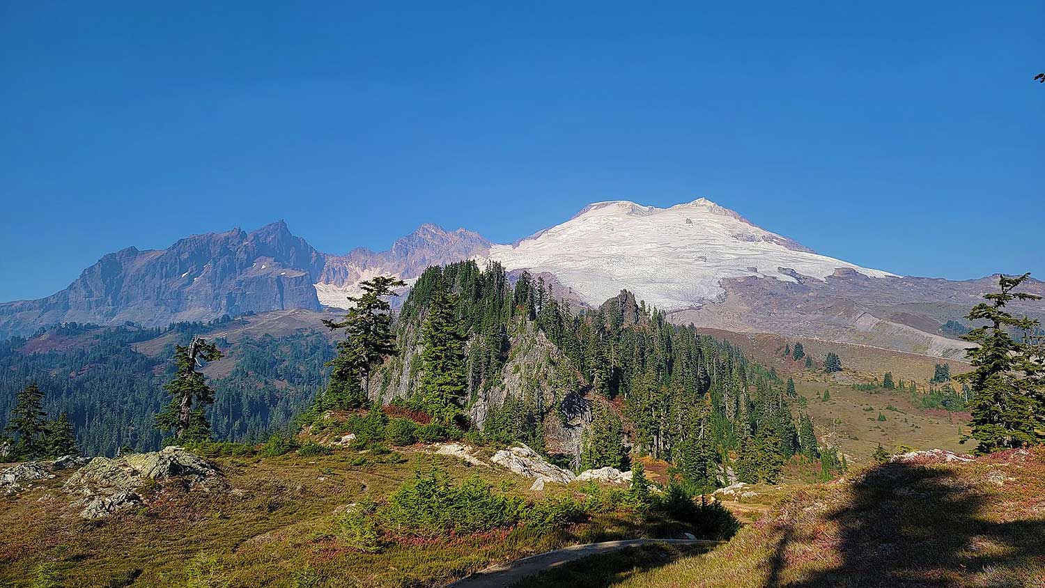
20. Boom Lake Trail

6.7 miles | 1,877 Feet Elevation Gain | 3 hours and 31 minutes to complete

Best easy hikes in Banff | Banff hikes to try
travelwiththesmile.com

The Boom Lake Trail is one of the most incredible moderately simple day hikes in Banff National Park. The path has a slight elevation climb at the start but is primarily level and well-marked as a woodland trail.

The road is excellent in the summer, and the hike to Boom Lake is well worth it. Albertans love this hike since it is simple for families and users seeking a calm day with a big reward at the finish.

The route and Boom Lake are occasionally surrounded by enormous boulders, providing beautiful areas to relax and enjoy the landscape. There are typically loons singing, the fish leaping, and eagles feasting on fish when people are here, adding to the actual Rocky Mountain nature experience.

This excellent route is often revisited. Regardless of the season, the path is always crowded. Throughout the warm seasons, bear warning signs are displayed, so visitors should proceed with caution.

The route and lakefront may be a little buggy, so bring insect and bear spray. If people can walk to the lake, here is where they should pause for breaks and stops to appreciate the beautiful views. During the summer, fishing license holders can catch fish in the lake.

Even in the winter, the lake and mountains are beautiful to see. The snow-covered trees create a winter scene. Walking off the compacted area into three feet or more of snow is frequent; therefore, visitors should wear boots and spikes. Snowshoes would assist avoid this and exploring the lake.

This is one of our favorite easy hikes in Banff during all four seasons!

19. The Wilcox Viewpoint via Wilcox Pass

5.8 miles | 1,713 Feet Elevation Gain | 3 hours and 6 minutes to complete

Best easy hikes in Banff | Banff hikes to try
flickr.com

The Wilcox Viewpoint via Wilcox Pass is a relatively easy trail with great views. Unless you’re fortunate enough to visit in August, the route is best conditioned and signposted towards the bottom.

We suggest breaking the trail into three pieces. Part one begins at the trailhead and ends with the red chairs, a Parks Canada icon. This segment is a gradual ascent to the ridge top seats through the forest. In part two, the red chairs take you to the Wilcox Pass, where you begin a gradual climb up into the meadow.

The last stretch to Wilcox Ridge is 1.4 kilometers long and has two lovely knolls. Because this section of the trail overlooks glaciers and tourist centers, it typically has some snow to traverse. Staying on the maintained track is also simple since you do not have to cross a significant river or bridge as in other portions.

The alpine meadows and the pass itself are pretty level. The peaks, knolls, and passes enhance the views of the glaciers and icefields over the parkway.

Animals, including bighorn sheep, elk, and bears, are regular sightings. Remaining at the route’s summit allows you to relax and enjoy a few more minor vistas. A handful of tiny streams at the point can be crossed without wet shoes, unless in the winter.

The heavy and soft snow makes this region challenging to finish in the winter.  It is impossible to reach the peak without snowshoes due to heavy snow. We recommend bringing snow gear or returning in late July/early August.

Overall, this is one of the best hikes in Banff during the summer months if you want gorgeous scenery and animal sightings!

18. Consolation Lakes Trail

4.7 miles | 1,079 Feet Elevation Gain | 2 hours and 19 minutes to complete

Best easy hikes in Banff | Banff hikes to try
awalkandalark.com

The Consolation Lakes Trail starts at the Moraine Lake parking area. Shortly before the rock pile ascent, the trail leaves the Rockpile Trail to the left. This 4.7-mile round-trip hike starts in a very rocky region with avalanche debris and snow heaps along the route in late spring – a good reminder of why this area is restricted in the winter!

The trail then enters the forest and continues for the rest of the hike on a pretty level path with occasional small uphill parts but minimal elevation gain.

It is relatively flat through the wooded stretch leading to the lakes, making it an easy hike for most people. However, the rocks and boulders might be loose, smooth, and huge once in the rock field. It is a highly slippery place with plenty of crevices between the stones. For this reason, hikers advise against transporting young children or pets across the rock field.

Many people like leaping into either of the two Consolation Lakes, accessible only by experienced hikers with rock piles and scrambles. The hike is impressive since you can see the glaciers from the rocky coast.

The lower region rock piles with views of Moraine Lake are often recommended as a pre-hike destination. There are beautiful vistas of nearby mountains, steep vertical cliffs, and prominent jagged peaks as the hike exits the forest. The Fay Glacier at the lake’s other end is similarly spectacular. We love being near the mountains and hearing tiny avalanches in the spring.

For a brief and simple hike, this hike was immensely gratifying. Because parking at Moraine Lake is restricted, visitors should come early, as parking fills up quickly after 7:30 a.m. on weekends. This is one of the best hikes in Banff if you’re an early riser!

17. Tunnel Mountain Hoodoos Trail

4.8 miles | 876 Feet Elevation Gain | 2 hours and 13 minutes to complete

Best easy hikes in Banff | Banff hikes to try
flickr.com

This track is well-kept and relatively easy, making it one of the best super easy hikes in Banff with gorgeous views. The trail begins at the suggested parking spot near the Banff Fairmont Lookout, where there is usually only limited parking. When this parking lot is packed, many people advocate starting the hike from the Hoodoos Lookout end and working your way back.

Both “ends” of the route include high hills, after which you’ll drop into a valley, hike along the river, and then climb back up. Because the Hoodoos end is substantially steeper, this chart shows the ideal route at the halfway point. Plan to pause for photos and recover your breath, although this is a moderate hike.

There may be a lot of snowmelt in the spring, making the path muddy and hazardous. Ice cleats were beneficial going down the steep slopes, and some individuals will find poles useful.

Large species such as Elk and Bear are pretty abundant along this path, although elk will be there for most of the year.

Take a lengthy break and hike leisurely into the Hoodoos, where you’ll have plenty of opportunities for photographs and rest, resulting in a one-hour hike.

There are no restrooms accessible in the parking spots, so be prepared. Banff offers many large public restrooms to use ahead of time.

16. Tunnel Mountain Trail

2.8 miles | 876 Feet Elevation Gain | 1 hour and 32 minutes to complete

Best easy hikes in Banff | Banff hikes to try
travelbanffcanada.com

The Tunnel Mountain Trail is a short but delightful hike that leads to a beautiful perspective of Banff and the surroundings from the summit of the famed Tunnel Mountain.

It is a generally simple path that enables people to become used to trekking in the Canadian Rocky Mountains, whether they are new hikers or expert hikers. Hikers with families like the overlooks, signs, and broad paths for spending time with family and friends, while runners enjoy the swift climb and challenge.

The trail starts on Banff’s Tunnel Mountain Drive. It winds through the forest on lengthy, well-graded switchbacks along the mountainside. Some of the switchbacks are steeper than others, while others level off, allowing you to catch your breath and take in the breathtaking views of downtown Banff.

The views are visible through the trees throughout the trail, but the most fabulous views are at the mountain’s summit towards the conclusion. Some exposed rocks surrounded by forest are ideal spots for sitting and admiring the views of Banff and the neighboring mountains and valleys. Glacial lakes, Sulphur Mountain, and Mount Rundle are visible from the crest, making it stunning.

This is one of the best easy hikes in Banff if it’s your first time hiking in the region.

15. Lake Louise Lakeshore Trail

2.8 miles | 354 Feet Elevation Gain | 1 hour and 11 minutes to complete

Best easy hikes in Banff | Banff hikes to try
flickr.com/

The Lake Louise Lakefront Trail is a short but famous stroll along the lakefront of one of Canada’s most renowned lakes. The lake trip starts in the crowded parking lot close to Fairmont Lake Louise.

You can canoe in the summer or go out into the lake in the winter. Many paths go into the mountains and higher up on the north side of the lake, so expect crowds unless you come early.

As the walk meanders around the lake, guests will appreciate the varied viewpoints. Many people love this path, from families with small children to elderly hikers who prefer the gentler terrain to trail runners who zip past.

This trail has various vistas and benches where you can watch animals, scenic views, and indigenous flora. There are a few access places to the lake along the route, but remember to carry rubbish back to the main area.

Hikers can wade into the lake during the summer and capture beautiful shots of the lake sediment. Snowboarding and glacier viewing are popular winter activities here since this is the trail’s closest point to the glaciers and mountains. You can use the same path back to the parking lot. Enjoy the vistas this way, for the views on the way back are entirely different.

The route becomes steeper after the lake, and it may be slippery or treacherous in the winter. Some parts of the path could be muddy. There are accessible parking spaces and restrooms at the trailhead.

If you’re looking for Banff hikes that are really more like a long walk, this is definitely your place!

14. Hector Lake Trail

2.8 miles | 351 Feet Elevation Gain | 1 hour and 11 minutes to complete

Best easy hikes in Banff | Banff hikes to try
rove.me

This is a reasonably easy trail to hike in any season, and it’s a great short day hike for anyone searching for a wilderness retreat with views of the Rockies and lakes.

The trail follows the banks of a big, glacier-fed lake in the Bow Valley, passing by a lake, a river, and even a significant river fjord. It is an excellent stop on the journey through the Banff-Yoho-Jasper corridor, with the trailhead immediately west of the Icefields Parkway, approximately 18 kilometers north of the Trans-Canada Highway junction in Banff National Park.

Because the water levels of the lake and marshy sections dictate how strenuous this hike will be, it might alter in quality from year to year. We advise bringing excellent waterproof hiking clothing in the summer since the lake can be extremely high and obstruct the trail.

It is also feasible to camp at many locations along this path. However, check the weather forecast since most terrain is flat and can become flooded during storms.

Many visitors choose to come here for a snowshoe or cross-country ski loop in the winter. The trail is utilized extensively during winter hiking and is usually compacted and simple to follow to the lake.

If you exited the packed trail, anticipate snow up to your knees; expect thick snow if you’re not on cross-country skis or snowshoes!

13. Fairview Lookout

11.5 miles | 548 Feet Elevation Gain | 52 minutes to complete

Best easy hikes in Banff | Banff hikes to try
tripadvisor.com

This Banff hike to Fairview Lookout, one of the top lookouts in Lake Louise, is a terrific way to get started hiking in the area. The track is not challenging, although it does include some mild elevation gain and is short but steep. However, if you come prepared for a little bit of a struggle, it’s pretty doable, and the view is well worth being out of breath when you reach the top.

Even though the path is primarily paved or loose gravel, the snow melts in the spring and early summer, and there may be very few snow patches remaining along the way. You should always wear excellent hiking footwear. It is still only accessible from the parking lot rather than the lake, so be aware of the height if hiking from the lake, which is only doable in the winter.

Because the trail remains primarily in the woods until you reach the overlook, there aren’t many options for views at first, but you can continue beyond the lookout and down closer to the beach for some spectacular vistas.

Even in the winter, this location is worth exploring since the paths surrounding the lake are highly popular. It’s a well-known favorite among Banff hiking regulars. The snow is usually compacted, but it can become slick heading down, so we recommend spikes if you have them.

12. Johnson Lake

1.9 miles | 230 Feet Elevation Gain | 48 minutes to complete

Best easy hikes in Banff | Banff hikes to try
flickr.com

Johnson Lake is a fantastic swim and picnic spot located on the Minnewanka road circle, a beautiful breezy ride with breathtaking views of abundant foliage, wild scenery, and a glacial lake.

The lake is a lovely expanse of calm water nestled amid some of Alberta’s oldest fir trees. Johnson Lake has Banff’s only beach, although being more petite than adjacent to Lake Minnewanka. You must hike the Johnson Lake trail to appreciate the ecosystem’s variety.

The Banff hiking trail has minimal elevation rise with plenty of delights. The lake trail is gorgeous and reasonably level. The views of Cascade Mountain and Mount Rundle are spectacular from here. The circular route starts at the parking lot and proceeds to the beautiful lake.

If you proceed counterclockwise, you’ll come to a bit of bridge that spans a beautiful brook that flows down a steep canyon to the water tower. The woodland trail is fun to get fresh air while walking under trees and plants.

If you hike the trail counterclockwise, you’ll get a great perspective of Cascade Mountain. You may also view animals throughout the year and purple calypso orchids in May. As you climb the trail, you’ll see a rope swing tucked amid the woods and an old abandoned home belonging to Billy Carver, who lived here for roughly 27 years starting in 1910.

11. Bow Falls Viewpoint

1.7 miles | 217 Feet Elevation Gain | 43 minutes to complete

Best easy hikes in Banff | Banff hikes to try
flickr.com

Bow Falls Viewpoint is one of the most basic hikes in Banff, and it’s more of a walk than a hike. The trail follows the Bow River from the Banff Canoe Club’s boat launch, through town, across the river, and down to Bow Falls. Alternatively, you can remain on the north side of the river and walk until you reach Surprise Corner, where you can join the Hoodoos Trail.

Most visitors begin at the road or pedestrian bridge and go south along the river. This path will take you down to the base of Bow Falls, where you can join the Golf Course loop.

The Bow River Trail is a pleasant, quiet walk around the outskirts of town that may be as long or short as you wish! Apart from a bit of hill, you must walk over as you reach Bow Falls; there is very little elevation change. It is relatively simple, except in the winter when it can be exceedingly slick and dangerous.

The elevation gain seems to be 217 feet, but apart from the slope towards the end, we would regard this Banff hike to be almost flat.

10. Peyto Lake Panorama Overlook

1.5 miles | 276 Feet Elevation Gain | 42 minutes to complete

Best easy hikes in Banff | Banff hikes to try
wallpapercave.com

Peyto Lake Trail is a short Banff hike that gives picturesque views of Peyto Lake in Alberta, close to the British Columbia border. Peyto Lake is a beautiful turquoise lake fed by Peyto Glacier. It is a terrific hike for the whole family. The picturesque Peyto Lake Overlook is accessible from the Icefields Parkway, north of Lake Louise and Moraine Lake.

Peyto Lake is located in Yoho and Jasper National Parks. You can see Bow Lake, the glacier, Peyto Lake, and the Canadian Rockies.

Peyto Lake is one of the most popular summer destinations in the Rockies. In the summer, it is advisable to arrive early in the morning. Peyto Lake is a magnificent, pure, and vibrantly colored lake along the Icefields Parkway. We suggest visiting early in the morning to avoid the crowds that will spend most of the time around noon here.

A short paved walk leads to the wooden observation platform, which offers spectacular views of the lake. It is a 10-15 minute uphill hike to the overlook, which is steep due to the height rise.

The neighboring mountains and pine trees complement the hues of Peyto Lake. We appreciate the vistas and snap photographs from this famous overlook every season.

9. Silverton Falls

1.1 miles | 367 Feet Elevation Gain | 37 minutes to complete

Best easy hikes in Banff | Banff hikes to try
flickr.com

Silverton Falls is a short yet enjoyable climb that leads to a beautiful cascade.

It’s a hidden treasure and lesser-known spectacular waterfall situated about 10 minutes along the Bow Valley Parkway from Johnston Canyon. The journey to the waterfall is just 0.7 kilometers long, and it begins on the same trail that goes to Rockbound Lake but branches off to the right at the fork.

The trail begins by passing through the forest on level ground, then rises over switchbacks to a tiny spot viewing this stunning multi-tiered waterfall. The track was narrow in places as it skirted a cliff. This location also offers spectacular views of the deep wooded valley and distant mountain range. This big waterfall is lovely to shoot and appreciate.

This hike is for you if you want to get away from the crowds and see a stunning waterfall and rewarding vistas for a fair bit of work on a short trail. It’s conveniently situated along the same route as Johnston Canyon, so if you’re already in the area, you should undoubtedly stop here on your way to or from Johnston Canyon.

Though this is one of the lesser-known easy hikes in Banff, it’s one of our absolute favorites in the summer!

8. Cascade Falls

0.8 miles | 472 Feet Elevation Gain | 35 minutes to complete

Best easy hikes in Banff | Banff hikes to try
pinimg.com

This 0.8-mile hike is a terrific opportunity to get some exercise while experiencing the tremendous force of the 300-meter Cascade Falls. You’ll be able to hike up the mountain and stand by the breathtaking waterfall. Follow the broad gravel walk across the grassy meadow from the parking area. It is a relatively straightforward approach. This path will lead you to the foot of the Cascade Mountains. On your course, you’ll get a fantastic view of the falls.

Continue on the route into the woods, passing an avalanche warning sign. The trail gets highly steep, swiftly gaining height but not for long. You’ll travel past old avalanche debris and downed trees as the trees begin to clear. Before reaching a rocky region with several trails, the track will constrict. Select a well-defined route that will get you to the waterfall’s base.

While taking in the flowing water of Cascade Falls, take in views of Mount Rundle across the valley. After a relaxing stop at the falls, return the way you came.

7. Mistaya Canyon

1.1 miles | 259 Feet Elevation Gain | 33 minutes to complete

Best easy hikes in Banff | Banff hikes to try
flickr.com

Mistaya Canyon is a famous and picturesque path in Banff National Park. It’s 5 kilometers south of North Saskatchewan. A short walk from the parking lot takes you to a wooden bridge across the Mistaya River, from which you can see the steep canyon.

It’s a stunning natural beauty with flowing water, rock formations, and several waterfalls. It is surrounded by breathtaking views, ideal for a picture opportunity. You can stroll along the river and cross the bridge to get different perspectives of the canyon.

The hike to the bridge goes downhill and back upwards, but it is easy and not too demanding. No particular shoes are necessary but wear something solid (we don’t recommend flip-flops).

Winter/spring visitors to Mistaya Canyon should be aware that the route is frequently coated in thick ice from the snow melting and freezing. Visitors should bring ice cleats or microspikes for more outstanding grip.

6. Fenlands Trail

6.3 miles | 180 Feet Elevation Gain | 30 minutes to complete

Best easy hikes in Banff | Banff hikes to try
flickr.com

The Fenland Trail is a short and straightforward day hike located near Banff. You’ll see elk and other animals in abundance here.

Mount Norquay Road leads to the trailhead. It’s a peaceful and beautiful stroll through the forest and by a little brook on a level looping trail. Along the journey, you’ll get some great views of the Canadian Rockies through the woods, and there will be lots of birds and small creatures to see.

The trail is similarly broad and well-kept, and if you want a somewhat longer, easy hike, you can proceed on the flat tracks to Vermillion Lakes.

Bears are often observed here due to their proximity to the lakes, and the trail is closed numerous times each year.

Although this trail is near urban areas, the thick trees and stumps along the river and water make bears easy to see if you are not prepared to hike in a group. Having bear spray on hand is also a good idea.

If you’re visiting Banff in the winter, this is a lovely short cross-country ski or snowshoe loop.

5. Panther Falls

0.8 miles | 246 Feet Elevation Gain | 26 minutes to complete

Best easy hikes in Banff | Banff hikes to try
pinterest.com

Panther Falls is a short and simple hike to a beautiful waterfall on the Icefalls Parkway. It’s a well-kept secret waterfall that you’d probably drive by many times without noticing!

There are many stunning vistas of the river, Panther Falls, and Bridal Veil Falls along the trail, following a few switchbacks against a few rock cliffs. It’s short and sweet, but it’s stunning.

This hike is also enjoyable in the winter, and if you are close to and behind the falls, snowshoeing or wearing ice cleats is a terrific way to make it a fun excursion. Bring ice spikes and a helmet if you intend on exploring it in the winter.

4. Athabasca Glacier

0.9 miles | 200 Feet Elevation Gain | 26 minutes to complete

Best easy hikes in Banff | Banff hikes to try
freepik.com

The Athabasca Glacier is one of Canada’s most recognized frozen beauties and one of the simplest glaciers for anybody to view. It is a pretty cool location, with many tourist attractions packed into a bit of space, and it’s effortless to reach, owing to the station being just off the Icefields Parkway.

Although there are paid choices to get onto the glacier on the safest days, most visitors prefer this free short hike to just watch the glacier from afar.

The trail is usually simple to follow; however, the region is rocky, but mainly in pebbles or huge stones easy to walk on.

The hike begins with a long steep ascent to approach the Columbia Icefields region, which may be difficult for some, particularly when the area is crowded between June and September.

Most of the year, after you’ve ascended the hill, it’s pretty windy and chilly, so wearing weather protection and even sunglasses might help keep you safe from the elements.

With lots of place markers to illustrate how far the glacier has receded, this is a terrific opportunity to observe the wonder of nature’s most prominent glaciers and how people have influenced the environment.

3. Sulphur Mountain Cosmic Ray Station

0.7 miles | 115 Feet Elevation Gain | 19 minutes to complete

Best easy hikes in Banff | Banff hikes to try
flickr.com

This renowned vantage point provides spectacular views of Banff and the surrounding region. It is a must-try if you’re just in the neighborhood for a short period.

Sulphur Mountain Cosmic Ray Station trail is primarily paved and woodland boardwalk paths that begin at the top of the Sulphur Mountain Gondola, which is usually a lovely spot to spend a beautiful summer day visiting the region.

This trail is popular with families since it is short but offers some of the most excellent views in the region along the ridge walks on Sulphur Mountain’s north side. The forested boardwalks will be pretty snowy and ice throughout the winter. Therefore, this region is only safe to visit during the summer.

It’s preferable to visit on a clear day since this mountain is usually above the cloudlines, obscuring views.

2. Lower Bankhead Trail

0.7 miles | 115 Feet Elevation Gain | 19 minutes to complete

Best easy hikes in Banff | Banff hikes to try
travelbanffcanada.com

Bankhead, Alberta, was a thriving coal-mining town of almost 1,000 people located close to the operations site of an anthracite coal mine in the early 1900s.

When the Bankhead Banff coal mine closed in 1922, several of the residential structures in Bankhead, Alberta, were relocated or destroyed. This unusual hike still has a surprising quantity of coal mining facilities.

This route provides hikers with an excellent opportunity to stretch their legs or rest in nature. The actual trail around Bankhead Site is charming, and it has many historical facts. The views are breathtaking, with more than 360-degree panoramas all around you. Hikers can continue along the trail till Cascade Ponds, where they can turn around and return.

The very informative signs and photographs of Bankhead Townsite and its crucial role in the region’s development will greatly interest new and returning hikers.

1. Moraine Lake Viewpoint

0.5 miles | 33 Feet Elevation Gain | 12 minutes to complete

Best easy hikes in Banff | Banff hikes to try
flickr.com

The Moraine Lake Viewpoint is a short trail that leads to the famed Moraine Lake. It is pretty popular and constantly used. The path is straightforward, measuring less than one kilometer in length, and brings people to the summit of a genuine rock pile through steps carved into the rocks.

From many viewpoint sites near the summit, there are stunning views of the glacial-blue Moraine Lake. There are also several seats where you can relax and take in the scenery, so there is always plenty of room to stretch out in the morning.

Arriving early for the dawn is the best option. Summer mornings are popular with photographers because they may appreciate the flat and reflecting Moraine Lake, especially when the turquoise water is so vivid and magnificent that the sun starts to peep over the lake bordered by ten peaks.

You can ride the Roam Transit from Banff to Moraine Lake for a more pleasant and stress-free experience since parking at Moraine Lake often fills up by 5:00 a.m. MT during the summer.

In addition to this stroll, people suggest performing one of the treks that start from the lake while visiting Moraine Lake. Eiffel Lake and Larch Valley are two fantastic, somewhat difficult walks that begin at the same trailhead and follow the lake’s coastline before splitting off in various directions. Both feature breathtaking views of the ten-peak valley. During the larch season, Larch Valley is spectacular. Another short and simple hike that starts from Moraine Lake is Consolation Lakes.