The 15 Best Hikes in San Diego
If you intend to hike in San Diego, you’ve come to the right place! There are several hiking trails in the area, and we’ll tell you about the best ones in this post.
San Diego is great for people who love the outdoors because of its seashore and laid-back vibe. Even if you don’t surf, there are many ways to enjoy the outdoors in the city. One of them is hiking.
In the city and its neighboring area, there are many different types of terrain, so hikers can find trails that range from easy nature preserves to challenging summit scrambles.
Torrey Pines State Natural Reserve, Sunset Cliffs, and Los Penasquitos Canyon Preserve are just a few beautiful natural places you can visit and hike.
You don’t have to go too far from the city to find the best hikes in San Diego, whether you desire a perfect moment by a tidepool or you’re into backwoods trekking. The geography around San Diego makes planning trips for people of all skillset and interests easy.
It ranges from short walks on rocky cliffs along the ocean to long hikes up mountains and through biodiverse forests. So, wear your hiking boots and try out one of these 15 best hikes in San Diego!
15. Palm Canyon Loop
2 miles | Easy | 295 Feet Elevation Gain
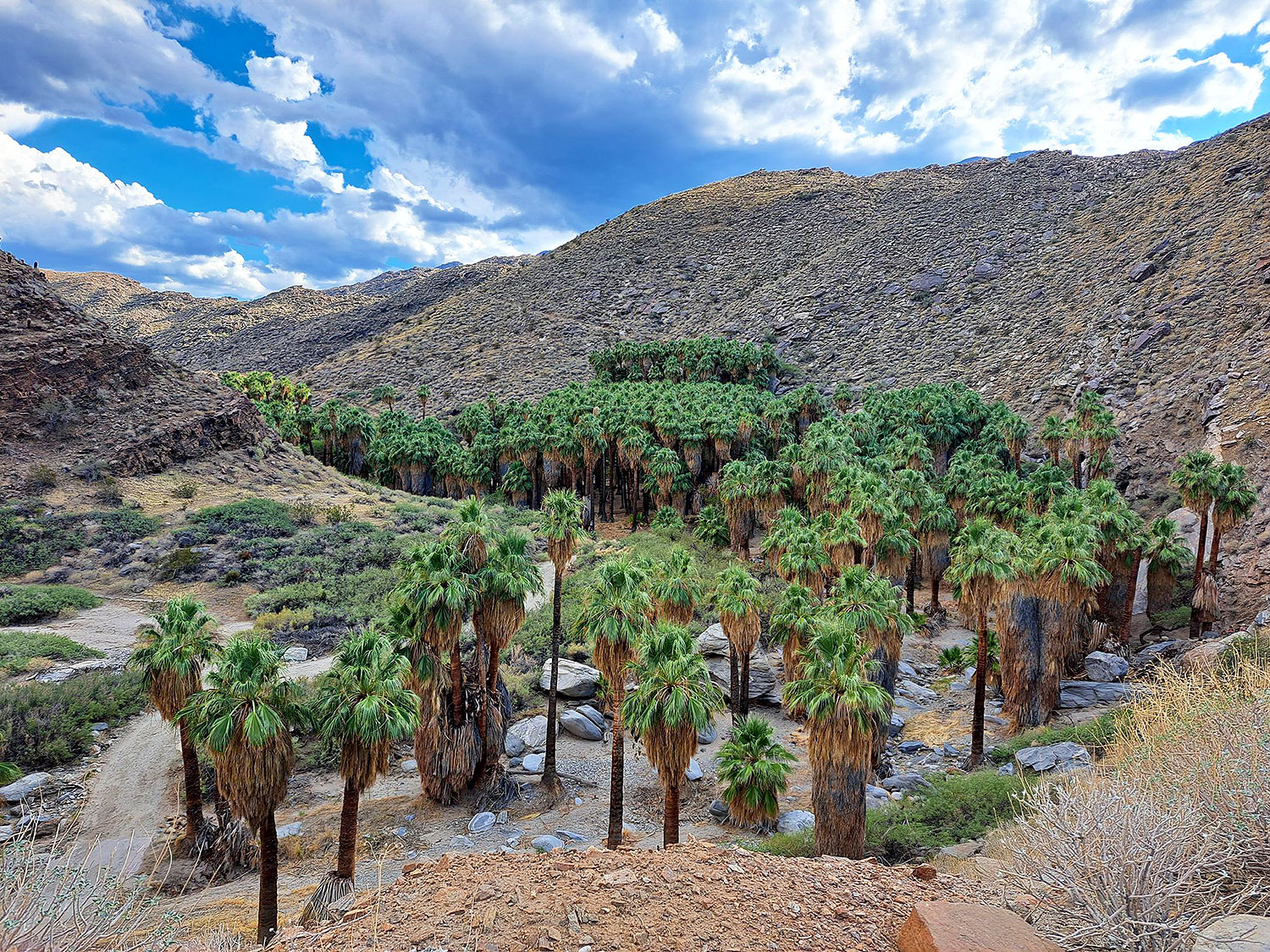
The Palm Canyon Loop trail is a desert oasis. This trail’s end is a natural desert oasis with tall palm trees, sparkling streams, and strange rock formations. More than 450 palm trees from 58 species grow in this tropical oasis.
This trail starts at the Agua Caliente Band of Cahuilla Indians Reservation on S. Palm Canyon Drive.
It is among the best short hikes in San Diego because of its unique scenery. It’s like a little piece of wonderland in the middle of the dry Palm Springs desert.
Since the trail is primarily flat, hikers of all skill levels can use it to get out into nature. Local hikers adore the Palm Canyon Loop path because it’s short, easy, and has a lot of beautiful and colorful scenery along the way.
The average time it takes to hike this loop close to Cathedral City is an hour. And since it is a trendy place for hiking and walking, you’ll probably meet other people while exploring.
November to July is the best time to visit this trail. Dogs can’t go on this trail, so you’ll have to leave them at home.
Also, remember that there is a fee to get on this trail. As of this writing, there is a $9 admission fee for adults and a $5 fee for children 6 to 12 years old. A $7 price is for seniors aged 62 and up or students.
14. Torrey Pines Beach Trail
2.3 miles | Easy | 364 Feet Elevation Gain
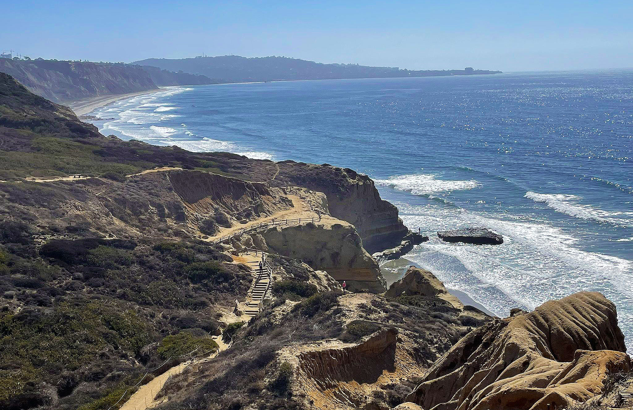
The Torrey Pines Beach Trail is one of the most renowned hikes in San Diego.
It is within the Torrey Pines State Natural Reserve, a 1,750-acre piece of land that looks out over the Pacific Ocean and has several hiking and biking trails.
As the name suggests, the reserve protects Torrey pines, a rare type of pine growing in San Diego and Santa Rosa Island. The reserve’s landscape includes ravines, floodplains, cliffs, and the shore.
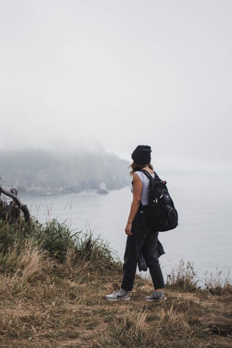
This trail has beautiful seaside bluffs that rise high above the rushing water of the Pacific. It’s a flat, easy trail that’s great for hikers of all skill levels, even kids!
The hike is worth it just for the vast views of the coast, but as a bonus, you’ll also get to walk through beautiful rock structures and wildflower meadows.
Hike at Torrey Pines in the evening so you can watch the sunset over the shore, but mornings can be lovely too because there are fewer people there. There is also not much shade, so if you decide to go, you should bring a hat and sunscreen.
Every day of the week, the reserve is open. Anticipate paying a fee to get in or park. Many people go there to use the beach amenities (not hiking).
If you have time, stop by the Torrey Pines Gliderport for crazy coast views. Also, it’s fun to watch the paragliders take off and land. Equally beautiful are La Jolla Shore Park and Beach. And, of course, walk around La Jolla Village.
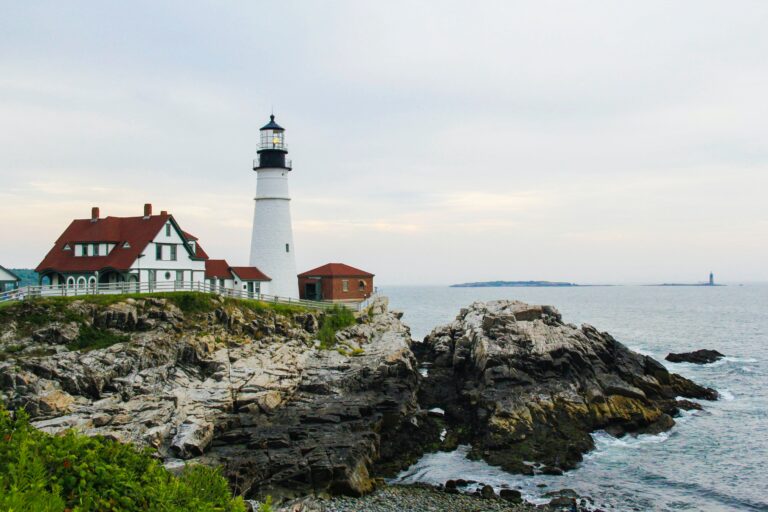
13. Bayside Trail
2.4 miles | Easy | 351 Feet Elevation Gain
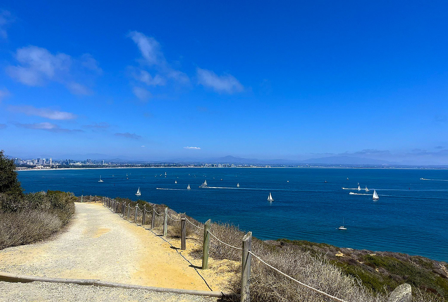
Cabrillo National Monument has several short trails with great views, like the Bayside Trail.
This trail is 2.4 miles round-trip and has excellent panoramas of the ocean, Ballast Point, sandstone cliffs, ships, downtown, Coronado Island, Tijuana, plant life, and, if the weather is right, snow on the peaks of the mountains.
Close to the old lighthouse is where the trail starts. Before you get to the lighthouse, you’ll see a sign for the Bayside Trail. It tells you to turn left and follows a paved road to the gravel/dirt route.
This tour is self-guided, with plenty of clear signs that describe the sensitive vegetation, weather, habitat, animal life, etc. There is also a heritage landmark with a flashing beacon shelter and power station built in 1919 and used throughout World Wars I and II.
Apart from that, there are many benches where you can sit and rest, think, enjoy the view, write, or look around at the beautiful nature.
The Southern Maritime Chaparral, which includes cliff spruce, dudleya, and barrel cactus, is also found along the trail. It is another rare and valuable habitat.
Check out the Visitor’s Center, which has a lot of historical displays, while you are on the property. In the western portion of the United States, there is a lot of information about the voyages of discovery.
The enormous statue of Juan Rodriguez Cabrillo, the initial European to set foot in California, is a must-see. From the viewing area, you can see the landing site.
And don’t forget to continue to the vicinity of the monument with the tide pools. You can walk around the area’s bluffs, coves, and arches on an easy 1-mile trail.
12. Batiquitos Lagoon Trail
3.4 miles | Easy | 30 Feet Elevation Gain
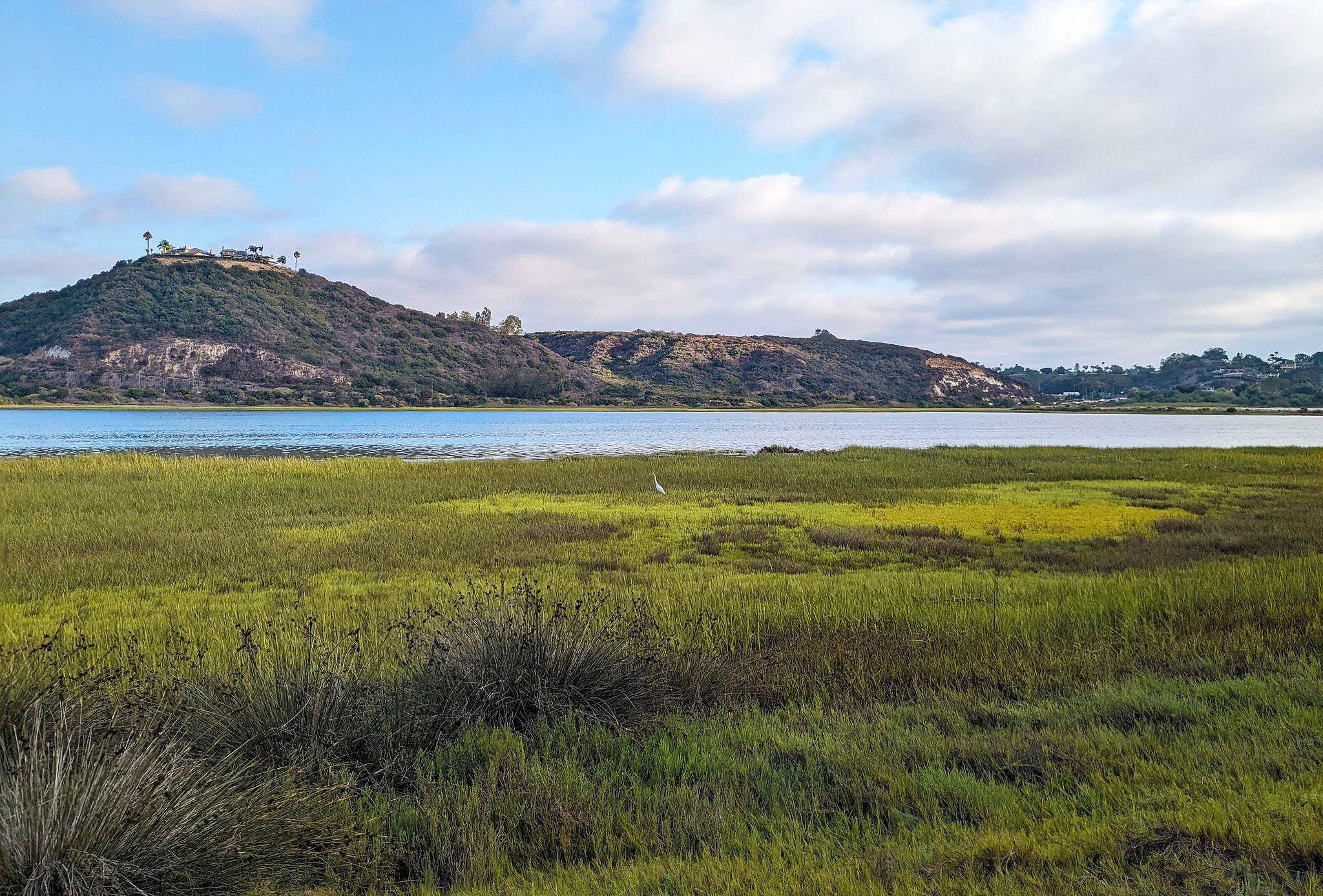
The Batiquitos Lagoon is a coastline wetland and estuary on 610 acres with a drainage area of about 55,000 acres. There aren’t many coastal wetlands left throughout Southern California. As a result, this is a unique area.
The Batiquitos Lagoon Trail is among the best spots to go hiking in San Diego if you like to see animals. This marshy habitat is home to several local species of birds, fish, and plants, which you can discover more about on this trail.
Expect to see rabbits, mud fowl, lizards, and various bird species.
For families and avid nature lovers, there is a Nature Center next door with a lot of information about the different organisms you can encounter in the lagoon. Also, the lagoon itself is beautiful and worth the hike.
This 3.4-mile (out and back) trail is relatively flat and suitable for strollers. It is an excellent place for an outing, a casual meander, jogging, and sightseeing. Also, the Batiquitos Lagoon trail is free for everyone, and there is a small parking lot at the trailhead.
11. Los Penasquitos Canyon Trail
6.8 miles | Easy | 157 Feet Elevation Gain
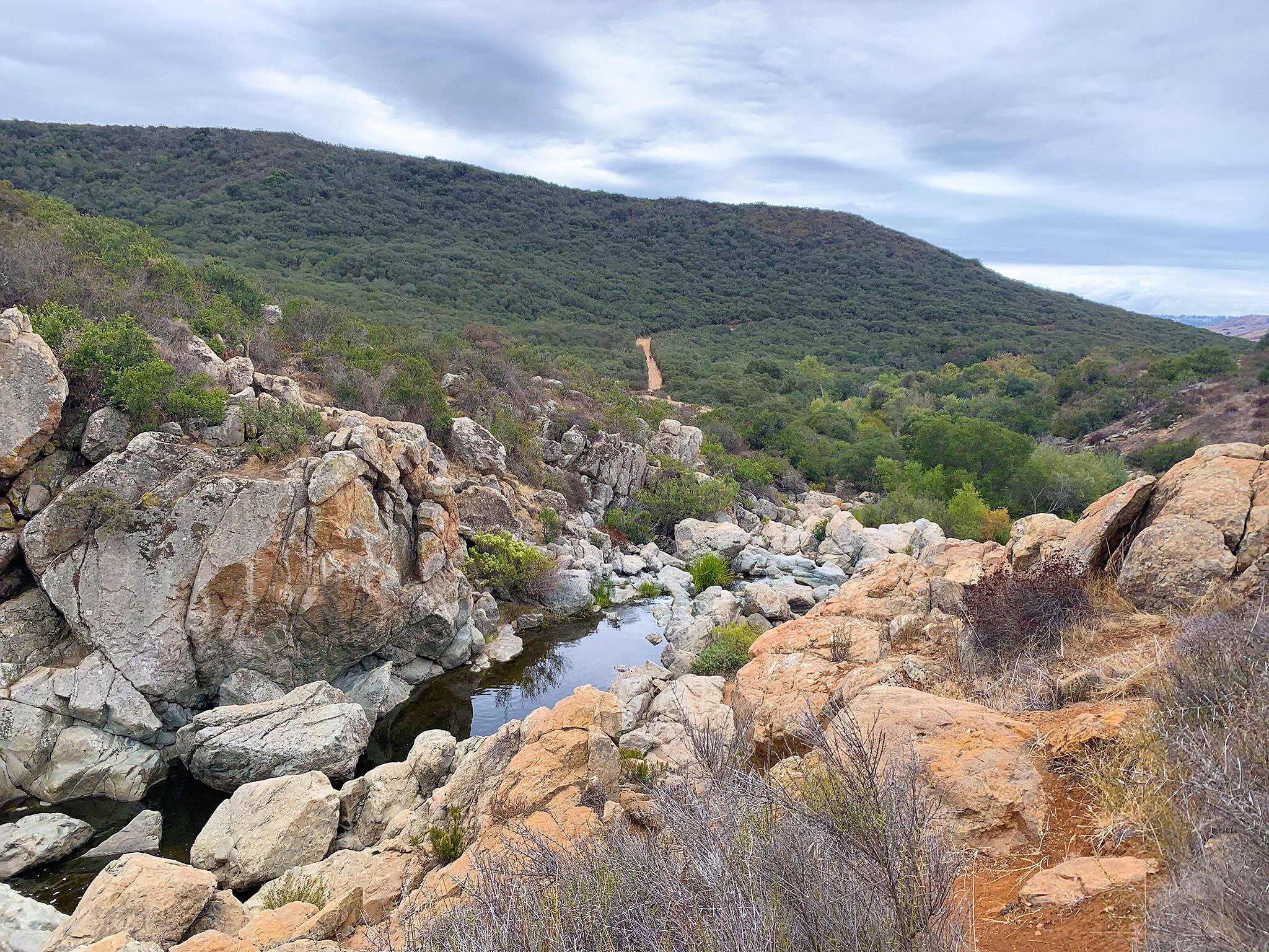
San Diego hikers love the Los Penasquitos Canyon Trail because it’s close to the city and suitable for people of all skill levels. The Los Penasquitos Canyon County Preserve is where it is.
The Los Penasquitos Canyon County Preserve is 4,000 acres and goes 7 miles between Mira Mesa, Sorrento Valley, and Rancho Penasquitos. On the trails, you’ll see a small lake, a stream, a waterfall, and groves of oak and sycamore trees.
Trails in the preserve get a lot of use and range in length from 2.5 miles to more than 7 miles. The courses are suitable for pets, and the Los Penasquitos Canyon Trail is among the easy.
It has a waterfall, small cliffs (called “Penasquitos”), and shade, and it’s a good option for families with young children. You can stay on the main path or explore one of the many small trails.
The Los Penasquitos Canyon Trail is among the best places to hike in San Diego because it goes through a vast canyon. Visitors can use this trail for many different things. It goes through wooded areas and immense meadows and ends at a cute waterfall.
Because hikers, runners, bikers, and other people use this trail, it can get bustling on the weekends. People like that this path is longer and has an easy surface, making it great for a long day of hiking and taking in the sights.
Even though the hike is easy, we recommend bringing a bottle of water and a hat, especially in the summer.
10. Big Laguna Trail
13.3 miles | Easy | 1,240 Feet Elevation Gain
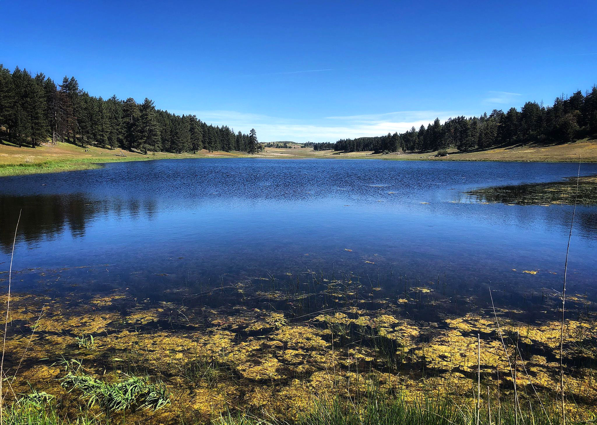
The Big Laguna Trail is a beautiful San Diego hiking trail perfect for a day-long adventure. It is unique in the broader San Diego area as it has rare wildflowers, stunning views of the mountains, and a peacefulness that only Mother Nature can give.
This 13-mile loop is conveniently 13 miles north of I-8 on Sunrise Highway. It goes through oak and pine forests, large meadows, and a clear blue lake during certain times of the year.
Also, the trail is excellent for exploring with family, friends, or yourself. Horses and people on foot can use it, making it a scenic route for all kinds of adventures. The trail is also an excellent way to learn how to ride a mountain bike!
This trail takes you through many distinct southern California ecosystems, from dense forest canopies to fully open meadows and, in wet years, even an alpine lake.
Before the Spanish took over the territory in the mid-1800s, the Kumeyaay Indians lived in these mountains for more than 9,000 years. Some heritage places along the path still show signs of their culture.
The trail is well-used and well-kept and connects to several other courses. Stay on the Big Laguna trail to avoid the more demanding Pacific Crest Trail, or take the Blue Jay or Falcon trails back to the campground for a more leisurely hike.
Big Laguna can be bumpy and has some good hills, so be ready for good exercise.
Note that you don’t need a permit to hike the Big Laguna trail, but you need a Forest Adventure Pass for each car you park at certain trailheads. You can buy an adventure pass for $5 per day or $30 per year.
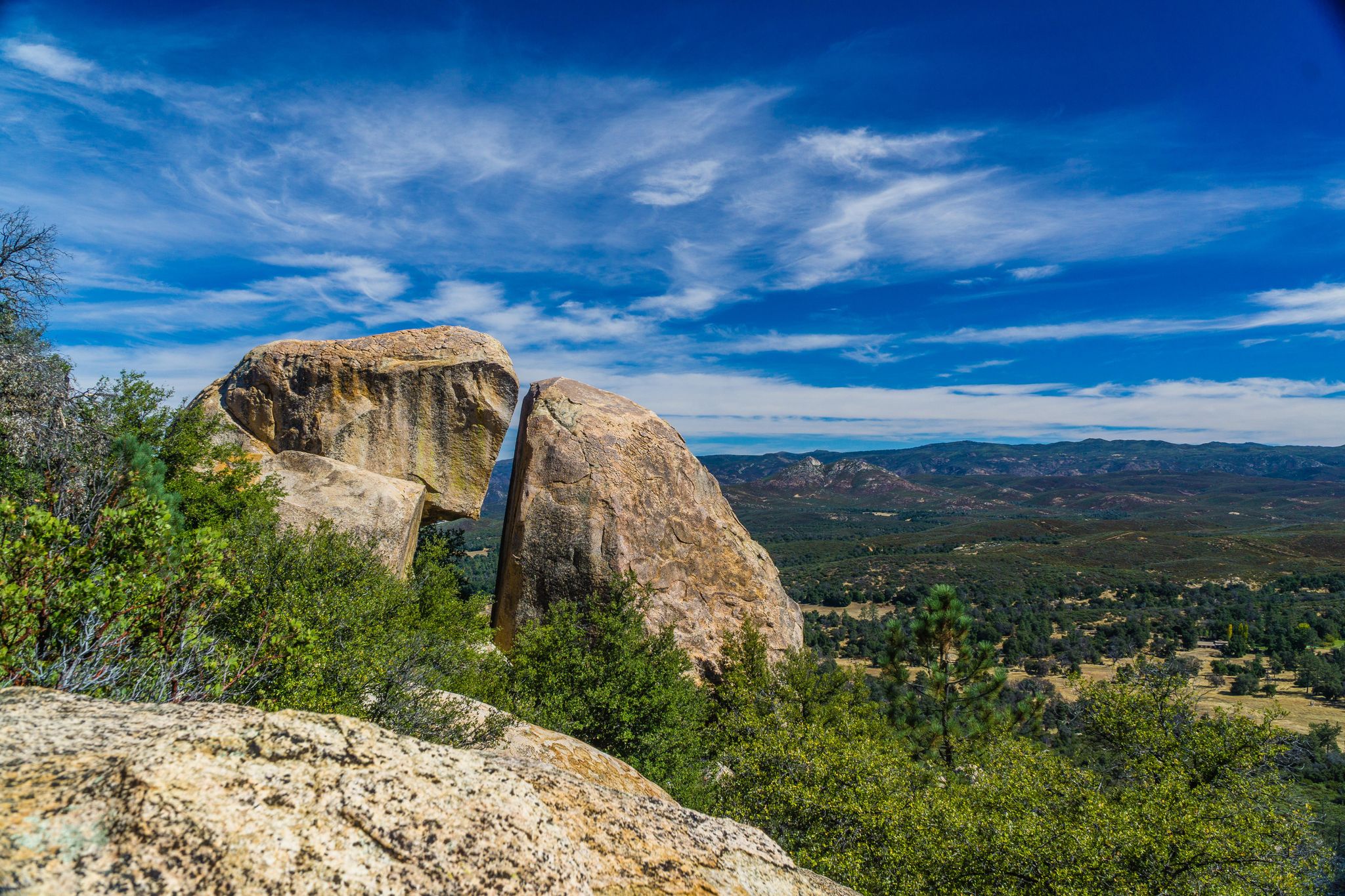
9. Stonewall Peak Trail
3.9 miles | Moderate | 830 Feet Elevation Gain
The Stonewall Peak trail is a nice challenge for hikers of any level. It is short, has a gentle incline, and offers views for miles. It gives you a beautiful view of Cuyamaca Rancho State Park.
Along it, several switchbacks direct to the top. Even though the switchbacks can be challenging and tedious, the views from the summit are more than worth it.
The Stonewall Peak Trail is the most famous hike in Cuyamaca Rancho State Park, and it’s easy to see why. There is a climb, but it’s not too hard. At the top is a distinctive bald granite summit with a 360-degree view of high mountain ranges, lakes, and the desert.
The hike is a short out-and-back, but there are options if you want to create a nice loop with viewpoints of Lake Cuyamaca.
Cuyamaca Rancho State Park is where the Stonewall Peak Trail is, and there is a fee to get in. Park in the lot of the campground, then walk across the street to begin the hike.
From the start, the trail will switch back up the peak’s west side, passing through shrubby and oak trees growing around. During the season, you’ll see a lot of wildflowers, especially ceanothus. You can also see monkeyflower, penstemon, manzanita, and many other flowers.
As the path winds up, views to the west and occasionally the north start to open up. Cuyamaca Peak, Middle Peak, North Peak, the town of Cuyamaca, and Lake Cuyamaca, are all things you’ll see right away.
If you keep going, you will get to the top, where there is a flat area with guard rails around it. You’ll see signs explaining what you’re seeing and pointing out local landmarks.
8. Three Sisters Falls Trail
4.1 miles | Moderate | 984 Feet Elevation Gain
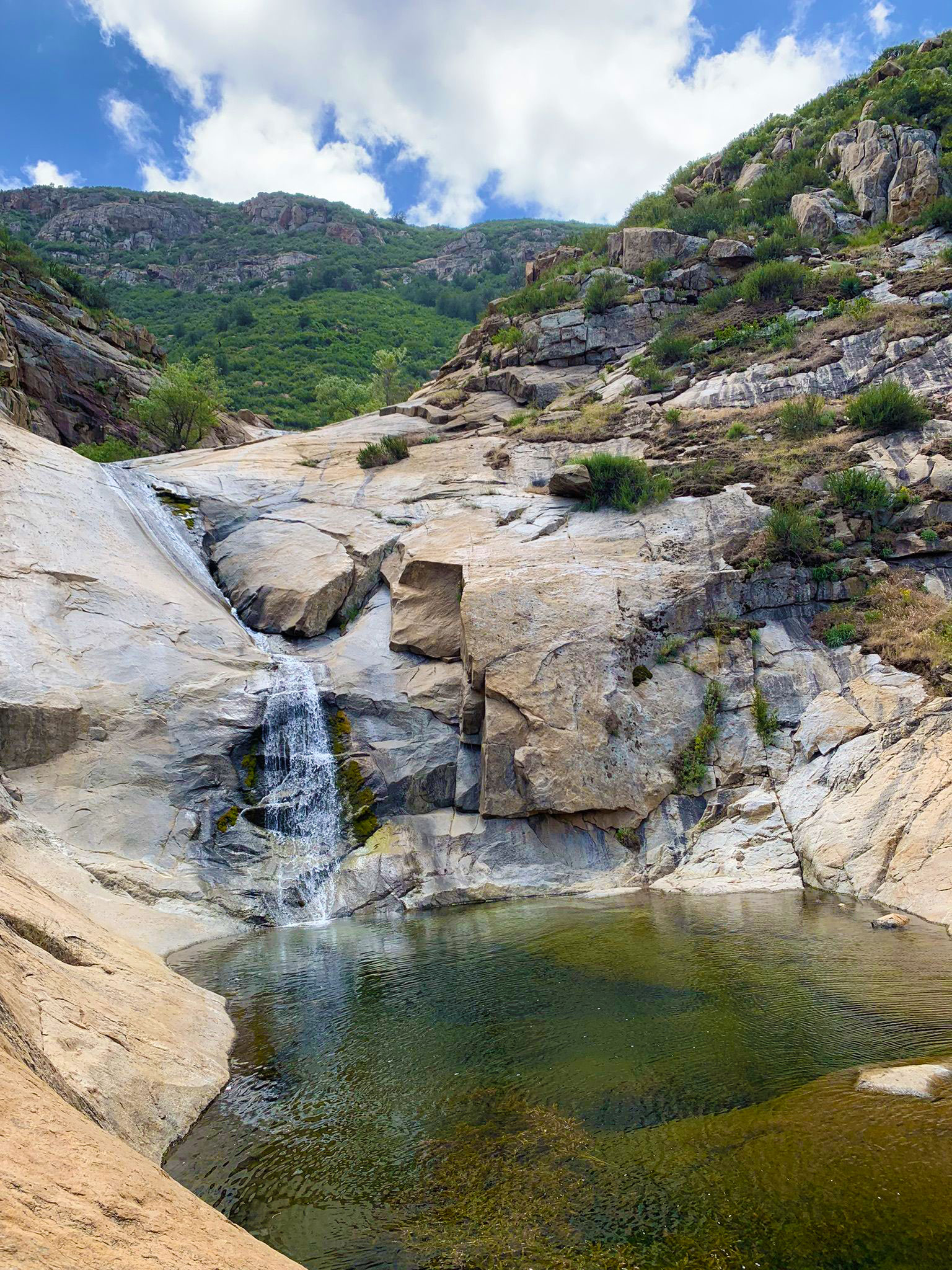
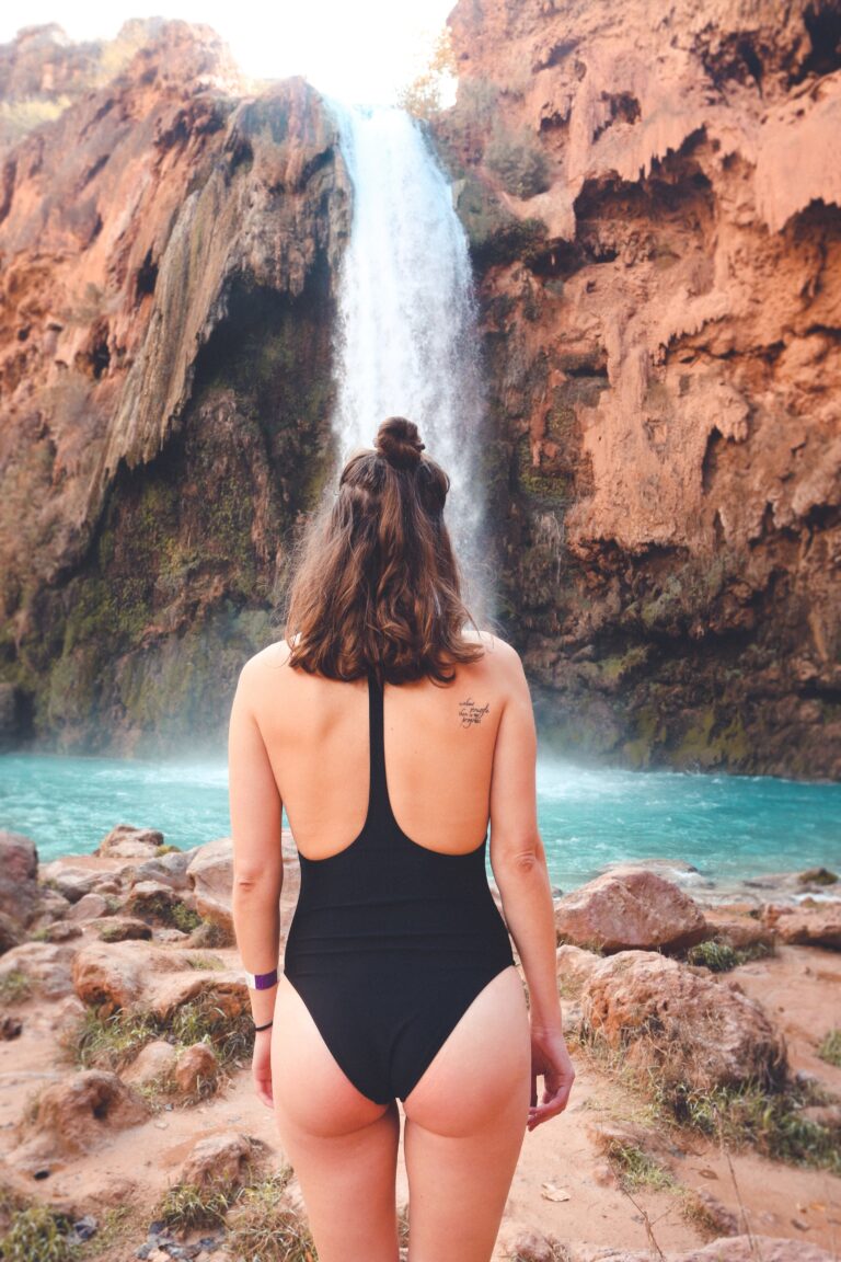
When it’s running, Three Sisters Waterfall, which is roughly 30 minutes south of Julian, is among the best waterfalls in Southern California. It is a group of waterfalls that flow over rocks. Three primary waterfalls make up the three sisters.
The best time to go is after a good rainy season. Even though the area is a beautiful place to visit, keep in mind that it is very steep to get into and out of the canyon.
You shouldn’t go there if you’re not ready for a more strenuous hike. Also, remember that it can be sweltering, so ensure you have a lot of water, especially during the summer.
The hike starts at a gate that keeps cars from driving onto the dirt road you are strolling. The path then stays flat for about half a mile. Along the way, a small shady area looks like a good place for a picnic.
From there, the path goes downhill and crosses a small creek. Before going around the mountain, you can see several plants if you cross the stream.
As you get closer to the waterfall, the trail gets harder. If you are on this part of the hike, we suggest you use hiking poles.
When you reach the bottom, you’ll be able to follow a small creek to the principal river or stream. And on the base of the first waterfall, you will undoubtedly be amazed by how beautiful this place is. There is a path to the second waterfall and a trail to the third.
It is a great hike that is best after a good rainy season, but you should be careful if you try it.
7. Cedar Creek Falls Trail
5.6 miles | Moderate | 1,050 Feet Elevation Gain
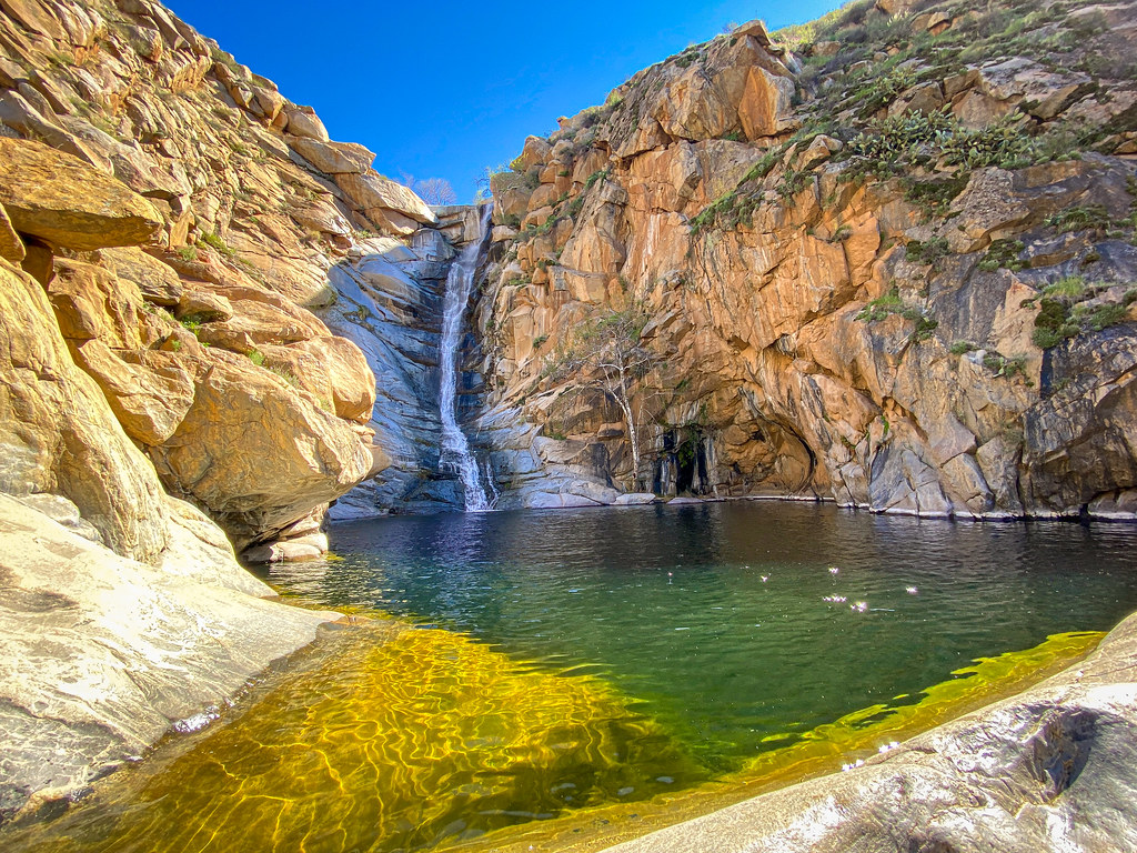
Do you want to get wet on a hike? Then it would help if you went on the Cedar Creek Falls trail. This hilly trail in Cleveland National Forest has three places where you have to cross streams that can be deeper than your knees depending on how much rain has fallen recently.
The trail’s end is a pretty waterfall, best seen after it rained. You’ll see beautiful, colorful spots of wildflowers, rock paths, and stunning views along the way.
This trail isn’t good for people who are just starting. During the summer, people often get sick from the heat, especially if they don’t bring adequate water and supplies. Please think about how fit you are before starting.
From the San Diego River Gorge trailhead or Saddleback Trailhead, the hike to Cedar Creek Falls is a challenging 5.6-mile out-and-back trail that goes through the beautiful backcountry hills of eastern San Diego.
The trail’s black oak, cedar, and cottonwood trees are a great place to watch birds.
It has beautiful views and is a great way to get some exercise. In the end, a spectacular waterfall and a natural swimming hole drop down. During the summer, the falls usually don’t flow, and the pool at the bottom stays still and grows algae.
The hike is all downwards, but the walkout is strenuous and takes over two miles of steady, moderate uphill hiking with an average grade of 8%.
Those new to hiking or hiking this trail for the first time should try to finish it in the fall, winter, or spring when temperatures are more relaxed, and the risk of getting sick from the heat is lower.
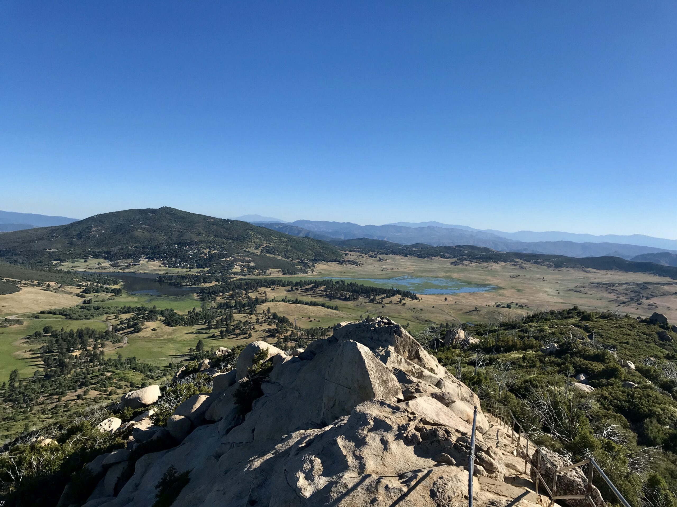
6. Potato Chip Rock Trail (Mt. Woodson)
7.4 miles | Moderate | 2,110 Feet Elevation Gain
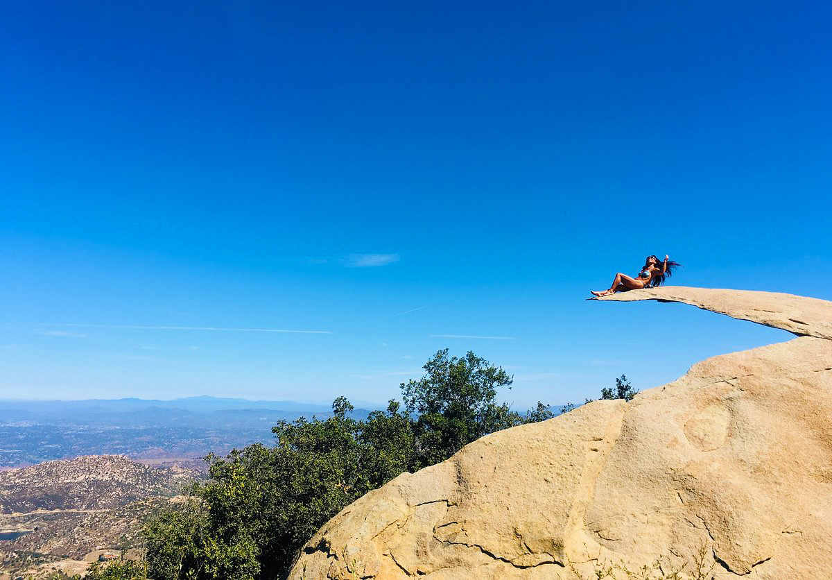
Potato Chip Rock is a hike that even people who don’t hike want to go on to take a picture. It is in the town of Poway, which is north of San Diego. It is a moderate 7.4-mile hike to a slender rock that people climb on, but it looks like it could break at any moment.
The climb to Potato Chip Rock starts near Poway Lake in Poway. It’s 5 to 10 minutes from the freeway, and if you don’t live in Poway, it costs $10 to park on holidays and weekends if you don’t live there.
A mile of the trail goes around the lake before you approach the start of the track. From there, the top is about 3 miles away.
This trail is in great shape. The forks have numerous signs, and the steep parts have good rock stairs. Along the trail, there are a lot of exciting rock shapes that will make your stroll up fun.
There is only one place that has actual shade while on the trail. It’s a small tree about halfway up, and if it’s hot, it’s a great place to relax. We also suggest that you bring enough water.
As you keep going up, you will have some great views of the ocean, mountains, and cities in the distance.
You’ll notice Potato Chip Rock at the altitude when you’re about a quarter of a mile from the top. The rock is before the top.
This unique rock is the big standout of this hike. To get to the top of this rock, you have to climb up it. It looks scary to stand on, but it doesn’t feel like that until you’re up there.
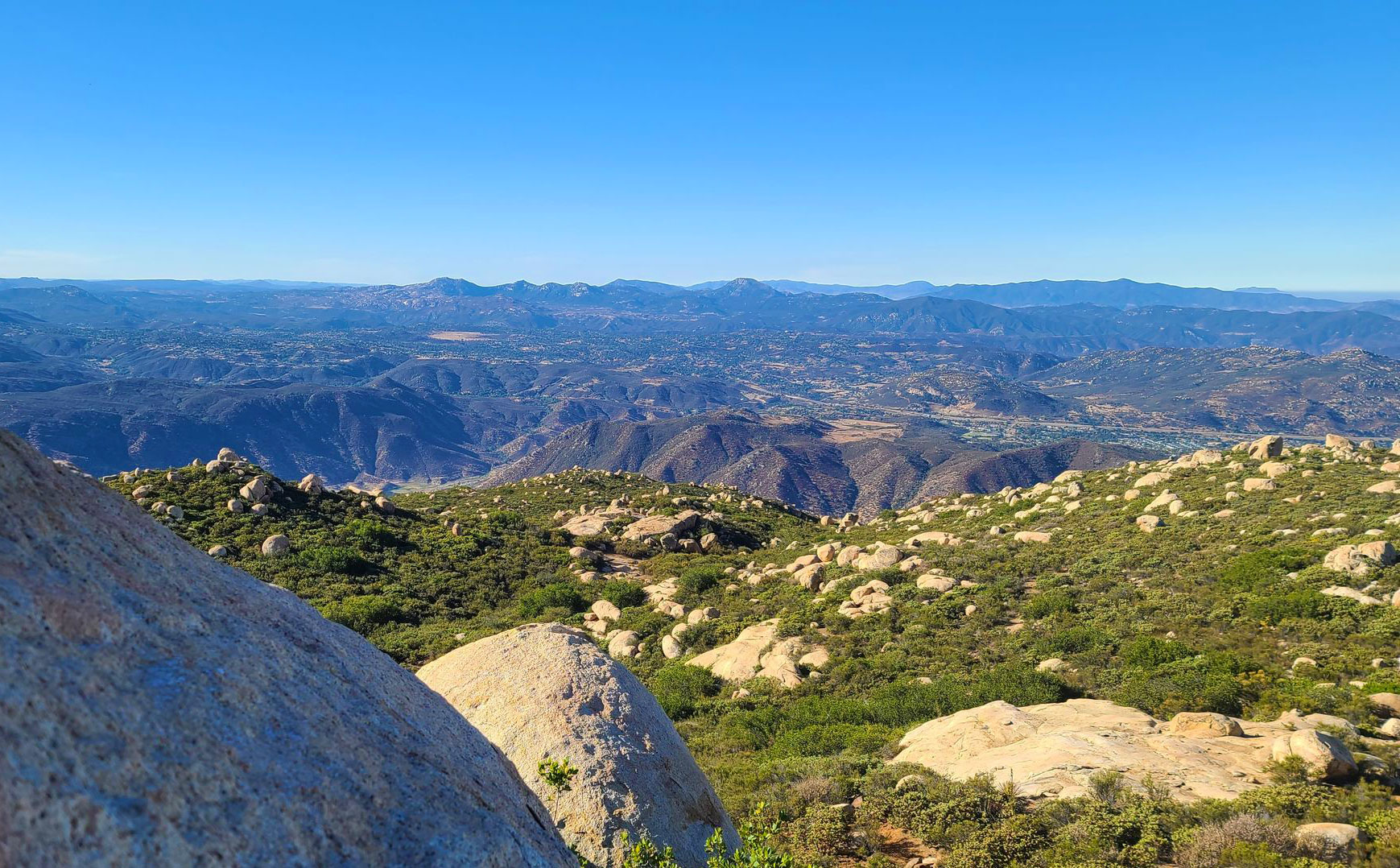
5. Cuyamaca Peak Loop Trail
7.7 miles | Moderate | 1,834 Feet Elevation Gain
Hiking Cuyamaca Peak takes you to the second-highest point in San Diego County, at 6,512 feet. It’s only 20 feet smaller than the highest peak, but it’s much easier to hike. On a clear day, you can view the surrounding islands and distant mountains from the summit.
Although the hike goes to a pinnacle, it’s not an arduous backcountry trip. Instead, it’s a fantastic hike for a beginner because there aren’t any tricky turns.
As one of the highest points in San Diego County, the Cuyamaca Peak Loop Trail has a lot of great views and beautiful scenery. With its beautiful old trees, expansive views of the valley, and gentle slope, this is one of the best hikes in San Diego for people of all skill levels.
All along the 7.7 miles of this loop trail, parts of the woods give you views of the nearby mountains.
The broader view includes Mt. San Gorgonio, Palomar Mountain, Toro Peak, Mt. San Jacinto, Santa Rosa Mountain, Santiago Peak, Mt. Baldy, San Bernadino Peak, and the remainder of the peaks in the far transverse ranges.
In the distance, the ocean’s long, cobalt blue arc will sparkle, and Catalina Island will break up the smooth, flat surface.
To the east, the Anza-Borrego desert, which includes the Salton Sea and the Santa Ysidro Mountains, will look like it goes on forever, while to the south, the highs of Northern Mexico will look ominous.
Also, this hike is best on clear fall, winter, or spring days after storms have cleaned up the pollution and haze from the air over San Diego. However, the trails can get very muddy after it rains, so it’s best to use waterproof hiking boots or trekking poles.
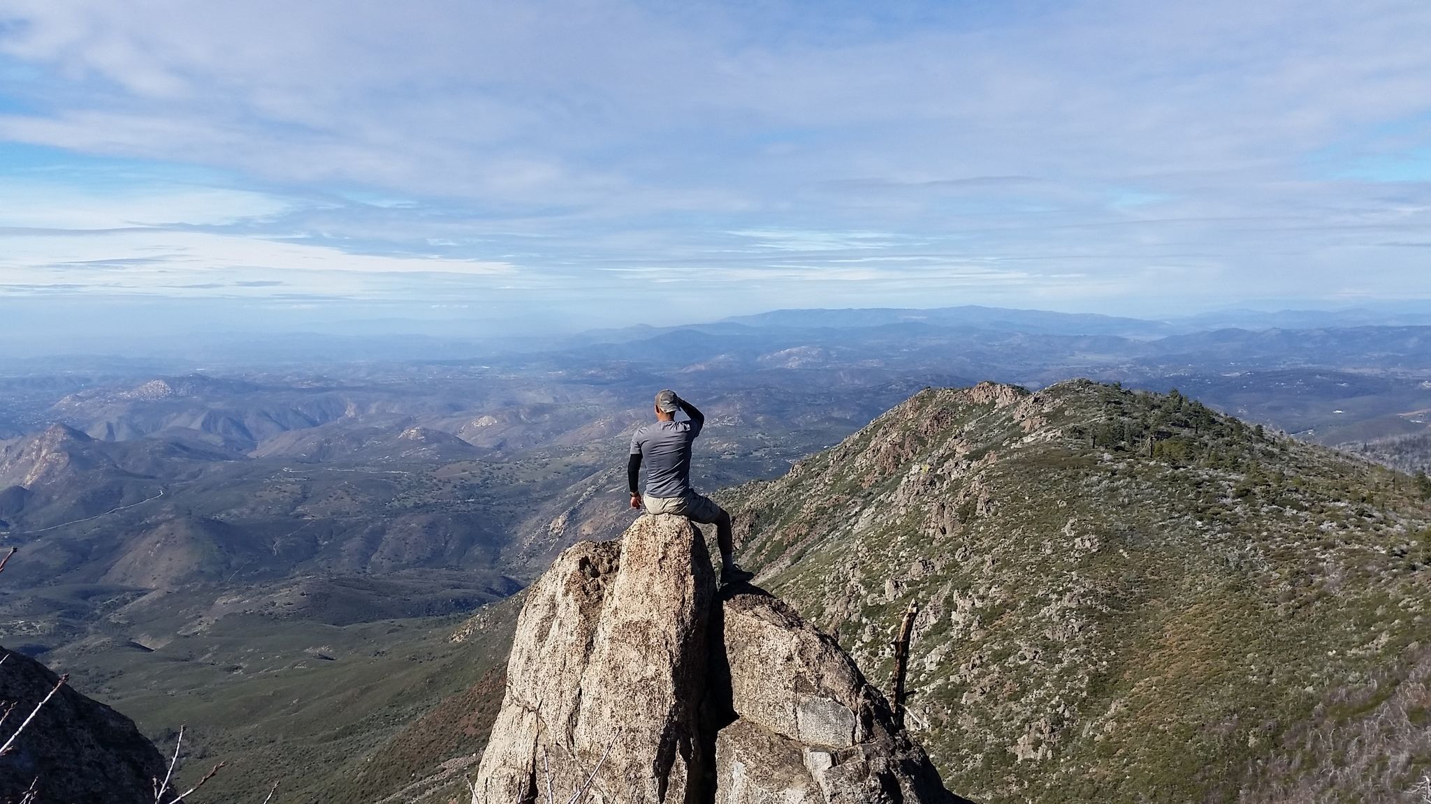
4. Corte Madera Mountain Trail
6.8 miles | Difficult | 1,509 Feet Elevation Gain
Corte Madera Mountain is a great way to start exploring the Pine Creek Wilderness, a big part of the Descanso District of Cleveland National Forest south of Interstate 8.
Pine Valley Creek and its canyon are the most noticeable parts of the wilderness. You can get a good picture of nature from Corte Madera and its sister peak, Los Pinos Mountain.
Along with great views, Corte Madera’s dramatic south face is home to many birds of prey that nest there, such as hawks, falcons, and golden eagles. Most of the time, these birds nest in the late fall, winter, or early spring.
From the few parking spots on the side of Corral Canyon Road, go past the locked gate and take an old dirt road through a forested area of coast live oaks.
The trail goes around this peak and down along a dangerous stretch of big granite rocks. You can see the ridgeline from the other edge of the peaklet.
Although the trail is rough and will require your full attention, you will have breathtaking views to the north and south.
The trail ends at a group of rocks right next to the cliff’s edge. There are a lot of places to sit down and take in the fantastic view. When you look west, you’ll see a line of exciting peaks that lead into the shallow canyons along the coast.
Near the summit are a couple of good campsites for backpackers, making this an enjoyable, if dry, place to camp. It is an excellent place to view the sun go down or catch a glimpse of the lights of San Diego as the full moon settles into the sea.
3. Indian Creek Loop
8.6 miles | Difficult | 1,001 Feet Elevation Gain
The Indian Creek Loop combines parts of several different paths, such as Noble Canyon, Indian Creek, and the PCT, into an 8.6-mile loop with a great variety of landscapes to enjoy.
To get there, take the Sunrise Highway exit off of I-8 east and make a left onto Sunrise Highway. You can park along both sides of the road at the Penny Pines trailhead, about 13.8 miles down Sunrise Highway.
The hike starts on the Noble Canyon Trail, goes downhill on the Indian Creek Trail, and crosses Indian Creek. Then it goes along an old jeep trail until it gets to the Pioneer Mail Picnic Area on the Sunrise Highway.
From there, take the PCT south to get back to Penny Pines. Most of the way to Garnet Peak from the picnic area is the same trail.
You can view intersections, wildflowers, and incredible views from the trail. The Garnet Peak will be to the east from the start.
After over a mile, the path winds through grassland, scattered pine trees, and chaparral brush. As you keep going, you’ll pass Pine Creek Road and go up a small hill with manzanita on it. After that, there’s a small section of sparse pine trees.
As the trail goes on, it goes downhill, and you’ll reach Indian Creek. If you keep going past the creek, you will see lovely sights of pastures and hills.
The highway will come back into view as you walk along the trail, but many side paths lead to incredible sights. Watch out for animals as you make your way to the trailhead.
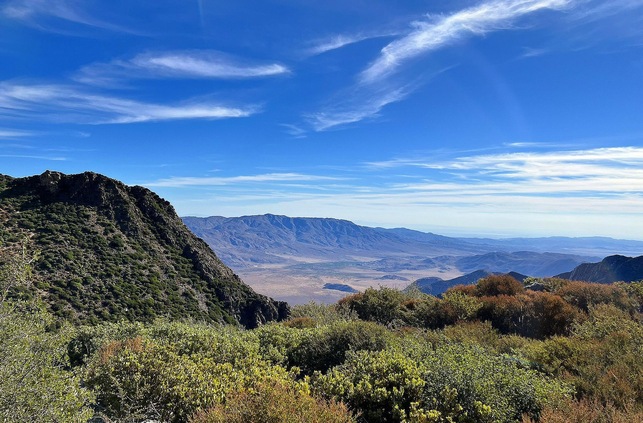
2. Whale Peak
8.8 miles | Difficult | 2,113 Feet Elevation Gain
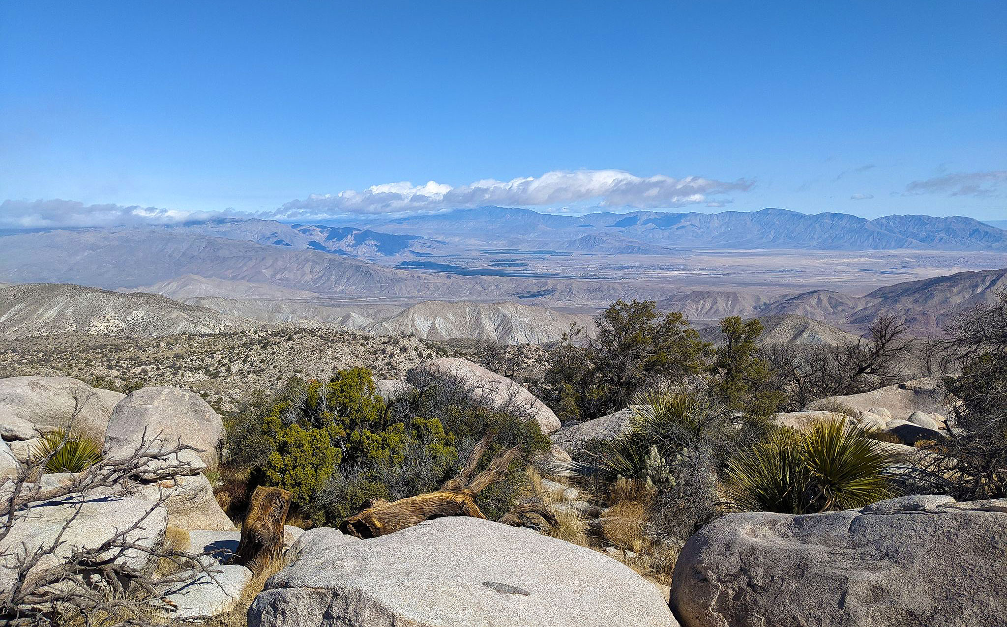
Take a beautiful hike up Whale Peak through the wild desert. This trail is for expert climbers and necessitates a high-clearance vehicle and the ability to find the path.
Apps that help find a way sometimes lead people to the wrong trailhead. After Scissors Crossing, turn onto the initial dirt road after S2, not the second one.
Whale Peak is in San Diego County, California, in the Anza Borrego State Park. The trail is in the Vallecito Mountains, east of Escondido and south of Highway 78.
Also, it’s not as tall as several of the highest peaks in the nearby mountains, but it’s ranked 68th on California’s Prominence List. You can view the Salton Sea from the top on a day with clear skies.
Whale Peak is an absolute desert apex with all the elegance and remoteness you would expect. The Anza Borrego Desert is famous for its wildflowers and wide range of desert plants.
Most of the hillsides are with brush and cacti. It has washes, dandelions, palm groves, cacti, and extensive views.
Visitors can also see desert iguanas, chuckwallas, and four types of rattlesnakes, roadrunners, falcons, kit foxes, mule deer, and bighorn sheep. The old Overland & Butterfield Stage Lines went through the area, and you can see a historical marker about them on Hwy. 78.
As you traverse the mountain upwards, the trail will slowly change from a desert to an alpine climate. You’ll pass by a few “false summits” and scramble your way up to the summit. When you get to the top, the views are amazing.
Do not attempt this trail when the weather is cooler.
1. El Cajon Mountain Trail
11.0 miles | Difficult | 3,579 Feet Elevation Gain
Get ready not to use the stair-master for a week. This epic hike is among the hardest ones in San Diego County. It has a lot of ups and downs that will engage your quads, calf muscles, and glutes until they give up.
Unlike the gym, though, this trip across one of the county’s most mountainous and rugged terrains will reward your hard work with beautiful views and the right to brag.
El Cajon Mountain is one of the more challenging hikes in San Diego. It will tease you with many false peaks and uphill parts on the way up and down. This trail is significant and essential for anyone searching for challenging hikes in San Diego.
It is the pinnacle of a massive block of granite that climbs up just above the town of El Cajon.
Like nearby Mt. Woodson, Iron Mountain, and Mt. Gower, the geography exhibits numerous instances of exposed granitic that shrunk into smooth, circular shapes through spheroidal weathering.
The hike begins with a smooth rise along a paved road but will soon shift into switchbacks. Don’t start cursing at the switchbacks, though, as they are the only ones you’ll encounter throughout the trail.
Most of the hike is an up straight steep ascent to the top. Stunning views start about halfway up. On clear days, you can see the Pacific Ocean within that distance.
In Closing
That’s all for our list of the 15 best hikes in San Diego!
As you can see, there is a trail for everybody in San Diego, from the most beautiful walking paths to the highest peaks. With so many options, we’re sure that at least one of these hiking trails in San Diego will appease your hiking itch.
Feel free to pin this post if you want to return to it later. Enjoy hiking!