16+ BEST Hikes In Acadia National Park
Going hiking in Acadia National Park? With so many awesome trails, it’s hard to know where to start. We’re sharing our absolute favorite hikes in Acadia along with need-to-know info about each trail!
Acadia National Park is a notable Maine attraction where natural beauty abounds. It has pink granite mountains, clean ponds, flowing brooks, stunning sea cliffs, and a sandy beach. Acadia is a dream for every outdoor enthusiast!
The park has 120 miles of hiking trails and 45 km of vehicle-free carriage roads. This path system includes stone bridges, rock stairs, wooden footbridges, and antique cairns. The views are just too stunning!
Acadia’s extensive route network provides a variety of hiking experiences, from strolls along the rocky coasts to challenging scrambles to the summits of stunning granite peaks. There’s something for everyone here.
Here are several beautiful hikes in Acadia National Park that you can try for a successful hiking experience while in the area. Here are our absolute favorites!
16. Wonderland Trail
1.4 miles | Easy | 78 Feet Elevation Gain

Near Bass Harbor, Maine, explore this 1.4-mile out-and-back walk. Usually regarded as an easy path, it takes at least a half hour to complete.
This family-friendly walk leads to attractive sites along the water. While the view is generally level compared to other popular portions of Acadia National Park, this location offers a safer and more relaxing spot to experience Acadia’s rough shoreline.
Wonderland runs southeast through a pine forest to the beach. This trail is a well-kept gravel road and is wheelchair accessible.
Along with parts of the trail, ropes protect the sensitive plants. Soon, the trail reaches the beach, and while the old road loops towards Bennet Cove to the north, feel free to admire the rocky shoreline. All ages enjoy exploring the shoreline and tidepools.
Cross-country skiers, hikers, and snowshoers flock to this area, so expect to run into other visitors while you’re out exploring this trail.
The route is open all year and is excellent to explore anytime. Dogs are allowed but have to be on a leash.
Wonderland is one of the best hikes in Acadia National Park for parents and kids. There are several excellent sites along the coast to enjoy lunch. You can visit one of the neighboring lobster pounds outside the park before or after climbing.
15. Ship Harbor Nature Trail
1.3 miles | Easy | 66 Feet Elevation Gain

This 1.3-mile circular trail in Bar Harbor Maine is well worth exploring. It takes about 28 minutes to complete this accessible route. This is one of the best easy hikes in Acadia National Park with gorgeous water views.
The Ship Harbor Trail is a well-maintained and easy-to-follow path that hugs Ship Harbor as it travels southeast through a wooded area. Although the trail has several different options, the one that embraces the waterfront is it’s most beautiful.
When the trail finally reaches the water, it’s time to explore the rocky shoreline that greets you. Wandering down the coast and checking out the many tidepools is a favorite pastime for visitors.
While exploring, you’re almost certainly going to stumble into other people, as this is a trendy spot for outdoor activities such as hiking, trail running, and birding.
Along the journey, attractively designed wildlife displays assist hikers in interpreting their surroundings. The path is like figure eight. Both loops offer different difficulty levels, with the first being wheelchair accessible and the second being more complex.
Like the neighboring Wonderland Trail, Ship Harbor is open yearly for everyone. Leashed dogs are welcome, making it a gorgeous, friendly trail.
14. Day Mountain
2.6 miles | Moderate | 564 Feet Elevation Gain
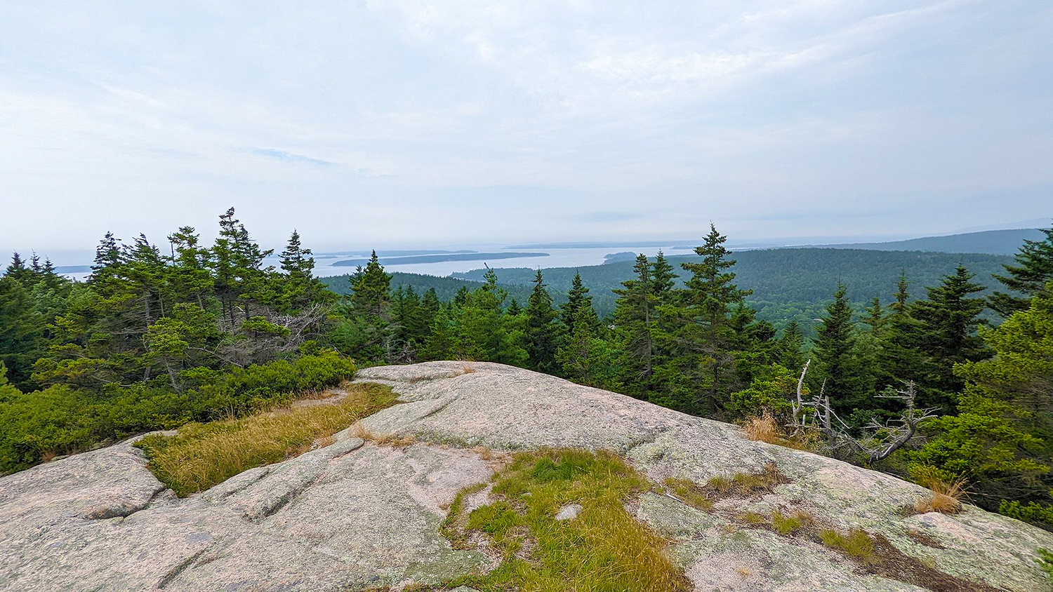
This 2.6-mile moderately challenging trail takes about 1 hour and 20 minutes to complete.
The Day Mountain Trail goes north through an excellent forested terrain and then enters the park. It is the only Acadia peak with a carriage road to the summit; however, it has more loops and switchbacks than other routes.
As the trail climbs Day Mountain, the landscape improves as more exposed granite allows for excellent vistas. Before reaching the summit, the trail crosses the carriage road three times.
While the peak isn’t as spectacular as some of Acadia’s more prominent peaks, the views are still incredible.
For a short family-friendly trip, you can turn around here. For a longer hike, proceed down the north face of Day Mountain, where the route rejoins the carriage road and crosses the Park Loop Road.
Due to some rugged and root-covered terrain, you’re unlikely to encounter many other hikers or trail runners along the way.
13. Flying Mountain and Valley Peak
1.5 miles | Moderate | 322 Feet Elevation Gain
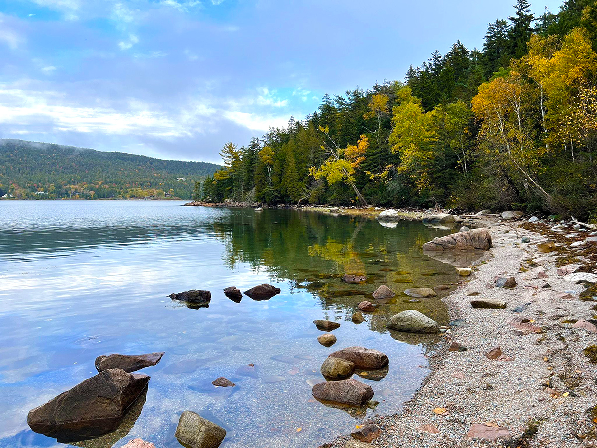
This moderately challenging Flying Mountain Trail takes about 46 minutes to complete. This is one of the best hikes in Acadia National Park for intermediate hikers seeking gorgeous views.
Flying Mountain is Acadia’s lowest-label summit in the same pantheon as Acadia and St. Sauveur. Despite its diminutive stature, it provides stunning views from the crest and an isolated stretch of shoreline that beckons visitors to unwind.
The Valley Peak Trail, which connects the top of St. Sauveur Mountain to the summit, can be used to make this a more extended trip with even better views over Somes Sound.
The Flying Mountain Trail climbs the peak’s forested south slope in minutes. This trail bends west and drops to Valley Cove, a peaceful oceanside area.
Valley Cove Trail continues north via a boulder field towards Somes Sound. The trail winds through a boulder field, then up and down to avoid obstructions near the coast. Several points along this hike give great views of Flying Mountain.
Take Valley Peak Trail south to St. Sauveur Mountain. This trail offers excellent views of Valley Cove. Take the St. Sauveur Mountain Trail west to the viewless summit sign if you want to be thorough. The east spur offers other magnificent views as the Valley Peak Trail descends.
From Flying Mountain to Valley Peak Trail, the loop trek visits distinct summits and Valley Cove’s beach. This path is more cost-effective than trekking St. Sauveur Mountain Trail via Acadia Mountain Trailhead. You should give this one a try!
12. Beech Mountain
1.2 miles | Moderate | 351 Feet Elevation Gain
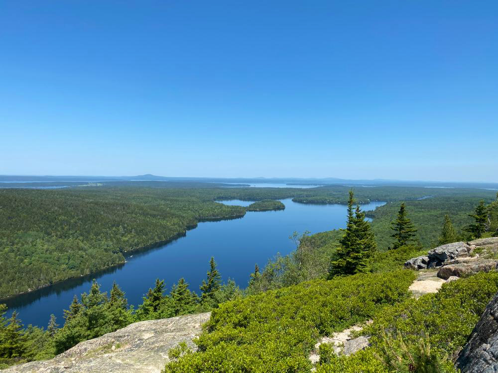
This moderately challenging hike in Acadia National Park takes about 43 minutes.
Beech Mountain is a conspicuous peak between Long Pond and Echo Lake with east-facing ridgelines and cliffs. In this section of Acadia National Park, a complex network of routes leads to the mountain’s peak. If you’re hiking Acadia National Park and want various options this is definitely a good hike to choose.
Beech Mountain Loop and Beech Mountain Valley Trail to South Ridge Trail are two nice loop hikes. Both hikes end with Acadia’s famed Beech Mountain fire tower.
The Beech Mountain Trail begins on gentle, forested slopes. Pick the left (eastern) loop for the shortest route to the top at the first trail junction.
Follow the trail up the granite formations. This route may appear challenging, but it’s short, and you’ll soon be at the summit under the Beech Mountain fire tower.
You can stroll up the first set of fire tower steps to enjoy a magnificent view in all directions. Northeast, you can see Acadia Mountain and Sargent Mountain.
You can also choose the Valley Trail for a more extended trip. The valley’s fallen stones make it feel like Jurassic Park. The Beech Mountain South Ridge Trail zigzags up the mountain. Once on the ridge, you’ll have unrestricted views east and west, including a famous climbing cliff.
Both routes offer excellent forest beauty and glimpses of Mansell Mountain and Long Pond to the west. If you’re up for the hike, do both circuits back to back. Alternately, you can go for the third route option, the more isolated West Ridge Trail that starts at Long Pond.
11. Sand Beach and Great Head Trail
1.8 miles | Moderate | 266 Feet Elevation Gain
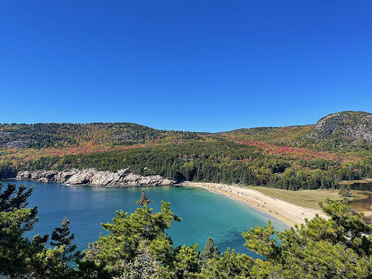
Sand Beach, Acadia’s lone sand beach, is tucked away in a secluded cove and is popular with locals and tourists, despite the chilly water temperatures.
The Great Head peninsula, located just to the east, boasts cliffs that stand 100 feet above the water on the far side of the peninsula. It’s an excellent 1-2 hour diversion from the beach to take in some of Mount Desert Island’s best stunning coastal areas while hiking the Great Head Trail.
The Great Head Trail ascends the cliffs at the beginning of the hike. On top of the cliffs, the trail levels out and follows the peninsula’s shoreline in an oval loop. There are several available places where you can rest and look at the rock formations along the course.
Great Head’s highest point offers a stunning view at the trail’s eastern end. If you want to feel the ocean’s roar, climb here. Many exposed slabs can fall, so keep the kids away – this is definitely a hike for adults.
To go back to Sand Beach, use the shorter shortcut or continue on your way up along the coastline. Signposts mark both options.
Few other places are available to abandon the track and explore the wild shoreline on the longer loop. Following an ancient dirt road south, the trail returns to Sand Beach in its last section.
The great head is an excellent excursion from Sand Beach. The trail is family-friendly, but the initial climb is challenging. Be careful with children at the Great Head highpoint’s towering, unprotected cliffs!
10. South Bubble Mountain
1.4 miles | Moderate | 492 Feet Elevation Gain
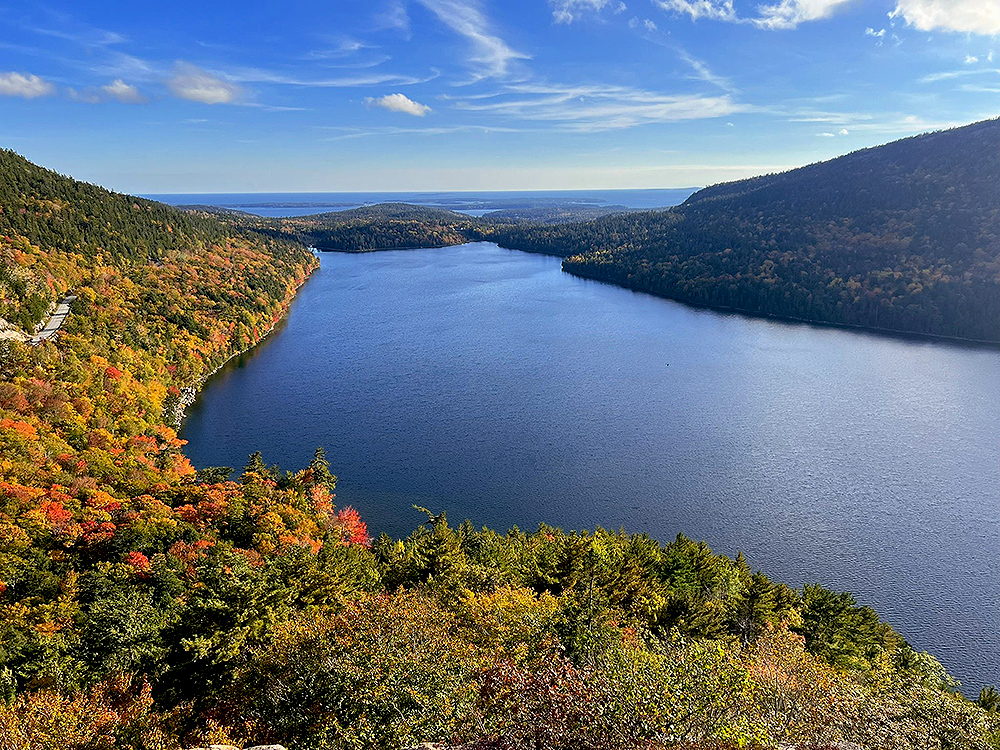
The view of the Bubbles across Jordan Pond from the south side of the pond is one of the most famous in Acadia. South Bubble and North Bubble have paths to their summits, making them some of the best day hikes in Acadia National Park.
Bubble Rock, also known as Balanced Rock, a massive boulder dragged by glaciers and put on a cliff’s edge, is a popular tourist destination in South Bubble. Make sure you watch your kids as you climb up the mountain from the Bubbles parking area to Bubble Rock.
Locate the “Bubbles Divide” Trailhead at the north end of the parking lot and hike west along the well-maintained route.
As the route climbs the valley between North and South Bubble, you’ll cross the North Bubble spur trail on the right, and the South Bubble spur path on the left (south). Follow the South Bubble Trail to its summit.
After a few minutes of hiking Acadia National Park, you’ll notice the trail to Bubble Rock. This site is perfect for snapping photographs and exploring, but the cliffs are dangerous, and a fall might be devastating. Down South Bubble Trail, you may see Jordan Pond and spend lunch before the trail’s core descent.
Take South Bubble Trail to Jordan Pond for extra hiking choices. Scrambling is present on this trail, but it is not overly taxing. It continues through a boulder field to Jordan Pond Trail from the cliffs. This public water supply prohibits swimming and wading.
If it’s your first time hiking Acadia National Park, head to South Bubble and Bubble Rock for the best views. Descending South Bubble Trail to Jordan Pond and climbing North Bubble are two great possibilities.
9. Perpendicular Trail
2.2 miles | Difficult | 889 Feet Elevation Gain

West of Long Pond, Mansell Mountain, and Bernard Mountain have various trails leading to their heights. The Perpendicular Trail is a challenging and scenic route composed of stone stairs that climb Mansell Mountain.
This fantastic hike is on a well-engineered trail with amazing views of Long Pond and Beech Mountain.
Hike the Perpendicular Trail up the endless steps to a boulder field. This path’s efforts and borders seem very intricate. After rising several hundred feet, there are iron rungs and a small ladder, although it’s not open like the Precipice Trail or Beehive Trail.
The trail penetrates Mansell Mountain’s woodland around halfway up. A short spur trail near the summit has a stunning view of Long Pond and Beech Mountain to the east. The course goes through a wooded marsh to the summit sign, with no spectacular views.
The Mansell Mountain Trail, which descends southward from the summit via a scenic vista, is the quickest and easiest way to return to the trailhead. As the route approaches the bottom of the mountain, it finishes at a dirt road/parking lot.
Although this hike doesn’t have much to show, unlike other Acadia summits, you can still have some spectacular perspectives of Long Pond and Beech Mountain. The fantastic work on the path’s construction, which appears to be even more meticulous than usual, makes it stand out!
8. Parkman Mountain, Bald Peak, and Gilmore Peak
2.4 miles | Moderate | 741 Feet Elevation Gain

Acadia National Park includes several lesser peaks worth exploring besides Cadillac Mountain and the major ones. Bald Peak, Parkman Mountain, and Gilmore Peak, west of Sargent and Penobscot, offer excellent vistas.
These are all great hikes in Acadia National Park for those who visit quite often and want to see something different!
The complicated route system of Acadia lets you unite these three peaks into a one-day hike. Hikers can see three antique carriage-road bridges in an extended circle.
Follow cairns and markings up Bald Peak’s southwest ridge. Bald peak has few trees covering the countryside; thus, the views are great, especially Upper Hadlock Pond to the south.
After gaining 700 feet, the summit relents and sees Parkman Mountain to the north. Continue north as the trail falls into a valley and ascends to Parkman Mountain for other spectacular views.
The last peak requires additional work. Take the steep and awkward Grandgent Trail east from the Parkman top to descend into an enormous forested valley.
From the valley bottom, take the Great Slide Trail to Gilmore Peak. Gilmore Peak offers excellent views in all directions, especially of Sargent Mountain.
To complete the loop, head to Parkman Mountain and descend the trail. The Parkman Mountain Trail features multiple granite shelves. A lone iron step supports hikers at a steep point near the woodland edge.
This path is a great hike, but there are several variants, like going on the Great Slide Trail or the Maple Spring Trail or continuing to Sargent Mountain. This hike is near Hemlock Bridge, Waterfall Bridge, and Hadlock Brook Bridge.
While the park has more prominent and steeper mountains, this climb is spectacular. The Acadia hike isn’t lengthy, but it’s complex with its highs, lows, and scrambling areas. Be cautious in the steep areas!
7. Beehive Trail
1.5 miles | Difficult | 509 Feet Elevation Gain

The Beehive is the picturesque peak that views Sand Beach from the northwest. The hike to the top of the Beehive Trail (aka. the Beehive Cliffs Trail) is a breathtaking Acadia classic, but it is not suitable for those who fear heights.
This clever approach ascends the rough south face of the peak using stone stairs, iron rungs, and railings for exposed rock scrambling. Great Head, Sand Beach, and the nearby areas are visible from the top.
The hike begins at the Bowl Trailhead immediately next to the renowned Sand Beach along the Park Loop Road. The Sand Beach parking lot and the right traffic lane are excellent places to leave your vehicle.
Because Sand Beach and the surrounding area are busy, you should arrive early or use the complimentary Island Explorer Shuttle Buses.
Start hiking the Bowl Trail through the Beehive’s woodland. Soon, you’ll reach the Beehive Trail and glimpse the towering summit. Follow the trail to the peak’s base, then up faults and granite breaks.
Hikers can climb the mountain using manufactured stairs, iron rung ladders, railings, and a grill board. All hurdles are reasonable, but the scrambling and exposure can be scary. Many fearful individuals will be walking this route slowly, so be patient if you’re a speedy hiker.
Soon, you’ll be on top of the Beehive with a great view of Sand Beach and the region. The peak is a great lunch spot.
Continue down the Beehive’s backside to the highpoint for Enoch Mountain and Champlain Mountain sights to the north. As you descend the west side, you’ll reach “The Bowl,” a lovely lake surrounded by peaks. The Bowl is a popular swimming spot but beware of leeches!
This climb has intense rock scrambling and beautiful views. This Acadia National Park hike is a must-do if you don’t mind exposure and crowds!
6. Penobscot Mountain and Sargent Mountain
5.6 miles | Moderate | 1,283 Feet Elevation Gain
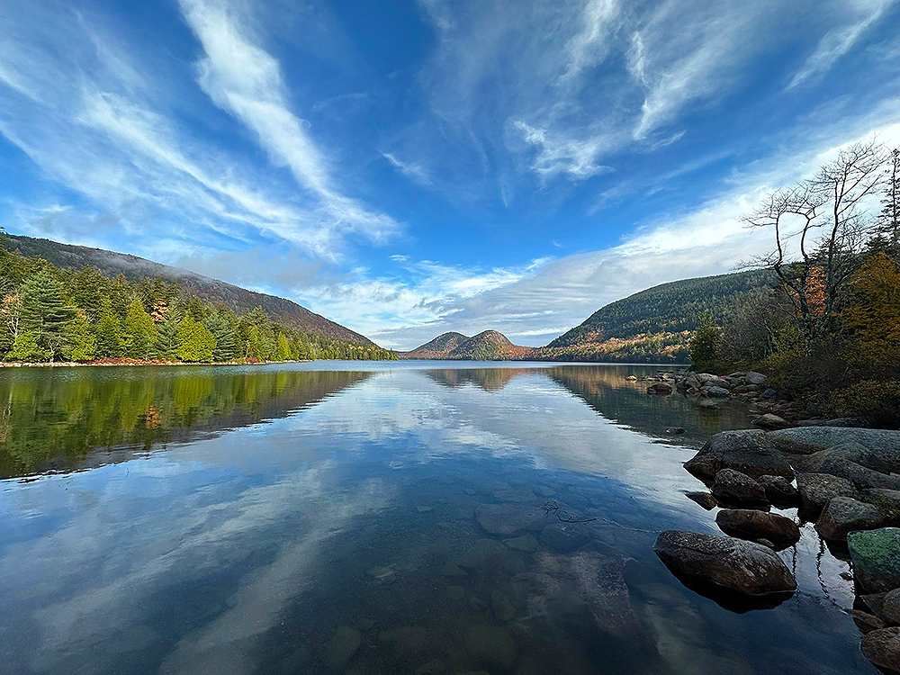
Looking for more difficult hikes in Acadia National Park? The Spring Trail, which ascends Penobscot Mountain, is a challenging but rewarding climb that rewards hikers with breathtaking views of the surrounding mountains.
You will also pass over different carriage-road bridges on this circle trip which is a bonus for bridge seekers.
From Jordan Pond North, go northwest to the ferry dock, turn left, and take the shoreline path to the pond’s southwest corner. Continue the carriage road south to the Spring Trail trailhead.
Spring Trail passes Jordan Stream and proceeds west under Penobscot Mountain. Soon, the route crosses a carriage road, so bridge enthusiasts may want to conduct brief diversion treks along with them.
Two miles to the north lies the 115-foot-long West Branch Bridge with a high, thin arch. Four miles south lies the Cliffside Bridge, a 230-foot-long structure created in the form of an old English castle.
Spring Trail west of the carriage route is intriguing. The trail climbs cliffs by zigzagging among rock bands. Hikers use iron and log railings. Even though it’s not the Beehive, the openness and grade may be disconcerting.
The north of Penobscot Mountain offers views of Jordan Pond and the Atlantic. Pink granite structures have grooves and wave patterns created by glaciers and a swamp near the summit from trapped rainfall.
If you are eager to extend your journey, you can continue going north to the taller nearby Sargent Mountain (the 2nd highest peak in Acadia).
As you climb out of the valley, you’ll pass an isolated pond before joining the Sargent South Ridge Trail. The view resembles Penobscot Mountain, gorgeous but bleak like the Scottish highlands.
Spring Trail to Penobscot and Sargent Mountains is a strenuous loop. This trip features Acadia peak perspectives, carriage-road bridges, and a promenade along Jordan Pond, making it a great adventure!
5. Norumbega Mountain
1.1 miles | Moderate | 568 Feet Elevation Gain

Mount Norumbega, on Mount Desert Island’s eastern side, is the highest point closest to Somes Sound. The “Goat Trail,” steep and well-named, quickly rises the mountain and reaches the top.
A circular climb around Norumbega Mountain brings hikers through a thick grove of young pines in a thickly forested area, obscuring the views. Lower Hadlock Pond’s shoreline walk is also well worth the effort.
The trail ascends close to 600 feet in .5 miles, but it’s not as dangerous as some of Acadia’s other peak hikes because it crosses multiple sheer rock walls.
You’ll get your best views of Bald Peak and Sargent Mountain in the distance as you near the summit and leave the lower forested region behind you.
The trail soon bends south and levels off at Norumbega Mountain’s peak. The top may be anti-climactic due to obstructed vistas. Even if you are high over Somes Sound, you can’t get a good peek of the lake or Acadia Mountain.
You could head around here, but a loop trek is more enjoyable. South of the summit sign, the trail becomes “Norumbega Mountain Trail” and declines the mountain’s south side through a dense grove of young pines.
The route ends at Lower Hadlock Pond near the dam outflow and pumphouse. The pond is a reservoir, so swimming isn’t allowed, but the northbound walk is pleasant.
At Lower Hadlock Pond’s north corner, the trail follows Hadlock Brook. Here, there are trail intersections and wooden bridges. Goat Trail Parking is marked. Lower Norumbega Trail’s final mile is forested.
This off-beat hike lacks stunning views, so it’s not for casual travelers, but the Goat Trail and wooded views near Lower Hadlock Pond are amazing!
4. Acadia Mountain
2.6 miles | Moderate | 689 Feet Elevation Gain
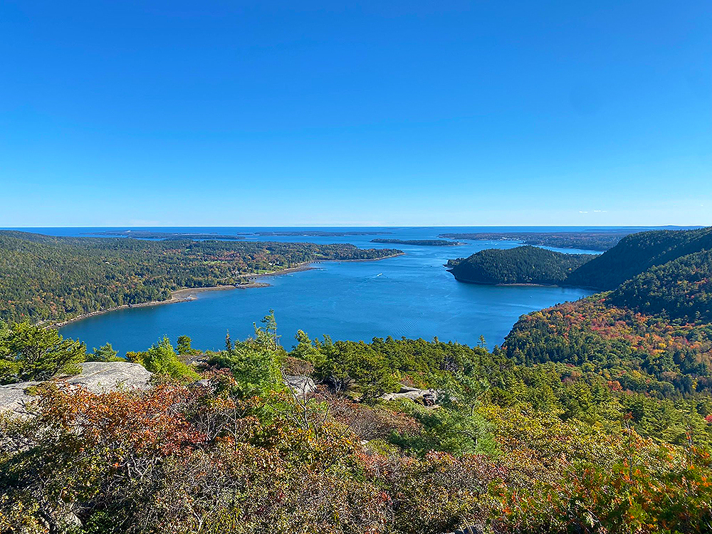
While Mount Desert Island’s tallest and most scenic summits reside on the island’s touristy east side, Acadia National Park’s “quiet side” west of Somes Sound has numerous worthwhile peak treks.
It’s a fantastic short climb to Acadia Mountain, located along Route 102 at Echo Lake. It offers stunning views in all directions, including into Somes Sound and the Atlantic Ocean in the distance. Except for Acadia Mountain, Mount Desert Island’s other peaks face westward.
You can hike Acadia Mountain from several routes, but the well-groomed roadside trail “Man o’ War” is famous to tourists.
The forested track quickly climbs Acadia Mountain’s west slope, including a few climbing portions. Soon, you’ll be walking along with granite formations to the summit. Impressive views surround the summit marker.
Mountain Acadia Follow the ridgeline east for more stunning views. The trail goes south and descends steeply through granite formations; numerous obstructions necessitate scrambling.
When back in the wooded valley, the hike crosses Man o’ War Brook, and an optional spur trail brings you to the seashore. Take the closed Man o’ War truck road west to complete the loop.
For longer loop hikes, continue up the Valley Peak Trail to St. Sauveur Mountain or follow the Flying Mountain Trail to Flying Mountain and return via St. Sauveur Mountain.
The summit of Acadia Mountain is a wonderful one! For all its diminutive stature, the view from this walk is breathtaking. Consider a loop up St. Sauveur Mountain to extend your time on the trail.
3. Cadillac Mountain North Ridge Trail
4.2 miles | Difficult | 1,129 Feet Elevation Gain

As an alternative to the Cadillac South Ridge Trail, the Cadillac North Ridge Trail begins at a trailhead just .2 miles past the beginning of the one-way stretch of the Park Loop Road. This is one of the more difficult hikes in Acadia National Park, perfect for advanced hikers.
You can find intriguing pink granite structures on a gradual elevation via a few nice stretches of forest, which provide a stunning view of a wide area to the north.
The Cadillac Summit Road, just a few hundred feet away from this trail, may prohibit you from experiencing the woods, but this is still a lovely trip. The lowest parts of the path are mainly wooded, but as you gain height, you’ll be able to see more expansive vistas.
This peak has adorable and stunning formations like many others on Mt. Desert Island. A few places where the trail crosses the Cadillac Summit Road, making for a less-than-pleasant wilderness experience.
Keep your eyes peeled to the north for ever-increasing vistas as you climb the mountain!
After roughly two hours of grueling ascent, the trail reaches the north end of the peak parking area, usually teeming with people and cars in the summer.
Make your way around a parking lot and head toward the south side of a parking lot to tag the peak and wander around Summit Loop Trail.
This hike in Acadia National Park is perfect for its stunning sunrise and sunset views. Do not forget to bring your headlamp and dress appropriately for the weather!
2. Cadillac Mountain South Ridge Trail
6.7 miles | Moderate | 1,549 Feet Elevation Gain
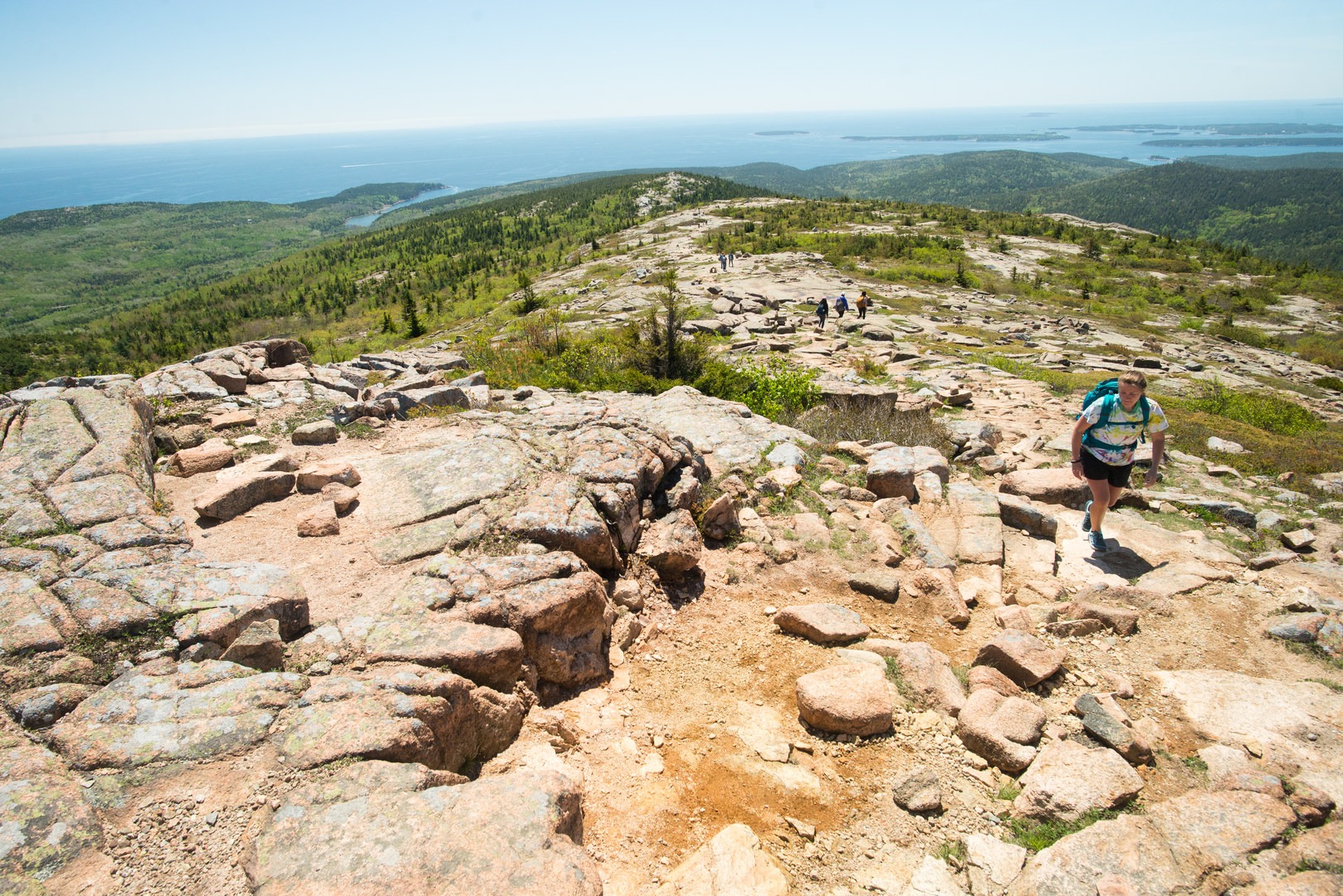
In contrast to most tourists, Mount Desert Island’s highest peak Cadillac Mountain offers several trekking paths that access the summit. The Cadillac South Ridge Track is one of the park’s most extensive straight sections of trail and is one of the most intriguing routes.
The trek begins at the Blackwoods Campground on the island’s south side and climbs steadily through stunning scenery before reaching the trail’s well-known top.
The Cadillac South Ridge Trail begins at around 180 feet above sea level and ascends steadily through beautiful woodland. A little peak along the Cadillac ridgeline known as Eagles Crag gives the first glimpse of the distant mountains.
Make your way around the loop to the east for the most incredible views. The flora thins out as the trail heads north, and the pinkish granite becomes more visible. It’s possible to see frogs, plants, and flowers in an area of the marsh where glaciers have hollowed out a trough-like pool.
The walk descends to the Featherbed, a lovely pond. After passing different Acadia National Park attractions, the South Ridge Trail climbs a barren granite slope with cairns and blue markings.
You’ll encounter the Cadillac West Face Trail and access road less than a mile from the top.
You’ll arrive at the southern side of Cadillac Mountain’s parking area with magnificent views along the Summit Loop walk. After a few hours on the South Ridge Trail, the top may be a culture shock with cars, people, and a tourist shop.
A hike on this trail leads to the peak of Acadia’s most iconic mountain. While riding to the summit is faster, hiking and seeing the sights is more gratifying!
1. Jordan Cliffs Trail
3 miles | Difficult | 1,033 Feet Elevation Gain

Penobscot Mountain’s east slope boasts Acadia’s most stunning cliffs. “Jordan Cliffs” give breathtaking viewpoints of Jordan Pond to the east.
The Jordan Cliffs Trail is a challenging trail that traverses the exposed rock bands of Penobscot Mountain. This route features railings that assist and is regarded as one of the park’s traditional iron rung paths, affording beautiful scenery along the way.
Nesting peregrine falcons close this trail from March 15 to August 15. You can check the National Park Service for restriction status. Additionally, this climb isn’t ideal for tiny children, anybody with a fear of heights, or unsteady walkers.
To approach the Jordan Cliffs Trail, hike north for .2 miles and then west at Post 14. Jordan Cliffs Trailhead is right (north). The trail begins at West Branch Bridge.
The Jordan Cliffs Trail ascends Penobscot Mountain gradually from carriage routes. As the path rises over wooded cliff sections, it becomes increasingly difficult and exposes Jordan Pond. Be careful of loose pebbles and tree roots along the way!
Halfway through the trek, a wooden staircase drops a 10 feet cliff band. After a few feet of descent, the trail’s final segment passes uneven cliff breaks. Railings help in narrow, vulnerable situations.
A steep iron rung ladder is the ultimate finale. A ladder leads to the Penobscot East Trail. Continue left (southwest) up the final route for clifftop views. Soon, you’ll reach Penobscot Mountain’s summit for stunning vistas.
Penobscot Mountain Trail, Deer Brook Trail, and The Amphitheater are great options for a return circular trek.
If you like Acadia’s “iron rung” trails, consider this nice hike with a creative track and incredible vistas. You must be careful on your walk because it has steep parts and lonely forested terrain. This is one of the more complicated hikes in Acadia National Park but the views make it worth it!
In Closing
Acadia’s broad trail network offers a wide range of hiking opportunities, from strolls along the stony beaches to demanding jumps to the slopes of granite peaks. All levels of hikers will have a good time here!
Consider some of these hikes in Acadia National Park whether you’re an Acadia veteran or this is your first visit. There’s definitely a hike on this list for everyone!


