15+ Must-Do Mount Baker Hiking Trails in Washington
Going hiking on Mount Baker? There are so many incredible hikes on Mount Baker that it’s hard to choose a trail! Here are some of our absolute favorites.
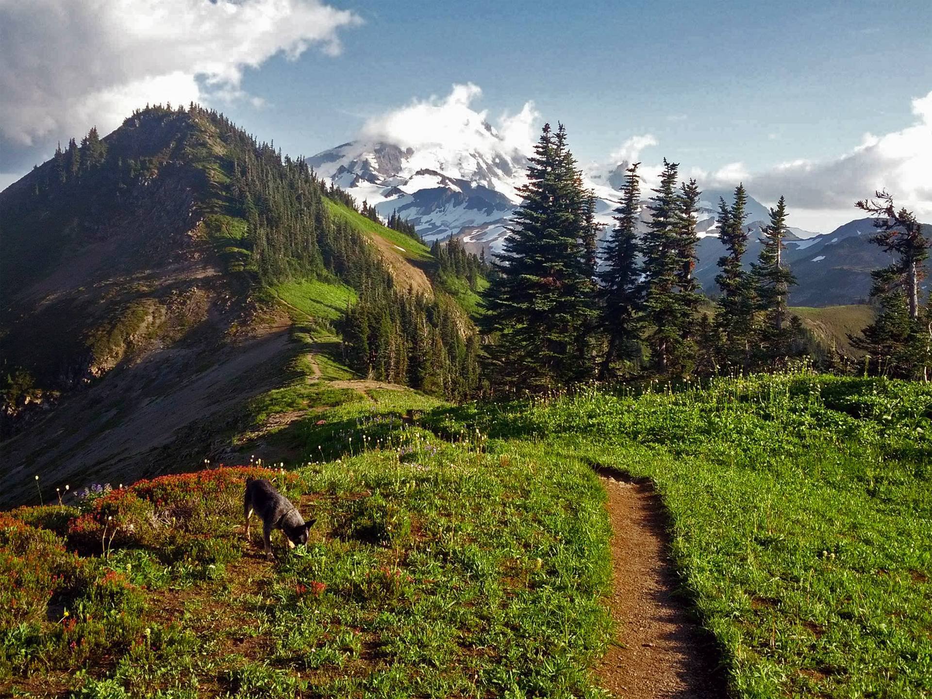
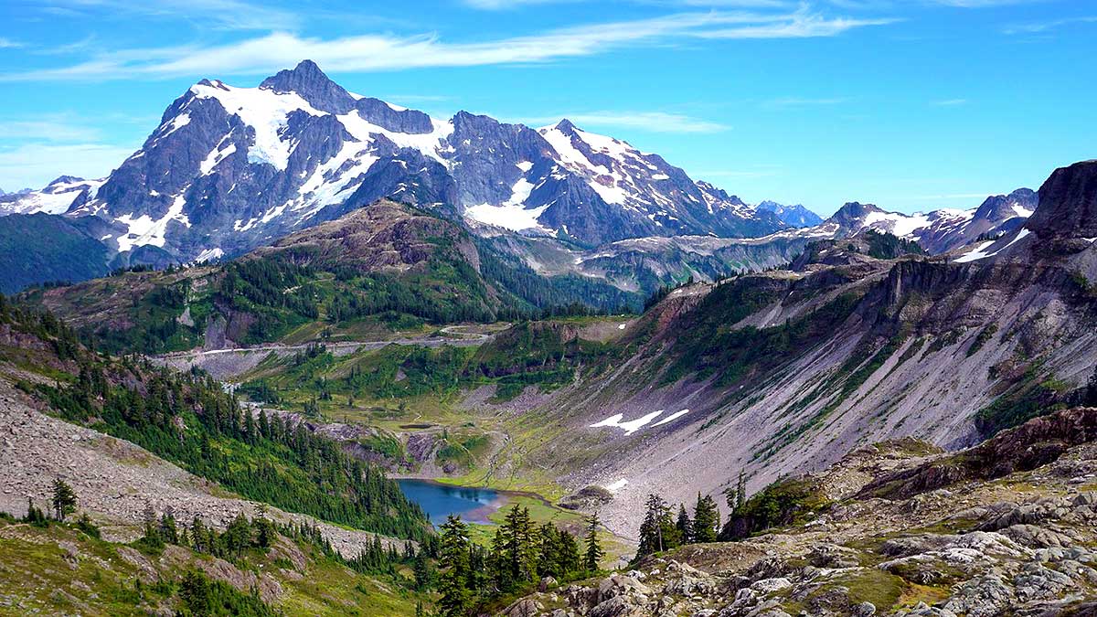
In the Mount Baker Wilderness, hikers will find a profusion of peaks, glaciers, alpine meadows, and a calm blue tarn. As the highest mountain in the North Cascade Range, Mount Baker is a currently active stratovolcano.
In the Puget Sound region, Mount Baker is referred regarded as the “White Sentinel” because of its frequent snowfall. Snowboarders and skiers go to this spectacular mountain, which towers above the US-Canada border, for its ideal conditions for sledding and snowboarding. Summertime on Mount Baker reveals the mountain’s full splendor as an excellent hiking destination.
Here, you’ll find yourself beneath the watchful gaze of the Great White. You’ll frequently see the snowy peaks in the distance as you walk along several trails.
Of course, hiking Mount Baker is popular because of the gorgeous views. Luckily, there are tons of hikes on Mount Baker for every skill level! Read on to see what hikes will work for you.
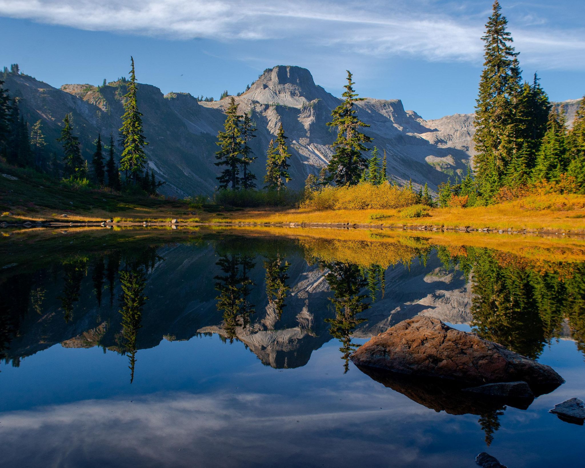
15. Heliotrope Ridge
5.9 miles | Difficult | 1,988 Feet Elevation Gain
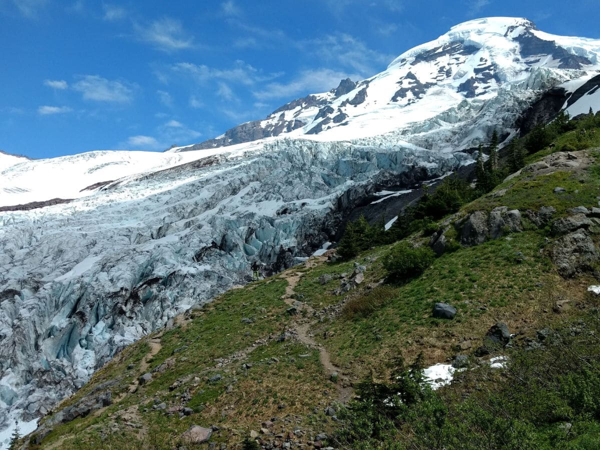
Heliotrope Ridge is a 5.9-mile out-and-back trail accessible in Deming, Washington. Generally regarded as a challenging route, it takes 3 hours and 19 minutes to complete.
This popular trail in the Mt. Baker Wilderness takes you through lush old-growth forest, flower-filled avalanche chutes, and steep moraines before reaching the icy alpine zone. The trail crosses Grouse Creek on a sturdy bridge and climbs slowly through deep woodland. The forest thins out as you rise higher in elevation, and huckleberries abound. The old location of the Kulshan Cabin lies just below the forest line. The landscape is rocky above the tree line, with herbaceous flora and several streams.
You can find a trail junction about two miles from the trailhead. The right fork rises 1,000 feet in a mile to Hogsback Camp, located at the base of the Coleman-Deming ascending route to Mt. Baker’s 10,781-foot summit. If you stay to the left, the trail reaches the most challenging of the route’s stream crossings. If you do not want to cross the stream, you must use the climber’s path to see the glacier.
You’ll come to a lateral moraine produced by retreating glaciers if you continue east after crossing the stream. The Coleman Glacier cascades down Mt. Baker’s sides into a tangle of ice, a spectacular sight from this vantage point. Climbers are often observed honing their ice climbing abilities in the ice blocks (seracs). You should never attempt to climb a glacier without the necessary equipment and expertise.
Along the Heliotrope Ridge Trail, you’ll come across multiple stream crossings. The depth of these streams varies dramatically based on various factors, including snowmelt, recent rainfall, and the time of day. By afternoon, a brook that was readily forded in the morning had turned into a roaring torrent. We strongly suggest bringing your poles when hiking this trail.
14. Table Mountain Trail
2.6 miles | Difficult | 725 Feet Elevation Gain

Pets are not permitted, and the trail is not suggested for little children due to the steep and challenging terrain. Glance up from the trailhead sign to find out why. The trail climbs the face of the vertical knob in front of you.
The course can be dangerous in any weather owing to snow, ice, or loose gravel. Make sure you’re wearing the right shoes and proceed with care. This trail will not appeal to acrophobes.
Start on the top trail, Table Mountain, from the northwest corner of the enormous parking area at Artist Point.
Shortly after, the trail starts as a rock-lined gravel path with its first switchback. It passes past fascinating rock formations on its approach to Table Mountain, where it begins its ascent in earnest.
After climbing 400 feet to the rock’s summit, a small side trail to the right leads to a fantastic view of Heather Meadows and its lovely lakes.
Continue down the somewhat flat “table” top’s south side. The main trail follows the south rim, affording steep vistas down the Chain Lakes Trail and the Swift Creek drainage. Reach the east side of the Table at 1.2 miles for panoramas of Ptarmigan Ridge, Mount Baker, and the Chain Lakes Trail, which lies 400 to 800 feet below.
The trail continues north for another 1.3 miles to a magnificent foreground for views of Mount Shuksan, where two tiny tarns form a lovely foreground. The trail leading north from the tarns is only a scrambling trail that leads to an uphill slope onto the Table Mountain Glacier before dropping precipitously to meet with the Chain Lakes trail 700 feet below.
13. Skyline Divide
9 miles | Moderate | 2,500 Feet Elevation Gain
The Skyline Divide, a 6000-foot-high northward extension of Koma Kulshan, turns into a midsummer haven with unmatched mountain scenery and endless floral meadows.
The hike begins at a trailhead kiosk that is well-signposted. Because the path is rather exposed, we recommend applying sunscreen before this hike.
The trail climbs 1500 feet in two miles to reach the ridgeline, so the slope is somewhat steep as you pass through a forest of western hemlock, mountain hemlock, and silver fir. Huckleberries grow late in the hiking season, while foamflower blossoms in the summer.
The dedication to trail maintenance by Washington Trail Association (WTA) has resulted in stairs and turnpikes that can resist up to 5000 pairs of boots every year. Fields of wildflowers blossom as you reach the timberline (elevation 5900 feet), and views of Kulshan appear through the woods.
Kulshan confronts you to the south as you burst out onto a ridgeline hill. The non-volcanic Shuksan, Kulshan’s second wife, lies to the east, while the High Divide is to the north. The trail splits to the left, leading to possible camping spots. Pass through the Mount Baker Wilderness on the right. The journey continues for another 2.5 miles along the gently rising ridgeline, passing through five knolls.
12. Horseshoe Bend Trail
2.4 miles | Easy | 220 Feet Elevation Gain
Mount Baker Highway has a hidden beauty that’s low enough to drive year-round and accessible to the entire family. It’s also an excellent site to experience the power of water.
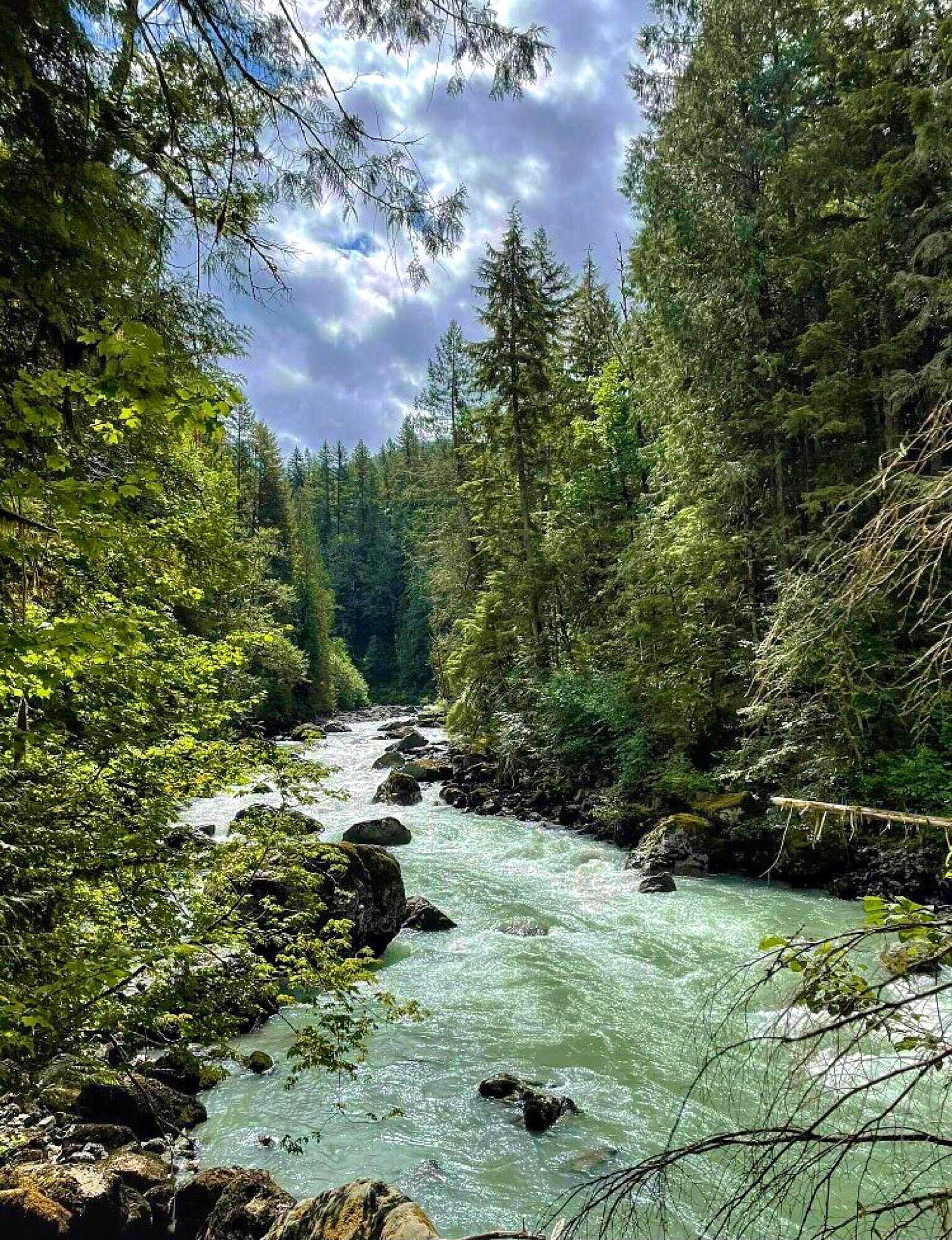
Paddlers and rafters who travel down the North Fork of the Nooksack River, which flows from Mount Shuksan’s glaciers, are in for a wild ride as it cuts past rocks the size of houses and other obstacles in its path.
Take the trail to the left as the roaring river squeezes its way through a tiny ravine. Proceed down a flight of wood stairs leading to the track from the luxury parking area at the river’s side. The trail climbs several stairs in a few hundred yards and enters the more profound and darker wood.
You’ll arrive at an area where a wonderfully positioned seat formerly stood at the river’s side after crossing a log bridge. The bench washed away years ago, but the supports that previously held it are still visible. However, you can still sit on a piece of driftwood and marvel at the Nooksack, which seems to erupt right before your eyes.
You can either continue or turn around at this point. The generally moderate riverbank trail meanders through a forest of gigantic moss-hung firs, hemlocks, and cedars that all but shut out the rain on those gloomy days.
Horseshoe Bend differs from the other trails on this list in that it is open all year round and welcomes pets. This is one of our favorite Mount Baker hikes for the whole family.
11. Goat Mountain Trail
8.2 miles | Difficult | 3,100 Feet Elevation Gain
The Goat Mountain Trail is ideal for those who like hiking uphill. The trail starts ascending immediately at the height of 2,500 feet. It levels off and proceeds west over an unusual tiny sidehill ridge, perhaps a lateral moraine or a fault scarp in this geologically confusing terrain, after roughly a dozen switchbacks and one mile of travel.
The cedar snags along the trail are remnants of a massive fire that ravaged the mountainside a century ago. The new firs and hemlocks offer shade, which keeps the understory and brush to a minimum – perfect for trail maintenance! Keep your eyes out for a Western White Pinecone on the trail, which indicates the presence of one of these uncommon trees.
A sign marking the entry to the Mount Baker Wilderness is passed at the 2-mile mark. Keep an eye out for a thin trail going to the east. The “Old Goat Trail,” which connects to an old lookout position, remains unmarked. The lookout is no longer active, but it may interest lookout enthusiasts. Because clouds often obscured the high peaks, several lookouts were established at lower altitudes. Lower lookouts provided a more incredible view in many cases.
Around 2.7 miles, the vistas begin to open up in earnest. Continue up a 5,200-foot bump through meadows to a fantastic outlook. The official trail continues for another half mile up a beautiful ridge crest, ending at 5,600 feet with views of rugged Mounts Sefrit, Shuksan, Baker, and others. The undocumented trail continues for another 0.8 miles and 1,000 vertical feet to the false high point of West Goat Mountain, which stands at 6,600 feet.
10. Winchester Mountain
3.4 miles | Moderate | 1,300 Feet Elevation Gain
The trail up to Winchester Mountain leads to an overlook at 6500 feet with panoramic views in all directions.
While you cannot view the lookout atop Winchester Mountain from the Twin Lakes parking lot, you may be able to glimpse the American flag fluttering from its neighboring flagpole. Similarly, you can see the trail winding from right to left across the treeless southeast slope.
Begin hiking up a somewhat steep trail dotted with blueberries from the trailhead between the two lakes. It swiftly emerges into the open, coming to a quarter-mile intersection with the High Pass trail. Continue straight, passing through several tight switchbacks lined with more blueberries and fireweed. The vistas enhance as you ascend.
The main trail continues straight for a short while before reversing direction to climb the hill immediately above. To the left is the snow path, a complex vertical scramble that should be considered if the circumstances make traversing the slope above too dangerous and you are equipped for snow travel.
From the peak, panoramas to the north are dominated by the High Pass route on Mount Larrabee and Border Peaks. The heads of multiple peaks, including Mount Shuksan and a portion of the Picket Range, are visible to the south and southeast. Mount Baker lies to the southwest, while Tomyhoi Lake and Tomyhoi Peak are northwest. Twin Lakes and the parking lot are located much farther down. There is plenty of space on the peak. Wander around photographing numerous sights or just rest and take in the views before returning.
9. Big Four Ice Caves
2.2 miles | Easy | 220 Feet Elevation Gain
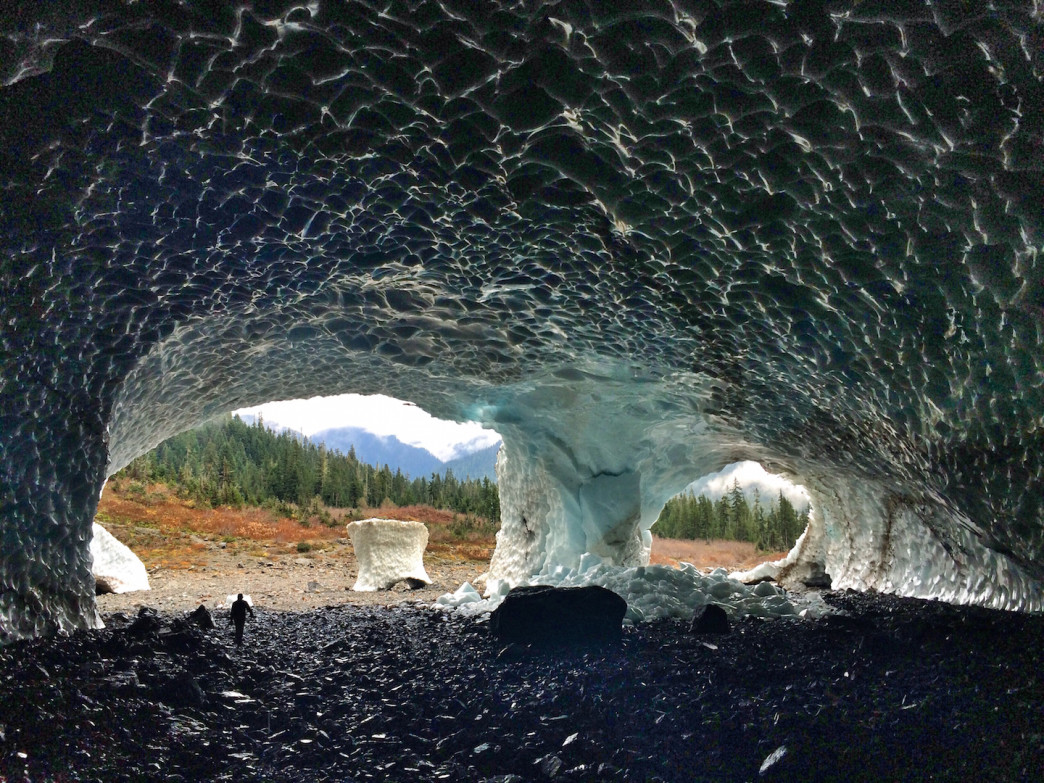
A large gravel and boardwalk trail leads to views of Big Four Mountain and the snow-covered caverns. This trail is suitable for all hikers.
Begin at the trailhead parking area and walk into the woods. See a big stump on its side, roots facing the trail. You will soon reach a crossroads. In the location of a historic hotel today, just a big chimney remains. A walkway spans a marsh to a green meadow with a picnic place.
Continue straight ahead, crossing the Stillaguamish River on a high-altitude metal bridge. Consider looking down to see the original path.
You’ll soon cross Ice Creek right before it enters the Stillaguamish. The trail continues into the woodland on a moderate incline of gravel and boardwalk.
Admire nature’s might in the wind-snapped trees near the trail. The trail continues onto an open meadow alongside a brook. Now you can see Big Four Mountain and the waterfalls cascading down the rock face. Take a little trek from the mountain to see the trailside wildflowers. Late April brings trillium, valerian, queen’s cup, and vivid pink fireweed.
After that little trail, you can now see the caverns. They are snow caves formed by melting snow, cliff waterfalls, and the wind beneath an avalanche chute. Do not enter or climb the caves! Despite their inviting appearance on a warm day, signs warn of danger.
The trail finishes in a rocky circle to safely see the caverns, Big Four, and surrounding splendor. Take the walkway back to the vehicle, looking for birds, dragonflies, and frogs. Enjoy a picnic and the ruins of a historic hotel.
Bring a blanket and a thermos of hot chocolate if you’re camping nearby to relax on the grass in the meadow and stargaze. The views are just too incredible!
8. Picture Lake
0.5 miles | Easy | 6 Feet Elevation Gain
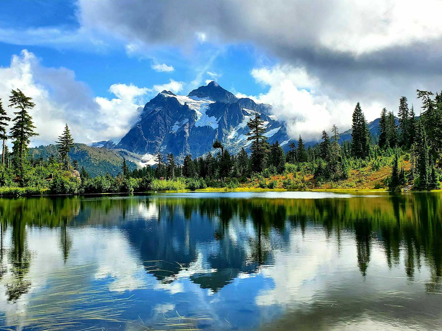
Picture Lake is picture-perfect! Grab the camera because you won’t miss an opportunity to snap a shot of this fascinating panorama.
It is an excellent addition to the list at half a mile long. Because it’s so flat, it’s perfect for hikers of all levels.
Picture Lake highlights the beautiful scenery in the Heather Meadows region. The iconic alpine panorama of Mt. Shuksan reflected in Picture Lake is one of the most photographed mountain vistas in North America. The background of mountains, wildflowers, and vibrant plant leaves make this a magnificent, universally accessible family trip.
Summertime installation of sign panels with information and a viewing scope will allow visitors to enjoy the paved viewpoint in all its glory. A place to relax is available on a platform that juts out into the water.
There are no designated accessible sites along Mount Baker Highway at the trail’s north end. However, one designated accessible place is in the paved parking lot off Mount Baker Highway, approximately a mile to the south. It has been identified with a waypoint. A boardwalk (with rails), gravel, or a natural surface is often used as the trail’s surface, and it is at least three feet wide.
This is one of our favorite hikes on Mount Baker for gorgeous water views! Seriously: it can’t be missed.
7. Lake Ann Trail
8.2 miles | Moderate | 1,900 Feet Elevation Gain
From the trail to Lake Ann, you can see Mount Shuksan’s west face, Fisher Chimney, the Curtis Glaciers, and Mount Baker. Stunning landscapes surround the lake in a rocky basin. You can even hear ice crashing down Mount Shuksan’s face on certain days.
The trail starts from a paved parking area right below Artist Point. Hike downhills through sub-alpine woodland. You’ll soon see a sign indicating you’ve entered Mt. Baker Wilderness.
After leaving the woods, the trail leads to a beautiful alpine basin. The trail descends past boulder fields, dry creek beds, meadows, wildflowers, and clear-flowing streams. It is part of Swift Creek’s headwaters.
You can spot Mount Shuksan and your destination across the basin.
The trail becomes simple, flat, and well-maintained, with vistas of Baker and Shuksan.
When you emerge from the jungle, glance back to your beginning location, and you’ll have views of Artist Point, Ptarmigan Ridge Trail, and Baker. Continue up talus slopes, heather meadows, and rocky basins, listening for pika squeaks and marmot whistles. Enjoy the wildflower displays as your views of Baker fade.
You will pass Lake Ann and come to a T as you continue down. The right trail leads to Lake Ann, with campsites and a climber’s path to the foot of Lower Curtis Glacier, the Fisher Chimney route for Mount Shuksan. The true treasure at this trail intersection is a close-up view of Mount Shuksan’s west face. Enjoy the perspectives before heading down to the lake or the route to Lower Curtis Glacier.
Lake Ann is a beautiful trek with a modest trail, although it may be busy. If you’re thinking about traveling, remember to leave no trace, especially if staying overnight.
6. Excelsior Peak via Damfino Lakes Trail
5.2 miles | Difficult | 1,558 Feet Elevation Gain
If you want to get your pulse pounding without spending all day mounting traverses, the Damfino Lakes Trail to Excelsior Peak is for you! This is one of our favorite hikes on Mount Baker for anyone who enjoys some serious exercise.
The trail starts in an old-growth forest that is dense enough to give shelter but thin enough to enable filtered sunlight. It connects with the Canyon Ridge trail two-thirds of a mile from the trailhead for a brief rise.
After a quarter-mile of flat ground, the trail ascends again through shaded woodland until it reaches slightly over 5000 feet. The forest gives way to grassy meadows and views of Excelsior Pass at 2.0 miles.
An apparent boot trail leads up to the summit of Excelsior Peak just uphill of the wooden pole. From the parking lot, this straight path is 5.6 miles round trip. Alternatively, the High Divide trail, which runs parallel to the peak, can be followed straight ahead. Follow the High Divide Trail, which slowly ascends through lupine and sedge if you have the time.
This portion of the trail is gorgeous in the fall. Another Divide pass is about a half-mile from Excelsior Pass. A boot route ascends Excelsior Peak from the east on this one. Continue as far as you like along the Divide.
Then, on your way back, climb Excelsior Peak’s boot route to the peak and take in the 360-degree vistas. You can return to the trailhead on a familiar trail by following the west boot way down to Excelsior Pass. Even if you don’t venture farther along the Divide, this suggested loop is just a 6.4-mile round trip, providing plenty of time for additional activities.
5. Bagley Lakes Loop
2.2 miles | Easy | 259 Feet Elevation Gain
Enjoy a family hike in Heather Meadows!
You can experience two dazzling alpine lakes, wildflowers, a stunning mountain background, and a year-round snowfield on this hike. In late summer, this trail has a fraction of the foot activity of the Artist Point trails.
Bagley Lakes is a loop, but families with young children can choose to travel out and back. Begin at the Bagley Lakes and Wild Goose trails parking lot. Turn right just beyond the trailhead and descend 60 feet to Lower Bagley Lake at the foot of Mount Herman. Hike down the trail that goes along the east side of the lake.
The trail is simple for small ones, and the wildflowers are beautiful. The source becomes a burbling stream for a quarter mile as the vistas of Table Mountain and the cirque below it open out. Cross the stream at Upper Bagley Lake and go along its northwest coast. There are areas to put your toes in the icy water or relax and enjoy the scenery.
The year-round snowfield in the upper half of the lake is ideal for a quick trip. It takes some skill around a stone wall to get there. The kids can toss snowballs, and everyone can observe the braided stream that leads to the lake. It is important to note that no one should play on the snow bridge that spans the brook since it might break.
Use the Chain Lakes trail around Lower Bagley Lake to complete the loop. Some boulders and seasonal streams make it a little more complicated than the trail, but most kids over four can do it. This trail crosses the lake’s outlet through a small dam. Return to the parking lot by turning left after the barrier.
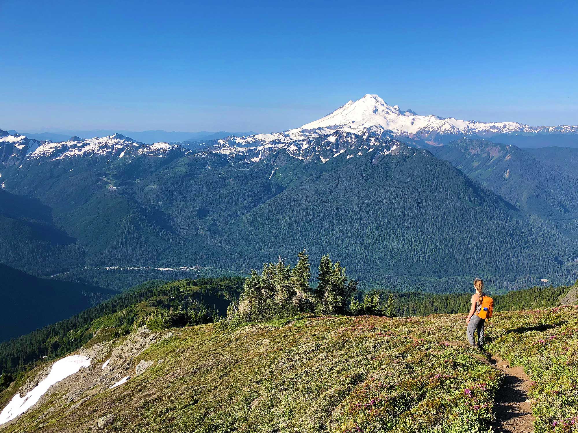
4. Yellow Aster Butte Trail
7.5 miles | Difficult | 2,550 Feet Elevation Gain
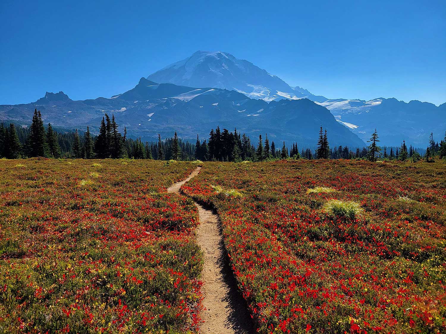
Yellow Aster Butte is a popular North Cascades route with views of Canada and vast floral fields. The High Divide Trail climbs the south-facing slopes of Mount Baker Wilderness. Spring and early summer wildflower displays are stunning as you rise. The hillsides become orange, crimson, and yellow in the fall. It is an incredible spot at any time of year and is well-known. We advise early arrival if you wish to camp on the route. Remember that all campsites must be 4 miles from the trailhead tarns.
The route immediately ascends from the trailhead. Hikers heading for Tomyhoi Lake will share the path on this steep climb that reaches about 1500 feet in a little over a mile.
The Puget Lobe’s retreat north sculpted some intriguing rock formations for the geologically inclined. Photographers will enjoy the beautiful vistas of Mounts Baker and Larrabee, the western High Divide, and the Canadian Border Peaks.
A mile and a half from the trailhead is the Yellow Aster Butte intersection. To the left is your destination. Right leads to Tomyhoi Lake, 2.5 miles distant.
The route to Yellow Aster Butte smoothens out as it follows the mountain’s south side. You can relax and enjoy the scenery for about two miles until you reach an unmarked intersection 3.6 miles from the trailhead.
Backpackers should leave their heavy bags at camp. The trail descends to the camping location through tight, steep switchbacks. Day hikers should turn right to reach the top of Yellow Aster Butte. The views from here are breathtaking, with Baker, Shuksan, Tomyhoi, and a slew of other craggy, snow-covered peaks dotting the horizon.
This is one of our favorite hikes on Mount Baker for flowers!
3. Park Butte Lookout Trail
7.2 miles | Moderate | 2,021 Feet Elevation Gain
Park Butte Lookout Trail is a Washington State Snopark utilized for snowmobiling in the winter. While hiking and snowshoeing are always permitted in this region, snowmobilers must share the roadways.
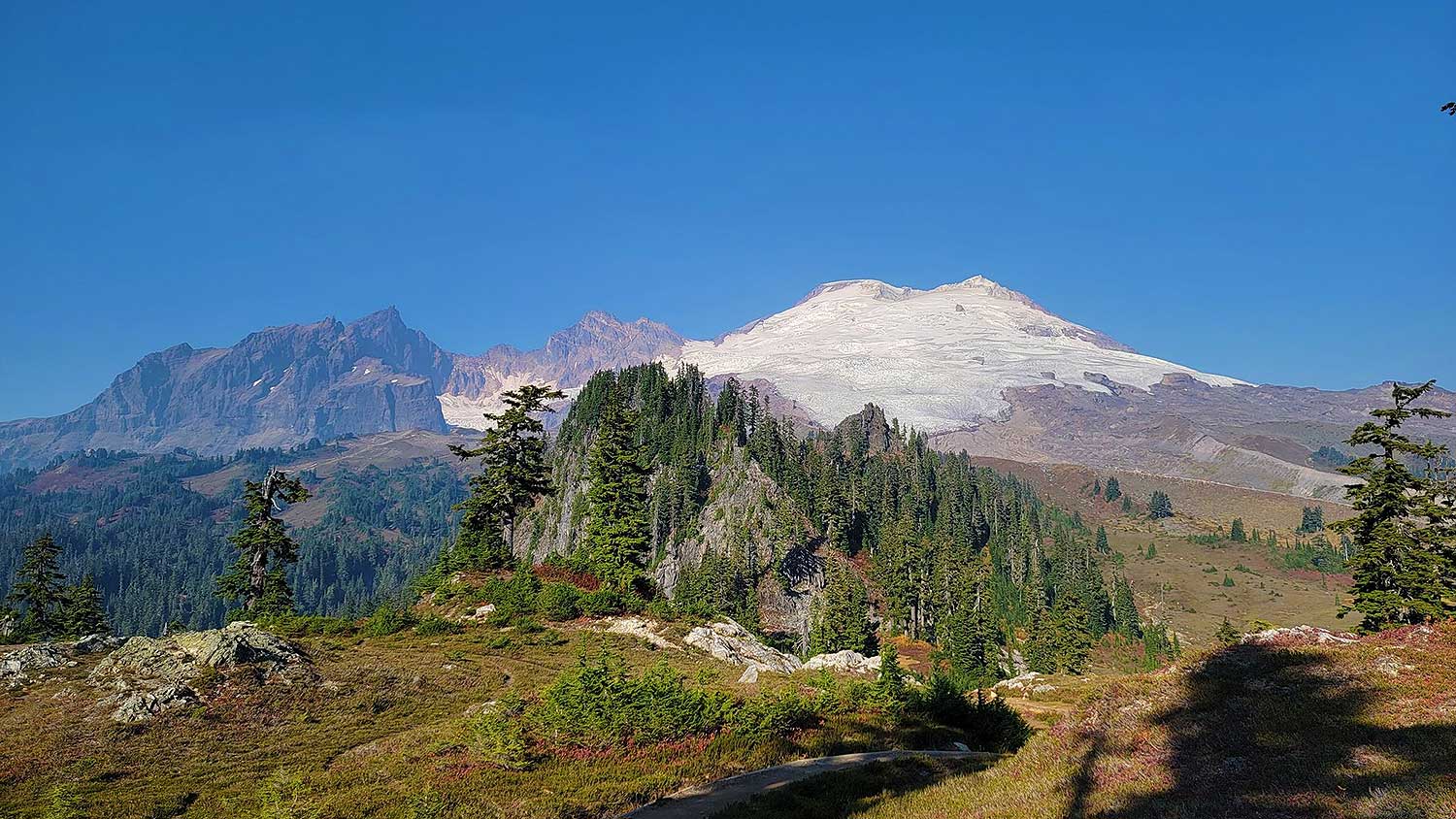
Take in spectacular views of Mt. Baker and its glaciers throughout the trail.
Begin your journey at the Mt. Baker National Recreation Area and make your way to the lovely Schrieber’s Meadow.
On the right, approximately 100 feet from the trailhead, is the Scott Paul Trail intersection.
Continue beyond the fork in the road and into Schrieber’s Meadow’s waist-high huckleberries and heather. This trail stretch offers east-facing views of Survey Point and is a terrific two-mile round trip for families.
After that, you’ll come to Rocky Creek, which may be difficult to cross during seasons of solid flow. The second intersection with Scott Paul Trail 603.1 is reached after the first-mile ascent and switchback through the woodland. Continue down Park Butte Trail to Morovitz Meadows by staying left at the fork. The broad meadows provide vast vistas, making this a popular rest stop.
Stay left at the next intersection to reach the Park Butte Lookout. The next trail intersection is close to Cathedral Camp. Park Butte is on the left at this junction. On the left, the trail levels off and passes over the beautiful Pocket lake. The last half-mile rises sharply to the overlook at 5,400 feet, marking the start of the Mt. Baker Wilderness.
2. Artist Ridge Trail
1.2 miles | Easy | 200 Feet Elevation Gain
The short hiking season draws a lot of hikers to this stunning trail. This is one of our favorite hikes on Mount Baker for the views!
Accessible for fewer than three months each year, crowds of hikers and tourists go to it when the snow finally starts to melt. The first heather blossoms appear in August, signaling the environment’s fragility, distinguished by elderly and deformed trees, barren patches, and side routes that branch off from the main trail.
On the Artist’s Ridge trail, you can see this. The vistas don’t get much better from elsewhere, and the trek is so short that there is no need to take a shortcut on the way back. If you walk to Huntoon Point, please keep on the graveled path. Leash laws are also required for dogs.
It may be pretty snowy in the Artist Point parking lot, even in late summer. Trail access isn’t always possible because of snowmelt, so climb up onto the ridge (just to your right of the restrooms) before heading out toward Mount Shuksan. If access is possible, turn left onto the trail.
Even though Shuksan and Baker tower over the trail, there are other peaks to the north, including American Border Peak, Mount Larrabee, Goat Mountain, and even Mount Stuart to the south. The ridge’s twisted trees and stumps show the massive amounts of snow it receives each year. Photographers will love the glacial tarns that dot this terrain. For a fleeting moment in the waning days of summer, tenacious flowers show their buds.
There is little privacy on a bright day here, but hikers coming early in the morning will find the fewest people and the most delicate sunshine for photography.
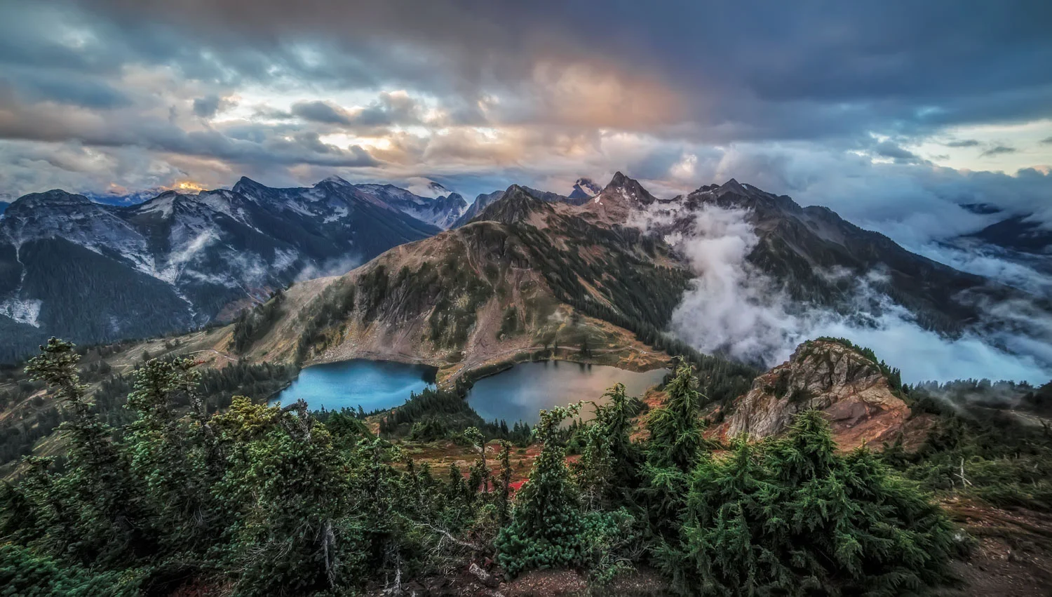
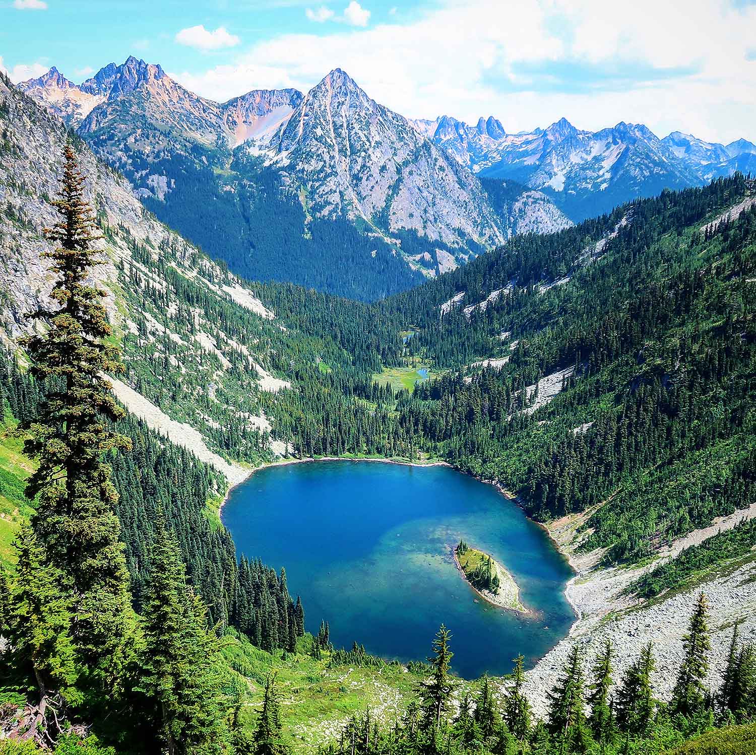
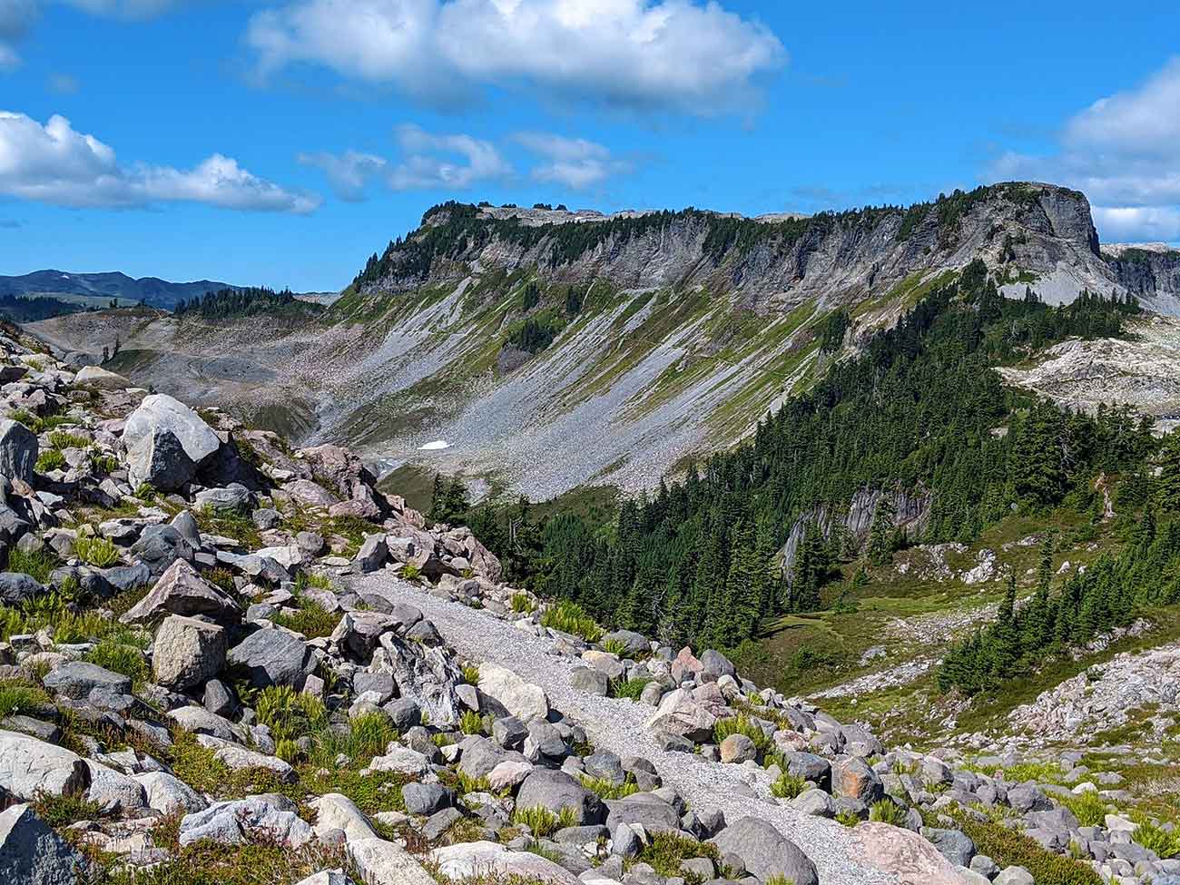
1. Chain Lakes Loop
6.5 miles | Moderate | 1,820 Feet Elevation Gain
This stunning circular hike has it all: panoramic views of Mounts Baker and Shuksan, as well as the North Cascades, swimming in alpine lakes, and a well-kept trail weaving through meadows and heather. You can’t go wrong with wildflowers in the spring, blueberry bushes for trailside munching in the late summer, or flaming color in the fall.
This description is for two ways of the same loop, both of which provide spectacular vistas and lots of trailside treats. Because this is a loop trek that you can access from three different parking lots, this trip has several possibilities, while some are better than others. There are eight sites here, including four at Mazama Lake and four at Hayes Lake. If you intend to go camping, keep in mind that only authorized areas marked with a tent logo are permitted.
Because certain areas might be difficult to follow, we suggest bringing the app or downloading the map for guidance.
There are several rough and steep portions, so wear strong shoes. Bring sandals or water shoes since the grounds are rocky if you want to go swimming or merely dip your toes in the lakes.
If you’re driving back from the mountains, make a pit stop at Deming’s Beer Shrine (North Fork Brewery), where the food and drinks, including root-bottled beer, are made perfectly.