15 Best Hikes In Vermont

Hiking in Vermont provides a wealth of breathtaking mountain vistas, spectacular waterfalls, and fascinating history. It’s one of our favorite hiking states year-round!

Despite its modest size, Vermont has a wide variety of hiking opportunities. Depending on your skill level, you can choose a steep 8-mile climb or a half-a-mile trek that offers gorgeous scenery. Other routes will take you to the state’s highest waterfalls, while others will take you to the top of a mountain for spectacular views.

Vermont’s abundance of open space and wildness means it is also a great spot to see animals and flora. And the four New England seasons offer plenty of opportunities to see a bit of everything!

Aside from The Long Trail, we’ve compiled a list of the best hikes in Vermont to help you plan a fantastic outdoor adventure, regardless of your hiking expertise.

15. Bingham Falls

0.5 miles | Easy | 144 Feet Elevation Gain
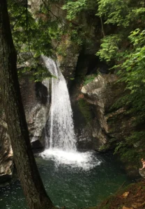
Best Hikes in Vermont: Bingham Falls, stunning scenery & unforgettable trail

Bingham Falls, located in Stowe in Vermont, is one of the most incredible simple treks if you’re looking for something short and sweet with a nice payoff at the end. You can take in breathtaking vistas of waterfalls and green pools along this half-mile-long woodland walk.

As a result of its simple accessibility, stunning geology, and photographic potential, Bingham Falls has rapidly become one of Vermont’s most famous waterfall treks. The journey down to the falls is just about a quarter-mile long, but it becomes steeper and more slippery as you get closer to the bottom, so you’ll want to wear excellent hiking shoes with plenty of tread.

Some portions of the route are close to the gorge’s cliffs. All visitors, particularly youngsters, should remain clear from these edges, even if they’ve been roped off, thought that goes for just about all hikes in VT. Accidental drowning is a real possibility if you venture into the gorge.

The hike begins with a gradual ascent over a broad path that leads to the gorge’s summit. You can choose to continue on the upper gorge route or go down to the falls at a split in the trail.

Views from the upper gorge are breathtaking, with the river carving its way through the rock wall in snake-like arcs. After a short distance, you’ll come upon a seemingly tranquil body of water. Hikers should avoid swimming in this pool because it funnels into a high-speed water vortex that may be dangerous, even though it looks calm.

At the first trail junction, take a right down a narrow stone path, using the stones as stairs to get to the falls.

This is one of the best easy hikes in Vermont that still offers really stunning views!

14. Thundering Brook Falls

0.4 miles | Easy | Minimal Elevation Gain
Best Hikes in Vermont: Thundering Brook Falls, stunning scenery & unforgettable trail

If you’re looking for a quick and easy way to see another of Vermont’s stunning waterfalls, Thundering Brook Falls is the trek for you.

Thundering Brook Falls plunges 125 feet over rugged metamorphic rock only minutes from Killington’s legendary slopes. Even if you just have 20 minutes to spend at the falls, you’ll find yourself mesmerized by the sound of the water crashing against the rocks below.

If you’re lucky enough to see it in the winter, you’ll be in for a treat: the cliff face is covered with snow and frozen icicles. But it’s gorgeous in the warm months, too!

To get to the falls, you’ll need to park in the nearby lot and then walk through the marsh along the boardwalk. As a result of its closeness to civilization, the marsh’s core might seem a little wild. We suggest bringing binoculars for birding in this area.

Before entering the woods, the boardwalk travels 0.2 miles through the marsh. To the left of this point, the Appalachian Trail has white blazes. Trail markers in blue blazes point the way to a viewing platform above the falls 100 yards to the right.

The deck provides views of the lower two falls, tiers at a 45-degree angle, and about 90 feet above Mount Holly Gneiss slabs. Running water creates windows in the heavy snow cover, revealing the bedrock’s complex folds and sharp edges throughout the winter months. The mini-hydro powerplant operated by a private company is also clearly visible.

In very slippery winter circumstances, this is when the majority of tourists will do a U-turn. However, if you go up the hill next to the observation platform, you’ll witness a 35-foot waterfall and two smaller cascades upstream, making the falls much more spectacular.

If you want to see insane sights (mainly of the waterfall), then this is one of the best easy hikes in Vermont to do so.

13. Owls Head Mountain

3.2 miles | Easy | 475 Feet Elevation Gain
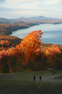
Best Hikes in Vermont: Owls Head Mountain, stunning scenery & unforgettable trail

The Sargent Ponds Wild Forest includes Owls Head Mountain, encompassing 45,000 acres. This notable mountain in the Long Lake region has four distinct peaks, two known as the “horns.” These horns lend the mountain the appearance of a great horned owl’s head.

If climbing a tower isn’t your thing, the top cliffs of Owls Head provide magnificent scenery, too. A 35-foot-tall fire tower, which replaced the previous wooden one, stands on the mountain’s highest peak. The building was abandoned in the 1970s but restored by volunteers and is again open to the public.

This location has a beautiful wetland with a lengthy boardwalk.  After approximately a mile, you’ll come to a three-way crossroads with a route that leads straight to Lake Eaton for about 4 miles. To continue climbing Owls Head, turn left here. The trail stays relatively simple for another mile before beginning to rise as it commits to gaining elevation progressively.

The trail descends shortly from the high ridge before entering a tiny valley at the actual summit’s base. The long ascent eventually ends at a col between two of Owls Head’s lower summits. Only the cement footers and a pail remain of the fire observer’s cottage, located in a spectacular white birch standing in this valley.

The last hike to the peak is quite tricky, with some slab rock and high stairs to navigate. The route leveled down before the fire tower base came into view, so the steepness doesn’t last long.

You have a fantastic view of the Long Lake below, with Blue Mountain in the distance from the partly open peak. A mind-blowing 360-degree view greets you from the tower!

Climb the stairs to glimpse the Central Adirondacks and the distant High Peaks. The Seward Mountains dwarf everything in the region.

12. Mount Olga

1.7 miles | Easy | 520 Feet Elevation Gain
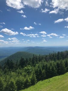
Best Hikes in Vermont: Mount Olga, stunning scenery & unforgettable trail

Molly Stark State Park has the Mount Olga Trail, one of southern Vermont’s best-kept secrets. The 1.7-mile route takes around 90 minutes to complete depending on how long you stay. Though it’s possible to go around the well-maintained trail in a short amount of time, you can choose to take your time and appreciate it.

This is definitely one of the best easy hikes in Vermont. It’s a short but rewarding trek, with a panoramic view of southern Vermont and northern Massachusetts from a fire tower.

The Mount Olga Trail (blue blazes) departs the picnic area on the right side of the ranger house and gradually ascends. In 2003, a lightning strike delaminated a tree, leaving its trunk arcing across the trail.

The route comes to a “T” after 0.7 miles. Turn left and climb over a slab of rock, passing three derelict cottages along the way. You can spot communications and fire towers just ahead of the fire tower.

Continuing, follow the Mt. Olga Route back to the campsite via a short offshoot trail. Take the southern loop (turning left) and track the route to descend into a mixed hardwood – evergreen forest.

The path crosses tiny drainage on a wooden bridge around 0.2 miles from the fire tower trail intersection. At 0.5 miles, the route swings west (left) and follows a stone wall, swiftly reaching the Shearer Hill Trail crossing.

Along the stone wall, follow the signs for the Mt. Olga trail. The route turns north (right) at the end of the stone wall and immediately meets the campsite road. Return to the parking lot and park office by turning right.

11. Quechee Gorge Dewey Pond Trail

1.4 miles | Easy | 147 Feet Elevation Gain
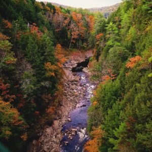
Best Hikes in Vermont: Quechee Gorge Dewey Pond Trail, stunning scenery & unforgettable trail

Vermont’s deepest canyon was carved nearly 13,000 years ago by glacier meltwater. If you’re looking for a spectacular view as you descend, this is the trail for you. It also has a large fence that stops youngsters from rushing over the ledge and below the canyon.

Family-friendly is what “Hike it Baby” is referring to. It is an excellent place for kids to run about and parents to relax. Just keep going, and you’ll find little pools to play about in and a beautiful river to walk in at the bottom.

Looking up at the gorge from the bottom will make you feel so tiny. This is one of the best hikes in Vermont for stunning views after a short climb!

All seasons are lovely times to come but we recommend summer and fall for the most spectacular views.

The 0.2-mile uphill portion of this journey may need some assistance from adults, so keep that in mind if you’re doing it with kids. Also, nursing benches are available for both new parents and exhausted children. Hiking in Vermont is difficult with children, but this is definitely the place to do it.

Quechee State Park is home to a wide variety of bird species, including the Canada goose, yellow-rumped warbler, mallard, northern goshawk, golden eagle, bald eagle, red-tailed hawk, veery, blue jay, Northern harrier, osprey, red-shouldered hawk, black-throated warbler, white-throated sparrow, scarlet tanager, and mourning dove.

If you prepare ahead and make reservations, there is a campsite. There are 45 tent/RV spaces at the campground and two facilities with showers. This is one of our favorite Vermont hiking spots when we want to spent the whole weekend.

10. Hamilton Falls

5.8 miles | Moderate | 757 Feet Elevation Gain
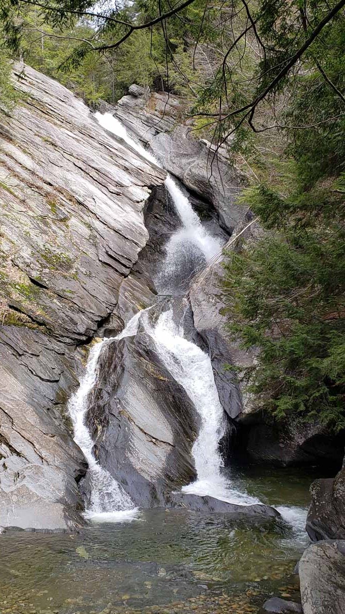
Best Hikes in Vermont: Hamilton Falls, stunning scenery & unforgettable trail

In the Ball Mountain State Recreation Area, this trek blends the natural splendor of Vermont’s forests with some exciting rock formations, culminating in a beautiful cascade at the finish. You’ll get some exercise without burning yourself out since this is a moderate trail.

Take the West River Trail from Jamaica State Park’s campsite if you want to see one of Vermont’s tallest waterfalls in an untouched natural environment. The Dumplings, a clump of stones beside the West River, can be found in this former railroad bed.

Initially, it’s an easy Vermont hike, but it becomes progressively more difficult as you near the falls. When you reach Hamilton Falls, however, the effort is well worth it since you will be able to enjoy the breathtaking environment and natural splendor that surrounds the waterfall.

To reach Hamilton Falls, continue on the West River Trail 1.5 miles beyond The Dumplings and bridge Cobb Brook. After a mile or so, you’ll see a steep slope on your left. Here you can get a good look at the 125-foot waterfall from the most significant vantage point.

There is a T-intersection at the top of the falls, where a left turn will take you to the summit. Trying to swim or climb the falls’ brink is dangerous and should be avoided at all costs.

9. Cantilever Rock

3 miles | Moderate | 1,092 Feet Elevation Gain
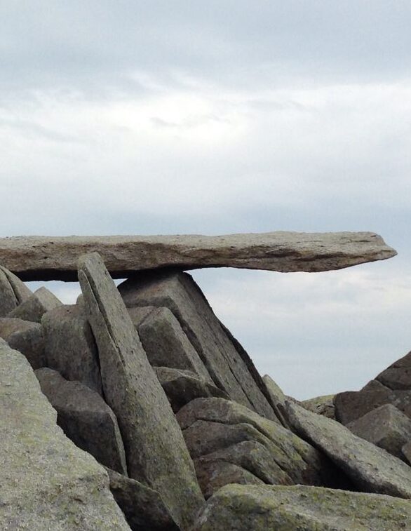
Best Hikes in Vermont: Cantilever Rock, stunning scenery & unforgettable trail
pinterest.co.uk

The Cantilever Rock route in Vermont’s Underhill State Park is a 3-mile journey that leads to one of the strangest rock formations in the state. The Cantilever Rock protrudes perilously out of the side of a cliff at the end of this woodland trail, which takes hikers down dirt roads and across wooden bridges.

There is a stunning view of mountains and terrain as far as the eye can see as you get at the end of the path, with a rocky peak to meet you at the top.

Starting at the New Discovery Campground, this well-marked walk offers spectacular views of the Green Mountains, Lake Groton, and Kettle Pond. The Maintenance Road or the North Parking Lot is where you can leave your cars.

Beginning at the North Parking Lot, you’ll have to walk an additional 0.8 miles each way. Despite the occasional ups and downs, hikers can access the rocky terrain of all ability levels. Along the way to the summit, there is a picnic pavilion where you can stop for a bite to eat.

8. Mount Pisgah

4.1 miles | Moderate | 1,653 Feet Elevation Gain
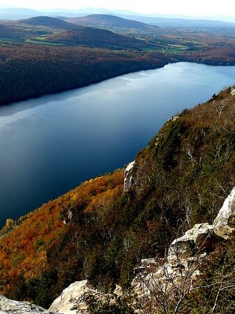
Best Hikes in Vermont: Mount Pisgah, stunning scenery & unforgettable trail

Mount Pisgah, one of Vermont’s most popular trails, is known for its breathtaking views of the surrounding mountains and Lake Willoughby. This Vermont hike near Orleans, Vermont, offers some of the best pictures in the state, especially in the fall when the leaves turn the forest scarlet and gold.

Mount Pisgah’s peak can be reached by a moderately inclining route, with stunning views both at the top and on the way up.

To the summit of Mt. Pisgah, you’ll find this shady and lovely route. There are several points of reference along with the approach to the summit. The trip isn’t challenging, but it can be tiring, especially for new hikers.

You’ll see Lake Willoughby and its lush surrounds best on a clear day, so consider hiking beyond the peak. To avoid the crowds, start early. Out and backing the path will take you between two and three hours.

There is a vast Mt. Pisgah information board where the path begins. Rosebay, Catawba rhododendron and mountain laurel fill the first half of the trail. After there, the route takes a left turn, becomes narrower, and climbs on logs. The short side route on the right provides your first excellent northward views at 0.8 miles – lots of layers of mountains.

The ascent is made more accessible by the presence of an abundance of spring and summer flowers along the way. You can see the high tower atop Frying Pan Mountain from the southwest just before the route makes a right turn at 1.1 miles.

Slopes become steeper from here on out. You can spot the tower in front of you as the route switchbacks on log stairs closer to the summit.

This is one of the best hikes in Vermont for semi-experienced hikers who want stunning views and a moderate climb.

7. Ice Beds Trail

1.6 miles | Moderate | 538 Feet Elevation Gain
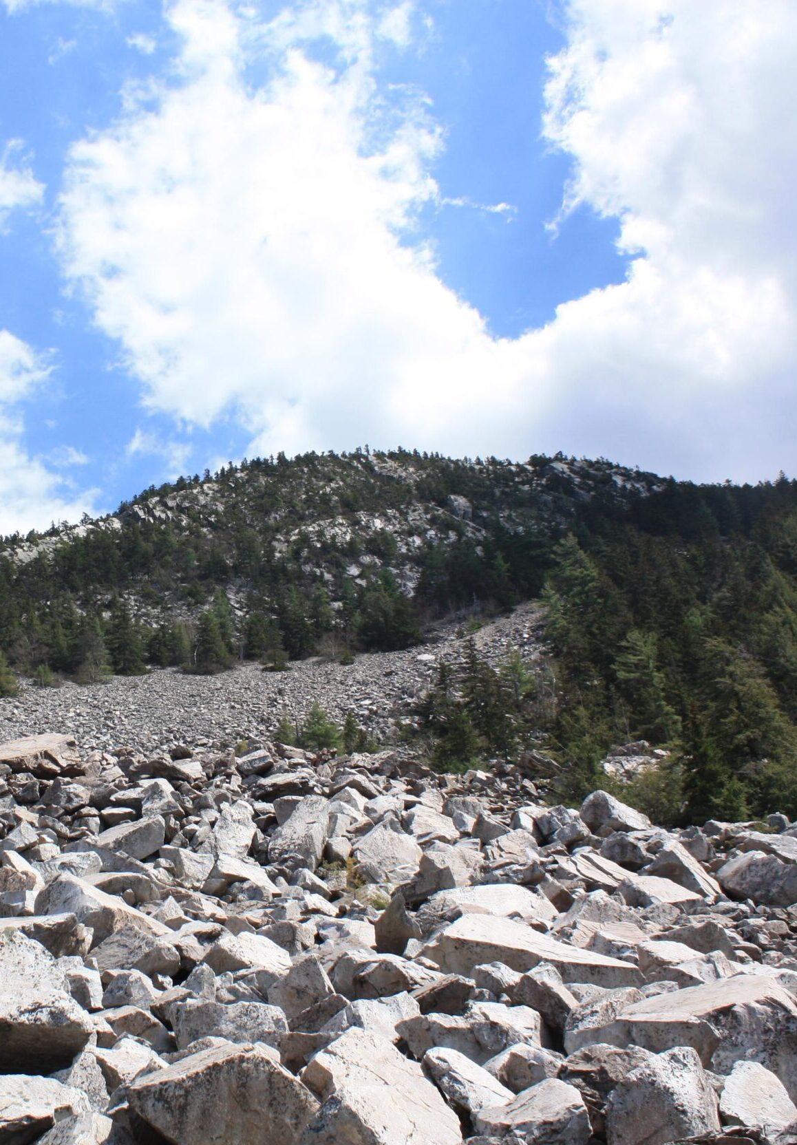
Best Hikes in Vermont: Ice Beds Trail, stunning scenery & unforgettable trail

The Ice Beds path near Wallingford, VT, is a great area to get your scrambling on while also taking in some of Vermont’s most stunning vistas. Despite its short length, this route ends in a boulder field where you may clamber to your heart’s delight.

There’s a stunning view of the surrounding mountains, as well as lots of rocks where you can sit back and relax. Make sure to carry waterproof hiking boots and thick socks to keep your feet and ankles safe from sliding on the mud-strewn terrain.

The Ice Beds parking area in Vermont’s Green Mountain National Forest is the starting point for this 1.6-mile roundtrip trek. The trailhead can be found by following the blue-blazed path from the parking lot entrance. The trailhead at the other end leads to the cliffs, not the ice beds, so pay attention to the signage.

The initial stretch of the path, which is rough and tough, is the most challenging part of the whole trek. There are multiple switchbacks to climb after crossing a stream, and the path reaches its highest point after 0.02 miles. A side branch leads to a spectacular panorama of the northern White Rocks Cliffs at the knoll.

For the next 0.1 kilometers, you’ll reach a new viewpoint with vistas of the cliffs and the valley down to the south. After taking in the scenery, return to the main route, which descends to an ancient woodland road.

Following an old road downward, the trail eventually comes to a river crossing that takes a left turn. The route follows the stream to the foot of the talus pile of enormous boulders from here. In the depths of this mound are the ice beds.

If you decide to ascend the talus pile, do it with care. Bring hiking boots that are both comfortable and supportive. For dogs to be permitted in the park, they must be on a leash at all times.

While this is one of the shortest Vermont hikes, it’s also one of the tougher ones, so be prepared to get agile.

6. Mount Abraham

5.1 miles | Moderate | 1,765 Feet Elevation Gain
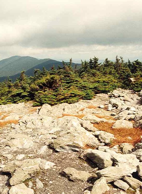
Best Hikes in Vermont: Mount Abraham, stunning scenery & unforgettable trail

Mount Abraham in Bristol, Vermont, is a shorter but no less complicated summit walk. This beautiful mountain peak trek is quite challenging, but the vistas are worth the effort, particularly in the fall when the foliage is at its height. This is one of the most gorgeous Vermont hikes by far!

You’ll need to scramble up this mountain if you want to reach the top, so be prepared. Above this mountain, you can enjoy one of Vermont’s most breathtaking views.

At the Lincoln Gap parking area, you can begin your trek. You can reach Mount Abraham’s peak in 1.1 miles by following the Long Trail to the north. Following the Long Trail for about 1.7 miles, you will come to a junction with the Battell Trail on your left. To return to the trailhead parking lot, retrace your steps back in the opposite direction you came.

Many hikers prefer to “peak bag” Mount Abraham by adding Mount Ellen to their itinerary, resulting in a 10.8-mile round trip with a 3,290-foot elevation gain in total.

Lincoln Gap is closed during the winter months, unlike other Vermont hikes. Be sure to check on the weather forecast before you go though, even in the warmer months.

If you plan on hiking the Long Trail from Lincoln Gap, be prepared to add a significant amount of mileage roundtrip to your overall hike. Snowshoes, traction, and winter equipment will be necessary.

It’s essential to remember that this path can get quite busy, particularly on weekends during peak hours. But hiking in Vermont (anywhere) is crowded during the weekends! We suggest going out during the week or early in the morning for the finest views and the fewest people.

5. Camel’s Hump Trail

6 miles | Moderate | 2,578 Feet Elevation Gain
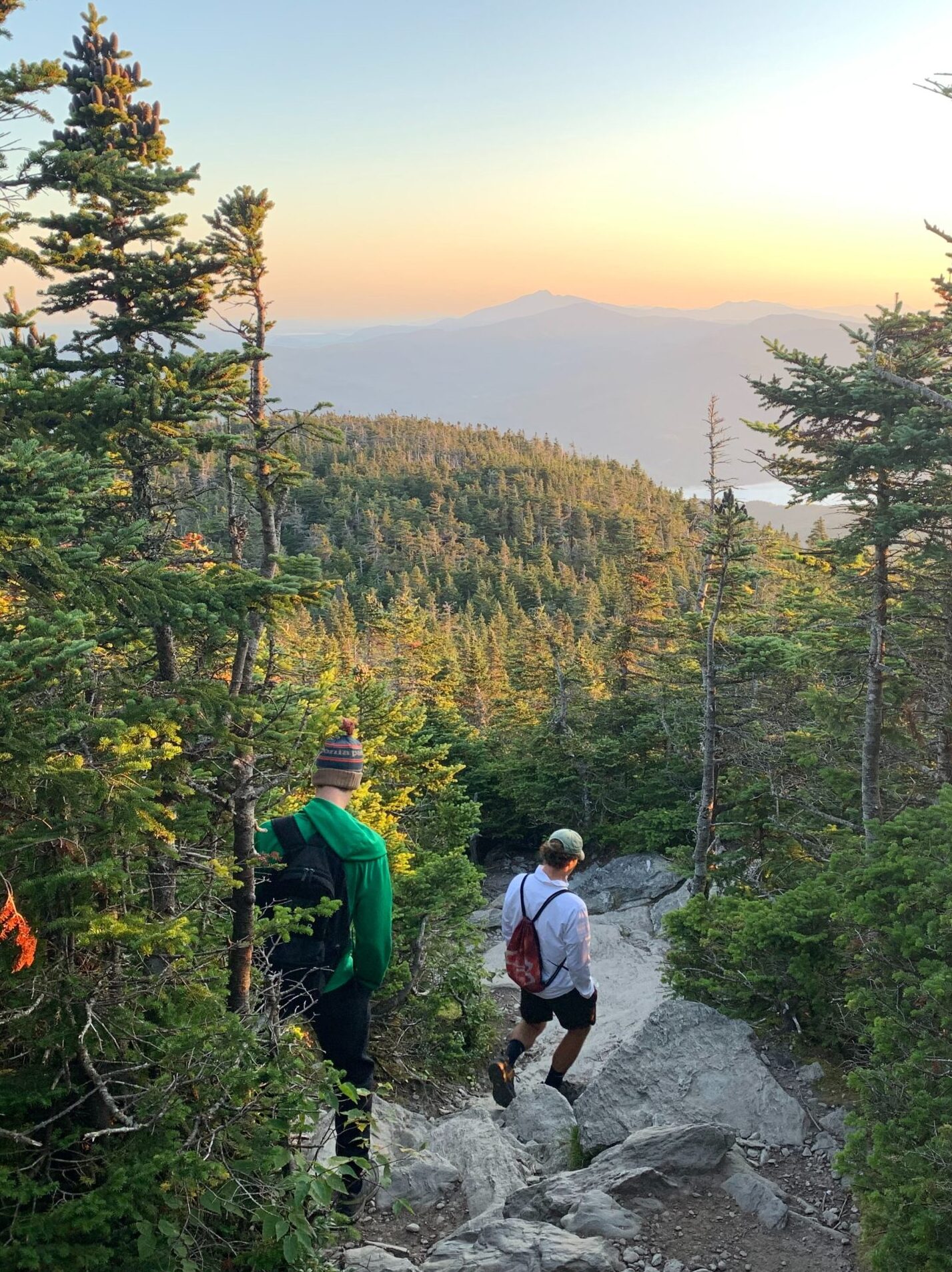
Best Hikes in Vermont: Camel's Hump Trail, stunning scenery & unforgettable trail

We suggest the Camel’s Hump Trail if you want to undertake kind of complicated hiking in Vermont. The trail’s first few miles have a modest slope and are ideal for beginners, though it ramps up quickly. If you’re looking for a challenging trek in a state park, go no further than this one.

On the rocky portions, there is some scrambling, but it is steeper and more strenuous. It is perhaps the most extraordinary hike in Vermont because of the picturesque scenery you’ll see from the summit of Vermont’s third-highest mountain.

The parking lot of Camel’s Hump Road provides Camel’s Hump’s trailhead access. You have two options for getting to the top: take the Monroe Trail to the top and back, or do the Monroe, Dean, and Long Trail circle.

The rough and steep sections are challenging to climb, especially in the last stretch. This is one of the more challenging hikes in Vermont specifically because of this part. The surrounding landscape will enchant you if you’re fortunate enough to reach the summit on a clear day. It isn’t easy to descend, so pause to recharge your energy before returning.

Hiking poles and hiking shoes are essential for this route, which will take you between four and five hours to complete.

4. Killington Peak via Bucklin Trail

7.2 miles | Moderate | 2,470 Feet Elevation Gain
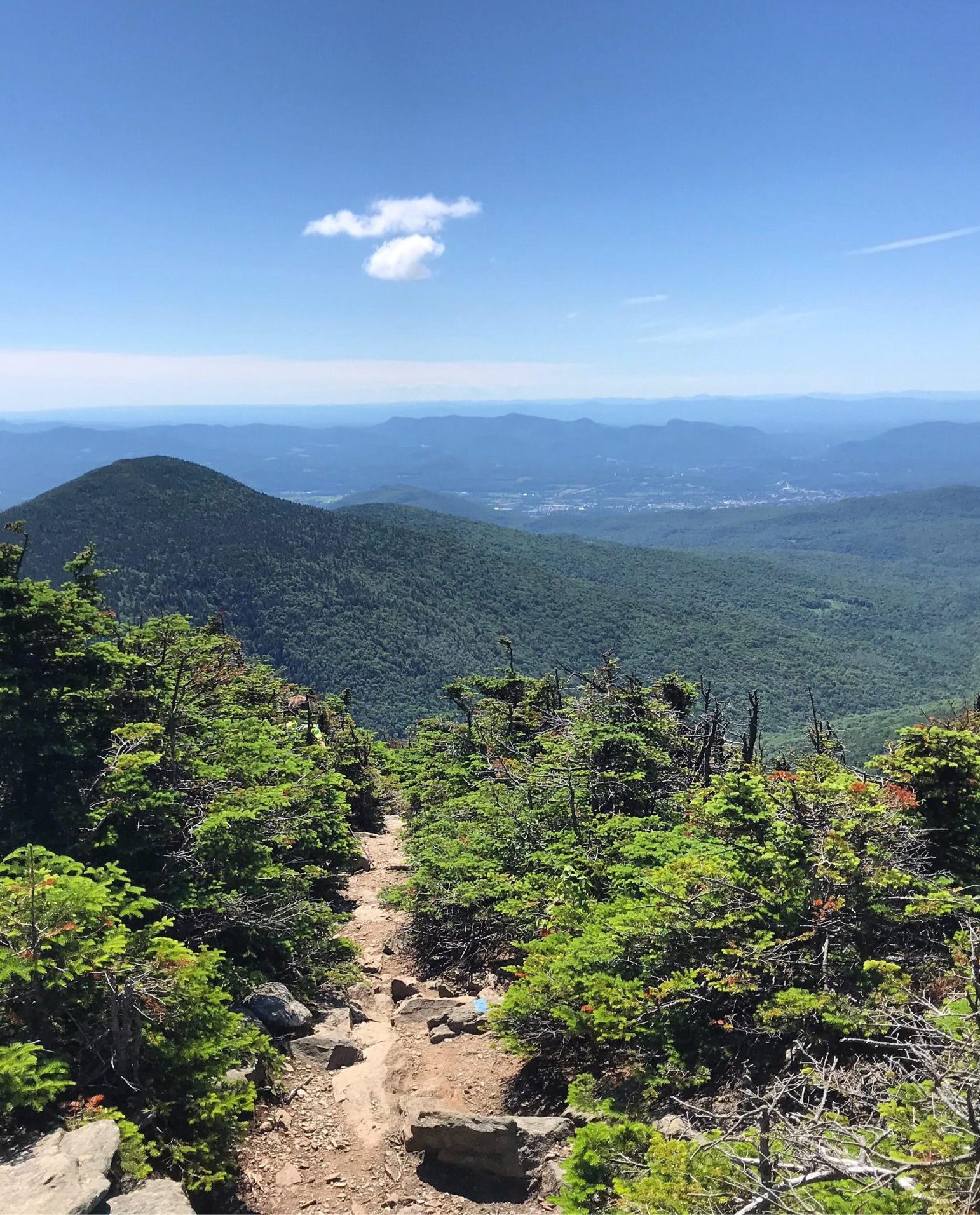
Best Hikes in Vermont: Killington Peak via Bucklin Trail, stunning scenery & unforgettable trail

Killington Peak is the highest point in the Green Mountains of Vermont, the Adirondacks in New York, and the White Mountains in New Hampshire, which you can view from this climb. Before reaching the peak’s top, the first two miles of the course are relatively simple due to a steady slope.

Snowshoes, crampons, or microspikes are recommended for the top part of the mountain, accessible through the trailhead in the winter.

The top of Killington, one of Vermont’s most renowned skiing peaks, is a great place to trek in the off-season. To reach the peak of Bucklin Mountain, hikers may use a local path called the Bucklin Trail. But unlike many hiking paths that intersect busy ski slopes, this one seems isolated and wooded, with few or no crossroads with the skiing courses.

During the first 1.4 miles of the Bucklin Trail, the trail follows Brewers Brook quite closely. The elevation is gentle for the first two miles; after that, it becomes steep. 0.2 miles into the trip, you’ll cross Brewers Brook on a bridge; 1.2 miles into the hike, you’ll strike it again on a bridge.

To get to the summit, you’ll need to take a left onto Killington Spur and scramble up some giant boulders on a 0.2-mile climb to the open, rocky peak.

3. Mount Mansfield Chin Via The Long Trail

4.7 miles | Challenging | 2,800 Feet Elevation Gain

Best Hikes in Vermont: Mount Mansfield Chin Via The Long Trail, stunning scenery & unforgettable trail

Mount Mansfield is Vermont’s highest mountain, making it a staple when hiking in Vermont. From a distance, its ridgeline resembles an extended head from the east side with numerous facial characteristics from south to north, including the Forehead, Chin, Nose, and Adam’s Apple. Hikers sometimes describe these features as “higher-elevation summits,” with the Chin being the highest point.

The Long Trail South from Route 108 is the simplest method to ascend Mount Mansfield from the Smugglers’ Notch side; it is a long and arduous walk. We strongly advise that you bring plenty of water, food, a route guide, a first aid kit, and appropriate boots.

From the trailhead on Route 108, begin your journey through quiet Vermont hardwood woodland, going up stepping stones and roots. The path starts with a gentle rise, but it gains about 2,800 feet in height in a little over two miles. There are several scrambling opportunities near the peak due to the terrain’s steepness and stony nature.

The most challenging part of the trip is a ridgeline ascent on the Long Trail. Ascend a couple of exposed rock faces by making a sharp bend to the left. The last stretch of the route to the Chin is a series of challenging climbs, so take your time.

Make the most of your summit time, but keep a careful watch on weather conditions and the passing of the day.

It’s risky to go on a mountain in Vermont during a storm or at night – you can find storm shelters along the way for this reason. Luckily, the Long Trail is well-signposted and easy to follow.

Drive up the Auto Toll Road at Stowe Mountain Resort and then climb the ridgeline from the parking lot on the Nose to the Chin for a more convenient route to the summit.

2. Mount Mansfield Loop

7.3 miles | Challenging | 2,880 Feet Elevation Gain
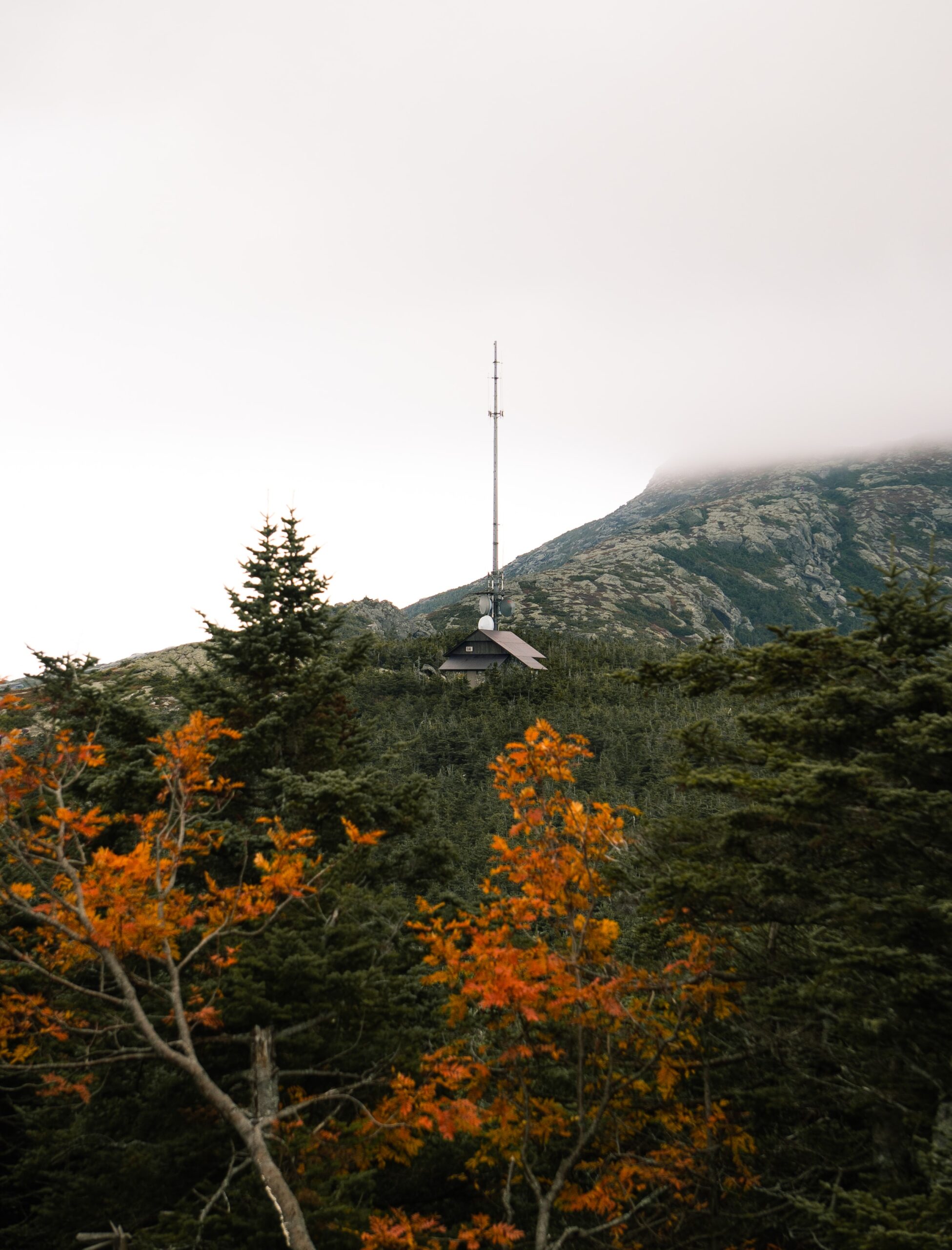
Best Hikes in Vermont: Mount Mansfield Loop, stunning scenery & unforgettable trail

The Mount Mansfield Loop trek is one of Vermont’s most famous climbs for experienced hikers since it takes you from the foot of the mountain to the state’s highest peak in a grueling 7.3 miles. Your heart rate will soar as you climb 2,880 feet in a little over three miles while passing through dangerously steep rock crevices and rocky sections.

Panorama views span from Smugglers’ Notch State Park to Underhill State Park, including several nearby ski resorts.

At 4,393 feet, you’ll also be on top of the highest peak in Vermont.

Anyone who has never scrambled before should avoid this route since it is challenging and demands a great deal of physical power and energy. In addition, this track should only be used in dry, sunny conditions, as it can be very hazardous and slippery when wet.

1. Equinox Mountain and Lookout Rock Trail: Our #1 Vermont Hike

6.3 miles | Challenging | 2,883 Feet Elevation Gain
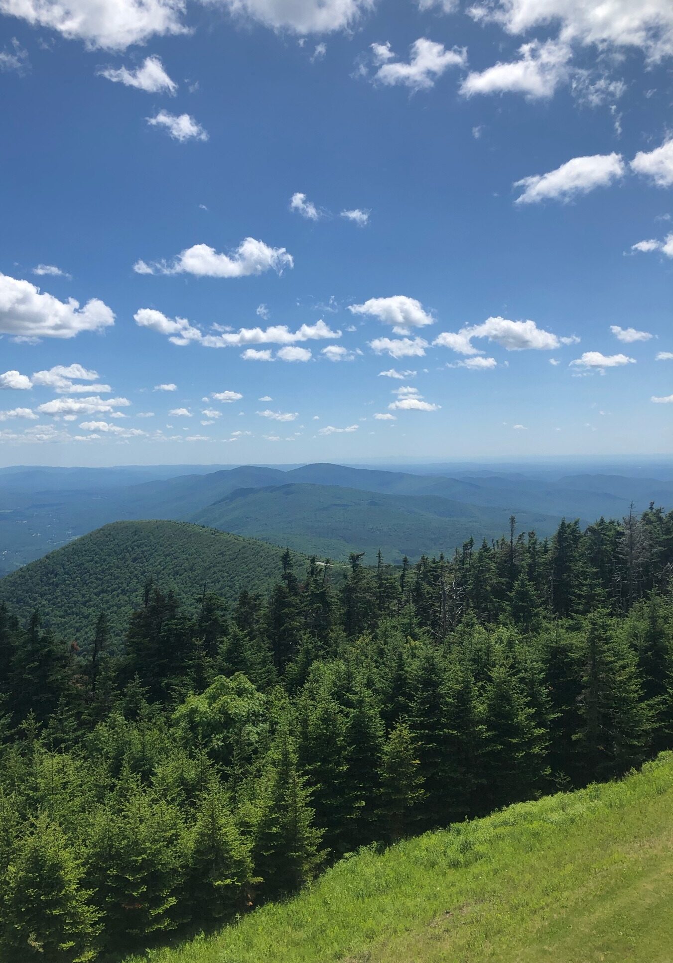
Best Hikes in Vermont: Equinox Mountain and Lookout Rock Trail: Our #1 Vermont Hike

Equinox Mountain and Lookout Rock Trail are Vermont’s most strenuous hikes and are excellent leg burners. You can locate its trailhead at 228-306 W Union St in Manchester. The relentless ascent from the mountain’s foot to its summit, with degree courses of steepness as high as 48% in certain places.

You’ll come across a variety of terrains, intriguing forest regions, and little lookouts along the hike. Views from the Lookout Rock are breathtaking, with the Green Mountains and the Green Mountain National Forest in the distance.

Although the scenery from the summit of Manchester and the adjacent mountains is magnificent, this climb is better suited for people seeking an “exercise” rather than a scenic one.

Hiking in the woods is a great way to get some exercise while also getting some relief from the sun’s heat.

Along the way, you’ll pass a cute tiny cottage. The trek offers several photo opportunities, so be sure to bring your camera along.

Vermont Hiking Tips

  1. Clothing and Gear – It’s important to dress appropriately and have the proper gear. Dress in various layers to remove or add as needed depending on the amount of exercise and the weather.
  2. Weather – Make sure to review the weather forecast before you go and be prepared to change your plans if necessary when hiking in Vermont. If they predict severe cold or high winds, adjust your plans. A sudden decrease in temperature with a stiff breeze can lead to hypothermia, making rain the most deadly weather.
  3. Avoid Skimping on Food and Water – On a solo Vermont hiking journey, it’s essential to have adequate food and drink for the day. If you find yourself stranded in the wilderness for an extended period, having the proper supplies on hand will alleviate post-hiking tiredness.
  4. Know Your Level – Everyone has their own pace while hiking in Vermont, and that should guide you in choosing which trails to go and how long you can spend on them.
  5. Do It Slowly – Making the most of your time in the outdoors depends on your level of self-assurance. It’s not fun to have doubts about your capabilities and be terrified of them. Begin by taking modest steps toward your objective rather than trying to tackle a full-scale solo wilderness expedition all at once. Hikes in Vermont range from easy to really difficult so take your time!

This list of the best hikes in Vermont can help you plan your journey. With almost enough trails to fill a whole year, these are some excellent ones to get you started!

16+ Most Incredible Mountains In The United States To Check Out

Hikers and climbers from all over the world go to the mountains of the United States because they provide a diverse landscape and a LOT of challenges. We’ve got it all here!

The United States is home to many dramatic mountain ranges and quaint mountain villages. Some mountain towns provide adrenaline-pumping activities, while others are ideal for unwinding after a long day of fun and adventure. Some individuals go all out on ice cliffs in preparation for more challenging slopes, while others prefer to take in the scenery from their base camps.

We’ve compiled a list of the most incredible mountain ranges in the United States for you to have excellent hiking experiences and stunning vistas. Regardless of your skill level, grab your hiking boots and a water bottle, and get ready to see these 16 magnificent mountains in the US.

16. Denali (Alaska)

Mountains in the United States, mountains in the US

Since Denali was first ascended in 1913, the tallest peak in North America, once known as Mount McKinley, has been the objective of ambitious high altitude climbers. Its status as a highly sought-after peak stems from its proximity to the Arctic Circle and the Pacific Ocean (Gulf of Alaska), which provides some of the world’s most violent weather.

Due to Denali’s infamous weather and accessibility, some climbers utilize it as a training ground for the Himalayas‘ 8,000-meter peaks and lengthy journeys to the Arctic or Antarctic. Denali is the highest mountain in the Denali Borough, the state of Alaska, the United States, the Alaska Range, and North America.

Denali is one of the world’s most challenging expedition destinations. While peaks in South America and Asia surpass its elevation, its considerable height above the Alaskan plain makes it a demanding test of individual strength, teamwork, and logistics. Also, Read- ( Midas Manifestation Review  )

No other summit offers such relief as Denali. Denali is 17,000 feet above sea level, Kilimanjaro is 14,000 feet, and Everest is 13,000 feet. Everest’s vertical gain from the standard base camp for the South Col approaches is 11,000 feet. Meanwhile, Denali’s summit climbs 13,000 feet from the landing location on the Kahiltna Glacier.

It also seems taller than it really is —- this is because the barometric pressure is lower in the northern/southern latitudes than in the equator, which gives climbers the illusion of being higher.

Six campgrounds are located along Denali’s Park Road. Each is distinctive in its position and access to various park regions. Except for Riley Creek and Savage River, all campsites are serviced by a Camper Transit bus.

15. Mount Rainier (Washington)

Mountains in the United States, mountains in the US

The Yakima Indians called the peak Tahoma “Great Snowy Peak.” On May 7, 1792, Captain George Vancouver called it in honor of British Navy Admiral Peter Rainier during a reconnaissance mission.

Mount Rainier is the Cascade Range’s tallest volcano and the fifth-highest peak in the continental United States. It is a massive mountain with several glaciers and routes suitable for climbers of all experience levels.

Over 10,000 people attempt to summit this mountain each year, and several expeditions aiming for higher peaks use Rainier as a training ground. The Disappointment Cleaver and the Emmons Glacier are two often climbed routes classified as class 4.

This mountain’s peak is unique among mountains. It has three distinct summits: Columbia Crest (14,411 feet), Point Success (14,158 feet southwest), and Liberty Cap (14,112 feet northwest), all separated by a vast crater. The most common routes take you to the crater rim, 14,150 feet above sea level. Many climbers assume this to be the top or near enough, but the true summit is a quarter-mile walk over the crater to Columbia Crest, which requires an hour round trip.

In the wilderness, parties are permitted to camp for 14 days. The maximum size of a party is 12, with any team of more than five considered a group. You can find high camps at Camp Muir on the south and Camp Schurman on the east on typical routes.

Trust us when we say: this is one of the most iconic mountains in the United States for a reason!

14. Sawtooth Ranger (Idaho)

Mountains in the United States, mountains in the US

Idaho’s Sawtooth Mountains are the state’s crown jewels and the epicenter of mountaineering and extensive wall climbing. Despite its growing popularity, the area keeps its pristine and uncrowded character, offering a treasure trove of rock climbs, couloir climbs, and exposed scrambles.

The road (approach road) and trail network are sparse. The backcountry is relatively uncrowded because of the harsh terrain. However, this is still one of the most well-known mountains in the US.

The region’s rock climbing is limited only by what has been discovered and recorded. Numerous fantastic new routes on summits and pinnacles remain undiscovered and unclimbed. You must possess endurance and tenacity since most peaks have complicated approaches.

The area is a renowned backpacking destination, and the many alpine lakes and streams offer spectacular scenery. The majority of locations involve trekking into the bush for at least 4-7 kilometers.

Day hiking is widespread, and there are several accessible trailheads. Although peak bagging is gaining popularity, many summits involve lengthy day climbs or overnight base camps.

13. Mount Whitney (California)

Mountains in the United States, mountains in the US

In the Sierra Nevada range of California, Mount Whitney is a mountain of unique peculiarities. It is the highest peak in the counties of Tulare and Inyo. It is the highest point in the Sierra Nevada and indeed in the whole state of California. It is also the highest point in the contiguous United States outside Alaska.

Mount Whitney’s elevation seems to be constantly assessed and reevaluated utilizing cutting-edge technology, altering the mountain’s height. Whitney’s official elevation is 14,496 feet. However, the National Geodetic Survey and National Oceanographic and Atmospheric Administration’s most current readings are 14,505 feet.

The 11-mile Mount Whitney Trail (class 1) is the shortest and most popular route to the top and is often combined with the 22-mile Mount Whitney Day Hike.

You only need shoes to approach this peak from the Whitney Portal trailhead at 8,365 feet in the summer and fall, but an ice ax and crampons may be required earlier in the season. Many hikers may take two days to complete this trail, staying at Outpost Camp or Trail Camp.

April, just before the quota season begins, is an exciting time to visit since the snowfall is firmer, and Trail Camp becomes a base camp for parties hanging out in the winter alpine beauty, using their 2-way radios to communicate with those above Trail Crest.

While there are several additional routes on Whitney, the most popular ones after the main path are the East Face, Mountaineer’s Route, the East Buttress, and the North Slope. Three of these climbs begin at Iceberg Lake, while the one is often climbed as a crossing from Mount Russell.

The Mountaineer’s Route is a popular destination throughout the winter. The East Face and East Buttress are the peak’s two famous challenging climbs. This is definitely one of the best mountains in the US for winter visits.

12. Bighorn Mountains (California)

Mountains in the United States, mountains in the US

Bighorn Mountain, situated in the San Gorgonio Wilderness in the San Bernardino Mountains, is one of the twenty-one summits exceeding 10,000 feet in southern California (south of the Sierra Nevada). It’s close to Mt. San Gorgonio and offers a nice break from the crowds.

Bighorn provides some off-track travel and a scenic ridgeline to break up the monotony of the path and tabletop summits of several other nearby peaks. Seriously: this is one of the most beautiful mountains in the United States by far.

From the parking area, go down the dirt road on the right side of the dry river bed for less than a quarter-mile until a sign indicating the route enters the river bed.  Cross the rock wash to reach the trailhead on the opposite side. There is no official route that crosses the river bed, but it’s easy to waste time attempting to locate the trailhead on the other side, particularly if beginning in the dark.

The path rises nearly 700 feet in roughly a half-mile of switchbacks from the trailhead. Continue through High Creek Camp on the route until you reach the left side of a large open sandy bowl with San Gorgonio and Dragons Head views. Follow the path up to about 10,700 feet, then go left for a lateral trek over the bowl’s broad sandy slopes, bearing Dragons Head.

The ridgeline of Dragons Head is to your left, while to your right is the ridgeline of The Tarn Bighorn’s district. Ascend slowly from The Tarn to the summit’s easternmost point. On the way to the high eastern end, you’ll cross two false summits on the ridgeline between Dragons Head and Bighorn.

11. Magazine Mountain (Arkansas)

Mountains in the United States, mountains in the US

Arkansas is a mountainous state in the midwest. It is traversed by three major mountain ranges that are among the oldest in North America and are distinctive in that they run east-west rather than north-south.

Mount Magazine is a flat-topped plateau with a sandstone crown surrounded by sheer rock cliffs. The ridge is crowned by two peaks: Signal Hill, the state’s highest point, and Mossback Ridge, which reaches a height of 2,700 feet.

Mount Magazine-Signal Hill is Arkansas’s and the Ozark plateau’s highest point. The ridge is located 120 miles northwest of Little Rock in the Boston Mountains. It is situated on Scenic Highway 309, about 17 miles south of Paris, Logan County, in the Ozark National Forest (also known as the Mount Magazine Scenic Byway).

Mount Magazine State Park encompasses the mountain; Signal Hill is the highest point on the hill. It is a well-developed state park with various facilities, a campsite, and recreational opportunities. The park has 18 campgrounds, hiking paths, a pavilion, a picnic area complete with facilities, and several picturesque viewpoints.

There is a gallery of exhibits and a gift store within the visitor’s center. Regularly, park personnel hosts interpretive programs. There are several things to choose from, including rock climbing, horseback riding, bicycling, ATV trail riding, and hang gliding. The annual “Mount Magazine International Butterfly Festival” is held at Mount Magazine. Furthermore, the mountain is home to many species, including black bears, whitetail deer, bobcats, and coyotes.

10. Uinta Mountains (Utah)

Mountains in the United States, mountains in the US

The Uinta Mountains are one of North America’s few mountain ranges that flow east to west rather than north to south. Within the Uinta Mountains, there are around 2000 lakes, of which 900-1000 are stocked with trout.

Along with Colorado’s San Juans, the Uintas contain the most continuous territory above the timberline of any region in the Continental United States. The area is lovely, with several lakes, meadows, wildflowers, and steep peaks. Once you leave the prominent fishing locations behind, solitude is SUPER easy to find.

The northeast region of the Uinta Mountains is quite rough. The Uintas, which begin at Hayden Peak and extend east to Mount Lovenia, are similar to the Tetons or other ranges.

East of Lovenia, the peaks become more moderate, with a few steep mountains (e.g., Red Castle and Henrys Fork Peak) interspersed throughout until you reach the Henrys Fork/Kings Peak region. East of Kings Peak, the Uintas become more moderate, with rounded peaks and just a few isolated cliffs.

You will also find the Dinosaur National Monument and a large portion of the surrounding region (but not entirely) in the Uinta Mountains. This region of the Uinta Mountains is unlike the high peaks to the west and is often more desert than alpine.

Dinosaur National Monument and the Surrounding Area are harsh environments filled with overturned rock beds, dinosaur bones, rivers, canyons, and mountains. The region is densely forested and scenically beautiful.

9. Mount Elbert (Colorado)

Mountains in the United States, mountains in the US

Mount Elbert is rightfully proud of its accomplishments: it is the tallest peak in Lake County, the highest in Colorado, the highest in the Rockies, and the second-highest in the contiguous United States. However, if you ask a non-climber or someone who lives outside of Colorado, they have never heard of it.

That is their loss since Mt. Elbert is a magnificent mountain deserving of universal attention and respect. One of the best features of Mt. Elbert is the relatively easy ascent to the top, which allows practically anybody of decent fitness to appreciate the mountain and its prestige. It’s actually one of our favorite mountains in the US to climb!

The peak was first ascended by H.W. Stuckle of the Haydon Survey in 1874. Since then, many people have climbed it, and it has even been summited by vehicle.

In the 1970s, several people claimed that Mt. Massive, Mt. Elbert’s neighbor, was more worthy of becoming Colorado’s tallest mountain. They piled rocks on Massive’s peak to make it taller. Mt. Elbert remained the tallest peak because several protestors demolished the summit cairn.

Although most guidebooks indicate Mt. Elbert’s elevation as 14,433 ft., a 2002 recalculation of historical measured values resulted in a global revision of peak elevations, concluding that Mt. Elbert’s actual elevation is 14,440 ft.

There are five primary ways to the summit; the most popular and most straightforward are the South Mt. Elbert Trail and the North Mt. Elbert Trail, both well-traveled class one trails. Summer is a popular time on these relatively easy roads to the peak, drawing all sorts of hikers and climbers, young and old.

Climbing Mount Elbert, as with any high peak, requires consideration of weather, altitude, and individual skill. However, with enough preparation and forethought, Mt. Elbert can provide an unforgettable climbing and outdoor experience.

8. Mount Mitchell (North Carolina)

Mountains in the United States, mountains in the US

Mount Mitchell, situated in North Carolina’s Black Mountains approximately 35 miles northeast of Ashville, is the highest mountain east of the Mississippi River. The Blue Ridge Parkway National Scenic Drive connects it to Clingmans Dome, the third highest mountain east of the Mississippi at 6,643 feet.

It is part of the Black Mountain Crest, which contains six other summits over 6300 feet, including Mount Craig, the second-highest mountain east of the Mississippi at 6,645 feet. Mount Mitchell State Park has the peak, but other approach paths (such as the Mount Mitchell Trail) begin in the Pisgah National Forest.

Throughout the summer, a variety of wildflowers bloom. Additionally, trout fishing is popular in the streams that flow down the Black Mountain Crest.

The most straightforward route to the peak is to drive around 100 degrees below the summit and then hike up a paved trail.

For those looking to get some exercise, a more acceptable route to the 6684 feet peak is the 5.6-mile class 1 Mount Mitchell Trail (USFS #190), which begins at the Black Mountain Campground (2680 feet).

You can also create a 15.5-mile loop hike by hiking to the summit from the campground, then continuing north along the Black Mountain Crest Trail (USFS #179, passing Mount Craig, Big Tom, Balsam Cone, and Cattail Peak), and down the Colbert Ridge Trail (USFS #178), before returning via gravel roads to the campground.

It is not unusual for the mountain to have two feet or more snow during the winter.

7. Mount Katahdin (Maine)

Mountains in the United States, mountains in the US

Katahdin is Maine’s tallest peak and the Appalachian Trail’s northern end. It is in Baxter State Park, a wilderness-managed region. The mountain rises above Maine’s comparably modest lakes and woodlands a mile above sea level. Timberline is about 3,500 feet because of the northern latitude.

From the south, the mountain is most magnificent, a sheer-like granite fortress that soars to great heights. It has a horseshoe-like form, with the open end facing northeasterly. There are five major peaks on the horseshoe, including Howe Peak, Hamlin Peak, Baxter Peak (top), South Peak, and Pamola Peak.

An unforgettable passage between South Peak and Pamola Peak is made possible by Katahdin’s most famous and frightening feature, the Knife Edge. Several hikers regularly climb Katahdin because of its prominence.

Katahdin seems to be volcanic, with its cirques resembling craters (the northeastern view is somewhat evocative of Mount St. Helens). But it is granite that has been worn and sculpted by glaciers.

The several routes to the summit all need some scrambling from second to fourth class and originate in one of three directions: north, east, or southwest. However, there are some difficult rock and ice paths.

Within the Great Basin cirque is a campground named Chimney Pond. From here, you can either climb the Cathedral Ridge Route (1.7 miles) that follows the prominent ridge west of Baxter Peak or the Saddle Trail (2.2 miles), which is a little more pedestrian. Alternatively, you can climb the Knife Edge (1.1 miles) via the Dudley Trail to Pamola Peak (1.3 miles).

If you wish to trek the entire western side of the mountain to the top, you can travel west from Chimney Pond to Hamlin Peak via the Hamlin Ridge Trail (2.2 miles).

6. Mount Washington (New Hampshire)

Mount Washington is the tallest mountain in North America, east of the Mississippi River, north of North Carolina, and south of Ellesmere Island. Additionally, it is one of New England’s most popular hiking, backcountry skiing, alpine climbing, and ice climbing locations. It’s by far one of the best mountains in the US and is a must-see if you’re in the New England area.

Between North Conway (to the south) and Gorham (to the west), it is lovingly known as “the Rock Pile.” Also, it is regarded as the “Home of the Guinness’ Worst Weather” and holds the world record for the highest wind speed ever recorded by man: 231 mph on April 12, 1934.

A cog train and road are atop this mountain, home to an observatory, museum, and snack store.

The 4.2-mile class 2 Tuckerman Ravine Trail, which begins at the AMC Pinkham Notch Visitor Center, is one of the quickest, most picturesque, and most popular routes to the summit. The Lion Head Trail is arguably the second most popular snow-free path and the most popular in the winter.

The Huntington Ravine Trail, one of the White Mountains’ two most challenging hiking paths, provides strenuous hikes, rock climbs, and ice climbs.

Mount Washington is nicknamed the rock pile due to the summit’s enormous slabs of New Hampshire quartzite and mica schist), which you will have the privilege of trekking over this summer.

As you can undoubtedly guess from the photographs, Mount Washington is a top-rated destination for winter mountaineering, skiing, and ice climbing. Winter allows dust off your crampons and goes up against snow or ice instead. However, you should always check for current avalanche and weather conditions, as this peak has claimed over 120 lives.

5. Mauna Kea (Hawaii)

Mountains in the United States, mountains in the US

On Hawai’i’s Big Island, Mauna Kea is the state’s tallest peak at 13796 feet. Mauna Kea is not a single summit; it is a collection of volcanic cinder cones, some red, others black, glued onto a monstrous mountain.

While it’s easy to make grandiose parallels about how Mauna Kea epitomizes the spirit of Hawai’i, the actual monarch mountain of the Big Island is Mauna Loa, which frequently distributes lava flows across a 50-mile radius in practically every direction. However, since the slopes of Mauna Kea are steeper than those of Mauna Loa, the former’s summit vistas are superior, and the climbs are shorter.

The Mauna Kea Trail is 6 miles long (one way) and rises 4,576 feet in elevation, beginning at the Onizuka Visitor Center at 9,200 feet. The route follows a partly paved summit road roughly between the Mauna Kea Ice Age Reserve border at 13,200 feet and the summit road’s high point at 13,700 feet.

The peak is a short walk of 5-15 minutes from the road’s terminus and a 100-foot height gain. Most “mountaineers” drive to the end of the road, which may be tough for walkers, particularly when the altitude begins. Apart from the moral superiority gained by trekking, you’ll enjoy spectacular and wild vistas along the route.

A brief side journey to Lake Waiau, a relatively small lake (less than 10 feet deep), approximately a mile and a half from the top, is a fascinating diversion. To give their babies “mountain strength,” Hawaiians used to bring their babies’ umbilical cords here to give them “mountain strength.”

If you’re in Hawaii, then this is one of the must-see mountains in the United States simply for the views.

4. Great Smoky Mountains (North Carolina)

Mountains in the United States, mountains in the US

The Great Smoky Mountains are one of the most visited mountain ranges in Eastern America. There are 25 peaks above 6000 feet in the range, 12 on the South Beyond 6000 list. Numerous further peaks exceed 5000 feet.

The range rises from the Pigeon River canyon and stretches over 70 miles to the Little Tennessee River. The Appalachian Trail follows the range’s spine, passing summits such as the Silers Bald, Mount Thunderhead Clingmans Dome, Mount Collins, Mount Kephart, Charlies Bunion, Tri-Corner Knob, Mount Guyot. The Appalachian Trail travels 71.4 miles across the range, about half of which is above 5000 feet.

With almost 522,000 acres of rugged high mountain wilderness, the Great Smoky Mountains National Park was officially established in 1934. The park receives around 9,000,000 visitors each year.

A recent park service research found that just 44% of tourists intended to spend a day hiking in the Smokies. Only 14% said they wanted to camp, and only 2% stated their intention to utilize backcountry shelters or campsites.

The 114 backcountry shelters or campsites are your sole option for an overnight stay in the Smoky Mountains backcountry. You can’t camp in any other location. To remain in the backcountry, you must also get a free permit from any Ranger Station or Visitors Center.

For obvious reasons, this is one of the must-see mountains in the US, but it’s definitely a trip you’ll want to plan well in advance and isn’t a place to wing-it.

3. Alaska Range (Alaska)

Mountains in the United States, mountains in the US

While not comparable in length, the Alaska Range is arguably the continent’s most incredible mountain range due to its excellent ruggedness, the enormity of its most significant peaks, infamously severe weather, and resulting glaciation.

The range cuts a 600-mile-long gash across southern Alaska, separating it from its interior. The White River in Canada borders it to the southeast. It has the continent’s tallest peak, as well as numerous additional steep peaks and alpine testpieces.

The area draws visitors seeking to experience Alaska’s breathtaking nature and seven summits hopefuls and world-class alpinists. Big-game hunters go to the site to demonstrate their vigor by killing gigantic specimens of the animal world, ranging from dangerous grizzly bears to magnificent Dall sheep, using high-powered rifles.

In winter, the Alaska Range blocks the flow of moist air from the Gulf of Alaska, causing extreme weather.

The region’s renowned conditions are harsh: massive glaciers, six-hour sunshine in the winter, and timberline between 2,500 and 3,000 feet. If you’re in Alaska, this is definitely one of the must-see mountains in the United States!

2. Grand Teton (Wyoming)

Mountains in the United States, mountains in the US

The name Grand Teton itself urges exploration and climbing of the region’s iconic routes. Grand Teton is a typical alpine peak in and of itself, deserving of its national park. For almost a century, climbers have been lured to “The Grand,” and pilgrimages from all over the globe continue.

With over 35 courses and 50 variations, there is something for everyone between 5.4 and 5.12. New routes emerge, including Stephen Koch and Hans Johnstone’s The Squeeze Box, Grade IV, M7, A0.

The Owen-Spalding is the typical route at Grade II, 5.4, and demands expert rock climbing abilities and equipment. The most well-known path is Exum Ridge, named for Grand Teton pioneer Glenn Exum.

On August 11, 1898, William Owen, Franklin Spalding, Frank Peterson, and John Shive made the first climb of The Grand using the now-famous Owen-Spalding route.

The Lupine Meadow trailhead serves as the starting point for most mountain routes. Expect a large number of vehicles at this trailhead. From the Lupine Meadow Trailhead (6,732 feet), ascend the Garnet Canyon Trail. The path splits after 1.7 miles. Continue straight for 1.5 miles until the route divides again. If climbing the Owen-Spalding, Exum, or Petzoldt ridges, go left toward Garnet Canyon.

You need to acquire permits for backcountry camping, especially for a high camp. Permits are available on a first-come, first-served basis at the Jenny Lake Ranger Station.

1. Sierra Nevada (California)

The Sierra Nevada is California’s mountain range. There are other more magnificent ranges in the state, but none compare to the Sierra Nevada’s tremendous beauty. The peak has served as a home to indigenous peoples, a frightening barrier to early immigrants, an El Dorado for gold seekers, and a year-round playground in contemporary times.

Today, the Sierra Nevada receives tens of millions of annual tourists. With unspoiled grounds, clean air, and spectacular views, tourists can experience the mountains as John Muir did 140 years ago. Two national parks and twenty wilderness areas safeguard the range’s most pristine parts from human development.

While sightseeing is undoubtedly the most popular activity, many visitors come to ski, camp, boat, fish, off-road, hike, and climb.

The Sierra Nevada runs 400 miles along California’s eastern border, its width varying between 50 and 80 miles. The northern half of the range is densely wooded and has lower altitudes; notable peaks are uncommon and hardly rise above the surrounding forest.

The Sierra’s drama begins towards the northern end of Lake Tahoe when the peaks leap over 9,000 feet. The famous Lake Tahoe area has dense ski resorts. The Granite Chief, Mount Rose, and Desolation Wildernesses protect the more pristine mountain regions.

Between Yosemite National Park and Lake Tahoe, the peaks reach an additional 11,000 feet. Volcanic rock dominates this region, providing limited options for rock climbing but beautiful hiking and scrambling.

Hiking Flume Gorge In New Hampshire: The Ultimate Guide

Are you hiking the infamous Flume Gorge in New Hampshire to get a look at one of the most beautiful waterfalls in New England? This ultimate guide will cover absolutely everything you need to know for an awesome day!

New Hampshire is definitely one of my favorite states in the US because the nature and views are just gorgeous. To be totally fair, this state is stunning during all seasons, but I especially love the summers because we get to hike to some of the coolest spots.

This last summer, we revisited Flume Gorge, one of our favorite hikes/waterfalls in New Hampshire. And let me tell you: this waterfall is not to be missed!

This was my third time visiting the Flume Gorge in New Hampshire as a fully grown adult (though it was a favorite of mine during college) and it honestly gets better every time I see it.

The views are gorgeous and it’s a great workout. The hike is easy but still feels like you’re doing something cool and dangerous.

Flume Gorge is a natural wonder located in the Lincoln, NH area. This 800-foot gorge is packed with stunning waterfalls, making it the perfect destination for a day of sightseeing. If you’re visiting New Hampshire for the first time (or even if you’re a seasoned local), Flume Gorge is a must-see, offering historic covered bridges, cascading waterfalls, and an 800 ft-long gorge.

I’ve put together this guide to provide some detailed information that comes from firsthand experience. I hope this helps you enjoy your trip and get the most out of visiting the beautiful Flume Gorge!

If you’re planning to hike, I recommend getting the AllTrails app or heading to the site for the most updated hiking info.

What Is Flume Gorge In New Hampshire?

flume gorge new hampshire

Flume is a narrow gorge covered with moss and towering granite walls. It’s insanely tall (over 90 feet in some places) and narrow, creating really dramatic views. It’s basically New Hampshire’s equivalent of a crater and is actually prehistoric!

Visitor boardwalks provide access to the narrowest sections of the gorge, which contain waterfalls, boulders, and pools.

Additionally, Flume Gorge offers two charming covered bridges, sections of tranquil forest trail, and incredible observation decks/viewpoints to check out the mountains.

You don’t have to be a mountaineer to enjoy Flume Gorge’s 2-mile loop. Just make sure to arrive early to avoid foot traffic, especially in the narrow gorge section.

When To Visit Flume Gorge:

flume gorge new hampshire

If you want to see seriously dramatic waterfalls then consider visiting Flume Gorge during the spring or summer. Sometimes, the waterfalls dry up in the late summer/early autumn so you won’t get the full effect.

However, you can see great waterfalls depending on the rainfall. I recommend that you do some research if you really want to visit later in the year. We’ve been once in the autumn and the waterfall was still pretty mind-blowing!

While the falls are usually better in the earlier months, you may want to hike the trail during the fall to see the foliage. Once the leaves start turning the observation points are much more dramatic, especially once you’ve passed the waterfall area.

So it really depends on what you want to see. Are you more excited to check out insane waterfalls? Go in the spring/early summer. Want to see gorgeous New England foliage? Your best bet is to visit Flume Gorge in the fall.

While you technically can visit NH’s Flume Gorge in the winter (it’s open all year), I would recommend against it. There’s no staff on-site and the climb is at your own risk. And trust me: the stairs are slippery enough in the summer!

The flume gorge is open from May 10th to October 20th with staff. You definitely wouldn’t want to go in the winter anyways; those stairs would be insanely slippery.

The typical hours are:

  • 5/10-6/30 8:30am-5pm
  • 7/1-9/2 8:30am-5:30pm
  • 9/3-10/20 8:30am-5pm

Around 1pm was the perfect time for us to arrive. The midday heat wasn’t a problem since the day was slightly cooler (high 70s).

Tickets & Prices:

flume gorge new hampshire

As of right now, the ticket prices are:

  • Ages 13+: $18
  • Ages 6-12: $16
  • 5 & Under: FREE w/ paid adult.

* All rates and dates are subject to change.

BTW, pets aren’t allowed in the Flume Gorge (past the ticket desk) but are allowed in nearby parks.

You’ll need to reserve tickets ahead of time, at least right now, through the New Hampshire State Parks.

If you don’t reserve tickets you may not be able to enter. They’re pretty strict due to the last few years, so you can’t just show up anymore. Make sure you book ahead since peak season fills up really quickly!

Flume Gorge Directions & Parking:

Flume Gorge is located near Lincoln, New Hampshire, along the Daniel Webster Highway.

It is located only 6 miles from nearby Artists Bluff, as well as 7 miles from the beginning and end of Kancamagus Highway.

Flume Gorge is really easy to find (it’s right off I-93). There’s plenty of parking available right outside the visitor center.

the flume gorge // the flume trail // the basin nh

Flume Gorge is a beautiful and popular spot in the White Mountain National Forest. During the weekends, it can get quite crowded, so try going on the early or later end.

12pm is the worst time to try and park because it’s when all the families from the morning and the afternoon are hiking the trails. Ticket lines can also be longish on the weekends, so plan to wait for a bit.

You’ll need to go through the visitor center before beginning your hike. The Flume Gorge Visitor Center has a cafe that sells snacks and ice cream, a gift shop, an information center, and a variety of displays from the 1800’s that are fun to check out.

There are also (super clean) bathrooms available that you’ll need to hit before you actually go through the ticket line. Once you purchase tickets you’re through the center, so do all of your sightseeing before joining the ticket line.

the flume gorge // the flume trail // the basin nh

The Hike On the Flume Trail:

  • Distance: 2 miles
  • Elevation: 500 ft gain
  • Hike Type: Loop
  • Hike Time: 1.5 – 2 hours
  • Dogs/Pets: Not permitted

This is an easy loop hike – you go up the Gorge and then around, so your main views are towards the beginning of the hike.

First, it’ll look like you’re simply hiking a regular mountain with only a few small streams like this one.

Check out more about the hike here.

flume gorge new hampshire

The loop that leads to Flume Gorge NH isn’t really a hike since it’s not long. Flume trail has a total distance of about 2 miles and a lot of the trek is uphill, though it isn’t long enough to feel like a workout.

flume gorge new hampshire

A lot of young kids made the trip on their own (without being carried). The hike would be difficult for anyone with a disability since the entire walk by the waterfall is wooded stairs. The hike is also not stroller-friendly.

the flume gorge // the flume trail // the basin nh

Along the way, there are so many picturesque photo spots! Before you reach the falls, you’ll begin to hike uphill. At some point, you’ll start walking on wooden boards, then you’ll reach the wooden stairs. This is the main part of the falls where you’ll have the best views.

Watch out – the stairs get really slippery! I recommend treading carefully since the rapids and falls are extremely strong right below the staircase.

But I promise you, it’s totally worth it, even if you’re scared of heights. FYI, the boards are inspected yearly and look brand new – they’re completely safe to walk on.

I really enjoyed the hike. It felt much more rural than other hikes in the area, and we saw a lot of critters (luckily, no bears!). You definitely feel like you’re actually in the wilderness, even if there are a lot of people around during the weekends.

Once you see the falls, you’ll continue with the rest of the loop to come back down. The elevation goes up really quickly (though it’s only about 500 feet) and the waterfall views are all in the beginning, then you have the rest of the hike to check out the mountainous scenery. It’s a bit more leisurely after you get off the stairs.

The Flume Gorge New Hampshire Falls

You’ll start to see the falls once you walk past Table Rock (a massive granite structure from the last ice age).

The narrow path grows much narrower after the first part of the hike, and the walls on either side grow much taller. Right away, you may feel mist. In comparison to the temperature outside near the lodge, this part of the walk was insanely cool!

flume gorge new hampshire

One huge piece of advice for anyone who wants to take photos (like me) is to hold on to your phone! Since I’ve lost my phone more times than I can count, this seemed like a perfect opportunity, especially while leaning over the railing to take photos.

For those of you who use professional cameras, you’ll definitely want to invest in some water-resistant equipment before seeing the Flume Gorge. There’s literally no avoiding the massive amounts of mist during this part of the climb

As you climb the stairs, you will see the largest part of the Flume (Avalanche Falls is 45 feet high!). It was cool to almost literally be a part of the falls while climbing the stairs, but I wish I had more time to stop and see it. If you go when the walk is busy then you’ll have to keep moving along during this part. Just another reason to try and see the Flume during the week!

the flume gorge // the flume trail // the basin nh

Once you get to the top and go around the corner, the views aren’t as great, but you’ll be able to check out some of the smaller streams and waterfalls at your leisure – you can stop as much as you’d like.

There’s also an observation deck right around the corner that we spent a few minutes on. You can’t really see the falls from the observation deck (strangely enough) but the sounds and atmosphere are just so cool.

I recommend that you get a look as much as possible while you’re climbing the stairs because that’s definitely the best view of the falls. You can’t go back down after, so you may be disappointed if you hurry through and realize that was the main event.

the flume gorge // the flume trail // the basin nh

Once you start to walk back, you’ll see the Liberty Gorge Cascade. These falls are smaller but do offer the opportunity to sit and observe the water. They’re really beautiful to see from above!

the flume gorge // the flume trail // the basin nh

There are also some great spots to grab a group photo up near the observation deck. Seriously – the views of the mountains are insanely gorgeous!

the flume gorge // the flume trail // the basin nh

The Pool

If you continue along the Flume trail after visiting the falls, you will be able to see the pool from hundreds of feet above.

It is surrounded by massive cliffs (which you’ll be standing on) and can reach a depth of 40 feet in some places! This pool was created during the Ice Age and is extremely cold (not that we’ve ever swum in it).

Since you are so high up, this is a small area with some cool views. If you are looking to take a break from the sun, this area is a great place to hang out.

the flume gorge // the flume trail // the basin nh

The Covered Bridge

What New Englander doesn’t love a good old covered bridge? Flume Gorge has two gorgeous covered bridges. The largest red bridge can even accommodate large trucks and buses!

flume gorge new hampshire

We also enjoyed seeing the smaller covered bridge. It’s only for foot traffic and is walkable, or you can choose to find this observation point (also on the loop) and take photos.

Don’t worry about missing anything – you’ll come across every interesting point on the loop! It’s super self-explanatory once you get past the falls.

The Wolf & Bear Dens

As soon as you reach the top of the stairs, you’ll find the bear den. If it isn’t too crowded, it is actually pretty cool to check out, especially because you can hear the waterfall right behind you. This used to be a bear den, but it’s now more of a tourist attraction.

You’ll come across a wolf den later on during your hike (after crossing the covered bridge). Checking it out is more challenging. While most of it can be walked through, at some point you will need to crawl on your hands and knees.

You can continue on the path around the wolf den to meet up with your group if you don’t like tight spaces. I highly recommend checking it out if you aren’t claustrophobic: it was really cool!

The Shuttle

If you do not want to hike the Flume trail the entire way up, you can take a shuttle up part of the way to see the waterfall. Keep in mind that you will still need to climb the stairs – nothing can be done about it.

If you need to, you can skip the beginning and end of the hike with the shuttle. Although we didn’t take it, it would be a great idea for those with trouble traveling or for families with young children.

Where to Swim:

There are very strict rules about not swimming during the 2-mile loop, and for good reason: the rapids are insane! There isn’t a good spot for swimming during the self-guided tour, which is why the signs were up. So no, you can’t swim at Flume Gorge (sadly).

But, there are lots of great swimming spots right near this area! After driving across the street we found a swimming spot literally right off the road in the Basin. Parking is easy (it’s right off the highway) and you only have to walk about 20 yards to get to the swimming hole.

Remember that the water is freezing! Taking a quick dip in this clean and refreshing body of water on a hot day is definitely worth the trip, even if you don’t plan to stay in it for a long time. Plus, it’s good for your hair!

Here are our two favorite spots for swimming near Flume Gorge in New Hampshire:

The Basin:

A large pothole of the Pemigewasset River, The Basin is located in Franconia Notch State Park. It measures 30 feet wide and 15 feet deep. Henry David Thoreau stood in 1839 watching the water cascade into the pool created over 25,000 years ago, when glaciers melted during the last Ice Age.

The swimming hole that’s adjacent to the Basin can now be accessed by a short hike (really more like a few yards). During a hot summer day, the water is always clear and refreshing.

You can park right across the street from Flume Gorge and walk out to the Basin. This is our favorite little swimming spot in the afternoons because it’s usually very private. 

Georgiana Falls:

Lincoln’s Georgiaiana Falls is a little-known hiking and swimming hole near Hanson Farm Road. 1.6 miles of dirt trails surround this relatively easy hike.

At the base of the 30-foot waterfall, you’ll find a cool swimming hole. In the middle of the summer, the water might not be deep enough to actually go swimming, but it’s perfect for dipping your feet in while enjoying a picnic in the park.

History of Flume Gorge

the flume gorge // the flume trail // the basin nh

Aunt Jess Guernsey discovered the Flume Gorge in 1808 (apparently she was there with her nieces and nephews), but it was actually formed around 200 million years ago during the Jurassic Period.

During the formation of the Gorge, the rocks were molten and liquid, but hardened and eroded over time to form the Gorge. Today, the Gorge is still getting deeper.

Despite its creation of the Pool and Table Rock, the Ice Age did little to alter the Gorge itself.

flume gorge new hampshire

FAQs About Hiking The Flume Gorge in NH:

flume gorge new hampshire

What are the hiking trails available at Flume Gorge Basin?

Flume Gorge Basin offers several hiking trails that allow visitors to explore the beautiful natural surroundings. Here are the main hiking trails available at Flume Gorge Basin in New Hampshire:

Flume Gorge Trail: This is the main and most popular trail at Flume Gorge Basin. It’s a 2-mile loop trail that takes you through the stunning Flume Gorge, where you’ll encounter wooden walkways, waterfalls, and scenic views. The trail is well-maintained and suitable for most fitness levels.

Liberty Gorge Trail: This trail is an extension of the Flume Gorge Trail and adds an extra half-mile loop. It offers a less crowded experience and takes you deeper into the forest, providing a peaceful and serene atmosphere.

Poolside Trail: This trail is a short, easy loop trail that branches off from the Flume Gorge Trail. It leads to a tranquil pool surrounded by trees and is a great spot to rest and enjoy the natural surroundings.

Rim Path Trail: The Rim Path Trail is a one-way trail that runs parallel to the Flume Gorge Trail and offers a different perspective of the gorge. It provides elevated views and connects back to the main trail.

It’s important to note that the Flume Gorge Trail is the primary trail for experiencing the gorge’s beauty, while the other trails provide additional options for exploration and variation in the hiking experience.

How long does it take to complete the hike at Flume Gorge Basin?

The time it takes to complete the hike at Flume Gorge Basin can vary depending on individual walking pace, the amount of time spent exploring and taking in the scenery, and the trail chosen. Here are some general estimates for completing the main Flume Gorge Trail:

Flume Gorge Trail: The 2-mile loop trail typically takes around 1.5 to 2 hours to complete at a leisurely pace, allowing time to enjoy the gorge, waterfalls, and other points of interest along the way.

If you choose to extend your hike by including the Liberty Gorge Trail or the Poolside Trail, you can expect to add an additional 15-30 minutes, depending on your pace and the time spent at each location.

It’s always a good idea to plan extra time for breaks, photography, and exploration to fully enjoy the natural beauty of Flume Gorge Basin.

What is the best time of year to hike Flume Gorge Basin?

The best time of year to hike Flume Gorge Basin in New Hampshire depends on your preferences and the kind of experience you are seeking. Here are some considerations for each season:

Spring (March to May): Spring offers mild temperatures and blooming vegetation. The trails may be less crowded during weekdays. However, some parts of the trail may have snow or ice remnants in early spring, so it’s important to check trail conditions before heading out. I recommend hiking in late spring.

Summer (June to August): Summer is the peak tourist season for Flume Gorge Basin. The weather is generally warm, and the trails are typically clear. However, this also means more visitors, especially on weekends and holidays. Consider visiting on weekdays or early in the morning to avoid crowds.

Fall (September to November): Fall is a particularly popular time to visit Flume Gorge Basin due to the stunning foliage. The surrounding forests transform into vibrant shades of red, orange, and yellow. The weather tends to be cooler, and the trails can be less crowded, especially during weekdays.

Winter (December to February): Flume Gorge Basin may have limited accessibility or be closed during the winter months. Heavy snowfall and icy conditions can make the trails hazardous. However, if you’re an experienced winter hiker and the trails are open, you can enjoy a serene and picturesque winter landscape.

Overall, the most crowded times at Flume Gorge Basin are during weekends and the summer months. If you prefer quieter experiences, visit on weekdays, early mornings, or during the shoulder seasons of spring and fall.

Can I bring food or drinks on the hiking trails at Flume Gorge Basin?

Yes, you can bring food and drinks with you on the hiking trails at Flume Gorge Basin. While there are no specific restrictions mentioned regarding outside food or beverages, I recommend being mindful and only bringing an amount that’s comfortable to carry.

With that being said, I also highly recommend packing lots of water and some protein-dense snacks!

Can I take photographs during the hike at Flume Gorge Basin?

Yes, you are generally allowed to take photographs during your hike at Flume Gorge Basin. Photography is a popular activity, as the area offers beautiful natural landscapes, waterfalls, and the iconic Flume Gorge itself. You can capture memories of your visit and enjoy the scenic views.

What Should I Wear To Flume Gorge in NH?

The classic New Hampshire hiking look is definitely athletic gear. You’ll want to wear cute athletic shorts, a good top, and bring plenty of layers. You’ll also see plenty of people wearing baseball hats.

As far as brands go, Patagonia is the it brand here. You’ll also see plenty of Nike and Adidas sneakers. You want to rock the serious hiking look if you want to look like a local. Don’t forget a nice pair of sunglasses!

Are there any nearby attractions or points of interest to explore after hiking at Flume Gorge Basin?

There are several nearby attractions and points of interest to explore after hiking at Flume Gorge Basin in New Hampshire. Here are a few of my favorite spots:

Franconia Notch State Park: Located adjacent to Flume Gorge Basin, Franconia Notch State Park offers a range of attractions. You can visit Echo Lake for swimming and picnicking, take a scenic drive along the Franconia Notch Parkway, hike the popular trails of Mount Pemigewasset (Indian Head), or hike Mount Lafayette.

Cannon Mountain Aerial Tramway: Ride the Cannon Mountain Aerial Tramway, located within Franconia Notch State Park, for breathtaking panoramic views of the White Mountains. At the summit, you can explore observation decks, hiking trails, and enjoy a meal at the summit restaurant.

The Lost River Gorge and Boulder Caves: Just a short drive from Flume Gorge Basin, you’ll find the Lost River Gorge and Boulder Caves. Explore a network of boardwalks and caves that wind through a gorge, offering opportunities to observe unique geological features and natural beauty.

Explore the Shops and Cafés of Lincoln: The town of Lincoln, located near Flume Gorge, has a charming downtown area with a variety of shops, boutiques, and cafés. Take a leisurely stroll, browse through unique shops, and stop for a cup of coffee or a snack at one of the local cafés. Click here to check out some of our favorite restaurants in Lincoln!

Relax by the Pemigewasset River: Find a peaceful spot by the Pemigewasset River, which flows through Franconia Notch State Park. Bring a blanket or a folding chair, sit by the riverbank, and enjoy the tranquil sounds of flowing water. It’s a great way to unwind and connect with nature.

Visit a Local Brewery or Winery: If you’re interested in craft beer or local wines, you can check out some of the breweries and wineries in the area. Relax with a pint of locally brewed beer or sample wines made from locally grown grapes while enjoying the laid-back atmosphere. Our favorites include Woodstock Inn Brewery, One Love Brewery, Seven Birches Winery, and White Mountain Winery.

Mount Washington: For those seeking a more challenging hiking experience, consider venturing to Mount Washington, the highest peak in the northeastern United States. The mountain offers various trails of different difficulties, including the famous Tuckerman Ravine Trail. Alternatively, you can drive up the scenic Mount Washington Auto Road or take the historic Mount Washington Cog Railway to reach the summit.

White Mountain National Forest: The White Mountain National Forest is a vast area with numerous hiking trails, scenic drives, and outdoor recreational opportunities. Explore the pristine wilderness, visit picturesque waterfalls like Sabbaday Falls or Arethusa Falls, or enjoy activities such as camping, fishing, or wildlife watching.

Enjoy Scenic Drives: The White Mountains region offers scenic drives with stunning views. Consider driving along the Kancamagus Highway (NH Route 112) or the Franconia Notch Parkway. These routes showcase breathtaking vistas, foliage (in the fall), and picturesque landscapes, allowing you to relax and take in the beauty of the area.

Are there any accommodations or camping options available near Flume Gorge Basin?

There are plenty of places to stay! While this area is more remote, it’s still geared towards tourism, especially in the summer.

Campgrounds: There are several campgrounds in the area where you can pitch a tent or park an RV, including Lafayette Place Campground and Cannon RV Park. These campgrounds provide facilities such as restrooms, showers, and picnic areas.

Lodges and Resorts: If you prefer a more comfortable stay, there are lodges and resorts in the vicinity of Flume Gorge. Examples include The Franconia Inn, Indian Head Resort, and Woodwards Resort, which offer a range of amenities such as comfortable rooms, dining options, and recreational activities.

Vacation Rentals: There are vacation rentals available in the nearby towns of Lincoln and Franconia, which offer options for cozy cabins, chalets, or condominiums. Websites like Airbnb and VRBO can help you find suitable accommodations in the area.

Hotels and Motels: Various hotels and motels are located within a short distance from Flume Gorge Basin. Options include The Franconia Notch Motel, Days Inn by Wyndham Lincoln, and The Lodge at Lincoln Station. These establishments offer comfortable rooms and convenient access to the hiking trails.

Make reservations in advance, especially during peak tourist seasons, to ensure availability.

24 Must-Do Hikes In New Hampshire

If you’re looking to go hiking in New Hampshire, then you’re in luck: there are tons of gorgeous hikes during every season. Because New Hampshire has so much amazing wilderness, we’ve compiled a list of the top hikes for you!

New Hampshire has some of the best hiking in the nation. The Granite State’s environment is diverse, ranging from super cool frozen waterfalls in the winter to postcard-worthy autumn views and gorgeous summer terrain.

The White Mountain National Forest in New Hampshire has one of the most popular and most challenging portions of the Appalachian Trail. This 800,000-acre region has six wilderness areas and represents almost 13% of the state’s total land area!

New Hampshire has 93 state parks, including beaches, recreation areas, historic sites, and more. With so much to see and do, it’s no surprise New Hampshire is a favorite hiking destination for tourists and locals alike.

We’ve put together a list of the finest treks in New Hampshire for any hiker’s taste, whether you want to take in the autumn foliage on a leisurely stroll or conquer one of the White Mountains’ numerous 4,000 feet peaks.

Here are the best hiking trails in New Hampshire, at least in our opinion!

When to Hike in New Hampshire?

One of our favorite things about New Hampshire is how diverse the weather is. There are so many beautiful times of year in NH that you really can’t go wrong!

Summer hiking in New Hampshire is popular because the forest trees provide shelter and the heat isn’t too bad.

Although melting snow can make trails slippery, spring hiking is exciting to observe nature awaken from its winter hibernation.

Autumn is a great season to hike in New Hampshire, provided you don’t mind covering up since it can get a little chilly!

We definitely don’t recommend hiking in New Hampshire in the winter. The weather gets seriously cold and some of these trails fill up with ice and snow.

The Best Hikes in New Hampshire

Here are the top hikes in New Hampshire right now!

24. Mt. Monadnock

Must-do and best hikes in New Hampshire: Mt. Monadnock
yankeemagazine.com

This rugged top boasts 360-degree vistas as far as Boston on a clear day, making Monadnock America’s most climbed mountain for a good reason.

You have many types of hiking trails on this mountain. The most popular is the four-hour roundtrip White Cross Trail, which starts at the Monadnock State Park entrance along US 101 in Jaffrey.

The lengthier, more challenging, but more varied Pumpelly Trail climbs the other side of the mountain from Dublin Lake, also off US 101. The Pumpelly Trail is a 6- to 7-hour roundtrip hike through the woods that ends with a climb over rocks and stones across an uneven ridge above the tree line.

Given Mt. Monadnock’s popularity and accessibility from Boston, you shouldn’t anticipate being alone on the peak on a good-weather day. It fills up quickly, so we love going on a weekday if possible.

Because the mountain is so high, it can be windy even on hot days, and the weather can change quickly, so you should definitely pack for all types of weather regardless of what temperature you feel at the base of the mountain.

23. Ammonoosuc Ravine Trail at Mt. Washington

Must-do and best hikes in New Hampshire: Ammonoosuc Ravine Trail

The climb of the Northeast’s highest peak along the Ammonoosuc River has a sequence of waterfalls, cascades, and vistas that exceed any other trek up the mountain.

It’s a nine-mile roundtrip trek from the trailhead directly below the Mt. Washington Cog Railway Base Station. You’ll pass the AMC cabin and Lakes of the Clouds on the way down. The Jewell Trail returns you to the trailhead in significantly less time and with equally stunning surroundings, so we recommend doing the loop.

The weather atop Mt. Washington is so harsh that Arctic gear is tested here, and it’s where the world’s most incredible land wind velocity was recorded. Definitely pack for the cold, regardless of the season!

22. Mt. Chocorua

Must-do and best hikes in New Hampshire: Mt. Chocorua

Famous for its iconic summit reflected in Chocorua Lake, Mt. Chocorua is New England’s most filmed mountain. It’s just off route 16, not far from the lake and the spectacular scenery, where you can take the famous Piper Trail.

You can take a more extended but more diverse and fascinating trip from the Kancamagus Highway at route 112. A side route to Champney and Pitcher Falls is about a mile into the ascent.

If the weather is dry, the falls can be disappointing, so you’ll definitely want to take this trip during a rainy month (which varies because NH weather can be so up and down, so check the local water levels before planning).

Mt. Chocorua has a rocky ledge at the summit where this route meets the Piper Trail. The longer route back follows the Bee Line and Bolles trails, but just be warned that it is about ten miles round-trip and involves a climb via a tricky pass that few people know about.

Before attempting this trip, make sure you have a hiking map and the AMC White Mountains Guide. The rocky peak of Chocorua is dangerous when wet, ice, or overcast. This is definitely one of the harder hikes in New Hampshire but the views are incredible!

21. Appalachian Trail near Presidential Range

Must-do and best hikes in New Hampshire: Appalachian Trail near Presidential Range

The Presidential Range traversing over Mt. Washington, the highest mountain in the Northeast, is one of the most picturesque parts of the Appalachian Trail. AMC huts provide bunks and food, and a hiker ferry allows you to skip slopes if you aren’t much of a climber.

This is one of the most well-loved hikes in NH because it’s super accessible for everyone and the views are truly incredible.

A multi-day trip from US 2 in Randolph to US 302 in Crawford Notch includes 13.5 to 18 miles and is a moderate to challenging NH hike.

The route from Randolph to Madison Springs Hut (through the Valley Way Trail) comprises a climb to the Appalachian Trail. The view from here is among the nicest in the White Mountains. The Appalachian Trail traverses the ridgeline to Adams, Clay, Jefferson, and Mt. Washington. This airline route’s features include Madison Springs and Lakes of the Clouds Hut.

20. Mt. Willard

Must-do and best hikes in New Hampshire: Mt. Willard

Below the timberline, this little peak blocks the entrance to Crawford Notch and compensates climbers with one of the White Mountains’ most fabulous viewpoints, once they make it to the top. The walk is a little over three miles roundtrip and rises through chilly woodlands to the cliffs.

Enjoy this panoramic view of Crawford Notch (and wild blueberries in mid-summer). There’s no better spot to see how glaciers cut and scraped New Hampshire’s Notch.

Make sure that you plan for the high cliffs and the quick plunge if you’re hiking with youngsters. There are two other short treks from the parking area beside Little Saco Lake, one around the lake and up to Elephant Head, and one to Beecher Falls. These are both a little less challenging.

Notchland Inn offers luxurious accommodations and cottages near Mount Willard, as well as a superb restaurant. The inn welcomes pets and has a gift store and complimentary breakfast. It’s a great place to stay if you really want to take your time and absorb these incredible views!

19. Franconia Notch Ridge Trail

Must-do and best hikes in New Hampshire: Franconia Notch Ridge Trail

The eight-mile climb over the crest of the Franconia Ridge provides a gorgeous multi-peak experience, but with the added excitement of a knife-edge route with mountainsides falling precipitously on either side.

You can accomplish this eight-hour trek in one day or break it up with an overnight stay at the Greenleaf Hut.

Along with the stunning vistas of Franconia Notch, the Falling Waters Trail offers three mountain summits and a succession of waterfalls.

The last climb from Cloudland Falls to Lafayette Campground, where the loop starts and concludes, is an excellent family trek and is a bit easier. On warmer days, take a swim in one or more pools.

This is definitely one of the best hikes in New Hampshire if you want incredible views! There are a few different options depending on your skill level, so plan ahead and decide where you want to end up.

18. Basin-Cascades Trail

Must-do and best hikes in New Hampshire: Basin-Cascades Trail

You can seldom find fantastic family-friendly attractions near the start of a hiking trail. The Basin is a vast pot-hole created by a glacier cascade, making it a truly gorgeous spot even for inexperienced hikers.

Even if you don’t climb the route that starts here, it’s worth a trip to learn about its creation and enjoy the Basin.

One of the state’s most accessible waterfalls is only a few yards away, a long moderate flow over ledges that entice climbing or resting to enjoy the vista. The walk alongside the falls leads to a succession of falls and cascades over flat ridges, perfect for picnics. There’s no shortage of beautiful spots along this NH hike!

Kinsman Falls and Rocky Glen Falls are a half-mile above the first cascades. You can cross a hardwood bridge and ascend to Lonesome Lake, though the terrain becomes rougher as you go.

To reach the trailhead, park at the Basin exit and walk through the highway tunnel. A few miles south of The Basin lies the family-friendly Indian Head Resort, including a pool for post-hike relaxation.

We recommend The Basin as one of the best introductory hikes in New Hampshire because it can be tailored to fit any skill level without sacrificing the incredible views and experiences!

17. Kinsman Falls

Must-do and best hikes in New Hampshire: Kinsman Falls

One of the numerous waterfalls in Franconia Notch State Park is Kinsman Falls. The Kinsman Falls is a 20-foot-high narrow waterfall. Unlike the other waterfalls on the stream, this one plunges steeply into a deep pool, offering the opportunity to swim during the warmer months.

Most hikers begin at The Basin Trailhead along I-93. The trailhead has distance markers to Kinsman Falls and the Lonesome Lake AMC Hut. Walk down the Upper Pemigewasset’s paved and crushed-gravel trail to the waterfall, then proceed up the more-rocky Basin Cascade Trail.

A wooden sign fastened to a tree marks Kinsman Falls, or at least the area where you’ll want to veer off the Basin Cascade Trail and hike up to these falls.

You will witness the most fantastic views of the falls and access to the swimming hole along the river’s edge. Swim with caution; the current may be strong, particularly after heavy rains.

If you’re already heading up the Basin Cascade Trail then it’s definitely worth it to take a small detail and check out the Kinsman Falls. Hiking in New Hampshire isn’t complete without seeing a stunning waterfall and this one fits the bill!

16. Thoreau Falls and Zealand Falls

Must-do and best hikes in New Hampshire: Thoreau Falls and Zealand Falls

Thoreau Falls, a 4.8-mile journey from Zealand Falls, is one of New Hampshire’s lesser-known waterfalls. Get a refreshing drink and enjoy the view of Zealand Notch from the veranda of the AMC Zealand Falls Hut! No roadways lead to this undiscovered Notch, so hikers can only glimpse it.

Hike up Zealand Road, between Twin Mountain and Bretton Woods, from Route 302. The track winds through coniferous forests and an old logging train line for two kilometers before circling a pond. The Zealand Trail terminates at the Ethan Pond or Twinway Trail confluence. You can reach AMC Hut and the vistas of the steep U-shaped Zealand Notch by Twinway (to the right).

To reach Thoreau Falls, use the forested Ethan Pond Trail below Zealand Falls. The Thoreau Falls Trail leads to the ledges at the top of the falls. A 20-foot straight plunge follows a sequence of cascades, pools, and channels. Hiking around the falls’ base offers new perspectives.

15. Pondicherry Wildlife Refuge

Must-do and best hikes in New Hampshire: Pondicherry Wildlife Refuge

Pondicherry Wildlife Refuge is a National Natural Landmark with 6,405 acres of swamp and woodland. It is ideal for novices and bird enthusiasts alike.

Embark on a trail adventure, and you will encounter a deer, moose, bear, beaver, or over 200 bird species. It is an excellent spot for individuals of all ages and abilities since most tracks are flat and simple.

Observe birds and enjoy the surroundings at Mud, Little, or Cherry Ponds. The Shore Path offers unbeatable views of the Presidential Range, including Mount Washington. Cherry Pond was previously a glacial lake and you can still see glacial erratics throughout trails.

Take the kids on a picturesque bicycle ride through the Pondicherry Rail Trail and Presidential Range Recreation Trail to observe wildflowers and Moorhen and Cedar Marsh. Or continue an 8-mile round via Owls Head Highway and Hazen Road.

14. Mt. Kearsarge Rollins Trail

Must-do and best hikes in New Hampshire: Mt. Kearsarge Rollins Trail

Mt. Kearsarge is 2,937 feet high and is accessible from two state parks. On the Winslow State Parkside, it’s a mild-moderate trek. Return along the Barlow Trail underneath the peak, creating a circle back to the parking area. The Barlow Trail is 1.7 kilometers long and has ledges and vistas.

The fire tower is approximately a mile up the mountain from the end of the road in Rollins State Park. You may follow the Lincoln Trail from the same parking lot for a more difficult but still brief climb.

Rangers typically welcome visitors throughout summer and autumn when the tower is operated. Its elevation of 3,000 feet allows it to have 360-degree views of the White Mountains and Vermont and many lakes.

Alternatively, you can hike the Lincoln Trail from the same parking lot for a more difficult but still brief ascent.

13. Arethusa Falls

Must-do and best hikes in New Hampshire: Arethusa Falls

The Arethusa Falls path in Crawford Notch State Park is a 3-mile roundtrip family-friendly climb to one of New Hampshire’s most spectacular waterfalls.

After seeing the falls’ impressive 140′ cascade over the granite rock wall, continue downstream to two lesser waterfalls and a swimming hole.

Hikers can utilize the Bemis Brook or Arethusa Falls trails. In terms of duration and difficulty, they’re almost identical. If you like rivers, the Bemis Brook route is worth a look.

Arethusa Falls is 2,150 feet high and the trailhead is 1,350 feet. It leads to an 800-foot elevation rise.

Keep in mind that this trek is a little steep for small children. We rank it as moderate-intermediate.

12. Mt. Pemigewasset

Must-do and best hikes in New Hampshire: Mt. Pemigewasset

The 2,557 feet Mt. Pemigewasset (also referred to as Indian Head) peak offers breathtaking views of the surrounding slopes.

Mt. Pemigewasset offers scenic views at Franconia Notch State Park. The Mount Pemigewasset Trail starts at the Flume Visitor Center’s parking lot’s north end. On the climb to the top, the trail crosses beneath Highway 93.

The roundtrip journey from the trailhead to the peak is 3.4 miles. The walk has bridges and stone steps but is primarily a pleasant stroll with nothing too strenuous.

Meanwhile, the Mount Pemi Trail is relatively strenuous, but you can hike it as a family adventure with a little additional time if you’re at all athletically inclined.

You will enjoy the late spring wildflowers and the woodland canopy as you gradually rise to the summit.

To get back to your vehicle, take the Mount Pemigewasset Trail back. The peak has cliffs and stunning views to the southwest. An alternative approach to the mountain is the Indian Head Trail, which starts farther south on Highway 93.

11. Mount Major

Must-do and best hikes in New Hampshire: Mount Major

In Alton Bay, New Hampshire, the Mount Major via Brook and Main Trail Circle is a 6.0 km moderately trafficked loop trail. It is ideally suited from April to November for hiking and snowshoeing. This route is dog-friendly as well.

The 3.6 miles Mount Major and Brook Loop Trail are ideal for a family outing or a romantic fall stroll. The vistas of Mount Washington and the Ossipee Range are worth the trip.

This intermediate-day stroll up Mount Major includes the Brook and Main Trails and is suitable for all ages! The trail is wooded till the peak, rugged and full of erratic glacial boulders. It becomes steeper halfway and up to the height, but you can choose the easy route (which is a bit longer but an easier climb) or an intermediate route that gets progressively steeper as you go.

The trail offers spectacular views of Lake Winnipesaukee and the White Mountains. On the top are the ruins of Mr. Phippen’s Hut and the sight of the Major Mountain Range. It is an excellent place to stop for a picnic before going back down.

The trail is open all year, but anticipate that you will have muddy terrain in the springtime and snow/ice in the wintertime.

10. Wapack Trail at Temple Mountain Reservation

Must-do and best hikes in New Hampshire: Wapack Trail at Temple Mountain Reservation
trailfinder.info

The Wapack Trail is a 21.5-mile hiking trail that connects Mt. Watatic in Ashburnham, Massachusetts, through North Pack Monadnock in Greenfield, New Hampshire. From ponds to marshes, dark forests to blueberry fields, stone walls, and cellar holes, it weaves through scenic beauty, with views of Boston and Vermont hills.

The Wapack Trail, marked in yellow, leads to Temple Mountain’s wooded summits. The mountain’s slopes are remnants of the historic Temple Mountain Ski Area.

It connects the northern entrance of Temple Mountain Reservation to the Wapack Trail. The 0.8-mile trek to the mountain’s peak is a steady but not strenuous hike up the access road.

To return to the parking lot, hike down the eastern slopes of Temple Mountain via the newly-blazed Beebe Trail, which connects to the Wapack Trail at the summit. The Beebe Trail is more wooded and offers a good amount of shade.

Several spots along the trail provide vistas to the north, including Currier Outlook, which overlooks South Pack Monadnock Mountain.

9. Lincoln Woods

Must-do and best hikes in New Hampshire: Lincoln Woods

The Lincoln Woods Trail follows the Pemigewasset River for 2.6 miles. The trail connects to the Black Pond Trail and the Franconia Brook Trail in the White Mountains of New Hampshire, about Northeast of Lincoln. The treks provide spectacular mountain scenery, a waterfall, and a gorgeous forested experience.

With a 10-mile out-and-back trail, you can cut your journey to the Pemigewasset Wilderness. It follows the Pemigewasset River over generally level ground. You could even capture the Franconia Falls in an ice-free fall if you visit during the right time of year!

Bondcliffs and Thirteen Falls Campsite are popular wilderness spots, but tourists flock to Franconia Falls in the summer for good reason. This is definitely one of our favorite hikes in NH during the summer months.

The Eastside and Lincoln Woods trails connect with numerous others, including Osseo, Bondcliff, Wilderness, and Cedar Brook.

8. Sugarloaf

Must-do and best hikes in New Hampshire: Sugarloaf

A hiker’s paradise, Sugarloaf is one of four 4,000-foot summits in the Carrabassett Valley, with lots of moderate trails into the foothills.

You will enjoy a 360-degree vista from the 3,600′ Burnt Mountain peak, including the snowfields of Sugarloaf on its eastern side and the Carrabassett River Valley communities.

From Mountainside Road, take Bigelow Mountain Road to the trailhead. The 3-mile track traverses a streambed and includes one fairly steep segment before reaching the wide top covered in lush alpine grass.

The Middle and North Sugarloaf Trails provide spectacular views of the White Mountains with an intermediate level of effort. This 6.6-mile moderate trek offers breathtaking sights of the White Mountains and the Presidential Range on a bright day.

7. Welch and Dickey

Must-do and best hikes in New Hampshire: Welch and Dickey

The Welch-Dickey trail is famous for its quick access to beautiful vistas. Through shady hardwood forests, the track eventually opens up to expansive views.

In the summer, you can pick wild berries on the way up. This hike requires some rock scrambling, so wear your suitable footwear. Yellow markers highlight the trail – the upper course has rock scrambles and ledges.

The Welch and Dickey Loop is a little more complicated but shorter than other hikes in NH. This challenging 4-mile loop offers spectacular views of the surrounding mountains as you climb up both Welch and Dickey Mountains.

6. Ripley Falls

Must-do and best hikes in New Hampshire: Ripley Falls

Ripley Falls is a 100-foot waterfall with a smooth granite face. Because the rock wall is at a 60-degree angle, the flowing water makes contact most of the way down.

The falls are in Crawford Notch State Park, and you can reach it through the trailhead off of Highway 302. The trailhead parking is well indicated from the roadway. The trail is 1.2 miles round way, making it great short trek during the summer.

Hiking to Ripley Falls takes only 10-20 minutes one way and 20-40 minutes roundtrip.

Despite its shortness, this path is more suitable for adults and older children due to its problematic footing and steepness. The steep 100ft trail of water cascading over the rocks is worth the short journey and is really gorgeous!

5. West Rattlesnake Mountain

Must-do and best hikes in New Hampshire: West Rattlesnake Mountain

West Rattlesnake Mountain and the trails are kept up by the University of New Hampshire (UNH) and managed by the Squam Lakes Conservation Society.

To park, follow signage, and only park in designated areas – parking can be pretty strict.

A combination of flat and gentle slopes takes you to the summit along the Old Bridle Path. The 2-mile round trip hike to West Rattlesnake Mountain’s rock outcrops is great for novices, families, and anyone searching for a short walk with a spectacular view.

The rocks provide lots of room to stretch out and enjoy a spectacular view of Squam Lake and its surroundings. The red pine, red oak, and staghorn sumac trees dominate the forested vegetation now. Douglas’ knotweed, a rare plant found only in a few places in New Hampshire, grows near the viewpoint.

Those who choose to trek farther might continue over the crest to East Rattlesnake Mountain or descend to Five Finger Point.

4. Pitcher Mountain

Must-do and best hikes in New Hampshire: Pitcher Mountain

Pitcher Mountain offers a short trek with a spectacular view for all ages. Choose from a 0.7-mile loop or an out-and-back hike to the 2,153 feet summit.

On the white trail, there is a broad sandy and gravel road. It is a relatively easy route, and it is good in the winter, even with snow and ice. The blue path is shorter but steeper and more rugged.

Pitcher Mountain’s peak provides New Hampshire, Vermont, and Massachusetts views. You can view adjacent fields, Mount Monadnock, the Green Mountains, and the White Mountains in clear weather. You can also see and learn from the 1915 fire tower, which is still maintained.

The top ridge is also covered with blueberry and raspberry patches, which are lovely when ripe. While most of the berry-growing land is private, the public can pick berries on the mountain for a small fee.

3. Red Hill

Must-do and best hikes in New Hampshire: Red Hill

Red Hill is a popular family trek with a great view. Native American hunting grounds cleared meadows and agriculture, and a forested slope with a leisure trail are all part of this mountain.

The Red Hill Trail enters the woods for about 0.3 miles before meeting up with the Cabin Trail. Although this intersection is now forested, the sign suggests it was initially cleared as part of the Horne family farm. Take one trail to the peak and return via the other to complete a nice little circle.

This is a lovely NH hiking spot in the fall because the leaves are truly beautiful, plus it’s a mild little trail, great for families.

2. The Carters

Must-do and best hikes in New Hampshire: The Carters

The Carter Range, located in northeastern New Hampshire, is not as well-known as Mount Washington, but it offers a unique vista of the Presidential Range. Peakbaggers will cross three 4,000-footers off their lists in New England and New Hampshire on this hike.

For a short while, Nineteen Mile Brook Trail follows the brook as it ascends from its trailhead on NH-16. There are lots of places to fill up on water or cool down during the summer.

The stream is strong, and there are rapids and minor falls. You will need snowshoes for this trek during the colder months; microspikes may be sufficient if there is little snow on the track, but snowshoes are better suited to fresh or thick snow.

The first crossroad is at 2,300 feet. The Nineteen Mile Brook Trail goes to the Carter Lakes and Carter Notch, while the Carter Dome Trail leads directly to the Carter Ridge. Both are viable possibilities. The climb from Carter Notch Hut to Carter Dome is more challenging and slippery in the winter; you may need a 10-point crampons.

Take the Appalachian Trail north over Carter Dome from the hut. You’ll reach Zeta Pass if you follow the crest. This journey will need another 900 feet of elevation gain to Carter Dome, then a return trip via Mount Hight.

Carter Dome, at 4,832 feet, is the range’s highest point and New England’s tenth-highest mountain. In addition to the summit, numerous short herd paths connect to ledges or clearings with great views, notably toward the Presidential Range in the west. You can also find fantastic views to the south into Carter Notch and the Wildcat Mountains, the Carter Range’s southern part.

The Carter Range’s additional peaks are north of Zeta Pass. The Carter Dome path descends directly to the pass, whereas the Appalachian Trail passes Mount Hight (4,675 feet). It’s one of New Hampshire’s highest points, but it’s too near to Carter Dome to count on its own. However, it has the finest views of the mountain, so don’t miss it.

1. The Signal Ridge and Mount Carrigain

Must-do and best hikes in New Hampshire: The Signal Ridge and Mount Carrigain
notchhostel.com

Signal Ridge and Mount Carrigain provide spectacular views of the White Mountains without the crowds. Mount Carrigain, at 4,700 feet, is the state’s 13th-highest 4,000-footer, so trust me: these views are incredible!

The trailhead is across a seasonal dirt road from a vast parking lot. While it meanders along and over Carrigain Brook, the Signal Ridge Trail is relatively simple.

Bear left at the trail intersection with the Carrigain Notch Trail to avoid beavers and moose in the flat, swampy stretch soon after the crossing. After this intersection, the climb gradually gains most of the height.

The view from the crest of Mount Lowell, Mount Washington, and other White Mountain summits is worth the effort. The observation tower atop Mount Carrigain offers a 360-degree panorama of the Presidential Range, the Franconia Ridge, Mount Chocorua, and more.

The ancient fire warden’s cottage is gone, but an old well is visible as you rise. A road ascended to the top of the cabin and observation tower and many of the paths in the region are former logging roads.

You definitely want to plan your New Hampshire hiking itinerary before you set off. Many state parks provide online parking reservations, otherwise, you’ll need to figure out where to park. Some parks do not accept dogs while others don’t, so plan accordingly.

This list of New Hampshire’s top hikes can help you plan your journey. With almost enough trails to fill a whole year, these are just some of our favorite ones to get you started.

Bring your camera, dress for the weather, and enjoy Mother Nature at her best!

22+ Best Hikes In Boulder, Colorado To Do This Year

Boulder, CO, is located at the foothills of the Rocky Mountains. This city has no shortage of outdoor experiences or wildlife.

In addition to mountain biking and rock climbing, Boulder is home to an abundance of hiking trails. The trails in Boulder are filled with families, friends, and solo hikers on any day of the week.

To help you pick the best one for you, we’ve listed some of the best hikes in Boulder, CO. Some are easy, some are difficult, but all of them are sure to have beautiful sights!

22. Fowler Trail

4 miles | Easy | 433 Foot Elevation Change

Top-rated hike near Boulder, Colorado: Fowler Trail

The Fowler Trail is one of the easy hikes in Boulder and is located in the Eldorado Canyon State Park. This family-friendly hike is the perfect option to see wildlife and watch rock climbers while taking in the beautiful view of the surrounding canyon.

Dogs are welcome on the trail; just make sure to keep them on leash. There is a parking area at Rattlesnake Gulch Trailhead where the hike begins.  

This trail can be hiked year-round – just make sure to watch out for ice!

21. McClintock Trail Hike

1.9 miles | Easy | 419 Foot Elevation Change

Top-rated hike near Boulder, Colorado: McClintock Trail Hike

The McClintock Trail Hike is one of the easy hikes in Boulder, and the best time to visit is definitely in the summer.

This hike is an all-skill level hike that boasts lush greenery, wildflowers, and a variety of shrubs and flowing grasses throughout the summer. The landscape is also dominated by pine and some deciduous trees.

Along the hike, you’ll catch a glimpse of the Flatirons. Unfortunately, this is not a dog-friendly hike, so leave your furry friends at home.

20. Ceran St. Vrain 

3.8 Miles | Easy | 807 Foot Elevation Change

Top-rated hike near Boulder, Colorado: Ceran St. Vrain 

Ceran St. Vrain is another one of our favorite easy hikes in Boulder, CO, full of beautiful scenery and wildlife. This hike is an easy trail through the forest that will shade hikers on even the sunniest days.

The trail follows South St. Vrain Creek for most of the hike through dense pine forests, patches, and wildflowers. Finally, the trail ends and connects with National Forest System Road 252.1. The way back on Ceran St. Vrain trail is uphill but only a gentle incline.

The Ceran St. Vrain trail includes a few unofficial backcountry campsites once you cross the footbridge over the creek if you are interested in an overnight stay.

19. Sawhill Ponds

1.6 Miles | Easy | 22 Foot Elevation Change

Top-rated hike near Boulder, Colorado: Sawhill Ponds

The trail at Sawhill Ponds is one of the best hikes in Boulder, CO. It is incredibly unique because it circles a wetlands habitat that you do not usually find in the plains of Colorado. Yet, surprisingly, the ponds are human-made. The Sawhill Ponds are against a backdrop of plains and rising foothills and indeed a sight to enjoy.  

Sawhill Ponds provide a mix of plant and animal life that can interest anyone. Coyotes and foxes hunt in the nearby plains, birds, and insects use the trees as shelter, and waterfowl enjoy the ponds. The trail is another one of the easy hikes in Boulder and an enjoyable one, perfect for a relaxing afternoon or bird-watching.

18. South Boulder Creek Trail

6.6 Miles | Easy | 170 Foot Elevation Change

Top-rated hike near Boulder, Colorado: South Boulder Creek Trail

This easy trail in Boulder is well-known for all skill levels and is located in East Boulder Community Park. This trail includes a cement path and a gravel path in areas and accessible parking spaces off of Baseline Road on the north end of the trail.

The best part of this hike is the number of wildlife visitors reported seeing. While this hike won’t take you through the mountains or the forest, you might have a chance to see a mountain lion, but it’s more likely you will see an abundance of deer, cows, smaller birds, and even a stray coyote.

This trail is easily connected to several other trails nearby.   

17. Enchanted Mesa Trail

1.9 Miles | Moderate | 344 Foot Elevation Change

Top-rated hike near Boulder, Colorado: Enchanted Mesa Trail

The name Enchanted Mesa Trail makes this hike sound like a magical journey, and this less crowded trail with its Ponderosa pines, wildflowers, and wildlife will definitely provide a fun adventure if you are looking for a short but moderate hike near Boulder.

The Enchanted Mesa trail is located in the Ridgway State Park and is one of the best hikes in Boulder if you want a great view of the Enchanted Mesa, Ridgway Reservoir, and the surrounding mountains. Once you’re on the trail, you’ll be able to see Mt. Sneffels in the distance!

This is definitely one of the best hikes in Boulder that everyone should experience for the views alone.

16. Red Rocks Trail

1.3 Miles | Moderate | 393 Foot Elevation Change

Top-rated hike near Boulder, Colorado: Red Rocks Trail

This short one-mile loop is a unique getaway that offers scenic views of Boulder and massive rock formations, not to be confused with Red Rocks in Denver. This is the perfect hike if you are interested in bouldering or just want to admire the giant rocks that jut out of the ground to transform the landscape. 

There is also an option to add an additional .8 mile to the hike by taking the Anemone trail to the west, adding a further 400ft elevation change that will provide views of the City of Boulder, Red Rocks Park, and the Colorado Front Range. 

15. Green Mountain West Trail

4 Miles | Moderate | 721 Foot Elevation Change

Top-rated hike near Boulder, Colorado: Green Mountain West Trail
bouldercolorado.gov/

The Green Mountain West Trail was recently rerouted in 2019 and is one of the best hikes in Boulder to catch the incredible sunsets Colorado has to offer.

This trail offers stunning views that show foothills, plains, and mountains. Once hikers make it to the summit, a summit marker will help find the peaks in the surrounding mountain ranges.

Additionally, this hike is the best spot to grab the perfect Instagram photo for a shorter distance. 

14. Mallory Cave Trail

3.4 Miles | Moderate | 803 Foot Elevation Change

Top-rated hike near Boulder, Colorado: Mallory Cave Trail

A pleasant surprise on this list is that Boulder has a bat cave! It’s not the most leisurely hike to access it, but it is filled with challenging climbs, pine forest, and stunning views. 

While the cave itself is closed to protect the Townsend Big-Eared Bats, visitors can still admire the cave from the outside at the end of the trail. The climb up to the cave’s gate is closed April 1 – October 1 each year to protect the rare bat colony from a fungal infection. This is definitely the best hike in Boulder, CO, if you love a challenge and want to try to catch a glimpse of the bats.

13. Eldorado Canyon Trail

6.6 Miles | Moderate | 1,994 Foot Elevation Change

Top-rated hike near Boulder, Colorado: Eldorado Canyon Trail

The Eldorado Canyon Trail is a year-round trail located in Eldorado Canyon State Park.

While the park has an $8 entrance fee, it is worth visiting for the fantastic views and challenging climb. In addition, many people use the trails for horseback riding and snowshoeing in the winter. 

The State Park is one of the three major rock-climbing areas in Boulder so you might see a few people dangling from the rocks but it makes for an interesting hike.  Other hikers have reported seeing rattlesnakes close to the trail so make sure to be aware of your surroundings.

12. Flagstaff Mountain

5.4 Miles | Moderate | 1,430 Foot Elevation Change

Top-rated hike near Boulder, Colorado: Flagstaff Mountain

Flagstaff Mountain is along the Front Range of the Rocky Mountains and features several hiking trails. The main Flagstaff Mountain trail is a convenient hike that takes you from the bottom to close to the summit.

While this is not the location for a quiet hike, it is close to the city and the best hike in Boulder for a trail run, hike, or bike ride. 

This is another hike where dogs are not allowed, so be sure to keep your furry friends at home for this one.

11. Gregory Canyon

3.6 Miles | Moderate | 1,197 Foot Elevation Change

Top-rated hike near Boulder, Colorado: Gregory Canyon

This moderate trail hike around Gregory Canyon is filled with wildflowers and a beautifully forested mountainside. Gregory Canyon is only 2 miles from downtown Boulder, and this untouched beauty will give you that authentic wilderness feel.

The Gregory Canyon trail makes a whole 3.6-mile hike if done as a loop. Black bears and mountain lions inhabit this area, so keep your eyes out for wildlife!

10. Lion’s Lair Spur Trail

4.1 Miles | Moderate | 810 Foot Elevation Change

Top-rated hike near Boulder, Colorado: Lion's Lair Spur Trail
https://bouldercolorado.gov/

This trail is a new addition to Boulder’s trail network, as it was recently completed in 2014. Keep in mind that no dogs are allowed here. This trail will take you through a series of switchbacks through the Ponderosa forest.

As you ascend the trail, you can enjoy the view of high peaks in the distance. Then, either return the way you came or make a longer loop by following the other trail options down.  

The trail got its name from the Mountain Lions that live nearby. It is one of the more frequent areas to spot mountain lions; it’s rare, but keep your eyes out!

This is one of the better easy hikes in Boulder if you want a bit of a challenge but aren’t an experienced hiker.

9. Lost Lake via Hessie Trail

4.4 Miles | Moderate | 807 Foot Elevation Change

Top-rated hike near Boulder, Colorado: Lost Lake via Hessie Trail

The trailhead to Hessie Trail is about a 30-minute drive from Boulder but definitely worth it if you are looking for a challenging hike with an alpine lake at the end. The trail is rocky in spots, gains elevation quickly, and takes you through a pine forest.

Once you reach the emerald alpine lake, you are welcome to swim in it if you so choose! There are also eight lakeside campsites available on a first-come, first-served basis.

8. Walker Ranch Loop

7.9 Miles | Moderate | 1,610 Foot Elevation Change

Top-rated hike near Boulder, Colorado: Walker Ranch Loop
https://bouldercolorado.gov/

The Walker Ranch Loop is a hiking and mountain biking trail that traverses through Walker Ranch Park and part of El Dorado Canyon State Park. The trail is primarily gravel and loose dirt, and you may even pass a horseback rider or two on your journey.

This moderately challenging hike will provide hikers with an abundance of sights, including forests, a rocky canyon, and distant views of the Continental Divide and Gross Reservoir Dam.

7. Mount Sanitas

3.2 Miles | Moderate to Difficult | 1,256 Foot Elevation Change

Top-rated hike near Boulder, Colorado: Mount Sanitas

Mount Sanitas is a “must-do” hike on several Boulder hiking lists, including Alltrails. The Centennial trailhead is accessible from downtown Boulder and is genuinely one of the best hikes in Boulder CO to do when you’re in town.

This trail is steep, with a few high steps on logs and boulders. Don’t be tricked into thinking you reached the summit early – there are a few false summits.

Still, once you finally reach the true summit, you will have unobstructed views of the city of Boulder and partially obstructed views of Indian Peaks to the west.

6. Royal Arch

4 Miles | Difficult | 1,492 Foot Elevation Change

Top-rated hike near Boulder, Colorado: Royal Arch
dailycamera.com/

While it is only a short hike, the destination of the Royal Arch is a favorite among tourists and locals alike.

Before even beginning, the trail hikers are greeted by views of the towering Flatirons in the distance. Once you enter the woods, prepare for a steep and steady climb through pine forests as you make your way to the arch.

Once you finally make it to the top, you’ll be able to enjoy nature’s creation in its fullest glory. 

5. First and Second Flatirons Loop

2.4 Miles | Difficult | 1,400 Foot Elevation Change

Top-rated hike near Boulder, Colorado: First and Second Flatirons Loop

The Flatirons are one of the first things you see as you head into the Boulder valley from Denver that are genuinely the icons of Boulder.

This is the best hike in Boulder if you want to experience the Flatirons in a short but challenging hike.

The trail runs steeply uphill from the start, and you may want to take frequent breaks on your way up, but there you will have plenty of flatiron views, wildflowers, and prairie grasses to admire.

4. Bear Peak Trail

7.8 Miles | Difficult | 2,880 Foot Elevation Change

Top-rated hike near Boulder, Colorado: Bear Peak Trail
bouldercolorado.gov

Bear Peak is Boulder’s second tallest peak at 8,461 feet high. If you’re up for the challenge, you’ll find yourself hiking through lush evergreen forests to the summit, which will surprise you with amazing views of the Front Range peaks and views of the cityscape.

Many reviewers on the hiking forums recommend doing this hike clockwise for a less strenuous journey – either way, this may be one of the best hikes in Boulder for 360-degree views.

3. Boulder Skyline Traverse

29.9 Miles | Quite Difficult | 10,380 Foot Elevation Change

Top-rated hike near Boulder, Colorado: Boulder Skyline Traverse

The Boulder Skyline Traverse is the most challenging hike on the list and a favorite among backpackers and serious trail runners, but it is the best hike in Boulder for traversing five of the tallest mountains.

These mountains include South Boulder Peak (8,549 ft), Bear Peak (8,459), Green Mountain (8,150 ft), Flagstaff Mountain (6,983 ft), and Mt. Sanitas (6,843 ft). 

The system of well-maintained and connected trails throughout the area will keep you moving on your hike through a variety of ecosystems, ranging from grassland to pine forests and mountain streams. 

2. Chasm Lake

8.4 Miles | Difficult | 2,450 Foot Elevation Change

Top-rated hike near Boulder, Colorado: Chasm Lake

Chasm Lake is the only hike on our list in Rocky Mountain National Park. This hike will take you above the tree line so make sure you are prepared for the elements. Chasm Lake is the best hike in Boulder, Co, if you want to traverse several of Boulder County’s life zones.

The hike begins in the woods at the trailhead, and you’ll pass a few streams where eventually you will find in the Sub-Alpine surrounded by “stunted wood” trees, also known as Krumholz.

You will find yourself in the Alpine for the last section of your hike, where you may find some wildflower patches. This hike is more of a gradual climb.

1. South Boulder Peak

8 Miles | Difficult | 2,880 Foot Elevation Change

Top-rated hike near Boulder, Colorado: South Boulder Peak
bouldercolorado.gov

There are several ways to hike to the South Boulder Peak – the Mesa Trail to the west is the most heavily trafficked trail, but for our recommendation, we suggest starting from the Towhee Trail.

You’ll begin your hike in the foothills of Townee Trail and connect to Shadow Canyon Trail until you reach the top of South Boulder Peak. It’s well worth the over 2,000-foot elevation change for the total panoramic views you’ll get at the top!

Pikes Peak is visible to the south, Mount Evans to the southwest, you’ll be able to see the full Indian Peaks range, and Longs Peak in the northwest. This hike is another one of Boulder’s best hikes, for panoramic views.

You won’t want to miss this hike for your next Instagram photo set!

Hiking Tips To Keep In Mind

1. Leave No Trace – When hiking and enjoying nature, be sure to take all of your trash out with you and not leave any garbage behind on the trail. Another part of “Leave No Trace” is making sure that you leave everything as you found it.  Make sure to not disturb any habitats or any natural areas.

2. Pack Enough Water – You can never have too much water when you are out on the trail!  Make sure that you have enough for the distance of your hike.

3. Sun and Bug Protection – You will be likely to encounter pesky bugs while hiking, so make sure to utilize bug spray or use protective clothing before you hit the trail.  The same goes for sun protection! Nobody enjoys leaving a fun hike with a sunburn.

4. Trail Maps – Many ranger stations or visitor centers offer trail maps, but it is recommended that you have one with you while hiking.  There are many apps available like Alltrails to help you on your adventure.

5. Parking – Many of these trails are highly trafficked and popular.  Make sure to do some additional research before showing up to make sure you have a place to park.  The reviews on Alltrails are a great place to start as other users leave helpful suggestions for additional parking locations.

Top 20+ Hikes In Arizona You Won’t Want To Miss

Arizona is in the Southwest region of the United States, laying just above the border of Mexico and tucked in-between California and New Mexico. This gorgeous state is home to around 200 named mountain ranges which provides adventure seekers with a plethora of hiking opportunities.

While Arizona is home to the famous Grand Canyon, this state holds so much more beauty to be discovered. Not only is Arizona the dream state to visit for many hikers, but this state is also rich in history.

22 Native American tribes call Arizona home. Some of these tribes span back to 12,000 years ago. Artifacts such as manmade doorways in the side of mountains that date back thousands of years ago are found on many of the famous trails laying throughout Arizona.

Today we present you with our absolute favorite 20+ hikes in Arizona, the Grand Canyon State. From the most famous landmarks to some of the smaller hidden gems, you’ll definitely want to check out some of these really popular and amazing hikes if you’re staying in the area.

Hiking in Sedona, Arizona

Fay Canyon

hiking and hikes in arizona

Fay Canyon is a gorgeous hiking spot within Sedona. The hike through Fay Canyon is 1.2-miles long which will take about an hour and a half to two hours on average to complete.

This trail is ranked as easy on the difficulty scale for hikers, meaning Fay Canyon is perfect for beginners. Entry to the trail is free; however, a Red Rocks Pass or America the Beautiful Pass must be displayed on your car’s dash to park.

Fay Canyon gives the best of both worlds providing glorious geological structures as well as beautiful greenery extending into the horizon.

Make sure to find the Fay Canyon Arch to experience one of Earth’s few naturally occurring bridges. For those who absorb all the scenery surrounding them, you will be the lucky few to catch a glimpse of ruins from the prehistoric Sinagua People who once inhabited the land thousands of years ago.

Devils Bridge

hiking and hikes in arizona

Devils Bridge is one of the most famous hiking spots known in Arizona located in the city of Sedona. The trail leading to Devils Bridge is a 2-mile hike that averages about two to three hours to complete.

Devils Bridge is ranked as easy to moderate on the difficulty scale. It’s perfect for beginner hikers looking for a bit more of a challenge. Whether you pay for entry to the trail depends on where you park to make your way to the naturally occurring bridge.

Parking at Dry Creek Road Trail Parking Lot will require a $5 Red Rock Pass to be displayed on the dash of your vehicle. Parking at the Devils Bridge trailhead will allow you to bypass paying any fees. Parking fills up extremely quickly so get there super early in the morning to snag a spot or later in the afternoon once the crowd rush has quieted down.

As Devils Bridge is one of the most popular tourist attractions in the state of Arizona, there is a possibility that you may have to wait in line to get photos taken. Despite the heavy foot traffic on this trail and possibly having to wait to take your pictures, the view is 100% worth the wait.

Birthing Cave Trail

hiking and hikes in arizona

Birthing Cave Trail is a unique hike in Sedona, Arizona leading to a mountain that greatly resembles the female anatomy as the name of the cave suggests.

The trail to Birthing Cave is 1-mile which will take about one to two hours to complete. This trail is ranked easy up until you reach the cave. The trail then becomes moderate to difficult as the cave walls are slippery, and the lower levels of the cave bring you close to the edge.

Hiking to Birthing Cave is completely free! Limited parking is located at the Long Canyon Trailhead so arrive early. Overflow visitors may park on the street, but this is very limited as well.

Pets are Permitted on the Birthing Cave Trail, but they must be on a leash. Peak seasons to visit the cave are in the spring and fall months.

Since it is Arizona, the weather gets quite hot often. Avoid the hottest parts of the day by visiting the trail in the early morning or just before sunset. Legend has it that Birthing Cave got its name from the Hopi people sending women into the cave to give birth.

Cathedral Rock

hiking and hikes in arizona

Cathedral Rock is exactly what it sounds like, a unique rock structure that resembles a cathedral. The hike up the trail to Cathedral Rock is a little over a mile that takes about an hour and a half to hike.

This trail is ranked as a moderate hike but has lots of difficult steep sections along the way. This trail requires a $5 parking fee to enter.

Cathedral Rock has very limited parking that fills up extremely quickly as many of Arizona’s tourist attractions do, so be sure to get to the parking lot bright and early. Overflow parking is available at the Yavapai Point Parking Lot; however, for those wanting a shorter hike starting here will, unfortunately, add four more miles to your hike one way making the total round trip about ten miles.

Cathedral Rock is pet-friendly, but they must remain on a leash the entire time. Whether you are lucky enough to snag a parking spot at the trailhead, or you must park at the Yavapai Parking Lot, the hike will be worthwhile when you can sit on the edge of cathedral rock to watch the sunset over the horizon.

Hiking in Page, Arizona:

Antelope Canyon

hiking and hikes in arizona

Antelope Canyon is about a .6-mile hike located in Page, Arizona that takes an average of one and a half hours to complete.

This canyon weaves through tall, gorgeous walls of pristine rock walls towering over you. Antelope Canyon is ranked as an easy hike to embark on. This canyon is on Navajo Nation land which means an approved tour guide is required.

Five companies offer approved tour guides for the upper canyon and only two offer guides for the lower canyon. Prices through these companies can cost anywhere from $50 to $100. In Antelope Canyon backpacks are prohibited when entering the canyon; however, cell phones, water, and cameras are permitted in the canyon.

The peak seasons to explore the beauty of Antelope Canyon are late spring and early fall. During May to September is when the famous light beams striking down into the canyon are visible which are perfect to plan your visit around.

Horseshoe Bend

hiking and hikes in arizona

Horseshoe Bend is one of the biggest hiking attractions in Arizona located in the city of Page 125 miles North of Flagstaff.

The hike to the view of the beautiful Colorado River is about ¾ of a mile so the trip will only take about an hour and a half to two hours allotting for enough time to enjoy the scenery and take photos. A permit is not required to enter but there is a parking charge. Parking costs $10 per car, $5 per motorcycle, and buses cost anywhere from $35 to $140 depending on the number of passengers on board.

The trail is open year-round from sunrise to sunset. Most visitors begin their hike before noon to beat the afternoon heat or late afternoon to watch the sunset. Once you have finished your hike at the bend, head down to the recreation area where you can kayak Wahweap Marina or hike the trails of Lake Powell!

The Wave, Coyote Buttes

hiking and hikes in arizona

The Wave is a 6-mile hike that takes two to four hours to complete. This rare site is located on the Utah and Arizona border between Page, Arizona, and Kanab, Utah, and we consider this to be one of the most spectacular hikes in Arizona!

Only 64 people are lucky enough to hike through the waver per day. This is done to limit foot traffic in the area to keep the site as beautiful as possible for as long as possible. But a $7 permit is required for entrance that must be obtained months in advance.

This permit for The Wave can be obtained through the online Wave lottery which will cost a $9 nonrefundable fee. Through the online lottery 48, lucky people are selected to be awarded a permit to hike through The Wave. The remaining 16 people are selected from the in-person lottery. Furry friends are permitted on the side, but this will cost an additional $7 per day. They also must be with you the entire duration of your visit, and of course, it is required to clean up their waste.

Water is unavailable during the hike, so be sure to bring plenty for each person in your group. The trail throughout The Wave is not well marked along with no cell service. It is strongly recommended to bring a GPS or snag a map which you can get from the ranger’s station along the trail.

Hiking in Scottsdale, Arizona:

Pinnacle Peak

hiking and hikes in arizona

Hiking in Arizona can provide some amazing experiences. Pinnacle Peak is a 1.7-mile hike located in Scottsdale that takes about two hours to complete. This trail is ranked as a moderate hike as there is a great elevation increase, but it doesn’t happen all at once.

Pinnacle Peak is one of the best hikes in Arizona for wildlife lovers as it is home to Gila monsters, bobcats, javelinas, mule deer, and grey foxes.

There is no cost to hike here unlike many hiking attractions in Arizona. With free parking as well as restrooms at the trailhead, Pinnacle Peak is open on average from 6:45 am to 6:00 pm. Make note that the times the trail is open do vary depending on the season, so be sure to check online with the link here!

The park does have some unique rules such as no pets, smoking is prohibited everywhere in the park including the parking lot, parking is only permitted at the trailhead, and all hikers must exit the parking lot before closing times. Make sure to check their website for the full list of rules before visiting.

Echo Canyon, Camelback Mountain

hiking and hikes in arizona

Echo Canyon, located in Scottsdale, is a 1.2-mile hike that will take about two hours to complete. While this trail is a short distance it is ranked as a difficult hike for experts only.

Furry friends are prohibited while hiking through Echo Canyon. Like many other hiking areas around Arizona, parking is very limited and fills up quickly even early in the morning, so waking up dark and early may be required to snag a spot.

Crowds can always be avoided by visiting on weekends! Camelback Mountain coined its name from the appearance of a laying-down camel.

Not too far into the hike, there is a warning sign for bees in the area, look to the right and there is a small cave to explore that is easily overlooked!
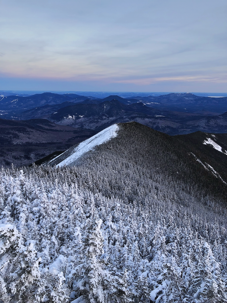
While Echo Canyon is a strenuous hike, the way up will be all worth the while at the end. The trail leads you to the top of the summit which is the highest point in the area that overlooks a beautiful mountain range and the city lights at night.

Hiking in Phoenix, Arizona:

Hidden Valley, Mormon Loop Trail

hiking and hikes in arizona

Mormon Loop Trail is a 4-mile loop trail located in Phoenix, Arizona that averages about two hours to complete. This trail winding through Hidden Valley is ranked as moderate as there is a high elevation gain within the first mile, and then the trail flattens out a good bit from there.

Parking is available at the trailhead and there is no need to worry if the lot is full by the time you arrive; parking on either side of the road is permitted. Furry friends are welcome on the trail if they are kept on a leash for the duration of the hike.

Peak seasons to hike Mormon Loop Trail is during spring and fall, mostly because summer in Arizona is excruciatingly hot with temperatures upwards of 100 degrees. This trail is a super fun journey with lots of rock formations to hike through and around. Mormon Loop Trail also leads to Fat Man’s Pass, another famous hike in Arizona.

Weavers Needle

Weavers Needle - Wikipedia

Weavers Needle is located in Phoenix, Arizona and it is a beautiful 12-mile loop trail. You may also hear of the local legend which says that lost gold can be found at the peak of the needle’s shadow. You should go take a look!

The hiking day will begin at the Peralta Trailhead which will then continue the loop for an average of eight hours. Weavers Needle is ranked as a moderate trail due to the length and steepness at times.

It’s recommended that a helmet be worn while on the trail, as rocky debris is sometimes common and potentially dangerous for less experienced hikers.

Aravaipa Canyon

Aravaipa Canyon Wilderness Permits, Aravaipa Canyon Wilderness - Recreation.gov

Aravaipa Canyon, located between Tucson and Phoenix, is 21.6-miles in length from one side of the canyon to the other.

Fully hiking Aravaipa Canyon takes about two to three days. The trail is ranked as difficult due to much of the trail being filled with water from the creek. Fully expect to be boulder hopping and to have wet feet!

A permit is required to enter the trail. This will cost $5 per day along with a $6 reservation fee per transaction. Aravaipa Canyon permits can be purchased online here.

Only 50 people are allowed on the site per day which means reservations will be limited. This also means your stay will be limited. However, it’s one of the best hikes in Arizona if you don’t want to deal with crowds as long as you reserve early.

Permits have a maximum of three days and two nights with parties no larger than ten. Unfortunately, pets are prohibited in Aravaipa Canyon.

Peak visiting months are March through May and October through November when the weather is not too cold to get wet as well as avoiding the extremely hot summer months. Aravaipa Canyon is highly recommended for wildlife lovers as it is home to deer, coyotes, hawks, turkeys, bears, and sheep.

This is by far one of my favorite Arizona hikes – you’ll love it if you’re up for some serious adventure.

Hiking Through the Havasupai Reservation:

Havasu Falls

Havasu Falls in Arizona is Nothing Short of Breathtaking – Trips To Discover

Havasu Falls is a beautiful waterfall located on the Havasupai Reservation. The hike is about 10-miles in length from the entrance to Havasu Falls. Hiking through the Reservation is ranked as moderate as it is not too difficult, but it is too immersive for a beginner hiker to complete.

*Be prepared to spend a little money on this amazing experience.*

To visit any of the falls located inside the Havasupai Reservation a permit is required and must be purchased from their website. Permits to visit are available from February through November. These reservations can only be purchased for 3 nights costing $100 during the week and $125 during the weekend. This means tickets will cost about $300 to $375 per person.

There is a campsite on the reservation for hikers to set up their homes for the next three days. Mules can be rented for $400 to carry up to 32 pounds of camping equipment. Reserving a mule can be done when purchasing your permit.

Peak months to visit the reservation are May through September. Picking the best season to fit your desires is crucial. Spring is the perfect time to hike temperature-wise, but it may be too cool to swim in the pools of the falls. Early summer months are perfect temperatures for swimming, but with the warmth comes more bugs. Regardless, this is one of the best hikes in Arizona with swimming by far!

Choosing to visit during peak summer months can be risky as this is flashflood season. Cancelations are possible during flash flood season that will result in no refunds or rescheduling. Make sure to read the fine print when purchasing your permit!

This is by far one of the best hikes in Arizona with waterfalls. It seriously can’t be missed!

Mooney Falls

Mooney Falls (Supai) - 2022 All You Need to Know BEFORE You Go (with Photos) - Tripadvisor

Mooney Falls is one of the more gorgeous Arizona hikes. Standing over 200-feet tall, this waterfall is located on the Havasupai Reservation and is the tallest waterfall you will encounter in the area.

This gorgeous waterfall is about a 1.5-mile hike from the Havasupai Reservation campground. The hike from the campground to Mooney Falls is one of the more difficult ones in Havasupai as you must hike through old mining routes down a slippery and steep cliffside. Mooney Falls was named after James Mooney in 1883 when he fell to his death trying to reach the bottom of the falls.

Since then, safety precautions have been made for hikers to get a thrilling experience down the cliffside while making it to the bottom to enjoy the beauty of the falls.

Beaver Falls

Epic Waterfalls - Beaver Falls in Havasupai - YouTube

Beaver Falls is a series of small waterfalls that create gorgeous blue-green swimming pools over sandstone and limestone. From the campsite, the hike to Beaver Falls is 3-miles which will take about an hour and a half to two hours to complete.

The falls are the perfect place to cool off and relax for the day in the gorgeous pool, or if you are looking for an adrenaline rush, cliff jumping is also common here. This is definitely one of the most gorgeous hikes in Arizona with waterfalls (multiple) that you won’t want to miss.

Hiking Through Arizona:

Robbers Roost

Robbers Roost, Utah, Guided Canyoning. 1-day trip. Certified guide

Hiking in Arizona provides outstanding experiences for any adventurer. Robbers Roost is a hidden gem located in Clarksdale, Arizona that can do just that! This trail is 3.6-miles in length and takes an average of one to three hours to complete.

Robber Roost is ranked as easy to moderate as there are a few steep points, so it is perfect for beginners looking for a bigger challenge. Since this is a hidden gem, this is not a heavily trafficked trail, so you may have it all to yourself!

There is a large cave to explore on the trail. The cave entrance lays on a steep edge, so continue with extreme caution, and do not attempt to enter after a rainstorm. From inside the cave, you will have breathtaking views of surrounding mountain ranges and the world below.

Wildcat Trail

Wildcat Trail, Monument Valley, Arizona/Utah

Wildcat Trail is a 1.6-mile hike located in the Oljato-Monument Valley, and it is considered to be one of the best Arizona hikes. The trail will take on average about two hours to complete.

This trail is ranked as easy, so it’s perfect for beginner hikers! Wildcat Trail itself is free to hike, but to enter Monument Valley Navajo Tribal Park there is a fee. This will cost $20 per vehicle of up to four passengers or will cost $10 per walk-in, motorcycle, or bicycle.

Wildcat Trail is the only hiking location in Monument Valley that does not require a tour guide. The trail is open to hiking before 11 am and after 5 pm and closed in the afternoon to protect hikers from the midday heat.

Pro tip: If you’re planning on hiking in Arizona then you should definitely get where you’re going early regardless of the trail!

Bob Bear Trail

Waterfall Trail at Fossil Creek | This large, natural waterf… | Flickr

Bob Bear Trail, formally known as Fossil Springs, is in Strawberry, Arizona.

This hike is 4-miles one way that should have an entire day set aside for it to spend the day in the swimming hole. Bob Bear Trail is rated as a moderate hike.

A permit is required only from April 1st to October 1st which will cost $6 per vehicle. From October 2nd to March 31st a permit is not required, so enjoy hiking for free!

While swimming in the gorgeous blue swimming hole with a waterfall flowing into it, be sure to find the cave near the waterfall.

Wolf Creek

Photos | Arizona adventure, Arizona travel, Prescott national forest

Wolf Creek, located in Prescott, Arizona, is a 1.8-mile hike that takes about an hour to an hour and a half to complete.

The trail is rated as a moderate hike that is kid-friendly. It’s a great spot for hiking in Arizona that appeals to everyone.

Parking can be found at Groom Creek Trailhead or along the side of upper Wolf Creek Road. Parking fills up quickly, so be sure to get there bright and early. Along the trail of Wolf Creek, the waterfalls are most beautiful after a good rain.

Cibecue Falls

Best time for Cibecue Falls in Arizona 2022 - Best Season - Rove.me

Cibecue Falls, located in Whiteriver, Arizona, is a 2-mile hike to the base of the falls. The trail to Cibecue Falls is rated as a moderate hike as it is mostly flat but covered in flowing water.

A permit is required costing $30 per person that must be purchased online. This permit will also grant you access to Apache Falls and allow you to camp in one of the Salt River Campgrounds.

Peak months to visit Cibecue Falls are May to September. The trail often closes during monsoon season due to flash floods, so be sure to plan your trip around this.

There are no restrooms available throughout the trail and picking up human waste is required on the trail. Be sure to go to the restroom before you arrive!

On the way up to parking for Cibecue Falls, there is often a vendor selling Navaho Bread for $5. Be sure to grab yourself a snack before your 4-mile roundtrip hike.

What To Pack While Hiking In Arizona:

  • Bags for waste
  • Extra pair of clothes (ya never know!)
  • First Aid kit
  • Good sturdy possibly waterproof hiking boots
  • Hydration additives
  • Plenty of water
    • One liter of water per person per two hours is recommended.
    • Many Arizona hiking locations do not have water available so always bring enough just to be safe.
  • Sun Protection
  • Toilet paper or wipes

Arizona offers hundreds of beautiful hiking opportunities throughout the state for beginners as well as experts. When hiking in Arizona be sure to follow Leave No Trace.

The seven principles for Leave No Trace are: plan & prepare, travel & camp on durable surfaces, dispose of waste properly, leave what you find, minimize campfire impacts, respect wildlife, and be considerate of other visitors. Other than that, enjoy the Arizona hikes and try out as many spots as you can.

Hikers, have fun, and be safe!

Seven Principles Sticker – Leave No Trace Online Store

Top 22+ Hikes In Phoenix Arizona To Check Out Right Now

You’ve come to the perfect location if you’re new to the Phoenix region or simply want to try out some new trails. Hiking in Phoenix can be fun, but it can also be dangerous and even deadly if you aren’t careful, especially during the summer months when temperatures spike.

This hikes list will help you locate the greatest spots to explore the great outdoors near Phoenix, Arizona, with everything from short and easy trails to more challenging hikes that will get your heart beating and leave you feeling accomplished.

So buckle up your shoes, double knot your hiking boots, and get ready to explore!

There are numerous excellent hikes in Phoenix and the surrounding area that are ideal for spending time with friends and family, getting some exercise, and viewing the environment.

Below is our selection of the best 20+ hikes to check out in Phoenix, AZ right now.

22. Camelback Mountain

hikes in phoenix, arizona hiking

Camelback Mountain is a stunning 2,704-foot peak located just north of metropolitan Phoenix, Arizona. It has stunning panoramic views of North Central and Downtown.

Ascend Camelback Mountain via Echo Canyon Trailhead, which begins at 3100 feet above sea level and ends at 1,400 feet above sea level, for a delightful hike that delivers a punch.

That may sound difficult, but don’t you worry: you probably will not be alone on the trip up to the top. Camelback Mountain is well known in the region and attracts over 800,000 visitors each year. This is a super popular spot for hiking in Phoenix!

To get to the top, either follow the Summit trail from the bottom to the top or the Cholla trail from the bottom to the halfway point, then turn around and finish the final half on the Summit Trail.

21. South Mountain Park

hikes in phoenix, arizona hiking

This popular hiking spot is only a few miles from downtown Phoenix and is ideal for running, hiking, and biking.

South Mountain Park, with its 1,300 acres, contains a little bit of everything, from lush meadows to rugged peaks. There are pathways to suit your needs, whether you’re searching for a relaxing stroll or a strenuous climb.

20. Piestewa Peak

hikes in phoenix, arizona hiking

Piestewa Peak, one of Phoenix’s top frequent hikes, is within easy driving distance of downtown and offers spectacular views of both downtown and Camelback Mountain.

This climb is ideal for beginners who want to overcome their fear of heights. It is also one of the best Phoenix hikes.

It can get very crowded on weekends as one of Phoenicians’ favorite hangouts, but if you stick around long enough and explore, some wonderful paths will take you away from everyone else. Keep your eyes peeled for some enjoyable sidewalks with spectacular sights.

19. Echo Canyon Trailhead

hikes in phoenix, arizona hiking

Echo Canyon is a great place for hiking and mountain biking, and it’s only a mile from North Mountain Park.

At 30th Avenue and Camelback Road, there is a trailhead. Parking, restrooms, water, and picnic tables are all available at the park, which is open from 7 a.m. to sunset.

This is an absolutely stunning hike that we definitely recommend! Just remember to bring lots of water because most months you’ll see temperatures of 75 degrees or (much) greater during the day.
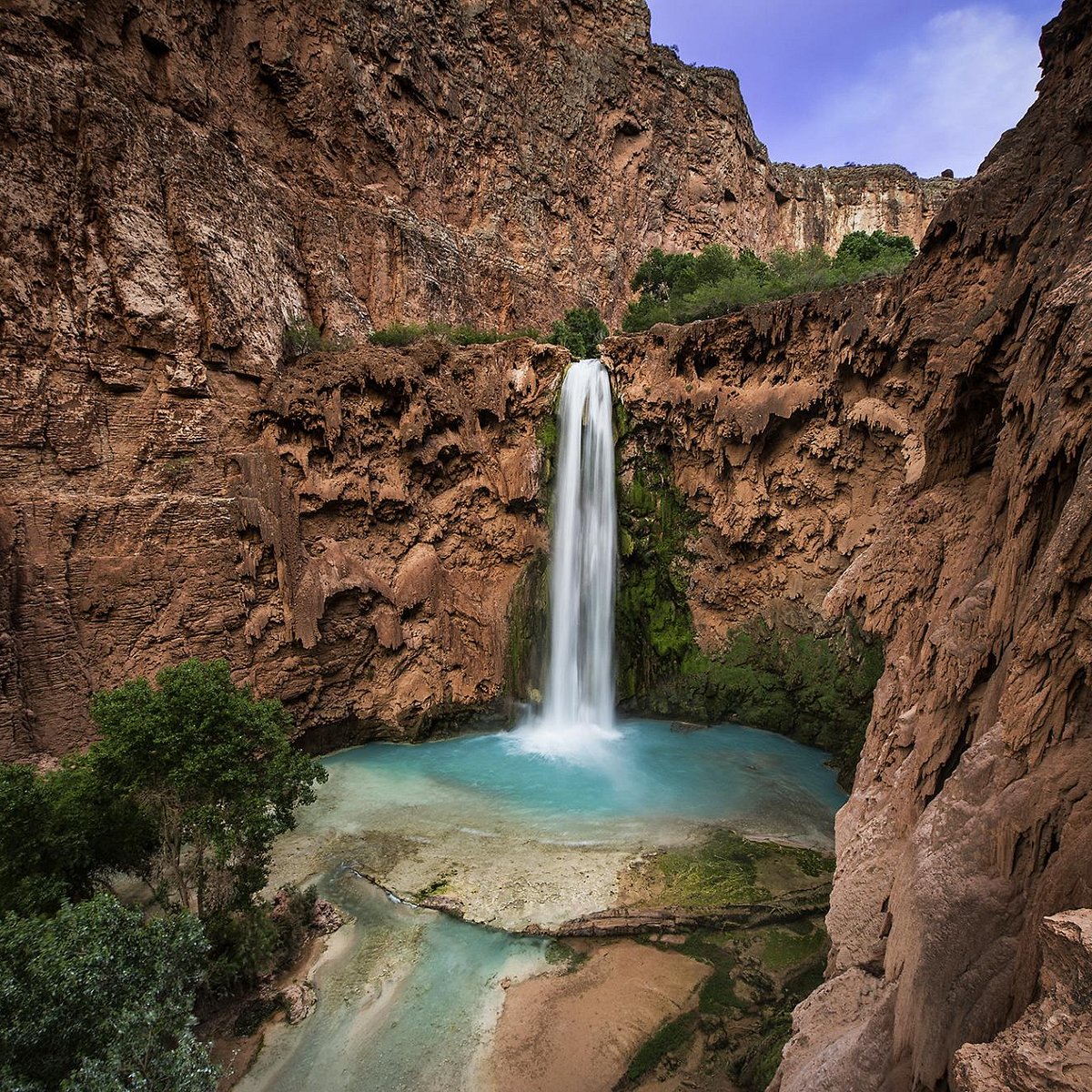
18. Usery Pass Trailhead

hikes in phoenix, arizona hiking

Usery Pass Trailhead is one of our favorite hiking trails near Phoenix, located just west of Apache Junction, Arizona.

It not only offers a fantastic view of the Mummy and the Superstition Mountains, but it also allows hikers to visit Usery Mountain, Regional Park. Hikers will be able to observe some ancient petroglyphs left by local natives from a long time ago from the Usery Pass Trailhead.

This is a relatively simple hike that most of us can accomplish without too much sweat. We loved it!
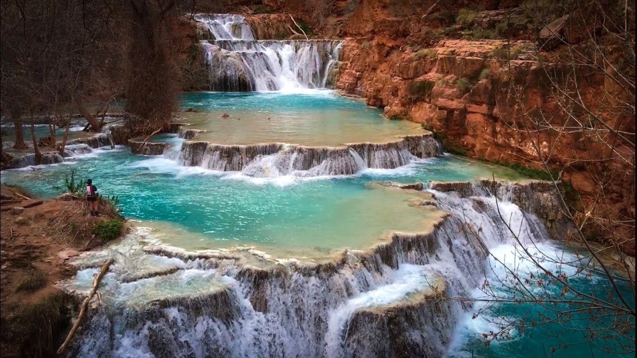
17. Blue Ridge Loop Trailhead 

hikes in phoenix, arizona hiking

Andrew Fulks, one of Tuleyome’s founders, loves this hike because it was one of the first he did in the area and the panoramic views are spectacular.

Keep in mind that this terrain is difficult to navigate and quite steep. This trail is best hiked in the spring when temperatures aren’t too hot. It’s over 10 miles long so it’s definitely a great workout and is a hike in Phoenix that you should thoroughly prepare for.

On Rayhouse Road, cross the low water bridge, then turn left and pass through the yellow gate with the sun-shaped pattern on the fencing. You’ll arrive at a little clearing through this access road. The metal sign indicating the Blue Ridge Trail will be on your right.

16. Pinnacle Peak Park

hikes in phoenix, arizona hiking

Pinnacle Peak Park is situated on Pinnacle Peak Road near Hayden Road, north of central Scottsdale AZ. This route offers stunning views of Camelback Mountain, one of Scottsdale’s most recognized attractions, and is available every day from 6 a.m. to 8 p.m.

The 1.8-mile circular track climbs 600 feet up and down hills and has a variety of landscapes, including desert plants and water features. Wildflowers will also bloom at different periods of the year.

All ages are permitted, but dogs are not permitted on paths marked as no dogs allowed (which are most paths). There are no facilities or drinking water within walking distance of these paths, so bring plenty of water and wear comfortable shoes.

It should take roughly two hours to complete the hike round trip. It’s a fun little hike near Phoenix with gorgeous views if you don’t want to spend the whole day on a trail!

15. Cholla Trailhead

hikes in phoenix, arizona hiking

Cholla Trailhead is one of Phoenix’s oldest trailheads, located near Desert Ridge, I-17, and Loop 101. It is a fantastic first hiking experience for newbies, offering a break from urban development and a chance to escape into nature for a few hours.

It’s ideal for hikers of all abilities, with plenty of shade and breathtaking vistas.

Make sure you don’t miss out on Mother Nature’s work of art — simply keep an eye out for cactus along the road. There are wonderful sights to be viewed at every turn if you can get past these nasty little suckers (and they will pinch you, so be careful).

Cholla Trailhead is well worth visiting, especially if you’re not a super experienced hiker but want to experience some of Arizona’s natural life.

14. Ledge Loop Trailhead

hikes in phoenix, arizona hiking

The Ledge Loop Trail is a moderate climb that rewards you with spectacular vistas of Camelback Mountain, rich vegetation, and little stream-fed ponds.

If you don’t feel like doing the complete loop around both peaks, you can do an out-and-back hike that includes a portion of the Goat Camp Trail.

Within Camelback Mountain State Park, this trailhead is located shortly before sunrise point. You can also access these routes from Echo Canyon Park or Piestewa Peak, but please follow any park laws to help protect these popular hiking spots as there are a lot of conservation efforts here.

These massive boulders are well-known among hikers, but they’re also well-known among locals who enjoy photographing the dramatic rocks against sunsets and other backdrops.

13. Boyce Thompson Arboretum

hikes in phoenix, arizona hiking

One of my favorite hikes in Phoenix is the Boyce Thompson Arboretum. It includes numerous routes, some of which are more difficult than others but all of which provide spectacular views and an understanding of Arizona’s plant life.

You’ll find desert-like landscapes as well as enormous swathes of forested areas in this diverse landscape.

And what if you don’t have enough time to go on a whole hike? It’s no problem. You can always take a nice drive through it— We think it’s best seen from a car because you can take it all in.

Because of its high height of over 5,000 feet, the sky is generally clear, making this one of the best hikes in Phoenix any time of year. Bring plenty of water and begin your hike early in the morning; it can get exceedingly hot in the afternoon (nearly 120 degrees Fahrenheit).

12. Hidden Valley Nature Center

hikes in phoenix, arizona hiking

This park has fantastic views of Camelback Mountain and plenty of hiking trails to explore. It’s ideal for hikers of all levels.

However, keep in mind that some of these trails are quite steep. This is definitely one of the steepest hikes in Phoenix.

On your way up, don’t forget to stop at their wildflower garden. Plan to hike for at least two hours and pack lots of water, as well as sunscreen, hats (plus points if they have a brim), bug spray, and any other essentials.

We believe you will agree that Hidden Valley Nature Center is one of the best Phoenix hikes and it should not be missed. You’ll enjoy an energizing ascent through their nature center while hiking their many trails surrounded by different vegetation, such as saguaro cactus or scrubs.

11. Lost Dutchman State Park

hikes in phoenix, arizona hiking

The Dutchman’s is popular among rock climbers, mountain bikers, bird watchers, and hikers of all kinds.

At an elevation of more than 5,200 feet, it’s an uncrowded path where you may spend as much time as you wish without running across anybody else. There are lots of spots to stop for a rest, and the views are spectacular.

It takes roughly two hours to climb either way, regardless of where you start. Multiple pathways intersect Lost Dutchman; if one becomes too busy, simply switch to another until everyone disperses. This is a great spot for varied hiking in Phoenix.

10. Lost Lake Park, Cave Creek

hikes in phoenix, arizona hiking

Another one of the great hikes in Phoenix Arizona is Lost Lake Park, and it’s open all year long. This track has a low elevation rise, making it perfect for beginner hikers who are just starting.

It’s a fun day trek to do with friends or family, or even by yourself. There are some amazing rock climbing opportunities along a wall on the right side of Lost Lake; however, if you decide to go bouldering here, make sure you have a spotter.

Cave Creek has nearly 150 miles of trails that cover a variety of terrain types such as peaks, canyons, and washes. Within Cave Creek Regional Park, there is a 91-year-old enormous sequoia tree known as Centennial Tree. This is one of the best hikes in Phoenix to view a ton of awesome nature!

9. Bell Rock Pathway

hikes in phoenix, arizona hiking

Bell Rock Pathway is a short and lovely hike located just north, northeast of downtown Scottsdale. It’s about a 1.5-hour drive up i-17.

Hikers will be awestruck by stunning views of Bell Rock and nearby sites like Camelback Mountain and Pinnacle Peak while traveling along a single trail for about one mile.

Locals advocate hiking early or late to avoid crowds, as this is a popular tourist destination. We highly recommend this one even if you have to come mid-day!

8. The Trans-Canyon Trail 

hikes in phoenix, arizona hiking

The Trans-Canyon Trail, which runs from Grand Canyon Village’s North Gateway Trailhead to Hermit’s Rest on the South Rim near Mather Point, is more than 50 miles long. Bring some water.

The Trans-Canyon Trail runs through lush foliage. Having been built by US Forest Service volunteers over years of hard work, be prepared to enjoy the seasonal wildflowers and unspoiled wilderness territory that is absolutely spectacular, yet relatively unfamiliar to most visitors. We hope you enjoy it!

7. Mescal Mountain Loop Trail

hikes in phoenix, arizona hiking

Mescal Mountain Loop Trail is the best hiking trail around Phoenix, Arizona. We highly recommend it! With about a 2-hour drive north on i-17 from Phoenix, you should be here in no time.

The hike itself is about a 6.4-mile out-and-back trip with a 1,335-foot elevation gain. It’s one of the best intermediate hikes in Phoenix.

Just outside of Fountain Hills, Arizona, the Mescal Mountain Loop Trail takes you on an excellent journey through magnificent pine forests and along gorgeous rolling hills. Mescal Mountain is a terrific place to visit if you want to enjoy great views on one of your favorite hikes in Phoenix. 

6. Roosevelt Lake

hikes in phoenix, arizona hiking

Take a picnic at Roosevelt Dam Overlook where the views are definitely worth the trek. Situated about 2 hours east of Phoenix AZ, you won’t want to miss this stunning view.

This climb reaches a height of 2,704 feet, making it one of Arizona’s highest spots! However, we recommend hiking this one on a weekday because on weekends you should expect to see a lot of people.

Lastly, as a bonus, you’ll have plenty of fun burning off some hard-earned calories by shopping or dining at Kierland Commons in North Scottsdale or Old Town Scottsdale on your way out from Roosevelt Dam Overlook. Here you will find more than 250 art galleries and boutique shops that we absolutely enjoyed!

4. Western Ave

hikes in phoenix, arizona hiking

Views of Camelback Mountain and McDowell Mountain can be found on this climb. Although Western Ave. is rated as easy, there are numerous ups and downs along the way that can make it appear more difficult than anticipated.

Even though most of Western Ave. has a broad, gravel trail, hikers frequently see horseback riders on their way up or down. We consider this one of the best Phoenix hikes!

Western Ave. is one of Arizona’s most popular hiking paths for novices and veterans alike due to its easiness and accessibility. In fact, it’s one of the best easy hikes in Phoenix that still has some variety, so it’ll be enjoyable for all levels.

Both sides of Western Ave. are bordered by two of Phoenix’s most well-known communities, Arcadia and Biltmore, making hiking en route simple from various sections of the city.

3. Tonto National Forest, AZ – Lost Dutchman State Park

hikes in phoenix, arizona hiking

Lost Dutchman State Park is home to one of my favorite walks. This park takes you on a journey through a natural beauty filled with high hills and deep canyons.

The hike is scenic and includes an old gold mine to explore if you have time. I recommend keeping on the route because there are rattlesnakes in some areas that off-trail hikers may encounter. But don’t worry – you’ll still see incredible views right from the trail!

This is a moderate hike (not too difficult) that’s really fun because it’s filled with both culture and adventure.

2. Tempe Town Lake Walking Path

hikes in phoenix, arizona hiking

Tempe Town Lake is one of Tempe’s most popular attractions. There are numerous attractions and sports you can try, including canoeing and paddleboarding, as well as rowing, fishing, and kayaking. The lake also attracts a variety of birds and serves as year-round habitat for ducks.

The Tempe Town Lake Trail is a one-mile stroll around the lake, which also features cycling routes. It’s a popular hangout for college students and young professionals, but it’s also bustling with joggers and dog walkers throughout the day.

If you want to enjoy some peace while hiking, go on weekdays or early in the morning. This is a perfect hiking route in Phoenix for beginners or anyone who is looking for more of a casual stroll.

1. Papago Park

hikes in phoenix, arizona hiking

Papago Park is a wonderfully unique location that is ideal for hikers in Phoenix. And it’s located right in the city!

It’s also one of America’s largest urban parks, with 4,210 acres dedicated to some of Arizona’s best trails and natural monuments (including some fantastic hiking). While exploring you’ll find the Papago Amphitheater, the William C Elliot Memorial, and if you have time you could even check out the Phoenix Zoo!

If you’re planning on hiking in the Phoenix area, make sure to stop at Papago Park. It’s a classic for a reason!

20+ Best Hikes In Sedona, Arizona That You Won’t Want To Miss

Whether you are an experienced hiker looking for new challenging adventures or a beginner that is looking for your first hiking trip spot, Sedona Arizona is the place to go. There are so many wonderful hikes in Sedona, with incredible views, that it’s hard to choose!

The famous vortex and red rocks area is considered a true paradise for hikers as it’s home to more than 200 trails and paths. However, there are plenty of awesome hikes in Sedona for all levels, offering all sorts of sights.

Today we present you with our absolute favorite 20+ hikes in Sedona, from the most famous landmarks to the hidden gems of Sedona! You’ll definitely want to check out these really popular hikes if you’re staying in the area.

How To Make Your Hike Memorable:

Sedona is one of the best places in the United States when it comes to hiking, but planning ahead is still crucial to making the best out of your trip!

Parking lots tend to get full very quickly as everyone usually gets to a hike via car. Our advice is to know where you want to go and plan ahead so that you will be able to park and start your hike in the morning when the site is less crowded. The earlier the better!

Otherwise, plan a smaller/shorter hike later in the afternoon, especially when the days are longer. Most parking lots begin clearing out after 12pm.

Always remember to bring water with you. The majority of Sedona hikes don’t have water facilities along the way and the sun can be very hot especially during summertime. Seriously: it can get dangerous pretty quickly.

When planning your hike always make sure to check if the site you are going to visit requires the red rock pass. This is a purchasable pass that allows you to visit specific sites and support the local maintenance of this area. The pass cost ranges from 5 dollars for a daily pass up to 20 dollars for a weekly pass.

It’s definitely worth it to buy these passes before you go! Some places won’t even let you park without the pass, while others will charge you 3x what you would have paid.

20. Cathedral Rock Hike

Explore 20+ Best Hikes in Sedona, Arizona: Cathedral Rock Hike

This is one of the most scenic trails that you will find in Sedona. The Cathedral Rock hike offers great views of famous landmarks such as Bell Rock and Courthouse, making it popular for a reason. The views are some of the best in the area!

When approaching this hiking trail consider that it may be tricky and tough in certain parts. However, it’s only a one-mile-long roundtrip and the elevation gain is around 500 feet.

The trailhead is located halfway down Back O Beyond Road, off Highway 179, between Sedona and the Village of Oak Creek. I definitely recommend that you check out this Sedona hike if you’re at all athletic – it’s really one of the first you should do as a hiking enthusiast!

19. Doe Mountain

Explore 20+ Best Hikes in Sedona, Arizona: Doe Mountain Trail

If you are looking for a less crowded spot to hike then the Doe Mountain hiking trail is a good choice. 

Most of this trail’s 430 feet elevation gain is spread along the first 0.7 miles which makes this a perfect trail for beginners. It’s one of the best easy hikes in Sedona that still has a lot of lovely perks!

The trail gives you incredible views of many Sedona Red Rocks landmarks such as Bear, Maroon, and Wilson mountains, Loy, Boynton, and Secret Canyons. It’s a great place to start if you’re not feeling up to the Cathedral Rock Hike.

You will find the trailhead of this hike about 36 miles from Flagstaff.

18. Boynton Canyon

Explore 20+ Best Hikes in Sedona, Arizona: Boynton Canyon Trail

Although this is one of the best easy hikes in Sedona Arizona, the Boynton Canyon hike trail is well known for its outstanding scenery.

This trail is perfect for those who are looking for a very easy walk around the red rocks of Sedona as it’s one of the easier trails to walk. It’s 7 miles roundtrip with 800 feet of elevation gain.

The beauty of this trail is enriched by its spiritual value as it has been recognized as one of the top vortex energy sites. If you’re looking for spiritual hikes in Sedona then this is definitely the first place you should check out.

When hiking this trail, keep an eye out for the local flora and wildlife as this is one of the best spots for birdwatching too! This trail really has it all and is so easy that there’s no excuse not to try it.

17. Soldier Pass Trail

Explore 20+ Best Hikes in Sedona, Arizona: Soldier Pass Trail

The Soldier Pass trail is an intermediate-level hike that will give you the chance to fully embrace nature as it’s one of the less crowded trails in Sedona, specifically in the Red Rock Mountains area.

This is a 6-mile-long loop trail with an altitude gain of 800 feet that has a unique look on the famous Devil’s Kitchen landmark.

If you are looking for an immersive personal experience with nature then we highly suggest you add a mile-long detour to Soldier Cave when you find yourself at the last fork in the road.

16. West Fork Hike

Explore 20+ Best Hikes in Sedona, Arizona: West Fork Hike

West Fork hike is one of Sedona’s most visited trails and it’s the perfect example of how widely the landscapes around this area can be different. You will find so many green and woody areas while walking beside beautiful canyon walls!

This trip is a 7-mile roundtrip with an elevation gain of 500 feet and is very accessible to every kind of hiker, but you do have to cross the stream in several places, so a good pair of waterproof shoes is going to be useful.

If you’re looking for hiking in Sedona with beautiful views and an easy-to-intermediate trail, plan to check out West Fork.

15. Fay Canyon

Explore 20+ Best Hikes in Sedona, Arizona: Fay Canyon Trail

If you are looking for an easy walk through Sedona’s wonderful red rocks then the Fay Canyon trail is what you are looking for.

It is a 2.6-mile roundtrip with an elevation gain of 390 feet, rich with many beautiful spots.

Many visitors usually don’t know that this path is home to an incredible natural arch that is located just half a mile up the trail. This looks just like a regular rock overhang, but once you take a closer look you’ll be astonished by this red rock formation.

This trail allows enjoying a very typical Sedona landscape with some hidden gems along the way such as hidden canyons and desert plants. It’s one of the coolest secret Sedona hikes for hidden spots!

14. Birthing Cave 

Explore 20+ Best Hikes in Sedona, Arizona: Birthing Cave Trail

The Birthing Cave hiking trail is probably one of the less-known spots in the Sedona area and it is the best place to go to if you want to feel a strong connection with nature.

It is a 2-mile roundtrip with a 300 feet elevation gain. The trail is a relatively easy hike, with a wide and flat path, making it an accessible walk to many.

Once you have meandered through the majority of this Sedona hike, you’ll start to see the peak of the cave poke around the corner.  The cave interior has a unique heart shape, its ceiling curves up to a point, with the cave’s base also coming to an end.

This is one of the best hikes in Sedona to really feel a spiritual connection. Something about the formation of the rocks allows for a massive spiritual vortex. We’ve brought friends here who didn’t believe in anything spiritual (like, at all) and even they could feel it. It’s that strong!

13. Bell Rock Climb 

Explore 20+ Best Hikes in Sedona, Arizona: Bell Rock Climb

This is one of the most popular hiking trails in Sedona as it gives you the possibility to climb one of its most famous and spectacular landmarks.

With a 3.6-mile-long trail and a 400-foot altitude gain, this hike is great for every kind of hiker since it’s up to you how far you want to go up on the climb. But I will say: the views of the landscape from the upper levels of Bell Rock are definitely worth a little extra walk.

The first 0.25 miles of this Sedona hike are marked with trail signs and wire that are filled with rock but as you head higher onto Bell Rock, the wire baskets disappear. You can continue to go up following your route (the climb is not marked) as long as you know where you’re going. I recommend checking out a map ahead of time.

12. Devil’s Bridge 

Explore 20+ Best Hikes in Sedona, Arizona: Devil's Bridge 

The Devil’s Bridge path is probably one of Sedona’s best hikes and one of the most popular. This incredible landmark is the largest natural sandstone arch in the Sedona area.

The hike is a 1.8-mile roundtrip with a 400-foot elevation gain and is a great trail for every kind of hiker. The path is smooth and clear as it was originally built for jeep tours, making it really easy to walk.

You can either look at the Devil’s Bridge from a lower point of you or take that last climb and walk across it and have a unique view of the panorama. This is one of the best easy hikes in Sedona with incredible views. Seriously, this has to be the easiest hike anywhere.

If you’re totally afraid of exercise but still want the views then this is by far one of the best hiking trails in Sedona!

11. Airport Mesa Loop Trail 

Explore 20+ Best Hikes in Sedona, Arizona: Airport Mesa Loop Trail 

The Airport Mesa is located in the south of Sedona. This trail makes a loop on its upper rim; from there you will be able to see many red rock famous landmarks such as Cathedral Rock, Bell Rock, Courthouse Butte, Munds Mesa, Thunder Mountain, and the town of Sedona.

This is a very easy 3-mile-long loop hike with a 400 feet elevation gain, however, if you don’t want to go all the way up, hike the short spur trail up to the top of the Summit Trail for awesome views over Sedona.

10. Courthouse Butte Loop Trail

Explore 20+ Best Hikes in Sedona, Arizona: Courthouse Butte Loop Trail

The Courthouse Butte Loop Trail is a moderate 3.9-mile loop trail that takes you to two of Sedona’s most prominent rock formations, Courthouse Butte and Bell Rock. 

You will have to take the Bell Rock trailhead to start, but then at the first fork continue north and you will get into the actual trail.

This is the perfect hike for beginners offering great views of Sedona’s landmarks, easy paths, and an abundance of wildlife.

9. Adobe Jack Trail

Explore 20+ Best Hikes in Sedona, Arizona: Adobe Jack Trail

The Adobe Jack Trail is one of the newest trails in the Sedona area with fantastic red rock views and a path that will lead you to a creek bed.

This is a 4-mile-long trail with an elevation gain of 167 feet which is best for intermediate hikers.

The trail is immersed in the natural red rock area but it also dips in and out of small green areas.  As you get lower, it may get a little rougher and rockier, but this is an overall doable trail that is perfect for those who are looking for a more sporty experience.

8. Schuerman Mountain Trail

Explore 20+ Best Hikes in Sedona, Arizona: Schuerman Mountain Trail

The Schuerman Mountain Trail is one of the best trails in Sedona if you are looking for a less-crowded but still visually stunning hike.

This 2-mile-long trail starts at Sedona High School with a moderate uphill for about half a mile before reaching the rim.

Schuerman is more mesa than a mountain and in fact, as you climb to the top of the mountain, you will be able to get some impressive views of the Verde Valley.

7. Broken Arrow Trail

Explore 20+ Best Hikes in Sedona, Arizona: Broken Arrow Trail

Although very popular, the Broken Arrow trail is the perfect hike for beginners who want to experience an immersive walk in the Red Rock area.

The trail is about 4 miles long and very easy to follow as it is also accessible for Jeep tours. There’s a gentle climb up a wide valley, lined on both sides by beautiful eroded red rock cliffs.

The uphill ends at the Chicken Point low pass, which has good views south towards Oak Creek village, and north to Sedona and the high mountains beyond.

This is one of the best hiking trails in Sedona for those of you who want an easy hike that still takes a few hours.

6. Wilson Mountain 

Explore 20+ Best Hikes in Sedona, Arizona: Wilson Mountain Trail

This trail is one of the most visually stunning paths that you can find in the Sedona area as it offers beautiful views of the Oak Creek Canyon.

This is a hard hike since it goes up 2300 feet in the first mile, so you may need to plan a whole day to accomplish this mission. However, the views you will get from this hike are going to be worth the effort.

Keep in mind that it may be hot during the summer so remember to have some water with you. Just north of Encinoso Picnic Area, 3 miles up canyon from Midgley Bridge, you can take an alternate route which is a lot cooler than the others if you’re doing this trail on an especially warm day.

5. Dawa Trail 

Explore 20+ Best Hikes in Sedona, Arizona: Dawa Trail

The Dawa hike is a 2.6 miles loop trail close to Doe Mountain interwoven with 3 other trails. 

It is a great walk for beginners as its elevation gain sits around 150 feet; it is considered more of a nature walk than an actual hike since it’s very easy to spot local wildlife on the path.

This loop trail has many great spots for incredible views and along the way, you will be able to find a beautiful evergreen forest that will open up to spectacular views of the surrounding red rock mountains.

4. Lower Chimney Rock Trail 

Explore 20+ Best Hikes in Sedona, Arizona: Lower Chimney Rock Trail 

This is the best choice if you’re looking for an easy hike in Sedona, close to downtown, and if you don’t have much time to spend walking.

The Lower Chimney Rock trail is a great way to experience the typical red rock landscape in Sedona because the trail shares its head area with Thunder Mountain, Little Sugarloaf Summit, and Chimney Rock Pass Trails, allowing you to get great views.

This is one of the best hiking trails in Sedona to check out if you don’t have a lot of time and want to stay close to the city.

3. Pumphouse Wash Trail 

Explore 20+ Best Hikes in Sedona, Arizona: Pumphouse Wash Trail 

If you are looking for a more adventurous type of hike the Pumphouse Wash trail is definitely what you are looking for!

This is one of the best hikes with water in Sedona as there are lots of boulder hopping opportunities and cool natural pools.

Although is not properly marked and flat, the trail is pretty doable and fun to walk. It’s totally up to you how far to walk as there’s not an official ending point.

2. Sketch-Ridge Loop TrailExplore 20+ Best Hikes in Sedona, Arizona: Sketch-Ridge Loop Trail

The Sketch-Ridge Loop Trail is a beautiful easy to moderate hike from a ledge on the eastern rim of Carroll Canyon. 

With a 285-foot elevation range and a roundtrip of 2.6 miles long, this trail offers amazing views of iconic red rock formations such as Bell and Courthouse Butte among many others like the Scorpion Pyramid.

The local flora is very abundant on the trail itself, especially during springtime.

1. Smoke Trail

Explore 20+ Best Hikes in Sedona, Arizona: Smoke Trail

This hike is very easy yet incredibly enjoyable for every kind of hiker as it follows the flowing waters of Oak Creek and offers a great view of the beautiful Cathedral rock in the distance.

The trail takes you through a green lush wooded area with is great during hot summer days. With a length of 0.5 miles, this path is a great choice for a relaxing nice walk.

If you’re looking for more secret hikes in Sedona, then you should definitely check out Smoke Trail. It’s usually not too crowded since not many people know about it!

15+ Best Hikes In Rocky Mountain National Park Right Now

Rocky Mountain National Park boasts more than three hundred miles of hiking trails. Whether you’re a family traveling with young kids or an enthusiastic peak collector, there is a little something for your whole group here, from flat lakeside strolls to steep mountain climbs. Everyone enjoys at least one of the hikes in Rocky Mountain National Park!

Choosing which trails to hike in Rocky Mountain National Park can be as overwhelming as ever if you’re currently planning a visit. With a short visit, you can experience quite a few of them, especially if you choose trails that are short and sweet.

A few of the best hikes in Rocky Mountain National Park include walks along meadows in search of awe-inspiring alpine lakes to trails that challenge you to summit a Colorado fourteener.

Are These Hikes In Rocky Mountain National Park Safe?

hikes in rocky mountain national park

These hikes are all safe if you use common sense. Don’t do anything risky or stupid! If you have to ask yourself whether something is dangerous or not, it probably is. Always bring a buddy with you.

You should also be aware of the elevation. Beware that the air is thinner at higher altitudes (and some of these hikes have insane altitudes), so take it easy and breathe deeply if you aren’t acclimated yet.

The Best Hikes in Rocky Mountain National Park

Here are the top hikes in Rocky Mountain National Park right now!

15. Emerald Lake

hikes in rocky mountain national park

It is for all the right reasons that the Emerald Lake trail is one of Rocky Mountain National Park’s most popular hikes. There’s something magical about this hike that is both accessible to most hikers and accompanied by gorgeous alpine scenery the entire way.

My favorite part? While hiking, you’ll pass three picture-perfect alpine lakes (Nymph Lake, Dream Lake, Emerald Lake), giving you plenty of opportunities to take a break.

In addition to the three main lakes, you can also choose to go the extra mile (literally) to see Lake Hayiaha. It adds an extra mile to the trek (and another one on the way back), but if you’re still hungry for more mountain delights, it’ll be well worth it.

14. Bridal Veil Falls

hikes in rocky mountain national park

There aren’t many waterfalls in Colorado even though the state is known for its natural beauty.

Are there exceptions to the rule? In Colorado, Bridal Veil Falls offers an unusual sight with its 20-foot cascade.

This 6.1-mile hike takes around 3 hours to complete. A moderately difficult trail, it follows Cow Creek and offers plenty of wildlife sighting opportunities (watch out for elk and mule deer) as well as beautiful aspens and meadows to keep you entertained along the way.

This is one of the best hikes in Rocky Mountain National Park if you really want to experience all the elements in nature!

13. Sky Pond

hikes in rocky mountain national park

The Sky Pond Hike is a great alternative for those who want to put their legs to the test if the Emerald Lake Hike is too easy for you.

With views of dramatic valleys, Sharkstooth and Taylor Peaks, and two dreamy alpine lakes, this 8-mile hike isn’t for the faint-hearted, but the views every step of the way are just stunning.

Read More: Hike to Sky Pond in Rocky Mountain National Park 

12. Long’s Peak via the Keyhole Route

hikes in rocky mountain national park

Interested in a true challenge? Longs Peak, the mountain at the top of Rocky Mountain National Park, might just be the most iconic mountain in the entire state.

If you want to put your hiking skills to the test, the Keyhole Route is the best route to take. However, there are several routes that can help you conquer this popular Colorado 14er (some easier than others).

On Longs Peak, there is a trail called the Keyhole Route that is a 14.5 mile (out and back) hike rated as extremely difficult due to its 4,991 foot elevation gain. While climbing, you will encounter steep cliffs, vertical rock faces, and loose rocks. The summit is also reachable only by scrambling, which makes it challenging for hikers of all levels.

You should not take this hike lightly. Previous hiking experience is a must, as is wearing a helmet. Make sure that the weather conditions are suitable for summiting before starting the hike.

11. Bear Lake

hikes in rocky mountain national park

While this easy hike is known as being the most manageable in Rocky Mountain, it doesn’t take anything away from the breathtaking views.

Despite the short nature of the trail (less than a mile long), you will get to enjoy views of nearby peaks as well as Bear Lake, a stunning body of water sure to leave you breathless.

Brear Lake trail is a stroller- and wheelchair-accessible trail, making it one of the most family-friendly hikes in Rocky Mountain National Park.

10. Chasm Lake

hikes in rocky mountain national park

Rocky Mountain seems to be king when it comes to picture-perfect, dreamy alpine lakes, which is why every hike on this list involves a lake. Chasm Lake is another hike that should be on your hiking list, especially if you’re in the mood for a long hike.

Along with the alluring lake at the end of the hike, the entire hike is filled with charm, and you’ll stop several times to enjoy the scenery along the way. A 7.7-mile trail that takes you by vistas of Long’s Peak, an amphitheater of rock formations, and a delightful waterfall can give you a pretty good idea of what to expect!

9. Sprague Lake

hikes in rocky mountain national park

One of the most popular short hikes in the park is to Sprague Lake, located off Bear Lake Road. Around this lake there is a handicap-accessible hiking trail.

Looping around the lake, this trail is 0.5 miles long. Hiking this trail is possible at all hours of the day, and there is always something new to see. Your party will enjoy the flat trail at Sprague Lake – it’s good for all athletic abilities!

Picnic tables and benches are nearby where you can enjoy the view while enjoying a picnic lunch. It’s a great place to watch the sunset as the colors in the sky light up behind the mountains. The park’s Eastern area is suitable for a half-day visit.

8. Loch Lake

hikes in rocky mountain national park

As you climb gradually through a spruce forest, you will come to Alberta Falls. The falls are not easy to see from the trail – climb the rocks straight ahead to get a better view.

After you ascend past the falls, you’ll begin to notice two things. For one thing, the number of people on the trail will drop by 85%. Secondly, the forest will begin to gradually change and get a lot thicker. Before reaching the Loch, you’ll have to traverse a few switchbacks.

In my experience, the side of the lake that you’ll find yourself first on is constantly windy, so you may want to move to the other side of the lake and take a few moments to enjoy the views before returning. While this is one of the more difficult hikes in Rocky Mountain National Park, the views are insanely gorgeous.

7. Nymph Lake

hikes in rocky mountain national park

From the Bear Lake Trailhead, Nymph Lake is an easy hike. It takes a little more than a mile to walk to and from Nymph Lake. Water lilies are frequently seen in the lake, making it a really gorgeous natural area. Whenever we go to another lake in the park, we often stop here first.

There is no better place to kick back, relax, and enjoy the views of the mountains than Nymph Lake. Despite the busy nature of the trail, there will be areas where you can sit and take in the view of this beautiful lake.

When hiking to Dream Lake, you will first come across Nymph Lake. I definitely recommend that you stop for a few moments to enjoy its beauty!

6. Dream Lake

hikes in rocky mountain national park

From the Bear Lake Trailhead, Dream Lake is an easy hike. It is the most photographed lake in the park.

The trail is about 2 miles roundtrip. It’s a short trek with a 426-foot elevation gain that’s great for beginners.

The hike passes Nymph Lake, which I highly recommend taking a glance at (it’s beautiful). After you arrive at Dream Lake, walk around the lake, sit on the perfect rock, and enjoy a snack.

hikes in rocky mountain national park

Trails leading to Dream Lake can also be crowded, so try to avoid hiking during peak hours of the day. Hiking to Emerald Lake or Lake Haiyaha is also an option if you want to hike more than a couple of miles once you’ve arrived.

This is definitely an ideal route if you have only one day to hike Rocky Mountain National Park!

5. Irene Lake

hikes in rocky mountain national park

Near Grand Lake, on the west side of the park, is the Irene Lake Trail. With an elevation gain of 85 feet, this trail is a 0.8-mile loop.

The parking area near the trailhead has restrooms and picnic tables.

In summer, there are beautiful wildflowers everywhere – they provide a colorful backdrop to the lake. If you are interested in bird watching, be sure to bring your binoculars. Plus, it’s not uncommon to see moose on this side of the park.

From the parking area, look across Trail Ridge Road to see Sheep Rock. It is often here that you can see Bighorn Sheep, which are frequent visitors to the park.

4. Black Lake

hikes in rocky mountain national park

The trail to Black Lake crosses Loch Lake/Sky Pond and then turns left just before the Loch just before the Black Lake.

Two other lakes will be seen on your way – Mills and Black Lake – the latter being 2.8 miles beyond the turnoff. Black Lake is particularly beautiful.

Having said that, if you only have time for one hike, I would recommend Sky Pond. But don’t get me wrong: Black Lake is a beautiful place for hiking in Rocky Mountain National Park! However, it’s a bit shorter/easier so not everyone will feel “done” after hiking to Black Lake.

The waterfall scramble on the way to Sky Pond may scare you, so this is the next best thing.

3. Alpine Ridge Trail

hikes in rocky mountain national park

Near the Alpine Visitor Center on Trail Ridge Road is the 0.7-mile out-and-back Alpine Ridge Trail.

As this trail reaches a height of more than 12,000 feet, I do not recommend this short hike until you have acclimatized to the elevation. It’s definitely one of the more difficult hikes in Rocky Mountain National Park.

While ascending the stairs near the Alpine Visitor Center, you should take in the view. It’s really stunning for the athletically-inclined.

You must remain on the trail at all times because the surrounding tundra is not a place for wanderers. Trust me on this! The climb is dangerous enough as-is due to the elevation.

The more steps you take as you ascend, the more likely you are to get winded – the elevation gain is 147 feet! Take it as slow as needed.

Winter hats and coats are recommended, as it is going to be cold at the top. But your climb will be a talking point for years to come because of the 360-degree view from the top!

2. Lily Lake

hikes in rocky mountain national park

In the east of the park, Lily Lake is a 0.8-mile loop trail. Enjoy the views as you stroll – they’re incredible!

Accessible to wheelchairs, the trail offers incredible views over the lake and bird watching opportunities. In some places, there is a boardwalk in addition to the dirt and gravel trail surface.

For a bit more of a challenge, you can take the Lily Ridge Trail. The view of the mountains will be even better if you hike a little further.

After a long hike or other outdoor activity, Lily Lake is the perfect place to relax and unwind. Wildflowers and birds can be seen in abundance at Lily Lake in the park.

Picnic tables and nearby toilets are also available. Visit the lake at sunset when it is stunning and the crowds have dispersed.

1. Mount Ida

hikes in rocky mountain national park

As you descend into the valley on the west side of the park, you will find this hike along Highway 34 on the south shore of Poudre Lake.

Since this trail is only accessible during the late spring and summer, it will only be accessible from the east side of the park. In November and May, it will be snowy if you enter from Grand Lake.

While the mileage might not seem that bad, the elevation is almost certainly going to make it seem ten times harder because you will be climbing upwards of 10,500 feet. By the end, you’ll get to 13,000 feet, which is extremely high.

If you’re coming from somewhere near sea level, do not attempt this hike the first day! Make sure you’re acclimated to the elevation.

The benefit of hiking at that elevation is that you’ll be above the treeline most of the time, which allows you to experience breathtaking views of the surrounding mountain peaks.

When you do this hike in the summer, as you’ll be above the treeline, be sure to finish by noon to avoid lightning storms that happen almost every day during the peak summer season.

What You Should Know Before Visiting Rocky Mountain National Park:

Buy The Right Pass: You will have to pay at least $20 for entry a day, and $30 for entry that is good for seven days. If you plan to visit multiple National Parks in the next year, consider investing in an America the Beautiful Pass, which costs $80 and includes 3 visits to National Parks, National Forests, or National Recreation Areas.

Watch Out For The Altitude: The altitude in Grand Teton is insane – it’s above 8,200 feet most of the time, meaning if you go hiking you’ll get to above 10,000 feet. Stay hydrated and take it easy on your first day.

It Gets Sunny: It feels like the heat is stronger in the mountains. Maybe being that much higher makes a difference? Remember to use sunscreen or bring a hat.

Pack The Right Gear: Before you go hiking in Rocky Mountain National Park, make sure that you have the right gear. For example, it will be a good idea to bring a map if you plan on going off-trail. Also, don’t forget your sunscreen and bug spray. You will also want to bring a day pack or backpack with enough water, a rain poncho or jacket, a first-aid kit, and snacks so you can go at your own pace. We always bring a few beers along but that’s a personal choice!

Plan For The Weather: Be sure to check the weather before you go on a hike. If it’s going to be sunny, make sure that you have sunscreen and/or a wide-brimmed hat with you! You will also want to bring an extra layer in case the weather changes suddenly, which is pretty common on these hikes in Rocky Mountain National Park.

Be Aware Of The Wildlife: Sometimes, you might find some wildlife hanging out by the trail. Don’t freak out! You should always keep your distance though, so use your best judgment when it comes to this. If an animal does approach you, calmly back up and move off the trail until it moves away from you.

Know When To Go: Most of these trails in RMNP are closed from December 1st – July 31st, so keep that in mind when planning your trip.

Parking Is Tough: In the fall, most lots are completely full by 7am. Yikes. From each of the trailheads, at least 4-5 highly trafficked hiking trails depart. Luckily, you can park at the Bear Lake Road park and ride, and a complimentary shuttle will whisk you to the trailheads. It’s even possible to ride the hiker shuttle to the Estes Park Visitor Center without having to worry about parking in the park.

East Versus West Sides: Alpine Ridge Road, which closes for the winter, connects the less-visited east and west sides. There is no better place to drive through Rocky Mountain National Park than above the treeline into the alpine tundra, where you can see the surrounding Rocky Mountains from above. This drive will lead you to the west side, or you can access it via Grand Lake. You can see wildlife, including moose, if you hike the Green Mountain Trail to Big Meadow.

Best Time To Go: There is no BAD time to hike in Rocky Mountain National Park, but if you want fewer people on the trails, I recommend coming during the week or during winter/spring.

With over 300 miles of trails winding through dense forests and open ridges to alpine tundra, Rocky Mountain National Park has trails for all levels.

This list of the best hikes in Rocky Mountain National Park should help you create your own hiking itinerary. Despite the fact that there are nearly enough trails to dedicate an entire year to hiking here, these are some great ones to get you started!