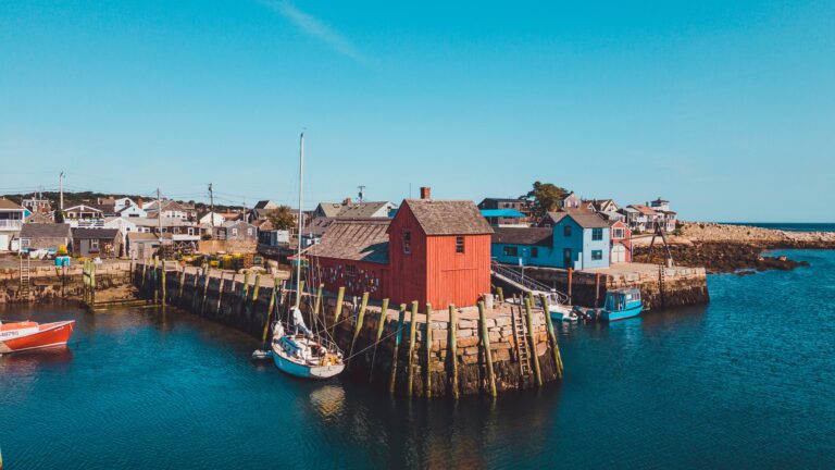
15 Best Hikes In Vermont
Hiking in Vermont provides a wealth of breathtaking mountain vistas, spectacular waterfalls, and fascinating history. It’s one of our favorite hiking states year-round!
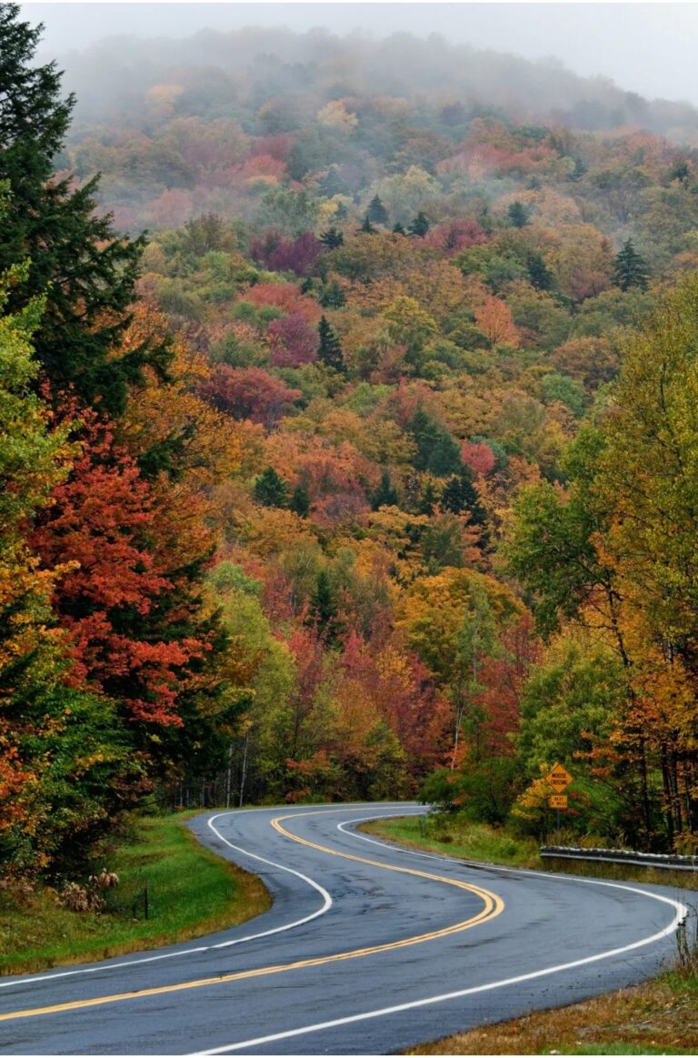
Despite its modest size, Vermont has a wide variety of hiking opportunities. Depending on your skill level, you can choose a steep 8-mile climb or a half-a-mile trek that offers gorgeous scenery. Other routes will take you to the state’s highest waterfalls, while others will take you to the top of a mountain for spectacular views.
Vermont’s abundance of open space and wildness means it is also a great spot to see animals and flora. And the four New England seasons offer plenty of opportunities to see a bit of everything!
Aside from The Long Trail, we’ve compiled a list of the best hikes in Vermont to help you plan a fantastic outdoor adventure, regardless of your hiking expertise.
15. Bingham Falls
0.5 miles | Easy | 144 Feet Elevation Gain
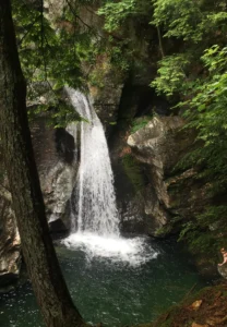
Bingham Falls, located in Stowe in Vermont, is one of the most incredible simple treks if you’re looking for something short and sweet with a nice payoff at the end. You can take in breathtaking vistas of waterfalls and green pools along this half-mile-long woodland walk.
As a result of its simple accessibility, stunning geology, and photographic potential, Bingham Falls has rapidly become one of Vermont’s most famous waterfall treks. The journey down to the falls is just about a quarter-mile long, but it becomes steeper and more slippery as you get closer to the bottom, so you’ll want to wear excellent hiking shoes with plenty of tread.
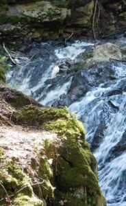
Some portions of the route are close to the gorge’s cliffs. All visitors, particularly youngsters, should remain clear from these edges, even if they’ve been roped off, thought that goes for just about all hikes in VT. Accidental drowning is a real possibility if you venture into the gorge.
The hike begins with a gradual ascent over a broad path that leads to the gorge’s summit. You can choose to continue on the upper gorge route or go down to the falls at a split in the trail.
Views from the upper gorge are breathtaking, with the river carving its way through the rock wall in snake-like arcs. After a short distance, you’ll come upon a seemingly tranquil body of water. Hikers should avoid swimming in this pool because it funnels into a high-speed water vortex that may be dangerous, even though it looks calm.
At the first trail junction, take a right down a narrow stone path, using the stones as stairs to get to the falls.
This is one of the best easy hikes in Vermont that still offers really stunning views!
14. Thundering Brook Falls
0.4 miles | Easy | Minimal Elevation Gain
If you’re looking for a quick and easy way to see another of Vermont’s stunning waterfalls, Thundering Brook Falls is the trek for you.
Thundering Brook Falls plunges 125 feet over rugged metamorphic rock only minutes from Killington’s legendary slopes. Even if you just have 20 minutes to spend at the falls, you’ll find yourself mesmerized by the sound of the water crashing against the rocks below.
If you’re lucky enough to see it in the winter, you’ll be in for a treat: the cliff face is covered with snow and frozen icicles. But it’s gorgeous in the warm months, too!
To get to the falls, you’ll need to park in the nearby lot and then walk through the marsh along the boardwalk. As a result of its closeness to civilization, the marsh’s core might seem a little wild. We suggest bringing binoculars for birding in this area.
Before entering the woods, the boardwalk travels 0.2 miles through the marsh. To the left of this point, the Appalachian Trail has white blazes. Trail markers in blue blazes point the way to a viewing platform above the falls 100 yards to the right.
The deck provides views of the lower two falls, tiers at a 45-degree angle, and about 90 feet above Mount Holly Gneiss slabs. Running water creates windows in the heavy snow cover, revealing the bedrock’s complex folds and sharp edges throughout the winter months. The mini-hydro powerplant operated by a private company is also clearly visible.
In very slippery winter circumstances, this is when the majority of tourists will do a U-turn. However, if you go up the hill next to the observation platform, you’ll witness a 35-foot waterfall and two smaller cascades upstream, making the falls much more spectacular.
If you want to see insane sights (mainly of the waterfall), then this is one of the best easy hikes in Vermont to do so.
13. Owls Head Mountain
3.2 miles | Easy | 475 Feet Elevation Gain
The Sargent Ponds Wild Forest includes Owls Head Mountain, encompassing 45,000 acres. This notable mountain in the Long Lake region has four distinct peaks, two known as the “horns.” These horns lend the mountain the appearance of a great horned owl’s head.
If climbing a tower isn’t your thing, the top cliffs of Owls Head provide magnificent scenery, too. A 35-foot-tall fire tower, which replaced the previous wooden one, stands on the mountain’s highest peak. The building was abandoned in the 1970s but restored by volunteers and is again open to the public.
This location has a beautiful wetland with a lengthy boardwalk. After approximately a mile, you’ll come to a three-way crossroads with a route that leads straight to Lake Eaton for about 4 miles. To continue climbing Owls Head, turn left here. The trail stays relatively simple for another mile before beginning to rise as it commits to gaining elevation progressively.
The trail descends shortly from the high ridge before entering a tiny valley at the actual summit’s base. The long ascent eventually ends at a col between two of Owls Head’s lower summits. Only the cement footers and a pail remain of the fire observer’s cottage, located in a spectacular white birch standing in this valley.
The last hike to the peak is quite tricky, with some slab rock and high stairs to navigate. The route leveled down before the fire tower base came into view, so the steepness doesn’t last long.
You have a fantastic view of the Long Lake below, with Blue Mountain in the distance from the partly open peak. A mind-blowing 360-degree view greets you from the tower!
Climb the stairs to glimpse the Central Adirondacks and the distant High Peaks. The Seward Mountains dwarf everything in the region.
12. Mount Olga
1.7 miles | Easy | 520 Feet Elevation Gain
Molly Stark State Park has the Mount Olga Trail, one of southern Vermont’s best-kept secrets. The 1.7-mile route takes around 90 minutes to complete depending on how long you stay. Though it’s possible to go around the well-maintained trail in a short amount of time, you can choose to take your time and appreciate it.
This is definitely one of the best easy hikes in Vermont. It’s a short but rewarding trek, with a panoramic view of southern Vermont and northern Massachusetts from a fire tower.
The Mount Olga Trail (blue blazes) departs the picnic area on the right side of the ranger house and gradually ascends. In 2003, a lightning strike delaminated a tree, leaving its trunk arcing across the trail.
The route comes to a “T” after 0.7 miles. Turn left and climb over a slab of rock, passing three derelict cottages along the way. You can spot communications and fire towers just ahead of the fire tower.
Continuing, follow the Mt. Olga Route back to the campsite via a short offshoot trail. Take the southern loop (turning left) and track the route to descend into a mixed hardwood – evergreen forest.
The path crosses tiny drainage on a wooden bridge around 0.2 miles from the fire tower trail intersection. At 0.5 miles, the route swings west (left) and follows a stone wall, swiftly reaching the Shearer Hill Trail crossing.
Along the stone wall, follow the signs for the Mt. Olga trail. The route turns north (right) at the end of the stone wall and immediately meets the campsite road. Return to the parking lot and park office by turning right.
11. Quechee Gorge Dewey Pond Trail
1.4 miles | Easy | 147 Feet Elevation Gain
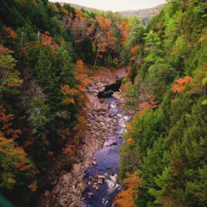
Vermont’s deepest canyon was carved nearly 13,000 years ago by glacier meltwater. If you’re looking for a spectacular view as you descend, this is the trail for you. It also has a large fence that stops youngsters from rushing over the ledge and below the canyon.
Family-friendly is what “Hike it Baby” is referring to. It is an excellent place for kids to run about and parents to relax. Just keep going, and you’ll find little pools to play about in and a beautiful river to walk in at the bottom.
Looking up at the gorge from the bottom will make you feel so tiny. This is one of the best hikes in Vermont for stunning views after a short climb!
All seasons are lovely times to come but we recommend summer and fall for the most spectacular views.
The 0.2-mile uphill portion of this journey may need some assistance from adults, so keep that in mind if you’re doing it with kids. Also, nursing benches are available for both new parents and exhausted children. Hiking in Vermont is difficult with children, but this is definitely the place to do it.
Quechee State Park is home to a wide variety of bird species, including the Canada goose, yellow-rumped warbler, mallard, northern goshawk, golden eagle, bald eagle, red-tailed hawk, veery, blue jay, Northern harrier, osprey, red-shouldered hawk, black-throated warbler, white-throated sparrow, scarlet tanager, and mourning dove.
If you prepare ahead and make reservations, there is a campsite. There are 45 tent/RV spaces at the campground and two facilities with showers. This is one of our favorite Vermont hiking spots when we want to spent the whole weekend.
10. Hamilton Falls
5.8 miles | Moderate | 757 Feet Elevation Gain
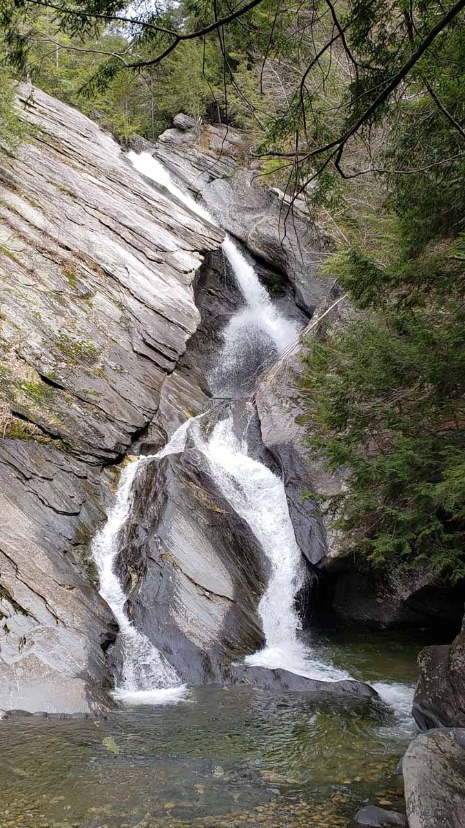
In the Ball Mountain State Recreation Area, this trek blends the natural splendor of Vermont’s forests with some exciting rock formations, culminating in a beautiful cascade at the finish. You’ll get some exercise without burning yourself out since this is a moderate trail.
Take the West River Trail from Jamaica State Park’s campsite if you want to see one of Vermont’s tallest waterfalls in an untouched natural environment. The Dumplings, a clump of stones beside the West River, can be found in this former railroad bed.
Initially, it’s an easy Vermont hike, but it becomes progressively more difficult as you near the falls. When you reach Hamilton Falls, however, the effort is well worth it since you will be able to enjoy the breathtaking environment and natural splendor that surrounds the waterfall.
To reach Hamilton Falls, continue on the West River Trail 1.5 miles beyond The Dumplings and bridge Cobb Brook. After a mile or so, you’ll see a steep slope on your left. Here you can get a good look at the 125-foot waterfall from the most significant vantage point.
There is a T-intersection at the top of the falls, where a left turn will take you to the summit. Trying to swim or climb the falls’ brink is dangerous and should be avoided at all costs.
9. Cantilever Rock
3 miles | Moderate | 1,092 Feet Elevation Gain
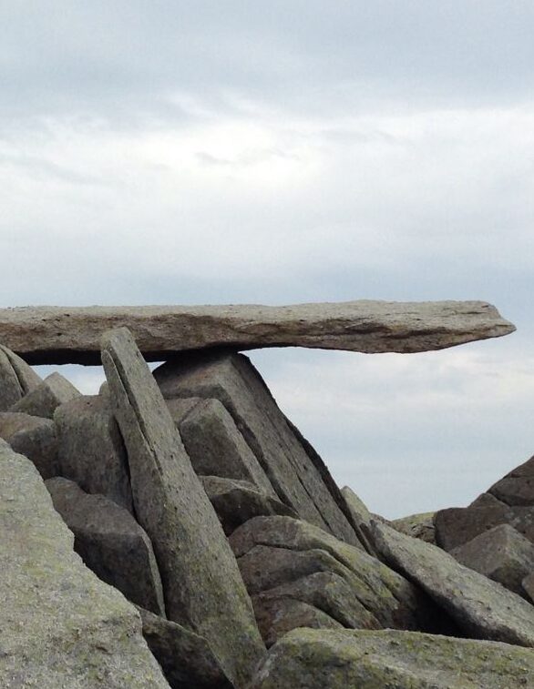
The Cantilever Rock route in Vermont’s Underhill State Park is a 3-mile journey that leads to one of the strangest rock formations in the state. The Cantilever Rock protrudes perilously out of the side of a cliff at the end of this woodland trail, which takes hikers down dirt roads and across wooden bridges.
There is a stunning view of mountains and terrain as far as the eye can see as you get at the end of the path, with a rocky peak to meet you at the top.
Starting at the New Discovery Campground, this well-marked walk offers spectacular views of the Green Mountains, Lake Groton, and Kettle Pond. The Maintenance Road or the North Parking Lot is where you can leave your cars.
Beginning at the North Parking Lot, you’ll have to walk an additional 0.8 miles each way. Despite the occasional ups and downs, hikers can access the rocky terrain of all ability levels. Along the way to the summit, there is a picnic pavilion where you can stop for a bite to eat.
8. Mount Pisgah
4.1 miles | Moderate | 1,653 Feet Elevation Gain
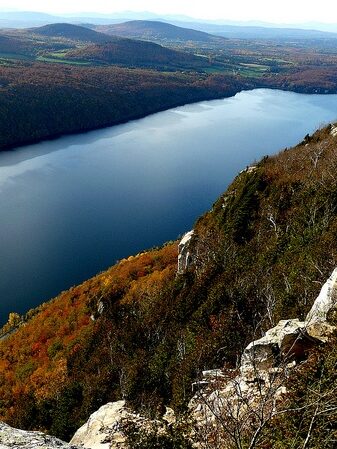
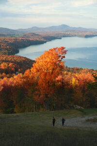
Mount Pisgah, one of Vermont’s most popular trails, is known for its breathtaking views of the surrounding mountains and Lake Willoughby. This Vermont hike near Orleans, Vermont, offers some of the best pictures in the state, especially in the fall when the leaves turn the forest scarlet and gold.
Mount Pisgah’s peak can be reached by a moderately inclining route, with stunning views both at the top and on the way up.
To the summit of Mt. Pisgah, you’ll find this shady and lovely route. There are several points of reference along with the approach to the summit. The trip isn’t challenging, but it can be tiring, especially for new hikers.
You’ll see Lake Willoughby and its lush surrounds best on a clear day, so consider hiking beyond the peak. To avoid the crowds, start early. Out and backing the path will take you between two and three hours.
There is a vast Mt. Pisgah information board where the path begins. Rosebay, Catawba rhododendron and mountain laurel fill the first half of the trail. After there, the route takes a left turn, becomes narrower, and climbs on logs. The short side route on the right provides your first excellent northward views at 0.8 miles – lots of layers of mountains.
The ascent is made more accessible by the presence of an abundance of spring and summer flowers along the way. You can see the high tower atop Frying Pan Mountain from the southwest just before the route makes a right turn at 1.1 miles.
Slopes become steeper from here on out. You can spot the tower in front of you as the route switchbacks on log stairs closer to the summit.
This is one of the best hikes in Vermont for semi-experienced hikers who want stunning views and a moderate climb.
7. Ice Beds Trail
1.6 miles | Moderate | 538 Feet Elevation Gain
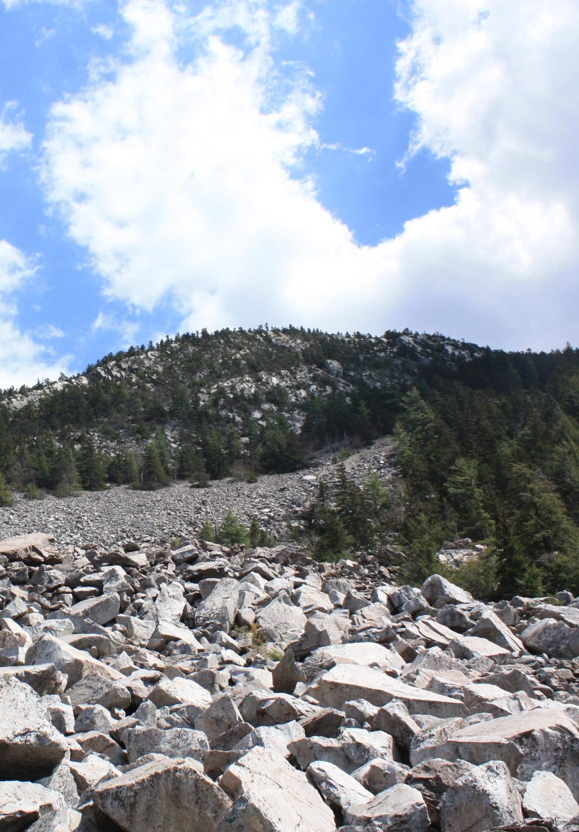
The Ice Beds path near Wallingford, VT, is a great area to get your scrambling on while also taking in some of Vermont’s most stunning vistas. Despite its short length, this route ends in a boulder field where you may clamber to your heart’s delight.
There’s a stunning view of the surrounding mountains, as well as lots of rocks where you can sit back and relax. Make sure to carry waterproof hiking boots and thick socks to keep your feet and ankles safe from sliding on the mud-strewn terrain.
The Ice Beds parking area in Vermont’s Green Mountain National Forest is the starting point for this 1.6-mile roundtrip trek. The trailhead can be found by following the blue-blazed path from the parking lot entrance. The trailhead at the other end leads to the cliffs, not the ice beds, so pay attention to the signage.
The initial stretch of the path, which is rough and tough, is the most challenging part of the whole trek. There are multiple switchbacks to climb after crossing a stream, and the path reaches its highest point after 0.02 miles. A side branch leads to a spectacular panorama of the northern White Rocks Cliffs at the knoll.
For the next 0.1 kilometers, you’ll reach a new viewpoint with vistas of the cliffs and the valley down to the south. After taking in the scenery, return to the main route, which descends to an ancient woodland road.
Following an old road downward, the trail eventually comes to a river crossing that takes a left turn. The route follows the stream to the foot of the talus pile of enormous boulders from here. In the depths of this mound are the ice beds.
If you decide to ascend the talus pile, do it with care. Bring hiking boots that are both comfortable and supportive. For dogs to be permitted in the park, they must be on a leash at all times.
While this is one of the shortest Vermont hikes, it’s also one of the tougher ones, so be prepared to get agile.
6. Mount Abraham
5.1 miles | Moderate | 1,765 Feet Elevation Gain
Mount Abraham in Bristol, Vermont, is a shorter but no less complicated summit walk. This beautiful mountain peak trek is quite challenging, but the vistas are worth the effort, particularly in the fall when the foliage is at its height. This is one of the most gorgeous Vermont hikes by far!
You’ll need to scramble up this mountain if you want to reach the top, so be prepared. Above this mountain, you can enjoy one of Vermont’s most breathtaking views.
At the Lincoln Gap parking area, you can begin your trek. You can reach Mount Abraham’s peak in 1.1 miles by following the Long Trail to the north. Following the Long Trail for about 1.7 miles, you will come to a junction with the Battell Trail on your left. To return to the trailhead parking lot, retrace your steps back in the opposite direction you came.
Many hikers prefer to “peak bag” Mount Abraham by adding Mount Ellen to their itinerary, resulting in a 10.8-mile round trip with a 3,290-foot elevation gain in total.
Lincoln Gap is closed during the winter months, unlike other Vermont hikes. Be sure to check on the weather forecast before you go though, even in the warmer months.
If you plan on hiking the Long Trail from Lincoln Gap, be prepared to add a significant amount of mileage roundtrip to your overall hike. Snowshoes, traction, and winter equipment will be necessary.
It’s essential to remember that this path can get quite busy, particularly on weekends during peak hours. But hiking in Vermont (anywhere) is crowded during the weekends! We suggest going out during the week or early in the morning for the finest views and the fewest people.
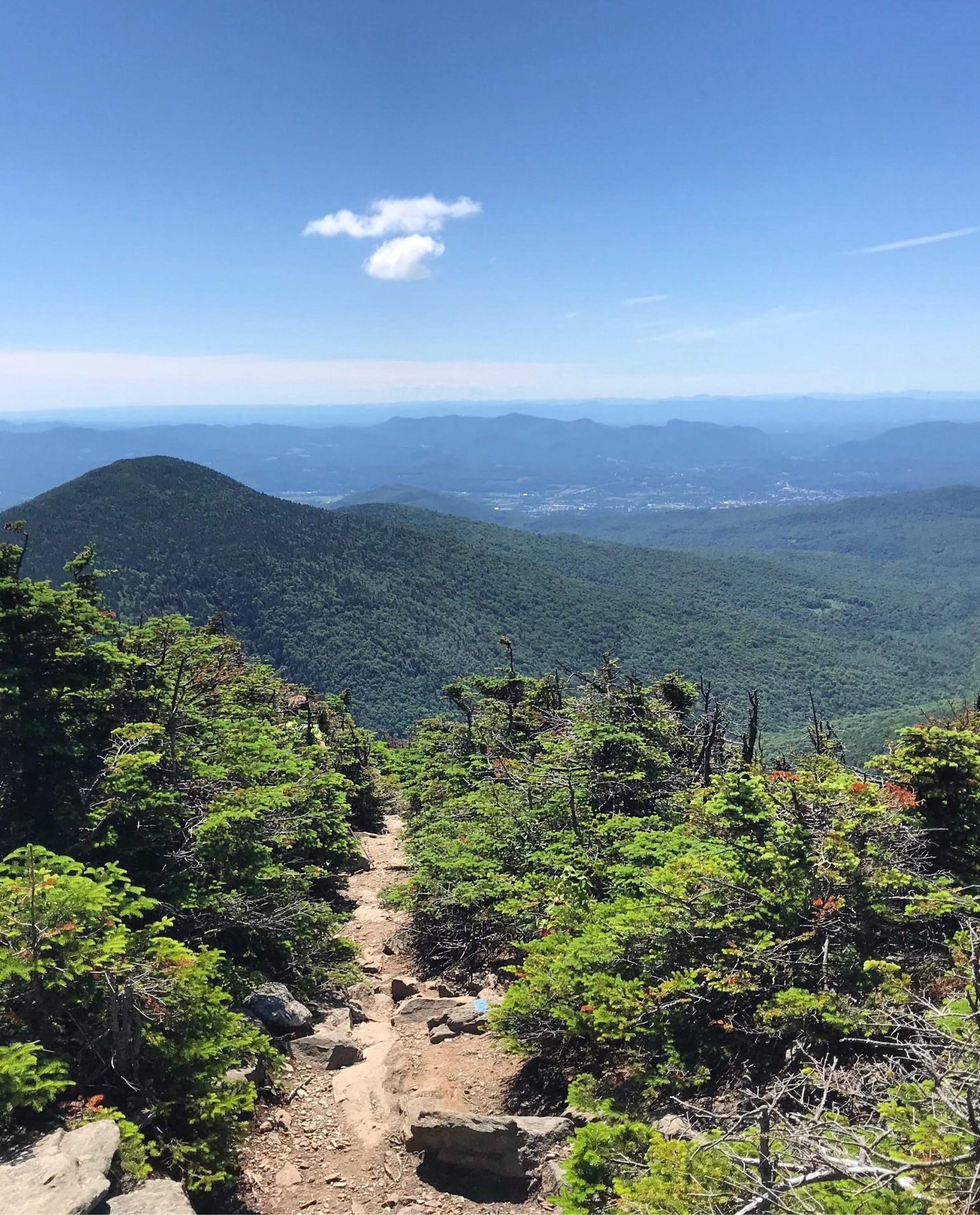
5. Camel’s Hump Trail
6 miles | Moderate | 2,578 Feet Elevation Gain
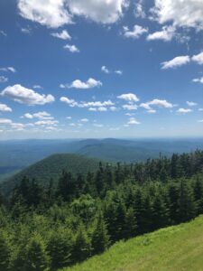
We suggest the Camel’s Hump Trail if you want to undertake kind of complicated hiking in Vermont. The trail’s first few miles have a modest slope and are ideal for beginners, though it ramps up quickly. If you’re looking for a challenging trek in a state park, go no further than this one.
On the rocky portions, there is some scrambling, but it is steeper and more strenuous. It is perhaps the most extraordinary hike in Vermont because of the picturesque scenery you’ll see from the summit of Vermont’s third-highest mountain.
The parking lot of Camel’s Hump Road provides Camel’s Hump’s trailhead access. You have two options for getting to the top: take the Monroe Trail to the top and back, or do the Monroe, Dean, and Long Trail circle.
The rough and steep sections are challenging to climb, especially in the last stretch. This is one of the more challenging hikes in Vermont specifically because of this part. The surrounding landscape will enchant you if you’re fortunate enough to reach the summit on a clear day. It isn’t easy to descend, so pause to recharge your energy before returning.
Hiking poles and hiking shoes are essential for this route, which will take you between four and five hours to complete.
4. Killington Peak via Bucklin Trail
7.2 miles | Moderate | 2,470 Feet Elevation Gain
Killington Peak is the highest point in the Green Mountains of Vermont, the Adirondacks in New York, and the White Mountains in New Hampshire, which you can view from this climb. Before reaching the peak’s top, the first two miles of the course are relatively simple due to a steady slope.
Snowshoes, crampons, or microspikes are recommended for the top part of the mountain, accessible through the trailhead in the winter.
The top of Killington, one of Vermont’s most renowned skiing peaks, is a great place to trek in the off-season. To reach the peak of Bucklin Mountain, hikers may use a local path called the Bucklin Trail. But unlike many hiking paths that intersect busy ski slopes, this one seems isolated and wooded, with few or no crossroads with the skiing courses.
During the first 1.4 miles of the Bucklin Trail, the trail follows Brewers Brook quite closely. The elevation is gentle for the first two miles; after that, it becomes steep. 0.2 miles into the trip, you’ll cross Brewers Brook on a bridge; 1.2 miles into the hike, you’ll strike it again on a bridge.
To get to the summit, you’ll need to take a left onto Killington Spur and scramble up some giant boulders on a 0.2-mile climb to the open, rocky peak.
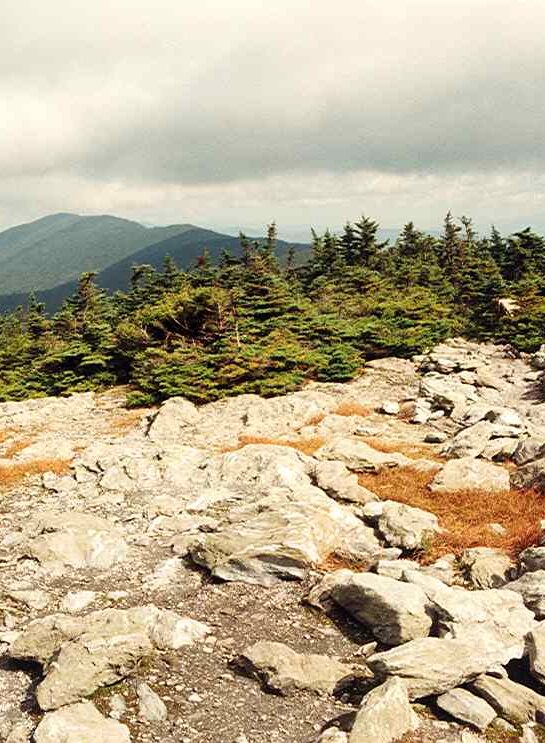
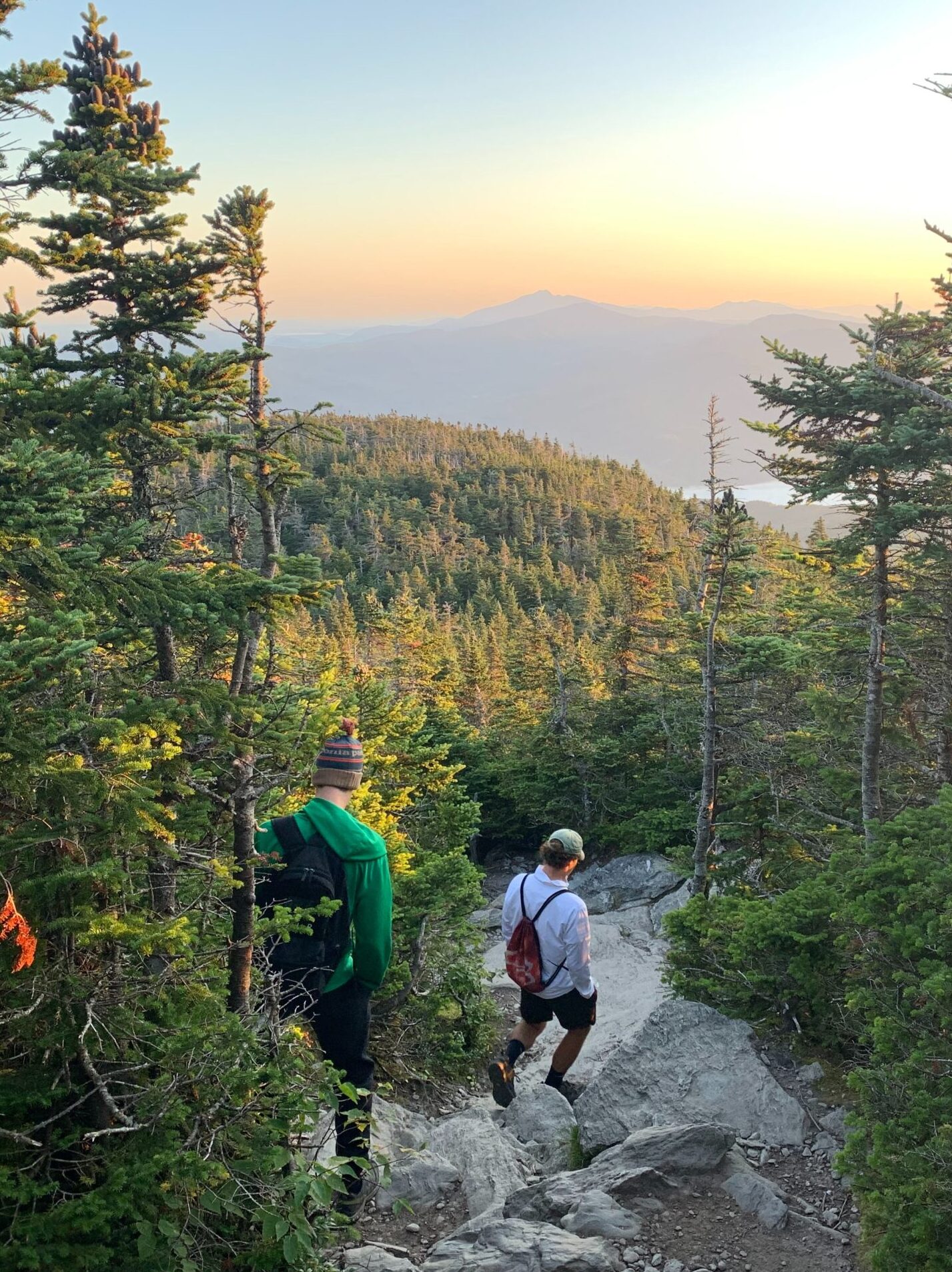
3. Mount Mansfield Chin Via The Long Trail
4.7 miles | Challenging | 2,800 Feet Elevation Gain

Mount Mansfield is Vermont’s highest mountain, making it a staple when hiking in Vermont. From a distance, its ridgeline resembles an extended head from the east side with numerous facial characteristics from south to north, including the Forehead, Chin, Nose, and Adam’s Apple. Hikers sometimes describe these features as “higher-elevation summits,” with the Chin being the highest point.
The Long Trail South from Route 108 is the simplest method to ascend Mount Mansfield from the Smugglers’ Notch side; it is a long and arduous walk. We strongly advise that you bring plenty of water, food, a route guide, a first aid kit, and appropriate boots.
From the trailhead on Route 108, begin your journey through quiet Vermont hardwood woodland, going up stepping stones and roots. The path starts with a gentle rise, but it gains about 2,800 feet in height in a little over two miles. There are several scrambling opportunities near the peak due to the terrain’s steepness and stony nature.
The most challenging part of the trip is a ridgeline ascent on the Long Trail. Ascend a couple of exposed rock faces by making a sharp bend to the left. The last stretch of the route to the Chin is a series of challenging climbs, so take your time.
Make the most of your summit time, but keep a careful watch on weather conditions and the passing of the day.
It’s risky to go on a mountain in Vermont during a storm or at night – you can find storm shelters along the way for this reason. Luckily, the Long Trail is well-signposted and easy to follow.
Drive up the Auto Toll Road at Stowe Mountain Resort and then climb the ridgeline from the parking lot on the Nose to the Chin for a more convenient route to the summit.
2. Mount Mansfield Loop
7.3 miles | Challenging | 2,880 Feet Elevation Gain
The Mount Mansfield Loop trek is one of Vermont’s most famous climbs for experienced hikers since it takes you from the foot of the mountain to the state’s highest peak in a grueling 7.3 miles. Your heart rate will soar as you climb 2,880 feet in a little over three miles while passing through dangerously steep rock crevices and rocky sections.
Panorama views span from Smugglers’ Notch State Park to Underhill State Park, including several nearby ski resorts.
At 4,393 feet, you’ll also be on top of the highest peak in Vermont.
Anyone who has never scrambled before should avoid this route since it is challenging and demands a great deal of physical power and energy. In addition, this track should only be used in dry, sunny conditions, as it can be very hazardous and slippery when wet.
1. Equinox Mountain and Lookout Rock Trail: Our #1 Vermont Hike
6.3 miles | Challenging | 2,883 Feet Elevation Gain
Equinox Mountain and Lookout Rock Trail are Vermont’s most strenuous hikes and are excellent leg burners. You can locate its trailhead at 228-306 W Union St in Manchester. The relentless ascent from the mountain’s foot to its summit, with degree courses of steepness as high as 48% in certain places.
You’ll come across a variety of terrains, intriguing forest regions, and little lookouts along the hike. Views from the Lookout Rock are breathtaking, with the Green Mountains and the Green Mountain National Forest in the distance.
Although the scenery from the summit of Manchester and the adjacent mountains is magnificent, this climb is better suited for people seeking an “exercise” rather than a scenic one.
Hiking in the woods is a great way to get some exercise while also getting some relief from the sun’s heat.
Along the way, you’ll pass a cute tiny cottage. The trek offers several photo opportunities, so be sure to bring your camera along.
Vermont Hiking Tips
- Clothing and Gear – It’s important to dress appropriately and have the proper gear. Dress in various layers to remove or add as needed depending on the amount of exercise and the weather.
- Weather – Make sure to review the weather forecast before you go and be prepared to change your plans if necessary when hiking in Vermont. If they predict severe cold or high winds, adjust your plans. A sudden decrease in temperature with a stiff breeze can lead to hypothermia, making rain the most deadly weather.
- Avoid Skimping on Food and Water – On a solo Vermont hiking journey, it’s essential to have adequate food and drink for the day. If you find yourself stranded in the wilderness for an extended period, having the proper supplies on hand will alleviate post-hiking tiredness.
- Know Your Level – Everyone has their own pace while hiking in Vermont, and that should guide you in choosing which trails to go and how long you can spend on them.
- Do It Slowly – Making the most of your time in the outdoors depends on your level of self-assurance. It’s not fun to have doubts about your capabilities and be terrified of them. Begin by taking modest steps toward your objective rather than trying to tackle a full-scale solo wilderness expedition all at once. Hikes in Vermont range from easy to really difficult so take your time!
This list of the best hikes in Vermont can help you plan your journey. With almost enough trails to fill a whole year, these are some excellent ones to get you started!