Navajo Loop Trail In Bryce Canyon: The Complete Guide
Heading to the Navajo Loop Trail in Bryce Canyon? You’ve come to the right place! The Navajo Loop Trail is one of our favorite Bryce Canyon hikes and we’re here to guide you every step of the way.
In Bryce Canyon, there are lots of hiking paths. Some only last an hour or less and are less than a mile long, while others last all day. Despite being small, Bryce Canyon National Park offers a lot to wow visitors, and one of the best is the experience on Navajo Loop Trail. The Navajo Loop Trail ranks among the busiest trails for a reason!
What makes Navajo Loop Trail different? The hike is magnificent because of the steep fall into the canyon, the trees at the base, and the vistas on the way up.
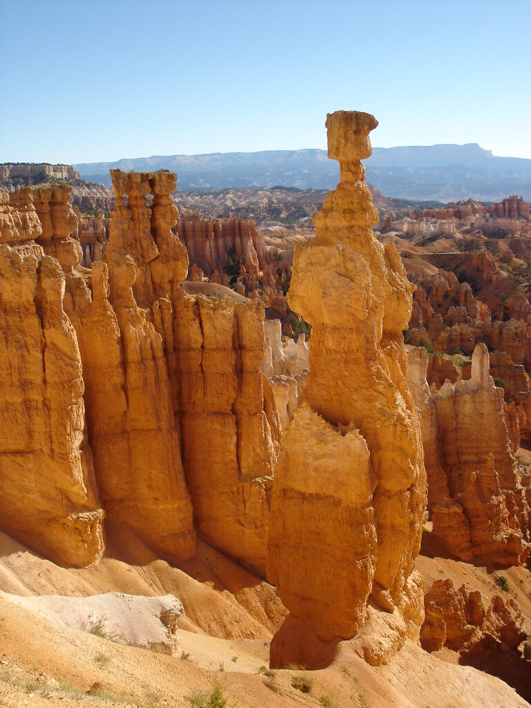
The famous Navajo Loop Trail starts and ends at Sunset Point. It goes down switchbacks between narrow walls of colorful limestone, giving you views of tall Douglas-fir trees and Thor’s hammer, the park’s most famous hoodoo.
We definitely recommend that you hike the Navajo Loop Trail if you’re heading to Bryce Canyon. The views are insane and the hike itself isn’t too difficult, making it perfect for all types of hikers.
About Bryce Canyon National Park
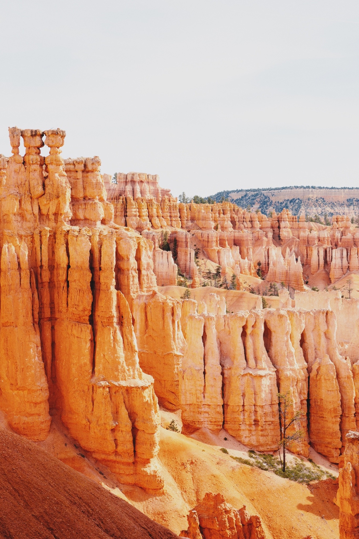
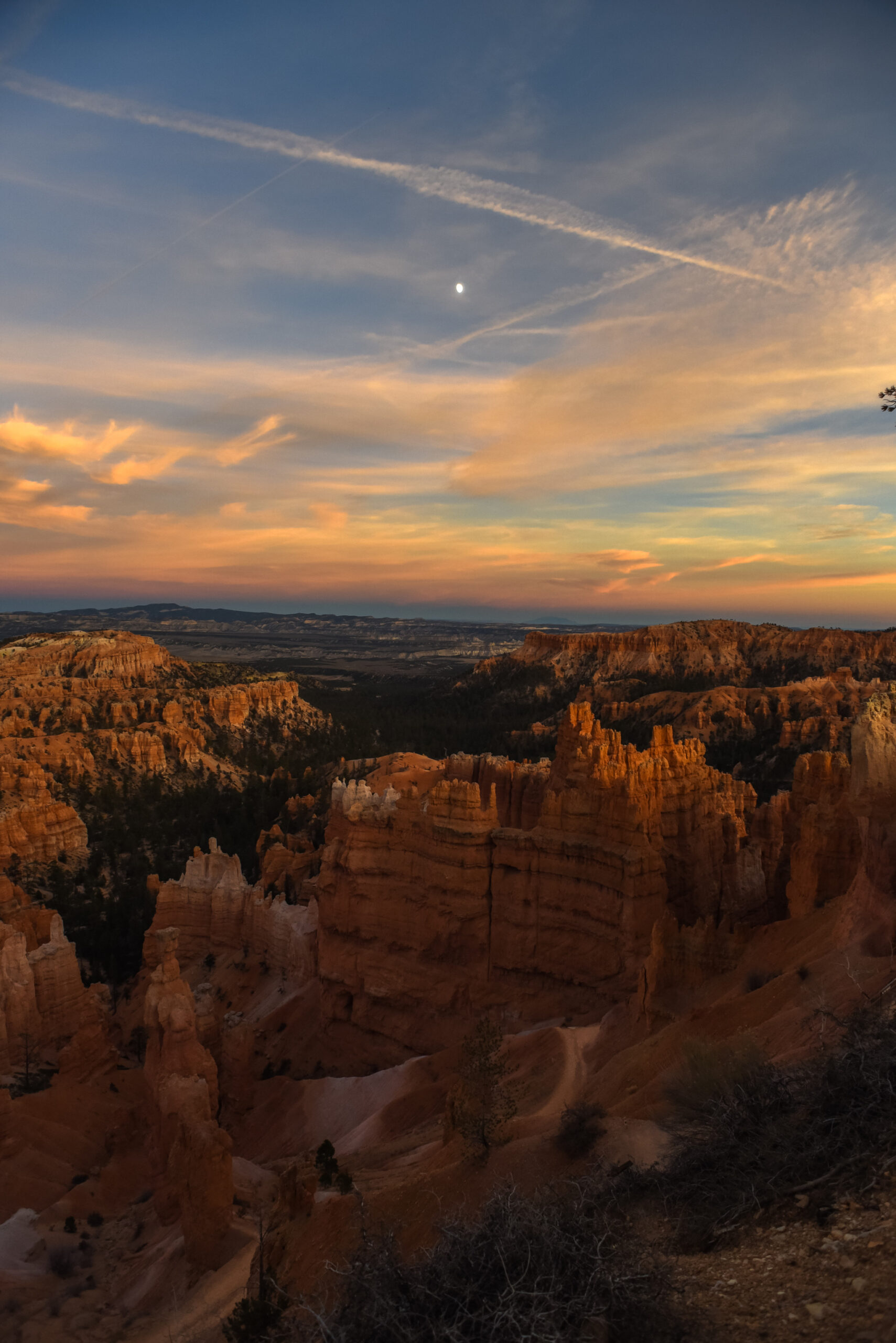
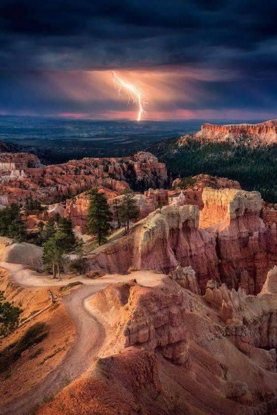
Bryce Canyon is one of the most distinctive national parks in the country with its sandstone rock formations and orange and pink hoodoos. With such wide-open views, there is no better spot to let yourself get carried away by nature!
Just behind Zion National Park in southern Utah is where you’ll find Bryce Canyon. Driving time from Salt Lake City is four hours. If you want to take a flight, Las Vegas is the closest airport and is about 4 hours away. McCarran Airport in Las Vegas is an excellent international airport for travelers from a distance.
The park separates into three climate regions: spruce or fir woodland, ponderosa woods, and pinyon pine or desert forest due to the area’s elevation of over 2,000 feet. Despite being bright for most of the year, Bryce Canyon National Park’s weather can be somewhat erratic. Be ready for anything during Bryce Canyon hikes, from virtually daily summertime thunderstorms to significant winter snowstorms.
About Navajo Loop Trail
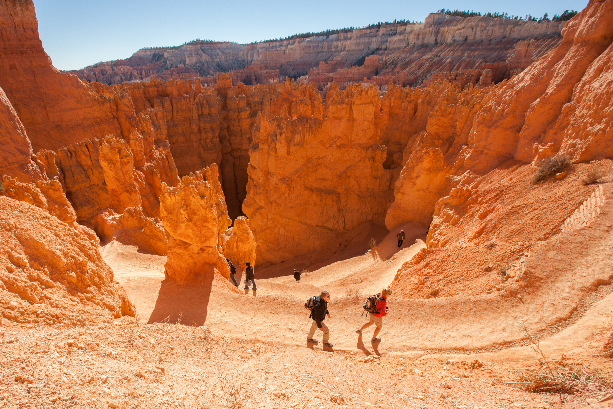
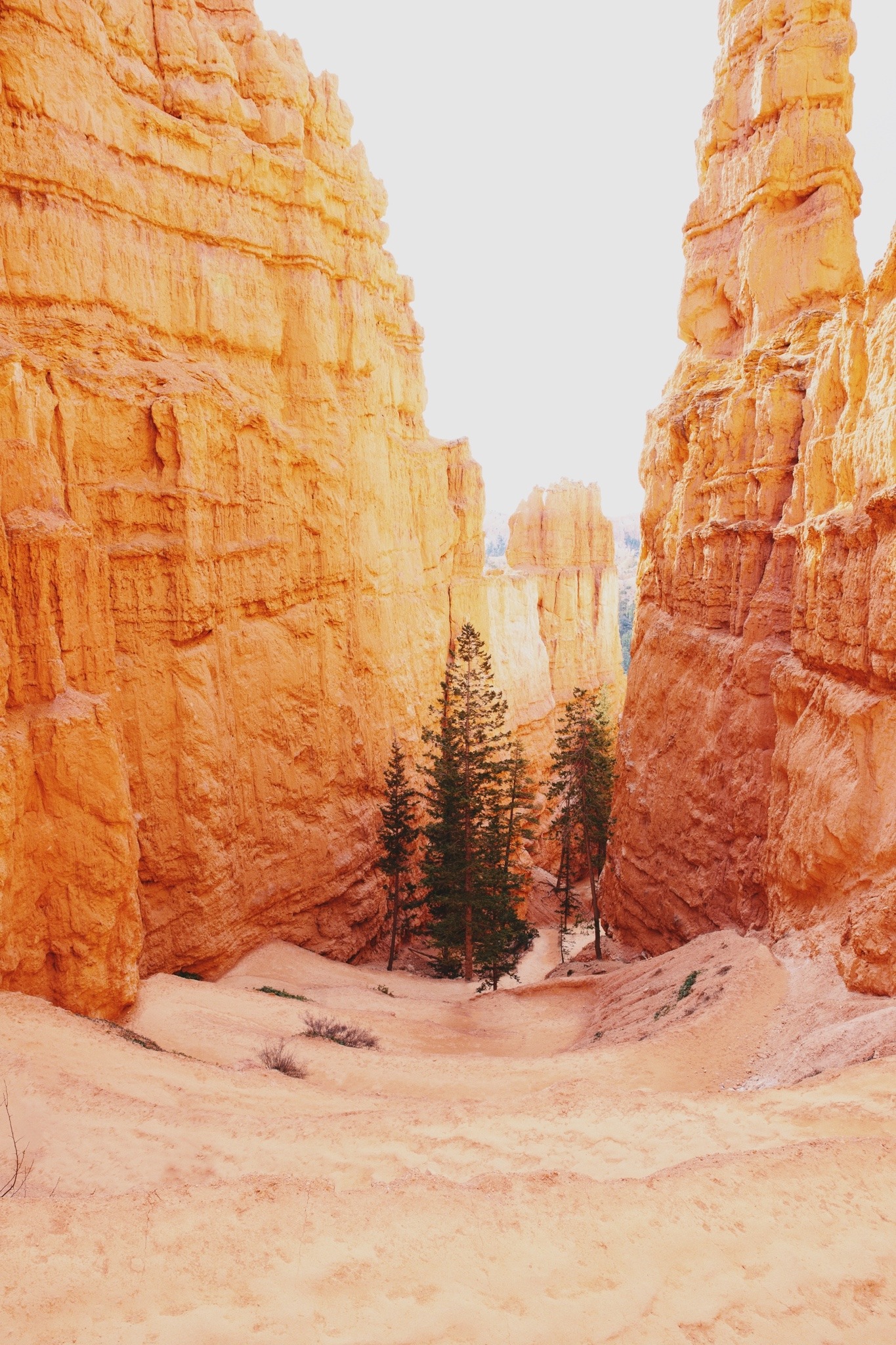
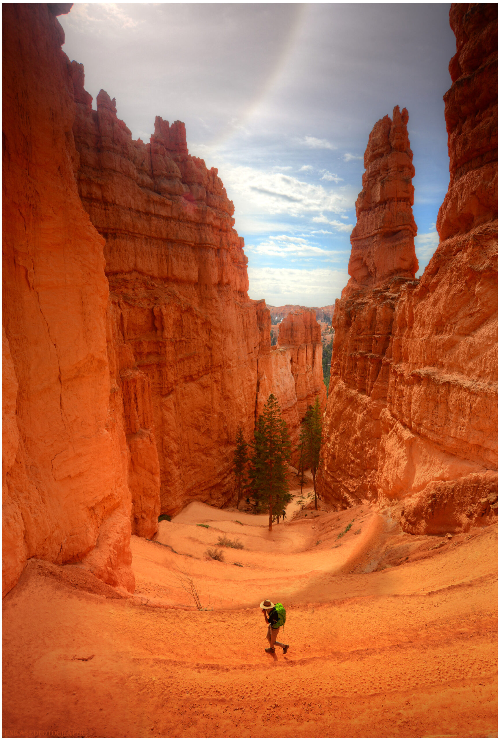
Among the most popular paths in Bryce Canyon National Park is the Navajo Loop Trail. The trailhead begins just across the street from Sunset Campground and starts by descending into the amphitheater and passing through “Wall Street,” a tiny switchbacked slot canyon between cliffs lined with tall Douglas fir trees.
The trail offers spectacular views of Thor’s Hammer, a well-photographed tall, slender pinnacle with a narrower neck that supports a massive, hammerhead-shaped rock. From the path are also magnificent views of the “Silent City,” where rock formations imitate towers, buildings, and temples. The “Temple of Osiris” is located to the east.
The Navajo Loop Trail is 1.5 miles in length and ascends/descends 550 feet, beginning and terminating at Sunset Point. Most people traverse the loop in 1-2 hours. For a lengthier trek, continue onto the roughly 3-mile Queen’s Garden Loop or Peakaboo Loop. Both of these routes can be connected to form a 6.35-mile figure-eight loop.
There are sections of the trail that give no shade and are quite hot during the summer, and areas shaded by rock formations and extremely chilly. So we recommend bringing enough water and wearing proper clothing with lots of layers.
Hiking The Navajo Loop Trail
The Sunset Point parking lot is the best place to start your journey on the Navajo Loop. Guests can drive or take the Park Shuttle to the parking lot.
From the Bryce Canyon Visitor Center, travel 1.2 miles south on UT-63 to get to the Sunset Point Parking area at the entry to Bryce Canyon National Park. Cross over Sunset Point Road on the left.
Get there early or ride the Park Shuttle because parking can become limited during the busy summer months. A little distance from the Bryce Canyon parking lot is where you’ll find the Navajo Loop Trailhead.
You must make a short hike along the canyon wall to get to Sunset Point from the parking area. This viewpoint is among the most frequented in the park; therefore, there will probably be a crowd there.
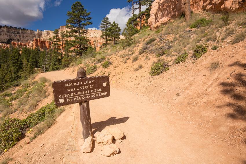
You can go a little down into the canyon from Sunset Point by following the Navajo Loop route, marked by a sign.
Sunset Point is the trail’s beginning and end. Choose which way of the loop you would like to hike when the trail forks at the start of the hike.
When To Hike Navajo Loop Trail
Hiking Navajo Loop Trail in Bryce Canyon National Park offers chances for enjoyment throughout the year, but keep in mind that lower temperatures prevail for a large portion of the year due to its high elevation. Daily high temperatures rarely exceed 80 degrees, not even in the summer.
Spring
In the park’s alpine meadows, wildflowers start to bloom, and meandering streams get a fresh start thanks to the recent snowmelt. Expect daytime highs in the 50s and 60s and a nighttime low of about 30 degrees in temperature.
Summer
Summer is the most popular season when daytime temperatures reach the upper 70s and low 80s. Contrary to typical seasonal fluctuations, Bryce Canyon receives the most rainfall throughout the summer. Expect numerous, brief thunderstorms and equally intense downpours.
Fall
As October arrives, lower elevations burst with fall foliage, and people start to diminish. Planning for milder weather is advisable because snowfall as early as October is not unusual.
Winter
Cross-country skis and snowshoes should be substituted for hiking boots once snowfall starts in early December. Winter is also the most incredible season for winter astronomy programs and organized full moon snowshoe hikes.
Where To Stay If You Hike Navajo Loop Trail in Bryce Canyon
There aren’t many campsites and accommodation types in or close to Bryce Canyon because it’s a small (approximately 55 square miles) and inaccessible park.
However, finding a location to put your hiking sticks at the end of each day shouldn’t be too difficult if you do some before planning or having a sense of adventure.
Here are the best options for you to stay near Bryce Canyon if you hike Navajo Loop Trail!
Sunset Campground
Located 1.5 miles south of Bryce Canyon Visitor Center, west of Sunset Point is a choice for car camping. It has 99 sites divided into three loops; Loop A is mainly for RVs, while Loops B and C are tent-only.
There are no available power, water, or sewer hookups. In the summer, a dump station is close to North Campground; the included cost of a campsite. There is potable water close to the dump station. A shuttle stop is available at the entrance of Sunset Campground, which is near Sunset Point.
North Campground
Another option for car camping is North Campground. It lies across the street from the visitor center and has 100 sites divided into four loops: A, B, C, and D.
Campers in RVs use Loops A and B. Tent campers should use loops C and D.
There are no available power, water, or sewer hookups. In the summer, a dump station is close to North Campground; use includes the cost of a campsite. There is potable water close to the dump station.
The Fairyland Loop/Rim Trail, General Store, and North Campground are all nearby.
Backcountry Camping
Get away from the tourists and explore Bryce Canyon’s backcountry to learn more about its distinctive geology and ecology. Up to 48 hours in advance, backcountry licenses are available at the visitor center for $5.
Two paths, the Under-the-Rim Trail (22.7 miles, eight sites) and the Riggs Spring Loop, provide access to backcountry camping (8.9 miles, four campsites). Only specific grounds are available for camping.
The Lodge at Bryce Canyon
At this historical lodge, established in 1924, rooms fill up quickly. The place, which has 70 modest accommodations, 40 cabins, three suites, and a studio, is close to the Bryce Amphitheater. Also, it has a restaurant open for breakfast, lunch, and dinner.
Towns
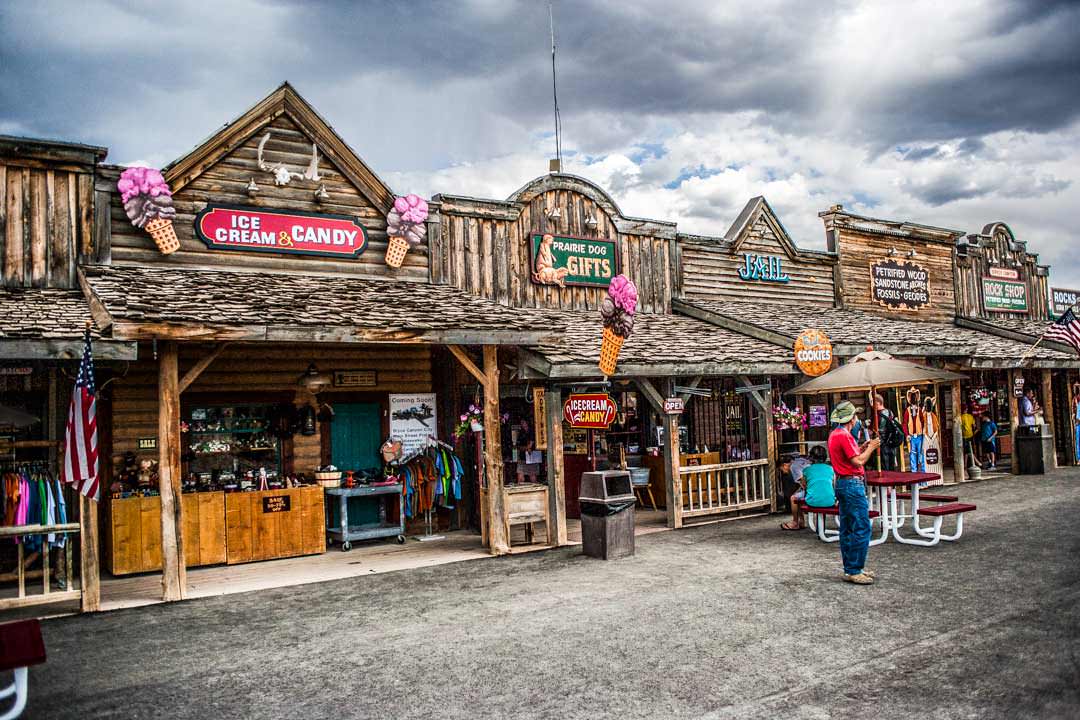
Throughout Bryce Canyon National Park, little villages are dispersed and provide various lodging options and dining establishments.
The Bryce Canyon Shuttle serves Bryce, which is the nearest and is located one mile from the park. Hatch, 24 miles from the national park, is conveniently on Highway 89, allowing faster access to Zion and the Grand Canyon.
Tropic, 10 miles from the park, or Cannonville, 15 miles from the national park, are excellent bases for people who want to explore Grand Staircase-Escalante National Monument.
What To Bring When Hiking the Navajo Loop Trail
To have an easy time hiking the Navajo Loop Trail and have a satisfying experience, here are the things you should not forget!
Food and Water: You will be hiking in a high-altitude environment, which can lead to dehydration, so it is best to bring ample water. Apart from water, do not forget packed lunch or snacks to eat while tackling the trail.
Hiking Gear: You can’t put just anything on the Navajo Trail because it’s a strenuous journey. While trekking some of the more challenging sections of the trail, it’s crucial to wear the appropriate footwear. Hiking poles can even be advantageous for some hikers.
Light Jacket: While hiking throughout the day, you’ll want to wear hiking gear because you’ll be hot. Eventually, as the sun sets, it will be freezing! You’ll want to be ready because the weather in Bryce Canyon changes dramatically from day to night.
Blanket: Red soil on the Navajo Loop Trail can ruin your clothes beyond belief. We advise carrying a small blanket with you on your trip if you want to pause, take a breather, and relish a picnic lunch.
Hats and Sunscreens: Even though you’ll be moving through a canyon, once the sun is right overhead, you won’t be able to hide from it. So it’s essential to pack a sturdy hat and sunscreen.
Camera: Not essential, but it is great to have a camera around. You’ll start looking back years later and regret taking all of your photos of Bryce Canyon with a blurry camera! Your photos will last a lifetime, so do not forget to bring a decent camera, preferably a small and lightweight one.
Hiking the Navajo Loop Trail
Are you ready to finally take the route? Here is what you would expect when you embark on your journey at Navajo Loop Trail.
Sunset Point
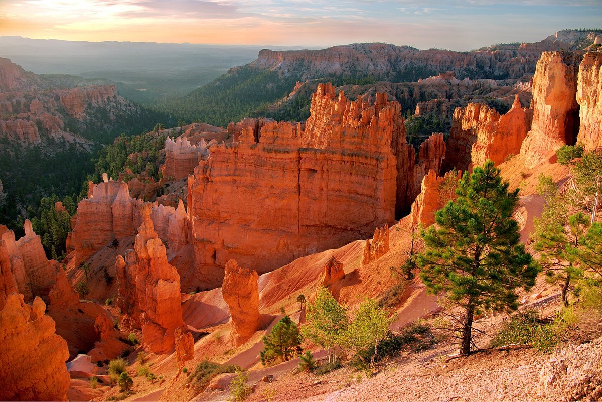
Your experience begins at Sunset Point. From this vantage point, you can appreciate the Silent City and the numerous hoodoos that comprise Bryce Canyon National Park. Hike along the Rim Trail from Sunset Point until Sunrise Point if you want to discover more.
After admiring the scenery from Sunset Point, proceed to the rim and follow the signs to the beginning of the Navajo Loop Trail. Be sure to get some hydration and use the parking area toilet before leaving.
The Fork and Thor’s Hammer
You’ll have the option to turn left toward the Twin Bridges or right into Wall Street soon after beginning the Navajo Loop trail.
If you are beginning your morning hike, it is advisable to proceed toward Twin Bridges. You’ll have better lighting within the slot canyon region if you save Wall Street for later in the day.
You’ll begin a sharp drop into the canyon shortly after passing the fork. The trail will be straightforward before giving way to a lengthy string of tightly spaced switchbacks.
As you begin the switchbacks, keep an eye out for one of Bryce Canyon’s most famous hoodoos. It would be best if you didn’t miss seeing Thor’s Hammer, which towers proudly above the barren terrain. As you make your way downhill into the canyon, it will be to the left.
Canyon Floor
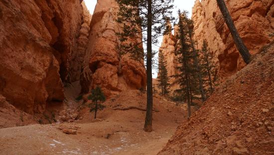
You will eventually descend past Thor’s Hammer and reach the canyon floor. A fantastic trail that crosses high walls and grows irregular trees can be spotted here. Although this section of the path has no official name, it was an exciting part of the trip.
You’ll find some tree cover here, which is nice if you’re trekking in the summer when the sun is already blazing at eight in the morning.
Twin Bridges
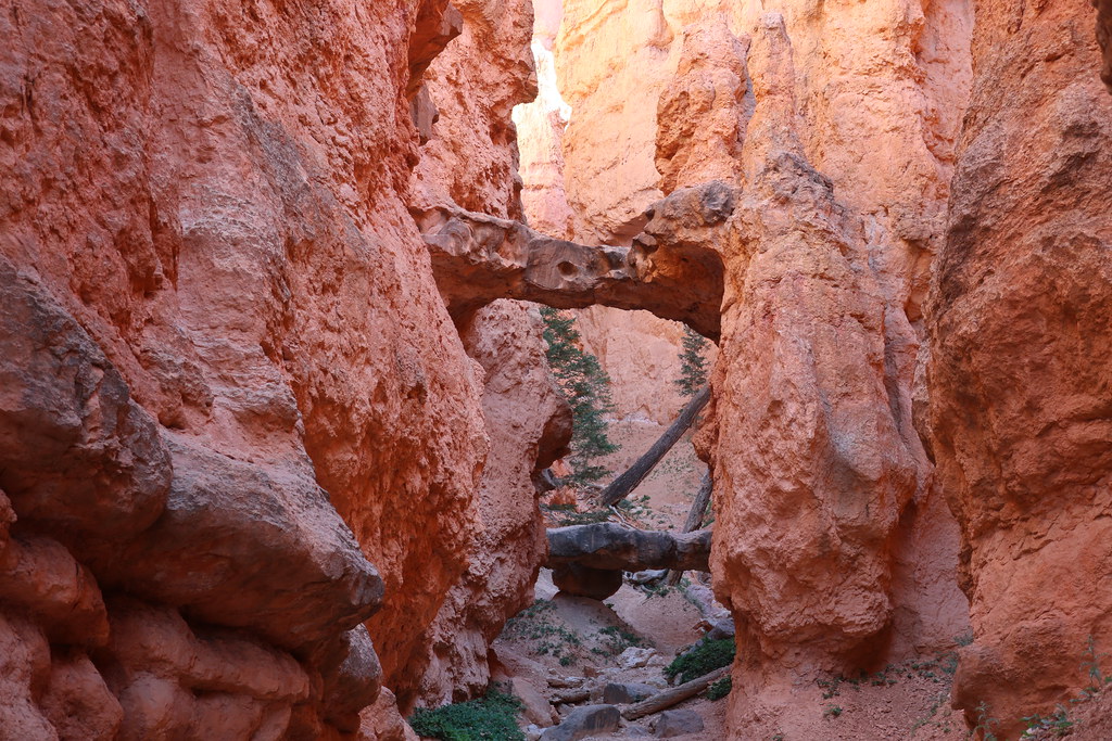
The Twin Bridges is the next significant landmark you’ll encounter along this trail. These arches were slit open into sandstone bridges that hung overhead like a city sidewalk, which is how they received their name.
Due to their fragility, the Twin Bridges come with several signs warning against approaching or attempting to cross them. Please obey the park rules while there since it is for your safety.
From a distance, they are equally spectacular, so feel free to gawk, take some pictures, and keep walking. There is yet more beauty to behold!
Trail Split Junction
You will leave the high canyon walls and enter the more exposed part of the canyon floor if you continue on the route from the Twin Bridges. From this point on, follow the path until you come to a trail divide.
Here, you get to decide how the remainder of your trekking day will pan out. You should keep to the right and follow the arrow that leads to Wall Street if you only have a short period and want to trek the Navajo Loop Trail. You’ll return to Sunset Point by doing this.
If you want to extend your journey, turn left to connect the Peek-A-Boo Loop or keep on to reach Sunrise Point on the Queen’s Garden Trail. Carry on reading to absorb more about these choices!
Wall Street
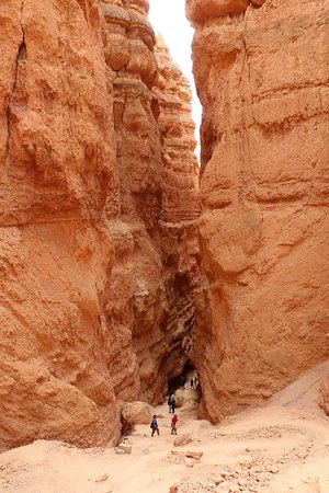
If you want to finish the Navajo Trail, turn right and follow the canyon floor route until you reach the stunning Wall Street entrance. It is simple to understand why Bryce Canyon National Park attracts so many visitors from throughout the nation when you step foot inside the canyon.
You’ll think you’ve entered a different world with its tall stone cliffs and Mars-like scenery.
You begin your journey within Wall Street at the canyon’s floor and travel through several high-walled slot canyons. Before you get to the top of the wall, the trail winds around like this.
From this point, you can anticipate taking a well-traveled and challenging route towards the canyon wall and Sunset Point. You won’t have to hike straight up because there are switchbacks in the path.
Drink plenty of water and take frequent pauses, if necessary. Most critical, halt and turn around! Thanks to this, you’ll also get some breathtaking aerial panoramas of Wall Street.
Best Add-On Hikes When Hiking the Navajo Loop Trail
What if you’ve completed the Navajo Loop Trail but still want more? Consider these other options for adding onto your hike!
Navajo Loop (Counter Clockwise)
1.4 miles | 459 feet elevation gain | Moderate
You can also hike Navajo Loop counterclockwise, even if neither side is straightforward. Most other hikers complete the loop clockwise, which places Wall Street as the hike’s ascent.
Since your legs and lungs are on fire, it is difficult to appreciate its vastness. It becomes more apparent how enormous these walls are as one descends into the emptiness of this seemingly unfathomable hole.
Second, if you climb the Navajo Loop’s north portion uphill, there are a couple of fantastic rest stops. Thor’s Hammer, Two Bridges, and the expansive views of Bryce Valley and elsewhere are all excellent reasons to pause and breathe in some much-needed oxygen.
To hike this loop, turn right at the junction underneath the rim, go over Wall Street, then keep to the left at the split just below the canyon’s bottom.
Navajo Loop to Queen’s Garden
2.5 miles | 600 feet elevation gain | Moderate
This well-liked loop connection is ideal for hikes of moderate length. Hikers can experience the true essence of Bryce Canyon National Park by linking the Navajo and Queen’s Garden paths.
Stop underneath the rim to get a bird’s-eye view of Thor’s Hammer, Bryce Canyon’s largest hoodoo at 150 feet. Next, take the right branch on the route to descend through Wall Street’s terrifying switchbacks.
The key to this loop is to turn left at the main intersection at the bottom of the canyon. The track is well-marked, so if you catch yourself climbing steadily immediately, do a U-turn at Two Bridges and pretend you knew where you were going.
You can access the Queen’s Garden connector to get right there. To return to the top at Sunrise Point, you must make a strenuous ascent.
Navajo and Peek-A-Boo Loop
4.5 miles | 1,400 feet elevation gain | Difficult
The Navajo/Peekaboo Trail’s figure 8 loop is the best option for lengthy hikes. Turn right on the first split below the rim to start this loop, then enjoy the breathtaking descent via Wall Street.
At the crucial intersection at the bottom of the canyon, turn right into the connection route. You will reach the Peekaboo Loop using this Connector. From here, it’s on you whether to go left or right.
Be aware that while horseback rides follow the loop clockwise, going counterclockwise is the less-dusty choice. As an alternative to making the entire Peekaboo Loop, you could take the challenging one-mile uphill offshoot to Bryce Point and catch the Park Shuttle back.
Take the connecting trail back towards the Navajo Trail to complete the loop if you decide.
Other Trails to Hike in Bryce Canyon National Park
If you stay longer in Bryce Canyon National Park and are curious about what other trails you can hike, these are some that you can try!
Queen’s Garden Trail
The Queen’s Garden Loop Trail is the best short hike to see the spectacular hoodoos of Bryce Canyon.
As hikers descend from Sunrise Point, they face hoodoos of all different sizes. On a clear day, the 80-mile-distance top of Navajo Mountain is visible on the horizon.
A closer look at the hoodoo structures reveals a color scheme of white, vermillion, yellow, pink, and purple. Pose for pictures within the custom tunnels that pass directly through the rock fins of Bryce Canyon.
Her Majesty is waiting at the trail’s finish. Have fun identifying her among the weirdly formed white rock pillars and try to figure out where she is lying. Searching for people, animals, and patterns in the Queens Garden Loop Trail hoodoos can let your imagination go wild.
Rim Trail
The Rim Trail offers the best access to Bryce Canyon National Park without descending into the canyon. Visitors can begin their breathtaking 5.5-mile journey along the rim of Bryce Canyon’s amphitheaters, either Fairyland Point or Bryce Point.
Peer over the verge if you dare and look down into the chasms of the Silent City.
As you travel from Bryce Point to the appropriately called Inspiration Point, stroll among stoic pine forests and ancient bristlecone pines. You can watch hikers ascending Wall Street’s steep switchbacks from Sunset Point.
Between Sunrise Point and Fairyland Point, pay attention to the aspen’s trembling rustling. At the same time, the world’s most extensive array of hoodoos is right beneath your feet.
Put on your snowshoes for a spectacular winter stroll above Bryce Canyon’s icy spires and pinnacles. The Rim Trail at Bryce Canyon offers unending views.
Tower Bridge Trail
The Tower Bridge Trail, a section of the Fairyland Loop Trail, is the ideal intermediate-distance hike for hikers to Bryce Canyon National Park.
Take in views of some of the most recognizable hoodoo formations in Bryce Canyon National Park, including the Chinese Wall or Crescent Castles.
At the midway mark of this climb, the Tower Bridge, the show’s true star, is waiting. You can reach the foot of this creation, which resembles London’s most iconic structure, by way of a 200-yard-long spur trail.
Wait a bit to take in the stunning natural architecture before beginning the ascent back to the rim. You might even meet the Steller’s Jay, a graceful park inhabitant.
Active hikers can opt to add a few more miles by continuing on the Fairyland Loop Trail.
Mossy Cave Trail & Bristlecone Loop Trail
Families will love these beautiful, quick hikes. Mormon settlers dug an irrigation ditch from the East Fork of Sevier River in the 1890s along the short (0.8 miles roundtrip) Mossy Cave Trail.
It has a small cascade and Mossy Cave, an underground spring-formed grotto with an overhanging that is wrapped in moss or, during the winter, with icicles.
The one-mile Bristlecone Loop Trail meanders through a spruce and fir forest and passes past cone-bearing pines that are close to 1,800 years old while traversing the highest part of the park, rising to a height of 9,100 feet.
Tips To Have The Best Hiking Experience at Bryce Canyon
If you hike Navajo Loop Trail or any other hikes in Bryce Canyon, these few things will help you get the best out of your time experiencing each!
Start Early: Early arrival has many benefits. You can avoid the crowd and avoid the midday heat during summer.
Don’t Rush: The elevation of Bryce Canyon is relatively high. Even with short climbs, it is typical to feel out of the air in this location. Taking your time and taking multiple breaks to gather your breathing on the way back up is best because the last ascent out of the amphitheater might be difficult.
Connect Hikes: To enjoy further what the canyon offers, consider connecting different hikes if possible. This way, you’ll be able to take in the scenery better than just taking a stroll on a single trail.
Guided Tours: You can opt to join a guided tour around the canyon for convenience. Guides can give you knowledge, share a great spot in the area, and access other things that are difficult to do on your own.
Other Activities To Do After Hiking the Navajo Loop Trail
If you get tired after hiking the Navajo Loop Trail or any other trails, here are some additional activities you can do while at the Bryce Canyon National Park.
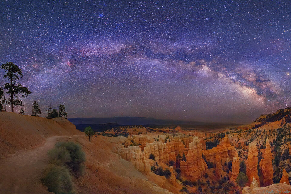
Stargazing
The National Park Service has referred to Bryce Canyon as “the last grand sanctuary of natural darkness” because of its better air quality and lack of light pollution.
Since 1969, the area has held regular astronomy-trained ranger-led midnight viewing events. These guides, also known as “Astronomy Rangers,” plan stargazing excursions for guests interested in learning more about the night sky.
Visitors can see the whole spectrum of the Milky Way’s pulsating hues and the shadows Venus and Jupiter’s brilliance cast on the atmosphere.
The Salt Lake Astronomical Society (SLAS) sponsors the park’s annual astronomy festival, which is open to enthusiastic stargazers. Moon lovers should plan their trip to match a full moon, including ranger-led full moon hikes.
Scenic Driving
The numerous picturesque overlooks that line Highway 63’s 18-mile route through the park’s central area offers some of the best perspectives of the entire area.
As you travel south, the eastern portion of the park road, or the left, is where all of the park’s overlooks are available.
These include the Sunrise, Sunset, Inspiration, and Bryce perspectives, among many more. Hang a left only one mile down the park’s border onto the route to Fairyland Canyon, where the hoodoos are at the line of sight, to get a close-up look of the red-rock spires.
Horseback Riding
Swap your hiking poles for reins and grab a ride on a horse or mule to the Bryce Amphitheater from spring through fall. An adventure unlike any other in the park, the wranglers at Canyon Trail Rides provide 2 to 4 trips into the amphitheater on a designated horse trail along the Peek-A-Boo Loop Trail.
Winter Sports
Bryce Canyon’s colors start to stand out in the winter. Bright white snow contrasts dramatically with the cliffsides’ crimson, pink, and orange rock spires.
The Fairyland Road or Paria Point Road remains unplowed for cross-country skiers and snowshoers. At the same time, most of the park’s other routes are still accessible to hikers using hiking boots with additional traction, such as mountaineering crampons.
After significant snowfalls, join one- to two-mile ranger-led snowshoe excursions that depart from the visitor center for a guided tour of Bryce’s frozen attractions.
Cycling and Mountain Biking
Cycling is permitted on all park roads, although not on trails or off-trail areas. On Scenic Byway 12, which passes through the northeastern portion of Bryce Canyon, road cyclists can put their endurance to the test.
Although the journey is challenging due to the steep elevation climbs and several switchbacks, the breathtaking sights are guaranteed to ease your aching legs.
Mountain bikers can experience their delights on open trails close to the park. One of them is Thunder Mountain Trail, 8.1-mile one-way singletrack that winds through ponderosa pines and is generally smooth, hard track to provide breathtaking views of Thunder Mountain.
The Cassidy Trail got its name after the gunslinging criminal Butch Cassidy, who formerly roamed these parts; it is 8.9 miles long and offers rides through red cliffs and pine forests. The Casto Canyon Trail is 5.5 miles long.
Final Thoughts
We threw out some other activities for you to do there! Bryce Canyon National Park is indeed a sight to behold. Hikers and non-hikers alike will find something to meet their outdoor desires.
Either hiking the famous Navajo Loop Trail, combining it with other trail systems in the area, or engaging in a scenic drive, the park will not disappoint.
Hopefully, this Navajo Loop Trail hiking guide gave you a good idea of where to start. Hiking the Navajo Loop Trail is amazing and is one of those hikes that’s totally worth it! It’s absolutely one of our favorite Bryce Canyon hikes and is where we recommend any hiker begins the journey at Bryce Canyon.
Related: Zion To Bryce Canyon: 2, 3, and 4 Day Road Trip Itineraries