The Ultimate Havasu Falls Hiking Guide

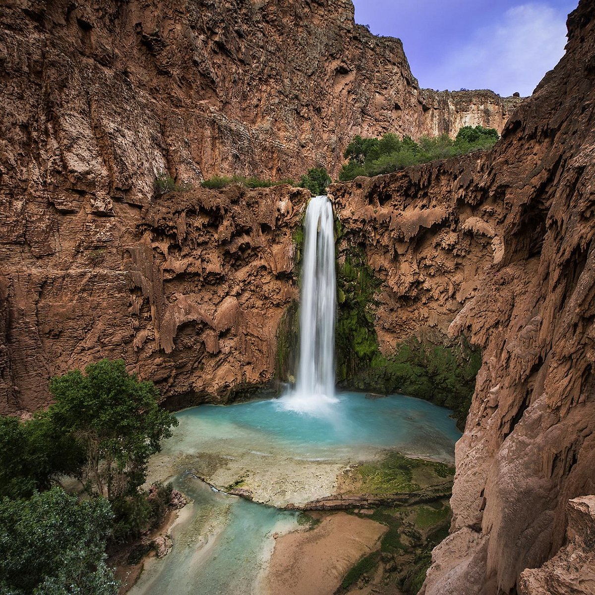
Havasu Falls is a piece of paradise on Earth.  No amount of photographs can do it justice! Located at the bottom of the Grand Canyon in Arizona, it has breathtaking scenery and waterfalls.

For centuries, the Havasupai Tribe has protected the Grand Canyon’s natural beauty on their territory, making them the proud proprietors of these natural treasures.

If you’re hiking Havasu Falls, there’s a lot you need to know. Consider this post to be a one-stop-shop for all your Havasupai Falls hiking needs.

We’ll provide you with all the information you need to know about hiking Havasu Falls, from the falls and the various hikes to packing your gear.

Why Should You Hike Havasu Falls?
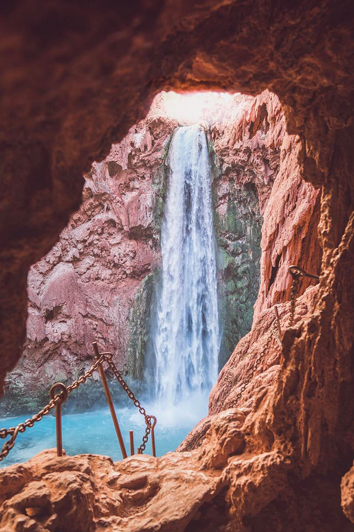
The ultimate guide to your Havasu Falls hike! If you're planning on hiking Havasu Falls in the Grand Canyon for your Arizona vacation, there are a few things you need to know.

From a beautiful red rock, a stream of emerald-blue water flows. Light from the shifting sun illuminates the canyon in various shades and colors, from a dark amber-red to a vibrant blue. Intricate colors that seem to have been painted on a canvas are natural here – it’s insane.

If you haven’t hiked Havasu, you definitely should. It’s one of the most magnificent climbs in the world and is certainly one of the most beautiful waterfalls in Arizona. There aren’t enough words to describe how breathtaking this oasis is in the middle of the desert.

The “Havasu Falls Trail” is named after one of the area’s five significant waterfalls, “Havasu Falls.” The Havasupai Indian Reservation is home to this section of Havasu Falls.

Originally known as the Havasu Baaja, or “people of the blue-green lakes,” the Havasupai Tribe is a nomadic people that live in this part of northwestern Arizona. The Havasupai Indian Reservation’s Supai Community is now the most isolated village in the United States.

Havasu Falls is really paradise in nature. Not only are the spiritual vibes pretty intense, but the views alone are just incredible. It’s better than Disney World!

The Havasupai Waterfalls

Before we get into the actual Havasu Falls hike, I want to go over the 5 waterfalls you can see along the way.
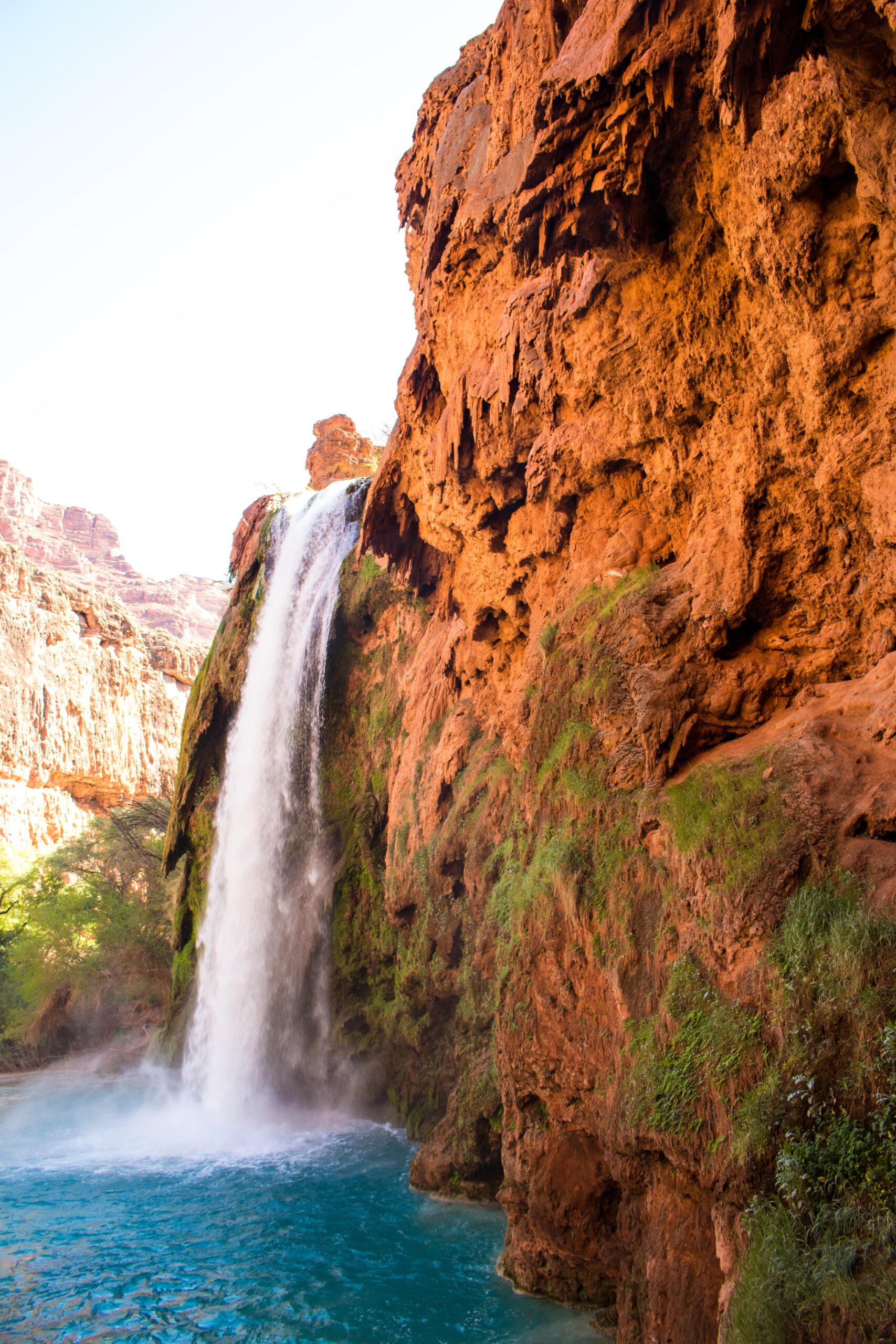
The ultimate guide to your Havasu Falls hike! If you're planning on hiking Havasu Falls in the Grand Canyon for your Arizona vacation, there are a few things you need to know.

Havasupai is home to five of the world’s most impressive waterfalls. Most are commonly regarded as world-class in their splendor, like Havasu Falls and Mooney Falls. The term “Shangri-la of the Grand Canyon” is often used to refer to this location.

The following is the list of the Havasu waterfalls (in order) that you can view on the hike from Supai to the Colorado River.

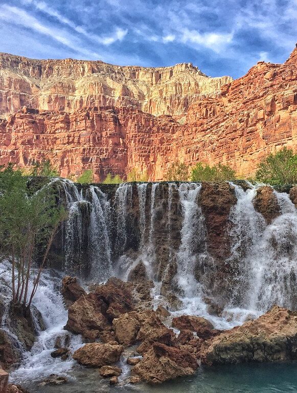
1. Fifty Foot Falls (New Navajo Falls)
The ultimate guide to your Havasu Falls hike! If you're planning on hiking Havasu Falls in the Grand Canyon for your Arizona vacation, there are a few things you need to know.

  • 50 feet in height
  • The result of the devastating 2008 floods and mudslides
  • Compared to the other swimming holes, it provides better swimming conditions and is less crowded
  • Situated around 0.8 miles upstream of Havasu Falls and about 1.0 miles below Supai Village
  • Surprisingly, this is the nearest significant waterfall to Supai

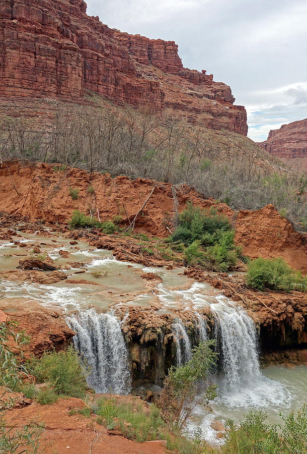
2. Lower Navajo Falls (Rock Falls)
The ultimate guide to your Havasu Falls hike! If you're planning on hiking Havasu Falls in the Grand Canyon for your Arizona vacation, there are a few things you need to know.

  • 30 feet in height
  • Created in part by the devastating floods and mudslides that struck the region in 2008
  • Excellent swimming chances even though many of the sites are shallow
  • About 0.15 miles of Upper Navajo Falls downstream

3. Havasu Falls
The ultimate guide to your Havasu Falls hike! If you're planning on hiking Havasu Falls in the Grand Canyon for your Arizona vacation, there are a few things you need to know.

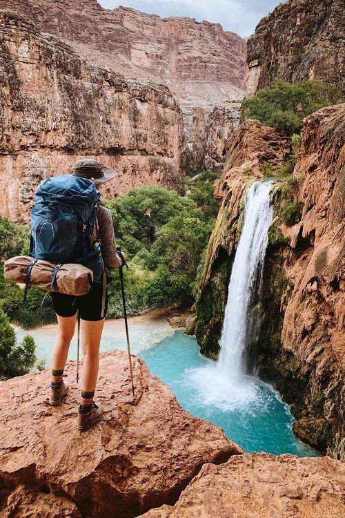
  • 96 feet in height
  • This waterfall is among the most well-known in Havasupai
  • Provides a wide range of fantastic swimming options
  • Situated immediately before the campsite (about 1.8 miles downstream of the Supai Village)

Don’t worry: Havasu Falls lives up to the photos in person. And unlike Mooney Falls, it’s pretty swimmable, making it a great place for families and adults. If you see nothing else on this trip you must see and hike Havasu Falls.  Plus, it’s a really short hike!

4. Mooney Falls
The ultimate guide to your Havasu Falls hike! If you're planning on hiking Havasu Falls in the Grand Canyon for your Arizona vacation, there are a few things you need to know.

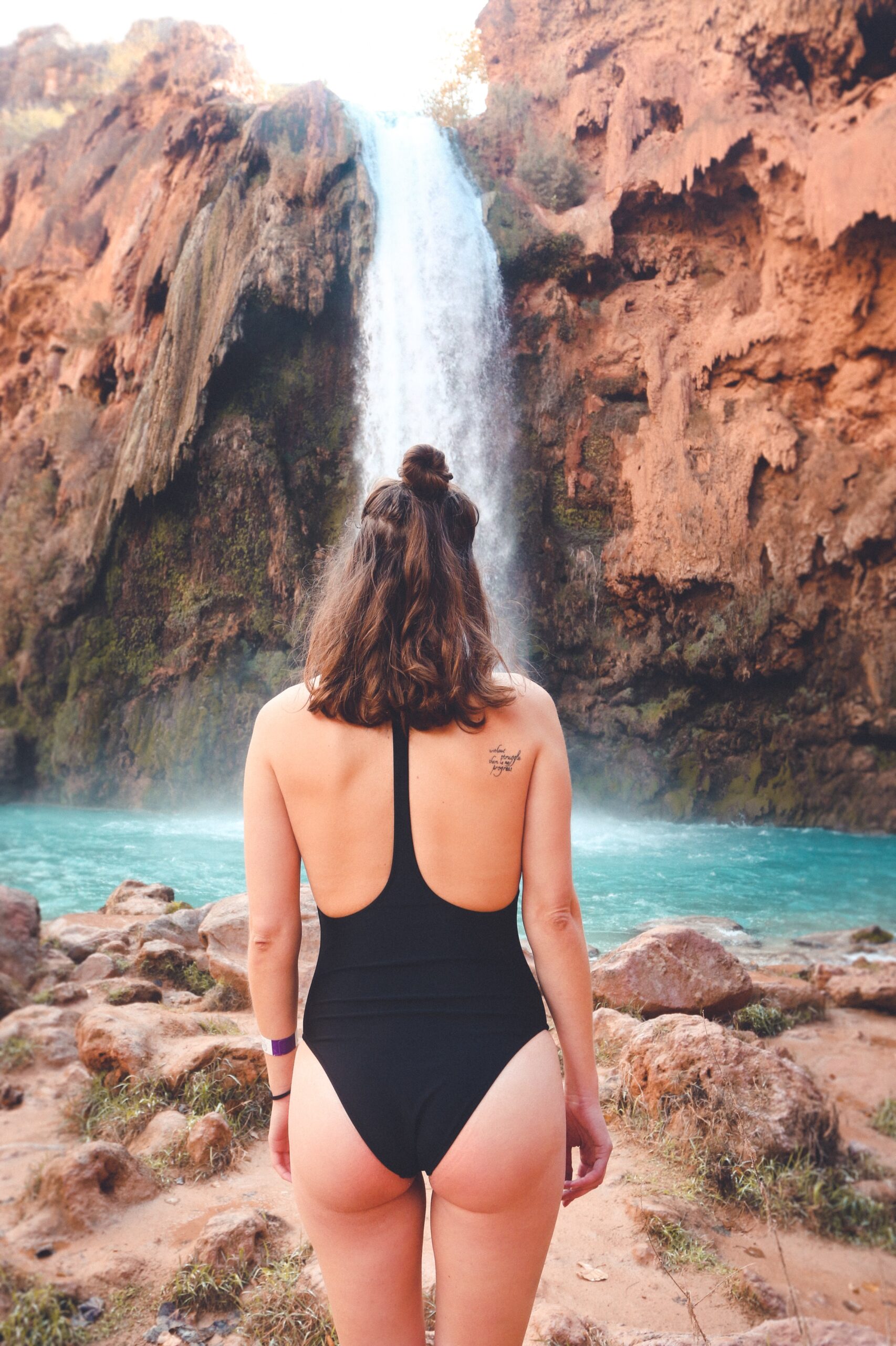
  • 196 feet in height
  • Although the flowing currents can make it dangerous, it is a fantastic place to swim at certain times of the year (check the signage)
  • To get to the waterfall’s base, you’ll have to descend a sheer rock face (you’ll find shackles and ladders to help you along the way)
  • Near the bottom of Havasu Falls, about a half-mile downstream from the campsite

Most people don’t realize that Mooney Falls is actually way bigger than Havasu Falls. However, hiking Havasu Falls is a lot easier, so not as many people actually make it to Mooney Falls. The climb down is more than a little treacherous.

5. Beaver Falls
The ultimate guide to your Havasu Falls hike! If you're planning on hiking Havasu Falls in the Grand Canyon for your Arizona vacation, there are a few things you need to know.

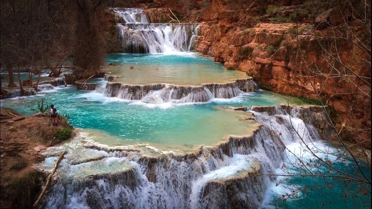
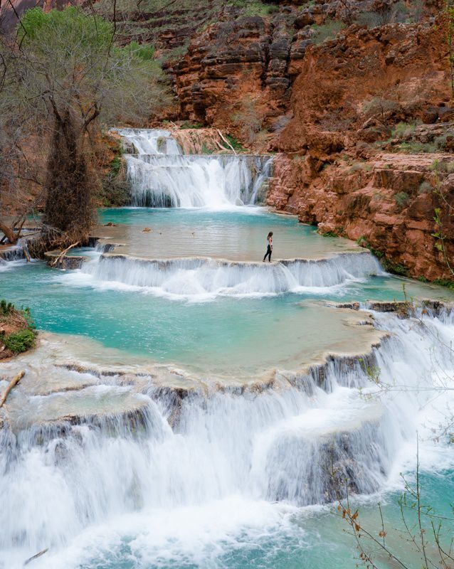
  • 40 feet-high waterfalls that cascade over five levels
  • Provides a wide range of fantastic swimming options
  • Situated a distance of 3.0 miles from Mooney Falls
  • To get here, you’ll need to trek 6.0 miles round trip across challenging and rocky terrain and cross multiple streams
  • We don’t advise visiting Beaver Falls during the summer because of the excessive temperatures

At Havasupai, it’s challenging to select a favorite waterfall because they all have their own unique and beautiful traits. Beaver Falls would be our pick if we had to make a choice.  It’s just the best place for swimming and actually hanging out.

The 6.0-mile round-trip journey to Beaver Falls from the campsite is famous, although only about half of the tourists to the Havasupai Indian Reservation do it.

If you don’t want to swim, then just hike to Havasu Falls and back – you’ll get incredible views without a super long trip.

Hiking The Havasu Falls: What To Anticipate
The ultimate guide to your Havasu Falls hike! If you're planning on hiking Havasu Falls in the Grand Canyon for your Arizona vacation, there are a few things you need to know.

You can reach Havasupai and Havasu Falls by a 10.0-mile one-way climb that descends 2,400 feet in height, making it one of the more difficult hikes in Arizona. We can classify the trek to Havasu Falls as moderately challenging, yet it’s not difficult to follow at all because it’s well laid out. Inexperienced hikers can find things more complicated than they are.

Havasu Falls, the community, and the campsite are all accessible without much difficulty; however, the base of Mooney Falls requires a steep down-climb.

Most of the hike’s decrease in height happens within its first mile. A series of switchbacks eases hikers down a somewhat steep descent.

Between the trailhead and Supai (8.0 miles away), there are just a few places to rest under a tree. Thus, during the year’s hottest months, most hikers start early (between 3:00 and 6:00 am) to make the return journey as comfortable as possible.

After 7 miles of hiking downhill, there are no water sources to replenish one’s fluids. Bring at least 2 liters of water with you.

Most hikers need 5-6 hours to complete the 10.0-mile trail from trailhead to campsite. Quick hikers will take less time (4-5 hours), whereas slow hikers will take longer (6-7 hours). Most individuals spend 30-60 minutes longer on the trek back out than they did on the way in.

Hualapai Hilltop Trailhead to The Confluence
The ultimate guide to your Havasu Falls hike! If you're planning on hiking Havasu Falls in the Grand Canyon for your Arizona vacation, there are a few things you need to know.

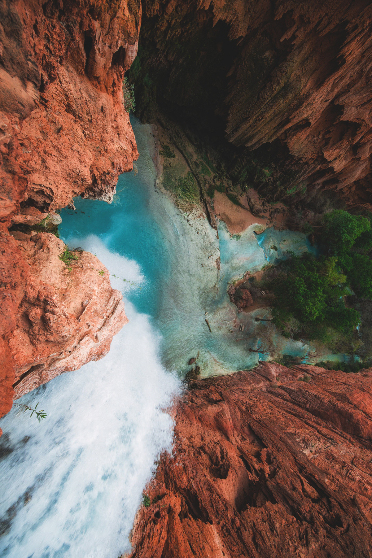
The information below provides you with the distances and elevations covered by the Havasupai Trail and the numerous locations that it leads to. We include a complete list of all the points of interest from the Hualapai Hilltop trailhead to the Confluence of Havasu Creek and the Colorado River:

  • The trailhead at Hualapai Hilltop (5,200 feet in elevation) is the starting point for the hike.
  • Havasu Creek is 6.7 miles (3,240 feet in elevation) from the trailhead.
  • The Tourist Office / Village of Supai is at 8.0 miles (3,190 feet in elevation).
  • The Upper Navajo Falls is 9.0 miles (3,095 feet in elevation).
  • At an elevation of 3,018 feet, Lower Navajo Falls is about 9.15 miles.
  • It takes 9.8 miles to reach Havasu Falls, at 2,812 feet in elevation.
  • The campground’s starting point is 10.0 miles away, with an elevation of 2,741 feet.
  • It takes 10.3 miles at 2,708 feet elevation from the end of the campground.
  • You can reach Mooney Falls in 10.4 miles at 2,607 feet elevation.
  • Beaver Falls is a 13-mile hike up a mountain (2,246 feet in elevation).
  • The Confluence is a distance of 16.00 miles (elevation of 1,820 feet).

Things to Consider

It’s worth noting that most tourists only go to Havasu Falls or Mooney Falls. If forecasted high temperatures are approaching, there is no need to go farther than Havasu/Mooney Falls from June to September. In the colder months, seasoned hikers only should attempt extending their journey beyond Havasu and Mooney Falls. It is not part of the standard Havasupai experience to trek Beaver Falls or The Confluence.

Getting to the foot of Mooney Falls and continuing downstream requires an extremely steep descent down a precarious rock face. There are many chains and ladders that you can use to help you. Those afraid of heights can have a panic attack and have to get back down. It should be okay as long as you can help them overcome their modest fear of heights. To make the descent and ascent easier, some hikers pack gloves made of rubbery material.

Beaver Falls and The Confluence are optional excursions and should only be for experienced hikers during the colder months. Hiking over rocky and rugged terrain to reach these two unique places might be challenging at times. Many improvised bridges span Havasu Creek, and you’ll encounter a few tricky sections of scrambling. Hiking back from The Confluence is best done as soon as the sun comes up so that you have plenty of time to get there and back before the sunsets.

Always bring an updated Havasupai trail map, and find it on the official Havasupai Tribe website. The Havasu Falls hike tends to change (slightly) quite often from storms!

Havasu Falls Hiking Permits
The ultimate guide to your Havasu Falls hike! If you're planning on hiking Havasu Falls in the Grand Canyon for your Arizona vacation, there are a few things you need to know.

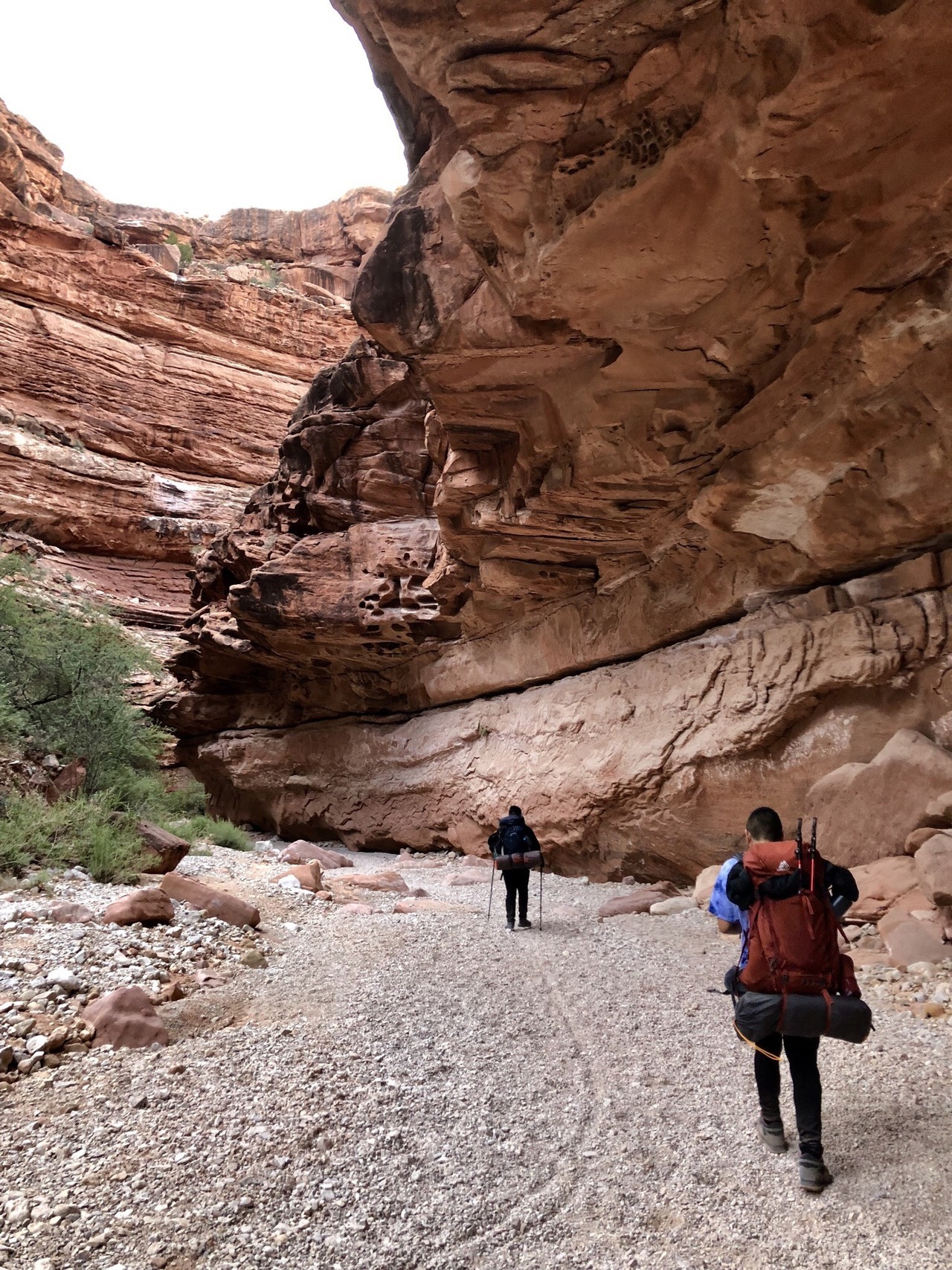
The Havasupai Tribe forbids day-through Havasu Falls hikes. To hike to Havasu Falls, you must purchase a 3-night/4-day camping permit instead of a 1-2 night ticket.

Do this via the Havasupai reserve system’s website when purchasing camping permits for your Havasu Falls hike. If you attend on certain days of the week, tickets might cost anything from $300 to $375 (weekends are more costly). The number of permits sold each day is limited to 300, and when they go on sale on February 1st each year, they sell out fast.

So OK: it’s kind of expensive, but it’s also never too crowded, which is the plus of purchasing tickets in advance.

It’s a good idea to have the following information on hand before attempting to make a reservation:

  • The name on the reservation. Reservations can only be confirmed if they are presented to Supai Village’s Tourist Check-in Office with a valid ID by the individual on the reservation;
  • Your preferred dates. Prepare a few selections before making your reservation. You may not secure your first, second, or third pick, so plan ahead of time;
  • A payment method. Reservations are non-refundable, non-transferable, and you can’t modify them once they are made;
  • You and your companions’ total number (you can’t change this later either)
  • Where you intend to rest your head at night (more on that shortly – there are a few different options)

The Havasupai Policies

These guidelines apply to visitors to Havasupai when hiking Havasu Falls:

  • Please refrain from photographing Havasupai’s citizens or community
  • Your permit does not enable you to remain longer than the allotted time
  • Please don’t bring more individuals than the number of persons permitted on your ticket
  • Practice the leave no trace (LNT) principles
  • Nudity is strictly prohibited
  • There will be no trekking at night, except for the hike in and out

Havasupai also forbids the following:

  • Alcohol (it will be confiscated if discovered)
  • Wood-burning fires (propane stoves, on the other hand, are acceptable)
  • Drones (it will be confiscated if found)
  • Major waterfall cliff-jumping
  • Rock-climbing
  • Off-trail hiking
  • Music played loudly
  • Littering (unfortunately, you’ll notice a lot of other people’s rubbish littering the place)

Havasupai and Havasu Falls are no longer open to day visitors. Before, it was possible to visit Havasupai on a 20+ mile day hike, but that option no longer exists today.

Havasupai tribal members can issue penalties and accompany day hikers off the reservation without their consent. So trust me: you don’t want to try and get around these rules. It’s definitely not worth it.

When Is the Best Time To Go to Havasu Falls?
The ultimate guide to your Havasu Falls hike! If you're planning on hiking Havasu Falls in the Grand Canyon for your Arizona vacation, there are a few things you need to know.

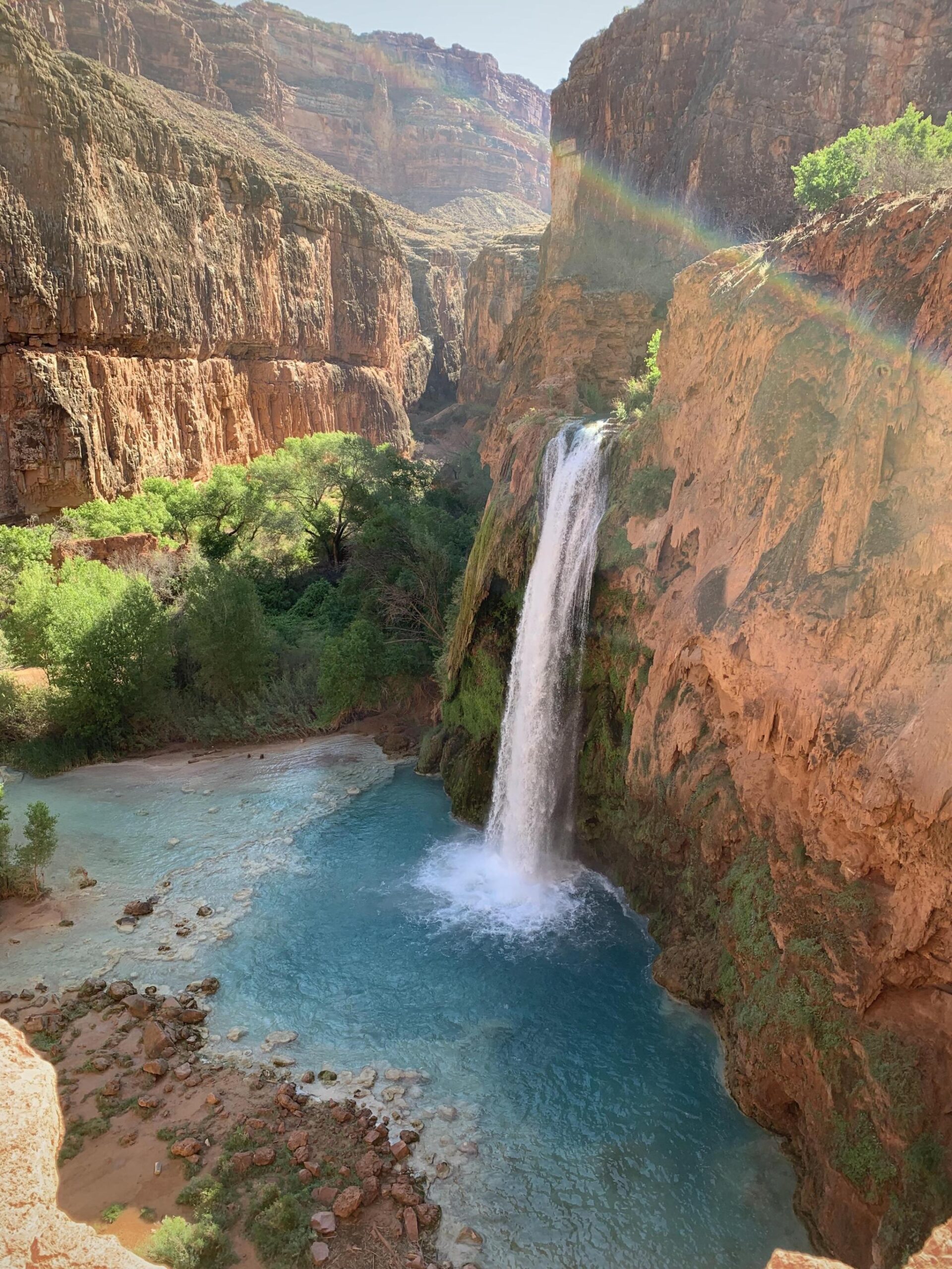
Havasu Falls permits are available from February to November, and the busiest months are May to September, with the monsoon months between July and August.

But that’s simplifying it since there are so many variables when hiking Havasu Falls. Here are more details about visiting each month.

February to April

During the colder months, the weather might be chilly, making it difficult to go for a swim. The Havasu Falls hike in (and back) will be considerably more pleasant in the colder months since the trail is mainly open to the sun. You’ll need to make sure that you have appropriate clothing and bedding since the nights can get cold.

May to June

It’s slightly warmer, but it might also be a little buggier. The average temperature in June is  96°F.

July to August

Havasupai receives the warmest temperatures during this period, with an average of 37℃/99°F. However, this is also the monsoon season and the busiest period for obtaining permits, even though the heat is extreme.

September to November

Temperatures can still be pretty warm in September but anticipate cooler temperatures in October and November and the chance that it could be freezing to swim depending on the year. Hiking Havasu Falls in the fall is definitely more of an adventure and less of a leisure vacation.

The ideal months to hike Havasu Falls are April, May, and October if you want the best of all worlds: mild temperatures that may yet urge you to take a dip in the water.

Remember that rain does not always imply the canyon is closed. Also, during the summer, when conditions are drier and the soil less able to absorb precipitation, flash floods are more likely to occur.

Getting to Havasupai

Getting to Havasupai isn’t always easy, but the reward is worth it! For Havasupai’s trailhead at Hualapai Hilltop, public transit is unavailable. To visit Havasupai, you’ll need to fly into one of these locations:

Major Airports

  • Las Vegas, Nevada (if you’re looking for a convenient airport, this is the best choice getting to Havasupai)
  • Phoenix, Arizona
  • Albuquerque, New Mexico

Minor Airports

  • Flagstaff, Arizona (even though this is the nearest airport, flying into it might be exorbitantly expensive)

To get to the Hualapai Hilltop trailhead at the end of Indian Road #18 in Arizona, you’ll need to hire a vehicle from one of these airports. From AZ 66 on the eastern edge of Peach Springs, go north on Indian Road #18 for approximately 60 miles (80 minutes).

Hualapai Hilltop trailhead is 170 miles from Flagstaff, Arizona, which takes around 3.0 to 3.5 hours to drive.

Las Vegas, Nevada to the Hualapai Hilltop trailhead is 221 miles, which takes around 4.0-5.0 hours to drive.

Phoenix, Arizona, to the Hualapai Hilltop trailhead is a 260-mile trip that takes between 4.5 to  5.5 hours of driving.

To get to the Hualapai Hilltop trailhead from Albuquerque, New Mexico, you’ll need to drive 490 miles for 7.5-8.5 hours.

Although the Havasupai Reservation is near Grand Canyon National Park, no highways lead there.

There are two primary routes to Havasupai from the Hualapai Hilltop trailhead:

  • 8-mile hike (one-way) to the Supai Village, followed by a 2-mile trek (one-way) to the campsite past Havasu Falls; and
  • A 15-minute helicopter flight to the Supai Village, followed by a 2-mile hike (one-way) past Havasu Falls to the campground.

The majority of visitors to Havasupai take the scenic route on foot. Helicopters are a possibility; however, there are several things to keep in mind:

  • No helicopter bookings are available, and flights are available on a “first-come, first-served” basis
  • Helicopter flights generally need a long wait time. Someone waited for seven hours, according to one report
  • Bring cash even though some people say credit cards are accepted if you’re taking a helicopter ride
  • For some reason, figuring out when the helicopter will take off is very hard since it doesn’t fly every day

Tips for Reaching the Trailhead
The ultimate guide to your Havasu Falls hike! If you're planning on hiking Havasu Falls in the Grand Canyon for your Arizona vacation, there are a few things you need to know.

It would be best to stop for gas before heading to the trailhead. That road is 60 miles long, and you’ll need another 60 miles to go back to the main road, so you’ll need at least 120 miles of gasoline in your tank. I can’t stress this enough when planning your Havasu Falls hike! It would suck to be stuck without gas.

Maintain vigilance. There are enormous animals on the route, like moose, cows, and deer, that can easily wreck your vehicle if you aren’t cautious while driving to the trailhead.

Keep an eye out for pebbles that can fall and damage vehicles if you park too close to the trailhead itself.

When you get to the village, you’ll need your license plate number, so snap a picture or write it down.

The trailhead does not have water, so bring your own.

Note that a mule ride to Havasupai is possible, but it’s pricey, and there are weight restrictions. If you want more information about a mule rental guide, you can go to the official website of Havasupai Tribe.

Lastly, neither powered nor mountain bikes are permitted in Havasupai.

Where To Sleep Before Havasupai?

The following hotels are the nearest to Hualapai Hilltop (the trailhead for the Havasupai hike):

Grand Canyon Caverns’ Inn

At the entryway to the Grand Canyon Caverns, situated in Peach Springs, Arizona, there is a 48-unit hotel room. It takes 66 miles and 80-90 minutes to travel from the trailhead. This is where we usually stay when hiking Havasu Falls (the night before).

Hualapai Lodge

It is also located in Peach Springs, where it offers 54 rooms in all. From the trailhead, it’s around 68 miles and takes about 80 to 90 minutes to travel.

There are several accommodation options in neighboring Kingman, Arizona (approximately 120 miles) and a couple in Seligman, Arizona (about 90 miles) in addition to the two hotels mentioned above.

There are also various campsites in Seligman and Kingman, including KOA Kampgrounds in both places.

Supai Village
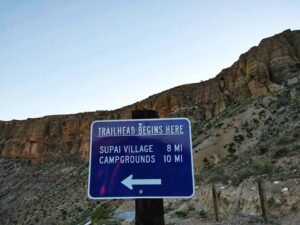
The ultimate guide to your Havasu Falls hike! If you're planning on hiking Havasu Falls in the Grand Canyon for your Arizona vacation, there are a few things you need to know.
southwestexplorers.com

You’ll be at the Supai Village in no time at all. You can’t miss it since it’s located along the primary route in town and well-marked. It’s tiny, and you’ll see some residences, a small shop, a school, a restaurant, the lodge, and a few other structures. Check-in and obtain your wristband and tent tag at the tourist office.

Fill your water bottles at the water station near the office, which also serves as a pleasant rest stop before the last push to the campsite. Feel free to explore some, but keep in mind that this is their home, so be kind. You are not permitted to capture the region, particularly the individuals who reside there.

There are barely two miles remaining on the trek at this point. On your route, there are a few lesser waterfalls worth seeing that give you a taste of what’s to come. There are several unique rock formations worth studying in this region.

You’ll see the gorgeous Havasu Falls on your right as you enter the campsite, which is up a somewhat steep climb. Have a few moments to admire how beautiful it is and take some photos since this is an excellent viewing location.

Where To Camp?
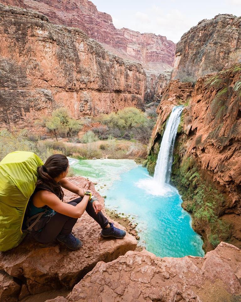
The ultimate guide to your Havasu Falls hike! If you're planning on hiking Havasu Falls in the Grand Canyon for your Arizona vacation, there are a few things you need to know.

The Havasupai campground, located on the banks of Havasu Creek, is a lovely spot to spend the night. We definitely recommend camping when hiking Havasu Falls!

All of these amenities are available at the campsite.

  • Several campsites are level and well-shaded
  • There are a plethora of trees to hang a hammock
  • Toilets that use compost as waste
  • Picnic tables (not every site has this)
  • A Fern Spring on the western side of the canyon provides drinking and cooking water; watch for water coming out of a pipe
  • Havasu Falls, Mooney Falls, and a slew of minor falls and swimming areas are all within easy reach

A “distributed” kind of camping allows campers to set up camp in whatever location they like. Campsites are available on both banks of Havasu Creek. Some temporary wooden bridges will enable you to cross the stream safely.

Havasupai does not allow you to book a particular campground. First-come, first-served is the rule for all sites. Campsites with a picnic table are available at a limited number of spots, so groups will have to move throughout their stay to find a better location.

Havasu Falls campsite is around 0.2 miles downstream and stretches for 0.3 miles. At the very end of the grounds, you will locate Mooney Falls, a beautiful spot to explore. You can pitch a tent anywhere you choose between the camp and the last pit toilets above Mooney Falls. There are no camping options below Mooney Falls and upstream of Havasu Falls.

A lot of people come to the campsite. Any night of the week, up to 300 individuals can camp here. Due to a shortage of more private areas on popular evenings, other groups can choose to camp extremely near you.

You must be extra cautious with your food and equipment at the campsite. Critter bags, bear canisters, or sturdy plastic buckets (with full closures) are excellent choices. In particular, mice, raccoons, and squirrels can be ruthless in their pursuit of a free meal.

The creatures can or will eat your backpacks, tents, coolers, plastic water bottles, and other items. Please do not disregard this warning; folks lose meals and have their gear damaged every night because of these animals. Put a massive boulder on top of a sturdy plastic bucket if you’re using one.

While camping immediately by Havasu Creek might be nice, we don’t suggest it during the rainy season (July to early September). We recommend camping on higher ground at this period (if you can spot it; there are just a few upland campsites).

What To Bring – Packing List for Havasu Falls

Reduce the amount of stuff you bring with you. There are pack mules and helicopters that can bring your luggage down for a price, but we recommend you carry your luggage right to the campground!

If you can’t carry your gear down the falls (with obvious exclusions), you shouldn’t be hiking to the falls, or you should lighten your load.

Here are the essentials you need when you hike Havasu Falls:

Tent/Hammock: To conserve weight, we opted not to pack a tent but instead slept in our hammocks.

Cameras and Other Equipment: Take a picture of this breathtaking scene. In addition to a camera and lenses, we also carried a Go-Pro camera and a portrait lens for taking close-up images, and a wide-angle lens for capturing landscapes (NOTE: Drones are prohibited, but tripods are allowed).

Hiking Shoes: We recommend hiking boots with ankle supports.

Water Shoes: The canyon is rocky and slippery, and at the bottom of the rivers you’ll be going through, so we recommend bringing this stuff. Take a pair of Chaco or any other form of water shoe on your explorations. From the town of the tribe to the campground, the last 2 miles are all sand, and walking in hiking shoes through this terrain becomes quite tricky. Sandals will be a tremendous assistance, believe us.

Outfits: It’s okay to re-wear clothing while you’re down at the falls, but you’ll want a new pair for your two significant hiking days, especially socks.

Hat: It will be sunny, so wear a hat and sunscreen to be safe.

Food: Some meal options are available within the Grand Canyon, but they are inconsistent, and you do not want to travel to the Grand Canyon’s bottom without sustenance. It’s vital to pack electrolytes and dry fruit, but you should also bring your favorite snacks.

Water: A half-gallon water supply is sufficient for the first 10 miles, but you will need to replenish it when you get to the campground. We are advised to carry filters, but we didn’t use them and were okay.

First Aid Kit: Ensure you pack a lot of bandaids since it’s almost impossible to go this far without getting a single blister.

Bug Spray: We highly recommend that you use bug bands. It has a milder odor and is much easier to handle than traditional materials.

Blanket: Even while it did not seem like it would be so chilly, the wind chill and night with just an added effect to block the cold makes you want to snuggle up.

Charger/Battery: If you forget to put your phone into airplane mode when visiting the Grand Canyon and hiking Havasu Falls, it is still a good idea to pack a charger in case your phone runs out of power while you’re there.

Flashlight/Headlamp: A headlamp or flashlight can come in handy if you go out before sunrise when hiking Havasu Falls.

Quick-dry Towel: You need this to wipe out your sweat during your hike.

Toiletries: Avoid taking a bath in the water. Don’t contaminate their water by using your chemicals since the tribe performs an excellent job protecting the water.

Photography Tips:
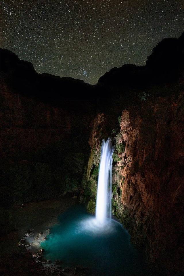
The ultimate guide to your Havasu Falls hike! If you're planning on hiking Havasu Falls in the Grand Canyon for your Arizona vacation, there are a few things you need to know.

It is a photographer’s dream! The Havasu Falls Trail is a great place to take stunning photographs. For the most fantastic Havasu Falls photos, here are a few tips:

Learn Long-exposure Photography: Long exposure photographs offer the illusion of movement in the image, such as water flow, and enable night photography. Depending on your camera, you can access advanced capabilities like long-exposure photographs. Get to know your camera.

Get a Tripod: Bringing a tripod can assist keep your camera stable for long exposure photographs and keep it dry. We shot pictures in the water to properly frame the waterfalls.

Bring a Powerful Light if Shooting at Night: If you’re interested in hiking Havasu Falls, bring a stronger light than your headlamps, such as a bike light or an LED flashlight. These additional lights might assist expose a night photograph or highlighting a specific subject in the photo.

Pack a Wide-Angle Lens: On this trip hiking Havasu Falls, a wide-angle lens can help depict the size of several waterfalls.

Grab a Lightweight Camera Case: It’s a damp environment and a steep climb at points, so carry a hand-free camera bag.

Bring a Waterproof Camera Like a GoPro: A GoPro HERO4 Silver with water housing is a terrific alternative if you want to go more in the water with your camera.

For Pictures, Wear Bright Colors or Swimwear: The rocks of Havasu Falls are brilliant blue and red, so wear colors that contrast with them.

Wait for the Ideal Shot: The Havasu Falls trail is a popular hike, so expect to share the course with other hikers. Unless you are an expert at Photoshop, try waiting a few minutes or getting up early than others to photograph the falls alone.

Use Your Phone To Snap Photos: Nowadays, you can shoot excellent shots even with a phone. Many modern phones, like the iPhone, have lengthy exposure and water resistance. To be safe, we suggest packing a waterproof phone case.

The baby blue tint of the falls is stunning in any light, but we preferred it with a bit of cloud cover. If you go in March, much of the weather is like this. When the sun hit the falls, they were utterly bleached out to our camera but remained stunning to the naked eye.

The weather is unpredictable, so we avoid photographing the falls during noon. Photography is best done early in the morning or late in the day. It was approximately 4 pm when we arrived in Beaver Falls, ideal. If you don’t, you’ll end up with unsightly shadows.

If you travel to Beaver Falls in the afternoon, make sure you get back to camp before dark. Don’t forget about the spooky ladder at Mooney!

It’s a once-in-a-lifetime opportunity to backpack Havasu Falls. We hope this article has you in your preparations for your hike to Havasu Falls.

12+ Stunning Waterfalls In Arizona That You Have To See

The beauty of Arizona’s landscapes and natural treasures have made it a popular tourist destination for decades. While the Arizona desert and sunset views are well-known across the globe, there are some really gorgeous Arizona waterfalls that are less-known but still worth a trip.

There are mountain valleys, Grand Canyon, Cathedral Rock, diverse forests, mountains, and so much more to see in this dry but oh so beautiful place. Thousands of visitors come to the state yearly to catch a glimpse of the breathtaking scenery.

Road trips in Arizona are legendary. And trust me: if you’re taking a road trip through the desert, you’ll definitely want to find some waterfalls in Arizona to stop for a quick dip.

The top Arizona waterfalls range significantly in magnitude, location, and difficulty accessing them. Several attractions may be closed or require reservations at certain times. Others necessitate an extensive, multi-day camping trip, while some are easily accessible and ideal for families with younger visitors.

If you are seeking a relaxing time, take a look at these stunning must-see waterfalls in Arizona!

14. Fossil Creek Falls

Stunning waterfalls in Arizona: Fossil Creek Falls
flickr.com

Fossil Creek Waterfall is a natural waterfall that you can reach through a 1-mile Waterfall Trail.

The area is usually secluded to sit back and enjoy the scenery. The Fossil Creek Waterfall and its grounds are open for day usage only with reserved permission from April through October.

The permit process can be complicated, but it is necessary to keep the area free of tourists and preserve this stunning piece of Arizona’s heritage. Plus, this is a guarantee that you’ll have peace and quiet.

Note that you can only purchase permits online in advance; they are not available on-site. Make sure you print out and carry your ticket with you.

The hike begins at the Waterfall Trailhead parking lot on the service road. A little distance from the parking area, you’ll see a sign that tells you to follow a trail that will lead you into the woods. As time goes by, you’ll notice that there’s a small creek nearby.

You’ll find isolated bathing spots and swinging ropes along the creekside as the trail winds its way through it.

The trail is ideal for families because it is simple to follow and only has modest elevation. Strollers are not encouraged because there are some muddy sections and wooden plank bridges to traverse, but otherwise, it’s relatively simple.

Swim in some of the state’s most refreshing waters once you arrive to reward yourself for your effort. If the rush of the waterfall is too much for you, try swimming in one of the nearby crystal-clear pools. There are tons of options at this spot so it’s one of our favorites!

13. Beaver Falls

Stunning waterfalls in Arizona: Beaver Falls
theoutbound.com

The breathtaking grandeur of Beaver Falls is worth the effort, even if you have to hike a long way to get here. The Havasu Falls, an 18-mile hike from the campground, is teeming with pools and turquoise waters cascading over limestone ledges.

Bolts, chains, and ladders aid the descent, and you’ll also pass by a stunning historical burial site for the Havasupai people. Enjoy the scenery and cool off in the refreshing pools once you arrive at your destination.

From Mooney Falls, it’s about a 4-mile hike to Beaver Falls. To make the most of your time, we recommend beginning the climb about 7-8 a.m. to ensure you return before sunset. You must ascend the cliff you dropped to reach Mooney Falls to return. Beaver Falls can only be reached by wading across three rivers, so be sure to have your water shoes.

The best part of the hike to Beaver Falls is the shaded sections, the rocky pathways, the wild grape fields, and the breathtaking vistas of the gigantic Grand Canyon cliffs. It is also much quieter than prior routes. You only have to wade through knee-deep water at least four river crossings and a few footbridges to get to Havasu Creek downstream from Mooney Falls.

Surely, Beaver Falls will be your favorite among the  Havasupai Falls. The water rushes down the sandstone and limestone terraces, forming a series of smaller waterfalls that include swimming and wading pools. Swimming, cliff jumping, and climbing all over the falls are just some of the activities available once you arrive.

After a long day of jumping and shooting, sit down to eat our dinner and enjoy the peace.

You must first camp at Havasu to go to Beaver Falls, arranged through the local tourism office.

12. Bridal Wreath Falls

Stunning waterfalls in Arizona: Bridal Wreath Falls
tucson.com

Saguaro National Park’s Bridal Wreath Falls, located in the Rincon Mountain District, is a somewhat popular route that offers stunning vistas of Tucson and occasional wildlife sightings.

If you’re searching for a solo hike or are just starting to hiking, this is the ideal route for you!

Stay on the Douglas Spring Trail to reach Bridal Wreath Falls. In addition to the numerous mile markers and signs that you’ll come across along the way, this hike has a great deal of clearly marked pathways. Many Arizona hikes lack clear directions, so this one is ideal for individuals who are just starting or need more supervision.

As soon as the trail begins its ascent, you’ll observe a noticeable elevation change. From here on, the trek will be moderately steep but manageable.

It’s a lovely upward hike amid desert vegetation and views for the next mile and a half. The falls can be heard before you can see them, and you can even catch a peek of them from the trail as you round the bend before the course opens up. There are saguaro and barrel cactus in the foothills, mesquite, and creosote-covered grasslands.

Despite its tiny stature, it’s a serene and beautiful sight. Rest here for a bit and grab something to eat before retracing your steps back down the path you just came up through the boulder field.

Tall canyon walls and a cottonwood-will canopy shade the falls, making for excellent photographers’ backgrounds.

March through October is ideal for visiting because of the mild temperatures and clear skies. You can see deer, javelina, and coyotes along the isolated trail, which is a great area to see the desert’s vegetation and fauna in their natural habitats.

11. Cibecue Falls

Stunning waterfalls in Arizona: Cibecue Falls
pinterest.com

Visit Cibecue Falls, and you’ll get to witness a different aspect of Arizona that you won’t find anywhere else. Driving to the trailhead is possible; it’s an adventure to navigate the winding roads, through towering cliffs, and along the stunning Salt River.

If you’re looking for a more challenging canyoneering-style hike, this one is for you. The trailhead is situated at the height of around 2900 ft. To get to the parking area, you’ll even have to cross the swiftly flowing Cibecue Creek. The site has a different set of rules and signs, which you should know.

There will be a lot of rock jumping on this trail because it is mainly in the creek. Your feet will get soaked.

Taking the creek upstream for two miles rewards you with stunning vistas of the canyon and a bevy of the creek’s unique water features. As a canyon, you’ll have lots of natural shade and a comfortable temperature thanks to the flowing water. You begin to appreciate its majesty when you’re near a waterfall as the canyon gets smaller and smaller.

About 30 feet high, the waterfall has a substantial water flow. Also, you can discover a natural cave/alcove just before the falls.

Use utmost caution when dealing with a rising body of water. There is a hazard of flash flooding in the canyon during monsoon season and severe weather.

Although the river is shallow, the waterfall’s pool is deep enough to swim in. It is not easy to resist the temptation to jump in and swim on a hot day, but please, do not do so for safety.

For those who plan to camp, the sites are relatively basic. There were no picnic tables on-site, and the facilities were rudimentary.

10. Seven Falls

Stunning waterfalls in Arizona: Seven Falls
https://ruinyourknees.com/seven-falls-hike-guide-tucson-arizona/

The Catalina Mountains in Tucson, Arizona, are home to a sequence of small waterfalls known as Seven Falls. Sabino Canyon Recreation Area provides access to Seven Falls. The Seven Falls trek is popular; the mix of accessibility, beauty, and water features makes it a worthwhile adventure.

Bear Canyon Trail, FS Trail No. 299, leads to Seven Falls. In addition to being well-maintained, the route follows a creek for much of its length. If you’re in Tucson and looking for a half-or full-day trip, be sure you hike Seven Falls.

While trekking to a waterfall, you’ll be traversing challenging terrain in the Arizona desert. For this hike, you’ll want to carry lots of water with you. Because Seven Falls is a moderately graded route, there are a few essentials that you should bring along with you.

Prepare your pack or wear shoes to get wet due to stream crossings and a waterfall after the walk. We recommend swimwear or dry clothing if you want to plunge into the watercourse the waterfall has formed.

Near the parking lot, you’ll find restrooms and water fountains. Visitors to the Sabino Canyon Recreation Area should know that pets are not permitted.

9. Ribbon Falls

Stunning waterfalls in Arizona: Ribbon Falls

One of the accessible waterfalls in Grand Canyon National Park is Ribbon Falls, located on the Rim to Rim Trail and accessible from Phantom Ranch.

You can find Ribbon Falls approximately six miles up Bright Angel Creek and conceal in a small canyon on the north bank of the Colorado River. Water-rich minerals have built a massive travertine spire under the falls around 100 feet high. It is a fantastic respite from the sun in this part of the canyon.

You can trek around the falls and stand behind them after you’ve had a swim in the icy water at the bottom. The trip to Ribbon Falls, despite its proximity, involves much forethought and preparation, but it’s worth it!

Getting to Ribbon Falls from Phantom Ranch needs backpacking or hiking trips. You must first obtain a backcountry camping permit from Grand Canyon National Park to go backpacking.

Staying at the Phantom Ranch dormitories or cabins for two nights is all you’ll need.

Phantom Ranch and Bright Angel Campgrounds are the only two options for this hike’s access. The South Kaibab Trail and the Bright Angel Trail are two options for getting to the canyon. You can also get here by river rafting down the Colorado River.

This canyon is on the river’s right bank, around mile 88. Another method to observe this waterfall is climbing the North Kaibab path from the North Rim of the Grand Canyon to Cottonwood campsite. To get to Ribbon Falls from Cottonwood Campground, you only have to walk about a mile downstream.

Ribbon Falls is a magnificent reward for your challenging trek. A large boulder covered in moss is struck by the falls. To the right side of the waterfall, an alcove provides a distinct perspective.

8. Grand Falls

Stunning waterfalls in Arizona: Grand Falls
istockphoto.com

These muddy waterfalls are a must-see, almost as beautiful as the chocolate waterfall in Willy Wonka and the Chocolate Factory. You’ll find this waterfall marvel in the Painted Desert, 30 miles east of Flagstaff.

The Grand Falls, a natural wonder in the Southwest, has multiple layers of water and a broad stance.

It is more than 180 feet tall and known for its spectacular rainbows. Because of rocks at the foot of Niagara Falls, the actual cascade is just 70 feet in height. Hence, Grand Falls does surpass Niagara Falls in size!

Use the picnic tables and pavilions adjacent to the gully’s edge if you want to spend the day exploring Grand Falls. Take food and water with you since this is an isolated location. Remember that you are on the Navajo property and should treat it with respect by removing all rubbish and leaving no trace.

Because this is indeed a beautiful waterfall, you can even find yourself hiking down to the water’s edge. The trail into the gully is less than a half-mile long and straightforward, but be aware of loose stones.

Ensure you have shoes that can handle the sticky mud if you plan to trek down the falls. When walking through muddy areas, keep an eye out for soft soil, which might give way beneath your feet at any time. Be cautious!

Don’t miss this spectacular oasis in the Southwest that erupts from the Arizona desert!

7. Mooney Falls

Stunning waterfalls in Arizona: Mooney Falls

Mooney Falls is one of the most spectacular waterfalls in the Havasupai Indian Reservation, full of stunning waterfalls. With more than 190 feet, it is the largest waterfall on the reserve.

Mooney Falls, situated just west of the Grand Canyon, can only be accessed through a lengthy and arduous journey or by helicopter. There is no way to get to Havasupai via car.

To reach Mooney and Havasu Falls, you’ll have to go over some rough terrain. To see these magnificent waterfalls, you must first get a permit and then travel to Arizona to the trailhead for Havasu Falls. There is a 10-mile journey to get to the campsite, where you can pitch a tent and rest for the night. It’s a long, arduous road, but it’s worth it when you reach the gorgeous oasis at the end.

The trailhead for Mooney Falls in Havasupai is located on the other side of the campground from Havasu Falls. Take the way via Havasupai campsite to get to the trailhead. There’s a short 1-mile walk from the Havasupai campsite to the beginning of the Mooney Falls trek.

A sign says “descend at your own risk,” which marks the beginning of the route. You can have a glimpse of the waterfall from a bird’s eye perspective from the trailhead.

You’ll come upon a cave in the rocks not long after seeing the “warning” sign. Continue your journey to the foot of Mooney Falls Havasupai by entering the cave.

Duck down as you make your way to the exit on the opposite side of the cave. The walls are adorned with chains that will assist you in navigating and maintaining your balance.

For a unique perspective, take a picture of Mooney Falls via the “window.” The Mooney Falls descent begins after leaving the cave.

6. Tanque Verde Falls

Stunning waterfalls in Arizona: Tanque Verde Falls

The Tanque Verde Waterfall in Tucson has a stunning 80-foot drop. The Lower Tanque Verde Falls Trailhead is only a short walk away. You will witness many small waterfalls and swimming holes along the way, and they’re a terrific place to take a break and cool down.

Following the stream bed to the falls will be the only way to get there once you’ve arrived at the creek itself. Swimmers should be aware of the slippery granite in the region, even if it is permitted. Remember to bring your camera to capture the magnificence of this secluded hidden waterfall.

You’ll see a series of caution signs as you make your way through the area. You’ll be on the canyon bottom in less than a half-mile. There should be impressive falls upstream if the water is running here.

Once you’ve reached this point, there’s no clear route ahead of you. Your next move is to go upstream. There are several minor waterfalls and pour-offs to keep you entertained. It becomes required to scramble and climb over stones after roughly 0.75 miles from the trailhead since the canyon becomes more severe.

In the end, you’ll come to the mouth of an exciting-looking, small passage. You can hear the roar of a 30-foot waterfall just around the bend, surrounded by sheer canyon walls. Although the waterfall is lovely, this one is not the Lower Tanque Verde Falls.

While the 30-footer serves as a great vantage point, you’ll need to clamber up the rock wall to the right of it to get to the true goal of this trip. However, the payoff is well worth the effort, and an impressive 75-foot Lower Tanque Verde Falls awaits you in a small cave. Reverse your direction and travel back the way you came from paradise.

5. Apache Falls

Stunning waterfalls in Arizona: Apache Falls

The Apache Falls is a little-known gem in the state of Arizona. Located deep inside the Salt River Canyon, the falls are a spectacular sight to see, and they’re also quite accessible.

In the Salt River Canyon, Apache Falls is one of the few waterfalls in Arizona located in a river rather than a stream, making it a stunning sight.

The falls need a permit to visit. Most tourists acquire the White Mt Apache permit and combine the trip with a climb to Cibecue Falls. It costs $30 to purchase online—logging in before making a purchase grants you access to Apache Falls.

To get to the falls from Phoenix, use Highway 60 east for 43 miles. Once you’ve crossed over the river, you’ll begin your descent into the canyon through a series of switchbacks and make your first left.

Parking is available in the lot.

Apache Falls is a mile-long trek with an easy difficulty rating due to the trail’s flatness. Before you see it, you’ll hear it thundering down the mountainside for roughly 10 minutes.

Also, the trek up the river beyond the falls is quite stunning, so we highly recommend it.

4. Pacheta Falls

Stunning waterfalls in Arizona: Pacheta Falls
pinterest.com

An undiscovered waterfall in the White Mountains is just begging to be found. Pacheta Falls, with its 130-foot cliffs and rich vegetation, is one of the most impressive waterfalls in the area. It is like something out of a jungle, not an Arizona desert, and the sight will take your breath away.

The falls are in the White Mountain Apache Reservation; therefore, visitors need a permit to go here. The Sunrise Gas Station sells permits. We recommend a high-clearance vehicle because the terrain is complex, and the roads might soon become inaccessible in a sedan if a major thunderstorm passes through the region.

It can be challenging to get here at times, but you’ll only have to walk 1.25 miles from the parking lot. Another option is to drive close to the falls, although this is more difficult and requires navigating some extremely rocky, unmarked roads.

Evergreen Douglas fir trees are blanketing the cliffs of the high country panorama when you look the opposite way. You’ll have trouble believing you’re still in Arizona when you see these quite surreal sights.

With a view from above the falls, you’ll be able to appreciate this natural beauty in an entirely new light.

Take your breath away as you watch the water tumble down the lush green hillsides, ultimately pouring into an oasis of clean water. Smaller waterfalls dot the landscape, further adding to its enchantment.

The foliage is stunning in the fall, so plan on being amazed if you come then.

Start on AZ-260 toward Sunrise Ski Resort, and then turn right towards the end of the road to reach Pacheta Falls.

3. Navajo Falls

Stunning waterfalls in Arizona: Navajo Falls
thousandwonders.net

After the 2008 flash flood in Havasu Canyon, Navajo Falls emerged as a natural wonder. Upstream Havasu Falls, there is a stunning array of waterfalls and cascades! Swimming in cool, clear water is a relaxing and rejuvenating experience.

Havasupai Campground is an excellent place to camp in the afternoon and evening because of the flash flood that permanently altered the canyon topography. It’s a quick walk from the campsite (just over 0.5 miles) and a refreshing alternative to Havasu Falls if it’s too busy there.

Upper Navajo Falls and Lower Navajo Falls are two separate waterfalls connected by a beautiful succession of cascades. Upper Navajo Falls, the fifth waterfall in Havasu Canyon, is slightly hidden from the main route, so be sure to explore a little to view it!

The Havasupai Tribe prohibits cliff jumping from Upper and Lower Navajo Falls, although many visitors will find it irresistible to leap from the cliffs.

Upper Navajo Falls is just upstream of Lower Navajo Falls, and it’s easy to overlook. Lower Navajo Falls may be seen well from the main route that connects Supai Village and the Havasupai Campground.

You can find the Upper and Lower Navajo Falls through an access road and a succession of well-defined paths that begin from the main route.

A vast pool formed by Upper Navajo Falls has attracted visitors who bring innertubes and other recreational floating equipment to enjoy the breathtaking canyon walls and the falls’ mist.

It’s essential to exercise caution while exploring this area and be mindful of the fragile system of travertine that is still emerging in the stream; the “stone” ledges you notice in the water are still growing and are thus quite unstable.

2. Madera Canyon Waterfall

Stunning waterfalls in Arizona: Madera Canyon Waterfall
pinterest.com

The sound of gushing water fills the air as you stroll through a canyon in southern Arizona. It is not Sabino Canyon but a hidden waterfall.

As an Arizona tourist, Madera Canyon Waterfall should be on your list of must-see attractions.

Go south on I-19 towards Nogales for 20 miles from Tucson, and you’ll find it. Take exit 63 in Green Valley and turn left onto Continental Road. Take Whitehouse Canyon Road, then turn right onto Madera Canyon Road after one mile. Enter Madera Canyon Road at the first parking lot on the right.

The unpaved track on the right is 200 feet down the paved path on the Proctor Trail. A trickle of water will lead you to a secret waterfall.

The water comes from Madera Creek, which is roughly a mile distant.

Nearby, Madera Creek provides the waterfall with its water supply. See what the picnic area beside the stream has to offer.

Sit on the slippery rocks near the waterfall to enjoy the view. Despite the roaring river, this area is relatively quiet. It’s a terrific place to take a breather, clear your thoughts, and see nature in action.

1. Wolf Creek Falls

Stunning waterfalls in Arizona: Wolf Creek Falls
theoutbound.com

In Banning State Park, Wolf Creek Falls is a modest waterfall with a tiny pool. A beautiful waterfall descends 12 feet where Wolf Creek joins the Kettle River at Wolf Creek Falls. After entering the park, follow the camping signage. The trailhead is on the left, and there is parking in a small lot to the right.

The Wolf Creek Trail is the quickest and most direct route to the falls. The course will branch off and blend in with its surroundings at some point. You can return by a similar path or the High Bluff Trail on the way back if you want to see more. The forest ground is covered with trilliums during the spring, making the level dirt route an enjoyable stroll through the woods.

The North Umpqua’s emerald green woodlands will be your favorite thing about trekking here. There is an almost continual rainforest-like wetness around them, even in the middle of the summer. As you cross the bridge to get to the trailhead, you’ll see a gorgeous rock covered in neon green moss. There’s a picnic table and a fascinating fallen tree on a sidetrack.

The hike is a moderate, downhill path from the trailhead to the stream. It’s easy to slide on the loose gravel, and rainfall can make the stones around it even more slippery. Wear long trousers and shoes with excellent grip if you’re going to be near the stream, lined with prickly bushes.

Once the route reaches the stream, it will flatten out and diverge in several ways. Turn right and follow the creek downstream until you come to a set of waterfalls.

If there has been just the appropriate amount of snowmelt and the temperature is perfect, it is common to encounter a frozen waterfall throughout the winter.

Waterfall Safety Preparation In Arizona

  • No matter how short the hike is, do some research on it. Ensure that the terrain is appropriate and doable for everyone in your group. It’s a good idea to scribble down waypoints and instructions, and having a map on hand never hurts. Even though mobile devices can be pretty helpful, you should not depend on them entirely.
  • Bring plenty of water! When hiking to a waterfall in the heat, it’s easy to get dehydrated and much worse.
  • Use a hiking pole for trail stability. Rough terrain or river crossings are common on many pathways. While navigating rugged or steep terrain, a trekking pole (or two) can substantially boost stability.
  • Wear breathable and light clothing. When it’s hot outside, pants and cotton apparel are ideal for soaking up sweat and keeping it around all day. Hypothermia can develop quickly if a hiker becomes lost and spends the night in the woods. As for socks, although some people find merino wool socks to be a little warm or unpleasant, they are fantastic at wicking away sweat and regulating your body’s temperature.
  • Proper footwear is crucial. Hiking boots/shoes provide good grip and support, especially important on the slick pathways and rocks surrounding waterfalls. A fall or a disabling injury might occur if you don’t have enough traction and support. Hiking should never be done in flip-flops or sandals.

The natural beauty of Arizona waterfalls is a gift to the cactus-strewn desert. Different kinds of them are available, and each is a terrific way to escape the oppressive heat. If you haven’t explored these waterfalls yet, you should include them in your itinerary.

Top 20+ Hikes In Arizona You Won’t Want To Miss

Arizona is in the Southwest region of the United States, laying just above the border of Mexico and tucked in-between California and New Mexico. This gorgeous state is home to around 200 named mountain ranges which provides adventure seekers with a plethora of hiking opportunities.

While Arizona is home to the famous Grand Canyon, this state holds so much more beauty to be discovered. Not only is Arizona the dream state to visit for many hikers, but this state is also rich in history.

22 Native American tribes call Arizona home. Some of these tribes span back to 12,000 years ago. Artifacts such as manmade doorways in the side of mountains that date back thousands of years ago are found on many of the famous trails laying throughout Arizona.

Today we present you with our absolute favorite 20+ hikes in Arizona, the Grand Canyon State. From the most famous landmarks to some of the smaller hidden gems, you’ll definitely want to check out some of these really popular and amazing hikes if you’re staying in the area.

Hiking in Sedona, Arizona

Fay Canyon

hiking and hikes in arizona

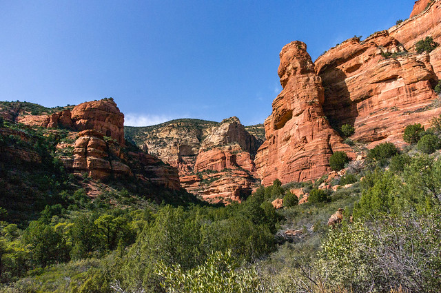
Fay Canyon is a gorgeous hiking spot within Sedona. The hike through Fay Canyon is 1.2-miles long which will take about an hour and a half to two hours on average to complete.

This trail is ranked as easy on the difficulty scale for hikers, meaning Fay Canyon is perfect for beginners. Entry to the trail is free; however, a Red Rocks Pass or America the Beautiful Pass must be displayed on your car’s dash to park.

Fay Canyon gives the best of both worlds providing glorious geological structures as well as beautiful greenery extending into the horizon.

Make sure to find the Fay Canyon Arch to experience one of Earth’s few naturally occurring bridges. For those who absorb all the scenery surrounding them, you will be the lucky few to catch a glimpse of ruins from the prehistoric Sinagua People who once inhabited the land thousands of years ago.

Devils Bridge

hiking and hikes in arizona

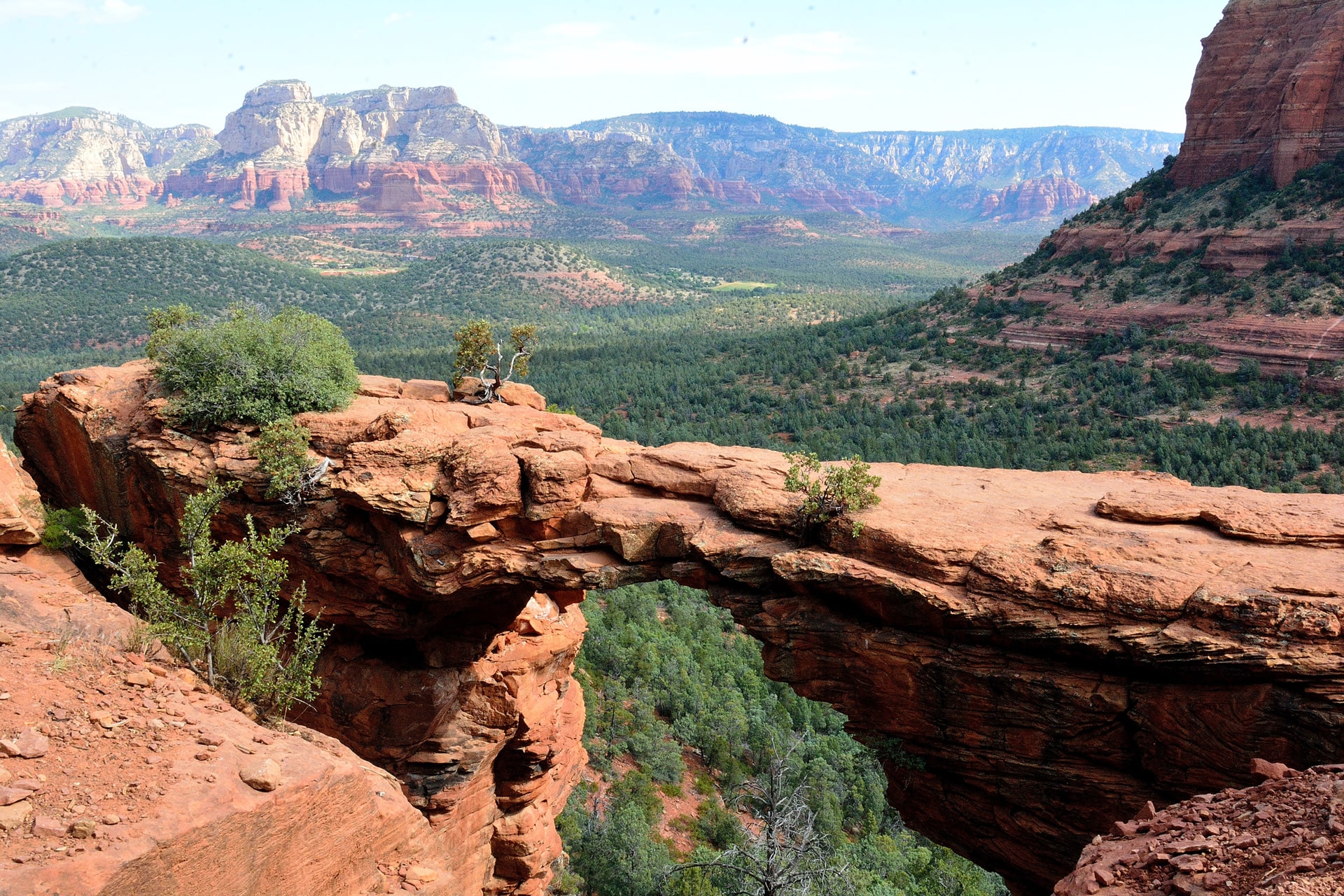
Devils Bridge is one of the most famous hiking spots known in Arizona located in the city of Sedona. The trail leading to Devils Bridge is a 2-mile hike that averages about two to three hours to complete.

Devils Bridge is ranked as easy to moderate on the difficulty scale. It’s perfect for beginner hikers looking for a bit more of a challenge. Whether you pay for entry to the trail depends on where you park to make your way to the naturally occurring bridge.

Parking at Dry Creek Road Trail Parking Lot will require a $5 Red Rock Pass to be displayed on the dash of your vehicle. Parking at the Devils Bridge trailhead will allow you to bypass paying any fees. Parking fills up extremely quickly so get there super early in the morning to snag a spot or later in the afternoon once the crowd rush has quieted down.

As Devils Bridge is one of the most popular tourist attractions in the state of Arizona, there is a possibility that you may have to wait in line to get photos taken. Despite the heavy foot traffic on this trail and possibly having to wait to take your pictures, the view is 100% worth the wait.

Birthing Cave Trail

hiking and hikes in arizona

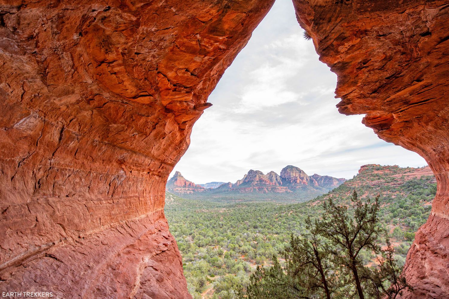
Birthing Cave Trail is a unique hike in Sedona, Arizona leading to a mountain that greatly resembles the female anatomy as the name of the cave suggests.

The trail to Birthing Cave is 1-mile which will take about one to two hours to complete. This trail is ranked easy up until you reach the cave. The trail then becomes moderate to difficult as the cave walls are slippery, and the lower levels of the cave bring you close to the edge.

Hiking to Birthing Cave is completely free! Limited parking is located at the Long Canyon Trailhead so arrive early. Overflow visitors may park on the street, but this is very limited as well.

Pets are Permitted on the Birthing Cave Trail, but they must be on a leash. Peak seasons to visit the cave are in the spring and fall months.

Since it is Arizona, the weather gets quite hot often. Avoid the hottest parts of the day by visiting the trail in the early morning or just before sunset. Legend has it that Birthing Cave got its name from the Hopi people sending women into the cave to give birth.

Cathedral Rock

hiking and hikes in arizona

Cathedral Rock is exactly what it sounds like, a unique rock structure that resembles a cathedral. The hike up the trail to Cathedral Rock is a little over a mile that takes about an hour and a half to hike.

This trail is ranked as a moderate hike but has lots of difficult steep sections along the way. This trail requires a $5 parking fee to enter.

Cathedral Rock has very limited parking that fills up extremely quickly as many of Arizona’s tourist attractions do, so be sure to get to the parking lot bright and early. Overflow parking is available at the Yavapai Point Parking Lot; however, for those wanting a shorter hike starting here will, unfortunately, add four more miles to your hike one way making the total round trip about ten miles.

Cathedral Rock is pet-friendly, but they must remain on a leash the entire time. Whether you are lucky enough to snag a parking spot at the trailhead, or you must park at the Yavapai Parking Lot, the hike will be worthwhile when you can sit on the edge of cathedral rock to watch the sunset over the horizon.

Hiking in Page, Arizona:

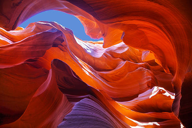
Antelope Canyon

hiking and hikes in arizona

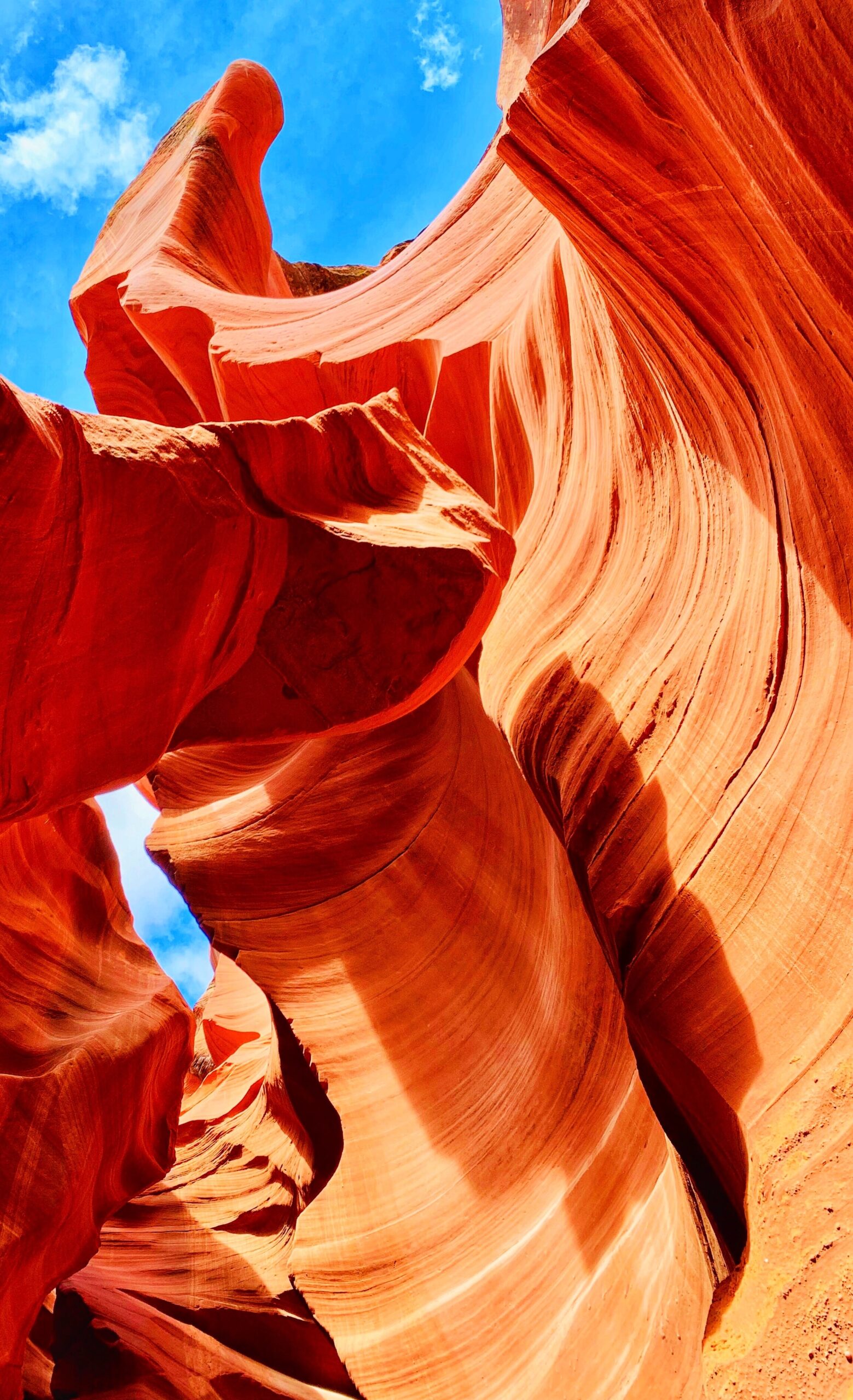
Antelope Canyon is about a .6-mile hike located in Page, Arizona that takes an average of one and a half hours to complete.

This canyon weaves through tall, gorgeous walls of pristine rock walls towering over you. Antelope Canyon is ranked as an easy hike to embark on. This canyon is on Navajo Nation land which means an approved tour guide is required.

Five companies offer approved tour guides for the upper canyon and only two offer guides for the lower canyon. Prices through these companies can cost anywhere from $50 to $100. In Antelope Canyon backpacks are prohibited when entering the canyon; however, cell phones, water, and cameras are permitted in the canyon.

The peak seasons to explore the beauty of Antelope Canyon are late spring and early fall. During May to September is when the famous light beams striking down into the canyon are visible which are perfect to plan your visit around.

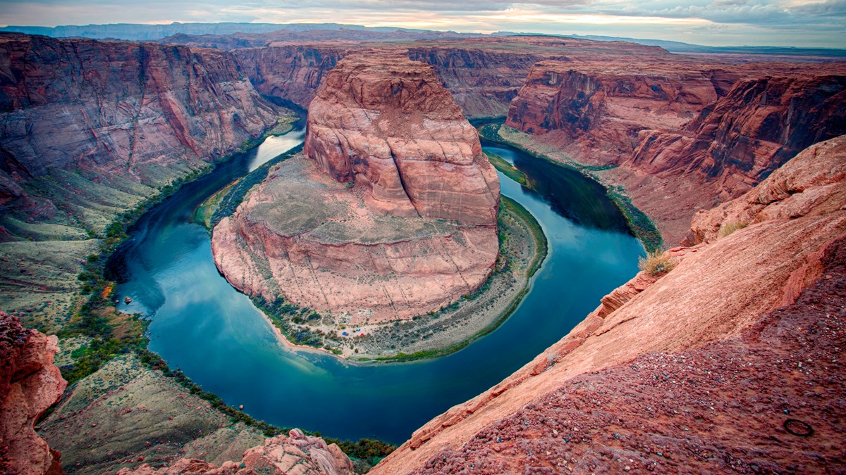
Horseshoe Bend

hiking and hikes in arizona

Horseshoe Bend is one of the biggest hiking attractions in Arizona located in the city of Page 125 miles North of Flagstaff.

The hike to the view of the beautiful Colorado River is about ¾ of a mile so the trip will only take about an hour and a half to two hours allotting for enough time to enjoy the scenery and take photos. A permit is not required to enter but there is a parking charge. Parking costs $10 per car, $5 per motorcycle, and buses cost anywhere from $35 to $140 depending on the number of passengers on board.

The trail is open year-round from sunrise to sunset. Most visitors begin their hike before noon to beat the afternoon heat or late afternoon to watch the sunset. Once you have finished your hike at the bend, head down to the recreation area where you can kayak Wahweap Marina or hike the trails of Lake Powell!

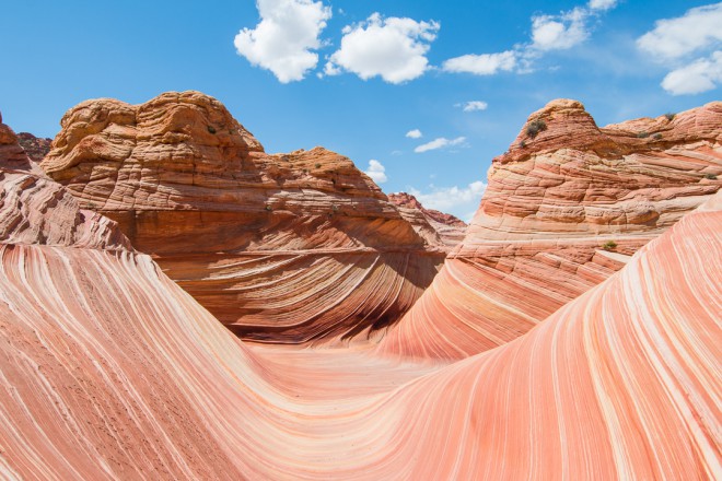
The Wave, Coyote Buttes

hiking and hikes in arizona

The Wave is a 6-mile hike that takes two to four hours to complete. This rare site is located on the Utah and Arizona border between Page, Arizona, and Kanab, Utah, and we consider this to be one of the most spectacular hikes in Arizona!

Only 64 people are lucky enough to hike through the waver per day. This is done to limit foot traffic in the area to keep the site as beautiful as possible for as long as possible. But a $7 permit is required for entrance that must be obtained months in advance.

This permit for The Wave can be obtained through the online Wave lottery which will cost a $9 nonrefundable fee. Through the online lottery 48, lucky people are selected to be awarded a permit to hike through The Wave. The remaining 16 people are selected from the in-person lottery. Furry friends are permitted on the side, but this will cost an additional $7 per day. They also must be with you the entire duration of your visit, and of course, it is required to clean up their waste.

Water is unavailable during the hike, so be sure to bring plenty for each person in your group. The trail throughout The Wave is not well marked along with no cell service. It is strongly recommended to bring a GPS or snag a map which you can get from the ranger’s station along the trail.

Hiking in Scottsdale, Arizona:

Pinnacle Peak

hiking and hikes in arizona

Hiking in Arizona can provide some amazing experiences. Pinnacle Peak is a 1.7-mile hike located in Scottsdale that takes about two hours to complete. This trail is ranked as a moderate hike as there is a great elevation increase, but it doesn’t happen all at once.

Pinnacle Peak is one of the best hikes in Arizona for wildlife lovers as it is home to Gila monsters, bobcats, javelinas, mule deer, and grey foxes.

There is no cost to hike here unlike many hiking attractions in Arizona. With free parking as well as restrooms at the trailhead, Pinnacle Peak is open on average from 6:45 am to 6:00 pm. Make note that the times the trail is open do vary depending on the season, so be sure to check online with the link here!

The park does have some unique rules such as no pets, smoking is prohibited everywhere in the park including the parking lot, parking is only permitted at the trailhead, and all hikers must exit the parking lot before closing times. Make sure to check their website for the full list of rules before visiting.

Echo Canyon, Camelback Mountain

hiking and hikes in arizona

Echo Canyon, located in Scottsdale, is a 1.2-mile hike that will take about two hours to complete. While this trail is a short distance it is ranked as a difficult hike for experts only.

Furry friends are prohibited while hiking through Echo Canyon. Like many other hiking areas around Arizona, parking is very limited and fills up quickly even early in the morning, so waking up dark and early may be required to snag a spot.

Crowds can always be avoided by visiting on weekends! Camelback Mountain coined its name from the appearance of a laying-down camel.

Not too far into the hike, there is a warning sign for bees in the area, look to the right and there is a small cave to explore that is easily overlooked!

While Echo Canyon is a strenuous hike, the way up will be all worth the while at the end. The trail leads you to the top of the summit which is the highest point in the area that overlooks a beautiful mountain range and the city lights at night.

Hiking in Phoenix, Arizona:

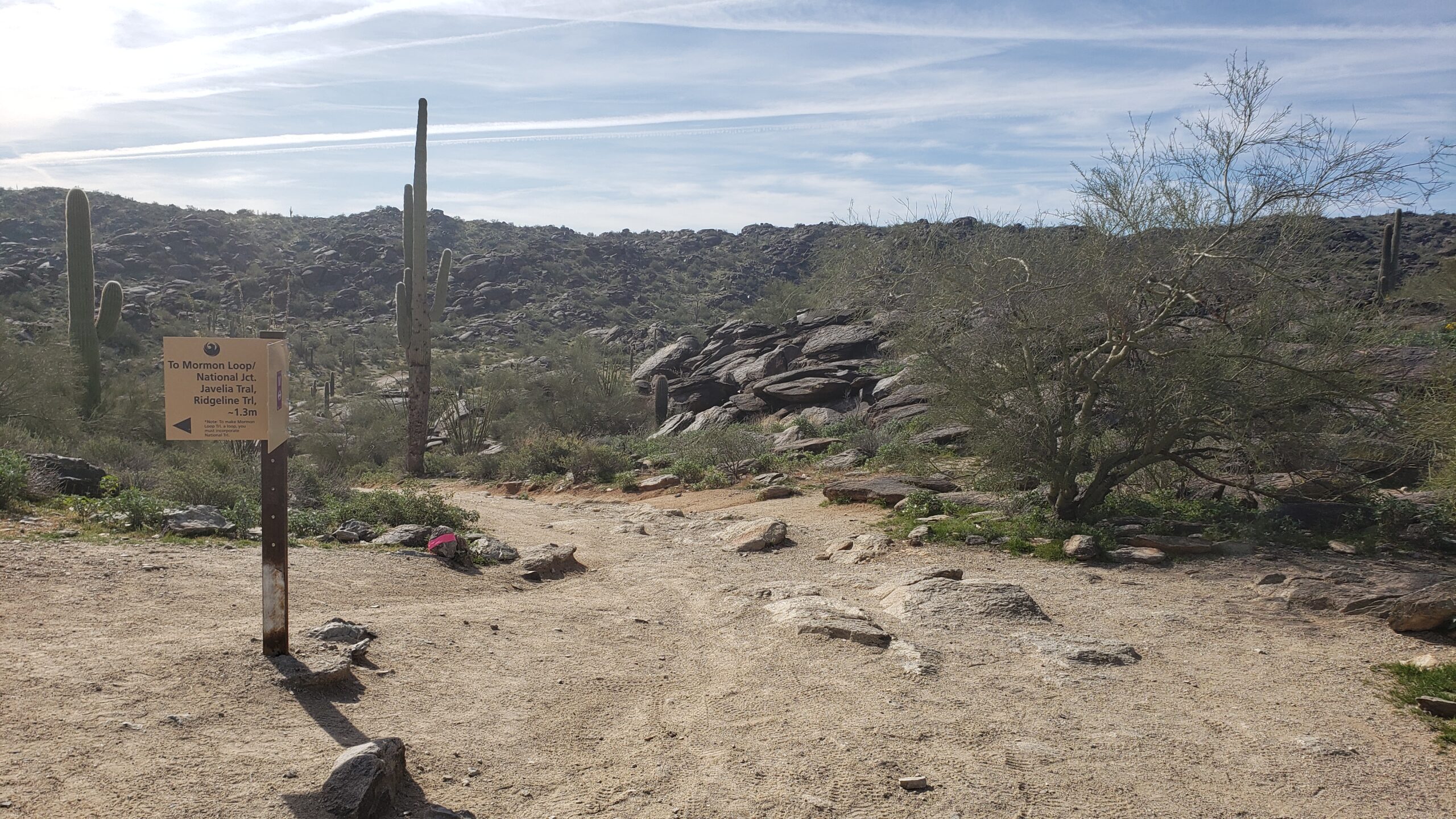
Hidden Valley, Mormon Loop Trail

hiking and hikes in arizona

Mormon Loop Trail is a 4-mile loop trail located in Phoenix, Arizona that averages about two hours to complete. This trail winding through Hidden Valley is ranked as moderate as there is a high elevation gain within the first mile, and then the trail flattens out a good bit from there.

Parking is available at the trailhead and there is no need to worry if the lot is full by the time you arrive; parking on either side of the road is permitted. Furry friends are welcome on the trail if they are kept on a leash for the duration of the hike.

Peak seasons to hike Mormon Loop Trail is during spring and fall, mostly because summer in Arizona is excruciatingly hot with temperatures upwards of 100 degrees. This trail is a super fun journey with lots of rock formations to hike through and around. Mormon Loop Trail also leads to Fat Man’s Pass, another famous hike in Arizona.

Weavers Needle

Weavers Needle - Wikipedia

Weavers Needle is located in Phoenix, Arizona and it is a beautiful 12-mile loop trail. You may also hear of the local legend which says that lost gold can be found at the peak of the needle’s shadow. You should go take a look!

The hiking day will begin at the Peralta Trailhead which will then continue the loop for an average of eight hours. Weavers Needle is ranked as a moderate trail due to the length and steepness at times.

It’s recommended that a helmet be worn while on the trail, as rocky debris is sometimes common and potentially dangerous for less experienced hikers.

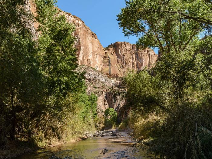
Aravaipa Canyon

Aravaipa Canyon Wilderness Permits, Aravaipa Canyon Wilderness - Recreation.gov

Aravaipa Canyon, located between Tucson and Phoenix, is 21.6-miles in length from one side of the canyon to the other.

Fully hiking Aravaipa Canyon takes about two to three days. The trail is ranked as difficult due to much of the trail being filled with water from the creek. Fully expect to be boulder hopping and to have wet feet!

A permit is required to enter the trail. This will cost $5 per day along with a $6 reservation fee per transaction. Aravaipa Canyon permits can be purchased online here.

Only 50 people are allowed on the site per day which means reservations will be limited. This also means your stay will be limited. However, it’s one of the best hikes in Arizona if you don’t want to deal with crowds as long as you reserve early.

Permits have a maximum of three days and two nights with parties no larger than ten. Unfortunately, pets are prohibited in Aravaipa Canyon.

Peak visiting months are March through May and October through November when the weather is not too cold to get wet as well as avoiding the extremely hot summer months. Aravaipa Canyon is highly recommended for wildlife lovers as it is home to deer, coyotes, hawks, turkeys, bears, and sheep.

This is by far one of my favorite Arizona hikes – you’ll love it if you’re up for some serious adventure.

Hiking Through the Havasupai Reservation:

Havasu Falls

Havasu Falls in Arizona is Nothing Short of Breathtaking – Trips To Discover

Havasu Falls is a beautiful waterfall located on the Havasupai Reservation. The hike is about 10-miles in length from the entrance to Havasu Falls. Hiking through the Reservation is ranked as moderate as it is not too difficult, but it is too immersive for a beginner hiker to complete.
*Be prepared to spend a little money on this amazing experience.*

To visit any of the falls located inside the Havasupai Reservation a permit is required and must be purchased from their website. Permits to visit are available from February through November. These reservations can only be purchased for 3 nights costing $100 during the week and $125 during the weekend. This means tickets will cost about $300 to $375 per person.

There is a campsite on the reservation for hikers to set up their homes for the next three days. Mules can be rented for $400 to carry up to 32 pounds of camping equipment. Reserving a mule can be done when purchasing your permit.

Peak months to visit the reservation are May through September. Picking the best season to fit your desires is crucial. Spring is the perfect time to hike temperature-wise, but it may be too cool to swim in the pools of the falls. Early summer months are perfect temperatures for swimming, but with the warmth comes more bugs. Regardless, this is one of the best hikes in Arizona with swimming by far!
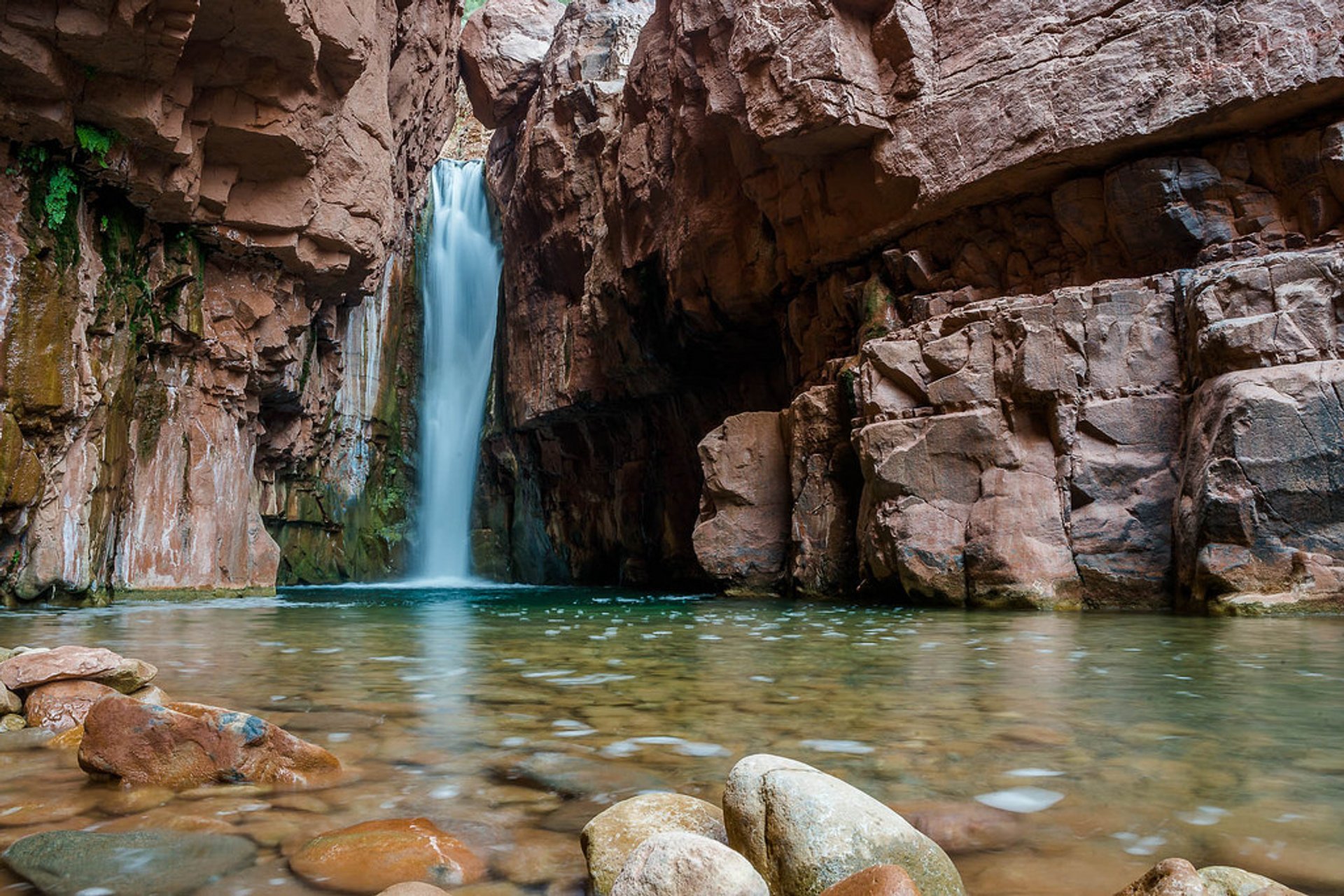
Choosing to visit during peak summer months can be risky as this is flashflood season. Cancelations are possible during flash flood season that will result in no refunds or rescheduling. Make sure to read the fine print when purchasing your permit!

This is by far one of the best hikes in Arizona with waterfalls. It seriously can’t be missed!

Mooney Falls

Mooney Falls (Supai) - 2022 All You Need to Know BEFORE You Go (with Photos) - Tripadvisor

Mooney Falls is one of the more gorgeous Arizona hikes. Standing over 200-feet tall, this waterfall is located on the Havasupai Reservation and is the tallest waterfall you will encounter in the area.

This gorgeous waterfall is about a 1.5-mile hike from the Havasupai Reservation campground. The hike from the campground to Mooney Falls is one of the more difficult ones in Havasupai as you must hike through old mining routes down a slippery and steep cliffside. Mooney Falls was named after James Mooney in 1883 when he fell to his death trying to reach the bottom of the falls.
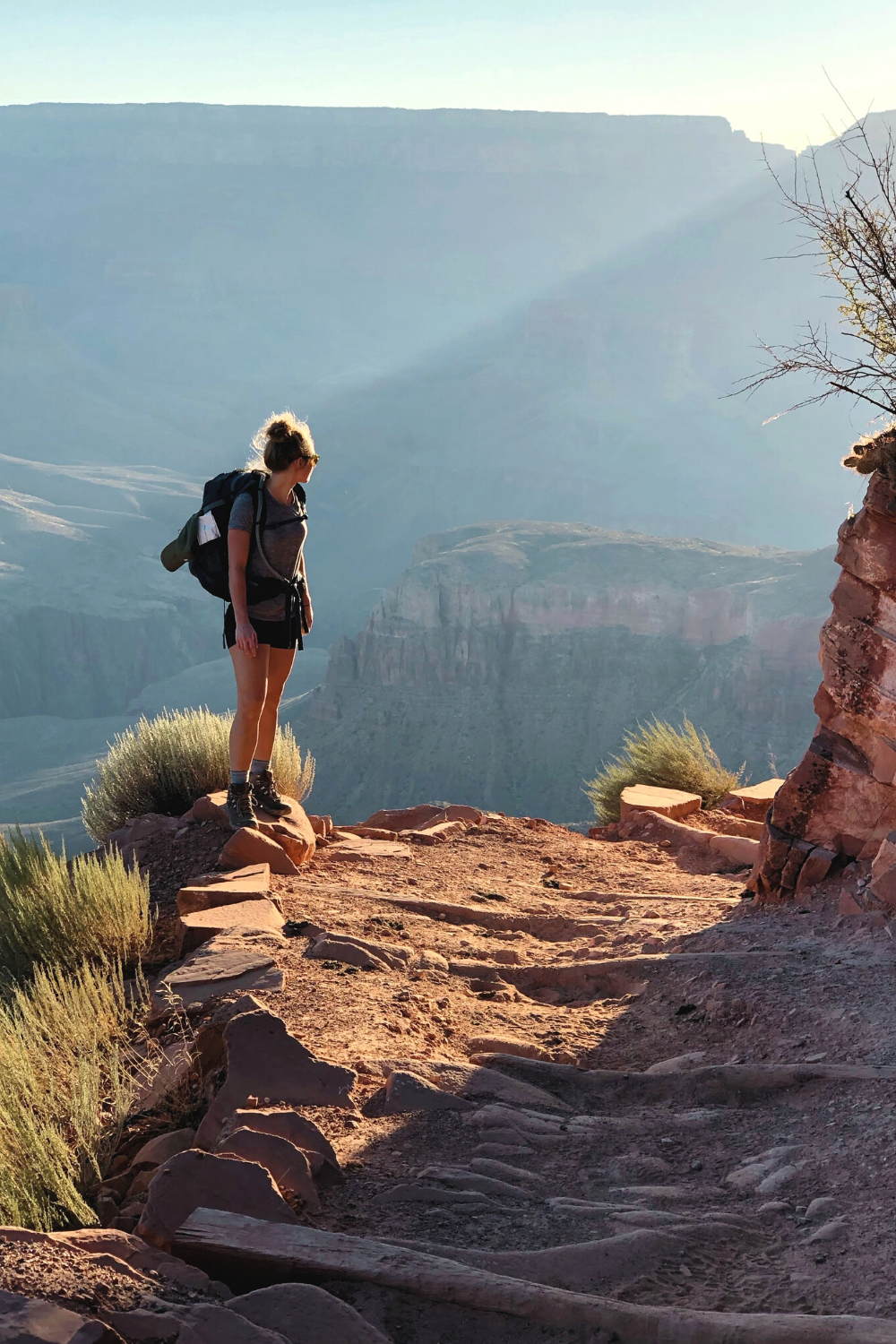
Since then, safety precautions have been made for hikers to get a thrilling experience down the cliffside while making it to the bottom to enjoy the beauty of the falls.

Beaver Falls

Epic Waterfalls - Beaver Falls in Havasupai - YouTube

Beaver Falls is a series of small waterfalls that create gorgeous blue-green swimming pools over sandstone and limestone. From the campsite, the hike to Beaver Falls is 3-miles which will take about an hour and a half to two hours to complete.

The falls are the perfect place to cool off and relax for the day in the gorgeous pool, or if you are looking for an adrenaline rush, cliff jumping is also common here. This is definitely one of the most gorgeous hikes in Arizona with waterfalls (multiple) that you won’t want to miss.

Hiking Through Arizona:

Robbers Roost

Robbers Roost, Utah, Guided Canyoning. 1-day trip. Certified guide

Hiking in Arizona provides outstanding experiences for any adventurer. Robbers Roost is a hidden gem located in Clarksdale, Arizona that can do just that! This trail is 3.6-miles in length and takes an average of one to three hours to complete.

Robber Roost is ranked as easy to moderate as there are a few steep points, so it is perfect for beginners looking for a bigger challenge. Since this is a hidden gem, this is not a heavily trafficked trail, so you may have it all to yourself!

There is a large cave to explore on the trail. The cave entrance lays on a steep edge, so continue with extreme caution, and do not attempt to enter after a rainstorm. From inside the cave, you will have breathtaking views of surrounding mountain ranges and the world below.

Wildcat Trail

Wildcat Trail, Monument Valley, Arizona/Utah

Wildcat Trail is a 1.6-mile hike located in the Oljato-Monument Valley, and it is considered to be one of the best Arizona hikes. The trail will take on average about two hours to complete.

This trail is ranked as easy, so it’s perfect for beginner hikers! Wildcat Trail itself is free to hike, but to enter Monument Valley Navajo Tribal Park there is a fee. This will cost $20 per vehicle of up to four passengers or will cost $10 per walk-in, motorcycle, or bicycle.

Wildcat Trail is the only hiking location in Monument Valley that does not require a tour guide. The trail is open to hiking before 11 am and after 5 pm and closed in the afternoon to protect hikers from the midday heat.

Pro tip: If you’re planning on hiking in Arizona then you should definitely get where you’re going early regardless of the trail!

Bob Bear Trail

Waterfall Trail at Fossil Creek | This large, natural waterf… | Flickr

Bob Bear Trail, formally known as Fossil Springs, is in Strawberry, Arizona.

This hike is 4-miles one way that should have an entire day set aside for it to spend the day in the swimming hole. Bob Bear Trail is rated as a moderate hike.

A permit is required only from April 1st to October 1st which will cost $6 per vehicle. From October 2nd to March 31st a permit is not required, so enjoy hiking for free!

While swimming in the gorgeous blue swimming hole with a waterfall flowing into it, be sure to find the cave near the waterfall.

Wolf Creek

Photos | Arizona adventure, Arizona travel, Prescott national forest

Wolf Creek, located in Prescott, Arizona, is a 1.8-mile hike that takes about an hour to an hour and a half to complete.

The trail is rated as a moderate hike that is kid-friendly. It’s a great spot for hiking in Arizona that appeals to everyone.

Parking can be found at Groom Creek Trailhead or along the side of upper Wolf Creek Road. Parking fills up quickly, so be sure to get there bright and early. Along the trail of Wolf Creek, the waterfalls are most beautiful after a good rain.

Cibecue Falls

Best time for Cibecue Falls in Arizona 2022 - Best Season - Rove.me

Cibecue Falls, located in Whiteriver, Arizona, is a 2-mile hike to the base of the falls. The trail to Cibecue Falls is rated as a moderate hike as it is mostly flat but covered in flowing water.

A permit is required costing $30 per person that must be purchased online. This permit will also grant you access to Apache Falls and allow you to camp in one of the Salt River Campgrounds.

Peak months to visit Cibecue Falls are May to September. The trail often closes during monsoon season due to flash floods, so be sure to plan your trip around this.

There are no restrooms available throughout the trail and picking up human waste is required on the trail. Be sure to go to the restroom before you arrive!

On the way up to parking for Cibecue Falls, there is often a vendor selling Navaho Bread for $5. Be sure to grab yourself a snack before your 4-mile roundtrip hike.

What To Pack While Hiking In Arizona:

  • Bags for waste
  • Extra pair of clothes (ya never know!)
  • First Aid kit
  • Good sturdy possibly waterproof hiking boots
  • Hydration additives
  • Plenty of water
    • One liter of water per person per two hours is recommended.
    • Many Arizona hiking locations do not have water available so always bring enough just to be safe.
  • Sun Protection
  • Toilet paper or wipes

Arizona offers hundreds of beautiful hiking opportunities throughout the state for beginners as well as experts. When hiking in Arizona be sure to follow Leave No Trace.

The seven principles for Leave No Trace are: plan & prepare, travel & camp on durable surfaces, dispose of waste properly, leave what you find, minimize campfire impacts, respect wildlife, and be considerate of other visitors. Other than that, enjoy the Arizona hikes and try out as many spots as you can.

Hikers, have fun, and be safe!

Seven Principles Sticker – Leave No Trace Online Store

Top 22+ Hikes In Phoenix Arizona To Check Out Right Now

You’ve come to the perfect location if you’re new to the Phoenix region or simply want to try out some new trails. Hiking in Phoenix can be fun, but it can also be dangerous and even deadly if you aren’t careful, especially during the summer months when temperatures spike.

This hikes list will help you locate the greatest spots to explore the great outdoors near Phoenix, Arizona, with everything from short and easy trails to more challenging hikes that will get your heart beating and leave you feeling accomplished.

So buckle up your shoes, double knot your hiking boots, and get ready to explore!

There are numerous excellent hikes in Phoenix and the surrounding area that are ideal for spending time with friends and family, getting some exercise, and viewing the environment.

Below is our selection of the best 20+ hikes to check out in Phoenix, AZ right now.

22. Camelback Mountain

hikes in phoenix, arizona hiking

Camelback Mountain is a stunning 2,704-foot peak located just north of metropolitan Phoenix, Arizona. It has stunning panoramic views of North Central and Downtown.

Ascend Camelback Mountain via Echo Canyon Trailhead, which begins at 3100 feet above sea level and ends at 1,400 feet above sea level, for a delightful hike that delivers a punch.

That may sound difficult, but don’t you worry: you probably will not be alone on the trip up to the top. Camelback Mountain is well known in the region and attracts over 800,000 visitors each year. This is a super popular spot for hiking in Phoenix!

To get to the top, either follow the Summit trail from the bottom to the top or the Cholla trail from the bottom to the halfway point, then turn around and finish the final half on the Summit Trail.

21. South Mountain Park

hikes in phoenix, arizona hiking

This popular hiking spot is only a few miles from downtown Phoenix and is ideal for running, hiking, and biking.

South Mountain Park, with its 1,300 acres, contains a little bit of everything, from lush meadows to rugged peaks. There are pathways to suit your needs, whether you’re searching for a relaxing stroll or a strenuous climb.

20. Piestewa Peak

hikes in phoenix, arizona hiking

Piestewa Peak, one of Phoenix’s top frequent hikes, is within easy driving distance of downtown and offers spectacular views of both downtown and Camelback Mountain.

This climb is ideal for beginners who want to overcome their fear of heights. It is also one of the best Phoenix hikes.

It can get very crowded on weekends as one of Phoenicians’ favorite hangouts, but if you stick around long enough and explore, some wonderful paths will take you away from everyone else. Keep your eyes peeled for some enjoyable sidewalks with spectacular sights.

19. Echo Canyon Trailhead

hikes in phoenix, arizona hiking

Echo Canyon is a great place for hiking and mountain biking, and it’s only a mile from North Mountain Park.

At 30th Avenue and Camelback Road, there is a trailhead. Parking, restrooms, water, and picnic tables are all available at the park, which is open from 7 a.m. to sunset.

This is an absolutely stunning hike that we definitely recommend! Just remember to bring lots of water because most months you’ll see temperatures of 75 degrees or (much) greater during the day.

18. Usery Pass Trailhead

hikes in phoenix, arizona hiking

Usery Pass Trailhead is one of our favorite hiking trails near Phoenix, located just west of Apache Junction, Arizona.

It not only offers a fantastic view of the Mummy and the Superstition Mountains, but it also allows hikers to visit Usery Mountain, Regional Park. Hikers will be able to observe some ancient petroglyphs left by local natives from a long time ago from the Usery Pass Trailhead.

This is a relatively simple hike that most of us can accomplish without too much sweat. We loved it!

17. Blue Ridge Loop Trailhead 

hikes in phoenix, arizona hiking

Andrew Fulks, one of Tuleyome’s founders, loves this hike because it was one of the first he did in the area and the panoramic views are spectacular.

Keep in mind that this terrain is difficult to navigate and quite steep. This trail is best hiked in the spring when temperatures aren’t too hot. It’s over 10 miles long so it’s definitely a great workout and is a hike in Phoenix that you should thoroughly prepare for.

On Rayhouse Road, cross the low water bridge, then turn left and pass through the yellow gate with the sun-shaped pattern on the fencing. You’ll arrive at a little clearing through this access road. The metal sign indicating the Blue Ridge Trail will be on your right.

16. Pinnacle Peak Park

hikes in phoenix, arizona hiking

Pinnacle Peak Park is situated on Pinnacle Peak Road near Hayden Road, north of central Scottsdale AZ. This route offers stunning views of Camelback Mountain, one of Scottsdale’s most recognized attractions, and is available every day from 6 a.m. to 8 p.m.

The 1.8-mile circular track climbs 600 feet up and down hills and has a variety of landscapes, including desert plants and water features. Wildflowers will also bloom at different periods of the year.

All ages are permitted, but dogs are not permitted on paths marked as no dogs allowed (which are most paths). There are no facilities or drinking water within walking distance of these paths, so bring plenty of water and wear comfortable shoes.

It should take roughly two hours to complete the hike round trip. It’s a fun little hike near Phoenix with gorgeous views if you don’t want to spend the whole day on a trail!

15. Cholla Trailhead

hikes in phoenix, arizona hiking

Cholla Trailhead is one of Phoenix’s oldest trailheads, located near Desert Ridge, I-17, and Loop 101. It is a fantastic first hiking experience for newbies, offering a break from urban development and a chance to escape into nature for a few hours.

It’s ideal for hikers of all abilities, with plenty of shade and breathtaking vistas.

Make sure you don’t miss out on Mother Nature’s work of art — simply keep an eye out for cactus along the road. There are wonderful sights to be viewed at every turn if you can get past these nasty little suckers (and they will pinch you, so be careful).

Cholla Trailhead is well worth visiting, especially if you’re not a super experienced hiker but want to experience some of Arizona’s natural life.

14. Ledge Loop Trailhead

hikes in phoenix, arizona hiking

The Ledge Loop Trail is a moderate climb that rewards you with spectacular vistas of Camelback Mountain, rich vegetation, and little stream-fed ponds.

If you don’t feel like doing the complete loop around both peaks, you can do an out-and-back hike that includes a portion of the Goat Camp Trail.

Within Camelback Mountain State Park, this trailhead is located shortly before sunrise point. You can also access these routes from Echo Canyon Park or Piestewa Peak, but please follow any park laws to help protect these popular hiking spots as there are a lot of conservation efforts here.

These massive boulders are well-known among hikers, but they’re also well-known among locals who enjoy photographing the dramatic rocks against sunsets and other backdrops.

13. Boyce Thompson Arboretum

hikes in phoenix, arizona hiking

One of my favorite hikes in Phoenix is the Boyce Thompson Arboretum. It includes numerous routes, some of which are more difficult than others but all of which provide spectacular views and an understanding of Arizona’s plant life.

You’ll find desert-like landscapes as well as enormous swathes of forested areas in this diverse landscape.

And what if you don’t have enough time to go on a whole hike? It’s no problem. You can always take a nice drive through it— We think it’s best seen from a car because you can take it all in.

Because of its high height of over 5,000 feet, the sky is generally clear, making this one of the best hikes in Phoenix any time of year. Bring plenty of water and begin your hike early in the morning; it can get exceedingly hot in the afternoon (nearly 120 degrees Fahrenheit).

12. Hidden Valley Nature Center

hikes in phoenix, arizona hiking

This park has fantastic views of Camelback Mountain and plenty of hiking trails to explore. It’s ideal for hikers of all levels.

However, keep in mind that some of these trails are quite steep. This is definitely one of the steepest hikes in Phoenix.

On your way up, don’t forget to stop at their wildflower garden. Plan to hike for at least two hours and pack lots of water, as well as sunscreen, hats (plus points if they have a brim), bug spray, and any other essentials.

We believe you will agree that Hidden Valley Nature Center is one of the best Phoenix hikes and it should not be missed. You’ll enjoy an energizing ascent through their nature center while hiking their many trails surrounded by different vegetation, such as saguaro cactus or scrubs.

11. Lost Dutchman State Park

hikes in phoenix, arizona hiking

The Dutchman’s is popular among rock climbers, mountain bikers, bird watchers, and hikers of all kinds.

At an elevation of more than 5,200 feet, it’s an uncrowded path where you may spend as much time as you wish without running across anybody else. There are lots of spots to stop for a rest, and the views are spectacular.

It takes roughly two hours to climb either way, regardless of where you start. Multiple pathways intersect Lost Dutchman; if one becomes too busy, simply switch to another until everyone disperses. This is a great spot for varied hiking in Phoenix.

10. Lost Lake Park, Cave Creek

hikes in phoenix, arizona hiking

Another one of the great hikes in Phoenix Arizona is Lost Lake Park, and it’s open all year long. This track has a low elevation rise, making it perfect for beginner hikers who are just starting.

It’s a fun day trek to do with friends or family, or even by yourself. There are some amazing rock climbing opportunities along a wall on the right side of Lost Lake; however, if you decide to go bouldering here, make sure you have a spotter.

Cave Creek has nearly 150 miles of trails that cover a variety of terrain types such as peaks, canyons, and washes. Within Cave Creek Regional Park, there is a 91-year-old enormous sequoia tree known as Centennial Tree. This is one of the best hikes in Phoenix to view a ton of awesome nature!

9. Bell Rock Pathway

hikes in phoenix, arizona hiking

Bell Rock Pathway is a short and lovely hike located just north, northeast of downtown Scottsdale. It’s about a 1.5-hour drive up i-17.

Hikers will be awestruck by stunning views of Bell Rock and nearby sites like Camelback Mountain and Pinnacle Peak while traveling along a single trail for about one mile.

Locals advocate hiking early or late to avoid crowds, as this is a popular tourist destination. We highly recommend this one even if you have to come mid-day!

8. The Trans-Canyon Trail 

hikes in phoenix, arizona hiking

The Trans-Canyon Trail, which runs from Grand Canyon Village’s North Gateway Trailhead to Hermit’s Rest on the South Rim near Mather Point, is more than 50 miles long. Bring some water.

The Trans-Canyon Trail runs through lush foliage. Having been built by US Forest Service volunteers over years of hard work, be prepared to enjoy the seasonal wildflowers and unspoiled wilderness territory that is absolutely spectacular, yet relatively unfamiliar to most visitors. We hope you enjoy it!

7. Mescal Mountain Loop Trail

hikes in phoenix, arizona hiking

Mescal Mountain Loop Trail is the best hiking trail around Phoenix, Arizona. We highly recommend it! With about a 2-hour drive north on i-17 from Phoenix, you should be here in no time.

The hike itself is about a 6.4-mile out-and-back trip with a 1,335-foot elevation gain. It’s one of the best intermediate hikes in Phoenix.

Just outside of Fountain Hills, Arizona, the Mescal Mountain Loop Trail takes you on an excellent journey through magnificent pine forests and along gorgeous rolling hills. Mescal Mountain is a terrific place to visit if you want to enjoy great views on one of your favorite hikes in Phoenix. 

6. Roosevelt Lake

hikes in phoenix, arizona hiking

Take a picnic at Roosevelt Dam Overlook where the views are definitely worth the trek. Situated about 2 hours east of Phoenix AZ, you won’t want to miss this stunning view.

This climb reaches a height of 2,704 feet, making it one of Arizona’s highest spots! However, we recommend hiking this one on a weekday because on weekends you should expect to see a lot of people.

Lastly, as a bonus, you’ll have plenty of fun burning off some hard-earned calories by shopping or dining at Kierland Commons in North Scottsdale or Old Town Scottsdale on your way out from Roosevelt Dam Overlook. Here you will find more than 250 art galleries and boutique shops that we absolutely enjoyed!

4. Western Ave

hikes in phoenix, arizona hiking

Views of Camelback Mountain and McDowell Mountain can be found on this climb. Although Western Ave. is rated as easy, there are numerous ups and downs along the way that can make it appear more difficult than anticipated.

Even though most of Western Ave. has a broad, gravel trail, hikers frequently see horseback riders on their way up or down. We consider this one of the best Phoenix hikes!

Western Ave. is one of Arizona’s most popular hiking paths for novices and veterans alike due to its easiness and accessibility. In fact, it’s one of the best easy hikes in Phoenix that still has some variety, so it’ll be enjoyable for all levels.

Both sides of Western Ave. are bordered by two of Phoenix’s most well-known communities, Arcadia and Biltmore, making hiking en route simple from various sections of the city.

3. Tonto National Forest, AZ – Lost Dutchman State Park

hikes in phoenix, arizona hiking

Lost Dutchman State Park is home to one of my favorite walks. This park takes you on a journey through a natural beauty filled with high hills and deep canyons.

The hike is scenic and includes an old gold mine to explore if you have time. I recommend keeping on the route because there are rattlesnakes in some areas that off-trail hikers may encounter. But don’t worry – you’ll still see incredible views right from the trail!

This is a moderate hike (not too difficult) that’s really fun because it’s filled with both culture and adventure.

2. Tempe Town Lake Walking Path

hikes in phoenix, arizona hiking

Tempe Town Lake is one of Tempe’s most popular attractions. There are numerous attractions and sports you can try, including canoeing and paddleboarding, as well as rowing, fishing, and kayaking. The lake also attracts a variety of birds and serves as year-round habitat for ducks.

The Tempe Town Lake Trail is a one-mile stroll around the lake, which also features cycling routes. It’s a popular hangout for college students and young professionals, but it’s also bustling with joggers and dog walkers throughout the day.

If you want to enjoy some peace while hiking, go on weekdays or early in the morning. This is a perfect hiking route in Phoenix for beginners or anyone who is looking for more of a casual stroll.

1. Papago Park

hikes in phoenix, arizona hiking

Papago Park is a wonderfully unique location that is ideal for hikers in Phoenix. And it’s located right in the city!

It’s also one of America’s largest urban parks, with 4,210 acres dedicated to some of Arizona’s best trails and natural monuments (including some fantastic hiking). While exploring you’ll find the Papago Amphitheater, the William C Elliot Memorial, and if you have time you could even check out the Phoenix Zoo!

If you’re planning on hiking in the Phoenix area, make sure to stop at Papago Park. It’s a classic for a reason!

20+ Best Hikes In Sedona, Arizona That You Won’t Want To Miss

Whether you are an experienced hiker looking for new challenging adventures or a beginner that is looking for your first hiking trip spot, Sedona Arizona is the place to go. There are so many wonderful hikes in Sedona, with incredible views, that it’s hard to choose!

The famous vortex and red rocks area is considered a true paradise for hikers as it’s home to more than 200 trails and paths. However, there are plenty of awesome hikes in Sedona for all levels, offering all sorts of sights.

Today we present you with our absolute favorite 20+ hikes in Sedona, from the most famous landmarks to the hidden gems of Sedona! You’ll definitely want to check out these really popular hikes if you’re staying in the area.

How To Make Your Hike Memorable:

Sedona is one of the best places in the United States when it comes to hiking, but planning ahead is still crucial to making the best out of your trip!

Parking lots tend to get full very quickly as everyone usually gets to a hike via car. Our advice is to know where you want to go and plan ahead so that you will be able to park and start your hike in the morning when the site is less crowded. The earlier the better!

Otherwise, plan a smaller/shorter hike later in the afternoon, especially when the days are longer. Most parking lots begin clearing out after 12pm.

Always remember to bring water with you. The majority of Sedona hikes don’t have water facilities along the way and the sun can be very hot especially during summertime. Seriously: it can get dangerous pretty quickly.

When planning your hike always make sure to check if the site you are going to visit requires the red rock pass. This is a purchasable pass that allows you to visit specific sites and support the local maintenance of this area. The pass cost ranges from 5 dollars for a daily pass up to 20 dollars for a weekly pass.

It’s definitely worth it to buy these passes before you go! Some places won’t even let you park without the pass, while others will charge you 3x what you would have paid.

20. Cathedral Rock Hike

Explore 20+ Best Hikes in Sedona, Arizona: Cathedral Rock Hike

This is one of the most scenic trails that you will find in Sedona. The Cathedral Rock hike offers great views of famous landmarks such as Bell Rock and Courthouse, making it popular for a reason. The views are some of the best in the area!

When approaching this hiking trail consider that it may be tricky and tough in certain parts. However, it’s only a one-mile-long roundtrip and the elevation gain is around 500 feet.

The trailhead is located halfway down Back O Beyond Road, off Highway 179, between Sedona and the Village of Oak Creek. I definitely recommend that you check out this Sedona hike if you’re at all athletic – it’s really one of the first you should do as a hiking enthusiast!

19. Doe Mountain

Explore 20+ Best Hikes in Sedona, Arizona: Doe Mountain Trail

If you are looking for a less crowded spot to hike then the Doe Mountain hiking trail is a good choice. 

Most of this trail’s 430 feet elevation gain is spread along the first 0.7 miles which makes this a perfect trail for beginners. It’s one of the best easy hikes in Sedona that still has a lot of lovely perks!

The trail gives you incredible views of many Sedona Red Rocks landmarks such as Bear, Maroon, and Wilson mountains, Loy, Boynton, and Secret Canyons. It’s a great place to start if you’re not feeling up to the Cathedral Rock Hike.

You will find the trailhead of this hike about 36 miles from Flagstaff.

18. Boynton Canyon

Explore 20+ Best Hikes in Sedona, Arizona: Boynton Canyon Trail

Although this is one of the best easy hikes in Sedona Arizona, the Boynton Canyon hike trail is well known for its outstanding scenery.

This trail is perfect for those who are looking for a very easy walk around the red rocks of Sedona as it’s one of the easier trails to walk. It’s 7 miles roundtrip with 800 feet of elevation gain.

The beauty of this trail is enriched by its spiritual value as it has been recognized as one of the top vortex energy sites. If you’re looking for spiritual hikes in Sedona then this is definitely the first place you should check out.

When hiking this trail, keep an eye out for the local flora and wildlife as this is one of the best spots for birdwatching too! This trail really has it all and is so easy that there’s no excuse not to try it.

17. Soldier Pass Trail

Explore 20+ Best Hikes in Sedona, Arizona: Soldier Pass Trail

The Soldier Pass trail is an intermediate-level hike that will give you the chance to fully embrace nature as it’s one of the less crowded trails in Sedona, specifically in the Red Rock Mountains area.

This is a 6-mile-long loop trail with an altitude gain of 800 feet that has a unique look on the famous Devil’s Kitchen landmark.

If you are looking for an immersive personal experience with nature then we highly suggest you add a mile-long detour to Soldier Cave when you find yourself at the last fork in the road.

16. West Fork Hike

Explore 20+ Best Hikes in Sedona, Arizona: West Fork Hike

West Fork hike is one of Sedona’s most visited trails and it’s the perfect example of how widely the landscapes around this area can be different. You will find so many green and woody areas while walking beside beautiful canyon walls!

This trip is a 7-mile roundtrip with an elevation gain of 500 feet and is very accessible to every kind of hiker, but you do have to cross the stream in several places, so a good pair of waterproof shoes is going to be useful.

If you’re looking for hiking in Sedona with beautiful views and an easy-to-intermediate trail, plan to check out West Fork.

15. Fay Canyon

Explore 20+ Best Hikes in Sedona, Arizona: Fay Canyon Trail

If you are looking for an easy walk through Sedona’s wonderful red rocks then the Fay Canyon trail is what you are looking for.

It is a 2.6-mile roundtrip with an elevation gain of 390 feet, rich with many beautiful spots.

Many visitors usually don’t know that this path is home to an incredible natural arch that is located just half a mile up the trail. This looks just like a regular rock overhang, but once you take a closer look you’ll be astonished by this red rock formation.

This trail allows enjoying a very typical Sedona landscape with some hidden gems along the way such as hidden canyons and desert plants. It’s one of the coolest secret Sedona hikes for hidden spots!

14. Birthing Cave 

Explore 20+ Best Hikes in Sedona, Arizona: Birthing Cave Trail

The Birthing Cave hiking trail is probably one of the less-known spots in the Sedona area and it is the best place to go to if you want to feel a strong connection with nature.

It is a 2-mile roundtrip with a 300 feet elevation gain. The trail is a relatively easy hike, with a wide and flat path, making it an accessible walk to many.

Once you have meandered through the majority of this Sedona hike, you’ll start to see the peak of the cave poke around the corner.  The cave interior has a unique heart shape, its ceiling curves up to a point, with the cave’s base also coming to an end.

This is one of the best hikes in Sedona to really feel a spiritual connection. Something about the formation of the rocks allows for a massive spiritual vortex. We’ve brought friends here who didn’t believe in anything spiritual (like, at all) and even they could feel it. It’s that strong!

13. Bell Rock Climb 

Explore 20+ Best Hikes in Sedona, Arizona: Bell Rock Climb

This is one of the most popular hiking trails in Sedona as it gives you the possibility to climb one of its most famous and spectacular landmarks.

With a 3.6-mile-long trail and a 400-foot altitude gain, this hike is great for every kind of hiker since it’s up to you how far you want to go up on the climb. But I will say: the views of the landscape from the upper levels of Bell Rock are definitely worth a little extra walk.

The first 0.25 miles of this Sedona hike are marked with trail signs and wire that are filled with rock but as you head higher onto Bell Rock, the wire baskets disappear. You can continue to go up following your route (the climb is not marked) as long as you know where you’re going. I recommend checking out a map ahead of time.

12. Devil’s Bridge 

Explore 20+ Best Hikes in Sedona, Arizona: Devil's Bridge 

The Devil’s Bridge path is probably one of Sedona’s best hikes and one of the most popular. This incredible landmark is the largest natural sandstone arch in the Sedona area.

The hike is a 1.8-mile roundtrip with a 400-foot elevation gain and is a great trail for every kind of hiker. The path is smooth and clear as it was originally built for jeep tours, making it really easy to walk.

You can either look at the Devil’s Bridge from a lower point of you or take that last climb and walk across it and have a unique view of the panorama. This is one of the best easy hikes in Sedona with incredible views. Seriously, this has to be the easiest hike anywhere.

If you’re totally afraid of exercise but still want the views then this is by far one of the best hiking trails in Sedona!

11. Airport Mesa Loop Trail 

Explore 20+ Best Hikes in Sedona, Arizona: Airport Mesa Loop Trail 

The Airport Mesa is located in the south of Sedona. This trail makes a loop on its upper rim; from there you will be able to see many red rock famous landmarks such as Cathedral Rock, Bell Rock, Courthouse Butte, Munds Mesa, Thunder Mountain, and the town of Sedona.

This is a very easy 3-mile-long loop hike with a 400 feet elevation gain, however, if you don’t want to go all the way up, hike the short spur trail up to the top of the Summit Trail for awesome views over Sedona.

10. Courthouse Butte Loop Trail

Explore 20+ Best Hikes in Sedona, Arizona: Courthouse Butte Loop Trail

The Courthouse Butte Loop Trail is a moderate 3.9-mile loop trail that takes you to two of Sedona’s most prominent rock formations, Courthouse Butte and Bell Rock. 

You will have to take the Bell Rock trailhead to start, but then at the first fork continue north and you will get into the actual trail.

This is the perfect hike for beginners offering great views of Sedona’s landmarks, easy paths, and an abundance of wildlife.

9. Adobe Jack Trail

Explore 20+ Best Hikes in Sedona, Arizona: Adobe Jack Trail

The Adobe Jack Trail is one of the newest trails in the Sedona area with fantastic red rock views and a path that will lead you to a creek bed.

This is a 4-mile-long trail with an elevation gain of 167 feet which is best for intermediate hikers.

The trail is immersed in the natural red rock area but it also dips in and out of small green areas.  As you get lower, it may get a little rougher and rockier, but this is an overall doable trail that is perfect for those who are looking for a more sporty experience.

8. Schuerman Mountain Trail

Explore 20+ Best Hikes in Sedona, Arizona: Schuerman Mountain Trail

The Schuerman Mountain Trail is one of the best trails in Sedona if you are looking for a less-crowded but still visually stunning hike.

This 2-mile-long trail starts at Sedona High School with a moderate uphill for about half a mile before reaching the rim.

Schuerman is more mesa than a mountain and in fact, as you climb to the top of the mountain, you will be able to get some impressive views of the Verde Valley.

7. Broken Arrow Trail

Explore 20+ Best Hikes in Sedona, Arizona: Broken Arrow Trail

Although very popular, the Broken Arrow trail is the perfect hike for beginners who want to experience an immersive walk in the Red Rock area.

The trail is about 4 miles long and very easy to follow as it is also accessible for Jeep tours. There’s a gentle climb up a wide valley, lined on both sides by beautiful eroded red rock cliffs.

The uphill ends at the Chicken Point low pass, which has good views south towards Oak Creek village, and north to Sedona and the high mountains beyond.

This is one of the best hiking trails in Sedona for those of you who want an easy hike that still takes a few hours.

6. Wilson Mountain 

Explore 20+ Best Hikes in Sedona, Arizona: Wilson Mountain Trail

This trail is one of the most visually stunning paths that you can find in the Sedona area as it offers beautiful views of the Oak Creek Canyon.

This is a hard hike since it goes up 2300 feet in the first mile, so you may need to plan a whole day to accomplish this mission. However, the views you will get from this hike are going to be worth the effort.

Keep in mind that it may be hot during the summer so remember to have some water with you. Just north of Encinoso Picnic Area, 3 miles up canyon from Midgley Bridge, you can take an alternate route which is a lot cooler than the others if you’re doing this trail on an especially warm day.

5. Dawa Trail 

Explore 20+ Best Hikes in Sedona, Arizona: Dawa Trail

The Dawa hike is a 2.6 miles loop trail close to Doe Mountain interwoven with 3 other trails. 

It is a great walk for beginners as its elevation gain sits around 150 feet; it is considered more of a nature walk than an actual hike since it’s very easy to spot local wildlife on the path.

This loop trail has many great spots for incredible views and along the way, you will be able to find a beautiful evergreen forest that will open up to spectacular views of the surrounding red rock mountains.

4. Lower Chimney Rock Trail 

Explore 20+ Best Hikes in Sedona, Arizona: Lower Chimney Rock Trail 

This is the best choice if you’re looking for an easy hike in Sedona, close to downtown, and if you don’t have much time to spend walking.

The Lower Chimney Rock trail is a great way to experience the typical red rock landscape in Sedona because the trail shares its head area with Thunder Mountain, Little Sugarloaf Summit, and Chimney Rock Pass Trails, allowing you to get great views.

This is one of the best hiking trails in Sedona to check out if you don’t have a lot of time and want to stay close to the city.

3. Pumphouse Wash Trail 

Explore 20+ Best Hikes in Sedona, Arizona: Pumphouse Wash Trail 

If you are looking for a more adventurous type of hike the Pumphouse Wash trail is definitely what you are looking for!

This is one of the best hikes with water in Sedona as there are lots of boulder hopping opportunities and cool natural pools.

Although is not properly marked and flat, the trail is pretty doable and fun to walk. It’s totally up to you how far to walk as there’s not an official ending point.

2. Sketch-Ridge Loop TrailExplore 20+ Best Hikes in Sedona, Arizona: Sketch-Ridge Loop Trail

The Sketch-Ridge Loop Trail is a beautiful easy to moderate hike from a ledge on the eastern rim of Carroll Canyon. 

With a 285-foot elevation range and a roundtrip of 2.6 miles long, this trail offers amazing views of iconic red rock formations such as Bell and Courthouse Butte among many others like the Scorpion Pyramid.

The local flora is very abundant on the trail itself, especially during springtime.

1. Smoke Trail

Explore 20+ Best Hikes in Sedona, Arizona: Smoke Trail

This hike is very easy yet incredibly enjoyable for every kind of hiker as it follows the flowing waters of Oak Creek and offers a great view of the beautiful Cathedral rock in the distance.

The trail takes you through a green lush wooded area with is great during hot summer days. With a length of 0.5 miles, this path is a great choice for a relaxing nice walk.

If you’re looking for more secret hikes in Sedona, then you should definitely check out Smoke Trail. It’s usually not too crowded since not many people know about it!