Complete Guide To The Kancamagus Highway: Attractions, Hikes, & More
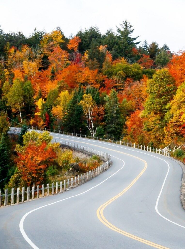
The Kancamagus Highway is New England’s most gorgeous drive, particularly during the region’s famous fall foliage season.
As the locals call it “the Kanc,” you can enjoy the sheer joy of driving through this densely wooded mountain gap, as many tourists do every year.
We’re huge fans of road trips, so hitting the highway in New Hampshire was an obvious choice for us once again this year. And the drive always exceeds our expectations! We expected scenic stops and beautiful fall foliage, but aside from that, we enjoyed the spectacular mountain views, quick roadside stops, colorful foliage, hikes, and charming waterfalls.
There are tons of photo opportunities along the Kanc, especially if you’re ready for a bit of trekking, so give yourself plenty of time for your trip.
This guide will cover all you need to know about the Kancamagus Highway to maximize the experience fully.
The Kancamagus Highway

The Kancamagus Highway, sometimes known as “the Kanc” for short, is a 34.5-mile section of Route 112 in New Hampshire’s White Mountains that links the towns of Lincoln and Conway.
The region has a long history of Native American tribes reaching back to the 1600s. Along the Kancamagus Highway, you will see instructional signs regarding the area you visit; these signs will often provide a brief history.
Chief Kancamagus, the last sagamore (chief) of the Pennacook Native Americans and known as the “Fearless One,” was the inspiration for the route. The roadway originated as two separate routes, one from Lincoln and the other from Conway, but the Civilian Conservation Corps (CCC) labored for 25 years to unite them.
While it began as two independent, disconnected roads, one from Lincoln and one from Conway, the CCC started to work in the 1930s to join the two roads, which took 25 years to complete.
Today, over 800,000 people use the road each year, and there are several views, trails, and sites to see as you drive up to 2,855 feet.
How Long Is The Kancamagus Highway Drive?
Without stopping, you can travel the entire length of the Kancamagus Scenic Byway in about an hour. Make sure to plan in time to view as many of the gorgeous locations, waterfalls, and even a climb. On the Kancamagus Highway, you could easily spend a whole day.
When calculating how long it will take to drive the Kancamagus, consider what you want to accomplish while there. If you’re going to see a waterfall, like Sabbaday Falls, you should allow 1.5 hours owing to the short trek and viewing. You could also see Rocky Gorge, which is just a short distance from the parking lot (more on these attractions in the latter part).
So how long it takes to travel the Kancamagus is primarily determined by the stops you make along the route. Most usual breaks and travel time should generally take around 2-3 hours.
The Kancamagus stretches for 34.5 miles. There are no businesses along this road, including petrol stations, so plan your journey carefully.
Where Does The Kancamagus Highway Start And End?
The Kancamagus Scenic Byway stretches from Lincoln, New Hampshire, to Conway, New Hampshire. The Kancamagus Scenic Byway spans 34.5 miles between these two New Hampshire communities.
If you’re coming from Interstate 93, the trip will begin in Lincoln, or in Conway if you’re arriving from Route 16.
On this two-lane roadway, the Kancamagus travels east to west, and you can drive in either direction.
When Is The Kancamagus Highway Open?
The Kancamagus Highway is accessible all year! You can enjoy the lovely Kancamagus Highway sights and Kancamagus Highway adventures in any season since the picturesque byway is plowed in the winter. Although the single significant crossroads, Bear Notch Road, which links the highway to the town of Bartlett, is blocked during the winter months.
The USDA Forest Service website has the most up-to-date road closures and advisories.
When To Visit The Kancamagus Highway?
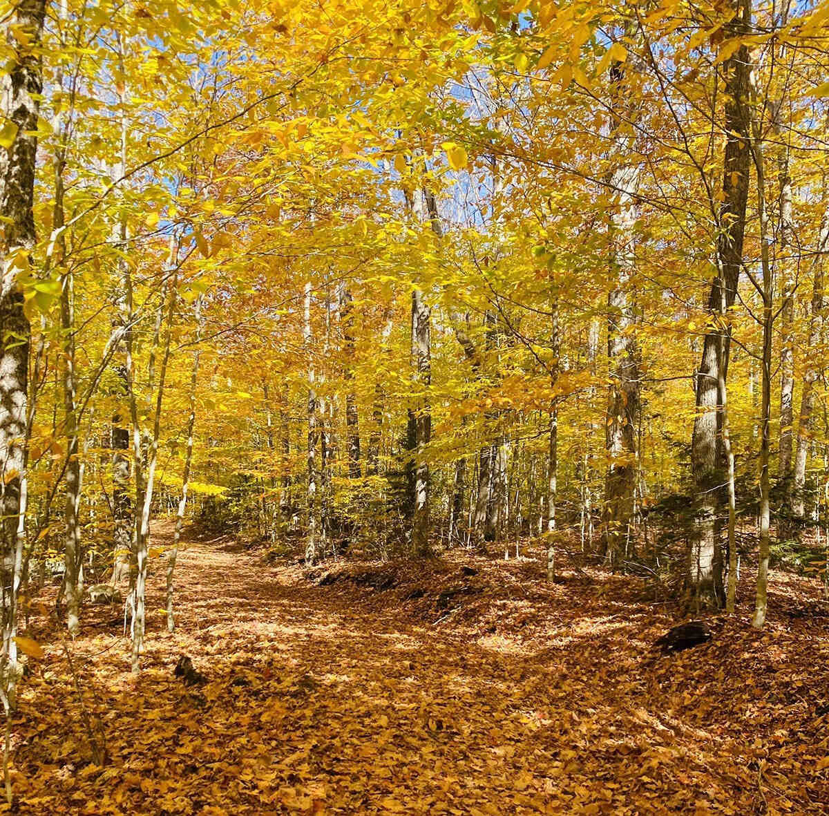
The Kancamagus Highway’s fall foliage season is undoubtedly one of the most beautiful seasons to visit. The Kancamagus Highway is most prevalent during the fall foliage season because of the vibrant colors. The scent of fresh fall air and the sun warming the changing leaves is something you’ll remember for the rest of your life, and it’ll always remind you of your time at the Kanc. It’s definitely one of the best things to do in fall in New Hampshire, and is a huge fall attraction for North Conway travelers.
Around the middle of September, the leaves on the Kancamagus Highway begin to change color. The first two weeks of October are when the fall foliage is at its peak. As the foliage season nears its end in this part of New Hampshire, the color of the leaves begins to turn brownish around the third or fourth week of October.
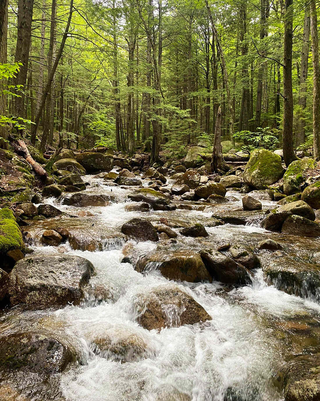
However, you can definitely visit the Kanc in the summer, too, and stop in lots of great swimming spots along the way.
What Is The Kancamagus Highway Weather?
The weather conditions on the Kancamagus Highway can vary significantly depending on the time of year and the current weather patterns. The Kancamagus Highway, also known as New Hampshire Route 112, is a scenic drive that crosses through the White Mountains of New Hampshire, USA. Here’s a general overview of what you might expect during different seasons:
Spring (March to May): In spring, you can experience rapidly changing weather conditions. Early spring might still have snow on the ground, especially at higher elevations. As the season progresses, you can expect milder temperatures, melting snow, and budding trees.
Summer (June to August): Summer is the most popular time to drive the Kancamagus Highway. The weather is generally warm with pleasant temperatures during the day and cooler nights. It’s a great time to enjoy the lush greenery and scenic views.
Fall (September to October): Fall is arguably the most famous season to drive the Kancamagus Highway due to the stunning display of fall foliage. The weather is typically cooler, and you can expect vibrant colors as the leaves change.
Winter (November to February): Winter brings cold temperatures and the possibility of snow and ice. The Kancamagus Highway can be closed during heavy snowstorms, and driving conditions can be challenging. However, if the road is open, you’ll be treated to a winter wonderland with snow-covered landscapes.
It’s important to note that weather conditions can change quickly in mountainous areas like the White Mountains. Before embarking on your drive, especially during the shoulder seasons (spring and fall) and winter, it’s advisable to check the weather forecast and road conditions. Make sure your vehicle is prepared for potential changes in weather, and exercise caution while driving, particularly in adverse conditions.
The Kancamagus Highway’s peak fall foliage season varies from year to year. The weather is essential in deciding when the leaves change colors and achieve their brightest hues, known as “Peak Fall Foliage.”
The most excellent part about leaf-peeping is that it’s beautiful to view the leaves regardless of the weather, so don’t let a lousy day prevent you from experiencing the Kancamagus Highway’s Fall splendor. Of course, the optimum weather is a bright, dry, warm day after recent rain.
If you are traveling the Kancamagus Highway from a distance, it is best to spend a few days in New Hampshire to enjoy the fall foliage while the weather is nice.
Do I Have To Pay An Entrance Fee For The Kancamagus Highway?
On the Kancamagus Highway, a $5 5-day pass per vehicle is necessary unless you have a $30 annual White Mountain National Forest permit. You can buy the passes online or at several local businesses. It is free to drive the Kanc straight through without stopping, although the pauses are well worth the price.
Does Kancamagus Highway Trip Allow Pets?
Yes, pets are generally allowed on the Kancamagus Highway and in the White Mountain National Forest.
However, they are typically required to be on a leash no longer than 6 feet in most areas. Visitors should clean up after their pets and be aware of specific pet regulations for hiking trails and facilities.
Pet safety, weather conditions, and potential wildlife encounters should also be considered. It’s advisable to check with authorities or visitor centers for up-to-date information on pet guidelines for the specific areas you plan to visit.
Where to Stay Near the Kancamagus Highway?

On each end of the Kancamagus Highway, there are many hotel alternatives. Popular hotels and inns sell out months in advance for busy weekends during the fall foliage season, and some demand two-night minimum stays.
On the Conway side of the Kanc, North Conway has the most hotel options, including family favorites such as the Red Jacket Mountain View Resort and the Hampton Inn & Suites North Conway, which offer indoor waterparks to keep the youngsters amused.
The 1785 Inn, a modest B&B with a fantastic view, is one of North Conway’s most excellent bargains. Darby Field Inn & Restaurant is charming, and it’s even closer to Conway, where most people start their Kancamagus Highway journey.
Consider lodging at The Mountain Club on Loon in Lincoln, on the Kanc’s western end. During the non-ski season, don’t forget to look into Airbnb for cabins and condos at reasonable prices. But if you don’t have the time to check, here are other best hotels to stay near the Kancamagus Highway:
Near Lincoln:
- Holiday Inn Express & Suites Lincoln East
- InnSeason Resorts Pollard Brook
- Woodstock Inn Brewery
- RiverWalk Resort at Loon Mountain
Near Conway:
Camping Along the Kancamagus Highway
Consider a camping holiday if you want to be right in the middle of the Kanc and its breathtaking beauty while also saving money. From mid-May through mid-October, most of the Kancamagus Highway campsites are open.
On the Kancamagus Highway, there are six White Mountain National Forest campsites where you can spend the night for a fee. All campgrounds provide amenities like bathrooms, drinking water, a fireplace, a picnic table, and spaces for parking. It has no trailer hookups, but tents, trailers, and RVs are accepted. These are:
Hancock Campground
Hancock Campground is located 5 miles east of Lincoln, on the west side of the Kancamagus Highway. There are 56 camping spots in Hancock Campground. Out of 56 campsites, 35 are RV-friendly.
Big Rock Campground
Big Rock Campground is located 6 miles east of Lincoln, on the west side of the Kancamagus Scenic Highway. There are 28 campsites in Big Rock Campground, but only tents are allowed at sites #21–28. All sites are available on a first-come, first-served basis. In mid-October, Big Rock Campground shuts.
Passaconaway Campground
The Kancamagus Scenic Highway runs through Passaconaway Campground, 15 miles west of Conway. There are 33 campsites in Passaconaway Campground. Sites 21 and 23 are on the creek, but they must climb a steep slope to get to the water.
Church Pond Trail, a 1.6-mile hike, is also accessible at Passaconaway Campground.
Jigger Johnson Campground
Jigger Johnson Campground is 12.5 miles west of Conway, New Hampshire, on the Kancamagus Highway. It has 75 campsites available. Only tents are allowed on sites 1-9.
It is the only campground on the Kancamagus Highway with coin-operated, handicapped-accessible showers. Only Jigger Johnson Campground campers have access to showers.
Blackberry Crossing Campground
Blackberry Crossing Campground is located 6 miles west of Conway, on the east side of the Kancamagus Highway. With just 20 campsites, Blackberry Crossing Campground is a modest campground.
Covered Bridge Campground
Covered Bridge Campground is located 6 miles west of Conway, on the east side of the Kancamagus Highway. There are 49 campsites at Covered Bridge Campground.
On the Kancamagus Highway, it is the only campsite that accepts bookings. You can make reservations by contacting 877-444-6777 or getting to Recreation. Gov
Take Passaconaway Rd to Covered Bridge Campground to go around this.
Some campgrounds, like Hancock Campground, are possibly open over the winter. But for winter availability, we strongly advise checking with a park ranger.
Best Stops Along The Kancamagus Highway
So you’re excited about the Kancamagus Highway, but what can you actually see and do along the way?
We’ve typically traveled the Kancamagus Highway from Lincoln to Conway. But you can drive it in any direction, and there are no distinct advantages to either.
You can either drive the 35-mile picturesque byway in one day or spend two days touring the Kanc.
We recommend at least a half-day visit to some of these popular stops:
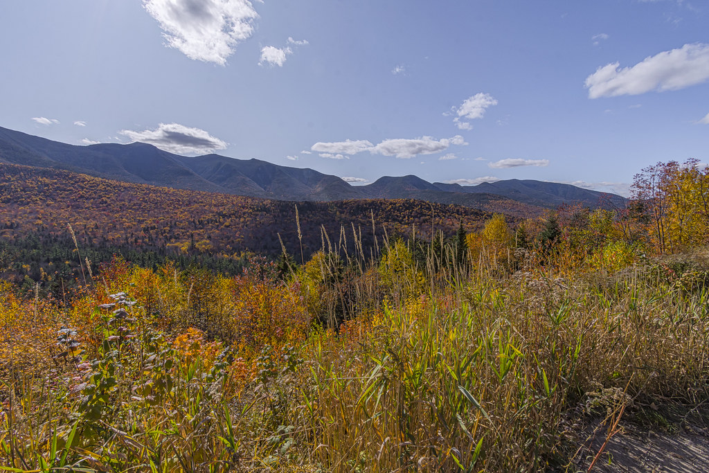
Kancamagus Highway Overlooks
The Kancamagus Highway features several picturesque overlooks with breathtaking views of the White Mountains. The Kancamagus Highway overlooks are great for seeing the mountains without hiking! Parking is available at each scenic viewpoint, although it fills up fast. We recommend visiting the Kancamagus Highway overlooks around sunrise or sunset to see the most spectacular views. Don’t miss these Kancamagus Highway attractions!
Hancock Overlook
Hancock Overlook is impossible to miss since it is located on a very tight U curve with a bit of roadside parking area for those who desire to stop.
One or two individuals will most likely be flying drones above to photograph the U bend from above with the fall colors in the trees. Heavy wind warnings will force you to delay if you attempt to fly a drone here.
You can park here and hike a modest 9-mile roundtrip path to Mount Hancock and South Hancock, two 4,000-foot+ peaks. The course is otherwise level and straightforward, with a steep but brief final rise.
We recommend coming as early as possible if you intend to climb this path since parking might be scarce.
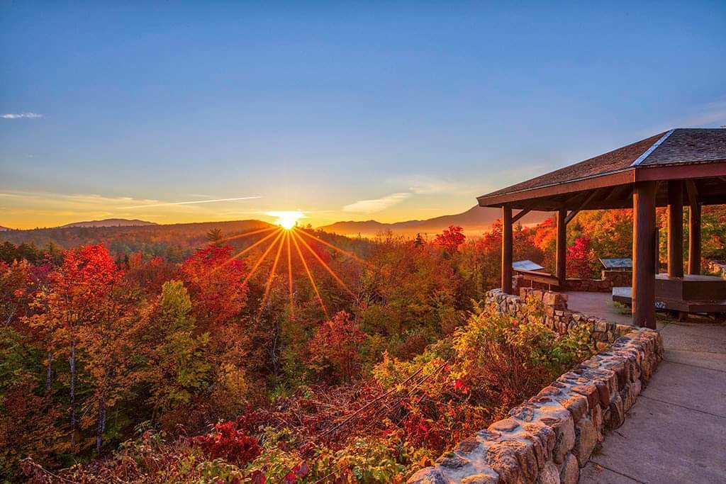
Pemigewasset Overlook

You’ll reach the summit of Kancamagus Pass after gaining some height.
Pemigewasset Overlook, just before the peak, offers stunning views of the undulating hills, including Mount Osceola.
We shot a picture of the Kancamagus Highway road using the drone going through the spectacular fall foliage. Make a point of stopping at one of the scenic byway’s most unique viewpoints!
If it rains, as it often happens in the fall, you can enjoy lovely mountains and forest views from a wooden pavilion.
CL Graham Wangan Overlook
Once you’ve passed over the peak of Kancamagus Pass and started descending, your next stop is just 1 minute or 0.2 miles away.
CL Graham Wangan Overlook is another of the Kancamagus Highway’s most spectacular overlooks, making it a must-see visit.
Here, you’re facing east at the Swift River and miles and miles of undulating hills dotted with colorful trees.
Sugar Hill Overlook

Sugar Hill is the last prominent viewpoint on your road drive through the magnificent White Mountains.
You’ve dropped in elevation, and the views to your east are stunning but don’t miss the Sugar Hill Scenic Vista parking lot.
Because the overlook is so near the Swift River, there will be another pavilion and more drones flying.
It is the last site where you can see miles of woodland from a high vantage point. So take as many shots as you need before beginning your descent.
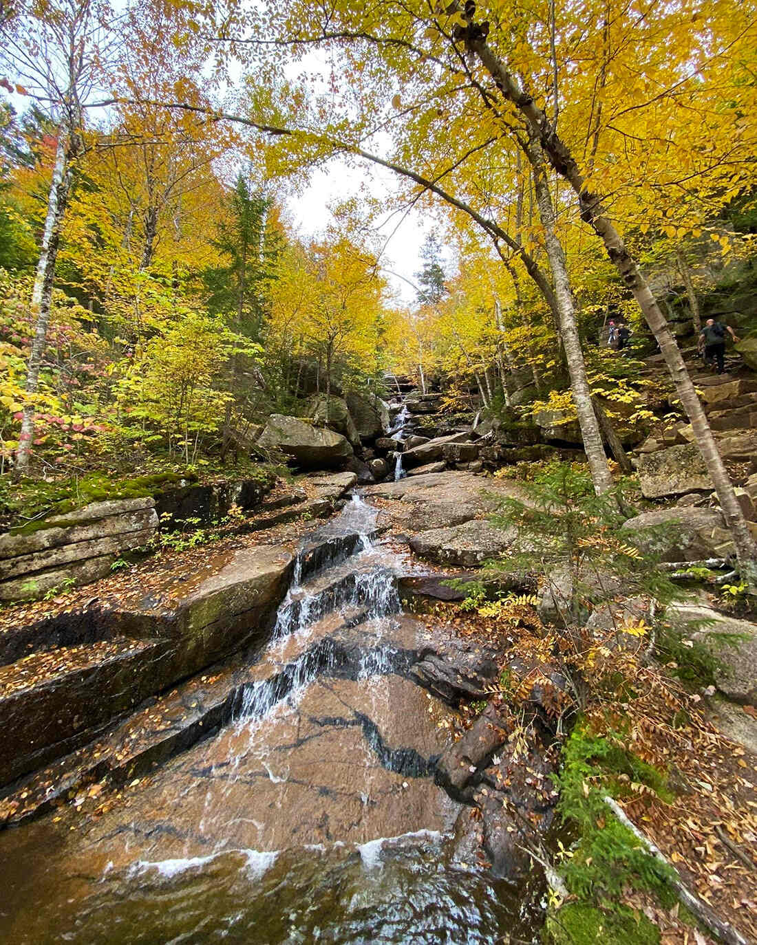
Kancamagus Highway Waterfalls
Did you know the Kancamagus Highway has easy-to-access waterfalls?! Kancamagus Highway waterfalls are among the top Kancamagus Highway attractions and should be on everyone’s bucket list.
Note that only Lower Falls and Franconia Falls allow swimming. Thus, you can’t swim (not permitted) in the other waterfalls.
Sabbaday Falls
0.6 miles | Easy | 102 Feet Elevation Gain

Sabbaday Falls is one of New Hampshire’s most famous waterfalls and the most popular destination along the Kancamagus Highway road trip.
As long as you can find a parking space, this is a must-see destination. You can easily reach Sabbaday Falls after a 15-minute stroll along a level gravel path.
Others ascend a steep stone stairway with wooden rails and a boardwalk to watch the falls from a higher vantage point, while others with elderly family members or impairments can enjoy the falls from here.
The waterfall is a 45-foot sequence of cascades tumbling over a tiny chute, and it’s a beautiful sight, but it’ll be crowded!
Rocky Gorge
Minimal | Easy | Between 33 to 430 Feet Elevation Gain

The Kancamagus Highway’s Rocky Gorge is a popular destination, especially in the fall when the foliage is at its greatest.
The Swift River narrows and passes through flumes with broad open rocky surfaces on both sides, ideal for youngsters to get out and have a short adventure.
A wooden bridge spans the river, providing a typical picture of the river’s banks lit by foliage.
Following short forest paths to Falls Pond and excellent reflection shots with Fall colors after crossing the bridge
Lower Falls
1.8 miles | Easy | 102 Feet Elevation Gain

Lower water levels benefit from traveling the Kancamagus Highway in the fall.
Lower Falls is an excellent example of a low-flowing river later in the season, but it’s still lovely with the vibrant contrasting colors in the trees.
It’s a popular entertainment location with parking, restrooms, and picnic tables. Swimming in an expansive natural pool in the river, sunbathing, relaxing, and eating lunch are options.
Swimming is unsafe at Lower Falls after heavy rain or when the water is high.
Champney Falls
3.1 miles | Moderate | 682 Feet Elevation Gain
Champney Falls is the best waterfall to go along the Kancamagus Highway if you like hiking.
The waterfall is a beautiful 70-foot cascade that is best visited in the spring or after recent rains in the summer. Expect shallow water levels in the fall.
The 3.1-mile trip follows Champney Falls Trail, and you can extend the hike to Mount Chocorua’s peak.
Many people prefer to add a spur route to Middle Sister of The Three Sisters since Mt Chocorua boasts some of the most incredible 360 panoramic views in the whole area.
Franconia Falls
6.8 miles | Easy | 423 Feet Elevation Gain

We propose Franconia Falls for a lengthy but straightforward climb to a gorgeous area. This largely level trip starts on the Lincoln Woods Trail and ends at Franconia Brook on the Franconia Falls Trail.
There are several rocky locations to sprawl out and rest around Franconia Falls. It is a tiny cascade that feeds into a pool where you can swim. You can find a broad, quiet swimming hole upstream from the falls.
The hike to Franconia Falls is 6.8 miles round trip, so keep that in mind while planning your trip. You may continue to Black Pond, just beyond the falls, if you want to travel any farther.
Kancamagus Highway Hikes
Hiking is a popular Kancamagus Highway attraction. The Kancamagus Highway has several lovely hikes for all levels. Here are our favorites!
Discovery Trail
1.4 miles | Easy | 682 Feet Elevation Gain
The Kancamagus Highway’s Discovery Trail is an often-overlooked aspect of the Kancamagus adventure. For individuals of all ages, it is informative, entertaining, and soothing. It is a must-see for families with children.
The Discovery Trail is an 85-acre forest tract known as a “Working Forest,” a phrase for a controlled piece of forest land. Wood, water, clean air, wildlife, leisure, and magnificent vistas are all carefully preserved. Balancing all of this at the same time is a difficult challenge. Make careful to remain on the path and clean up any garbage you bring in or discover along the route.
Use the trail guide since it is well-written and informative. It will take you through every step of the journey and point out numerous details that you might otherwise miss.
Boulder Loop
3 miles | Moderate | 912 Feet Elevation Gain

It will take about 3 hours to complete the loop while taking in the sights. Don’t miss “The View,” a side route with some spectacular landscapes.
Boulder Loop Trail is a circle-shaped loop that loops around an area with several enormous boulders and returns you to the starting place in either direction. Many hikers advocate trekking this loop in the other direction. This hiking trail may be busier than others due to increased use. The Albany Covered Bridge Parking Lot is where you’ll find the Boulder Loop Trail parking and trailhead.
The trailhead charges a fee to park.
This hike has a lower height rise than many of White Mountain’s other famous trails, but it still offers stunning views.
South Moat Mountain

5.8 miles | Difficult | 2,133 Feet Elevation Gain
This 5.8-mile out-and-back track near Conway is worth a try. It takes an average of 3 hours and 22 minutes to finish this challenging trek.
The South Moat Mountain Trail leads to the summit of South Mout Mountain and is a steady ascent. Hikers will confront a steady climb until they reach the peak, where they will be rewarded with panoramic views.
The parking space holds 20-25 cars; thus, it’s not unusual for the parking lot to be completed early on a sunny weekend morning.
Hancock Trail
9 miles | Moderate to Difficult | 2,631 Feet Elevation Gain

The trail is mostly moderate, but the final mile to the summit of North Hancock is challenging. In this section, hikers will have to travel on rocks and scrambles, which is particularly tough to descend, so be cautious.
It is a pleasant circular trail in New Hampshire that leads to two 4,000-foot summits (Hancock and South Hancock). There are no spectacular vistas, but you will get glimpses of the Tripyramids from the summits of the other mountains.
There is no phone service in the area; download the map before traveling to the trailhead to prevent getting lost.
Mount Chocorua
7.4 miles | Moderate | 2,244 Feet Elevation Gain
Mount Chocorua is a 7.4-mile out-and-back trail located in Albany. It takes an average of 3 hours and 59 minutes to finish this moderately tricky course.
Spring and early summer are the most acceptable times to see this long cascading waterfall with several tiny ponds.
The trail climbs through the woods and along a creek. This trail has a few short steep portions, but it’s an excellent hike for families with children and dogs.
The waterfall is stunning but best seen in the spring and early summer when the water is at its most vigorous. In the late summer and fall, it begins to dry up. It might be an enjoyable winter trek!
The Bonds
20 miles | Difficult | Elevation Gain (Depends on the route)

A circuit of three 4000-foot summits, West Bond, Mount Bond, and Bondcliff, together known as The Bonds, is one of the classic hikes in the White Mountains. These peaks are above the treeline and provide spectacular views of the Pemigewasset Wilderness and adjacent mountains.
The Bonds are also among the White Mountains’ most inaccessible peaks, demanding a strenuous 20-mile day hike or more depending on the route. It is a beautiful 1-night backpacking trip with plenty of time to hang out on the summits and soak in the spectacular morning and evening vistas.
Most hikers and backpackers approach The Bonds from the north, beginning at Zealand Road, or from the south, starting at the Lincoln Woods Visitors Center and parking lot off the Kancamagus Highway, and returning to their starting location after their journey. It is also possible to traverse The Bonds from north to south, starting from Zealand Road and to hike to Lincoln Woods, or vice versa. However, this involves driving a car around 30 miles to the destination.
Other Attractions Along The Kancamagus Highway
If the activities and sites above are not enough for your full-packed Kancamagus Highway trip, here are the additional attractions worth your time:
Russell-Colbath House

Along the Kanc, the Russell-Colbath House is a bit historic jewel.
We believe this is one of the superb stops along the Kancamagus Highway, and you’ll be captivated by the narrative if you talk to Gary or any other local employees.
Thomas Russell and his son Amzi constructed the Russell-Colbath House in 1832, and it is now on the National Register of Historic Places list. The home has packed historical items.
An open-air barn, erected in 2003 and packed with art and historical exhibitions, is located on the property. The Rail-n-River Trail, a paved and ADA-accessible hiking route, is accessible behind the property. Returning to the Kancamagus National Scenic Byway is simple.
Albany Covered Bridge

While there are several covered bridges in New Hampshire, this one is both historical and valuable.
The Albany Covered Bridge was erected in 1857, demolished in 1858, and rebuilt soon after by Amzi Russell. It was renovated in 1970 and is still in use today (although cars must be under 7’9′′ and foot traffic is only allowed during the winter).
Covered Bridge Campground is only accessible by bridge, which keeps the big RVs out!
Where to Eat Before and After the Kancamagus Highway Trip?
If you’re hungry before or after driving the Kanc, here are some recommendations to the west and east of the route!
Here are the sites to have food in Western Kanc:
Littleton
Lincoln
You can also try Polly’s Pancake Parlor in Franconia for breakfast or Rek-Lis Brewing Company in Bethlehem.
If you don’t prefer the Western Kanc, you have choices in Eastern Kanc too! So here are sites to visit in Conway:
- Peach’s Restaurant
- Wicked Fresh Craft Burgers
- Flatbread Company
- Frontside Coffee Roasters
- Cheese Louise
What to Pack for a Kancamagus Highway Trip?
The weather in the White Mountains is unpredictable, so dress in layers. The Kancamagus Highway is chilly in the late fall or winter, so bring a heavy winter jacket and layers. Carry trustworthy hiking clothing and coatings for your Kancamagus Highway hikes no matter what season you come. So, here are the crucial things you need to pack for a Kancamagus Highway Trip:
Boots: Even if you don’t hike, hiking boots provide comfort and durability.
Hiking Socks: Socks are also necessary for exploration comfort. The Darn Tough Hiker Boot cushions are our go-to hiking socks and our one trusted pair.
Backpack: Vacations usually include a hiking backpack. It allows us to carry food, clothing, and other items for our adventures.
Water Bottles: It’s vital to stay hydrated whether trekking or traveling!
Jackets: The White Mountains weather is unpredictable, so be prepared.
Tent: Camping requires durable and comfortable gear.
Bag: A perfect sleeping bag will meet all your needs!
Cooking System: Bring your own if a campground doesn’t have a barbecue. Because it’s efficient, tiny, and light, we use the Jetboil Zip Cooking System.
Suit: In the summer, don’t forget your swimming suit!
Sandals: After a long trek, it’s nice to change into cozy sandals. It is your go-to sandal for comfort and durability.
Kancamagus Highway Travel Tips
To maximize your Kancamagus Highway Travel experience, here are the tips we can give you:
Fill up Before You Board The Kanc: The Kancamagus Highway has no gas stations, so fuel up at Lincoln or Conway.
Get a GPS Audio Guide: This audio tour narrates depending on your present position and advises you when to stop for fascinating views.
Bring Cash for Parking Passes: Parking in the White Mountain National Forest costs $5 per day and is paid by cash in an envelope at one of the highway parking lots. Got a $20 bill? You pay for four days. Otherwise, find out about yearly and national passes here.
Be a Good Instagrammer: Standing in the middle of the road to snap the ideal shot puts you and others at risk.
Pets are Welcome: You can bring your dogs on hiking routes in the White Mountain National Forest, but they must be leashed. Your pets will have an enjoyable experience here, too!
Don’t Swim Where It’s Forbidden: There’s a reason for this. The lady rose and fell forward, smashing hard against the rocks, despite the NO SWIMMING warnings at Rocky Gorge.
Pack a Picnic: The Kancamagus Highway has no food stations but many picnic places! Picnic tables are available at Sabbaday Falls, Rocky Gorge, and Otter Rocks.
Is it worthwhile to travel the Kancamagus Highway? Absolutely! The Kancamagus Highway is well worth the trip. It is a breathtaking journey, one of the top things to do in New Hampshire, and one of the best sites in the country to see fall foliage.