15+ Must-See Gorgeous Lakes In Yosemite

There are some truly beautiful lakes in Yosemite that you don’t want to miss. Whether you’re looking to hike to a lake with epic views or swim in an easily accessible lake, we’ve got a spot for you on this list!

Yosemite is located deep in California’s Sierra Nevada mountains and is home to Yosemite National Park. In terms of popularity, it’s second only to Yellowstone. The sculpted granite walls, spires, domes, and gables entice visitors, who also come to hear the roar of the waterfalls.

This park has one of the world’s tallest falls and supports 400 species of fauna, making it a vital habitat.

Within the national park, there are several opportunities for outdoor activity. Several paths go to various lakes and natural views, making it a haven for outdoor enthusiasts.

The lakes in Yosemite provide a wide variety of outdoor activities and breathtaking scenery for you to enjoy. Don’t miss these top 15 gorgeous lakes in Yosemite on your next lakeside adventure!

15. Tenaya Lake

The Top Most Gorgeous Lakes In Yosemite
unsplash.com

Tenaya Lake is situated in Yosemite’s high country, or alpine zone, of Yosemite National Park, between Yosemite Valley and Tuolumne Meadows. It has an elevation of 8,150 feet above sea level.

Kayaking, boating, swimming, and even sunbathing are all popular activities here, so it’s known as the “Jewel of the High Country” by some.

Tenaya Lake has a medium level of thronging. Because it’s so far from Yosemite Valley and less popular than other water sites like Yosemite or Bridalveil Falls, Tenaya Lake can be on the quieter side. However, don’t expect to be the only one there – it’s gorgeous and is definitely a destination.

Tenaya Lake has three granite mountains on each side, making it a mile long. One drawback: Tioga Road runs along the lake’s northern shore.

You might encounter difficulties if you want to cross the lake’s outflow on the western bank in spring and early summer. The route includes wading across the lake’s entrance and outflow, then strolling beside Tioga Road on the north shore. The whole journey, however, is well worth it.

If you want the most incredible views of Tenaya Lake in the shortest amount of time, park near the lake’s western side and walk south along the coastline until you reach the lake’s exit. You can see the stunning mountain vistas without putting in any effort.

You can get to the lake by taking Tioga Road for 31 miles east from Yosemite Valley’s Highway 120, which will lead you to the Crane Flat turn-off onto Tioga Road. From there, the lake is right alongside the road and difficult to miss. The lake is 15.5 miles west of Yosemite’s east entrance near Tioga Pass.

14. Cathedral Lakes

The Top Most Gorgeous Lakes In Yosemite
unsplash.com

The Cathedral Lakes are two lakes on one trail in Yosemite National Park. The lower lake is 9,288 feet above sea level, while the upper lake is 9,585 feet. The lakes are about a mile southwest of Cathedral Peak and two miles east-northeast of Tenaya Lake, with Tresidder Peak nearby.

Hikes beginning from the Tuolumne Meadows area are some of the most popular in the Tioga Road region, and this one is no different, with a large crowd expected. John Muir Trail is part of the renowned trail, and you’ll likely see other hikers along the main route and at Lower Cathedral Lake (a half-mile diversion off the Muir trail). Hiking up into the Yosemite high country, you will find folks who are considerably happier and friendlier than you would find in a place like your workplace.

A high level of scenery awaits you here—one of Yosemite’s most stunning High Sierra lakes in Lower Cathedral Lake. There are three mountains around it: Cathedral Peak on the east, Echo Peak on the south, and Tresidder Peak on the north.

After the swamp crossing, a big rock shelf on the smaller lake’s eastern shore is gorgeous and restful.

The Tioga Road is usually open from June through October, making it a great time to visit. Early in the season, expect swampy conditions, and towards the end of the season, be ready for cold and storms.

You can reach the trailhead by car from Tioga Road, located at Tuolumne Meadows’ westernmost tip. Road 120 at Crane Flat is 38 miles east, while Tioga Pass is 9 miles west of this location.

Cathedral Lake is one of the most popular lakes in Yosemite and is definitely where we recommend starting! However, be prepared for some serious crowds, especially on warm days.

13. Young Lakes

The Top Most Gorgeous Lakes In Yosemite
alltrails.com

Two trails (6 miles long each) lead to the Young Lakes, a great day hike spot near Tuolumne Meadows. The western trail is less attractive, mainly passing through dense forest, but the eastern course opens up to stunning views of the Ragged Peak range, granite mountains, and Alpine meadows. The lakes themselves are nestled beneath these spectacular peaks.

The route ends at the shore of the biggest area of the lake, but you can locate these two peaks (rising above the lake) by going along a shorter track, which ascends a little farther east. Several notable peaks are visible from the path: Sheep Peak, North Peak, and Mt. Conness.

The short side road to Soda Springs and Parsons Memorial Lodge, a popular destination in Tuolumne Meadows, is the starting point for both paths to the Young Lakes. There are two ways to get to Dog Lake and Lembert Dome from the Glen Aulin Trail: the eastern route, which begins at the Soda Springs road intersection, and the western path, which branches north after one mile of the Glen Aulin Trail.

There is a junction around 5.5 miles, and the lower lake is a mile further. On the east side of Ragged Peak, towards the upper end of Dingley Creek, large meadows provide wide-ranging, long-distance viewpoints, making it a more picturesque route.

12. Lukens Lake

The Top Most Gorgeous Lakes In Yosemite
alltrails.com

At an altitude of 8,230 feet, you can find Lukens Lake along Tioga Road at the park’s west end. Lukens Lake, surrounded by dense pine and fir trees, is one of Yosemite’s less beautiful lakes (compared to other lakes in this list).

It lacks the magnificent mountain background in the High Sierras to the east. Instead, the primary attractions are the flowery meadows along the trail, the water’s stillness, and the deep woodland.

You can expect a medium level of thronging here. At the lake, it’s not unusual to see a group of people, despite this being one of the less impressive lakes, mainly because it’s closer to the campgrounds.

If you’re traveling the long route, the closest restrooms are at the White Wolf campsite, which is 1.9 miles west and 1.1 miles north of the trailhead.

Through paths, you can access Lukens Lake from the highway or White Wolf Campground. The trail to Lukens Lake winds through a mature forest before dropping to the water’s edge. There is a mild elevation change on the courses, making for an enjoyable trek.

There is plenty of room for parking at a pullout on Tioga Road. When the wildflowers bloom in early June, it’s a great time to come.

If you go a long way, you can find a restaurant and a snack store at White Wolf Lodge, right across the road from the trail start.

11. Mirror Lake

The Top Most Gorgeous Lakes In Yosemite
iliketowastemytime.com

As Bald Mountain approaches during your hike, you’ll see Mirror Lake. On a clear day, you’ll see a lake and surrounding cliffs from here. Only non-motorized boats are permitted, making the site ideal for canoeing, kayaking, and fishing.

The picturesque attractions include the pool at Mirror Lake and the vista of Mt. Watkins (8,500 feet), which rises over the extreme north end of Tenaya Canyon.

Open year-round, it features an easy-to-moderate trail. There are informative exhibits about the local animals and plants along its tracks. You can see wildflowers from your campsite, set in a wooded area. It’s also possible to go hiking, biking, horseback riding, or see animals while you’re here.

Expect serious crowds at Mirror Lake, especially during the summer. It’s easily one of the most crowded lakes in Yosemite, mainly because it’s a great swimming hole.

If you’re a swimmer, the best time to visit is when the weather is hot. The route is still available in the winter, but the crowds aren’t as bad as in summer.

The trailhead is located at the easternmost tip of Yosemite Valley and is well-signposted. Hike east from Curry Village or the Ahwahnee Hotel via the trailhead shuttle or on foot from either location to get there.

10. Dog Lake

The Top Most Gorgeous Lakes In Yosemite
alltrails.com

Dog Lake is nestled in a wooded valley with a backdrop of granite peaks and towering domes in the background. Although, despite its lack of grandeur, this lake is still beautiful and one of the most accessible in the park since it is only 1.4 miles off Tioga Road. The story behind Dog Lake’s name is one of its most appealing aspects.

In this area, evergreen trees encircle lakes surrounded by mountains and meadows. In 1898, the US Geological Survey sent Robert Marshall here to retrieve an abandoned sheepdog and her litter of pups, giving the lake its name. You won’t be able to see any dogs here now, though. They’re permitted in Yosemite’s constructed sections but not on the park’s unpaved paths.

Even though the lake isn’t as awe-inspiring, the short climb to get there is worth it.

From June through October, Tioga Road is open. There are generally many people around since the trek is so short. It’s definitely one of the most popular Yosemite lakes due to the ease of the trek.

To get there, you must first travel Highway 120 ten miles from Yosemite Valley to the Crane Flat turn-off onto Tioga Road, and then follow Tioga Road 40 miles east. The trailhead is located 7 miles west of Yosemite’s east entrance at Tioga Pass.

Many hikers combine the Lembert Dome trek with the one at the trailhead because of the nearby parking lot. You can find a trailhead for this path east of Tuolumne Meadows.

9. Ostrander Lake

The Top Most Gorgeous Lakes In Yosemite
alltrails.com

At an elevation of 8,500 feet, Ostrander Lake is a picturesque alpine lake surrounded by the High Sierras peaks. Skiers undertake the 10-mile trek from Badger Pass in the winter to take in the views.

Ostrander Lake is a typical High Sierra mountain lake with a granite shoreline that adds to its allure. First, you’ll walk through meadows and streams, and if you’re there at the proper time of the year, you’ll see more wildflowers than you can count – not only in the meadows and along the stream banks all over the route. After a short distance, you’ll come to a wide-open area with views of the backside of Half Dome and the surrounding peaks.

This lake has a moderate hike. There is a lot of elevation in the second part of the path, but at least you’ll be able to warm up with some enjoyable walking through meadows before that happens.

The trek to the lake is just 12.4 miles round-trip in the summer. This hike is at its busiest during June and July when the meadows and stream banks are blanketed with vibrant wildflowers.

8. Hetch Hetchy Reservoir

The Top Most Gorgeous Lakes In Yosemite
rove.me

The first sights of Hetch Hetchy Valley are when you round the bend and glimpse the dance of light on water. You can see water cascading from rocky heights hundreds of feet downhill. In the spring and early summer, you will hear the roar of the falls.

Hetch Hetchy Reservoir’s deep motionless water reflects sunlight, clouds, and the bold shadows of the surrounding mountains in the foreground. As John Muir put it, “a great landscape garden, one of Nature’s rarest and most beautiful mountain temples.” Hetch Hetchy Valley is one of these temples. It’s truly a beautiful sight!

When Yosemite Valley is bustling with tourists in the summer, Hetch Hetchy provides a welcome respite. Only a tiny percentage of Yosemite’s tourists make the trek to this remote park area.

You won’t find any Starbucks or RVs on the road here. A valley that’s been likened to Yosemite Valley in size is instead the star of this stunning landscape. It’s ideal for anybody who enjoys seeing new places and wants a quiet nature hideaway.

Hetch Hetchy gets very few tourists, but the hike to Wapama Falls is where most congregate. To begin, cross the O’Shaughnessy Dam and go east along the reservoir’s shoreline. You can view the water and Kolana Rock from the pleasantly sloping ground, a 2,000-foot-tall cliff.

Also, it is part of Yosemite National Park, although the park’s entrance is located at a distinct location. Just beyond the Big Oak Flat Entrance gate and 12.5 miles east of the little town of Buck Meadows, turn north along Evergreen Road to go to Hetch Hetchy. You can reach Hetch Hetchy Reservoir in 16.5 miles by driving up the ancient Hetch Hetchy railroad grade, which passes via many remote routes.

7. Evelyn Lake

rove.me
alltrails.com

A typical above-the-tree-line pure water lake, Evelyn Lake, is 10,330 feet north of the Vogelsang High Camp plateau and has sandy beaches where you can dip or bathe your toes.

Evelyn Lake has a 350-foot slope to the south, so tourists can’t see Vogelsang or Parsons peaks, but they can see the Gaylor Peaks and the white mountain area of Yosemite to the north.

It is possible to reach Evelyn Lake from Vogelsang High Camp via the Rafferty Creek trail or Lyell Canyon by the Ireland Lake trail near Potters Peak and then continue east to reach Evelyn. The second path has a substantially steeper ascent compared to the Rafferty Creek Trail.

South of Evelyn Lake is a distinctive alpine bluff with a tundra-like atmosphere with multiple ponds that feed the lake in the early part of each season. You will see a unique perspective of the peaks above Townsley Lake and all the other peaks in the area from atop the bluffs.

6. Saddlebag Lake

The Top Most Gorgeous Lakes In Yosemite
alltrails.com

When you visit Saddlebag Lake, you feel like you’re at the world’s top. The lake is surrounded by some of the most incredible fishing and trekking opportunities in the Eastern Sierra.

One of the region’s highest-accessible lakes, Saddlebag Lake, is only short from the Tioga Pass entrance to Yosemite National Park.

Access to the 20 Lakes Basin is made possible by the Saddlebag Lake Resort’s water taxi service, which transports guests across the lake’s almost 340 acres. Fishing for brook and golden trout is excellent in the basin.

Saddlebag Creek runs out of the dam and provides excellent brook trout fishing and stunning mountain vistas. Saddlebag Lake and its surroundings are vast and seldom seem crowded, making it an ideal location for a family vacation.

It is roughly 12 miles from highway 395 and highway 120 to Saddlebag Lake Road. You can reach the lake in about three miles by following the route.

5. Cherry Lake

The Top Most Gorgeous Lakes In Yosemite
fs.usda.gov

Cherry Lake, the Stanislaus National Forest’s biggest lake, is located in the Groveland Ranger District just outside Yosemite National Park. Dion R. Holm hydropower units are powered by the reservoir lake, which provides drinking water for the San Francisco region.

The lake is a popular summer destination for fishing, boating, and water sports. It’s open year-round; however, the road leading to it can be blocked during the winter months.

Cherry Creek’s branches run southwest from the Emigrant Wilderness and feed Cherry Lake. As far as whitewater rafting goes, Cherry Creek has some of the most challenging whitewater in the United States.

The Andresen Mine Trail is a moderate 4.5-mile climb that rises from 2100 feet to 1900 feet in elevation. It starts at the foot of the bridge. You can drive to Cherry Lake Road one mile beyond the Kirkwood Powerhouse. Take a left onto 1S23Y and park in the middle of the road.

Another hiking trail, the North Mountain Trail, is a challenging trek with a 2,500-foot ascent over three miles. You will see an abandoned fire tower at the trail’s ridge path. You can drive to Cherry Lake Road about 5 miles from the District Office. Approximately two miles beyond the Kirkwood Powerhouse, turn right and go up Cherry Lake Road.

The gated road is a mile away on the right-hand side. Ensure you don’t go too close to the gate when you park. Just beyond the locked gate, the trail starts on the right side of the road.

Cherry Valley Campground offers scattered camping on the lake’s southwest coast in its 46 campsites.

4. Townsley Lake

The Top Most Gorgeous Lakes In Yosemite
midsierramusing.blogspot.com

The Vogelsang Region of the High Sierra has Townsley Lake, situated between Fletcher and Parsons Peaks. Like many of Yosemite’s other lakes, it’s known for its crystal clear waters, rocky shores, and sandy floors.

At 10,353 feet above sea level, the lake offers spectacular views of granite mountain ranges and green meadows. The only way to get to Townsley Lake from Fletcher Lake is by an unofficial route that leads to the lake. Over the year, visitors with their fishing gear have carved out pathways.

On the extreme eastern edge of Townsley lake, there is an entirely different lake experience. After a challenging ascent, the Basket Lake sits a few hundred feet above the granite rock field. No one will hear you even if you cry for aid from this height.

Hanging Basket is a deep, frigid lake surrounded by granite spires, making it one of the most peaceful spots you’ll ever find. Swimmers should use care due to the very chilly water.

Backpackers can bypass the Vogelsang base camp location and proceed to Townsley Lake since you can camp around the lake. As a hammock camper, trees were numerous on the North slope, but tree sizes varied, so locating the appropriate spot can take some time.

The trees shrink and dwarf with brutal winters, and the only flatlands appear on the lake’s far eastern shore. There are several rock croppings on the north shore slope where you can find tent sites.

3. Lake Eleanor

The Top Most Gorgeous Lakes In Yosemite
reddit.com

Lake Eleanor, Yosemite’s most prominent natural lake, was enlarged in 1918 by constructing a concrete dam across its eastern shore. This dam was built to provide water to the San Francisco area.

The isolation of Lake Eleanor and its stunning vistas draw visitors to the lake. With 953 acres of surface area, this Yosemite National Park lake is a favorite destination for hikers seeking peace while taking in the beauty of the water shimmering in the sunlight.

You can find Yosemite National Park’s Lake Eleanor northwest of Hetch Hetchy Reservoir on the park’s northern border. Driving to the Cherry Lake Dam and then heading east to the lake are viable options for getting to this spot.

Miguel Meadow and Kibbie Lake are both nearby trailheads. It’s a pleasant hike since there are no high hills. Although it’s a four-mile journey to get to the lake, the reward is worth it.

Fishing is allowed year-round, but the summer months are the most fantastic time to visit Lake Eleanor in Yosemite National Park.

Trolling from a canoe on Lake Eleanor is some of the most incredible fishing, but getting there requires quite a portage. From the beach, you can also catch fish. Anglers can catch rainbow and brown trout. A short distance away, Frog Creek is an excellent place to start.

In Yosemite’s backcountry, you’ll always have the opportunity to encounter animals. Try to observe bald eagles, deer, and even black bears while you’re there.

2. Gaylor Lakes

The Top Most Gorgeous Lakes In Yosemite
alltrails.com

Gaylor Lakes comprises two lakes: the upper Gaylor and the lower Gaylor. A short but challenging climb will take you to the lower Gaylor lake. You can then climb to the upper Gaylor lake from there.

From the start of the trek, the landscape is breathtaking. The trail begins with a challenging ascent, but the rewards are the spectacular views of Dana Meadows and the surrounding mountains, including Dana, Mammoth, and Gibbs.

The view from the top of the pass is stunning, with mountains to the east of Yosemite and the high Gaylor Lakes valley, which has prehistoric air from the peak when you look down on it. There are five lakes in the valley, all gorgeous, and you can glimpse the mountains surrounding Tuolumne Meadows beyond the valley’s horizon. Located above Upper Gaylor Lake, there is also an abandoned 1870s mine.

Compared to Yosemite Valley, the Tioga Road area is a post-Ebola wasteland on weekdays and a bustling tourist destination on weekends. It’ll be easy to identify other hikers in the Gaylor Lakes valley because of the wide-open scenery, but they’ll be dispersed around the basin’s several picturesque sites.

If you’re coming from Yosemite Valley, travel Highway 120 for ten miles to Crane Flat, where you’ll turn right onto the Tioga Road, which will take you 48 miles east to the trailhead.

To get to the trailhead from the east entrance at Tioga Pass, drive through the Yosemite entry gate and immediately turn right into the parking area.

1. May Lake

The Top Most Gorgeous Lakes In Yosemite
alltrails.com

Visit May Lake, which is noted for its short, straightforward climb. To see all the lake offers, you only need one day. Tioga Pass provides access to the lake through a one-mile ascent. It has a lake camp where you can unwind and go fishing.

Like many high lakes in Yosemite, May Lake is situated at the foot of spectacular granite cliffs (Mt. Hoffmann). With its low side giving access to a drop-off overlooking the Tioga Road region to Clouds Rest and Tenaya Lakes, May Lake ranks as one of Yosemite National Park’s most spectacular lake hikes.

If you don’t fly with Horizon Air, you won’t have many opportunities to see Clouds Rest and Half Dome from the air, and the views of the northern wilderness are almost as impressive. There are also some excellent views of May Lake from the Mt. Hoffmann hike. Even though May Lake is lovely, Mount Hoffmann elevates this trip to the next level.

Since it’s a short trek and the May Lake High Sierra Camp is located on the eastern side, you won’t be the only one here. The crowds aren’t as bad as they would be if it were situated directly adjacent to Yosemite Valley, like Mirror Lake.

To get there, you must reach Tioga Road from Yosemite Valley by driving ten miles north on Highway 120 to the Crane Flat turn-off and another 28 miles east to the May Lake turn-off. Take the Tioga Road west for 20 miles from Yosemite’s east entrance at Tioga Pass to the turn-off. The parking facility at the trailhead is 1.8 miles away from the turn-off.

Tips on Visiting Yosemite

Here are some of the tips when visiting Yosemite:

1. Make a Reservation in Advance: Reservations are necessary to drive into Yosemite National Park from May 20 through September 30, 2022, during peak hours (6 am – 4 pm). There will be no first-come, first-served campsites in 2022 since campgrounds will need reservations in advance.

2. Be Patient and Adaptable: Yosemite attracts millions of visitors from April through October. Most people see Yosemite Valley, but other attractions are across the park.

3. Retain the Wild: Respect animals from afar. Never approach, feed, or allow animals to come to you. Getting too near to park animals might be harmful to both of you. Injuries from squirrels and deer outnumber bears and mountain lions in Yosemite. Living around animals exposes you to sickness. Always store food properly and obey speed restrictions.

4. Safely Enjoy Rivers and Falls: Be cautious while near Yosemite’s rivers, lakes, and waterfalls. If you want to cross a river or a stream to cool down, look for a spot with calm water. Choose a site downstream that isn’t near rapids or waterfalls if you’re worried about being carried away by concealed currents. Keep a safe distance from fast-moving water. All it takes is a slip-on wet (or even dry) rock to be carried away.

5. Get Ready for Your Trip: The weather is warming up, and you want to go hiking or climbing. Great! Make sure to prepare and plan ahead of time. Someone should know where you’re going and when they would expect you to return so they can find you. A headlamp or torch (with additional batteries) plus a map and compass are essential for any outdoor adventure.

If you want to get away from the city’s hustle and bustle and spend quality time with your family, consider visiting one of Yosemite’s most gorgeous lakes.

Next: The 15 Best Hikes in San Diego

The 15 Best Hikes in San Diego

If you intend to hike in San Diego, you’ve come to the right place! There are several hiking trails in the area, and we’ll tell you about the best ones in this post.

San Diego is great for people who love the outdoors because of its seashore and laid-back vibe. Even if you don’t surf, there are many ways to enjoy the outdoors in the city. One of them is hiking.

In the city and its neighboring area, there are many different types of terrain, so hikers can find trails that range from easy nature preserves to challenging summit scrambles. 

Torrey Pines State Natural Reserve, Sunset Cliffs, and Los Penasquitos Canyon Preserve are just a few beautiful natural places you can visit and hike. 

You don’t have to go too far from the city to find the best hikes in San Diego, whether you desire a perfect moment by a tidepool or you’re into backwoods trekking. The geography around San Diego makes planning trips for people of all skillset and interests easy. 

It ranges from short walks on rocky cliffs along the ocean to long hikes up mountains and through biodiverse forests. So, wear your hiking boots and try out one of these 15 best hikes in San Diego!

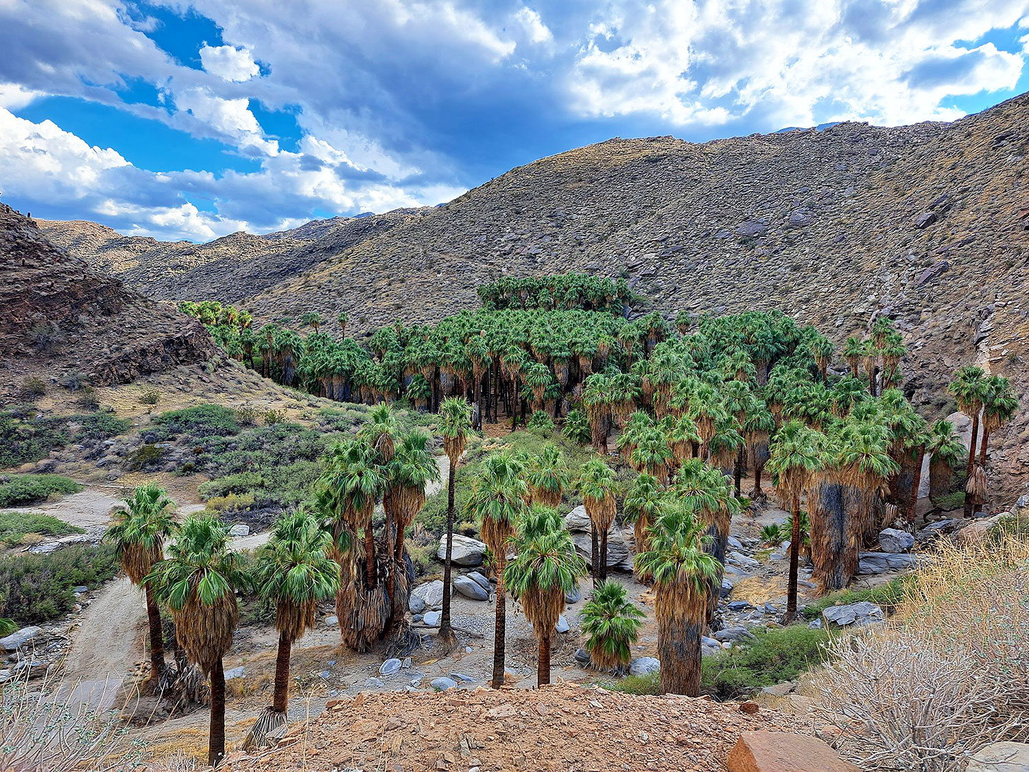
15. Palm Canyon Loop

2 miles | Easy | 295 Feet Elevation Gain

The best hikes in San Diego
alltrails.com

The Palm Canyon Loop trail is a desert oasis. This trail’s end is a natural desert oasis with tall palm trees, sparkling streams, and strange rock formations. More than 450 palm trees from 58 species grow in this tropical oasis.

This trail starts at the Agua Caliente Band of Cahuilla Indians Reservation on S. Palm Canyon Drive.

It is among the best short hikes in San Diego because of its unique scenery. It’s like a little piece of wonderland in the middle of the dry Palm Springs desert.

Since the trail is primarily flat, hikers of all skill levels can use it to get out into nature. Local hikers adore the Palm Canyon Loop path because it’s short, easy, and has a lot of beautiful and colorful scenery along the way.

The average time it takes to hike this loop close to Cathedral City is an hour. And since it is a trendy place for hiking and walking, you’ll probably meet other people while exploring. 

November to July is the best time to visit this trail. Dogs can’t go on this trail, so you’ll have to leave them at home.

Also, remember that there is a fee to get on this trail. As of this writing, there is a $9 admission fee for adults and a $5 fee for children 6 to 12 years old. A $7 price is for seniors aged 62 and up or students.

14. Torrey Pines Beach Trail

2.3 miles | Easy | 364 Feet Elevation Gain

The best hikes in San Diego
alltrails.com

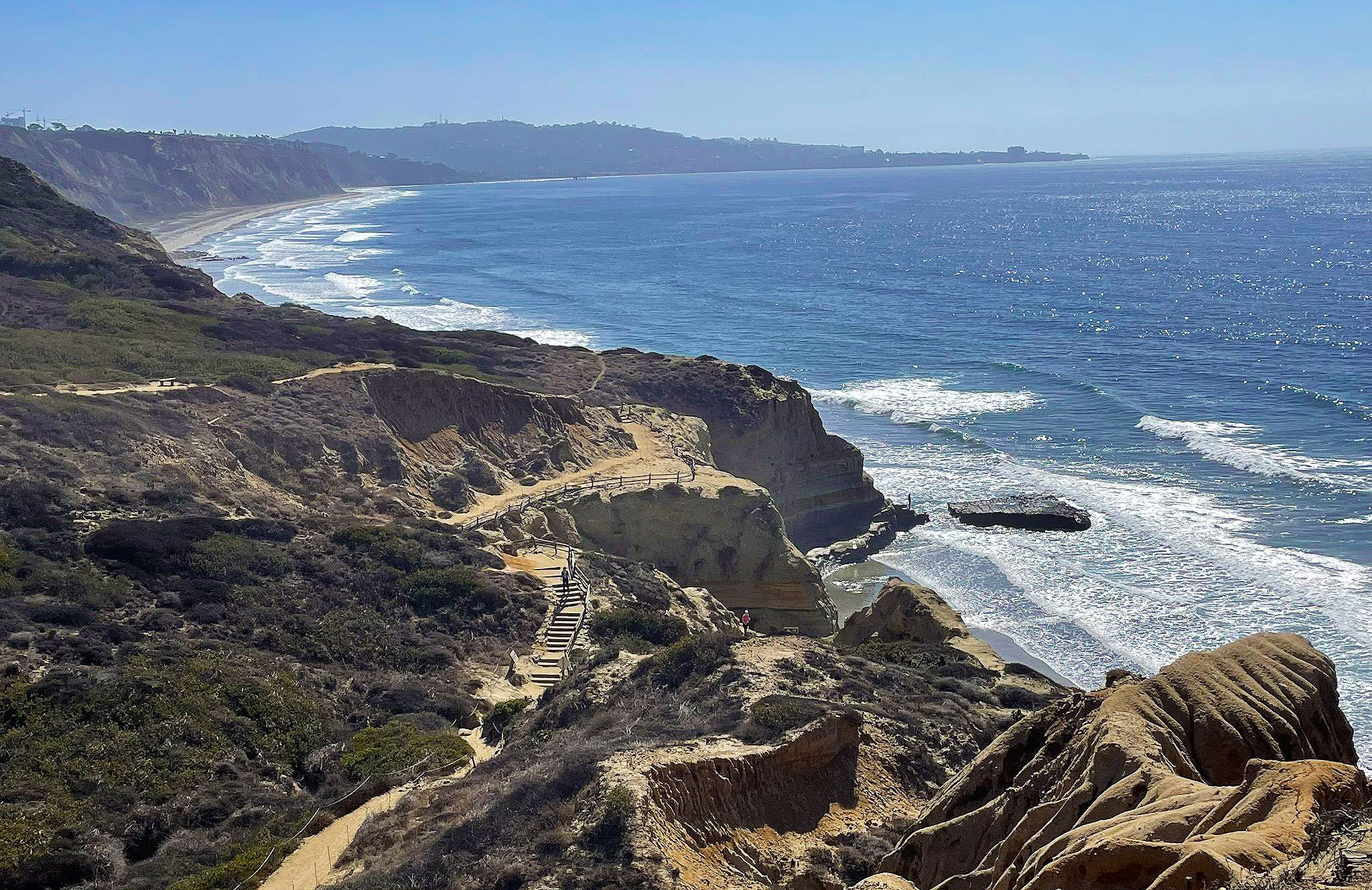
The Torrey Pines Beach Trail is one of the most renowned hikes in San Diego.

It is within the Torrey Pines State Natural Reserve, a 1,750-acre piece of land that looks out over the Pacific Ocean and has several hiking and biking trails.

As the name suggests, the reserve protects Torrey pines, a rare type of pine growing in San Diego and Santa Rosa Island. The reserve’s landscape includes ravines, floodplains, cliffs, and the shore.

This trail has beautiful seaside bluffs that rise high above the rushing water of the Pacific. It’s a flat, easy trail that’s great for hikers of all skill levels, even kids! 

The hike is worth it just for the vast views of the coast, but as a bonus, you’ll also get to walk through beautiful rock structures and wildflower meadows.

Hike at Torrey Pines in the evening so you can watch the sunset over the shore, but mornings can be lovely too because there are fewer people there. There is also not much shade, so if you decide to go, you should bring a hat and sunscreen.

Every day of the week, the reserve is open. Anticipate paying a fee to get in or park. Many people go there to use the beach amenities (not hiking).

If you have time, stop by the Torrey Pines Gliderport for crazy coast views. Also, it’s fun to watch the paragliders take off and land. Equally beautiful are La Jolla Shore Park and Beach. And, of course, walk around La Jolla Village.

13. Bayside Trail

2.4 miles | Easy | 351 Feet Elevation Gain

The best hikes in San Diego
alltrails.com

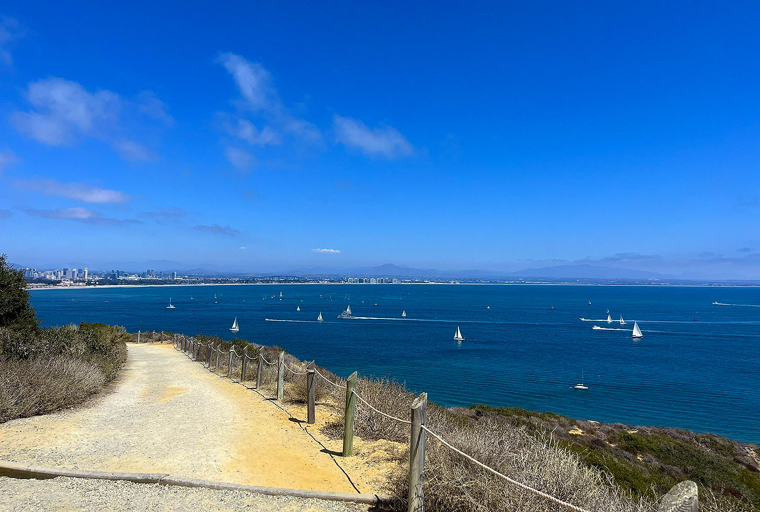
Cabrillo National Monument has several short trails with great views, like the Bayside Trail. 

This trail is 2.4 miles round-trip and has excellent panoramas of the ocean, Ballast Point, sandstone cliffs, ships, downtown, Coronado Island, Tijuana, plant life, and, if the weather is right, snow on the peaks of the mountains.

Close to the old lighthouse is where the trail starts. Before you get to the lighthouse, you’ll see a sign for the Bayside Trail. It tells you to turn left and follows a paved road to the gravel/dirt route.

This tour is self-guided, with plenty of clear signs that describe the sensitive vegetation, weather, habitat, animal life, etc. There is also a heritage landmark with a flashing beacon shelter and power station built in 1919 and used throughout World Wars I and II.

Apart from that, there are many benches where you can sit and rest, think, enjoy the view, write, or look around at the beautiful nature.

The Southern Maritime Chaparral, which includes cliff spruce, dudleya, and barrel cactus, is also found along the trail. It is another rare and valuable habitat. 

Check out the Visitor’s Center, which has a lot of historical displays, while you are on the property. In the western portion of the United States, there is a lot of information about the voyages of discovery.

The enormous statue of Juan Rodriguez Cabrillo, the initial European to set foot in California, is a must-see. From the viewing area, you can see the landing site.

And don’t forget to continue to the vicinity of the monument with the tide pools. You can walk around the area’s bluffs, coves, and arches on an easy 1-mile trail.

12. Batiquitos Lagoon Trail

3.4 miles | Easy | 30 Feet Elevation Gain

The best hikes in San Diego
alltrails.com

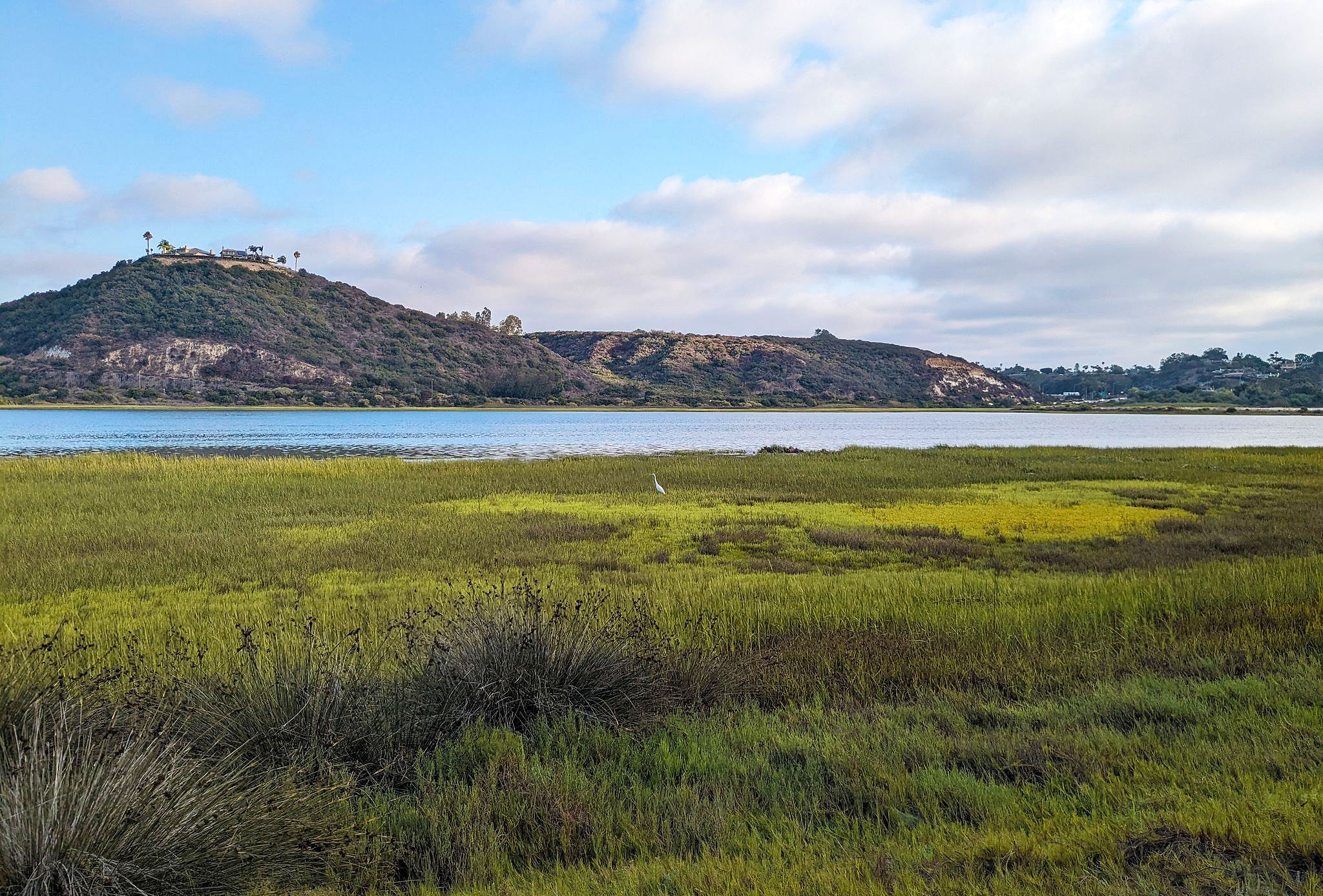
The Batiquitos Lagoon is a coastline wetland and estuary on 610 acres with a drainage area of about 55,000 acres. There aren’t many coastal wetlands left throughout Southern California. As a result, this is a unique area.

The Batiquitos Lagoon Trail is among the best spots to go hiking in San Diego if you like to see animals. This marshy habitat is home to several local species of birds, fish, and plants, which you can discover more about on this trail. 

Expect to see rabbits, mud fowl, lizards, and various bird species.

For families and avid nature lovers, there is a Nature Center next door with a lot of information about the different organisms you can encounter in the lagoon. Also, the lagoon itself is beautiful and worth the hike.

This 3.4-mile (out and back) trail is relatively flat and suitable for strollers. It is an excellent place for an outing, a casual meander, jogging, and sightseeing. Also, the Batiquitos Lagoon trail is free for everyone, and there is a small parking lot at the trailhead.

11. Los Penasquitos Canyon Trail

6.8 miles | Easy | 157 Feet Elevation Gain

The best hikes in San Diego
alltrails.com

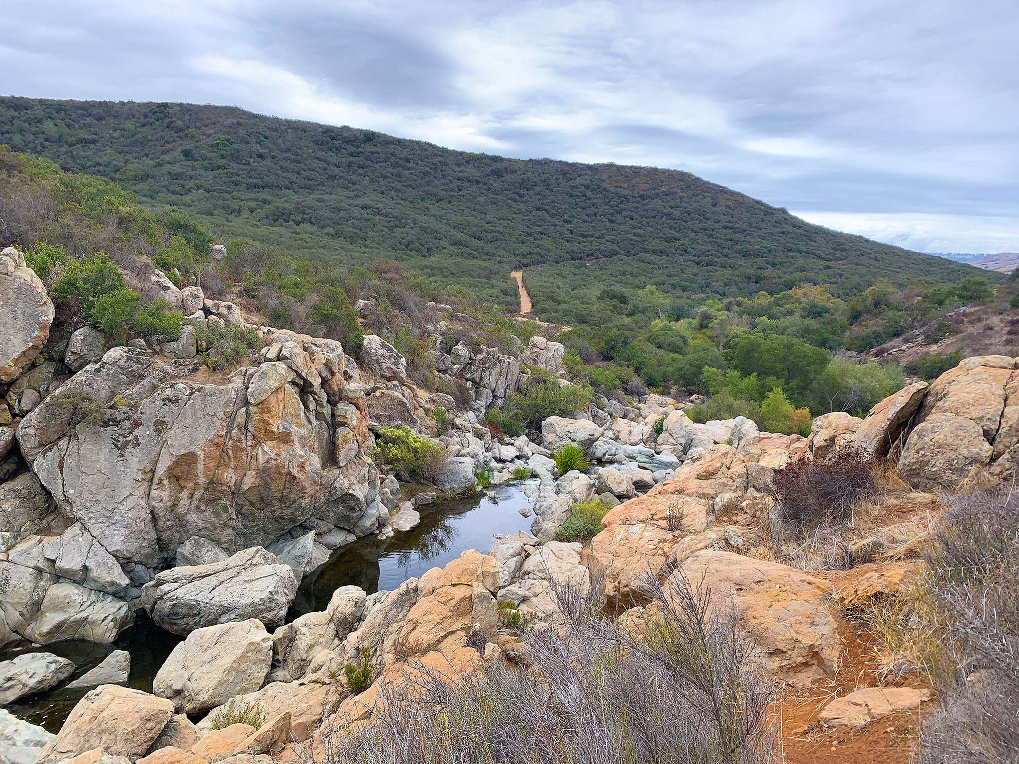
San Diego hikers love the Los Penasquitos Canyon Trail because it’s close to the city and suitable for people of all skill levels. The Los Penasquitos Canyon County Preserve is where it is.

The Los Penasquitos Canyon County Preserve is 4,000 acres and goes 7 miles between Mira Mesa, Sorrento Valley, and Rancho Penasquitos. On the trails, you’ll see a small lake, a stream, a waterfall, and groves of oak and sycamore trees.

Trails in the preserve get a lot of use and range in length from 2.5 miles to more than 7 miles. The courses are suitable for pets, and the Los Penasquitos Canyon Trail is among the easy.

It has a waterfall, small cliffs (called “Penasquitos”), and shade, and it’s a good option for families with young children. You can stay on the main path or explore one of the many small trails.

The Los Penasquitos Canyon Trail is among the best places to hike in San Diego because it goes through a vast canyon. Visitors can use this trail for many different things. It goes through wooded areas and immense meadows and ends at a cute waterfall. 

Because hikers, runners, bikers, and other people use this trail, it can get bustling on the weekends. People like that this path is longer and has an easy surface, making it great for a long day of hiking and taking in the sights.

Even though the hike is easy, we recommend bringing a bottle of water and a hat, especially in the summer.

10. Big Laguna Trail

13.3 miles | Easy | 1,240 Feet Elevation Gain

The best hikes in San Diego
alltrails.com

The Big Laguna Trail is a beautiful San Diego hiking trail perfect for a day-long adventure. It is unique in the broader San Diego area as it has rare wildflowers, stunning views of the mountains, and a peacefulness that only Mother Nature can give.

This 13-mile loop is conveniently 13 miles north of I-8 on Sunrise Highway. It goes through oak and pine forests, large meadows, and a clear blue lake during certain times of the year. 

Also, the trail is excellent for exploring with family, friends, or yourself. Horses and people on foot can use it, making it a scenic route for all kinds of adventures. The trail is also an excellent way to learn how to ride a mountain bike!

This trail takes you through many distinct southern California ecosystems, from dense forest canopies to fully open meadows and, in wet years, even an alpine lake. 

Before the Spanish took over the territory in the mid-1800s, the Kumeyaay Indians lived in these mountains for more than 9,000 years. Some heritage places along the path still show signs of their culture. 

The trail is well-used and well-kept and connects to several other courses. Stay on the Big Laguna trail to avoid the more demanding Pacific Crest Trail, or take the Blue Jay or Falcon trails back to the campground for a more leisurely hike. 

Big Laguna can be bumpy and has some good hills, so be ready for good exercise. 

Note that you don’t need a permit to hike the Big Laguna trail, but you need a Forest Adventure Pass for each car you park at certain trailheads. You can buy an adventure pass for $5 per day or $30 per year.

9. Stonewall Peak Trail

3.9 miles | Moderate | 830 Feet Elevation Gain

The best hikes in San Diego
gohikingsandiego.com

The Stonewall Peak trail is a nice challenge for hikers of any level. It is short, has a gentle incline, and offers views for miles. It gives you a beautiful view of Cuyamaca Rancho State Park. 

Along it, several switchbacks direct to the top. Even though the switchbacks can be challenging and tedious, the views from the summit are more than worth it.

The Stonewall Peak Trail is the most famous hike in Cuyamaca Rancho State Park, and it’s easy to see why. There is a climb, but it’s not too hard. At the top is a distinctive bald granite summit with a 360-degree view of high mountain ranges, lakes, and the desert. 

The hike is a short out-and-back, but there are options if you want to create a nice loop with viewpoints of Lake Cuyamaca.

Cuyamaca Rancho State Park is where the Stonewall Peak Trail is, and there is a fee to get in. Park in the lot of the campground, then walk across the street to begin the hike.

From the start, the trail will switch back up the peak’s west side, passing through shrubby and oak trees growing around. During the season, you’ll see a lot of wildflowers, especially ceanothus. You can also see monkeyflower, penstemon, manzanita, and many other flowers.

As the path winds up, views to the west and occasionally the north start to open up. Cuyamaca Peak, Middle Peak, North Peak, the town of Cuyamaca, and Lake Cuyamaca, are all things you’ll see right away.

If you keep going, you will get to the top, where there is a flat area with guard rails around it. You’ll see signs explaining what you’re seeing and pointing out local landmarks.

8. Three Sisters Falls Trail

4.1 miles | Moderate | 984 Feet Elevation Gain

The best hikes in San Diego
alltrails.com

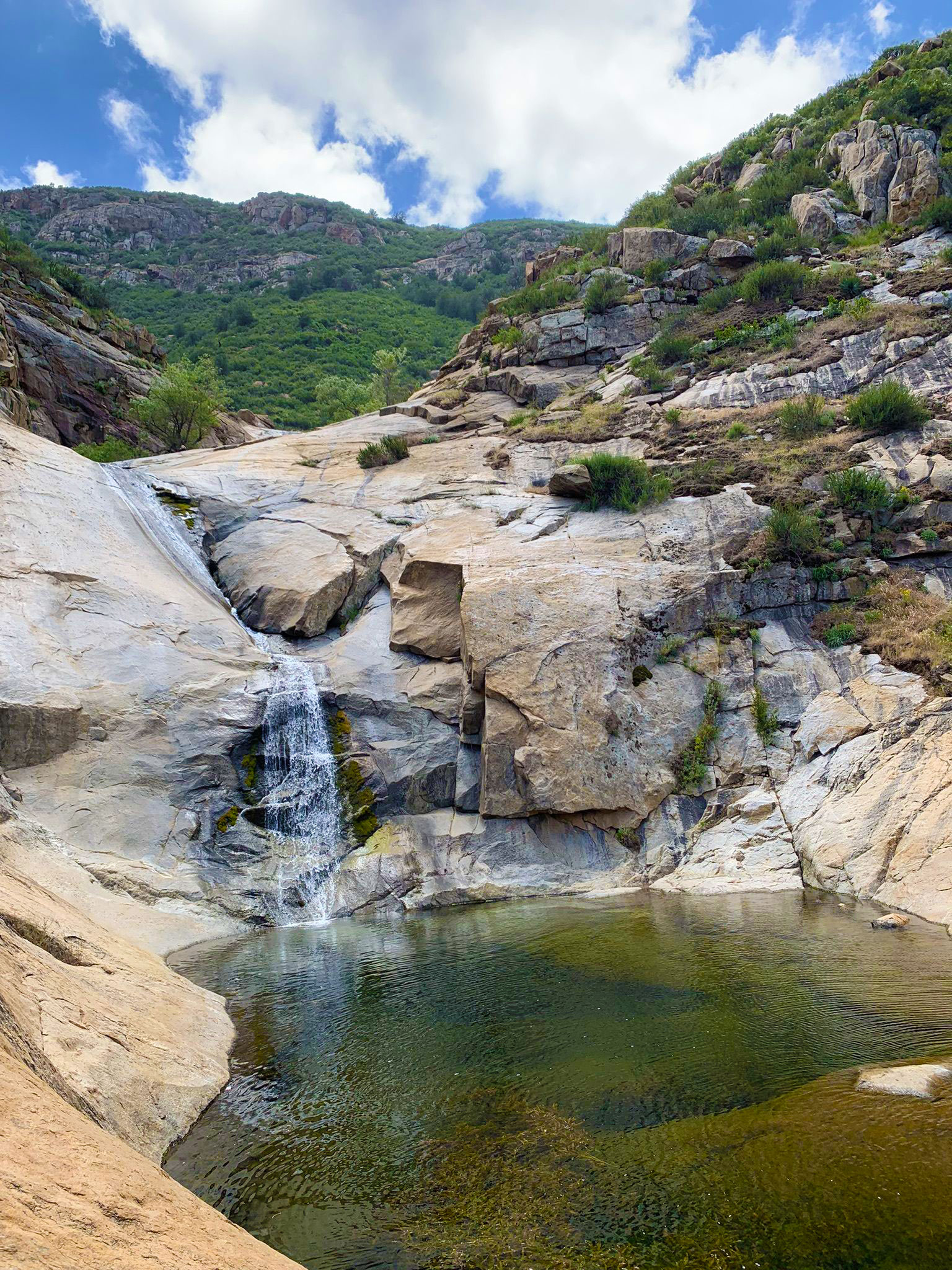
When it’s running, Three Sisters Waterfall, which is roughly 30 minutes south of Julian, is among the best waterfalls in Southern California. It is a group of waterfalls that flow over rocks. Three primary waterfalls make up the three sisters.

The best time to go is after a good rainy season. Even though the area is a beautiful place to visit, keep in mind that it is very steep to get into and out of the canyon. 

You shouldn’t go there if you’re not ready for a more strenuous hike. Also, remember that it can be sweltering, so ensure you have a lot of water, especially during the summer.

The hike starts at a gate that keeps cars from driving onto the dirt road you are strolling. The path then stays flat for about half a mile. Along the way, a small shady area looks like a good place for a picnic.

From there, the path goes downhill and crosses a small creek. Before going around the mountain, you can see several plants if you cross the stream.

As you get closer to the waterfall, the trail gets harder. If you are on this part of the hike, we suggest you use hiking poles.

When you reach the bottom, you’ll be able to follow a small creek to the principal river or stream. And on the base of the first waterfall, you will undoubtedly be amazed by how beautiful this place is. There is a path to the second waterfall and a trail to the third.

It is a great hike that is best after a good rainy season, but you should be careful if you try it.

7. Cedar Creek Falls Trail

5.6 miles | Moderate | 1,050 Feet Elevation Gain

The best hikes in San Diego
flickr.com

Do you want to get wet on a hike? Then it would help if you went on the Cedar Creek Falls trail. This hilly trail in Cleveland National Forest has three places where you have to cross streams that can be deeper than your knees depending on how much rain has fallen recently.

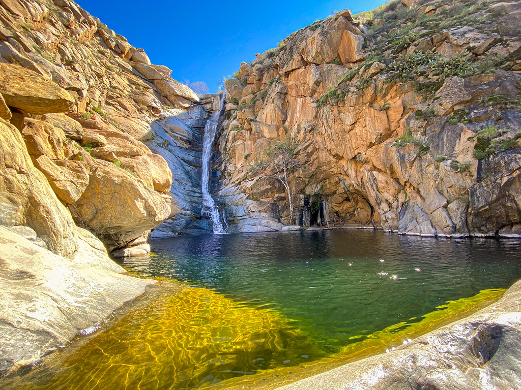
The trail’s end is a pretty waterfall, best seen after it rained. You’ll see beautiful, colorful spots of wildflowers, rock paths, and stunning views along the way.

This trail isn’t good for people who are just starting. During the summer, people often get sick from the heat, especially if they don’t bring adequate water and supplies. Please think about how fit you are before starting. 

From the San Diego River Gorge trailhead or Saddleback Trailhead, the hike to Cedar Creek Falls is a challenging 5.6-mile out-and-back trail that goes through the beautiful backcountry hills of eastern San Diego. 

The trail’s black oak, cedar, and cottonwood trees are a great place to watch birds.

It has beautiful views and is a great way to get some exercise. In the end, a spectacular waterfall and a natural swimming hole drop down. During the summer, the falls usually don’t flow, and the pool at the bottom stays still and grows algae.

The hike is all downwards, but the walkout is strenuous and takes over two miles of steady, moderate uphill hiking with an average grade of 8%.

Those new to hiking or hiking this trail for the first time should try to finish it in the fall, winter, or spring when temperatures are more relaxed, and the risk of getting sick from the heat is lower.

6. Potato Chip Rock Trail (Mt. Woodson)

7.4 miles | Moderate | 2,110 Feet Elevation Gain

The best hikes in San Diego
tripadvisor.com

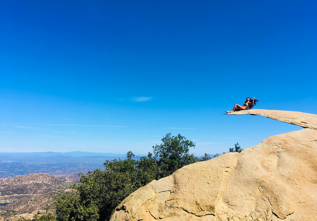
Potato Chip Rock is a hike that even people who don’t hike want to go on to take a picture. It is in the town of Poway, which is north of San Diego. It is a moderate 7.4-mile hike to a slender rock that people climb on, but it looks like it could break at any moment.

The climb to Potato Chip Rock starts near Poway Lake in Poway. It’s 5 to 10 minutes from the freeway, and if you don’t live in Poway, it costs $10 to park on holidays and weekends if you don’t live there.

A mile of the trail goes around the lake before you approach the start of the track. From there, the top is about 3 miles away.

This trail is in great shape. The forks have numerous signs, and the steep parts have good rock stairs. Along the trail, there are a lot of exciting rock shapes that will make your stroll up fun.

There is only one place that has actual shade while on the trail. It’s a small tree about halfway up, and if it’s hot, it’s a great place to relax. We also suggest that you bring enough water.

As you keep going up, you will have some great views of the ocean, mountains, and cities in the distance.

You’ll notice Potato Chip Rock at the altitude when you’re about a quarter of a mile from the top. The rock is before the top.

This unique rock is the big standout of this hike. To get to the top of this rock, you have to climb up it. It looks scary to stand on, but it doesn’t feel like that until you’re up there.

5. Cuyamaca Peak Loop Trail

7.7 miles | Moderate | 1,834 Feet Elevation Gain

The best hikes in San Diego
pinterest.com

Hiking Cuyamaca Peak takes you to the second-highest point in San Diego County, at 6,512 feet. It’s only 20 feet smaller than the highest peak, but it’s much easier to hike. On a clear day, you can view the surrounding islands and distant mountains from the summit.

Although the hike goes to a pinnacle, it’s not an arduous backcountry trip. Instead, it’s a fantastic hike for a beginner because there aren’t any tricky turns.

As one of the highest points in San Diego County, the Cuyamaca Peak Loop Trail has a lot of great views and beautiful scenery. With its beautiful old trees, expansive views of the valley, and gentle slope, this is one of the best hikes in San Diego for people of all skill levels.

All along the 7.7 miles of this loop trail, parts of the woods give you views of the nearby mountains.

The broader view includes Mt. San Gorgonio, Palomar Mountain, Toro Peak, Mt. San Jacinto, Santa Rosa Mountain, Santiago Peak, Mt. Baldy, San Bernadino Peak, and the remainder of the peaks in the far transverse ranges. 

In the distance, the ocean’s long, cobalt blue arc will sparkle, and Catalina Island will break up the smooth, flat surface.

To the east, the Anza-Borrego desert, which includes the Salton Sea and the Santa Ysidro Mountains, will look like it goes on forever, while to the south, the highs of Northern Mexico will look ominous.

Also, this hike is best on clear fall, winter, or spring days after storms have cleaned up the pollution and haze from the air over San Diego. However, the trails can get very muddy after it rains, so it’s best to use waterproof hiking boots or trekking poles.

4. Corte Madera Mountain Trail

6.8 miles | Difficult | 1,509 Feet Elevation Gain

The best hikes in San Diego
tripadvisor.com

Corte Madera Mountain is a great way to start exploring the Pine Creek Wilderness, a big part of the Descanso District of Cleveland National Forest south of Interstate 8.

Pine Valley Creek and its canyon are the most noticeable parts of the wilderness. You can get a good picture of nature from Corte Madera and its sister peak, Los Pinos Mountain.

Along with great views, Corte Madera’s dramatic south face is home to many birds of prey that nest there, such as hawks, falcons, and golden eagles. Most of the time, these birds nest in the late fall, winter, or early spring.

From the few parking spots on the side of Corral Canyon Road, go past the locked gate and take an old dirt road through a forested area of coast live oaks. 

The trail goes around this peak and down along a dangerous stretch of big granite rocks. You can see the ridgeline from the other edge of the peaklet.

Although the trail is rough and will require your full attention, you will have breathtaking views to the north and south.

The trail ends at a group of rocks right next to the cliff’s edge. There are a lot of places to sit down and take in the fantastic view. When you look west, you’ll see a line of exciting peaks that lead into the shallow canyons along the coast.

Near the summit are a couple of good campsites for backpackers, making this an enjoyable, if dry, place to camp. It is an excellent place to view the sun go down or catch a glimpse of the lights of San Diego as the full moon settles into the sea.

3. Indian Creek Loop 

8.6 miles | Difficult | 1,001 Feet Elevation Gain

The best hikes in San Diego
alltrails.com

The Indian Creek Loop combines parts of several different paths, such as Noble Canyon, Indian Creek, and the PCT, into an 8.6-mile loop with a great variety of landscapes to enjoy.

To get there, take the Sunrise Highway exit off of I-8 east and make a left onto Sunrise Highway. You can park along both sides of the road at the Penny Pines trailhead, about 13.8 miles down Sunrise Highway.

The hike starts on the Noble Canyon Trail, goes downhill on the Indian Creek Trail, and crosses Indian Creek. Then it goes along an old jeep trail until it gets to the Pioneer Mail Picnic Area on the Sunrise Highway. 

From there, take the PCT south to get back to Penny Pines. Most of the way to Garnet Peak from the picnic area is the same trail.

You can view intersections, wildflowers, and incredible views from the trail. The Garnet Peak will be to the east from the start.

After over a mile, the path winds through grassland, scattered pine trees, and chaparral brush. As you keep going, you’ll pass Pine Creek Road and go up a small hill with manzanita on it. After that, there’s a small section of sparse pine trees.

As the trail goes on, it goes downhill, and you’ll reach Indian Creek. If you keep going past the creek, you will see lovely sights of pastures and hills.

The highway will come back into view as you walk along the trail, but many side paths lead to incredible sights. Watch out for animals as you make your way to the trailhead.

2. Whale Peak

8.8 miles | Difficult | 2,113 Feet Elevation Gain

The best hikes in San Diego
alltrails.com

Take a beautiful hike up Whale Peak through the wild desert. This trail is for expert climbers and necessitates a high-clearance vehicle and the ability to find the path.

Apps that help find a way sometimes lead people to the wrong trailhead. After Scissors Crossing, turn onto the initial dirt road after S2, not the second one.

Whale Peak is in San Diego County, California, in the Anza Borrego State Park. The trail is in the Vallecito Mountains, east of Escondido and south of Highway 78. 

Also, it’s not as tall as several of the highest peaks in the nearby mountains, but it’s ranked 68th on California’s Prominence List. You can view the Salton Sea from the top on a day with clear skies.

Whale Peak is an absolute desert apex with all the elegance and remoteness you would expect. The Anza Borrego Desert is famous for its wildflowers and wide range of desert plants. 

Most of the hillsides are with brush and cacti. It has washes, dandelions, palm groves, cacti, and extensive views.

Visitors can also see desert iguanas, chuckwallas, and four types of rattlesnakes, roadrunners, falcons, kit foxes, mule deer, and bighorn sheep. The old Overland & Butterfield Stage Lines went through the area, and you can see a historical marker about them on Hwy. 78.

As you traverse the mountain upwards, the trail will slowly change from a desert to an alpine climate. You’ll pass by a few “false summits” and scramble your way up to the summit. When you get to the top, the views are amazing. 

Do not attempt this trail when the weather is cooler.

1. El Cajon Mountain Trail

11.0 miles | Difficult | 3,579 Feet Elevation Gain

The best hikes in San Diego
alltrails.com

Get ready not to use the stair-master for a week. This epic hike is among the hardest ones in San Diego County. It has a lot of ups and downs that will engage your quads, calf muscles, and glutes until they give up.

Unlike the gym, though, this trip across one of the county’s most mountainous and rugged terrains will reward your hard work with beautiful views and the right to brag.

El Cajon Mountain is one of the more challenging hikes in San Diego. It will tease you with many false peaks and uphill parts on the way up and down. This trail is significant and essential for anyone searching for challenging hikes in San Diego.

It is the pinnacle of a massive block of granite that climbs up just above the town of El Cajon. 

Like nearby Mt. Woodson, Iron Mountain, and Mt. Gower, the geography exhibits numerous instances of exposed granitic that shrunk into smooth, circular shapes through spheroidal weathering.

The hike begins with a smooth rise along a paved road but will soon shift into switchbacks. Don’t start cursing at the switchbacks, though, as they are the only ones you’ll encounter throughout the trail. 

Most of the hike is an up straight steep ascent to the top. Stunning views start about halfway up. On clear days, you can see the Pacific Ocean within that distance.

In Closing

That’s all for our list of the 15 best hikes in San Diego!

As you can see, there is a trail for everybody in San Diego, from the most beautiful walking paths to the highest peaks. With so many options, we’re sure that at least one of these hiking trails in San Diego will appease your hiking itch.

Feel free to pin this post if you want to return to it later. Enjoy hiking!

19+ Gorgeous California Islands To Visit

Looking to visit some of the most gorgeous islands in California? Here are our absolute favorite California islands that you can’t miss.

Many factors contribute to California’s status as one of the most popular tourist destinations in the United States. Some of the world’s most stunning beaches are located here, as are some of the country’s best music festivals and restaurants. As if the Golden State couldn’t get any better. It’s the most geographically and culturally diverse state in the country. Plus, the weather is so beautiful!

Just a few miles off the coast of California, you’ll discover a series of stunning islands, which is another reason to fall in love with the state. The best part is that they’re just a short boat journey from most of the big cities on the mainland.

Some of these California islands are too pretty to miss! Here are the top 19+ islands in California that you need to know about.

19. Catalina Island

The best islands in California to visit

White sand beaches, colorful mansions nestled into the hillside, and boats floating in pure blue seas welcome you from the minute you arrive at Avalon, on Catalina Island, 22 miles off the coast of Southern California.

Kayaking and glass-bottom boat rides are just two of the island’s numerous recreational activities. It’s a little more than a one-hour ferry ride from Long Beach, San Pedro, and Dana Point to get here. Of course, spending extra money on a helicopter, private boat, or private plane is also an option.

Catalina is great for snorkeling and scuba diving because of its varied marine life. Although visitors are not permitted to rent cars, Catalina can easily be explored by foot, bicycle, or golf cart.

Avalon is located on the island’s resort side, with opulent hotels, good cuisine, a golf course, and a classic art deco theater housed inside the casino. However, over 88 percent of Catalina Island is undeveloped, making the backcountry and other bays perfect for off-grid camping and trekking.

18. Alcatraz Island

The best islands in California to visit

While Alcatraz misses the stunning scenery of some of the other islands, it is worth a visit for its history alone.

Alcatraz, often known as the Rock, was a federal prison that housed prominent criminals such as Al Capone from 1934 until 1963. In the 1960s, indigenous tribes and sympathizers used the island as a Civil War fort and occupied the location.

You can enjoy the self-guided audio tour (included in the price of your boat ticket), which has the voices of real correctional officers, and convicts arranged to prison-themed music – think a cacophony of footfall, keys rattling, and metal doors banging. To guarantee a seat, book at least a week in advance, particularly during the summer and holiday weekends.

Alcatraz offers panoramic views of the city and the Golden Gate Bridge on clear days. Even though Alcatraz is just 1.5 miles (2.4 kilometers) off the coast of San Francisco, cold and hazardous seas surround it.

If you want to visit this island, note that the Alcatraz ferries leave from Fisherman’s Wharf. It’s essential to schedule tours since they sometimes sell out weeks ahead of time. There are certain times when you may pay to sleep in jail overnight for the adventurous.

17. Santa Barbara Island

The best islands in California to visit

The smallest of the Channel Islands is deceiving in its diminutive size. From afar, this one-square-mile island may seem lonely.

But the island has relaxing elephant seals, golden flowers blossoming, Scripps’ murrelet chicks tumbling, and rich cultural heritage. Santa Barbara Island is a crossroads for humans and wildlife. It’s one of the best California islands to visit if you’re interested in nature!

This island is 38 miles from the mainland’s nearest point. It is the smallest of the California Channel Islands, at about one square mile (639 acres). The island, formed by underwater volcanic activity, is approximately triangular and rises from the sea as a massive, twin-peaked mesa with high cliffs.

Travelers can observe the island’s extraordinary comeback of plant and animal life after years of habitat and species loss due to ranching and agricultural operations, including the introduction of nonnative plants, rabbits, and cats. Although nonnative grasses continue to dominate the landscape, native vegetation is progressively rebounding thanks to restoration efforts by the National Park Service.

Santa Barbara Island’s rocky coastlines also serve as resting and breeding grounds for California sea lions, harbor seals, and northern elephant seals. These marine animals forage in the island’s dense kelp forests. You can hear sea lions’ loud barking from most parts of the island.

Webster Point, Sea Lion Rookery, and Elephant Seal Cove provide good vantage points for seeing seals and sea lions. Additionally, visitors may leap into the sea to see what lurks under the ocean’s surface. You can see beautiful sea stars, prickly sea urchins, and vivid orange Garibaldi fish when snorkeling at the Landing Cove. California sea lions and the rare harbor seal inhabit Landing Cove’s waters and rocky ledges.

As you can see, this is one of the best islands in California to visit if you’re interested in nature – this island has it all!

16. Coronado Island

The best islands in California to visit
sandiegoexplorer.com

Coronado is a tethered island since it is connected to San Diego by the Silver Strand, a narrow piece of land. However, it retains an island atmosphere, with extensive beaches and soft sand. You can use the Coronado Bridge to get there by driving, but a boat also leaves from downtown. This is definitely one of the more accessible islands in California that still has the island feel!

It is known for its powdery beaches (including a designated, leash-free dog beach) and the historic Hotel del Coronado. Hotel Del will unveil a refurbished spa, updated guest rooms (spacious patios and fire elements in select ground floor rooms), and a rebuilt rooftop bar and restaurant in 2020.

It had a crucial part in early naval aviation history in the United States and its coastal resort dreams. Beginning in 1855, American industrialists bought the island and developed it.

Spend the day on the beach, biking across town, shopping the shops and galleries on Orange Avenue, or having lunch or beverages at the hotel and exploring the grounds. This is one of the top islands in California that you can’t miss because it’s just so easy to get to!

15. Brother Islands

The best islands in California to visit
suggest.com

Are you looking for a respite from the city’s quick pace? Need to contemplate your unfinished manuscript in a remote but lovely location? Consider The Brothers Islands, some of the more rugged California islands positioned in the strait between San Francisco and San Pablo Bays.

While West Brother Island is strikingly desolate, East Brother Island is vibrant with a historic lighthouse and Victorian bed & breakfast offering 360-degree views of the San Francisco cityscape, Mount Tamalpais, and the Marin coastline. East Brother Light Station has been operational since 1873; the Inn opened in 1979 to raise funds for restoring and maintaining the lighthouse and its amenities.

Today, visitors are transported to the island four evenings a week by a 10-minute boat journey from Richmond and are welcomed with Champagne and hors d’oeuvres upon arrival. The culinary journey continues with a multi-course meal prepared with vegetables from the chef’s garden and served at a communal table. Breakfast is included in the package, as is a tour of the island and lighthouse.

Volunteering is another less expensive and karma-boosting option to enjoy the island. There is a requirement for various “wickies,” a colloquial term for lighthouse keepers who used to trim the wicks that illuminated the trail for maritime vessels.

14. Naples Island

The best islands in California to visit

If you’ve never been to Naples Island in California, you should do so. It’s one of the top California islands for a reason! Located in Alamitos Bay on three tiny islands, it’s famed for its picturesque canals that evoke the waterways of Venice.

As evident by its name, the city has a similar appearance to Naples, Italy. The majority of the island’s streets are even named after Italian places.

Naples Island is your place if you want to experience the Mediterranean without leaving Florida! A trip to Naples Island is a must for anybody who wants to visit Italy but hasn’t had the chance.

Take a gondola ride along the picturesque rivers and charming Italian-style architecture. Paddleboarding or kayaking is another excellent option for exploring one of Cali’s best-kept secrets.

13. Angel Island

The best islands in California to visit
flickr.com

Angel Island is a natural wonder of the state of California. If you’re looking for some of the most excellent views of San Francisco Bay, you’ll want to visit the most oversized natural island.

There are many stories to tell about Angel Island’s past. Indigenous tribes initially utilized it as a haven from the dangers of the outside world. At that time, it was a haven for the likes of Juan Manuel de Ayala. It’s one of the most excellent spots to spend a day away from the city, only six miles from San Francisco.

The island operated as an immigration processing center for immigrants seeking a better life in the United States at one time. Because of this, it’s referred to as the “Ellis Island of the West.” It is now a museum that tells the tale of the island’s past.

Mount Livermore, the highest point on the island, is a great place to go trekking or bicycling. There are 360-degree views of San Francisco’s skyline from the island’s top.

Camp on Angel Island and take a sunset sail if you want to extend your journey to the island beyond a brief day excursion.

12. Balboa Island

The best islands in California to visit
flickr.com

Balboa Island is a terrific destination to visit if you’re looking for a California island getaway. It’s a magnificent artificial island in Orange County that can be seen by ferry or an overland bridge, and it’s located in the center of Newport Beach.

Balboa Island is a one-of-a-kind, artificial treasure. It is beautiful whether you drive, walk, bike, or ride the Balboa Island Ferry to the island. There are several activities available on Balboa Island. Marine Avenue is lined with beautiful coastal boutiques selling one-of-a-kind nautical designs, fashionable beachwear, art, and jewelry.

Furthermore, it is home to charming Balboa Island restaurants and cafes providing a range of flavorful meals. Balboa Island’s culinary offerings extend beyond the fresh local fish of the day, with Italian, Mexican, and French-Swiss tastes included.

Nothing on Balboa Island is more legendary than the Balboa Bar and Frozen Banana. For almost 75 years, the local sweet tooth treasures have been reproduced and duplicated, notably on the popular television comedy “Arrested Development.” The delectable sweets are dipped in chocolate and coated with various toppings, including almonds, sprinkles, and cookie crumbs. Whatever your preference, Balboa Island in Newport Beach has everything.

11. Treasure Island

The best islands in California to visit
skylinescenes.com

Treasure Island is one of California’s most distinctive islands. It’s an artificial island in the center of San Francisco Bay that was erected in the 1930s for the Golden Gate International Exposition. The San Francisco-Oakland Bay Bridge and the Golden Gate Bridge were completed in time for the fair.

The island was transformed into a military installation during WWII until the early 1990s. Several structures on the island have now been placed on the National Register of Historic Places.

The Treasure Island Music Festival, a two-day event featuring the greatest names in rap, hip-hop, rock, electronic, and independent music, is well-known.

The weekly flea market is another popular event on Treasure Island. It’s an open-air market with the most amazing antiques, art, upcycled and repurposed things, and various plants. The market, which takes place over two days, draws individuals from all across the Bay Area together.

Many food trucks also serve anything from gourmet street cuisine to regional specialties like Bay Area shrimp and crab. It’s no surprise that it’s a favorite hangout for residents and visitors alike.

If you’re looking for a fun social scene then Treasure Island is one of the best islands in California to visit!

10. Woodley Island

The best islands in California to visit
theatlasheart.com

Woodley Island, located near Jaroujiji, or what is now known as Eureka, on California’s Pacific coast north of San Francisco, provides fresh air and sea activities in a northern California environment.

Cafe Marina, Woodley’s Bar, and the Table Bluff lighthouse are all worth seeing (the first lighthouse to illuminate Humboldt Bay). Cruise around the Bay on a kayak, stand-up paddleboard, or canoe rented from Humboats Kayak Adventures.

It’s also possible to go whale watching or go on an eco-tour through the Humboldt Bay National Wildlife Refuge while kayaking.

Both business and leisure boats can be moored at its vast marina. Visitors can buy freshly caught crab and fish from arriving vessels during the open fishing season.

Birdwatchers go to the island to witness the godwits, pelicans, egrets, and other species that populate the waters around it, making it a popular destination.

This is definitely one of the best islands in California if you’re looking for lots of hands-on nature activities!

9. San Nicolas Island

The best islands in California to visit
dreamlandresort.com

At 78 nautical miles (nm), San Nicolas Island is the most isolated of the Channel Islands in California and 53 miles from the closest shore. Windswept, grassy slopes, and wave-cut terraces characterize the 14,500-acre (23-square-mile) island in the Pacific Ocean.

The US Navy presently manages and operates it as a weapons testing and training facility. A tiny airport serves the island, commonly called “Midtown” because of the many buildings housing the naval base. You cannot land on the island, and one of the offshore sea zones is limited for transit or anchoring.

Currently, the US Navy occupies the island predominantly. However, a conservation effort will safeguard the island’s natural fauna, including fox subspecies found nowhere else on the planet.

To visit, you have to work for the navy, but you can do a cruise around the island – the area is just gorgeous!

8. Harbor Island

The best islands in California to visit
marinas.com

Harbor Island is located in San Diego Bay between Shelter Island and Downtown San Diego, California.

It is about two miles long and a few hundred yards broad. It was initially formed during harbor dredging operations to deepen the passage for bigger navy supercarriers. Harbor Island Drive, which traverses the length of the island, connects it to the mainland. It is right across from San Diego International Airport, making it an ideal spot to unwind while waiting for connecting flights.

The atmosphere and views of San Diego Bay on the island are comparable to those of its sister island, Shelter Island. Several marinas are located between the peninsula and the mainland, accommodating several thousand yachts.

Harbor Island Park is situated on the island and provides an excellent vantage point for sea-going activity. On the island, there are two luxury hotels with superior services and restaurants: the Hilton San Diego Airport and the Sheraton Harbor Island. They have attractive restaurants exposed to the marina’s soothing winds, which add to the holiday experience.

A continuous ocean breeze keeps walkers, joggers, skaters, and cyclists cool. They take panoramic views of the San Diego cityscape, Coronado Island, and the Big Bay from a beachside walkway.

It is also a great spot to see the city lights at night, see fireworks on July 4th, enjoy the annual Boat Parade of Lights in December, and watch sailing contests like America’s Cup.

This is one of the best islands in California to visit because it’s so easily accessible and has great restaurants and activities!

7. Anacapa Island

The best islands in California to visit

Anacapa Island is a great area to go camping for a half-day, one-day, or short overnight excursion.

There are literally no services/restaurants/stores on the islands, so you can’t make up for lousy planning after if you forget something. It’s essential to plan ahead! Anacapa Island is a test of preparedness and self-reliance.

A small visitors center, hiking paths, and the last big lighthouse erected on West Coast are just a few of the attractions of Anacapa Island. At Frenchys Cove, you may go tide pooling, but only if you’re fortunate enough to catch one of the few boat trips to the cove.

If you’re looking for the top islands in California that require you to really rough it, this should be your pick.

6. Shelter Island

The best islands in California to visit
konakaimarina.com

Shelter Island, situated across the sea from Coronado, is more like a peninsula than an island.

It is one of San Diego’s main boating destinations, with marinas, resort hotels, restaurants, and bayside parks that attract sailors and landlubbers alike.

This is definitely one of the best islands in California for fishermen. Anglers catch a variety of Pacific species, including Yellowtail, Albacore, Halibut, Dorado, Calico Bass, and a variety of rockfish on short and long-range sportfishing excursions that leave from here. Humphreys Half Moon Inn & Suites, which hosts summer Concerts By The Bay, and draws nationally recognized singers and comedians, is also located on Shelter Island.

The Yokohama Friendship Bell, a massive bronze bell housed in a pagoda structure, is located at the end of Shelter Island. It was a gift from Yokohama, Japan, in 1958 to mark the sister city connection between San Diego and Yokohama.

If you visit this island, you can do sports fishing, attend the summer Concerts by the Bay, and see the Yokohama Friendship Bell.

5. San Miguel Island

The best islands in California to visit
wikimedia.org

The weather on San Miguel Island, which is the westernmost of the Channel Islands, can be turbulent and unpredictable. The island has no visitors center, no merchandise, no hotel, and no water, so you must be ready.

You can only visit the island if you have a permit, and if you go beyond the ranger station, you must be accompanied by a ranger. Because the island has initially been a bombing range, these restrictions protect the island and its inhabitants.

After all, how often do you have the chance to go to a distant island far from civilization?

Without a ranger, you may visit Cuyler Harbor Beach, Nidever Canyon, the Cabrillo Monument, and the Lester Ranch site, and the hiking paths take you through spectacular landscapes. Also, you can go on a guided excursion to Point Bennett or the caliche forest with the rangers.

While this is definitely one of the “rougher” California islands to visit, the nature is truly incredible.

4. Santa Rosa Island

The best islands in California to visit
latimes.com

A one-day journey, a multi-day boat trip, or an overnight camping trip are all options for visiting Santa Rosa Island. However, getting to this island is more complicated, and the weather may be stormy at any time of year, with gusts of up to 30 knots not unusual. As a result, tourists must be ready for inclement weather.

Like all of the Channel Islands, Visiting Santa Rosa Island is a test of foresight and self-reliance.

Hiking routes and guided walks enable you to discover the island’s varied environment, ranging from sandy beaches to alpine peaks. Water Canyon Beach, one of the most excellent beaches in the Channel Islands, is located here.

3. Santa Cruz Island

The best islands in California to visit
zillowstatic.com

Santa Cruz Island is the ideal location for a one-day or overnight camping vacation, depending on the length of your stay.

Like any Channel Island, Visits to Santa Cruz Island need planning and self-reliance. Once you’ve landed on the islands, you’re stuck with the consequences of lousy preparation since there are no services available.

Santa Cruz Island is your best pick if you’re seeking a vacation destination with a lot to do. Learn about the island’s flora and fauna at the visitor’s center, enjoy a breathtaking trek, or visit Scorpion Beach for some of the best swimming, diving, snorkeling, and kayaking you’ll ever experience.

2. San Clemente Island

The best islands in California to visit
unsplash.com

As the smallest of the eight Channel Islands in California, San Clemente Island ranks as the fourth-largest in terms of area. It has a 56-square-mile land area, 21 miles in length, and a width of two to four miles.

The Island of Santa Catalina lies 21 miles north. The island, which is 41 miles off the coast, is the second closest to the mainland in the distance. The island’s highest peak is Mount Thirst, at 1965 feet.

California Channel Islands include San Clemente Island, located in Los Angeles County, one of three Navy-owned islands in this grouping. Two outlying rocks are Bird Rock and Castle Rock at the northern tip.

San Clemente Island is home to rare and endangered species, some of which are endemic. For those who dare to snorkel and dive around the island, remember that certain portions of the island are exclusive to military personnel, including Navy Seals in training.

1. Farallon Island

The best islands in California to visit
sfgate.com

Farallon Islands National Wildlife Refuge is a sprawling refuge covering 3,295 square miles off the northern and central California coasts. It’s a true maritime Eden, teeming with marine life on apparently inhospitable rocky outcrops and the water surrounding them. Gray, humpback, blue whales, and orcas make seasonal visits, while pods of porpoises, dolphins, sea lions and seals remain year-round.

More life exists in or near the magnificent Farallon Islands, which rise out of the water 30 miles west of San Francisco. Sea lions and seals live here, and the sky has several seabirds. The refuge preserves the contiguous United States’ most significant seabird rookery, home to tufted puffins, rhinoceros auklets, and pigeon guillemots.

While this natural aquatic world is remote, it is not inaccessible. From May to November, the Oceanic Society offers full-day guided cruises to the Farallon Islands, with trained naturalists providing color commentary and assisting you spotting wildlife. Scheduled tours leave from the San Francisco shoreline and Sausalito, a municipality in Marin County.

With so much life under the waters, it’s unsurprising that the ocean here also harbors excellent white sharks. From late September to November, Great White Adventures provides day excursions. In carefully prepared underwater shark cages, you can safely see white sharks in their natural habitat. While their elegance, indifference, and wine-cask-thick glides can give you the shivers, their grace, and physical power are undeniable.

If you can’t make it to the Farallon Islands, check out the schedule of events at the California Academy of Sciences in San Francisco’s Golden Gate Park.

Hopefully, this gives you a good overview of the best islands in California! Whether you’re looking for a well-developed nightlife or more reserved California islands with lots of wildlife, these islands in California have it all.